Items Similar to Large Title Cartouche and a View of Wilhermsdorf, Beieren, Germany, 1744
Want more images or videos?
Request additional images or videos from the seller
1 of 5
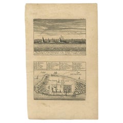
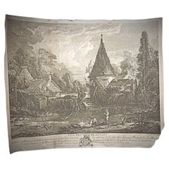
Large Title Cartouche and a View of Wilhermsdorf, Beieren, Germany, 1744
$277.35
$346.6920% Off
£207
£258.7420% Off
€232
€29020% Off
CA$382.59
CA$478.2420% Off
A$418.49
A$523.1120% Off
CHF 220.35
CHF 275.4320% Off
MX$4,996.34
MX$6,245.4220% Off
NOK 2,808.34
NOK 3,510.4320% Off
SEK 2,568.96
SEK 3,211.2020% Off
DKK 1,767.46
DKK 2,209.3220% Off
About the Item
Antique print titled 'Sauber und nach dem Leben gezeichnete Prospecten und Plans, von den wichtigsten der Holländisch-Ost-Indischen-Compagnie in Africa u: Asia (..)'. Frontispiece of Heydt's 'Allerneuester Geographisch- und Topographischer Schau-Platz von Africa und Ost-Indien oder Ausführliche und Wahrhafte Vorstellung und Beschreibung, von den Wichtigsten der Holländisch-Ost-Indischen Compagnie in Africa und Asia (..)'.
It shows a large title cartouche surrounded by figures and below a view of Wilhermsdorf (place of publication).
Artists and Engravers: Johann Wolfgang Heydt (1705 - ?), a German artist who worked for the Dutch East India company.
- Dimensions:Height: 11.82 in (30 cm)Width: 13.59 in (34.5 cm)Depth: 0 in (0.02 mm)
- Materials and Techniques:
- Period:1740-1749
- Date of Manufacture:1744
- Condition:Wear consistent with age and use. Condition: Fair, age-related toning. Creasing and wear. Blank verso, please study image carefully.
- Seller Location:Langweer, NL
- Reference Number:Seller: BG-100871stDibs: LU3054327299212
About the Seller
5.0
Recognized Seller
These prestigious sellers are industry leaders and represent the highest echelon for item quality and design.
Platinum Seller
Premium sellers with a 4.7+ rating and 24-hour response times
Established in 2009
1stDibs seller since 2017
2,809 sales on 1stDibs
Typical response time: 1 hour
- ShippingRetrieving quote...Shipping from: Langweer, Netherlands
- Return Policy
More From This Seller
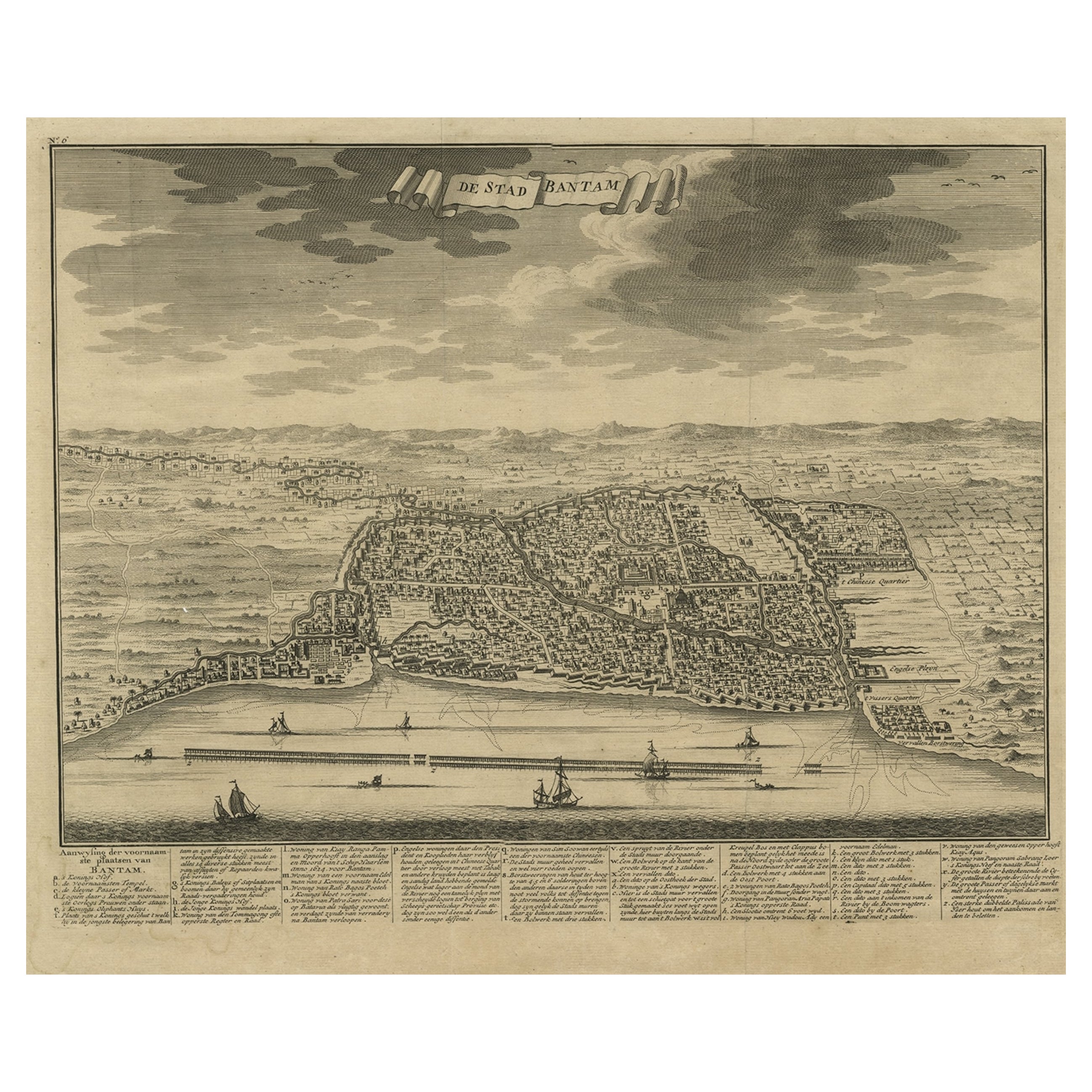
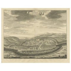
View AllDecorative View of the Indonesian Town of Bantam
Banten
, Java, 1726
Located in Langweer, NL
Decorative town-view of the town of Bantam (Banten). In lower margin key a-z to the principal places in town.
The Banten Sultanate was founded in the 16th century and centred in ...
Category
Antique 1720s Maps
Materials
Paper
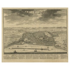
$535 Sale Price
20% Off
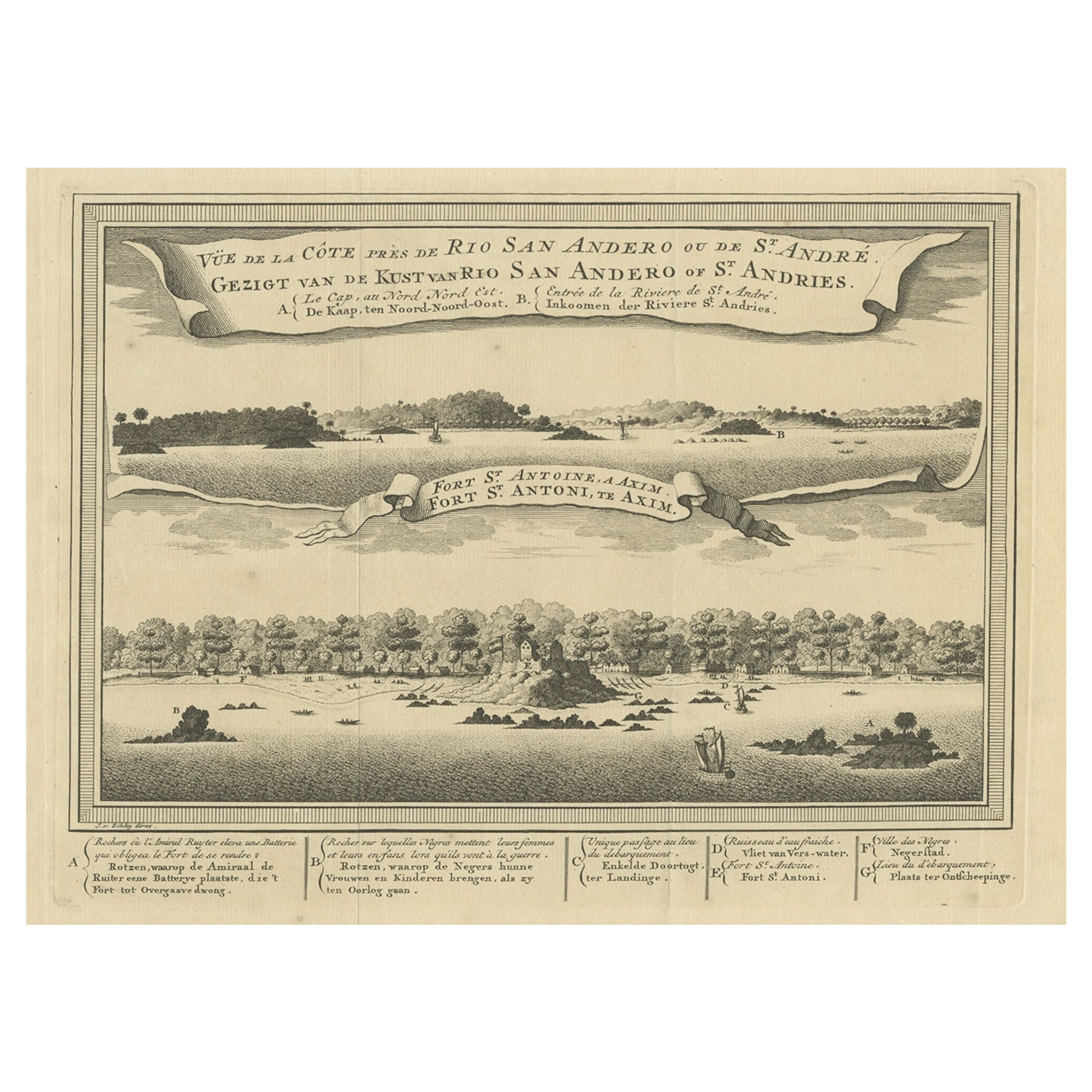
Antique Print of a Fort on the Ivory Coast and Axim, Africa, 1748
By Jakob van der Schley
Located in Langweer, NL
Antique print titled 'Vue de la Cote pres de Rio San Andero - Gezigt van de Kust van Rio San Andero' and 'Fort St. Antoine a Axim - Fort St. Antoni, te Axim'. View of the Ivory coast...
Category
Antique 18th Century Prints
Materials
Paper
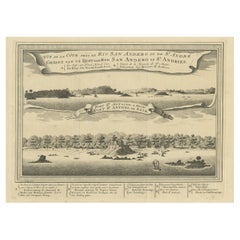
$277 Sale Price
20% Off
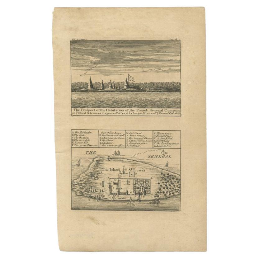
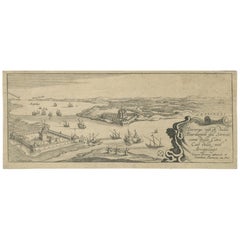
Antique Plan and View of Saint-Louis, Senegal, Africa, 1746
Located in Langweer, NL
Antique print titled ‘The Prospect of the Habitation of the French Senegal Company’. Plan and view of Saint-Louis, Senegal, Africa. This print originates from 'A Collection of Voyage...
Category
Antique 18th Century Prints
Materials
Paper
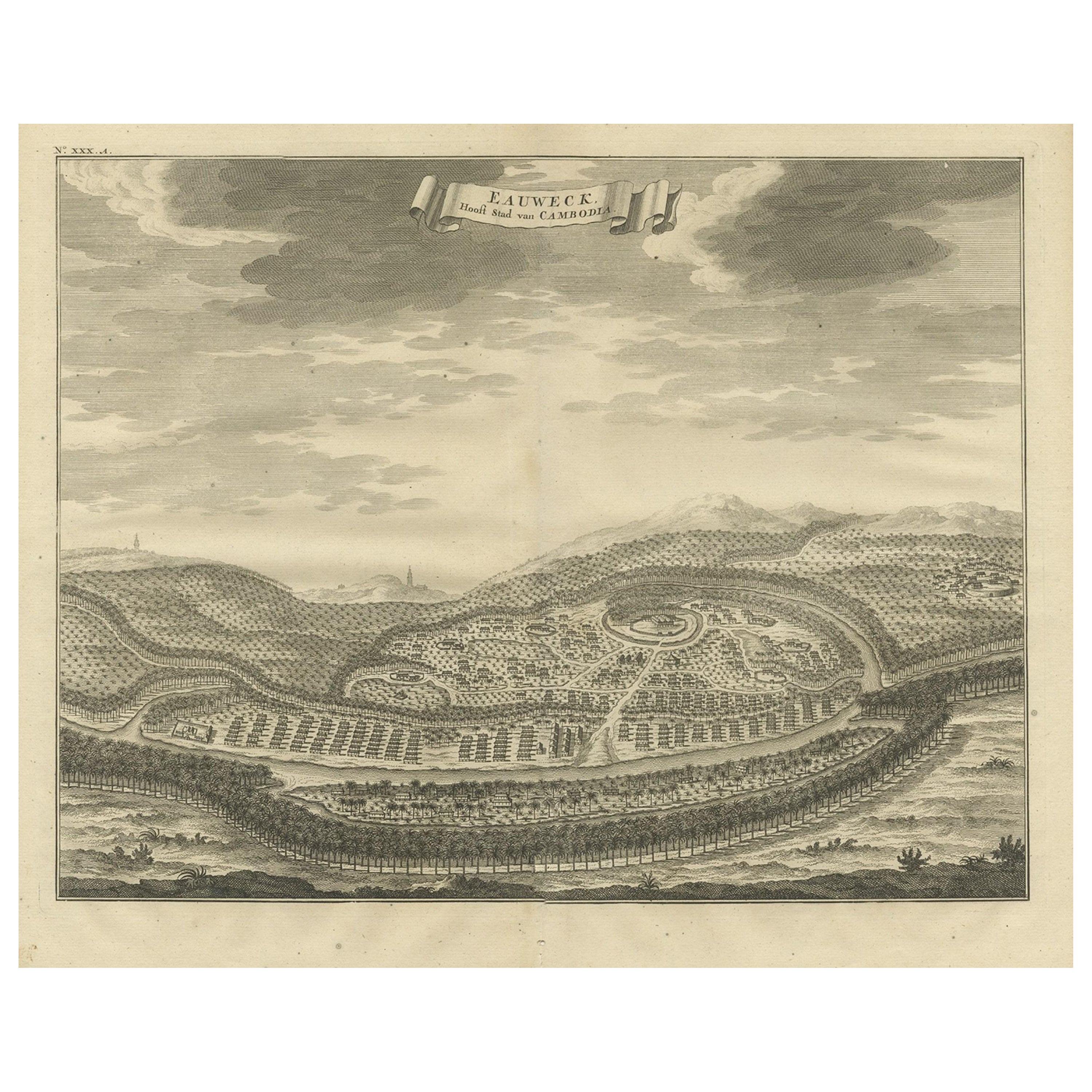
Panoramic Engraved View of the Town of Longvek
or Lavek
in Cambodia, ca.1726
Located in Langweer, NL
Description: Antique print titled 'Eauweck, Hooft Stad van Cambodia'. Decorative panoramic view of the town of Longvek (or Lavek) in Cambodia. It was the second capital city during t...
Category
Antique 1720s Prints
Materials
Paper
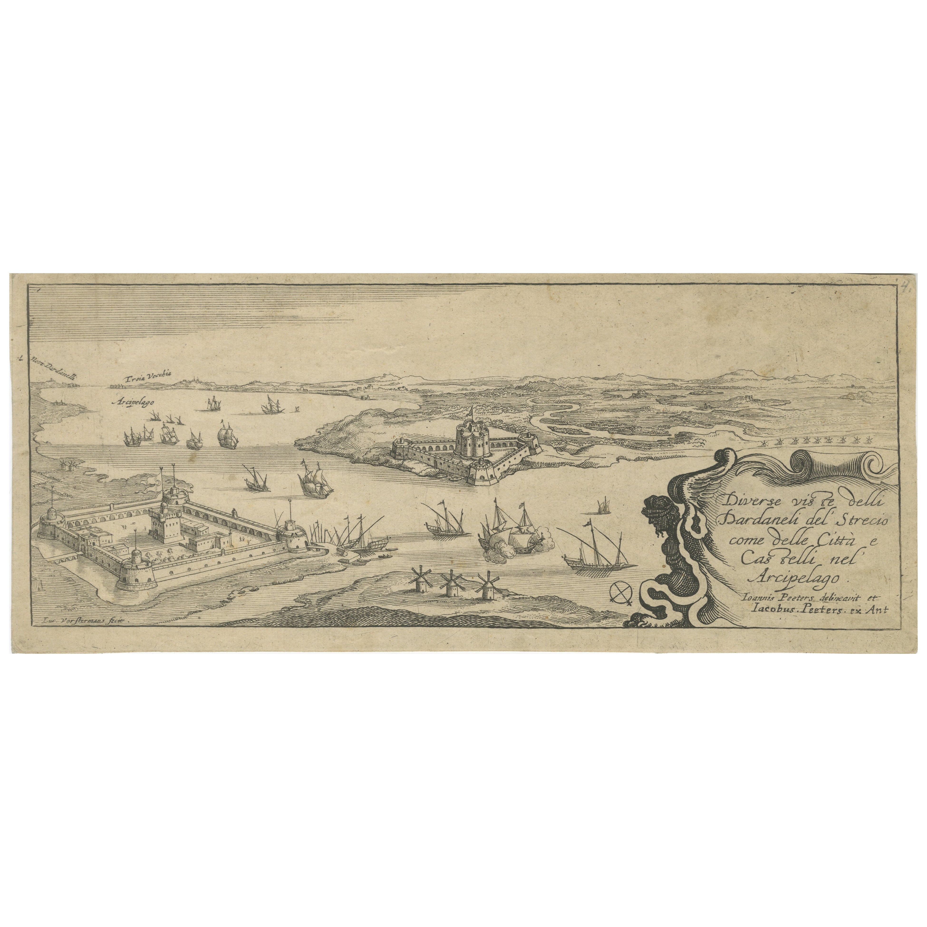
Title page from "Views of the Dardanelles", engraved by Jacob Peeters, ca. 1680
Located in Langweer, NL
Title:
Diverse viste delli Dardanelli del Strecio, come delle Città e Castelli nel Arcipelago – Title page of the series, engraved by Jacob Peeters after Jan Peeters, Antwerp, circ...
Category
Antique 1680s Prints
Materials
Paper
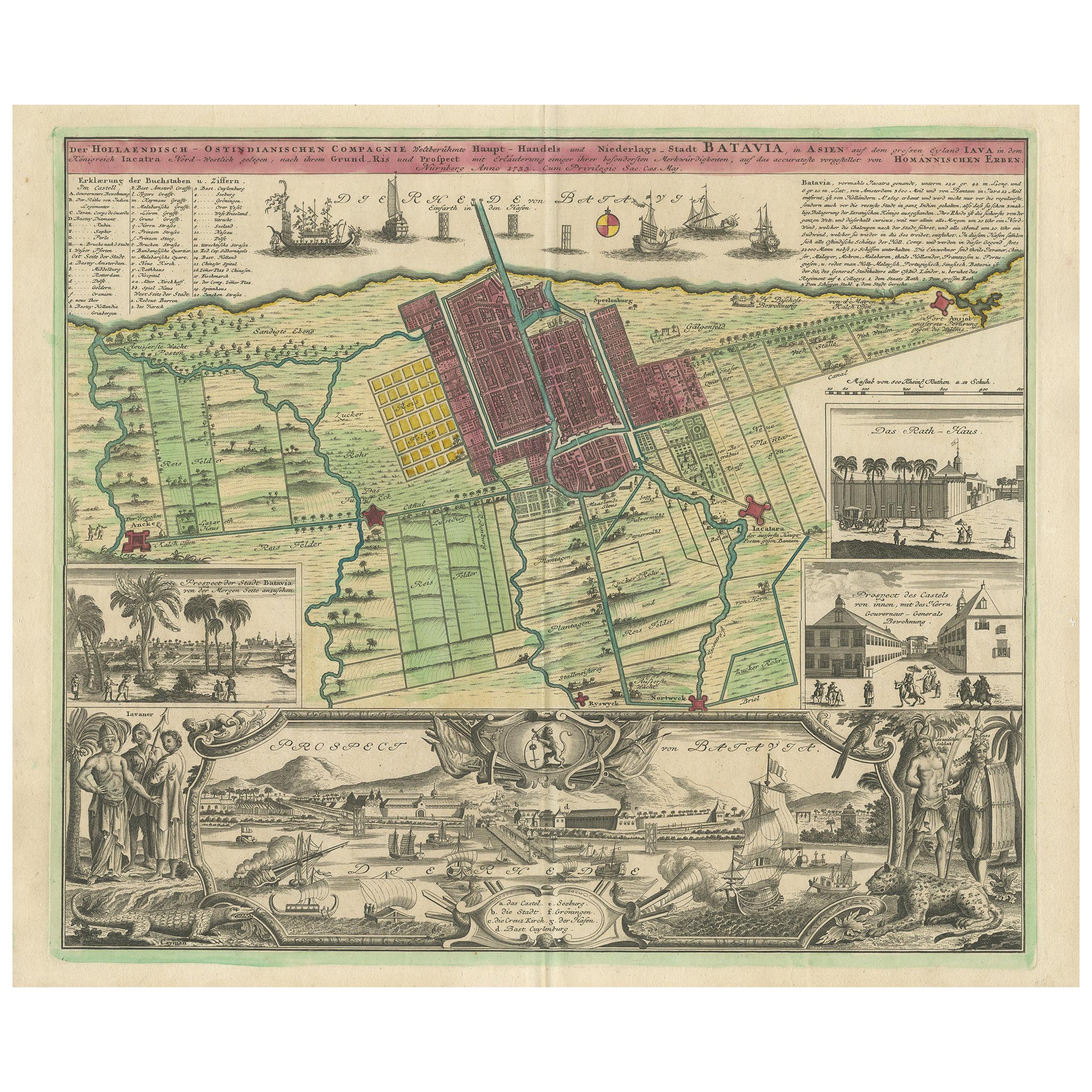
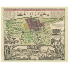
Antique Map and Views of Batavia by Homann Heirs,
1733
Located in Langweer, NL
Antique map titled 'Der Hollaendisch-Ostindianischen Compagnie weltberuhmte Haupt-Handels und Niederlags-Stadt Batavia, in Asien auf dem grossen Eyland Iava in dem konigreich Iacatra...
Category
Antique Mid-18th Century Maps
Materials
Paper
$2,241 Sale Price
25% Off
You May Also Like
18th Century Hand-Colored Homann Map of Germany, Including Frankfurt and Berlin
By Johann Baptist Homann
Located in Alamo, CA
An 18th century hand-colored map entitled "Tabula Marchionatus Brandenburgici et Ducatus Pomeraniae quae sunt Pars Septentrionalis Circuli Saxoniae Superioris" by Johann Baptist Homa...
Category
Antique Early 18th Century German Maps
Materials
Paper

$620 Sale Price
20% Off
17th Century Toulouse, Savve, Sommieres Topographical Map by Iohan Peeters
Located in New York, NY
Fine topographical 17th century map of Toulouse, Savve and Sommieres by Iohan Peeters
Beautiful engraving of the capital of France's Occitanie Region, Toulouse, called La Ville Rose- the Pink City, for the terracotta bricks used in its many buildings, giving the city a distinct apricot-rose hue. An important cultural and educational center, the city's residents included Nobel Prize winners and world renown artists- Henri de Toulouse-Lautrec, Henri Martin, Jean-Auguste-Dominique Ingres, Antonin Mercie, Alexandre Falguiere and more recently Cyril Kongo...
Category
Antique 17th Century Dutch Maps
Materials
Paper

Antique Map - Gallia - Etching by Johannes Janssonius - 1650s
By Johannes Janssonius
Located in Roma, IT
Antique Map - Gallia is an antique map realized in 1650 by Johannes Janssonius (1588-1664).
The Map is Hand-colored etching, with coeval watercoloring.
Good conditions with slight ...
Category
1650s Modern Figurative Prints
Materials
Etching

17th Century Topographical Map, Champagne-Ardenne, Marsal, Maubert Iohan Peeters
Located in New York, NY
Fine topographical 17th century map by Iohan Peeters of Marsal and Maubert Fontaine in the Champagne-Ardennes Region of North Eastern France.
Fabulous period engraving for a Wine Ce...
Category
Antique 17th Century Dutch Maps
Materials
Paper

Antique Lithograph by François Boucher "Vue des Environs de Beauvais" - 2Y169
Located in Bordeaux, FR
This antique lithograph by François Boucher, titled "Vue des Environs de Beauvais," offers a glimpse into the picturesque landscapes of Beauvais as envisioned by the renowned 18th-ce...
Category
Antique 18th Century French Empire Antiquities
Materials
Paper
$203 Sale Price
50% Off
17th Century Topographical Engraving Nantes
St. Malo, France, by Iohan Peeters
Located in New York, NY
The ancient city of Saint Malo in North Western France has long been associated with adventure on the high seas, piracy and exploration. It was the birthplace of several important in...
Category
Antique 17th Century Dutch Maps
Materials
Paper

More Ways To Browse
East India Company
Dutch East India Company
Antique Coal Mining
Antique Dutch Bible
Antique Louisiana Map
Antique Maps Of Sicily
Iran Map
Map Of Great Britain
Sardinia Map
Antique Map Of Thailand
Antique Wooden Roller
Croatia Map
Kentucky Antique Furniture
Louisiana Antique Furniture
Map Of Ancient Greece
Map Of Native American Tribes
Old Spice
Romania Map