Items Similar to Maine Antique Railroad Map c.1888 – Pine Tree State Counties
Settlements
Video Loading
Want more images or videos?
Request additional images or videos from the seller
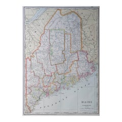
1 of 14
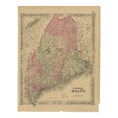
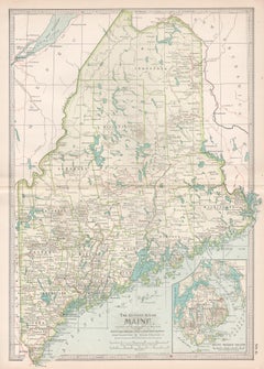
Maine Antique Railroad Map c.1888 – Pine Tree State Counties
Settlements
$552.87
£409.53
€460
CA$756.31
A$824.34
CHF 435.82
MX$9,923.51
NOK 5,531.67
SEK 5,071.41
DKK 3,504.95
About the Item
Antique Map of Maine – Rand McNally, circa 1888
This antique map of Maine was published by Rand, McNally
Co. around 1888. It depicts the Pine Tree State in great detail, showing its counties, towns, rivers, and transportation routes at a time when railroads were beginning to connect its inland towns with the coastal ports.
The map extends from the Atlantic Ocean coastline, including Portland, Bangor, Augusta, and Rockland, to the inland lakes and forests near the Canadian border. The state’s rugged eastern coastline is finely engraved with wave patterns, highlighting its many bays and harbors. Numerous small islands off the coast are also carefully shown.
Railroads are marked in red and blue, tracing lines from Portland and Augusta northward and eastward, linking Maine’s ports with Boston and the greater New England railway system. These routes illustrate Maine’s role in the lumber, fishing, and shipping industries of the late 19th century. The map also captures Maine’s expansive rural geography, with many small towns and settlements scattered across its forested interior.
Rand McNally’s precision and clarity make this both a functional reference and a decorative historical map. It appeals to collectors of New England cartography, maritime history, and late 19th-century American maps.
Condition report:
Very good condition with even age toning. Original center fold as issued with slight darkening along the crease. Plate mark visible. Clean margins with minimal handling wear. Strong impression with crisp detail.
Framing tips:
A black or walnut frame with a cream mat will highlight the fine engraved detail. A double mat with ivory outer and muted blue inner will draw attention to the Atlantic coastline, balancing the land and sea detail.
Technique: Lithograph with original outline color
Maker: Rand, McNally
Co., Chicago, circa 1888
- Dimensions:Height: 20.67 in (52.5 cm)Width: 14.18 in (36 cm)Depth: 0.01 in (0.2 mm)
- Materials and Techniques:Paper,Engraved
- Place of Origin:
- Period:
- Date of Manufacture:1888
- Condition:Good condition with even age toning. Original center fold as issued with slight darkening along the crease. Plate mark visible. Clean margins with minimal handling wear. Strong impression with crisp detail.
- Seller Location:Langweer, NL
- Reference Number:Seller: BG-12794-131stDibs: LU3054346475612
About the Seller
5.0
Recognized Seller
These prestigious sellers are industry leaders and represent the highest echelon for item quality and design.
Platinum Seller
Premium sellers with a 4.7+ rating and 24-hour response times
Established in 2009
1stDibs seller since 2017
2,813 sales on 1stDibs
Typical response time: 1 hour
- ShippingRetrieving quote...Shipping from: Langweer, Netherlands
- Return Policy
More From This Seller
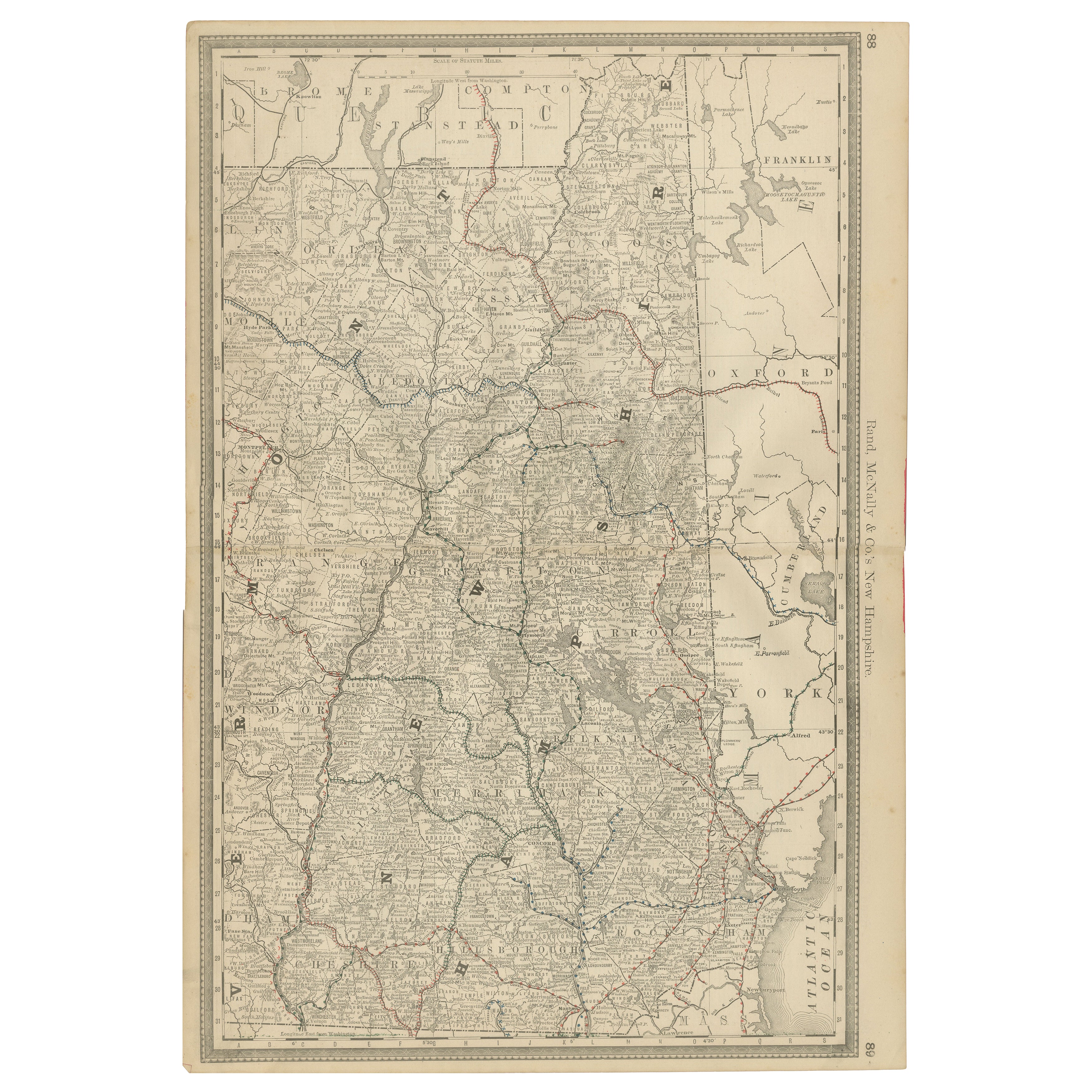
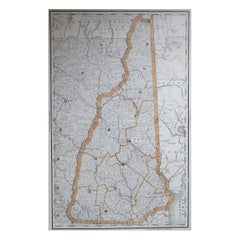
View AllNew Hampshire Antique Railroad Map c.1888 – Granite State Counties
Cities
Located in Langweer, NL
Antique Map of New Hampshire – Rand McNally, circa 1888
This antique map of New Hampshire was published by Rand, McNally & Co. around 1888. It provides a detailed late 19th-century ...
Category
Antique Late 19th Century American Maps
Materials
Paper
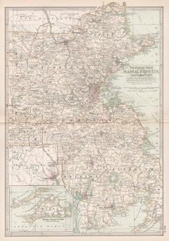
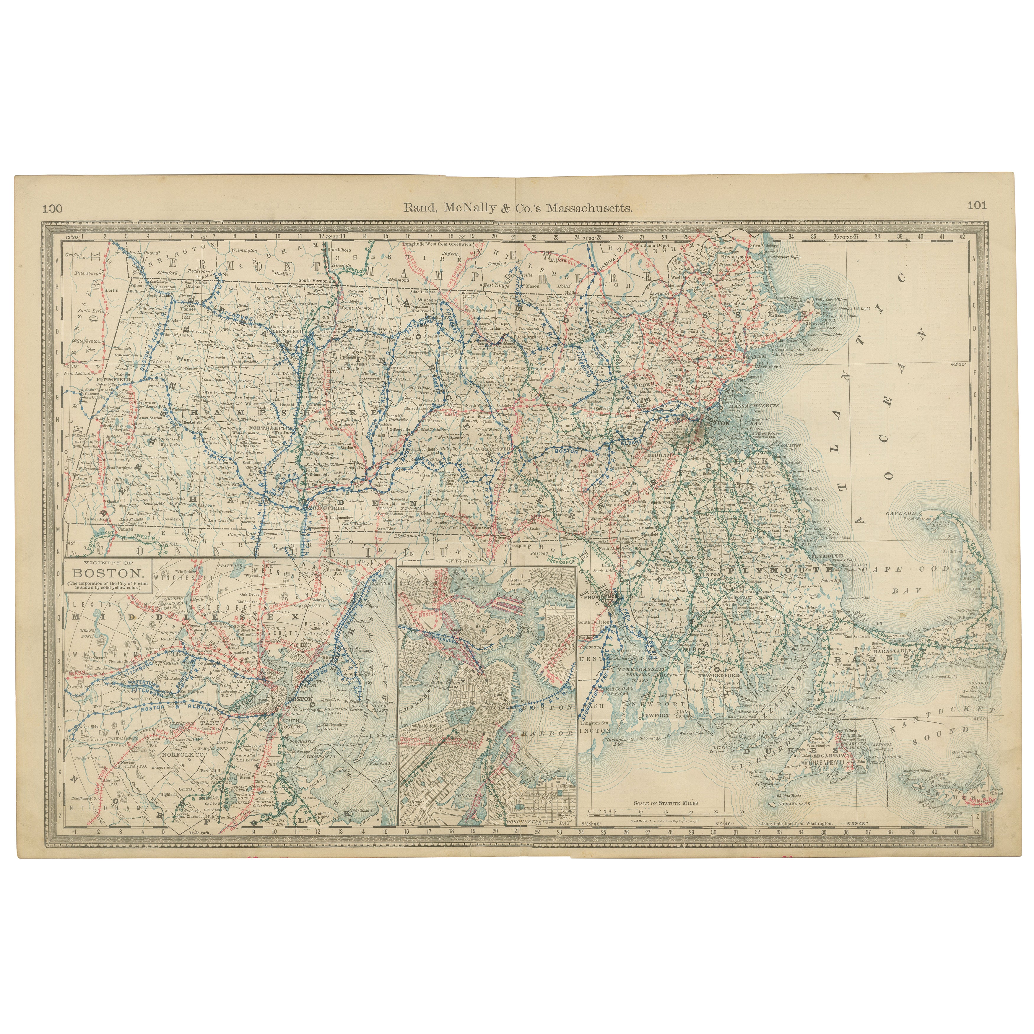
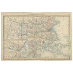
Massachusetts Antique Map c.1888 – The Bay State, Railroads
Boston Inset
Located in Langweer, NL
Antique Map of Massachusetts with Boston Inset – Rand McNally, circa 1888
This antique map of Massachusetts was published by Rand, McNally & Co. around 1888. It offers a detailed la...
Category
Antique Late 19th Century American Maps
Materials
Paper
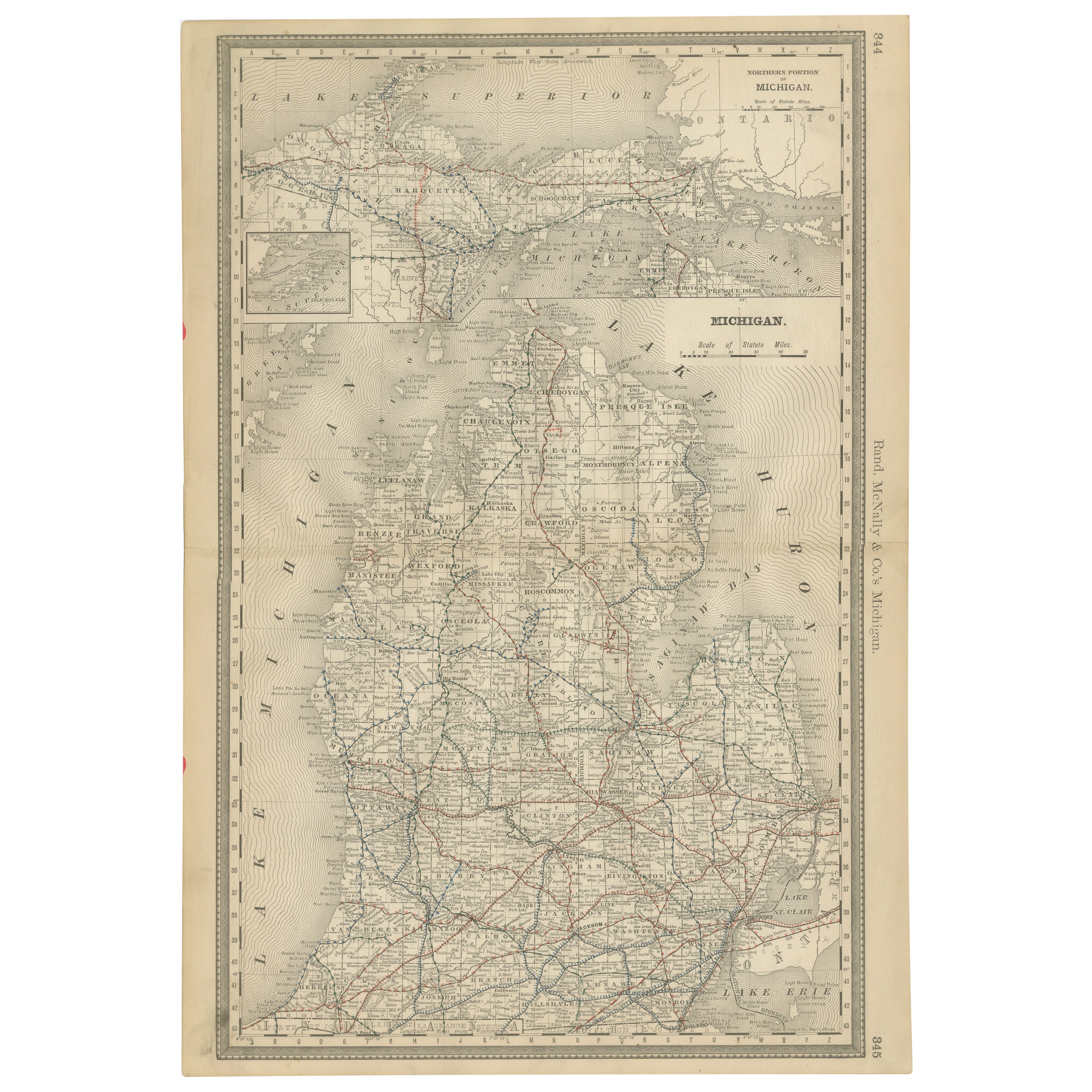
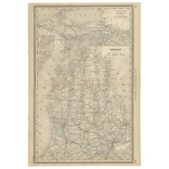
Antique Map of Michigan – The Wolverine State with Railroads
Counties, 1888
Located in Langweer, NL
Antique Map of Michigan – The Wolverine State with Railroads & Counties, 1888
This antique engraved map of Michigan, published in 1888 by Rand...
Category
Antique Late 19th Century American Maps
Materials
Paper
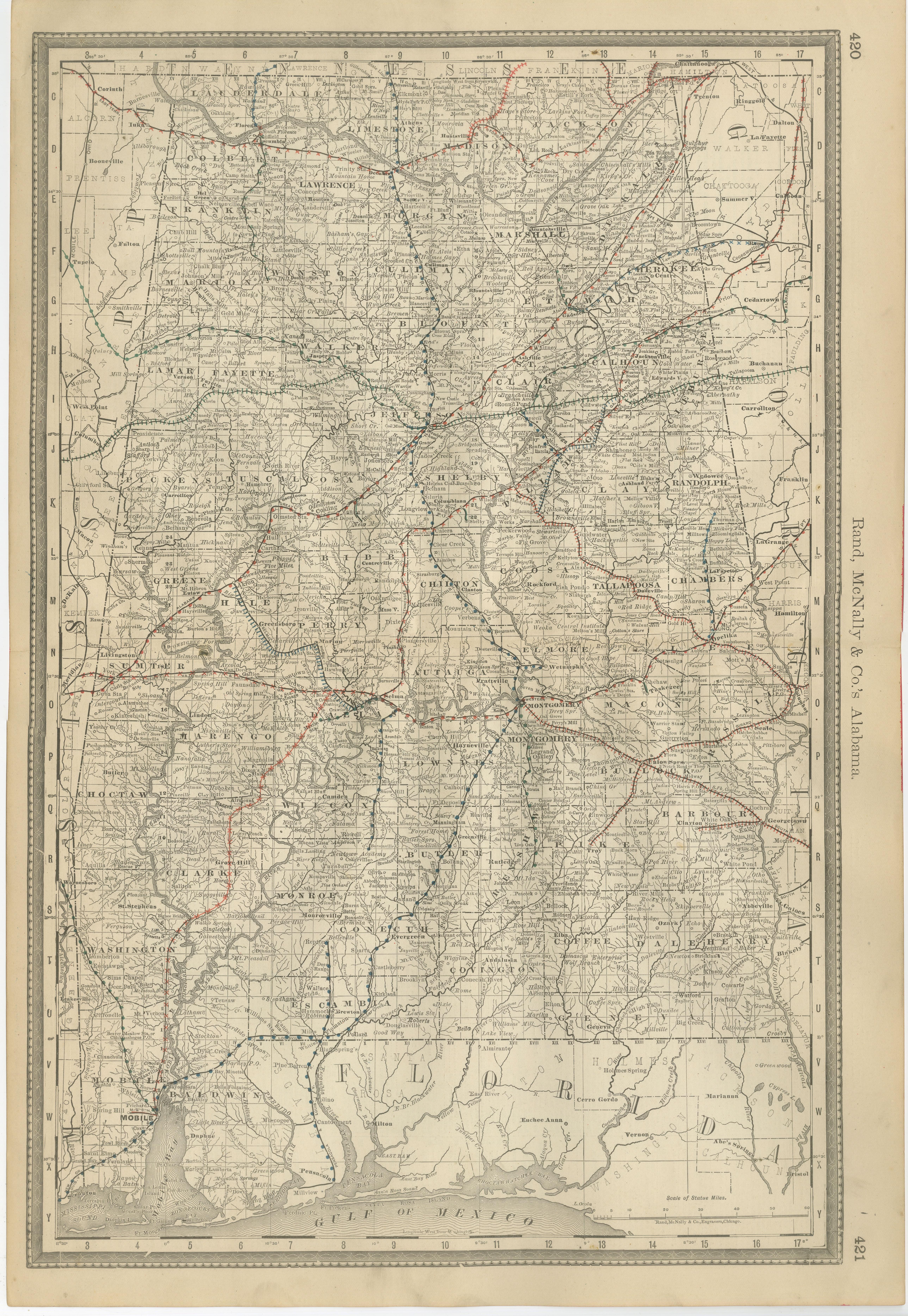
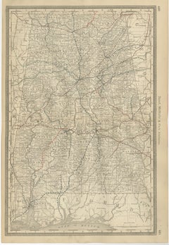
Alabama Antique Map 1888 – The Heart of Dixie, Railroads
Towns
Located in Langweer, NL
Alabama Map 1888 – Rand McNally Antique Lithograph
This antique 1888 map of Alabama, published by Rand, McNally & Co., provides a highly detailed view of the state during a period o...
Category
Antique Late 19th Century American Maps
Materials
Paper
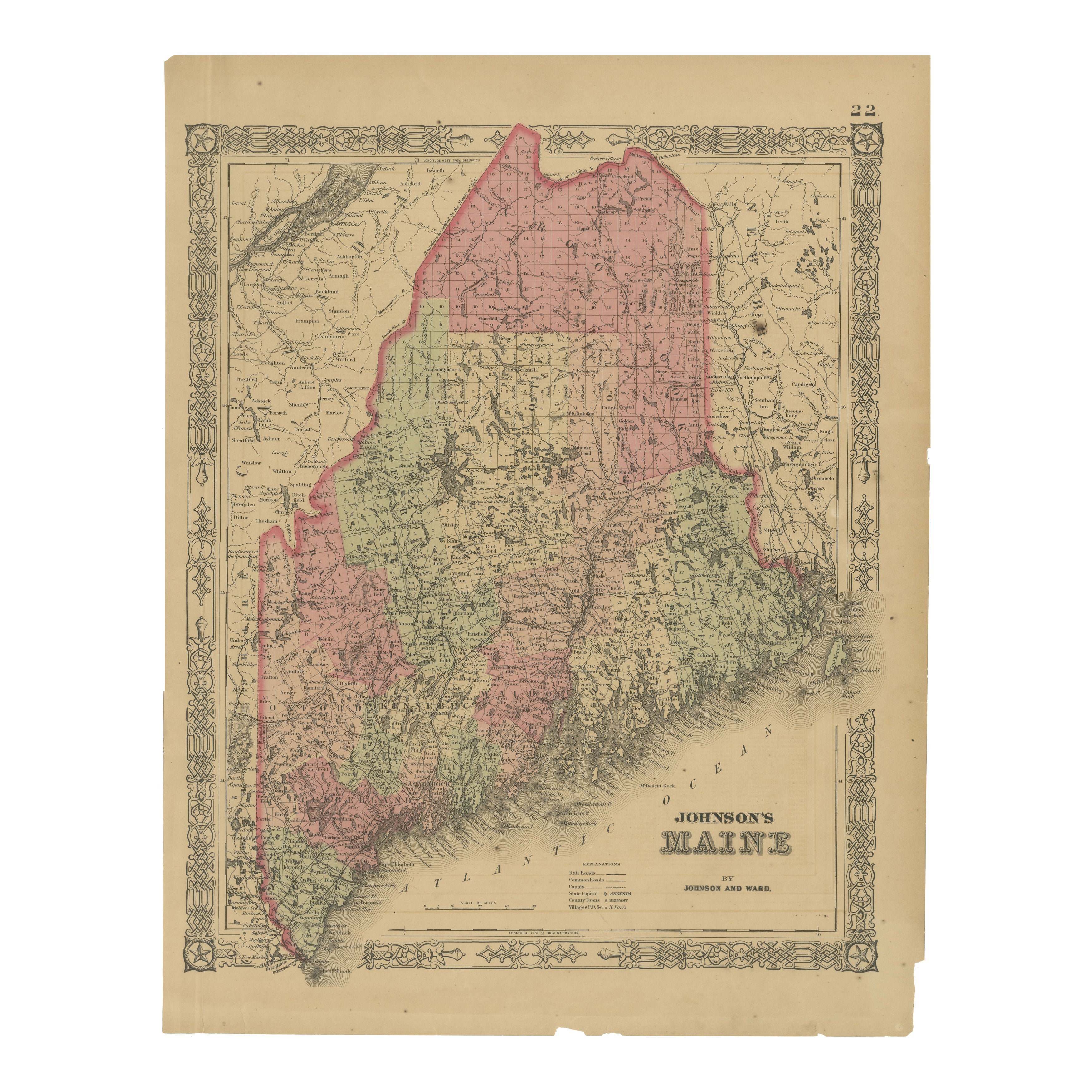
Maine County Map – Johnson, Hand-Colored, USA c.1864
Located in Langweer, NL
Johnson’s Maine Map, USA Published c.1864 – Hand-Colored County Map
This is a finely engraved and hand-colored map titled Johnson’s Maine, published by Johnson and Ward in New York ...
Category
Antique Mid-19th Century American Maps
Materials
Paper
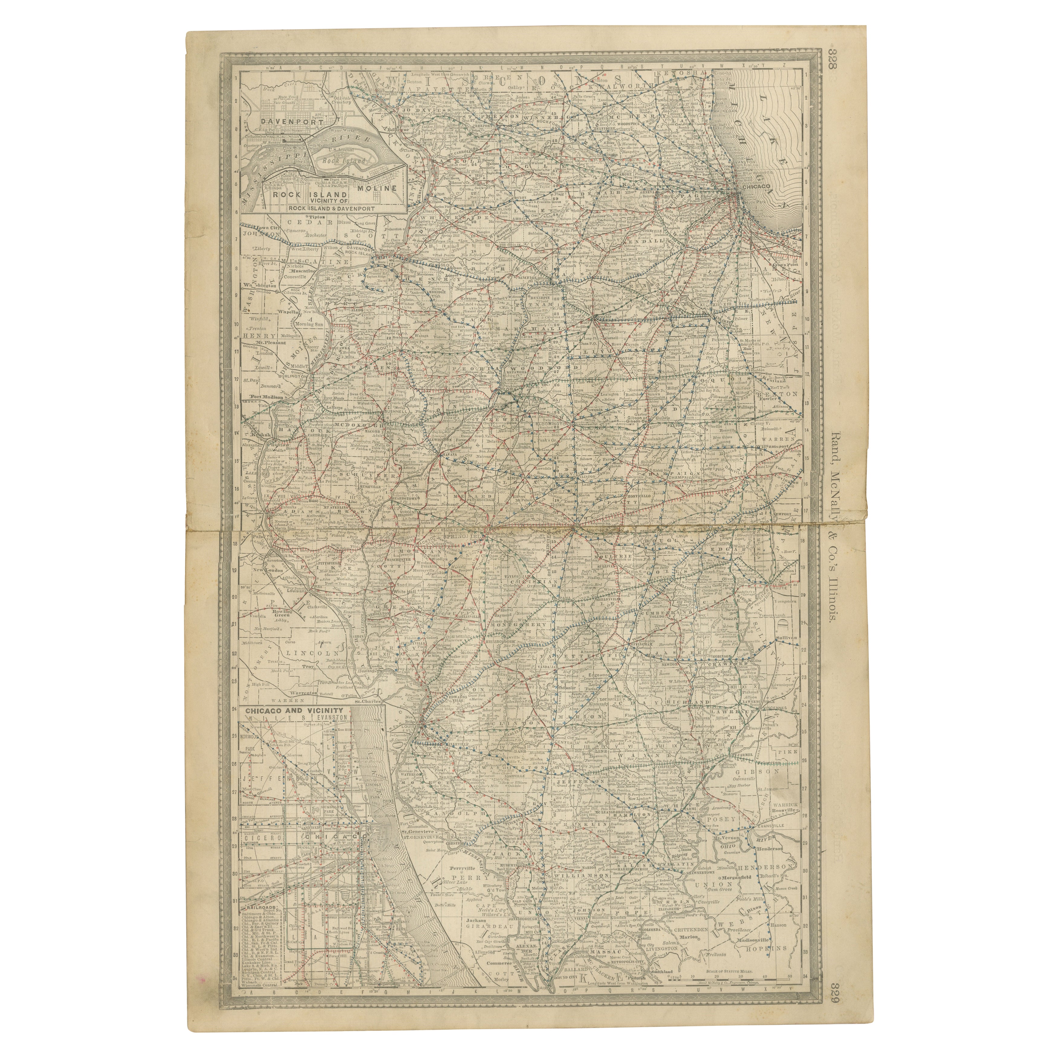
Detailed Antique Map of Illinois – Railroads, Cities
Counties, 1888
Located in Langweer, NL
Antique Map of Illinois – Railroads, Cities & Counties, 1888
This finely detailed antique map shows the state of Illinois in the late 19th century, engraved and published in 1888 by...
Category
Antique Late 19th Century American Maps
Materials
Paper

You May Also Like
Maine. USA Century Atlas state antique vintage map
Located in Melbourne, Victoria
'The Century Atlas. Maine'
Original antique map, 1903.
Central fold as issued. Map name and number printed on the reverse corners.
Sheet 40cm by 29.5cm.
Category
Early 20th Century Victorian More Prints
Materials
Lithograph
Original Antique Map of the American State of Maine, 1903
Located in St Annes, Lancashire
Antique map of Maine
Published By A & C Black. 1903
Original colour
Good condition
Unframed.
Free shipping
Category
Antique Early 1900s English Maps
Materials
Paper

1891 Map of Norfolk County Massachusetts
Located in Norwell, MA
1891 map of Norfolk county Massachusetts including the towns of Wrentham, Franklin, Medfield, Sherborn, Norwood etc., measures: 23 x 31.
Category
Antique 19th Century Maps

Large Original Antique Map of Maine, USA, C.1900
Located in St Annes, Lancashire
Fabulous map of Maine
Original color
Engraved and printed by the George F. Cram Company, Indianapolis.
Published, C.1900
Unframed
Free shipping.
Category
Antique 1890s American Maps
Materials
Paper
Large Original Antique Map of New Hampshire, USA, 1894
By Rand McNally
Co.
Located in St Annes, Lancashire
Fabulous map of New Hampshire
Original color
By Rand, McNally & Co.
Published, 1894
Unframed
Free shipping.
Category
Antique 1890s American Maps
Materials
Paper
Massachusetts, Eastern Part. USA. Century Atlas state antique vintage map
Located in Melbourne, Victoria
'The Century Atlas. Massachusetts, Eastern Part'
Original antique map, 1903.
Central fold as issued. Map name and number printed on the reverse corners.
Sheet 40cm by 29.5cm.
Category
Early 20th Century Victorian More Prints
Materials
Lithograph