Items Similar to Map of Asia Minor
Cyprus with Medallions – Weigel Engraving c.1720
Video Loading
Want more images or videos?
Request additional images or videos from the seller
1 of 12
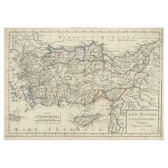
Map of Asia Minor
Cyprus with Medallions – Weigel Engraving c.1720
$448.04
$560.0520% Off
£333.72
£417.1620% Off
€376
€47020% Off
CA$616.99
CA$771.2320% Off
A$671.57
A$839.4720% Off
CHF 355.84
CHF 444.8020% Off
MX$8,076.70
MX$10,095.8720% Off
NOK 4,524.46
NOK 5,655.5720% Off
SEK 4,146.16
SEK 5,182.7020% Off
DKK 2,864.87
DKK 3,581.0920% Off
About the Item
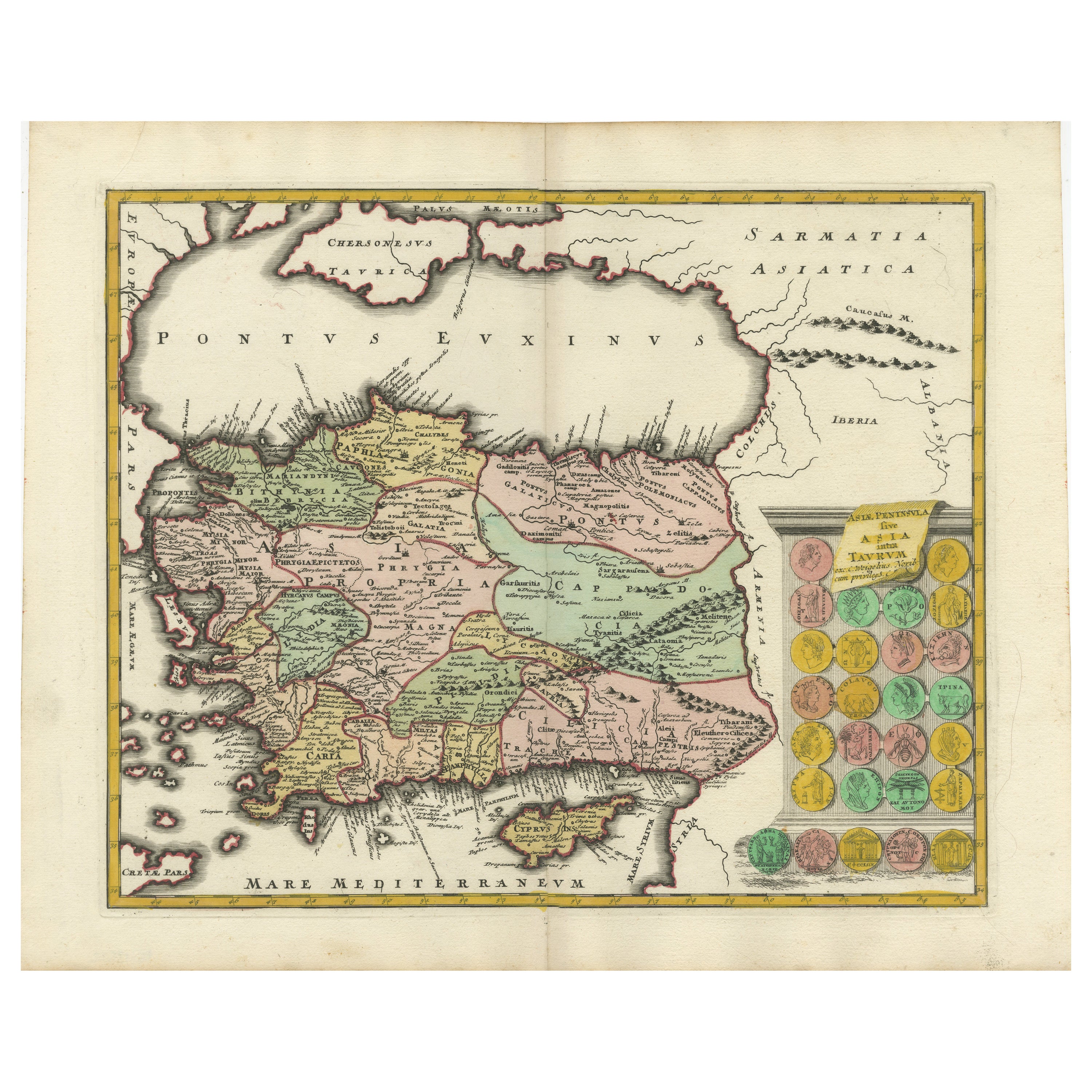
Map of Asia Minor
Cyprus with Medallions – Weigel Engraving c.1720
This finely engraved antique map, titled Asiae Peninsula sive Asia intra Taurum, presents an early 18th-century interpretation of Asia Minor and Cyprus as understood in classical antiquity. The map, published by Christoph Weigel around 1720, offers a comprehensive look at the region stretching from the Taurus Mountains to the Aegean and Mediterranean Seas, including ancient territories such as Lydia, Lycia, Cappadocia, and Cilicia.
The visual composition is further enriched by 27 detailed medallion engravings at the right margin, representing classical figures, emperors, or mythological scenes, lending the map both historical depth and decorative appeal. These vignette-style embellishments reflect Weigel’s commitment to producing maps that were not only informative but also visually engaging for the educated audience of the Enlightenment.
The map is adorned with Latin labels and place names corresponding to Roman-era geography, making it an excellent tool for scholars or collectors interested in the classical world. The island of Cyprus is prominently depicted, along with major cities such as Ephesus, Antioch, Tarsus, and Iconium (modern Konya). The terrain is rendered in fine hachuring, and the coastal regions are marked with ancient harbors and towns.
Christoph Weigel (1654–1725) was a German engraver and publisher based in Nuremberg, renowned for his detailed historical maps, city plans, and scientific illustrations. His works are prized for their craftsmanship, clarity, and the integration of cartographic information with historical references.
Condition report: Overall very good condition with light age toning and a central fold, as issued. Slight edge wear and minor foxing confined to margins. Strong plate impression and clear detail throughout.
Framing tips: Ideal for display in a classic dark wood or gilded frame with a neutral or parchment-toned mount to highlight the engraved details and period aesthetics.
- Dimensions:Height: 15.04 in (38.2 cm)Width: 18.78 in (47.7 cm)Depth: 0.02 in (0.5 mm)
- Materials and Techniques:Paper,Engraved
- Place of Origin:
- Period:
- Date of Manufacture:c.1720
- Condition:Overall very good condition with light age toning and a central fold, as issued. Slight edge wear and minor foxing confined to margins. Strong plate impression and clear detail throughout.
- Seller Location:Langweer, NL
- Reference Number:Seller: BG-135721stDibs: LU3054336143002
About the Seller
5.0
Recognized Seller
These prestigious sellers are industry leaders and represent the highest echelon for item quality and design.
Platinum Seller
Premium sellers with a 4.7+ rating and 24-hour response times
Established in 2009
1stDibs seller since 2017
2,824 sales on 1stDibs
Typical response time: 1 hour
- ShippingRetrieving quote...Shipping from: Langweer, Netherlands
- Return Policy
More From This Seller
View AllDecorative Antique Map of Cyprus and Asia Minor by Christoph Weigel, Circa 1720
Located in Langweer, NL
Title: Asiae Peninsula sive Asia Intra Taurum by Christoph Weigel, Circa 1720 – Decorative Antique Map of Cyprus and Asia Minor
Description: Thi...
Category
Antique 1720s Maps
Materials
Paper
$629 Sale Price
20% Off
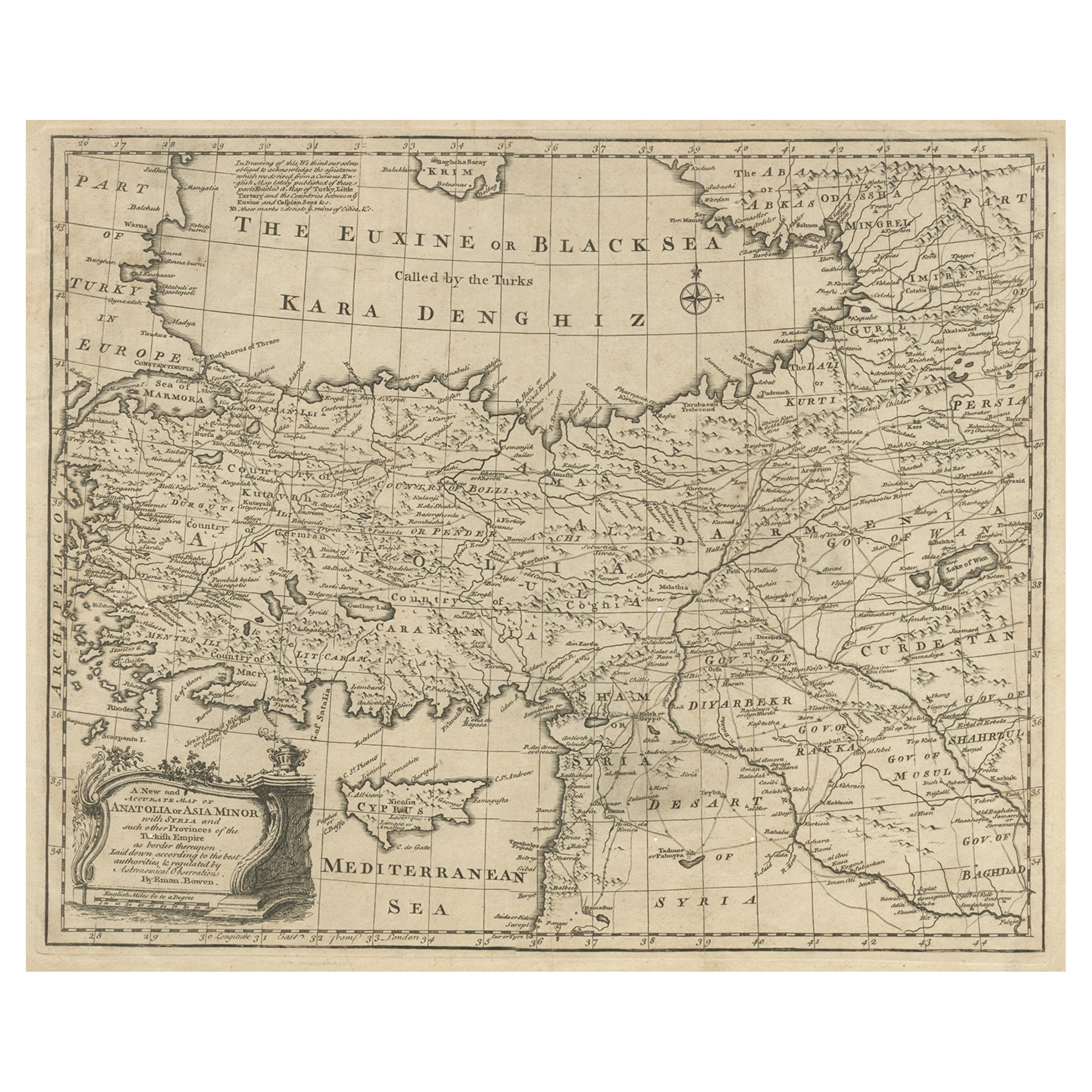
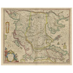
Antique Map of Asia Minor with Cyprus, Syria and Turkey and the Black Sea, 1747
Located in Langweer, NL
Antique map Middle East titled 'A New and accurate map of Anatolia or Asia Minor, with Syria and such other provinces of the Turkish Empire (.....
Category
Antique 18th Century Maps
Materials
Paper
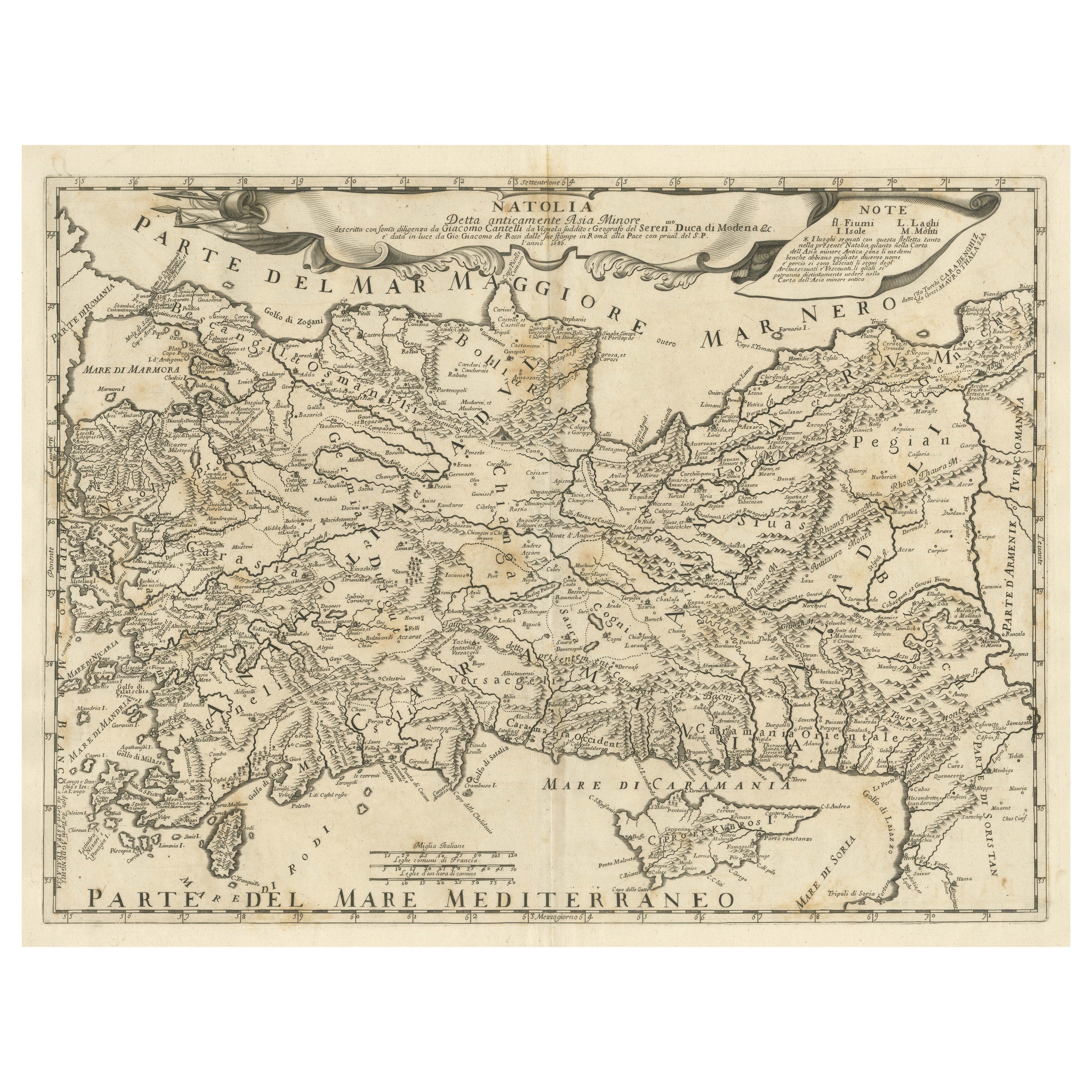
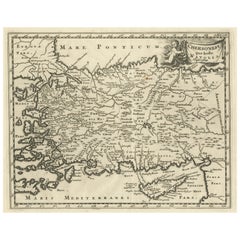
Original Italian Antique Map of Asia Minor and Cyprus and Neighboring Regions
Located in Langweer, NL
Antique map titled 'Natolia detta anticamente Asia Minor (..)'. Rare map of Asia Minor (Turkey) and Cyprus and neighboring regions. The map provides one of the most detailed and up t...
Category
Antique Late 17th Century Maps
Materials
Paper
$619 Sale Price
20% Off
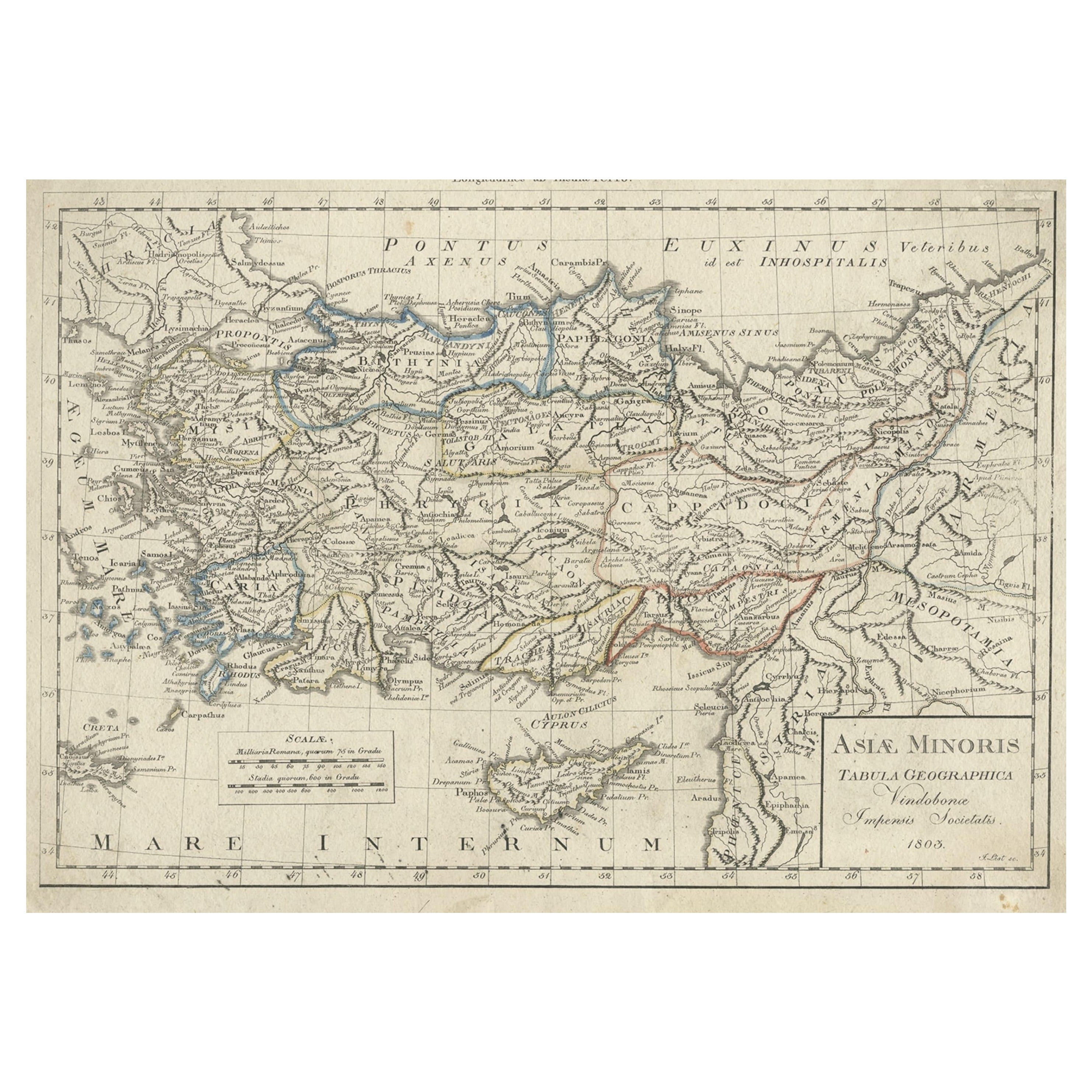
Antique Map of Asia Minor, Present-day Turkey and Cyprus, 1803
Located in Langweer, NL
Antique map titled 'Asiae Minoris Tabula Geographica'. Uncommon antique map of Asia minor, comprising most of what is present-day Turkey. Source unknown, to be determined.
Artists...
Category
Antique 19th Century Maps
Materials
Paper
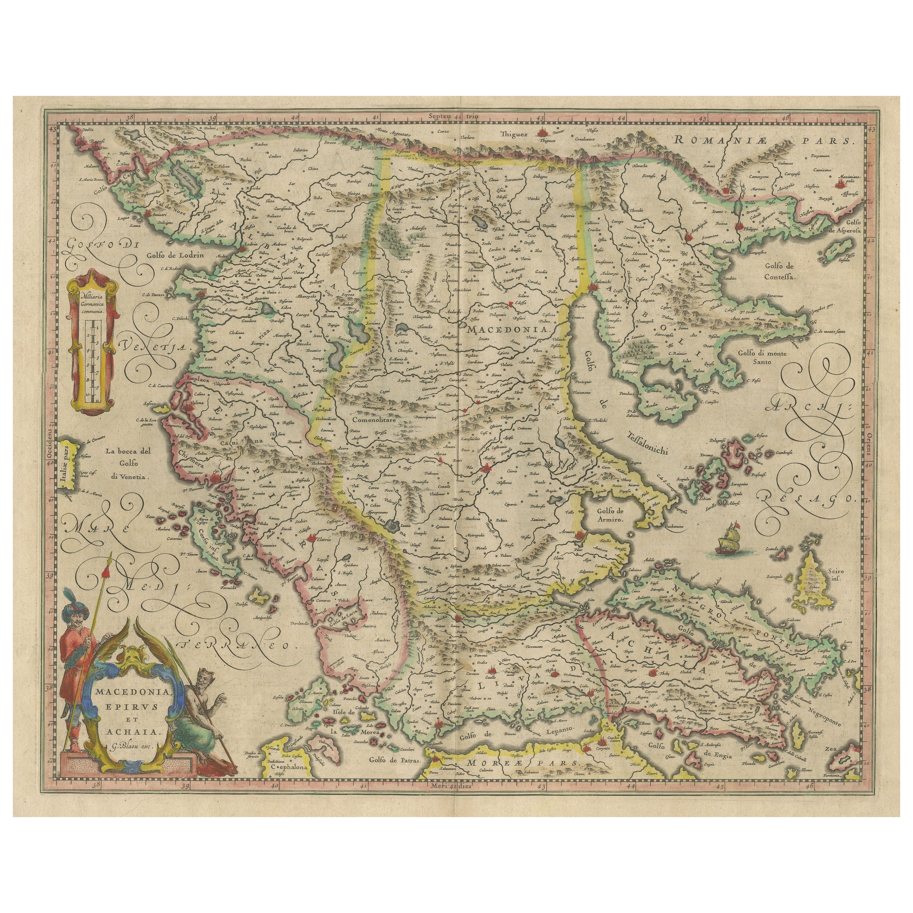
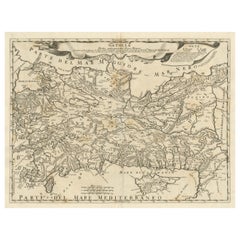
Antique Map of Macedonia, Northern Greece and part of Turkey in Europe
Located in Langweer, NL
Antique map titled 'Macedonia Epirus et Achaia'. Original old map of Macedonia, northern Greece, and part of Turkey in Europe. Published by W.J. Blaeu, circa 1640.
Willem Janszoon ...
Category
Antique Mid-17th Century Maps
Materials
Paper
$762 Sale Price
20% Off
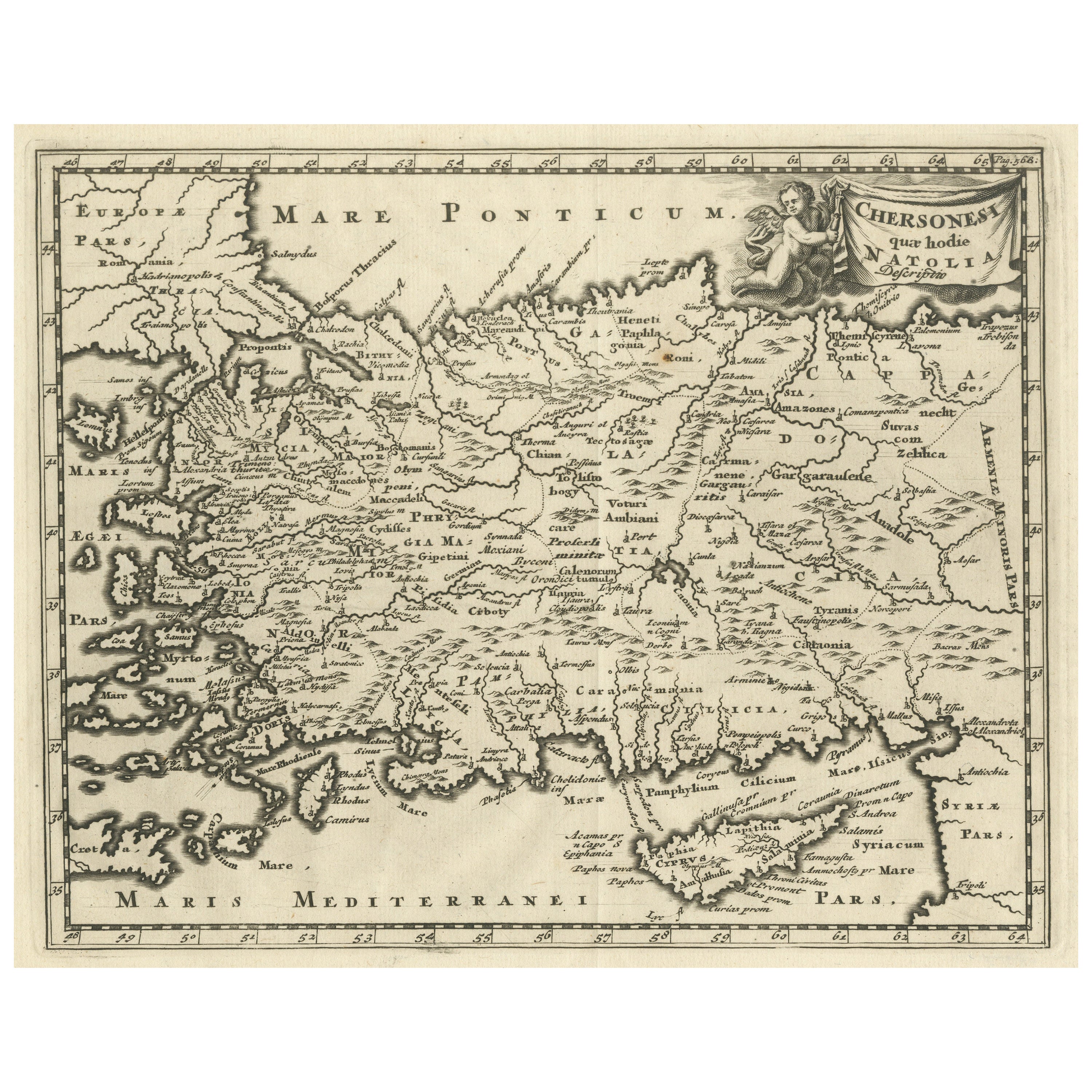
Antique Map of Asia Minor with part of the Greek Archipelago and Cyprus, 1729
Located in Langweer, NL
Antique map titled 'Chersonesi quae hodie Natolia Descriptio'. Decorative, smaller map of Asia Minor including part of the Greek Archipelago and Cyprus. The drape-style title cartouc...
Category
Antique Mid-18th Century German Maps
Materials
Paper
You May Also Like
Large Original Antique Map of Cyprus. 1894
Located in St Annes, Lancashire
Superb Antique map of Cyprus
Published Edward Stanford, Charing Cross, London 1894
Original colour
Good condition
Unframed.
Free shipping
Category
Antique 1890s English Maps
Materials
Paper

Original Antique Map of Ancient Greece, Achaia, Corinth, 1786
Located in St Annes, Lancashire
Great map of Ancient Greece. Showing the region of Thessaly, including Mount Olympus
Drawn by J.D. Barbie Du Bocage
Copper plate engraving by P.F Tardieu
Original hand color...
Category
Antique 1780s French Other Maps
Materials
Paper

Hand-Colored 18th Century Homann Map of the Black Sea, Turkey and Asia Minor
By Johann Baptist Homann
Located in Alamo, CA
An attractive original early 18th century hand-colored map of the Black Sea and Turkey entitled "Carte de L'Asie Minevre ou de la Natolie et du Pont Evxin Tiree des Voyages et des Ob...
Category
Antique Early 18th Century German Maps
Materials
Paper

Southern Greece: A Large 17th C. Hand-colored Map by Sanson and Jaillot
By Nicolas Sanson
Located in Alamo, CA
This large original hand-colored copperplate engraved map of southern Greece and the Pelopponese Peninsula entitled "La Moree Et Les Isles De Zante, Cefalonie, Ste. Marie, Cerigo & C...
Category
Antique 1690s French Maps
Materials
Paper

1790 Thomas Stackhouse Map, Entitled "Russia in Europe, " , Ric.a004
Located in Norton, MA
1790 Thomas Stackhouse map, entitled
"Russia in Europe"
Ric.a004
Stackhouse, Thomas
Russia in Europe [map]
London: T. Stackhouse, 1783. Map. Matted hand-colored copper engraving. Image size: 14.5 x 15.25 inches. Mat size: 22.75 x 23.75 inches. A beautiful example of this map of Eastern Europe...
Category
Antique 17th Century Unknown Maps
Materials
Paper

Engraving Depicting 16th Century Map of Terra Sancta
Located in Buchanan, MI
Abraham Ortelius (Flemish, 1527-1598) Terra Sancta.
Engraving depicting 16th century map of Terra Sancta. Site 15" x 19.5.
Category
Antique 18th Century and Earlier Maps
Materials
Paper

More Ways To Browse
Antique Scientific Illustration
Antique Scientific Illustrations
Asia Minor
Cyprus Furniture
Antique Furniture Cyprus
Irish Antiques 16th Century
Ithaca Antique Map
Leonard Jones
Russia Globe
Salt Lake City Used Furniture
World Map Copper
Green French Glass
Mid Century Modern Wicker Chair
Mid-Century Modern Wicker Chairs
Curved Back Mid Century Dining Chairs
Glass Stopper
Stretcher Tables
Antique French Lithographs