Items Similar to Map of Belgium and the Grand Duchy of Luxembourg, Leiden 1876


Want more images or videos?
Request additional images or videos from the seller
1 of 10
Map of Belgium and the Grand Duchy of Luxembourg, Leiden 1876
$384.34
£284.96
€320
CA$528
A$576.39
CHF 303.48
MX$6,904.52
NOK 3,881.37
SEK 3,543.76
DKK 2,438.28
About the Item
Title: Map of Belgium and the Grand Duchy of Luxembourg, Leiden 1876
Description:
This elegant 19th-century Dutch map, titled “België en het Groot Hertogdom Luxemburg,” was published in 1876 in the Nieuwe Hand-Atlas der Aarde in haren Tegenwoordigen Toestand by M. Frijlink, revised by A. van Otterloo, and printed by D. Noothoven van Goor in Leiden. The map presents Belgium and Luxembourg in fine detail, showcasing the political and geographical landscape of the region during the late 19th century.
Each province is carefully outlined in soft hand-coloring—Flanders, Brabant, Hainaut, Liège, Namur, and Luxembourg—while major rivers, roads, and railways are meticulously engraved. Prominent cities including Brussels, Antwerp, Ghent, Bruges, Liège, and Luxembourg are marked clearly, with three inset maps providing closer studies: one of Brussels (*Brussel*), one of Antwerp (*Antwerpen*), and one showing the vicinity of Liège (*Omstreken van Luik*). The map also labels neighboring regions in France, Germany, and the Netherlands, emphasizing Belgium’s position at the heart of Europe.
Produced during an era when Belgium was consolidating its modern infrastructure and identity, this map combines historical context with the precision and clarity of Dutch educational cartography. The fine engraving, balanced layout, and clean typography typify the craftsmanship of the Noothoven van Goor publishing house in Leiden, known for its refined geographic atlases.
Condition report:
Good condition with light even toning and occasional small foxing marks along the outer edges. Original center fold as issued. The printed image remains crisp, and the coloring is soft and well-preserved. No tears or repairs.
Framing tips:
This map’s balanced composition and delicate coloring make it ideal for framing with a light cream or ivory mat and a thin black or walnut frame. It pairs beautifully with maps of the Netherlands or France from the same series, adding historical character to a study or office.
Technique: Lithograph with original hand-coloring
Maker: M. Frijlink
A. van Otterloo, published by D. Noothoven van Goor, Leiden, 1876
- Dimensions:Height: 17.33 in (44 cm)Width: 21.66 in (55 cm)Depth: 0.01 in (0.2 mm)
- Materials and Techniques:
- Place of Origin:
- Period:
- Date of Manufacture:1876
- Condition:Good condition with light even toning and occasional small foxing marks along the outer edges. Original center fold as issued. The printed image remains crisp, and the coloring is soft and well-preserved. No tears or repairs.
- Seller Location:Langweer, NL
- Reference Number:Seller: BG-12788-141stDibs: LU3054347455032
About the Seller
5.0
Recognized Seller
These prestigious sellers are industry leaders and represent the highest echelon for item quality and design.
Platinum Seller
Premium sellers with a 4.7+ rating and 24-hour response times
Established in 2009
1stDibs seller since 2017
2,810 sales on 1stDibs
Typical response time: <1 hour
- ShippingRetrieving quote...Shipping from: Langweer, Netherlands
- Return Policy
More From This Seller
View AllBenelux Antique Map – Netherlands, Belgium
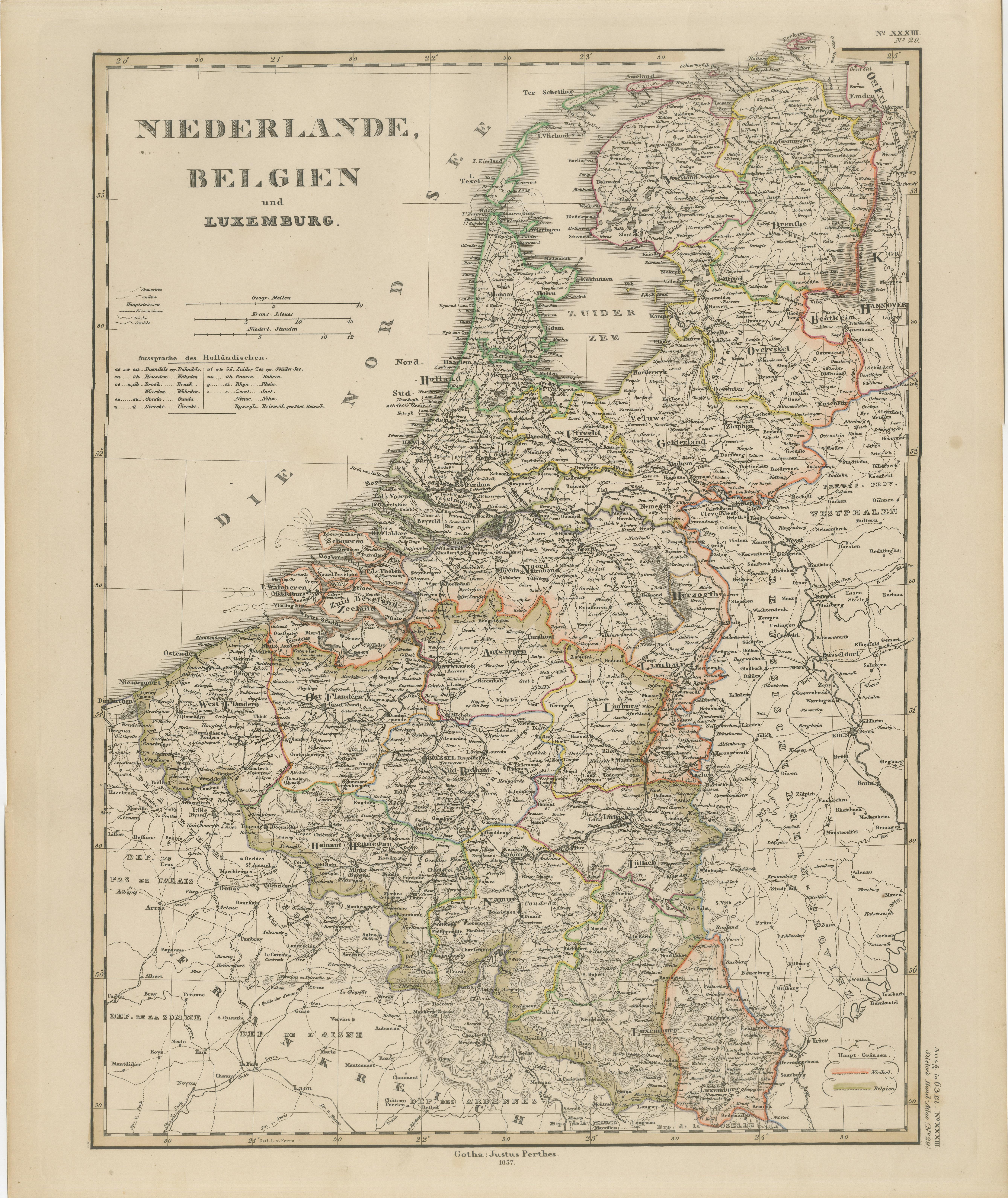
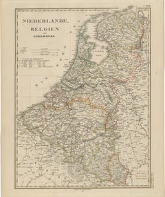
Luxembourg by Perthes, 1857
Located in Langweer, NL
1857 Map of Netherlands, Belgium & Luxembourg – Justus Perthes Engraving
Antique map titled "Niederlande, Belgien und Luxemburg," published by Justus Perthes in Gotha in 1857. This...
Category
Antique Mid-19th Century German Maps
Materials
Paper
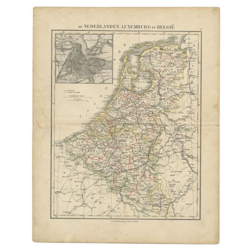
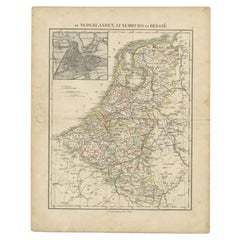
Antique Map of the Netherlands, Belgium and Luxembourg by Petri, c.1873
Located in Langweer, NL
Antique map titled 'De Nederlanden, Luxemburg en België'. Old map depicting the Netherlands, Luxembourg and Belgium. With an inset map of Amsterdam. T...
Category
Antique 19th Century Maps
Materials
Paper
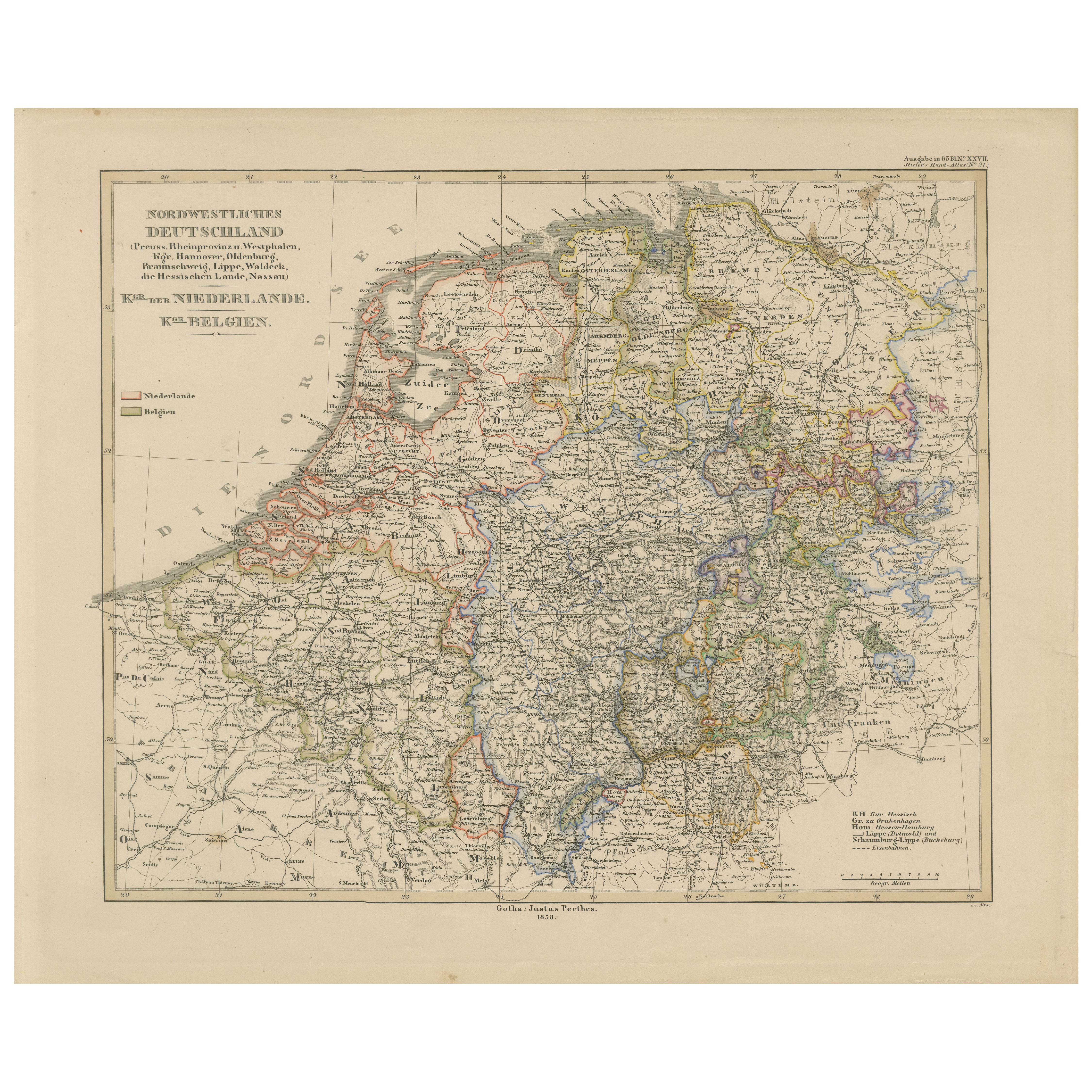
Antique Map of Prussia, Hanover, Netherlands
Belgium – 1858
Located in Langweer, NL
Antique Map of Northwestern Germany, Netherlands & Belgium – 1858
Detailed 19th-century engraved map titled "Nordwestliches Deutschland, Kgr. der Niederlande, Kgr. Belgien" (Northwe...
Category
Antique Mid-19th Century German Maps
Materials
Paper
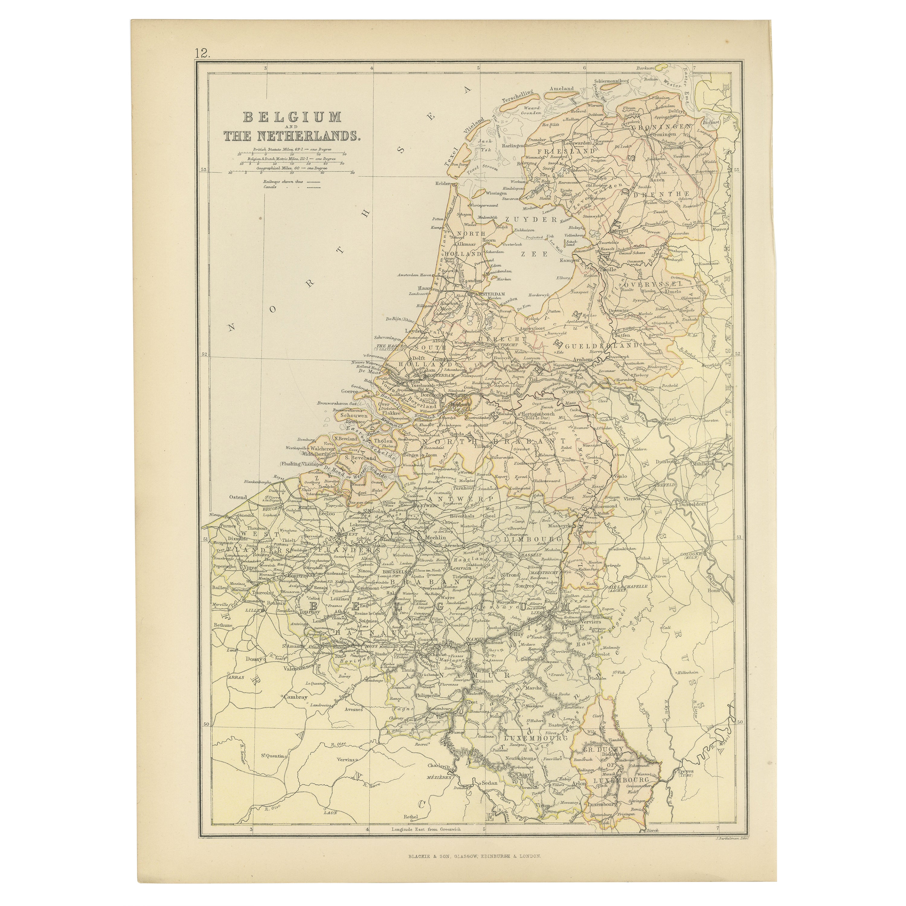
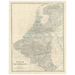
Antique Map of Belgium and The Netherlands by A.K. Johnston, 1865
Located in Langweer, NL
Antique map titled 'Belgium and The Netherlands'. This map originates from the ‘Royal Atlas of Modern Geography’ by Alexander Keith Johnston. Published by William Blackwood and Sons,...
Category
Antique Mid-19th Century Maps
Materials
Paper
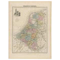
Antique Map of the Netherlands and Belgium, circa 1880
Located in Langweer, NL
Antique map titled 'Hollande et Belgique'. Old map of the Netherlands and Belgium. With decorative vignette of the Antwerp cathedral. This map o...
Category
Antique 19th Century Maps
Materials
Paper
$182 Sale Price
20% Off
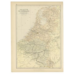
1882 Map of Belgium and The Netherlands Highlighting Geographical Details
Located in Langweer, NL
This 1882 map of Belgium and The Netherlands, published by Blackie and Son as part of the 'Comprehensive Atlas and Geography of the World,' offers a detailed representation of the tw...
Category
Antique 1880s Maps
Materials
Paper
$182 Sale Price
20% Off
Free Shipping
You May Also Like
The Netherlands (Holland), Belgium and Luxemburg. Century Atlas antique map
Located in Melbourne, Victoria
'The Century Atlas. The Netherlands (Holland), Belgium and Luxemburg.'
Original antique map, 1903.
Inset maps of 'Amsterdam' and 'Brussels'.
Central fold as issued. Map name and num...
Category
Early 20th Century Victorian More Prints
Materials
Lithograph

France, Northern Part. Century Atlas antique map
Located in Melbourne, Victoria
'The Century Atlas. France, Northern Part.'
Original antique map, 1903.
Inset maps of 'France in Provinces' and 'Paris and Vicinity'.
Central fold as issued. Map name and number pr...
Category
Early 20th Century Victorian More Prints
Materials
Lithograph

1752 Vaugoundy Map of Flanders : Belgium, France, and the Netherlands, Ric.a002
Located in Norton, MA
Large Vaugoundy Map of Flanders:
Belgium, France, and the Netherlands
Colored -1752
Ric.a002
Description: This is a 1752 Didier Robert de Vaugondy map of Flanders. The map de...
Category
Antique 17th Century Unknown Maps
Materials
Paper

Aube, France. Antique map of a French department, 1856
By Victor Levasseur
Located in Melbourne, Victoria
'Dept. de L'Aube', steel engraving with original outline hand-colouring., 1856, from Levasseur's 'Atlas National Illustre'.
This area of France is known for its production of Chaou...
Category
19th Century Naturalistic Landscape Prints
Materials
Engraving

Map of Haute Vienne - Original Lithograph - 19th Century
Located in Roma, IT
Map of Haute Vienne is an original lithograph artwork realized by an Anonymous engraver of the 19th century.
Printed in the series of "France Pittoresque".
Titled "France Pittore...
Category
19th Century Modern Figurative Prints
Materials
Lithograph

Austria-Hungary, Western Part. Century Atlas antique vintage map
Located in Melbourne, Victoria
'The Century Atlas. Austria-Hungary, Western Part'
Original antique map, 1903.
Central fold as issued. Map name and number printed on the reverse corners.
Sheet 40cm by 29.5cm.
Category
Early 20th Century Victorian More Prints
Materials
Lithograph
