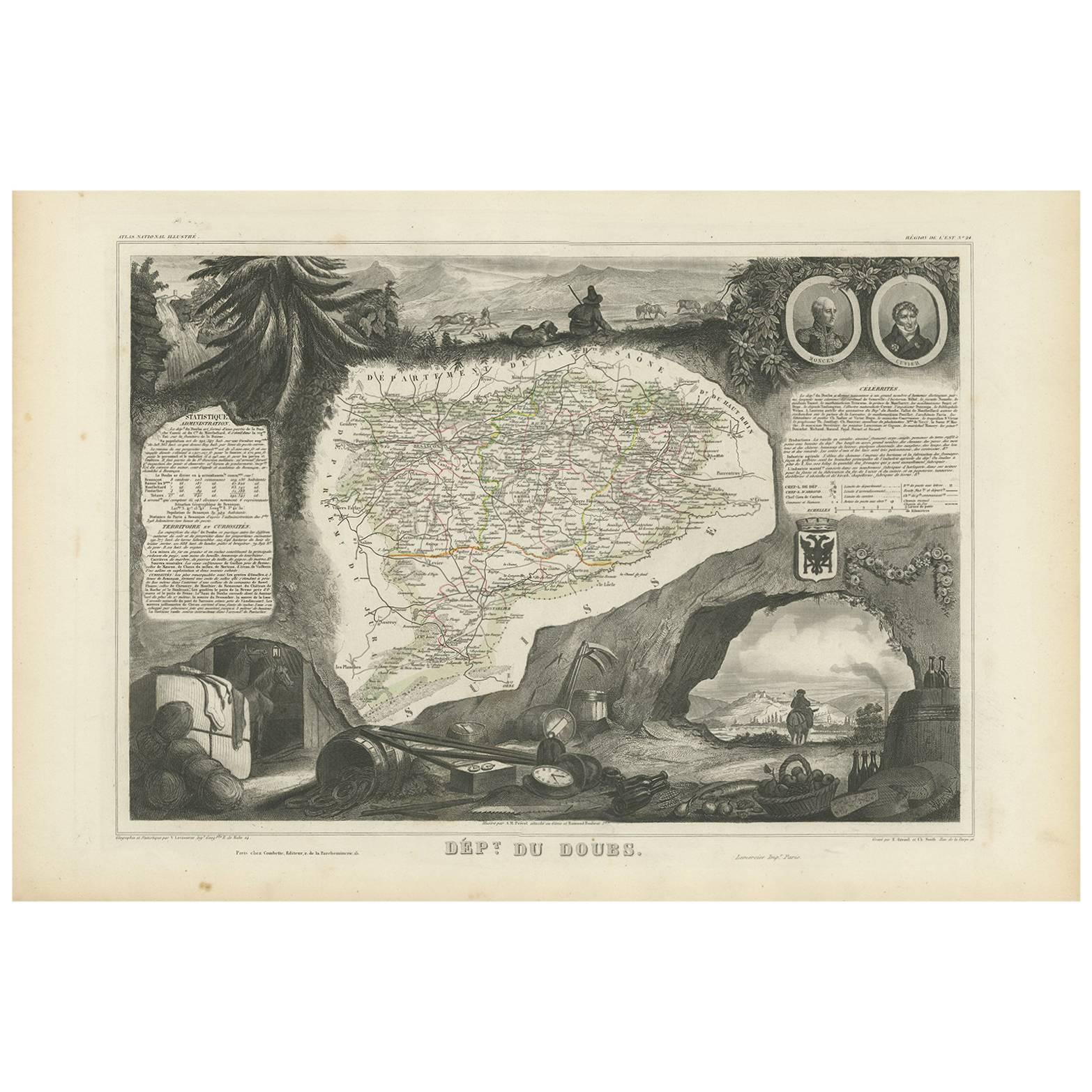
Items Similar to Map of Doubs France with Besançon and Swiss Border Landscape, 19th Century


Want more images or videos?
Request additional images or videos from the seller
1 of 10
Map of Doubs France with Besançon and Swiss Border Landscape, 19th Century
$143.46
£107.07
€120
CA$197.89
A$216.46
CHF 113.97
MX$2,584.31
NOK 1,452.59
SEK 1,328.77
DKK 914.20
About the Item
Map of Doubs France with Besançon and Swiss Border Landscape, 19th Century
Description:
This decorative 19th-century map of the department of Doubs in eastern France was drawn by Alexandre Vuillemin and published in Paris by Migeon as part of the *Nouvel Atlas Illustré*. Situated along the Swiss border, Doubs is a region defined by its mountainous terrain, rich natural beauty, and a long history of scientific and cultural achievement—all reflected in this finely engraved and hand-colored map.
The map shows the department in great detail, with towns, roads, rivers, and mountain ranges clearly engraved and bordered in soft violet watercolor. Besançon, the prefecture and historic heart of the region, is prominently displayed near the center. Other communes such as Montbéliard, Pontarlier, Morteau, and Baume-les-Dames are also clearly labeled.
In the lower left corner is a portrait of Georges Cuvier, the renowned naturalist and paleontologist born in Montbéliard. His scientific legacy is subtly honored in the floral and shell motifs surrounding his likeness. The vignette in the lower right captures the fortified city of Besançon along the Doubs River, nestled among hills and cliffs—an iconic scene that speaks to the city's strategic and cultural importance. The right edge also features the coat of arms of Doubs and a small image of the Saut du Doubs, a picturesque waterfall near the Swiss border.
Doubs is located within the Jura Mountains and forms part of the historic region of Franche-Comté. While not a major wine-producing department like nearby Burgundy, Doubs is known for its production of regional specialties including Comté cheese, smoked sausages, absinthe (especially around Pontarlier), and Jura wines from adjacent departments. Its mountainous terrain supports dairy farming, forestry, and small-scale viticulture along select valleys.
This map is not only a fine piece of decorative cartography, but also a celebration of Doubs’ blend of natural science, alpine beauty, and borderland heritage. It is ideal for collectors with interests in French geography, scientific history, or 19th-century engraving.
Condition summary:
Very good condition with some light foxing and toning in the margins. The engraved lines remain sharp and the original hand coloring is fresh and clean.
Framing tips:
This map suits a dark wood or black frame to emphasize the borderland topography. Pair with a light beige or soft lavender mat to enhance the violet border tones. Use UV-protective glass for long-term preservation.
- Dimensions:Height: 10.28 in (26.1 cm)Width: 12.8 in (32.5 cm)Depth: 0.01 in (0.2 mm)
- Materials and Techniques:Paper,Engraved
- Place of Origin:
- Period:
- Date of Manufacture:circa 1850
- Condition:Very good condition with some light foxing and toning in the margins. The engraved lines remain sharp and the original hand coloring is fresh and clean.
- Seller Location:Langweer, NL
- Reference Number:Seller: BG-13331-241stDibs: LU3054345363862
About the Seller
5.0
Recognized Seller
These prestigious sellers are industry leaders and represent the highest echelon for item quality and design.
Platinum Seller
Premium sellers with a 4.7+ rating and 24-hour response times
Established in 2009
1stDibs seller since 2017
2,809 sales on 1stDibs
Typical response time: 1 hour
- ShippingRetrieving quote...Shipping from: Langweer, Netherlands
- Return Policy
More From This Seller
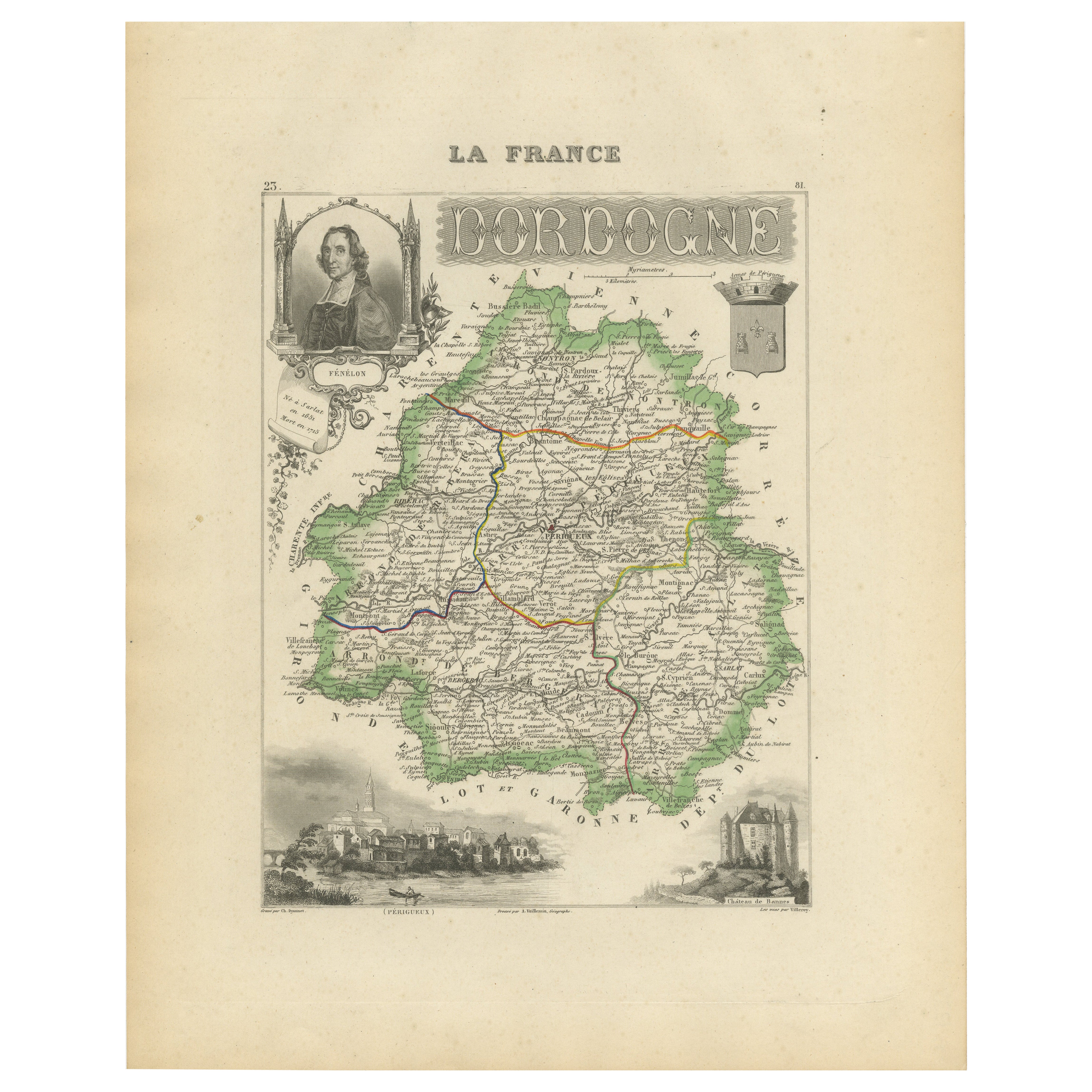
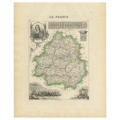
View AllMap of Dordogne France with Périgueux and Château de Jumilhac, 19th Century
Located in Langweer, NL
Map of Dordogne France with Périgueux and Château de Jumilhac, 19th Century
Description:
This richly detailed 19th-century map of the Dordogne department in southwestern France was ...
Category
Antique Mid-19th Century French Maps
Materials
Paper
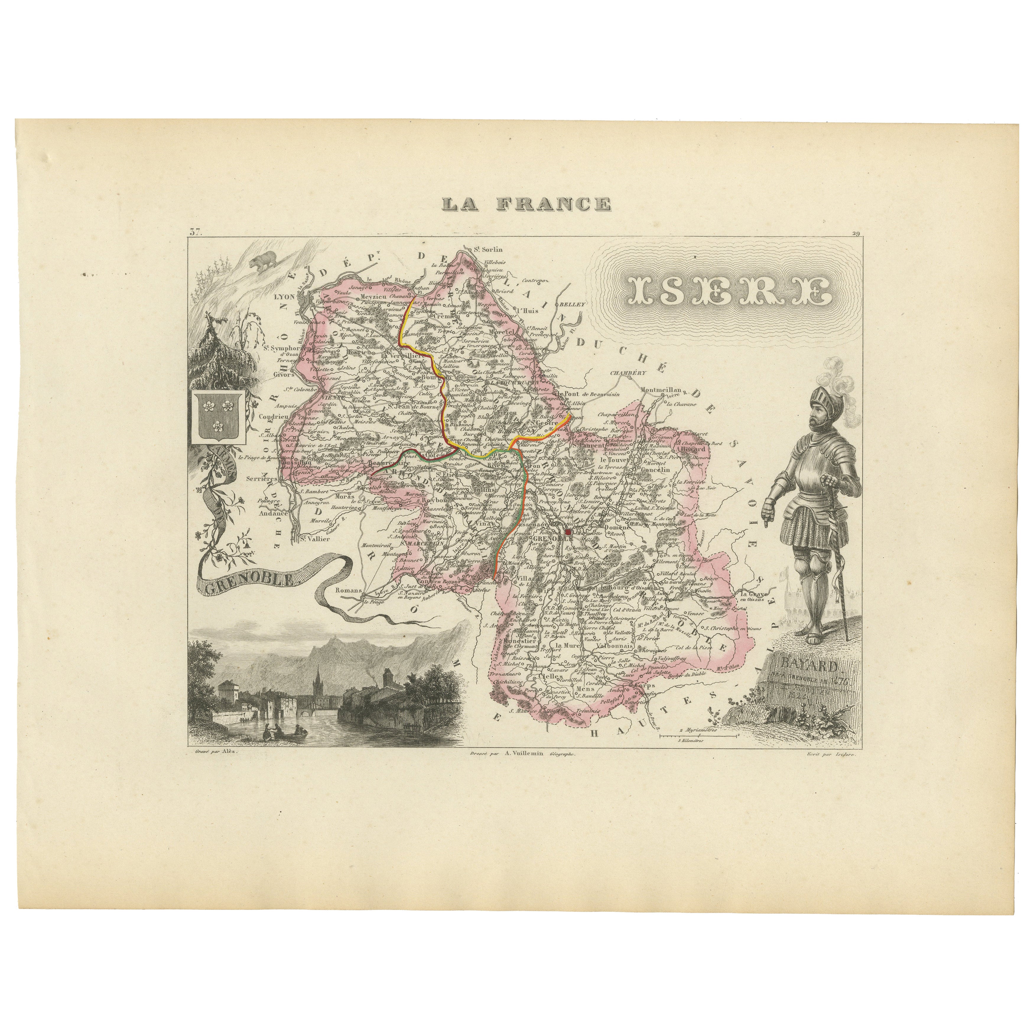
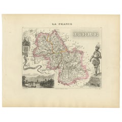
Antique French Map of Isère Region with Grenoble, Vienne, Dauphiné, 1800s
Located in Langweer, NL
Antique Map of Isère, France by Vuillemin, 19th Century
This decorative 19th-century map presents the département of Isère in southeastern France, engraved by Alexandre Vuillemin. C...
Category
Antique Mid-19th Century French Maps
Materials
Paper
Antique Map of Doubs ‘France’ by V. Levasseur, 1854
By Victor Levasseur
Located in Langweer, NL
Antique map titled 'Dépt. du Doubs'. Map of the French department of Doubs, France. The whole is surrounded by elaborate decorative engravings designed to illustrate both the natural...
Category
Antique Mid-19th Century Maps
Materials
Paper
Map of Aube France with Troyes and Champagne Wine Region, 19th Century
Located in Langweer, NL
Map of Aube France with Troyes and Champagne Vineyards by Vuillemin, 19th c
Description:
This 19th-century map of the Aube department in the Grand Est region of northeastern France ...
Category
Antique Mid-19th Century French Maps
Materials
Paper

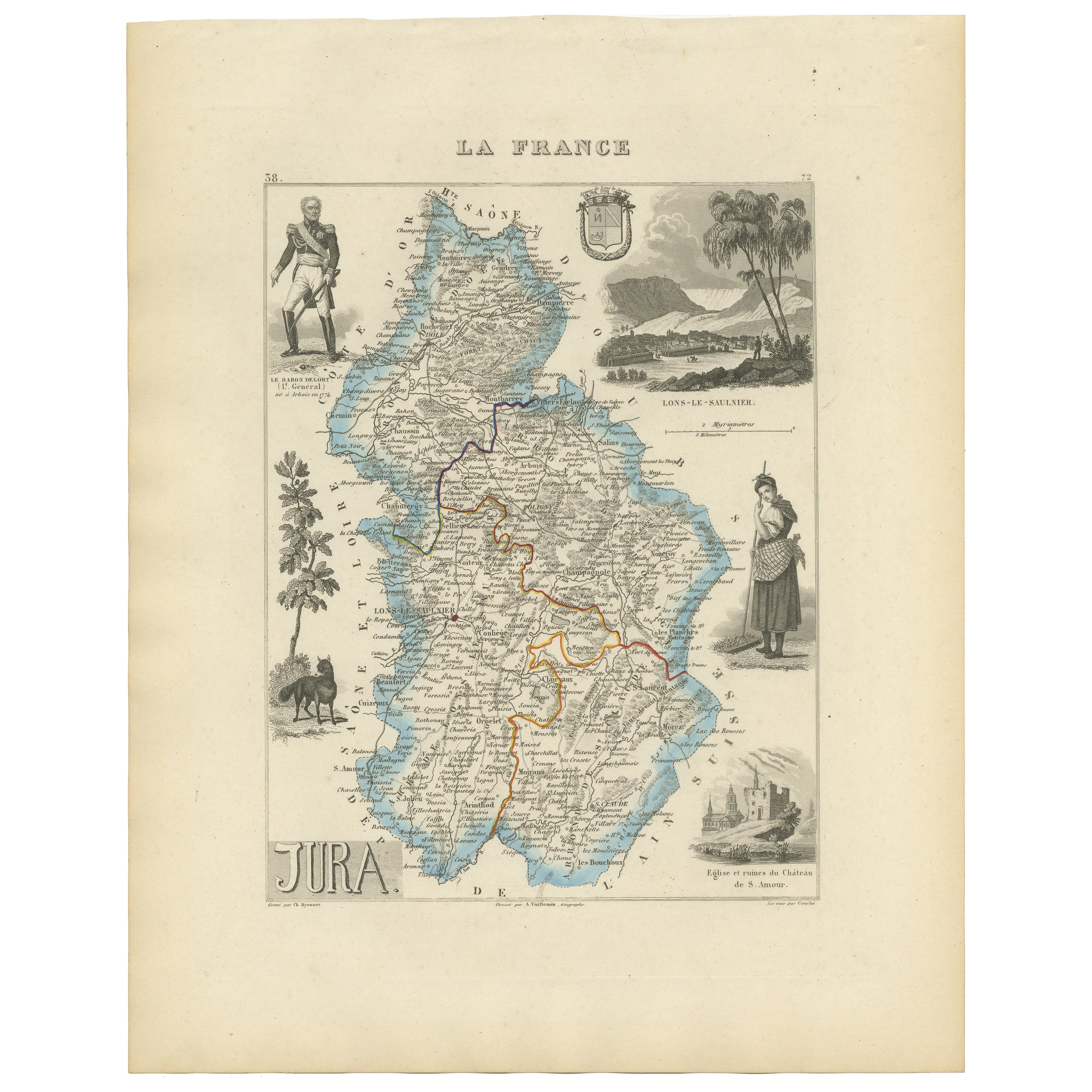
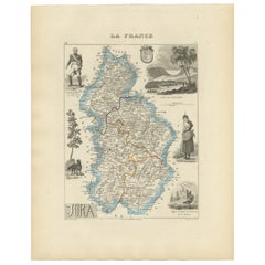
Antique French Map of Jura Region with Lons-le-Saunier, Dole, 1800s
Located in Langweer, NL
Antique Map of Jura, France by Vuillemin, 19th Century
This decorative 19th-century engraved map shows the département of Jura in eastern France, produced by Alexandre Vuillemin. Th...
Category
Antique Mid-19th Century French Maps
Materials
Paper
Map of Côtes-du-Nord France with Saint-Brieuc and Brittany Coastline, c.1850
Located in Langweer, NL
Map of Côtes-du-Nord France with Saint-Brieuc and Brittany Coastline, 19th c
Description:
This elegant 19th-century map of Côtes-du-Nord, the historic name for what is now known as ...
Category
Antique Mid-19th Century French Maps
Materials
Paper

You May Also Like
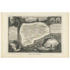
Aube, France. Antique map of a French department, 1856
By Victor Levasseur
Located in Melbourne, Victoria
'Dept. de L'Aube', steel engraving with original outline hand-colouring., 1856, from Levasseur's 'Atlas National Illustre'.
This area of France is known for its production of Chaou...
Category
19th Century Naturalistic Landscape Prints
Materials
Engraving

Jura, France. Antique map of a French department, 1856
By Victor Levasseur
Located in Melbourne, Victoria
'Dept. du Jura', steel engraving with original outline hand-colouring., 1856, from Levasseur's 'Atlas National Illustre'.
The Jura wines are very distinctive and unusual, such as V...
Category
19th Century Naturalistic Landscape Prints
Materials
Engraving

Map of Deux Sèvres - Original Etching - 19th Century
Located in Roma, IT
Map of Deux Sèvres is an original antique etching realized by an anonymous engraver of the 19th Century.
Printed in series of "France Pittoresque" at the top center.
The state of p...
Category
19th Century Modern Figurative Prints
Materials
Etching

Bas Rhin, France. Antique map of a French department, 1856
By Victor Levasseur
Located in Melbourne, Victoria
'Dept. du Bas Rhin', steel engraving with original outline hand-colouring., 1856, from Levasseur's Atlas National Illustre.
Part of the Alsace wine region surrounding Strasbourg. T...
Category
19th Century Naturalistic Landscape Prints
Materials
Engraving

Large 19th Century Map of France
Located in Pease pottage, West Sussex
Large 19th Century Map of France.
Remarkable condition, with a pleasing age worn patina.
Recently framed.
France Circa 1874.
Category
Antique Late 19th Century French Maps
Materials
Linen, Paper

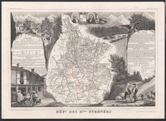
Hautes Pyrenees, France. Antique map of a French department, 1856
By Victor Levasseur
Located in Melbourne, Victoria
'Dept. des Hautes Pyrenees', steel engraving with original outline hand-colouring., 1856, from Levasseur's Atlas National Illustre.
This area is home to the wine producing region, ...
Category
19th Century Naturalistic Landscape Prints
Materials
Engraving
More Ways To Browse
Paisley Rugs and Carpets
Black And Chrome Lounge Chair
Vintage 1930 Dining Room Set
Antique Victorian Dining Tables
Environment Furniture
Italian Plastic Chairs
Made In Belgium
Black Crystal Glasses
French Mid Century Modern Rug
China Silk Rug
Chrome Glass Coffee Tables
Antique Italian Chairs
Antique Walnut Bar
Beni Ourain Rugs
French Iron And Glass Table
Glass Top Wood Base Coffee Tables
T Chair
Antique Silver Basket