Items Similar to Map of the Dutchy of Holstein and the Territories of Hamburg
Lübek, 1875

Want more images or videos?
Request additional images or videos from the seller
1 of 6
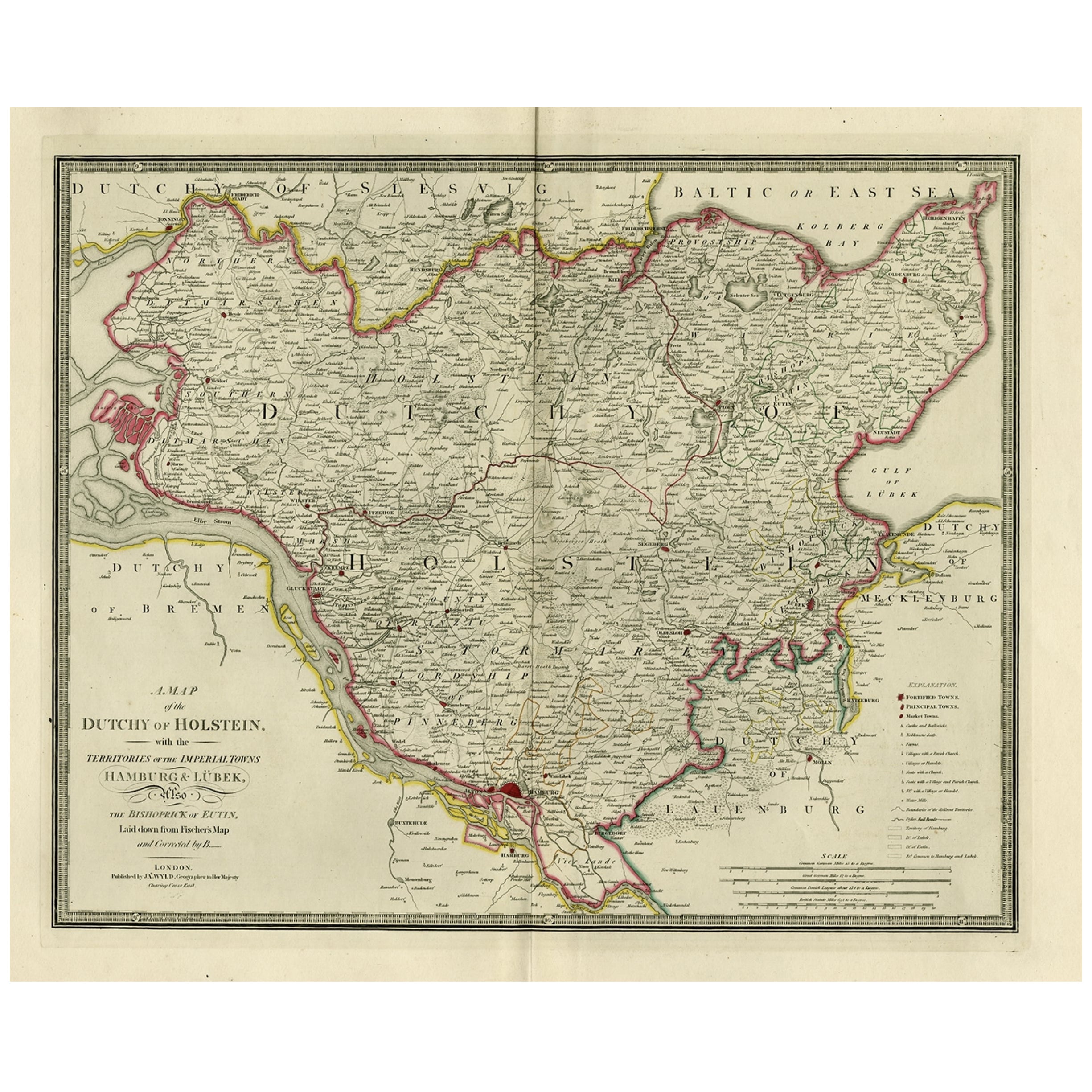
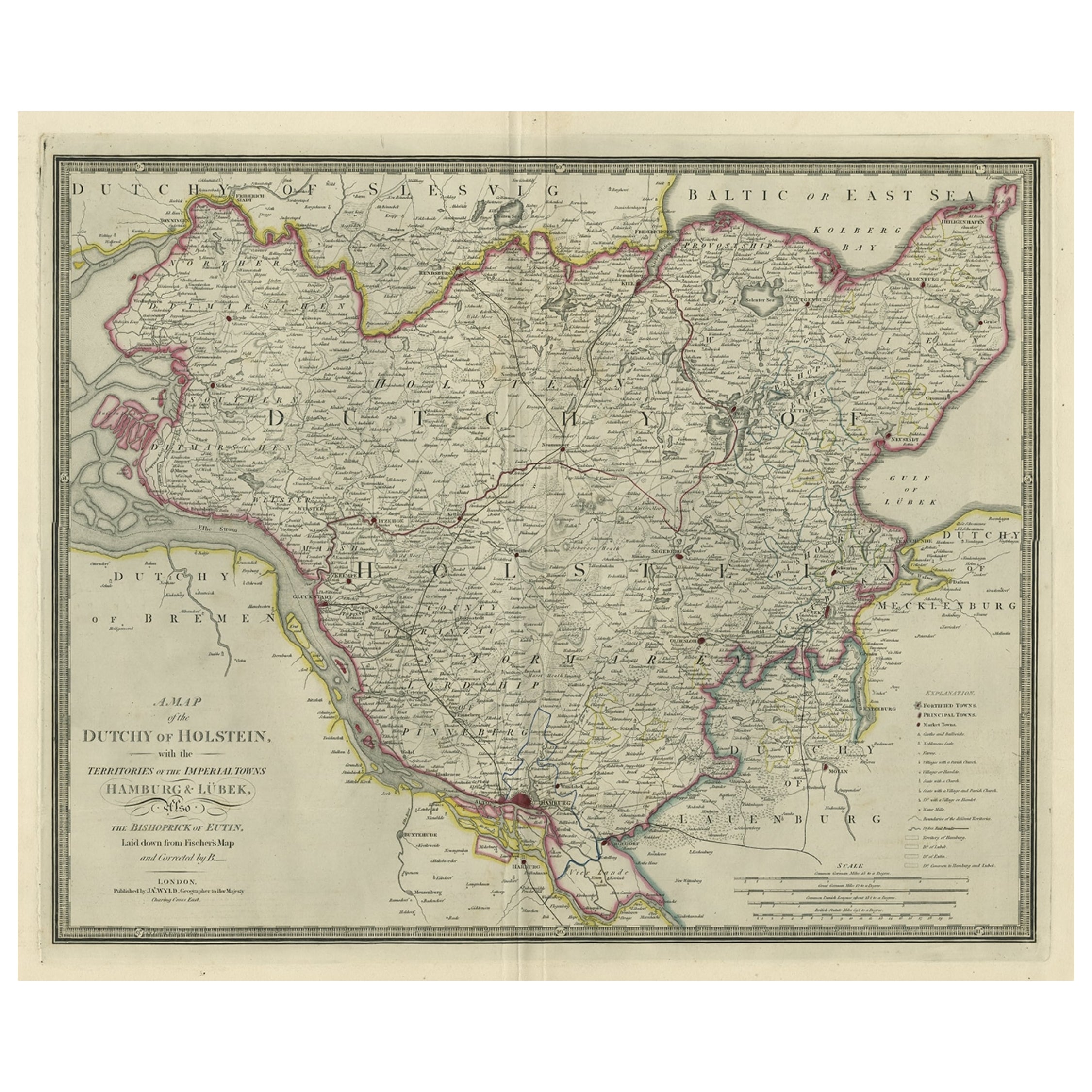
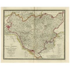
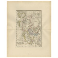
Map of the Dutchy of Holstein and the Territories of Hamburg
Lübek, 1875
$903.15
$1,128.9420% Off
£669
£836.2520% Off
€752
€94020% Off
CA$1,235.74
CA$1,544.6720% Off
A$1,344.58
A$1,680.7220% Off
CHF 711.94
CHF 889.9220% Off
MX$16,176.16
MX$20,220.2020% Off
NOK 9,040
NOK 11,30020% Off
SEK 8,270.97
SEK 10,338.7120% Off
DKK 5,730.86
DKK 7,163.5720% Off
About the Item
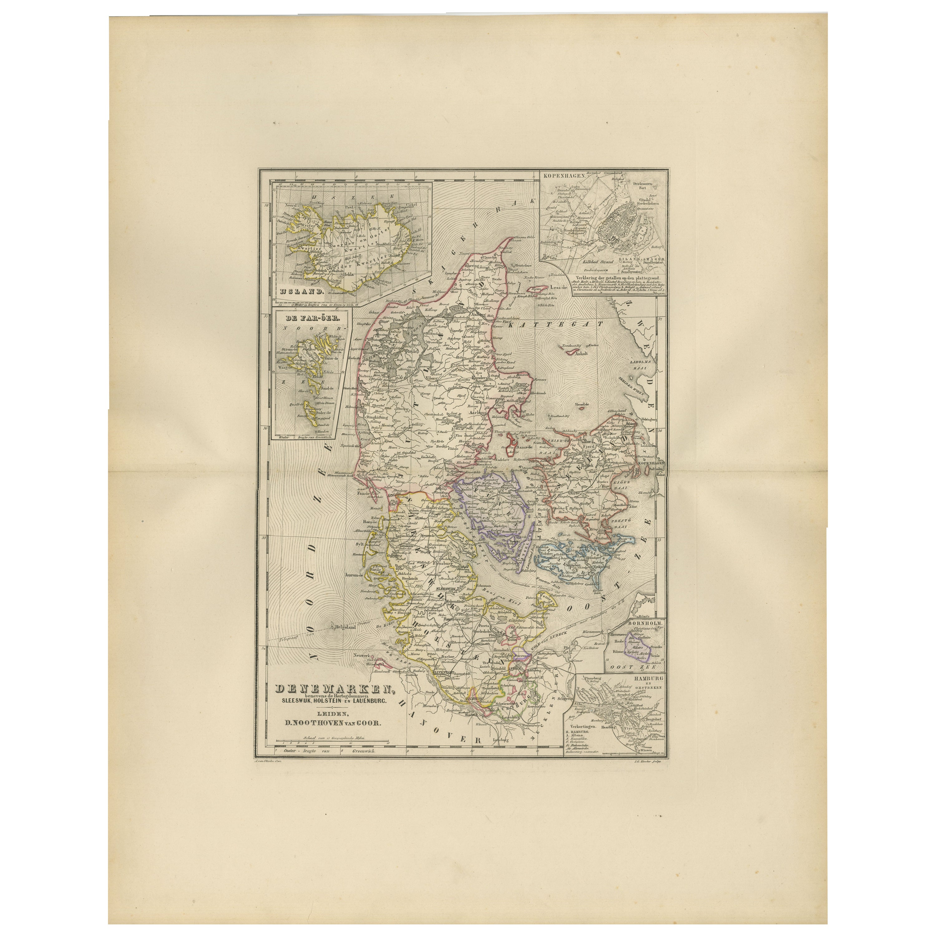
Title: Map of the Dutchy of Holstein and the Territories of Hamburg
Lübek by James Wyld, ca. 1875
Description: This is an antique map titled "A Map of the Dutchy of Holstein, with the Territories of the Imperial Towns Hamburg
Lübek, and the Bishoprick of Eutin." It was published by James Wyld, a well-known cartographer of the 19th century, in London. The map, based on Fischer's earlier work and corrected by B., shows detailed geographical information about the Dutchy of Holstein, with focus on the Imperial Towns of Hamburg and Lübek. This particular edition is likely from around 1875, printed on very sturdy paper typical of the period, and features finely engraved details along with attractive coloring, highlighting the different territories and regions.
James Wyld was one of the most prominent British cartographers of the 19th century, often known for acquiring and updating earlier maps. It is likely that Wyld's name appears on this map because he either purchased the rights to Fischer's original plates or reprinted and corrected the map for his publishing series. Wyld’s updates allowed this map to stay relevant and useful for contemporary audiences by adding new geographical details.
Condition Report:
The map is in excellent condition for its age, printed on sturdy paper. There is minor toning consistent with its age but otherwise free from tears, stains, or significant folds. The coloring is well-preserved, and the print remains crisp.
- Dimensions:Height: 23.23 in (59 cm)Width: 28.35 in (72 cm)Depth: 0.01 in (0.2 mm)
- Materials and Techniques:Paper,Engraved
- Period:
- Date of Manufacture:1875
- Condition:The map is in excellent condition for its age, printed on sturdy paper. There is minor toning consistent with its age but otherwise free from tears, stains, or significant folds.
- Seller Location:Langweer, NL
- Reference Number:Seller: BG-13842-241stDibs: LU3054342584922
About the Seller
5.0
Recognized Seller
These prestigious sellers are industry leaders and represent the highest echelon for item quality and design.
Platinum Seller
Premium sellers with a 4.7+ rating and 24-hour response times
Established in 2009
1stDibs seller since 2017
2,816 sales on 1stDibs
Typical response time: 1 hour
- ShippingRetrieving quote...Shipping from: Langweer, Netherlands
- Return Policy
More From This Seller
View AllOld Map of Holstein with the Imperial Towns Hamburg
Lubeck, Germany, 1854
Located in Langweer, NL
Antique map titled 'Map of the Duchy of Holstein with the territories of the Imperial Towns Hamburg & Lubeck (..)
Based on a map by Fischer.' Map of the Duchy of Holstein. From Jam...
Category
Antique 1850s Maps
Materials
Paper
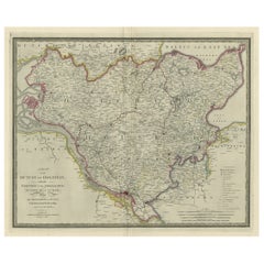
Large Original Antique Map of the Dutchy of Holstein, Germany, ca.1840
Located in Langweer, NL
Antique map titled 'A Map of the Dutchy of Holstein, with the Territories of the Imperial Towns Hamburg & Lubek, Also The Bishoprick of Eutin, Laid down from Fischer's Map (..)'. Sca...
Category
Antique 1840s Maps
Materials
Paper
$807 Sale Price
20% Off
Map of the Kingdom of Württemberg, Oberamt Tettnang in Germany, circa 1885
Located in Langweer, NL
Administrative Map of the Kingdom of Württemberg, Oberamt Tettnang, circa 1885
This detailed antique map titled "Handkarte von dem Königl. Württ. Oberamt Tettnang" was created by G....
Category
Antique 1880s Maps
Materials
Paper
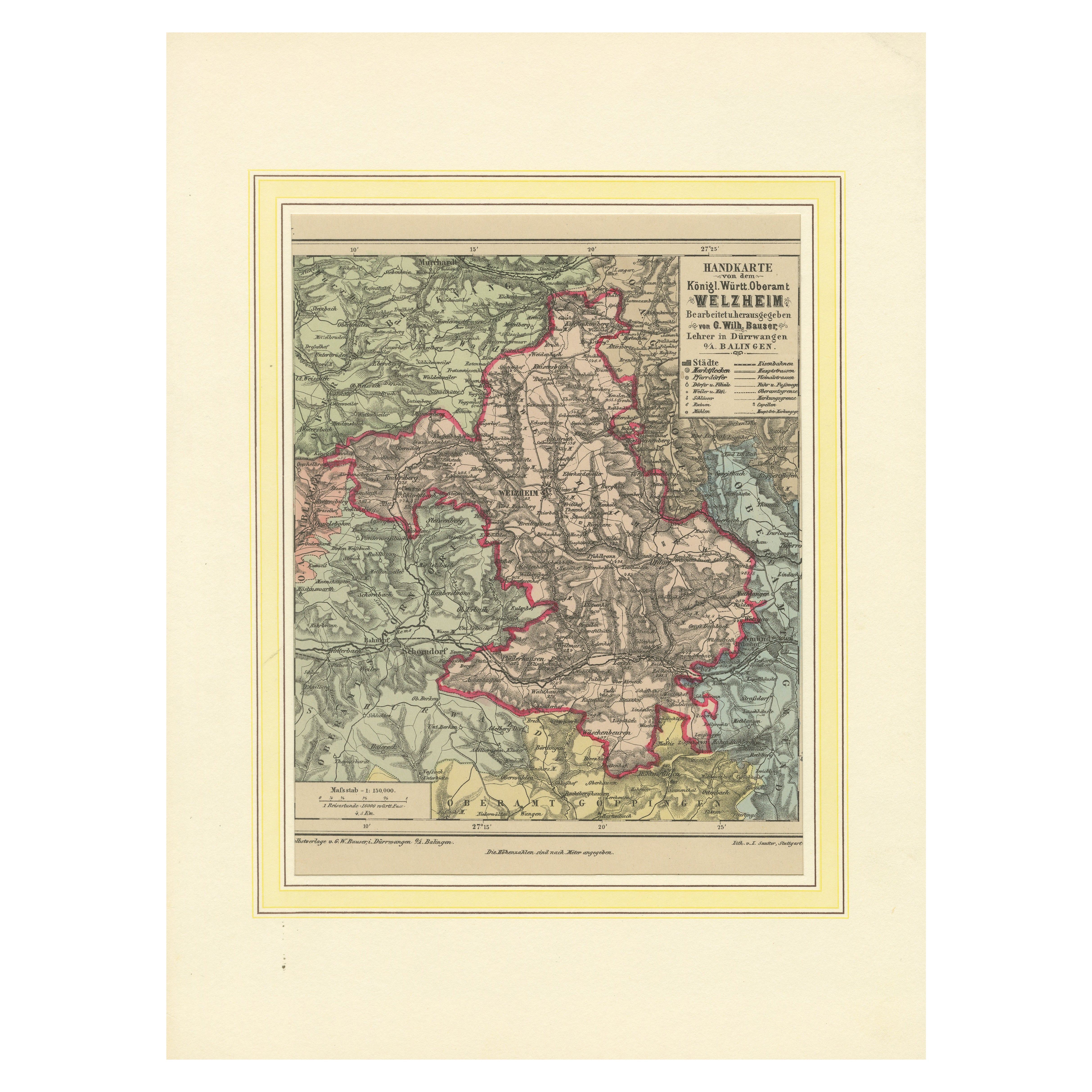
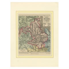
Decorative Map of the Royal Württemberg District of Welzheim, Germany, ca.1880
Located in Langweer, NL
The Royal Württemberg District of Welzheim is located in Germany. Welzheim is a town in the state of Baden-Württemberg, which was historically part of the Kingdom of Württemberg. The...
Category
Antique 1880s Maps
Materials
Paper
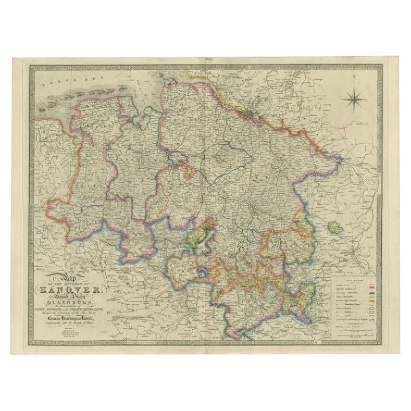
Antique Map of Northern Germany by Wyld, c.1840
Located in Langweer, NL
Antique map titled 'Map of the Kingdom of Hanover, with the Grand Duchy of Oldenburg, the Principalities of Lippe Detmold and Schauenburg Lippe, likewise the Territories of the Free ...
Category
Antique 19th Century Maps
Materials
Paper
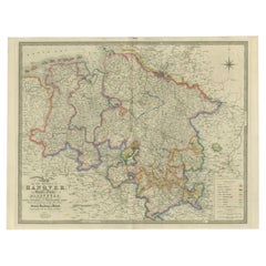
$379 Sale Price
20% Off
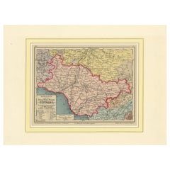
Map of Denmark, Schleswig, Holstein and Lauenburg – Leiden 1876
Located in Langweer, NL
Title: Map of Denmark, Schleswig, Holstein and Lauenburg – Leiden 1876
Description:
This 19th-century Dutch map, titled “Denemarken, Sleeswijk, Holstein en Lauenburg,” was published...
Category
Antique 1870s Dutch Maps
Materials
Paper
You May Also Like
1839 Map of Karte Des "Russischen Reiches in Europa Und Asien" Ric.R0013
Located in Norton, MA
1839 map of Karte Des
"Russischen Reiches in Europa and Asien"
Ric.r013
Map of the European and Asian parts of Russian Empire. Karte der Russischen Reiches in Europa und Asien...
Category
Antique 19th Century Unknown Maps
Materials
Paper

1849 Map of "Europaische Russland",
Meyer Map of European Russia
, Ric. R017
Located in Norton, MA
1849 Map of
"Europaische Russland"
( Meyer Map of European Russia)
Ric.r017
A lovely map of European Russia dating to 1849 by Joseph Meyer. It covers the European portions of...
Category
Antique 19th Century Unknown Maps
Materials
Paper

1853 Map of "Russia in Europe Including Poland" Ric.r016
Located in Norton, MA
Description
Russia in Europe incl. Poland by J Wyld c.1853
Hand coloured steel engraving
Dimension: Paper: 25 cm W x 33 cm H ; Sight: 22 cm W x 28 cm H
Condition: Good ...
Category
Antique 19th Century Unknown Maps
Materials
Paper

Original Antique English County Map, Nottinghamshire, J
C Walker, 1851
Located in St Annes, Lancashire
Great map of Nottinghamshire
Original colour
By J & C Walker
Published by Longman, Rees, Orme, Brown & Co. 1851
Unframed.
Category
Antique 1850s English Other Maps
Materials
Paper

1851 Map of "Independent Tartary", Ric. R018
Located in Norton, MA
1851 Map of
Independent Tartary
"Russia"
Ric.r018
A highly decorative 1851 map of Independent Tartary by John Tallis and John Rapkin. Covers the regions between the Caspian Sea and Lake Bakquash and between Russia and Afghanistan. These include the ancient Silk Route kingdoms of Khiva, Tartaria, Kokand, and Bokhara. Today this region roughly includes Kazakhstan, Uzbekistan, Turkmenistan, Kyrgyzstan, and Tajikistan. This wonderful map offers a wealth of detail for anyone with an interest in the Central Asian portion of the ancient Silk Road. Identifies various caravan routes, deserts, wells, and stopping points, including the cities of Bokhara and Samarkand. Three vignettes by W. Bragg decorate the map, these including an image of Tartars on a Journey, a horseback Bride Chase, and a tartar camp site. Surrounded by a vine motif border. Engraved by J. Rapkin for John Tallis's 1851 Illustrated Atlas .
Tartary Antique Map...
Category
Antique 19th Century Unknown Maps
Materials
Paper

Original Antique English County Map - Monmouthshire. J
C Walker. 1851
Located in St Annes, Lancashire
Great map of Monmouthshire
Original colour
By J & C Walker
Published by Longman, Rees, Orme, Brown & Co. 1851
Unframed.
Category
Antique 1850s English Other Maps
Materials
Paper

More Ways To Browse
18th Century Wood Side Tables
Antique Hand Carved Dining Room Sets
Mid Century Modern Pitcher
Vintage Italian Leather Dining Chair
Vintage Movie Posters
Blue Green Wool And Silk Rug
Brown Sheepskin Chair
Vintage Brass Bar Carts
Antique Botanical Prints
Green Persian Rug
17th Century Blue And White
50 X 50 Coffee Table
Antique Wood Panel Painted
Milo Baughman 1970
Spanish Baroque Furniture
Stone China
Couch Console
Vintage Burn