Items Similar to Map of Iran, Arabia, Asia Minor
Caucasus by Perthes, 1858


Want more images or videos?
Request additional images or videos from the seller
1 of 10
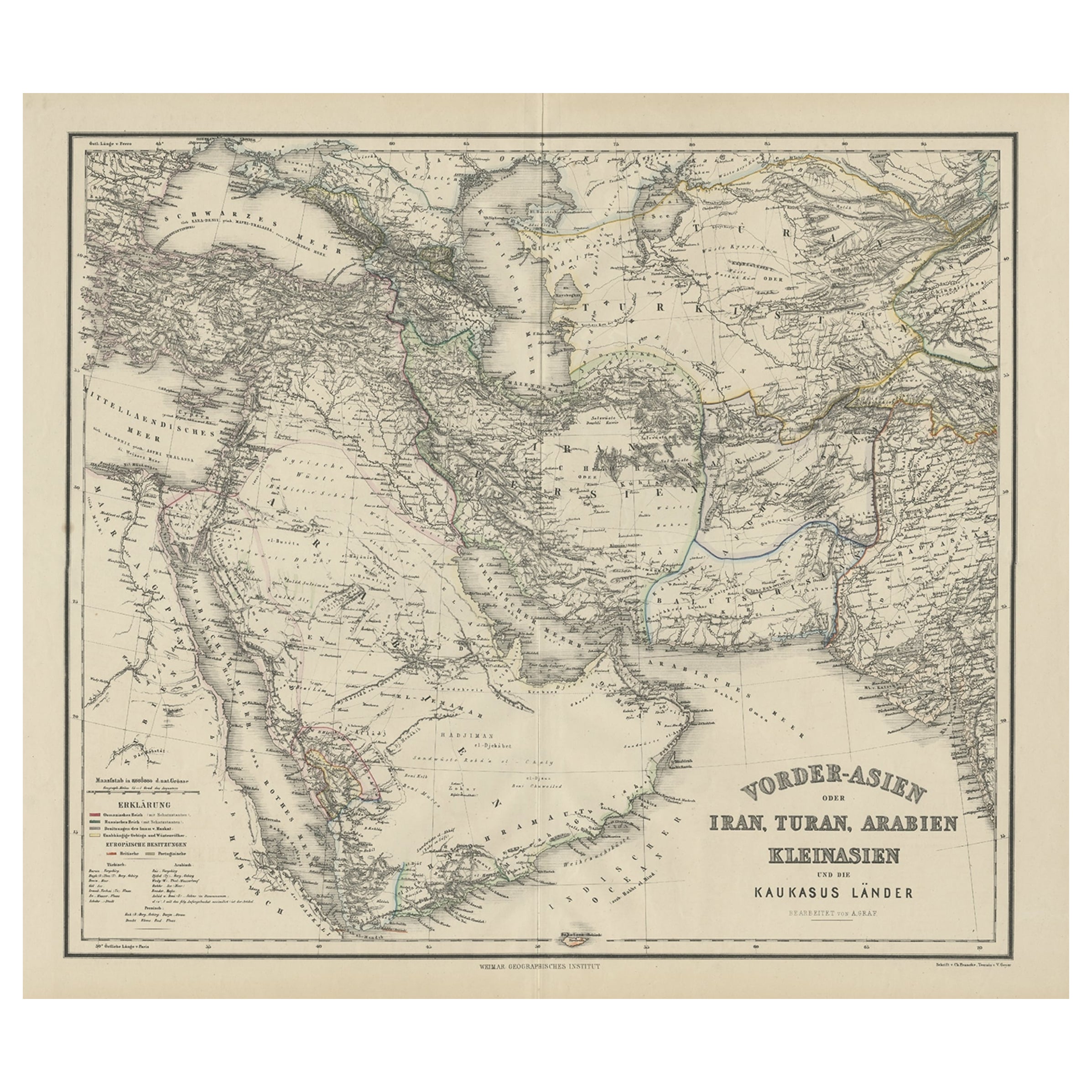
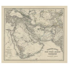
Map of Iran, Arabia, Asia Minor
Caucasus by Perthes, 1858
$767.97
£569.12
€640
CA$1,049.59
A$1,142.57
CHF 606.48
MX$13,747.56
NOK 7,684.87
SEK 7,041.52
DKK 4,875.07
About the Item
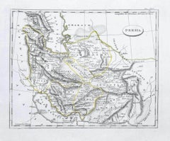
Map of Iran, Arabia, Asia Minor
Caucasus by Perthes, 1858
This is a detailed engraved map titled Vorder-Asien oder Iran, Turan, Arabien, Kleinasien und die Kaukasus Länder, published by the Weimar Geographisches Institut (Justus Perthes) in 1858. The map depicts Western Asia including modern-day Turkey, Iran, Iraq, the Arabian Peninsula, Central Asia, and the Caucasus region.
It shows extensive political boundaries, major cities, rivers, and mountain ranges with precise German cartographic labeling. The left section includes a key (Erklärung) indicating international boundaries, regional boundaries, trade routes, and caravan roads, which were critical for understanding commerce and travel routes in the mid-19th century. The typography and engraving style are characteristic of the Weimar publishing house's scientific maps of the period.
This map is from the historical Stieler’s Hand-Atlas series, one of the finest German atlases known for its accuracy and clarity. The title cartouche is elegant yet understated, located at the lower right corner, and the map bears the engraver's imprint: "Weimar Geographisches Institut."
Condition report:
Good condition. Strong dark impression on clean paper with original outline hand coloring. Light general age toning, faint scattered spots in margins, and minor marginal handling marks typical for atlas maps of this age. Original center fold as issued with repairs.
Framing suggestion:
Frame with a classic black or dark wood moulding and an archival off-white or cream mat to emphasize the detailed engraving and subtle outline coloring. UV-protective glass is recommended to preserve the paper quality and prevent fading.
- Dimensions:Height: 22.64 in (57.5 cm)Width: 27.17 in (69 cm)Depth: 0.01 in (0.2 mm)
- Materials and Techniques:
- Place of Origin:
- Period:
- Date of Manufacture:1858
- Condition:Good condition. Strong dark impression on clean paper with original outline hand coloring. Light general age toning, faint scattered spots in margins, and minor marginal handling marks typical for maps of this age. Original center fold as issued.
- Seller Location:Langweer, NL
- Reference Number:Seller: BG-13746-201stDibs: LU3054345745592
About the Seller
5.0
Recognized Seller
These prestigious sellers are industry leaders and represent the highest echelon for item quality and design.
Platinum Seller
Premium sellers with a 4.7+ rating and 24-hour response times
Established in 2009
1stDibs seller since 2017
2,816 sales on 1stDibs
Typical response time: 1 hour
- ShippingRetrieving quote...Shipping from: Langweer, Netherlands
- Return Policy
More From This Seller
View AllOld German Antique Map of Iran and Arabia, 1866
Located in Langweer, NL
Antique map titled 'Vorder-Asien oder Iran, Turan, Arabien, Kleinasien und die Kaukasus Länder'. Large map centered on Iran. It shows the area from Turkey to Mumbai in India. Include...
Category
Antique 19th Century Maps
Materials
Paper
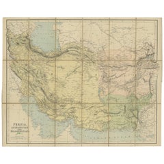
Antique Map of West Asia, circa 1900
Located in Langweer, NL
Antique map titled 'Persia, Afghanistan and Beloochistan'. Folding map on linen.
Published circa 1900. Stamp below title.
Category
Early 20th Century Maps
Materials
Paper
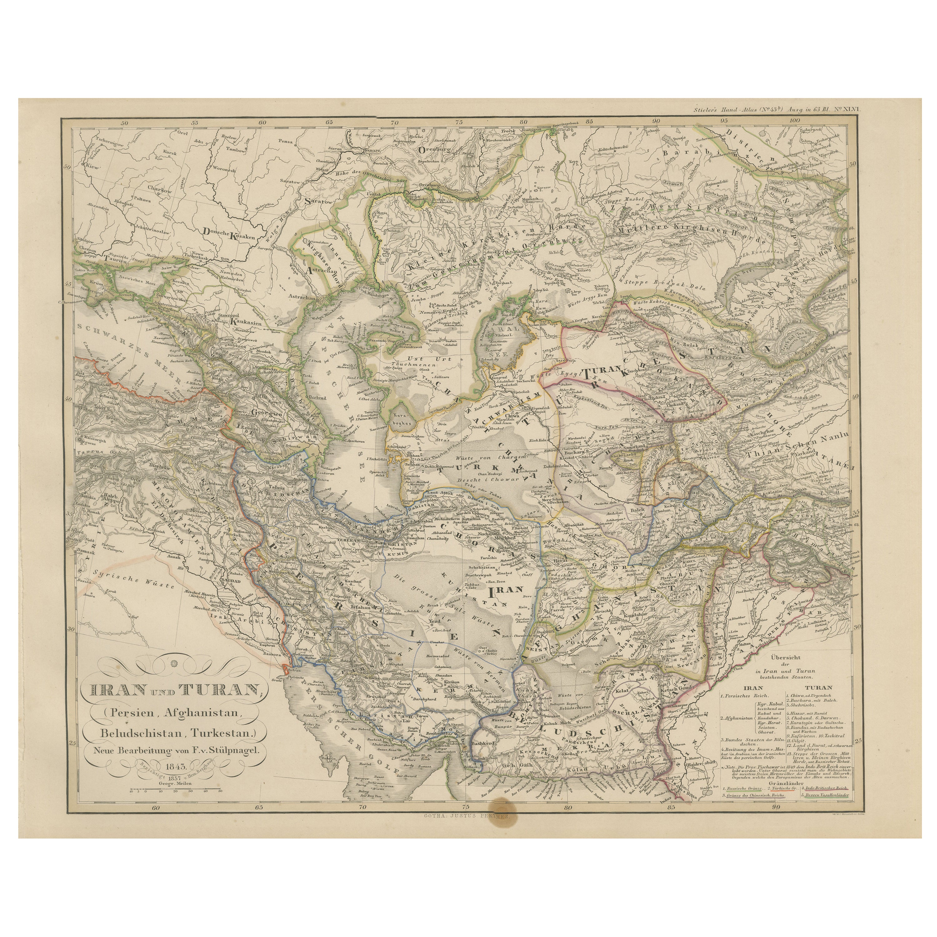
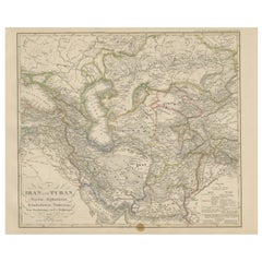
Iran and Turan Map – Persia, Afghanistan, Baluchistan, Turkestan 1858
Located in Langweer, NL
Iran and Turan Map – Persia, Afghanistan, Baluchistan, Turkestan 1858
This impressive antique print shows “Iran und Turan (Persien, Afghanistan, Beludschistan, Turkestan),” meaning ...
Category
Antique Mid-19th Century German Maps
Materials
Paper
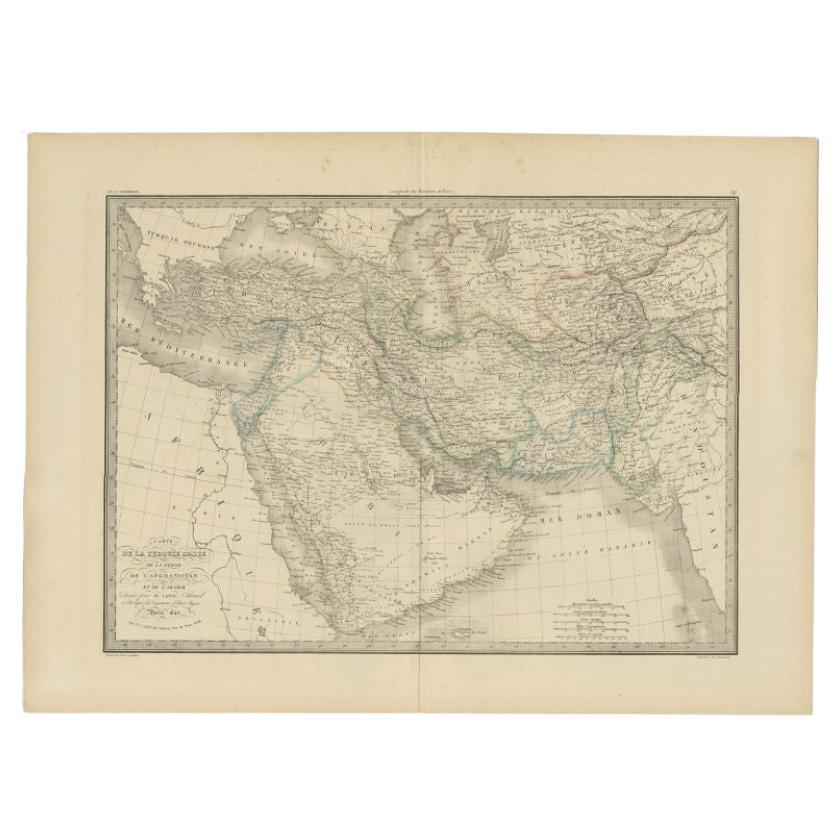
Antique Map by Pierre M. Lapie, Turkey, Persia, Afghanistan, 1842
By Pierre M. Lapie
Located in Langweer, NL
Antique map titled 'Carte de la Turquie d'Asia, de la Perse, de l'Afghanistan'. Map of Turkey, Persia and Afghanistan. This map originates from 'Atlas universel de géographie ancienn...
Category
Antique 19th Century French Maps
Materials
Paper

Antique Map of Persia and Afghanistan by Johnston, 1882
Located in Langweer, NL
Antique map titled 'Persia and Afghanistan'.
Old map of Persia and Afghanistan. This map originates from 'The Royal Atlas of Modern Geography, Exhibiting, in a Series of Entirely O...
Category
Antique 19th Century Maps
Materials
Paper

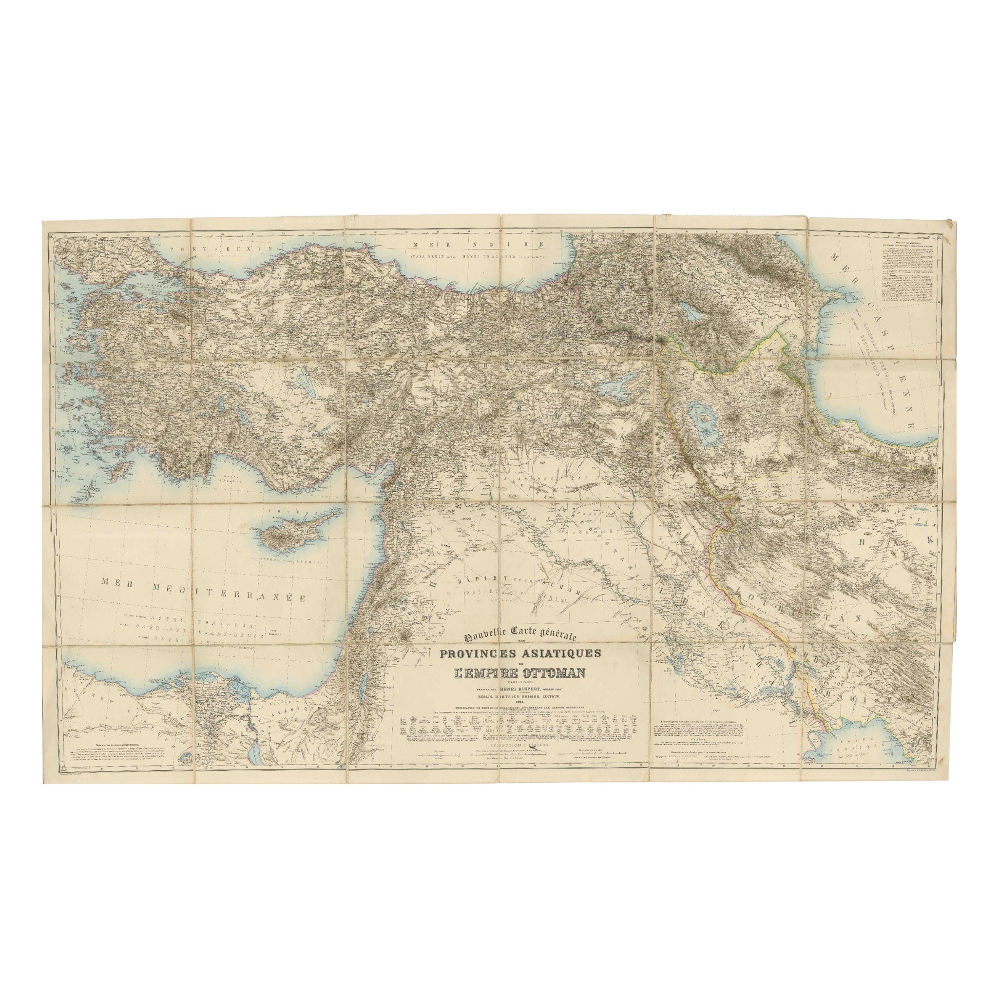
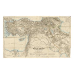
Large 1884 Kiepert Map of Asian Ottoman Provinces – Anatolia, Syria, Mesopotamia
Located in Langweer, NL
1884 Kiepert Map of Asian Ottoman Provinces – Anatolia, Syria, Mesopotamia
This remarkable mid-19th-century folding map is titled “Nouvelle Carte générale des Provinces Asiatiques d...
Category
Antique 1880s English Maps
Materials
Paper
You May Also Like
Map of Persia - Original Etching - Late 19th Century
Located in Roma, IT
This Map of Persia is an etching realized by an anonymous artist.
The state of preservation of the artwork is good with some small diffused stains.
Sheet dimension: 25.5 x 44
At t...
Category
Late 19th Century Modern Figurative Prints
Materials
Etching
Persia, Armenia
Adjacent Regions: A 17th Century Hand-colored Map by De Wit
By Frederick de Wit
Located in Alamo, CA
A large 17th century hand colored copperplate engraved map entitled "Novissima nec non Perfectissima Scandinaviae Tabula comprehendens Regnorum Sueciae, Daniae et Norvegiae distincte...
Category
Antique Late 17th Century Dutch Maps
Materials
Paper

$1,500 Sale Price
20% Off
Large Original Antique Map of Afghanistan. Edward Weller, 1861
Located in St Annes, Lancashire
Great map of Afghanistan
Lithograph engraving by Edward Weller
Original colour
Published, 1861
Unframed
Good condition
Category
Antique 1860s English Victorian Maps
Materials
Paper

Map of the Holy Land "Carte de la Syrie et de l
Egypte" by Pierre Lapie
By Pierre M. Lapie
Located in Alamo, CA
This is an early 19th century map of ancient Syria and Egypt entitled "Carte de la Syrie et de l'Egypte anciennes/dressée par M. Lapie, Colonel d'Etat M...
Category
1830s Landscape Prints
Materials
Engraving

Large Original Vintage Map of Persia / Iran, circa 1920
Located in St Annes, Lancashire
Great maps of Persia.
Unframed.
Original color.
By John Bartholomew and Co. Edinburgh Geographical Institute.
Published, circa 1920.
Free shipping.
Category
Vintage 1920s British Maps
Materials
Paper

Original Antique Map of India by Dower, circa 1835
Located in St Annes, Lancashire
Nice map of India
Drawn and engraved by J.Dower
Published by Orr & Smith. C.1835
Unframed.
Free shipping
Category
Antique 1830s English Maps
Materials
Paper

More Ways To Browse
Arabian Antique
Asia Minor
China Silk Rug
Chrome Glass Coffee Tables
Antique Italian Chairs
Beni Ourain Rugs
French Iron And Glass Table
Glass Top Wood Base Coffee Tables
T Chair
Antique Silver Basket
Antique Walkers
Ebony Wood Furniture
Opalescent Glass
Pair Of Danish Chairs
Veneer Dining Tables
1970 Italian Armchair
Furniture Uk
House Of Denmark Table And Chairs