Items Similar to Map of Lancashire

Want more images or videos?
Request additional images or videos from the seller
1 of 5
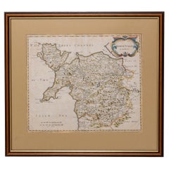
Map of Lancashire
$763.36
$954.1920% Off
£556
£69520% Off
€653.54
€816.9320% Off
CA$1,058.43
CA$1,323.0320% Off
A$1,138.25
A$1,422.8120% Off
CHF 608.62
CHF 760.7820% Off
MX$13,726.97
MX$17,158.7120% Off
NOK 7,696.47
NOK 9,620.5920% Off
SEK 7,012.48
SEK 8,765.6020% Off
DKK 4,883.39
DKK 6,104.2420% Off
About the Item
Saxton Map of Lancashire hand coloured. Encased in an ebonised frame.
Dimensions
Height 21 Inches
Width 24 Inches
Depth 1 Inches
- Dimensions:Height: 21 in (53.34 cm)Width: 24 in (60.96 cm)Depth: 1 in (2.54 cm)
- Materials and Techniques:
- Place of Origin:
- Period:
- Date of Manufacture:circa 1900
- Condition:Wear consistent with age and use.
- Seller Location:Cheshire, GB
- Reference Number:1stDibs: LU947636261522
About the Seller
4.9
Platinum Seller
Premium sellers with a 4.7+ rating and 24-hour response times
Established in 1980
1stDibs seller since 2012
454 sales on 1stDibs
Typical response time: 2 hours
Associations
LAPADA - The Association of Arts
Antiques DealersInternational Confederation of Art and Antique Dealers
Associations
- ShippingRetrieving quote...Shipping from: Cheshire, United Kingdom
- Return Policy
More From This Seller
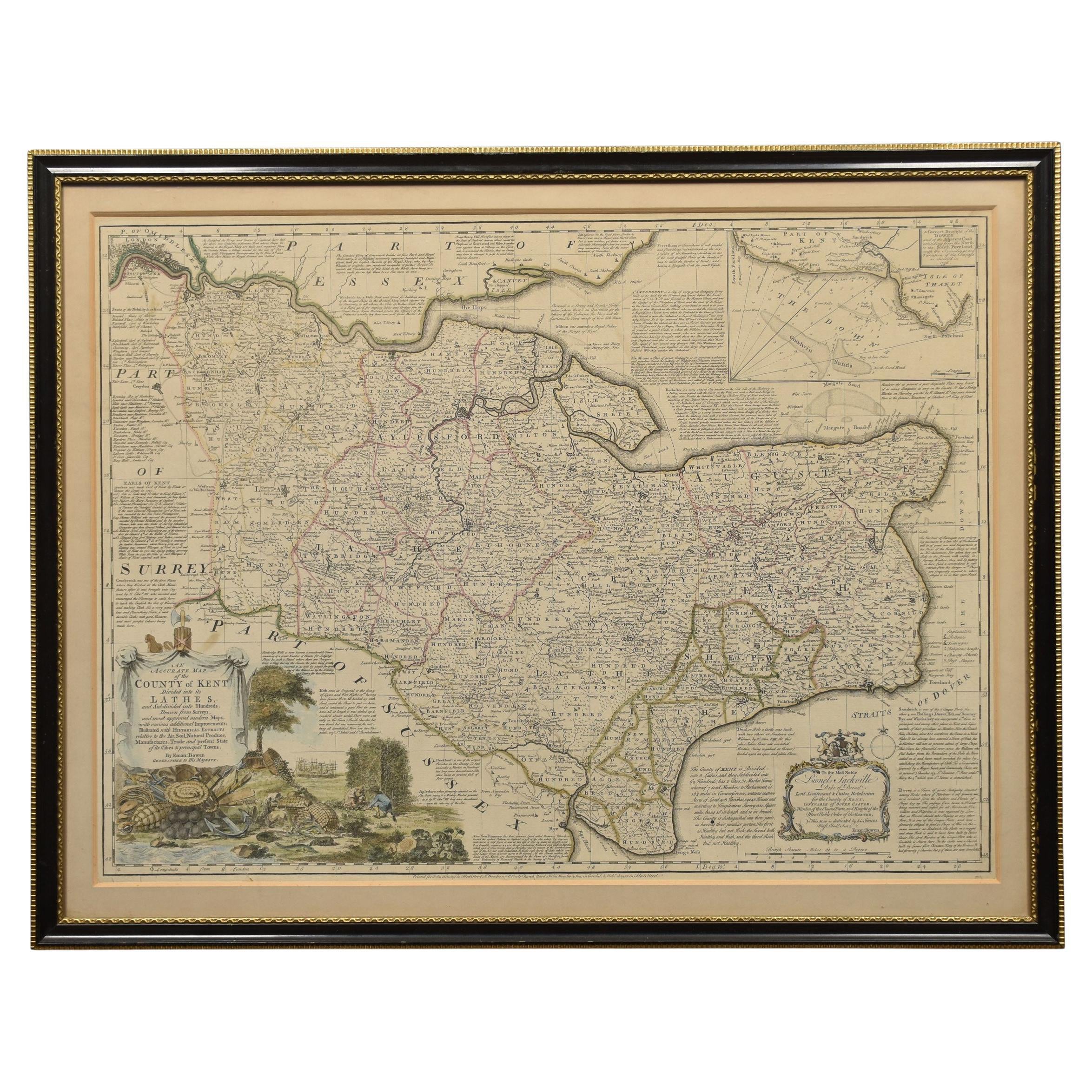
View AllMap of Essex by Emanuel Bowen
Located in Cheshire, GB
Map of part of Essex and part of Kent, hand-coloured. Encased in an ebonized and gilded frame.
Dimensions
Height 25.5 Inches
Length 32.5 Inches
width 1 Inches.
Category
Antique Late 19th Century British Maps
Materials
Paper

$988 Sale Price
50% Off
Northwest Coast and Isle of Man Map
Located in Cheshire, GB
Greenville Collins Northwest Coast and Isle of Man. hand coloured chart, encased in an ebonised frame.
Dimensions
Height 26.5 Inches
Width 30 Inches
Depth 1 Inches
Category
Early 20th Century British Maps
Materials
Paper

$521 Sale Price
20% Off
Chart of the Harbour of Liverpool
Located in Cheshire, GB
PL Burdett A Chart of the Harbour of Liverpool hand coloured. Encased in an ebonised frame.
Dimensions
Height 23.5 Inches
Width 28 Inches
Depth 1 Inches
Category
Early 20th Century British Maps
Materials
Paper

$631 Sale Price
20% Off
Large open bookcase
Located in Cheshire, GB
Rosewood open bookcase, the large rectangular breakfront top having raised spindle gallery, above three bays of adjustable shelves, divided by twisting pilasters. All are raised on a...
Category
Antique 19th Century British Bookcases
Materials
Wood
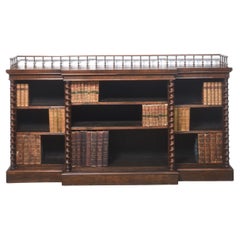
$7,084 Sale Price
20% Off
Early Victorian Canterbury
Located in Cheshire, GB
Early Victorian Canterbury, having three divisions with ‘C’ scroll and foliate uprights. Above a single drawer with turned handles. All raised up on four turned legs with brass caps ...
Category
Antique 19th Century British Magazine Racks and Stands
Materials
Wood
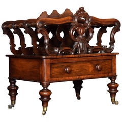
$1,208 Sale Price
20% Off
19th Century open bookcase
Located in Cheshire, GB
Open bookcase, the large rectangular well-figured marble breakfront top above three bays of adjustable shelves, divided by circular column pilasters. All raised on a plinth base.
Dim...
Category
Antique 19th Century British Bookcases
Materials
Wood
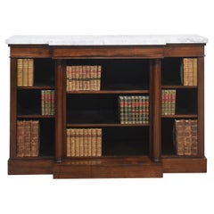
$6,425 Sale Price
20% Off
You May Also Like
Antique West Yorkshire Map, English, Framed Lithography, Cartography, Victorian
Located in Hele, Devon, GB
This is an antique lithography map of West Yorkshire. An English, framed atlas engraving of cartographic interest, dating to the mid 19th century and later.
Superb lithography of t...
Category
Antique Mid-19th Century British Victorian Maps
Materials
Paper

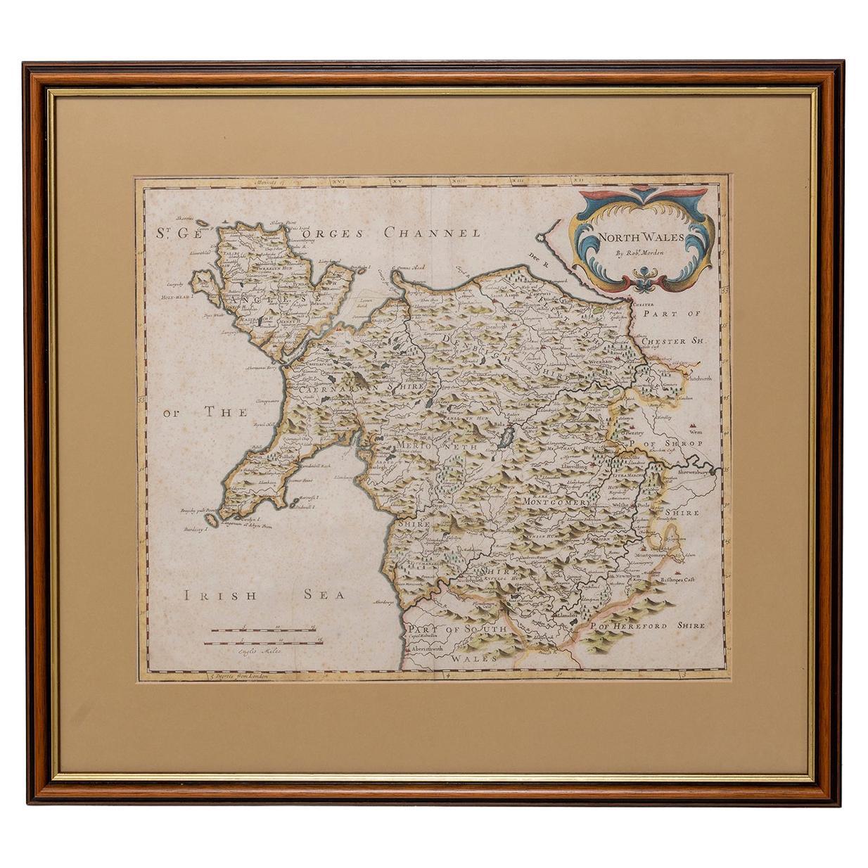
Map North Wales Robert Marsden Anglesey
Located in BUNGAY, SUFFOLK
Map of North Wales by Robert Marsden
Including Anglesey
Charming topography and detail and colouring
just purchased more information to follow.
Category
Antique 18th Century English Georgian Maps
Materials
Paper

Map Suffolk Southwold Aldeburgh Dunwich Bawdsey Harwich Ipswich
Located in BUNGAY, SUFFOLK
Map Suffolk including many popular destinations on the coast Southwold, Dunwich, Aldeburgh bawdsey felixstowe harwich ipswich.
Charming topography and colouring.
In the original fr...
Category
Antique 19th Century European Georgian Maps
Materials
Paper
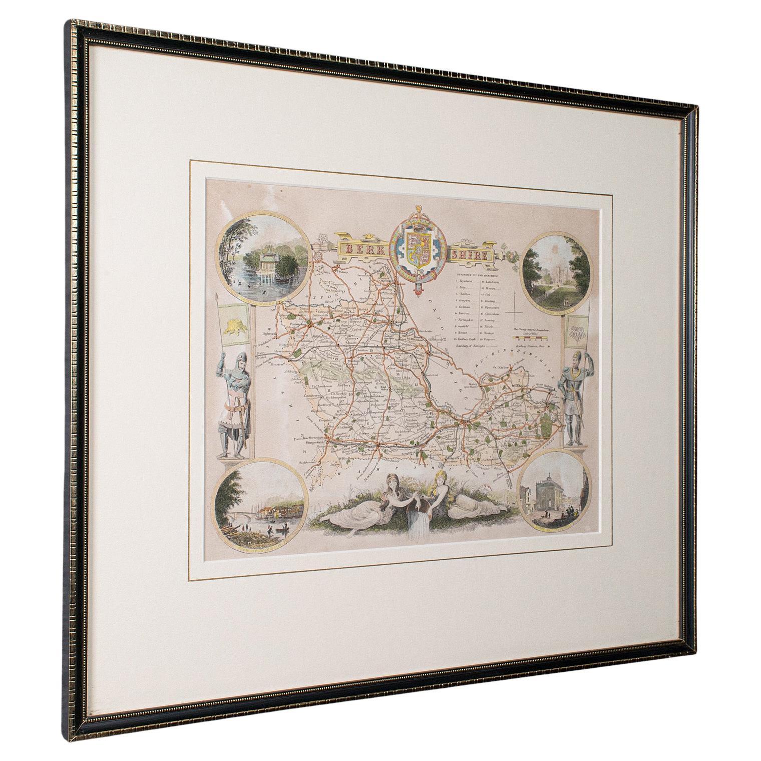
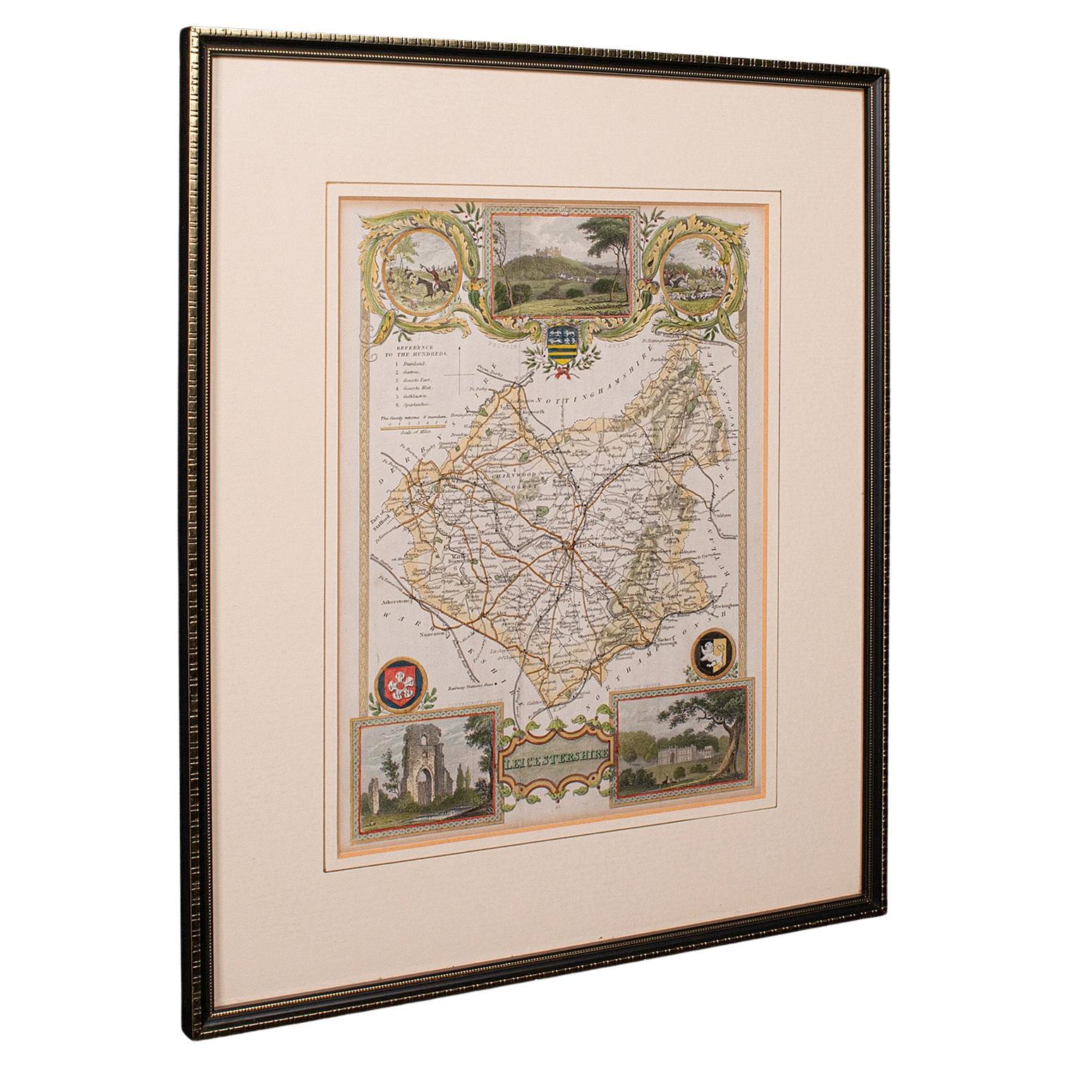
Antique Leicestershire Map, English, Framed Cartographic Interest, Victorian
Located in Hele, Devon, GB
This is an antique lithography map of Leicestershire. An English, framed atlas engraving of cartographic interest, dating to the mid 19th century and later.
Superb lithography of Le...
Category
Antique Mid-19th Century British Victorian Maps
Materials
Wood

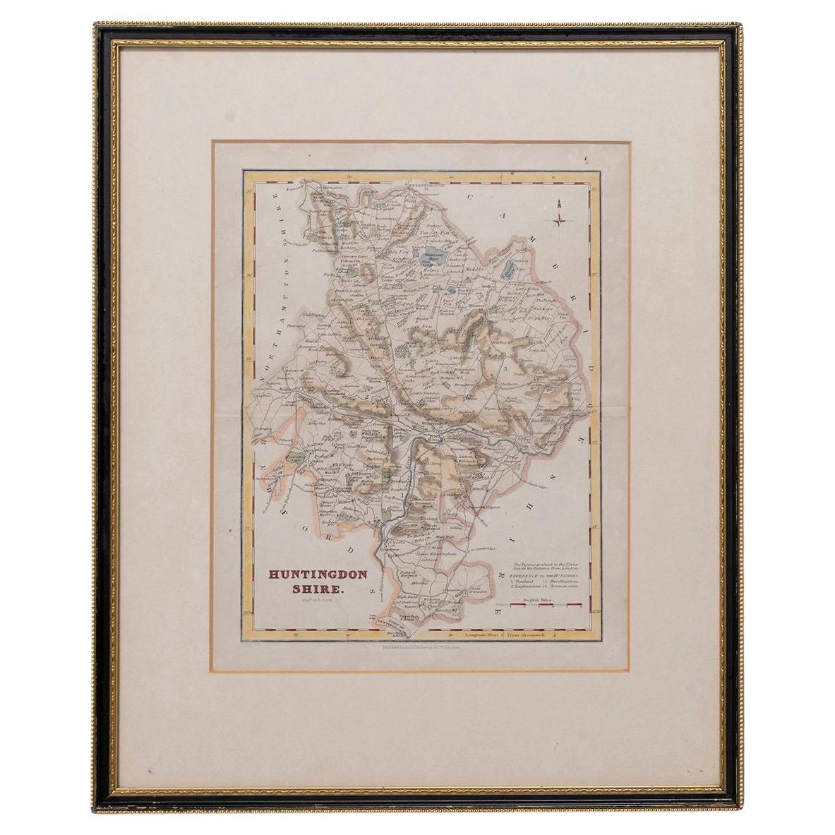
Map Huntingdonshire R Scott Archibald Fullarton
Co Glasgow
Located in BUNGAY, SUFFOLK
Folding Map of Huntingdonshire by R Scott with distances from London and reference to the hundreds.
Published by Archibald Fullarton & Co Glasgow. Measure: 40...
Category
Antique 19th Century English Victorian Maps
Materials
Paper

Large Antique County Map of Derbyshire, England, 1805
Located in Langweer, NL
Antique map titled 'A Map of Derbyshire from the best Authorities'. Original old county map of Derbyshire, England. Engraved by John Cary. Originates from 'New British Atlas' by John...
Category
Antique Early 19th Century British Maps
Materials
Paper
More Ways To Browse
World Map Copper
Mid Century Modern Wicker Chair
Mid-Century Modern Wicker Chairs
Curved Back Mid Century Dining Chairs
Glass Stopper
Stretcher Tables
M Table
Antique Sultanabad Carpets
China Chair
English Antique Desks
Used Beige Sofa
Antique Plate Germany
Hand Tufted Rugs
Rare China
Side Table Made In Denmark
Thonet Antique
Victorian Hall Tables
Vintage Computer