Items Similar to Map of Samoa or Schiffer-Inseln (Navigator Islands) - 19th Century German Map

Want more images or videos?
Request additional images or videos from the seller
1 of 6
Map of Samoa or Schiffer-Inseln (Navigator Islands) - 19th Century German Map
$95.54
£71.39
€80
CA$131.78
A$144.36
CHF 75.99
MX$1,722.98
NOK 968.62
SEK 885.47
DKK 609.54
About the Item
Map of Samoa or Schiffer-Inseln (Navigator Islands) - 19th Century German Map
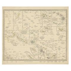
This detailed 19th-century map of the Samoa Islands, also known as the Navigator Islands (Schiffer-Inseln), was published by the Bibliographisches Institut in Leipzig as part of Meyer's Konversations-Lexikon, a widely used German encyclopedic series. The map is printed in color lithography and provides a comprehensive overview of the Samoan archipelago, including Upolu, Savai'i, Tutuila, and other smaller islands.
The main map highlights the two largest islands, Savai'i and Upolu, situated in the South Pacific Ocean. Both islands are meticulously drawn with topographical details, including mountains, rivers, and the names of villages and settlements. The rugged terrain of Savai'i and Upolu is indicated through shaded relief, illustrating the mountainous nature of the islands. The German place names reflect the influence of German colonization, as Samoa became a German protectorate in 1900 and remained under German control until World War I.
In the lower section of the map, there is a detailed inset of Upolu at a larger scale (1:375,000), providing more precision in identifying important locations. Another inset in the upper right corner depicts the settlements around the harbor of Apia, the capital city of Samoa and a significant port. The harbor map, at a scale of 1:87,500, shows various landmarks and coastal features, including plantations and European settlements. The legend specifies plantations, buildings, and terrain types, emphasizing Apia's strategic and economic importance.
The map clearly indicates the coordinates (latitude and longitude), helping to locate the islands accurately. The typography and precise cartographic style are typical of German mapmaking from the period, combining accuracy with aesthetic appeal. The map also features a distance scale in kilometers and the indication of coral reefs, highlighting the natural barriers to navigation around the islands.
Historical Context:
During the 19th century, Samoa became a focal point of European colonial ambitions. Germany, the United States, and Great Britain all vied for control of the islands, leading to treaties and international agreements that eventually placed the western islands under German rule. This map reflects that period of German influence and showcases the strategic importance of the islands for shipping and trade.
Condition:
The map is in good condition with vibrant coloring and minimal signs of age. The paper is stable and well-preserved, with crisp printing and sharp detailing. Light toning around the edges is consistent with the map's age.
Framing tips: To preserve this historical piece, it is recommended to frame it using archival materials and a simple wooden frame that enhances the map’s elegance and historical value.
- Dimensions:Height: 5.91 in (15 cm)Width: 9.26 in (23.5 cm)Depth: 0.01 in (0.2 mm)
- Materials and Techniques:
- Period:
- Date of Manufacture:circa 1890
- Condition:The map is in good condition with vibrant coloring and minimal signs of age. The paper is stable and well-preserved, with crisp printing and sharp detailing. Light toning around the edges is consistent with the map s age.
- Seller Location:Langweer, NL
- Reference Number:Seller: BG-035261stDibs: LU3054344141152
About the Seller
5.0
Recognized Seller
These prestigious sellers are industry leaders and represent the highest echelon for item quality and design.
Platinum Seller
Premium sellers with a 4.7+ rating and 24-hour response times
Established in 2009
1stDibs seller since 2017
2,806 sales on 1stDibs
Typical response time: 1 hour
- ShippingRetrieving quote...Shipping from: Langweer, Netherlands
- Return Policy
More From This Seller
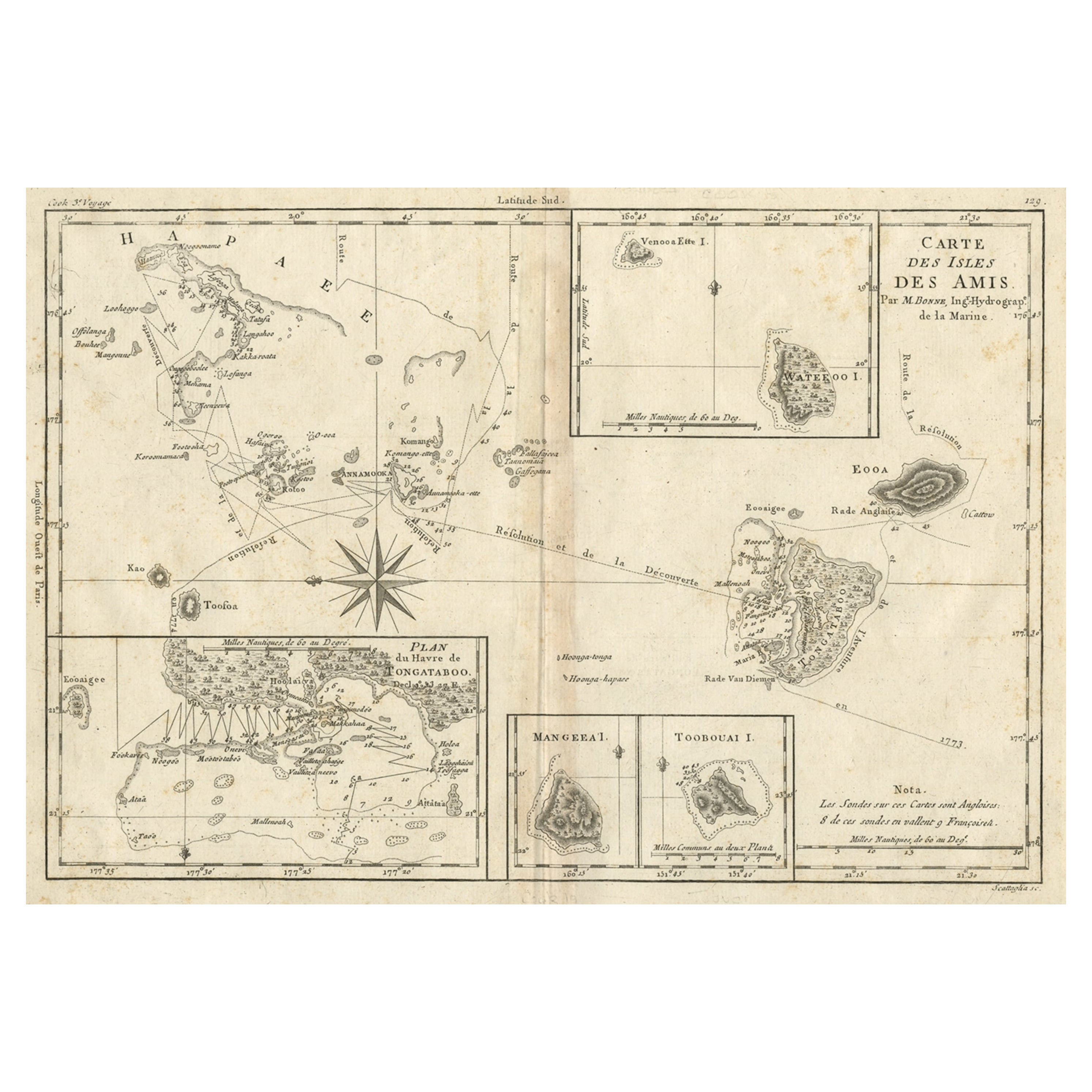
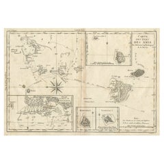
View AllOld Map of the Kingdom of Tonga, Also Known as the Friendly Islands, ca.1780
Located in Langweer, NL
Antique print, titled: 'Carte des Isles des Amis.'
Map of the Kingdom of Tonga, also known as the Friendly Islands, and one of the last hereditary monarchies. Cook named this gro...
Category
Antique 1780s Maps
Materials
Paper
$248 Sale Price
20% Off
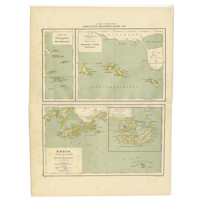
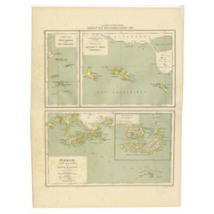
Antique Map of the West Indies and Ambon in Indonesia, 1900
Located in Langweer, NL
Two maps on one sheet titled 'De West-Indische Eilanden (Nederlandsch Gedeelte)' and 'Ambon, Leasi-Eilanden en Banda-Eilanden'. Old map of the Dutch West Indies and Ambon Island, Ind...
Category
20th Century Maps
Materials
Paper
$133 Sale Price
20% Off
Antique Map of the Nias Archipelago, Sumatra, Indonsia, 1900
Located in Langweer, NL
Antique map of Nias Island and surrounding islands including the Banyak islands, Pini island and Simeulue Island. This map originates from 'Atlas van Nederlandsch Oost- en West-Indië...
Category
20th Century Maps
Materials
Paper

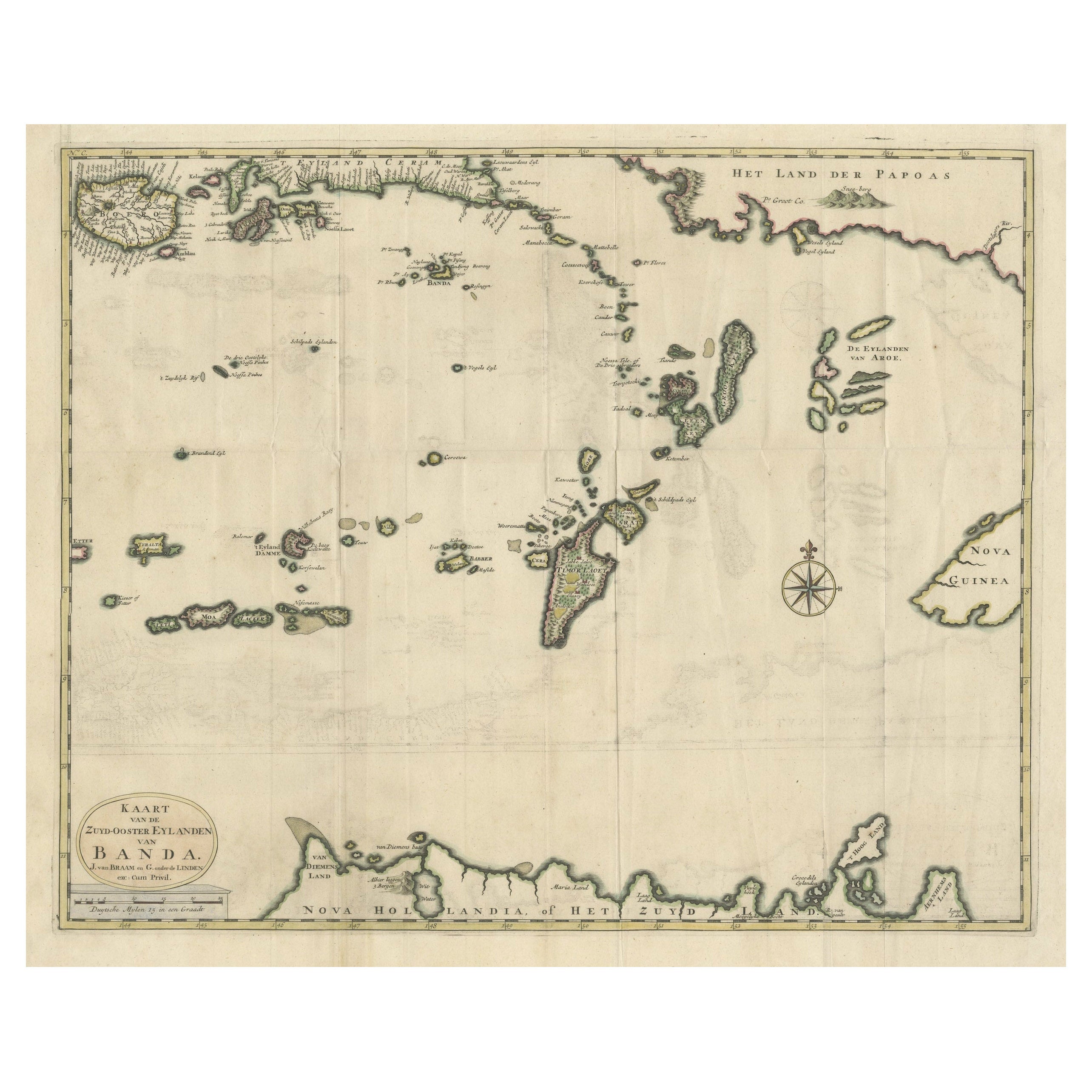
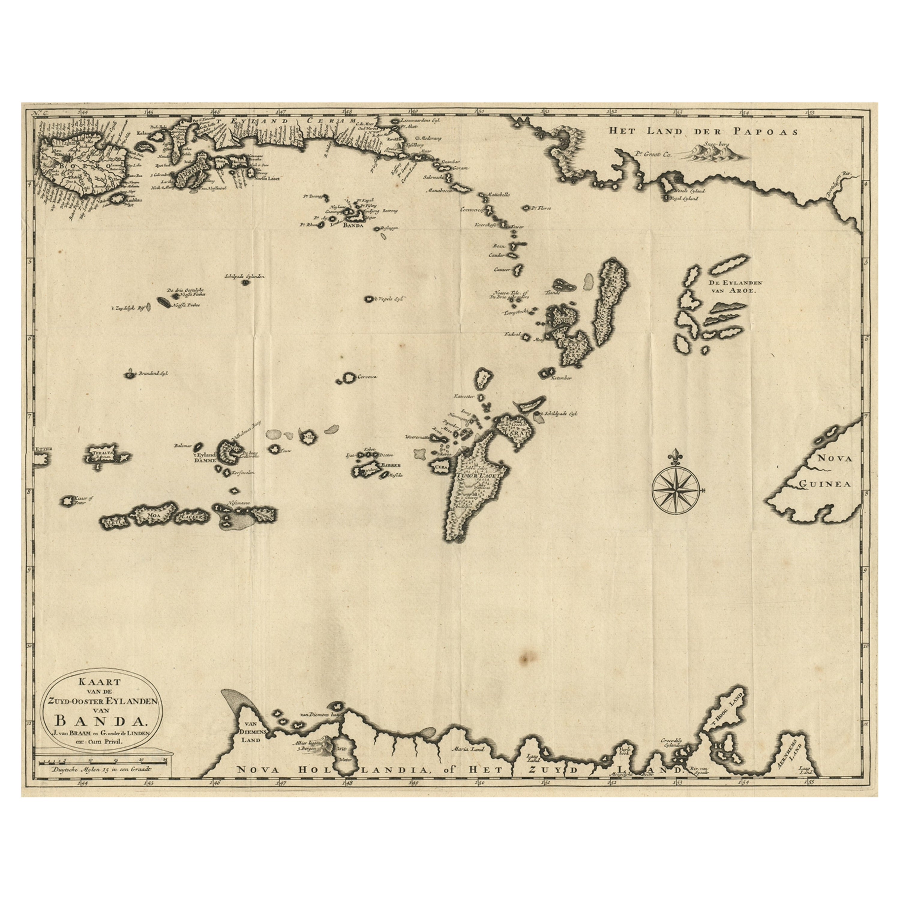
Old Antique Map of the Banda Islands (Southeast), Indonesia
Northern Australia
By F. Valentijn
Located in Langweer, NL
Original antique map titled 'Kaart van de Zuyd-Ooster Eylanden van Banda'. Important map of the seas and islands surrounding the Banda Islands, Indonesia, extending south to northern Australia, east to Papua New Guinea and north to Ceram. Published 1724-1726 by Joannes van Braam...
Category
Antique Early 18th Century Maps
Materials
Paper
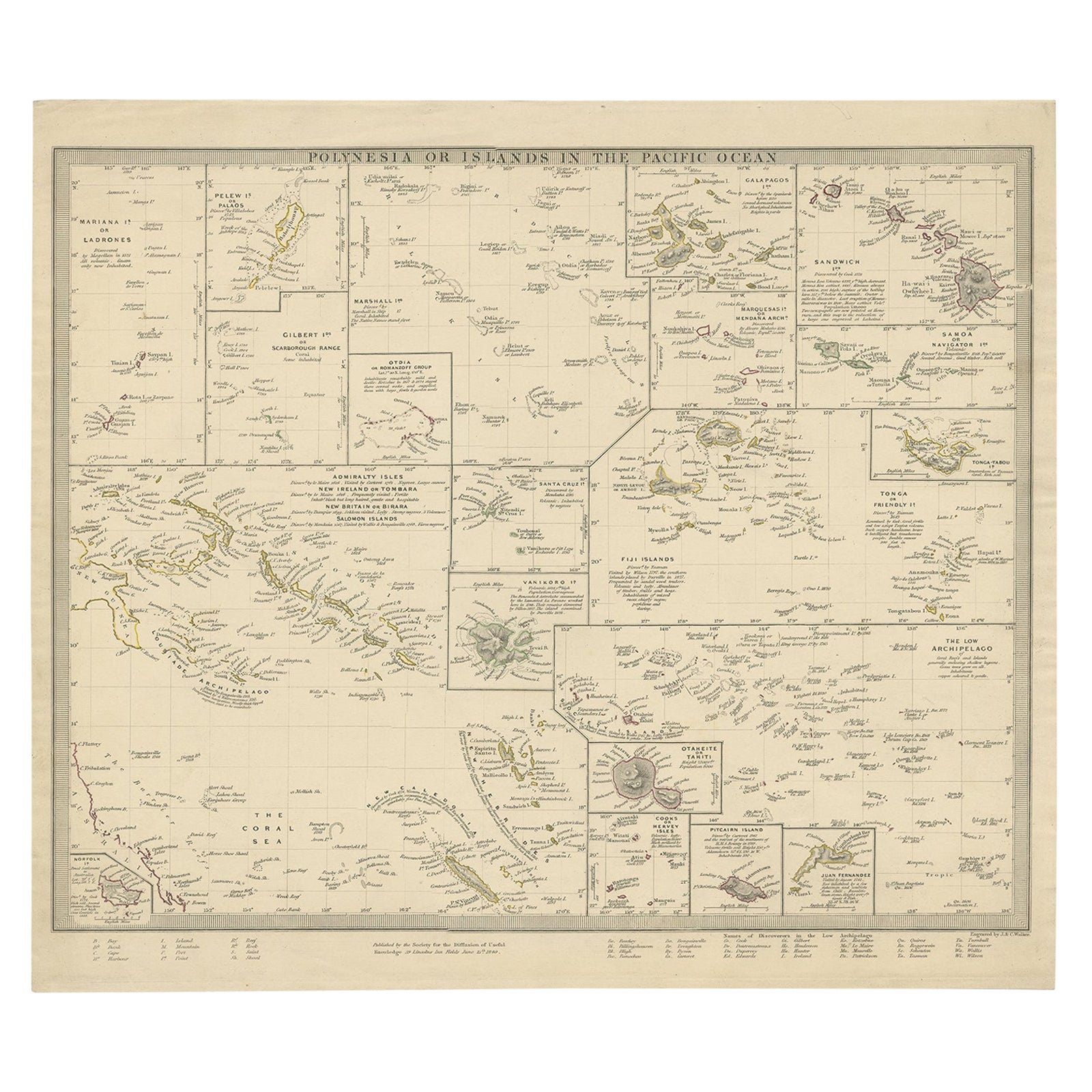
Antique Map of Polynesia with Details of Many Islands, 1840
Located in Langweer, NL
Antique map titled 'Polynesia or Islands in the Pacific Ocean'.
This map depicts various islands including the Lousiade Archipelago, Tahiti, Pitcairn Island, Juan Fernandez, The lo...
Category
Antique 19th Century Maps
Materials
Paper
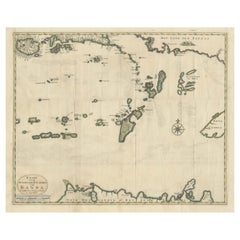
Map of the Southeastern Part of the Banda Islands, Incl Northern Australia, 1726
Located in Langweer, NL
Antique map titled 'Kaart van de Zuyd-Ooster Eylanden van Banda.'
Map of the southeastern part of the Banda islands. This map originates from 'Oud en Nieuw Oost-Indiën' by Franço...
Category
Antique 1720s Maps
Materials
Paper
$1,070 Sale Price
20% Off
You May Also Like
Original Antique Map of US Possessions In The Pacific Ocean, C.1900
Located in St Annes, Lancashire
Fabulous map of US possessions in the Pacific Ocean
Original color.
Engraved and printed by the George F. Cram Company, Indianapolis.
Published, C.1900.
Unframed.
Free shipping.
Category
Antique 1890s American Maps
Materials
Paper

Large Original Vintage Map of The Pacific Islands Including Hawaii
Located in St Annes, Lancashire
Great map of The Pacific Islands
Unframed
Original color
By John Bartholomew and Co. Edinburgh Geographical Institute
Published, circa 1...
Category
Vintage 1920s British Maps
Materials
Paper

Large Original Antique Map of The Canary Islands. 1894
Located in St Annes, Lancashire
Superb Antique map of The Canary Islands
Published Edward Stanford, Charing Cross, London 1894
Original colour
Good condition
Unframed.
Free shipping
Category
Antique 1890s English Maps
Materials
Paper

Original Antique Map of Hawaii And Adjacent Islands. C.1900
Located in St Annes, Lancashire
Fabulous map of Hawaii. With a vignette of Honolulu
Original color.
Engraved and printed by the George F. Cram Company, Indianapolis.
Published, C.1900.
Unframed.
Free shipping.
Category
Antique 1890s American Maps
Materials
Paper

Large Original Antique Map of The Leeward Islands. 1894
Located in St Annes, Lancashire
Superb Antique map of The Leeward Islands
Published Edward Stanford, Charing Cross, London 1894
Original colour
Good condition
Unframed.
Free shipping
Category
Antique 1890s English Maps
Materials
Paper

Antique St Christopher
Nevis Map, English, Caribbean Cartography, Georgian
Located in Hele, Devon, GB
This is a superb antique map of St Christopher and Nevis. An English, framed Caribbean island cartography engraving, dating to the Georgian period and later, circa 1780. A fascinatin...
Category
Antique 1780s British Georgian Maps
Materials
Glass, Paper
More Ways To Browse
Leather Pouf And Ottomans
Low Side Tables
Set Of Four Italian Dining Chairs
Silk Runner Carpet
3x5 Rugs
Italian Lacquer Dining Room Sets
Round Brass Table
Round Table Base
Belgian Antiques
Cream Soup
Early English Silver
James Bond
Paisley Rugs and Carpets
Antique Pagoda
Black And Chrome Lounge Chair
Ceramic 1960s Italy
Vintage 1930 Dining Room Set
Antique Brass And Copper