Items Similar to Map of Spain and Portugal – Nieuwe Hand-Atlas by Frijlink
van Otterloo, 1876


Want more images or videos?
Request additional images or videos from the seller
1 of 12
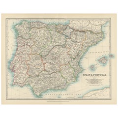
Map of Spain and Portugal – Nieuwe Hand-Atlas by Frijlink
van Otterloo, 1876
$384.34
£284.96
€320
CA$528
A$576.39
CHF 303.48
MX$6,904.52
NOK 3,881.37
SEK 3,543.76
DKK 2,438.28
About the Item
Title: Map of Spain and Portugal – Nieuwe Hand-Atlas by Frijlink
van Otterloo, 1876
Description:
This detailed 19th-century map, titled “Spanje en Portugal,” was published in 1876 in the Nieuwe Hand-Atlas der Aarde in haren Tegenwoordigen Toestand by M. Frijlink, revised by A. van Otterloo, and printed by D. Noothoven van Goor in Leiden. The map presents the Iberian Peninsula in exceptional detail, featuring the political and physical geography of Spain and Portugal during the late 19th century, rendered in fine Dutch cartographic style.
Each province is outlined in distinct hand-colored borders—red for Portugal, blue for the interior Spanish provinces, and yellow along key boundaries. The map includes the Balearic Islands, Gibraltar, and adjacent portions of North Africa. Insets provide close-up views of Lisbon (*Lissabon en Omstreken*) and the Strait of Gibraltar, along with a comparative scale chart showing Spain’s position relative to European latitudes. Rivers, mountain ranges, and major roads are carefully engraved, while cities such as Madrid, Barcelona, Seville, and Porto are clearly marked.
This plate reflects both educational precision and aesthetic craftsmanship. It served as a reference for geography education in Dutch schools, combining scientific accuracy with elegant lithographic execution. The atlas from which it originates—Frijlink’s *Nieuwe Hand-Atlas*—was among the most comprehensive of its era, featuring maps engraved by leading Dutch cartographers and printed with high production standards.
Condition report:
Good condition with light toning and scattered foxing around the margins. Original center fold as issued. The image remains sharp with vivid original coloring. No tears or repairs.
Framing tips:
An ivory or light grey mat paired with a dark wooden or black frame will enhance the warm vintage tones of this map. Ideal for display in studies, travel-themed interiors, or classical home libraries.
Technique: Lithograph with original hand-coloring
Maker: M. Frijlink
A. van Otterloo, published by D. Noothoven van Goor, Leiden, 1876
- Dimensions:Height: 17.33 in (44 cm)Width: 21.66 in (55 cm)Depth: 0.01 in (0.2 mm)
- Materials and Techniques:
- Place of Origin:
- Period:
- Date of Manufacture:1876
- Condition:Good condition with light toning and scattered foxing around the margins. Original center fold as issued. The image remains sharp with vivid original coloring. No tears or repairs.
- Seller Location:Langweer, NL
- Reference Number:Seller: BG-12788-71stDibs: LU3054347454362
About the Seller
5.0
Recognized Seller
These prestigious sellers are industry leaders and represent the highest echelon for item quality and design.
Platinum Seller
Premium sellers with a 4.7+ rating and 24-hour response times
Established in 2009
1stDibs seller since 2017
2,810 sales on 1stDibs
Typical response time: <1 hour
- ShippingRetrieving quote...Shipping from: Langweer, Netherlands
- Return Policy
More From This Seller
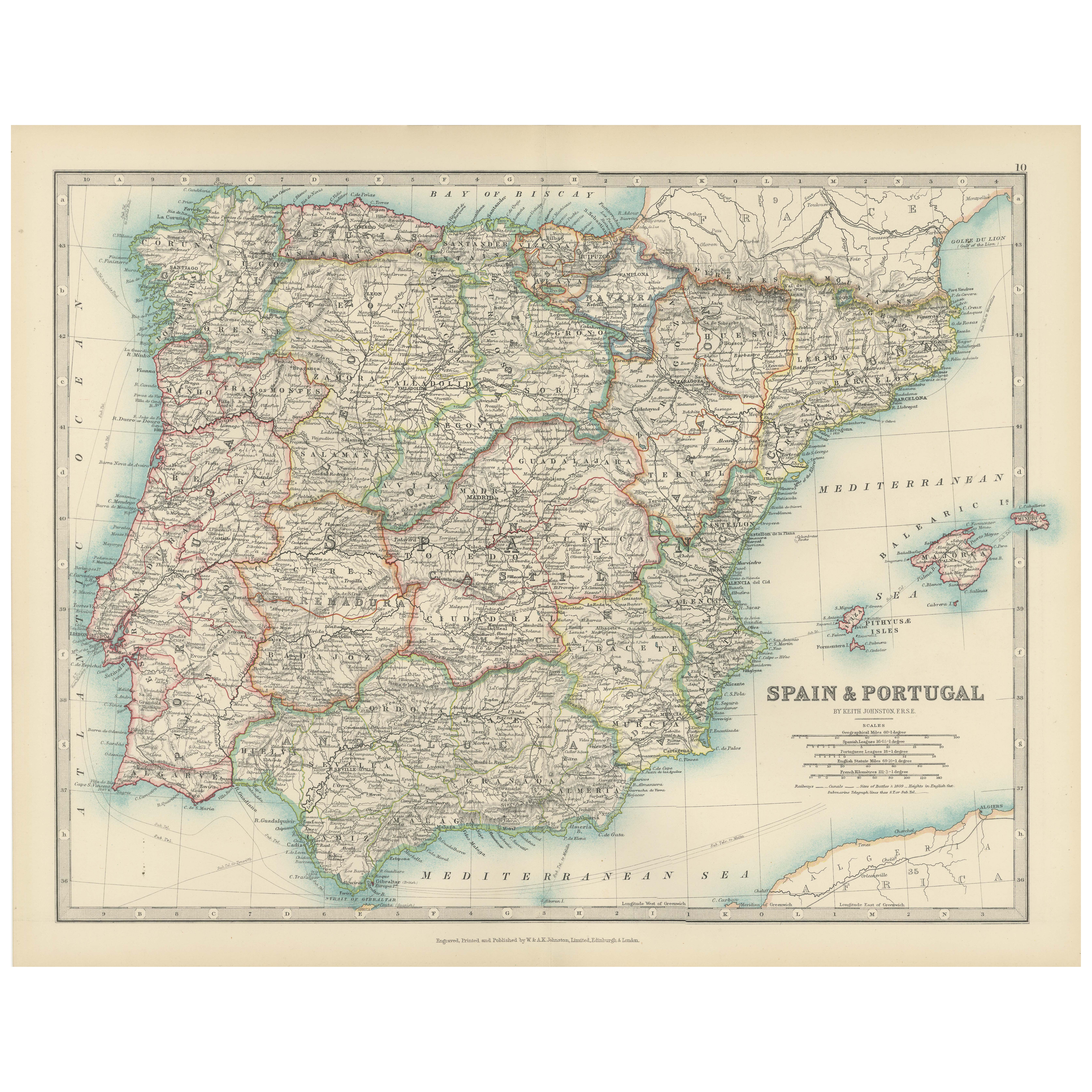
View AllAntique Map of Spain and Portugal, 1903, Regional Boundaries and Coastal Detail
Located in Langweer, NL
Antique Map of Spain and Portugal, 1903, Featuring Regional Boundaries and Coastal Detail
Description: This antique map, titled "Spain & Portugal," was engraved and published in 190...
Category
Early 20th Century Maps
Materials
Paper
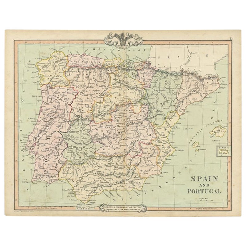
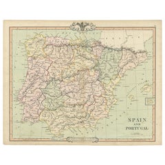
Antique Map of Spain and Portugal by A
C. Black, 1870
Located in Langweer, NL
Antique map titled 'Spain and Portugal'. Original antique map of General map of Spain and Portugal with inset map of Gibraltar. This map originates from ‘Black's General Atlas of The...
Category
Antique Late 19th Century Maps
Materials
Paper

$198 Sale Price
40% Off
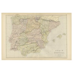
Antique Map of Spain and Portugal by Levasseur,
1875
Located in Langweer, NL
Antique map titled 'Carte générale de l'Espagne et du Portugal (..)'. Large map of Spain and Portugal. This map originates from 'Atlas de Géographie Moder...
Category
Antique Late 19th Century Maps
Materials
Paper

$360 Sale Price
40% Off
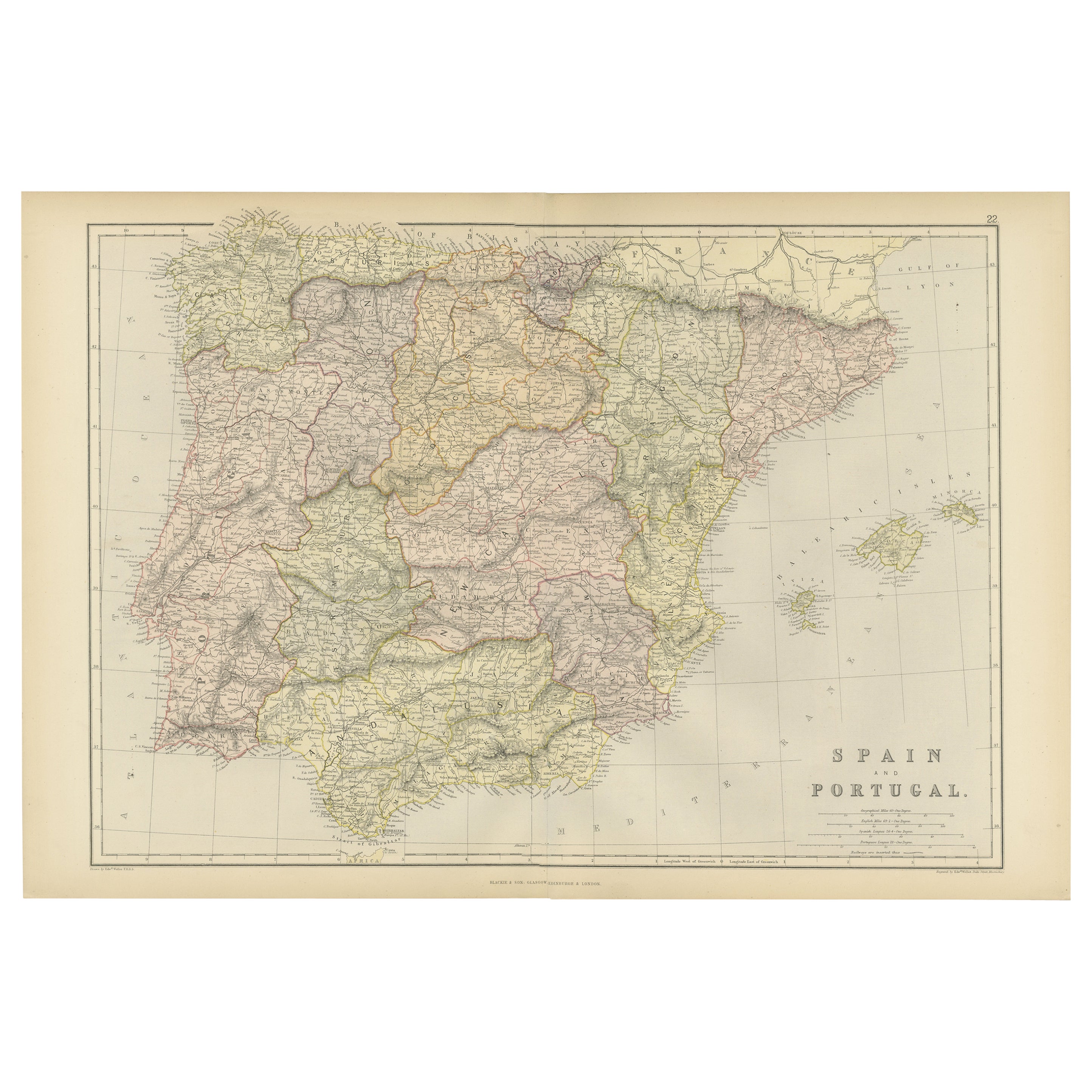
Antique Map of Spain and Portugal by Cruchley, 1854
Located in Langweer, NL
"Antique map of Spain and Portugal. Also depicts the islands Formentera, Ibiza, Mallorca and Minorca. Artists and Engravers: Engraved and publishe...
Category
Antique 19th Century Maps
Materials
Paper
$115 Sale Price
20% Off
Original Antique Map of Spain and Portugal, 1882
Located in Langweer, NL
Embark on a historical voyage with an original Antique Map of Spain and Portugal from the esteemed 'Comprehensive Atlas and Geography of the World,' meticulously crafted in 1882. Thi...
Category
Antique 1880s Maps
Materials
Paper
$163 Sale Price
20% Off
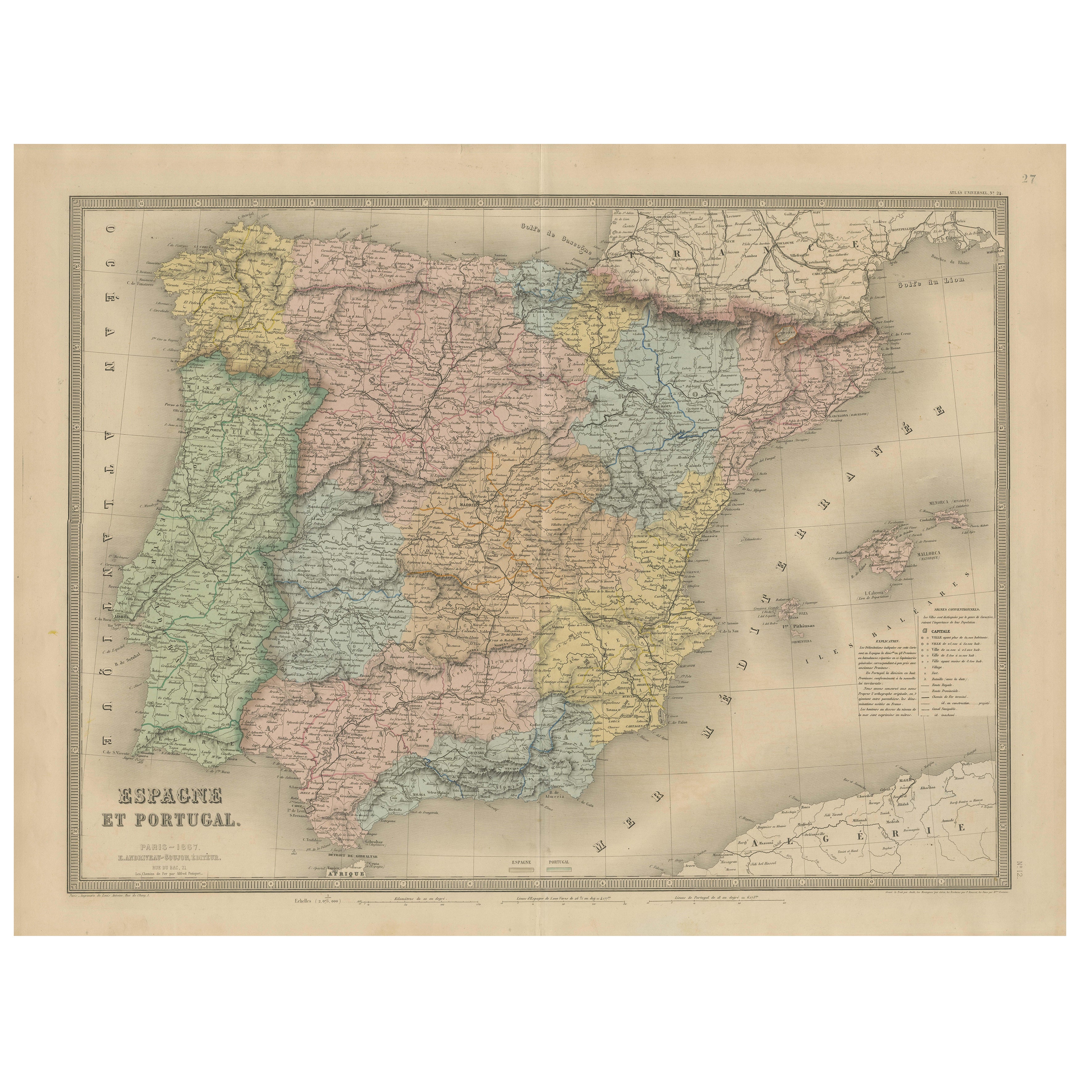
Spain
Portugal Map – Antique 1867 Engraving by Andriveau-Goujon, Paris
Located in Langweer, NL
Antique Map of Spain and Portugal – “Espagne et Portugal” by Andriveau-Goujon, 1867
This finely detailed antique map titled “Espagne et Portugal” was published in Paris in 1867 by t...
Category
Antique Mid-19th Century French Maps
Materials
Paper

You May Also Like
Map of Spain and Portugal - Etching by Pierre François Tardieu - 1837
Located in Roma, IT
Map of Spain and Portugal is an Etching realized by Pierre François Tardieu in 1837.
Good conditions.
The artwork is realized in a well-balanced composition. the artwork and belong...
Category
1830s Modern Figurative Prints
Materials
Lithograph

Large Original Vintage Map of Spain, circa 1920
Located in St Annes, Lancashire
Great map of Spain
Original color.
Good condition
Published by Alexander Gross
Unframed.
Category
Vintage 1920s English Maps
Materials
Paper

Map of Spain and Portugal - Original Etching - Late 19th Century
Located in Roma, IT
This Map of Spain and Portugal is an etching realized by an anonymous artist.
The state of preservation of the artwork is good with some small diffused stains.
Sheet dimension: 28...
Category
Late 19th Century Modern Figurative Prints
Materials
Etching

Spain and Portugal: A Hand-colored 17th/18th Century Map by Visscher
By Nicolaus Visscher
Located in Alamo, CA
This is an early 18th century map of Spain and Portugal, with attractive original hand-coloring, entitled "Hispaniae et Portugalliae Regna per Nicolaum Visscher cum Privilegio Ordinum Hollandiae et Westfrisiae" first published by Nicolaes Visscher II (1649-1702) in 1688, and later re-published from Visscher's original copper plate by Peter Schenk, Junior in Amsterdam in 1725. The cartouche in the right lower corner depicts a coat of arms representing one combined kingdom of Spain and Portugal before their break-up. Putti hold up the coat-of-arms of Phillip II on the right and a queen reaches for it on the left. There is a scale cartouche in the lower left corner surmounted by two putti and a wheel. This is an outstanding depiction of the Iberian peninsula, showing Spain and Portugal and Balearic Islands. The map includes portions of North Africa and the Strait of Gibralter.
This copperplate engraved map is presented in a cream-colored mat. It is printed on fine chain-linked, laid paper. The mat measures 26.5" high by 30" wide and the sheet measures 21.75" high by 26.375" wide. There is a central fold, as issued. The lower portion of the fold is reinforced on the verso. There is a small paper defect at the lower edge of the fold and another at the edge of the right corner, as well as a few small tears along the lower edge; none affecting the map and all covered by the mat. There are a few small faint spots in the upper margin and on the left. The map is otherwise in very good condition.
The Visscher family were one of the great art and cartographic printing families of the 17th century. Begun by Claes Jansz Visscher...
Category
Late 17th Century Other Art Style Landscape Prints
Materials
Engraving

$1,020 Sale Price
20% Off
18th Century Hand Colored Map of Spain and Portugal by Visscher
By Nicolaes Visscher II
Located in Alamo, CA
This is an early 18th century map of Spain and Portugal, with attractive original hand-coloring, entitled "Hispaniae et Portugalliae Regna per Nicolaum Visscher cum Privilegio Ordinu...
Category
Antique Early 18th Century Dutch Maps
Materials
Paper

$1,020 Sale Price
20% Off
After Johann B. Homann (1664-1724) - 19th C, General Map of Spain and Portugal
Located in Corsham, GB
General map of Spain and Portugal divided into its current provinces by D.T. Lopez, newly drawn by F. L. G. in Nuremberg at the Heret of Homann, 1782. A double-page engraved map with...
Category
19th Century More Prints
Materials
Engraving
