Items Similar to Map Sussex
Want more images or videos?
Request additional images or videos from the seller
1 of 6
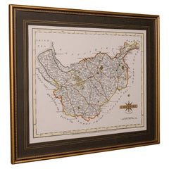
Map Sussex
$825.84
£600
€701.99
CA$1,128.68
A$1,228.66
CHF 652.17
MX$14,783.46
NOK 8,263.94
SEK 7,572.10
DKK 5,242.41
About the Item
Map of Sussex with explanation
Maker unknown.
- Dimensions:Height: 31 in (78.74 cm)Width: 37 in (93.98 cm)Depth: 2 in (5.08 cm)
- Style:Victorian (Of the Period)
- Materials and Techniques:
- Place of Origin:
- Period:
- Date of Manufacture:circa 1820
- Condition:Wear consistent with age and use.
- Seller Location:BUNGAY, GB
- Reference Number:1stDibs: LU3867332645792
About the Seller
5.0
Vetted Professional Seller
Every seller passes strict standards for authenticity and reliability
Established in 1985
1stDibs seller since 2018
103 sales on 1stDibs
Typical response time: 5 hours
- ShippingRetrieving quote...Shipping from: BUNGAY, United Kingdom
- Return Policy
More From This Seller
View AllMap Suffolk Southwold Aldeburgh Dunwich Bawdsey Harwich Ipswich
Located in BUNGAY, SUFFOLK
Map Suffolk including many popular destinations on the coast Southwold, Dunwich, Aldeburgh bawdsey felixstowe harwich ipswich.
Charming topography and colouring.
In the original fr...
Category
Antique 19th Century European Georgian Maps
Materials
Paper
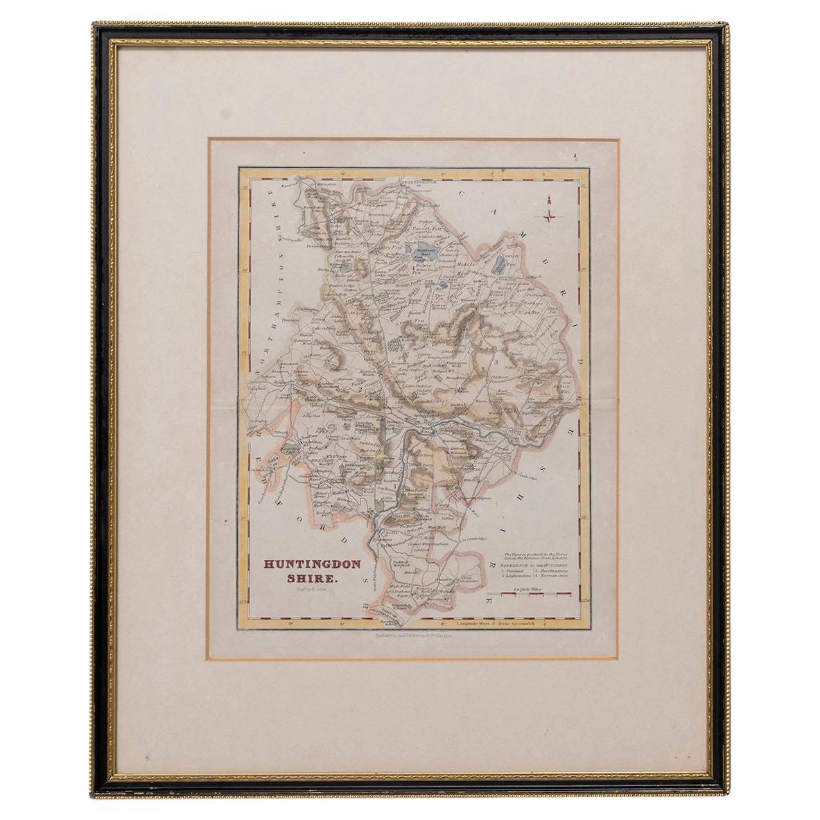
Map Huntingdonshire R Scott Archibald Fullarton
Co Glasgow
Located in BUNGAY, SUFFOLK
Folding Map of Huntingdonshire by R Scott with distances from London and reference to the hundreds.
Published by Archibald Fullarton & Co Glasgow. Measure: 40...
Category
Antique 19th Century English Victorian Maps
Materials
Paper

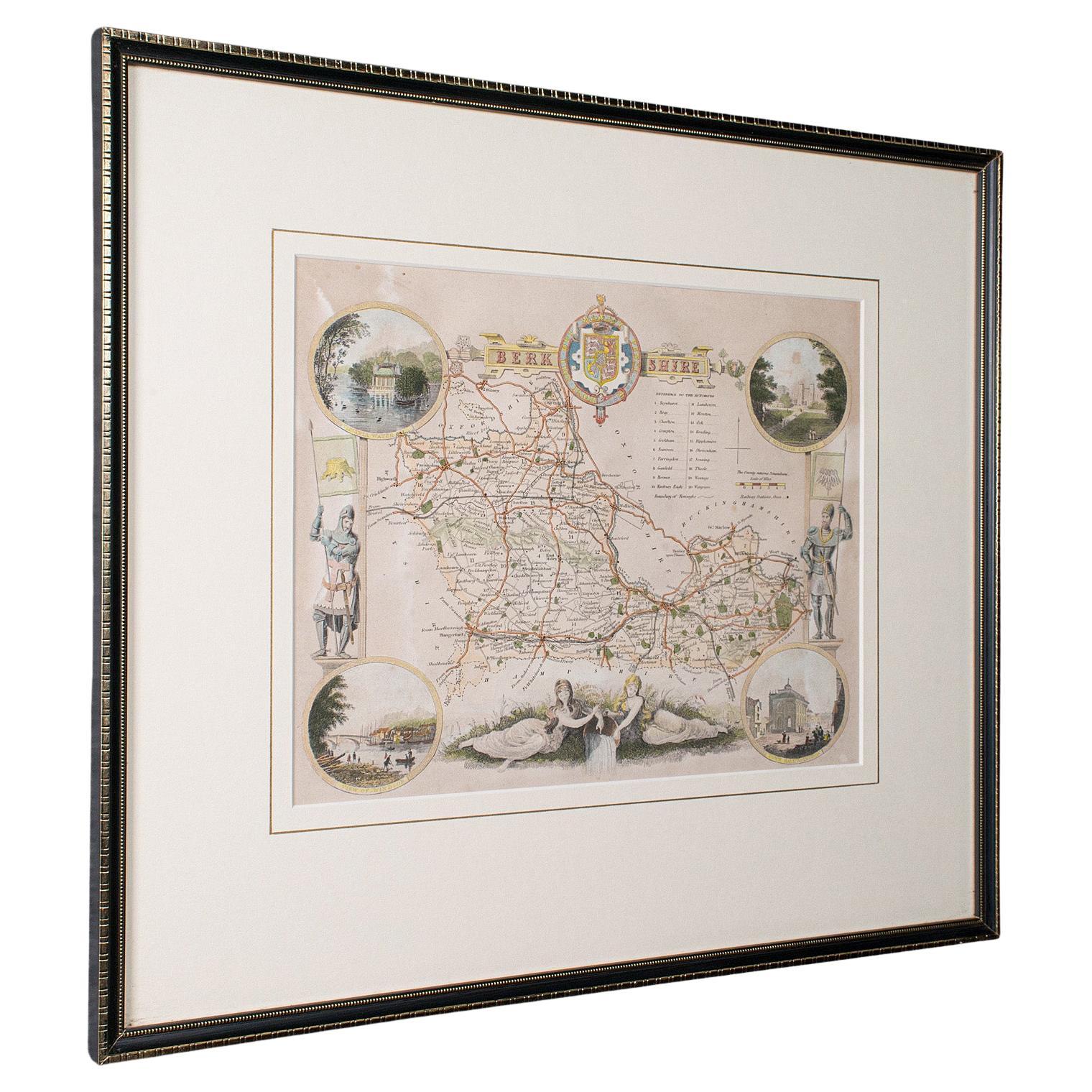
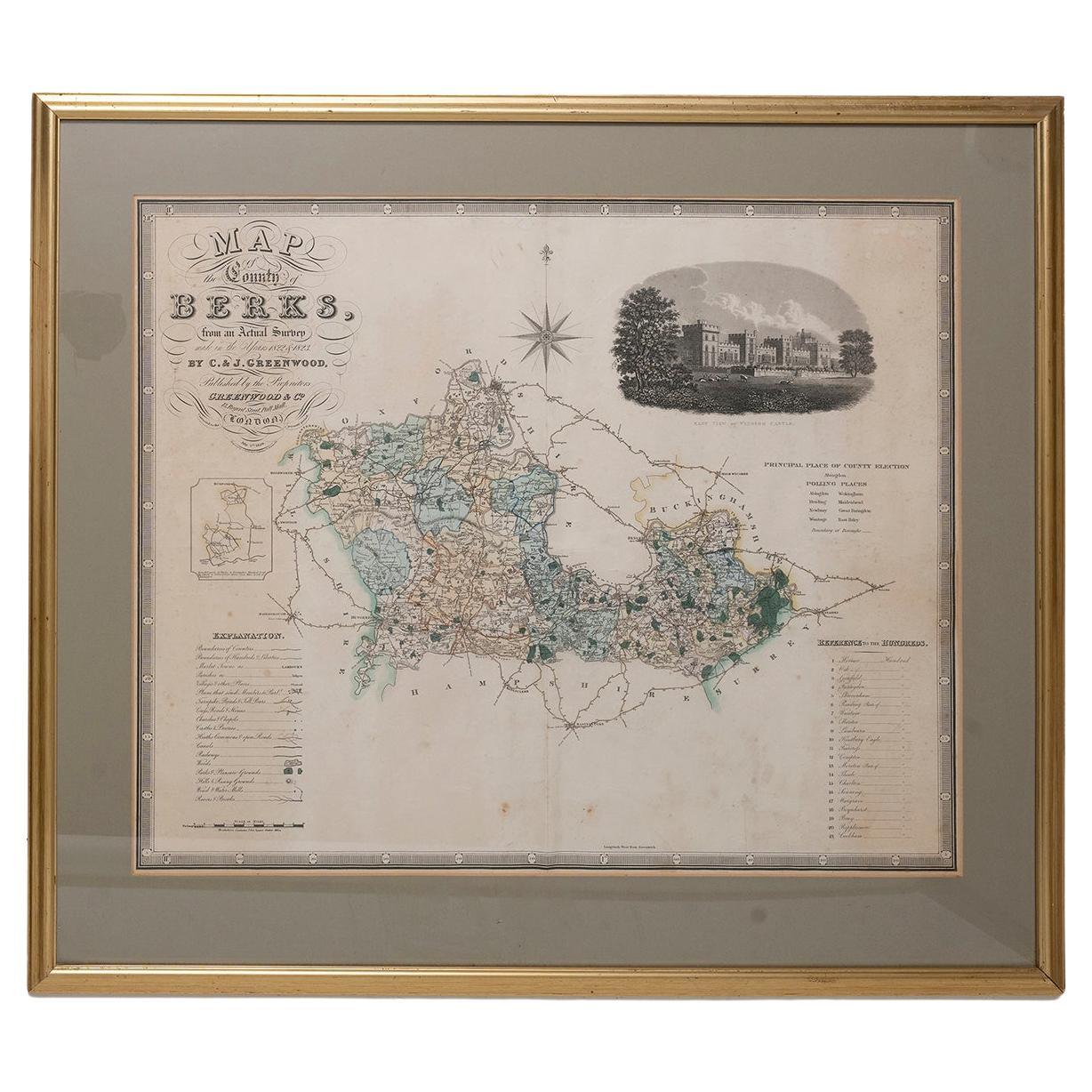
Map Berkshire C&J Greenwood Windsor Castle JDower Polling Hundreds
Located in BUNGAY, SUFFOLK
Map of the County of Berkshire from an Actual Survey made in the Years 1822 & 1823 by C&J Greenwood
Published by the Proprietors Greenwood & Co 13 Regent Street Pall Mall London Ju...
Category
Antique 19th Century English Georgian Maps
Materials
Paper

Map Devonshire Richard Creighton J&C Walker Sculp Samuel Lewis
Located in BUNGAY, SUFFOLK
Devonshire drawn by Richard Creighton with reference to the Unions
Artist Richard Creighton
Engraved by J&C Walker Sculp
Published in Samuel Lewis Topographical Dictionary 1831, a...
Category
Antique 19th Century English Victorian Maps
Materials
Paper
Map Bedfordshire No 3 General Framed
Located in BUNGAY, SUFFOLK
A general map of Bedfordshire with its hundreds. Measure: 37cm 14 1/2" high
A scale of 5 miles.
in the original green mount and traditional black and gold frame.
charming map with...
Category
Antique 18th Century English Georgian Maps
Materials
Paper

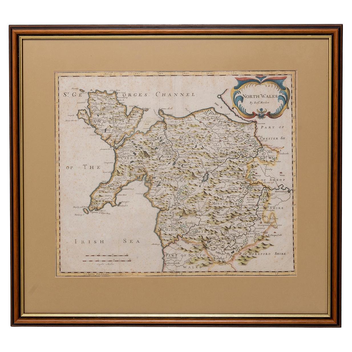
Map North Wales Robert Marsden Anglesey
Located in BUNGAY, SUFFOLK
Map of North Wales by Robert Marsden
Including Anglesey
Charming topography and detail and colouring
just purchased more information to follow.
Category
Antique 18th Century English Georgian Maps
Materials
Paper

You May Also Like
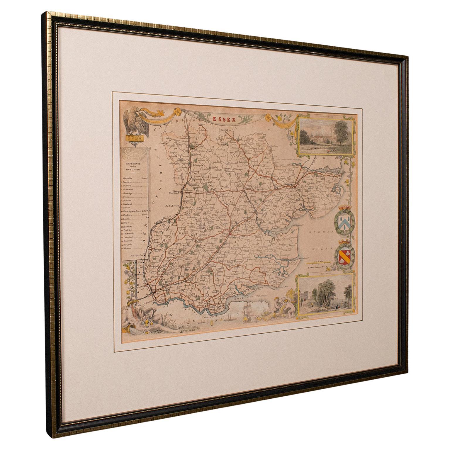
Antique County Map, Essex, English, Framed, Cartographic Interest, Victorian
Located in Hele, Devon, GB
This is an antique lithography map of Essex. An English, framed atlas engraving of cartographic interest, dating to the mid 19th century and later.
Superb lithography of Essex and ...
Category
Antique Mid-19th Century British Victorian Maps
Materials
Wood

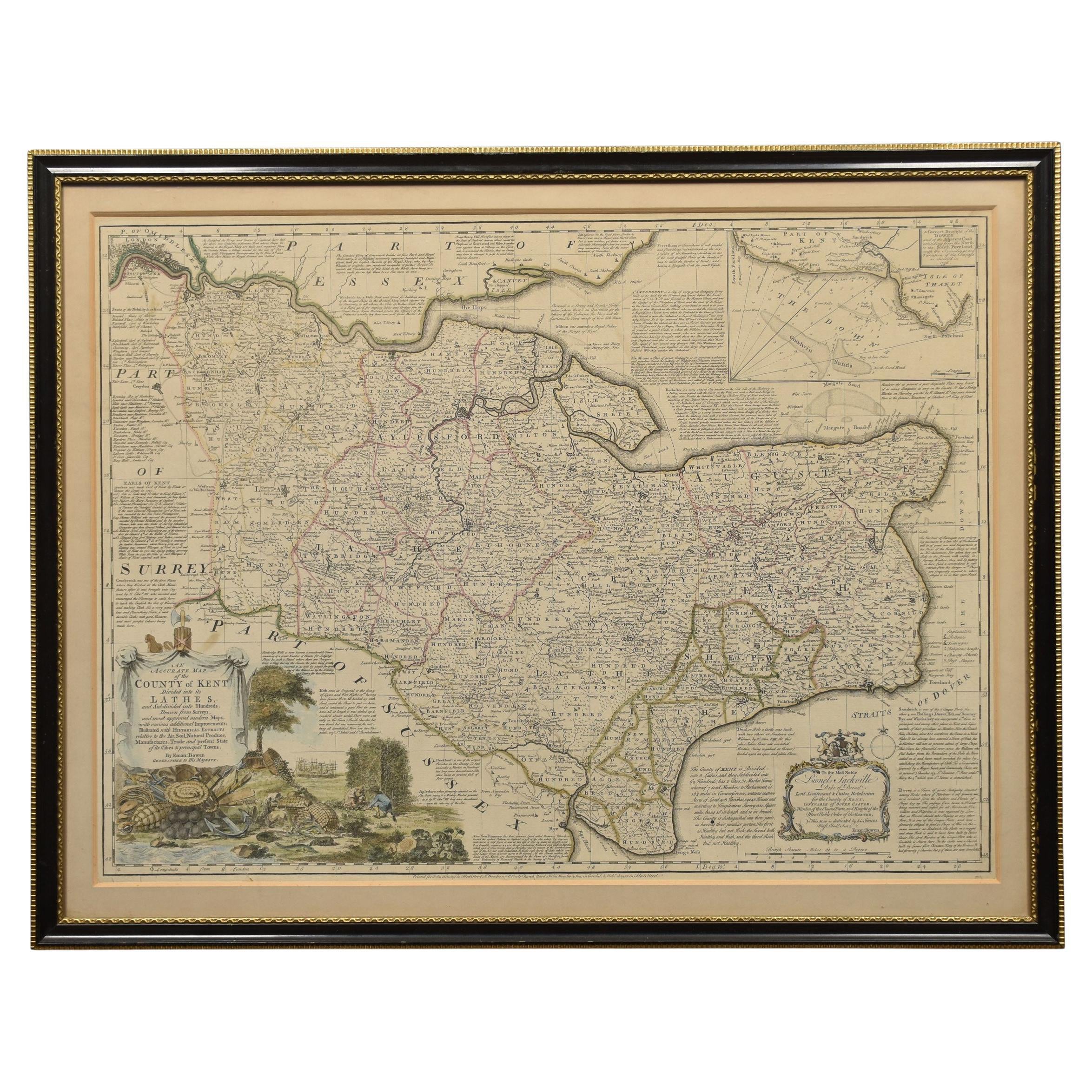
Map of Essex by Emanuel Bowen
Located in Cheshire, GB
Map of part of Essex and part of Kent, hand-coloured. Encased in an ebonized and gilded frame.
Dimensions
Height 25.5 Inches
Length 32.5 Inches
width 1 Inches.
Category
Antique Late 19th Century British Maps
Materials
Paper

$991 Sale Price
50% Off
Antique West Yorkshire Map, English, Framed Lithography, Cartography, Victorian
Located in Hele, Devon, GB
This is an antique lithography map of West Yorkshire. An English, framed atlas engraving of cartographic interest, dating to the mid 19th century and later.
Superb lithography of t...
Category
Antique Mid-19th Century British Victorian Maps
Materials
Paper

Map of Lancashire
Located in Cheshire, GB
Saxton Map of Lancashire hand coloured. Encased in an ebonised frame.
Dimensions
Height 21 Inches
Width 24 Inches
Depth 1 Inches
Category
Early 20th Century British Maps
Materials
Paper

$765 Sale Price
20% Off
Original 1891 Walker Map
Located in Norwell, MA
Original 1891 map of Massachusetts by Walker. Towns include Cambridge, Boston, Dedham, Ashland, Brookline, Newton etc... burl wood frame. Measures...
Category
Antique 19th Century Maps

Vintage County Map of Cheshire, English, After John Cary, Cartography Interest
Located in Hele, Devon, GB
This is a vintage Cheshire map, a fine reproduction of John Cary’s late 18th century cartography, and presented within a smart glazed frame.
Superb county map of Cheshire, offering ...
Category
Vintage 1980s British Georgian Maps
Materials
Glass, Paper
More Ways To Browse
Map New Holland
Mauritius Antique Map
Nantucket Poster
Nicolas Baier
Ruben Benjamin
Washington Dc Map
Wood Carved Golfer
1681 Moses Pitt
Antique Map Bermuda
Antique Map Of Brooklyn
Antique Map Of Republic Of Texas
Extra Large Map
George Weymouth
Georgetown Map
Hemisphere Antiques
J Matthews
Japanese Kite
Maltese Falcon