Items Similar to Map of Sweden and Norway with Inset of Stockholm, Leiden 1876


Want more images or videos?
Request additional images or videos from the seller
1 of 13
Map of Sweden and Norway with Inset of Stockholm, Leiden 1876
$383.10
£286.49
€320
CA$527.89
A$575.91
CHF 304.94
MX$6,901.05
NOK 3,883.60
SEK 3,551.26
DKK 2,437.18
About the Item
Title: Map of Sweden and Norway with Inset of Stockholm, Leiden 1876
Description:
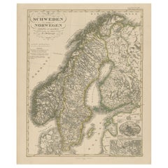
This fine 19th-century Dutch map, titled “Zweden en Noorwegen,” was published in 1876 in the Nieuwe Hand-Atlas der Aarde in haren Tegenwoordigen Toestand by M. Frijlink, revised by A. van Otterloo, and printed by D. Noothoven van Goor in Leiden. The map presents a clear and elegant representation of Scandinavia, covering the kingdoms of Sweden and Norway in their 19th-century political configuration, when both nations were united under a single monarch.
The map is engraved with exceptional precision and delicately hand-colored to differentiate the borders of Sweden, Norway, and neighboring regions. Major cities, towns, rivers, and mountain ranges are finely labeled, including Stockholm, Christiania (now Oslo), Gothenburg, Bergen, and Trondheim. It also shows the Gulf of Bothnia, the Norwegian fjords, and the complex lake system that defines Sweden’s geography. Insets at the upper left depict the region of Stockholm (*Omstreken van Stockholm*) and a map of Scandinavia and northern Europe (*Scandinavië en Noord-Europa*), enriching the educational and geographical context of the chart.
This map exemplifies the clarity and accuracy of Dutch cartography in the late 19th century, balancing informative precision with decorative simplicity. It formed part of Frijlink’s *Nieuwe Hand-Atlas*, a work widely used in schools and institutions across the Netherlands, printed to the highest standards of the Leiden publishing house Noothoven van Goor.
Condition report:
Good condition with even toning and minor foxing in the wide margins. Original center fold as issued. The printed image is sharp and the hand-coloring remains soft and harmonious. No tears, losses, or repairs.
Framing tips:
A light cream or soft grey mat with a narrow black or walnut frame suits this map beautifully. The balanced layout and fine engraving make it ideal for display in study rooms, libraries, or interiors inspired by exploration and geography.
Technique: Lithograph with original hand-coloring
Maker: M. Frijlink
A. van Otterloo, published by D. Noothoven van Goor, Leiden, 1876
- Dimensions:Height: 21.66 in (55 cm)Width: 17.33 in (44 cm)Depth: 0.01 in (0.2 mm)
- Materials and Techniques:
- Place of Origin:
- Period:
- Date of Manufacture:1876
- Condition:Good condition with even toning and minor foxing in the wide margins. Original center fold as issued. The printed image is sharp and the hand-coloring remains soft and harmonious. No tears, losses, or repairs.
- Seller Location:Langweer, NL
- Reference Number:Seller: BG-12788-111stDibs: LU3054347454932
About the Seller
5.0
Recognized Seller
These prestigious sellers are industry leaders and represent the highest echelon for item quality and design.
Platinum Seller
Premium sellers with a 4.7+ rating and 24-hour response times
Established in 2009
1stDibs seller since 2017
2,792 sales on 1stDibs
Typical response time: <1 hour
- ShippingRetrieving quote...Shipping from: Langweer, Netherlands
- Return Policy
More From This Seller
View All1882 Map of Sweden and Norway Highlighting Geographical and Political Features
Located in Langweer, NL
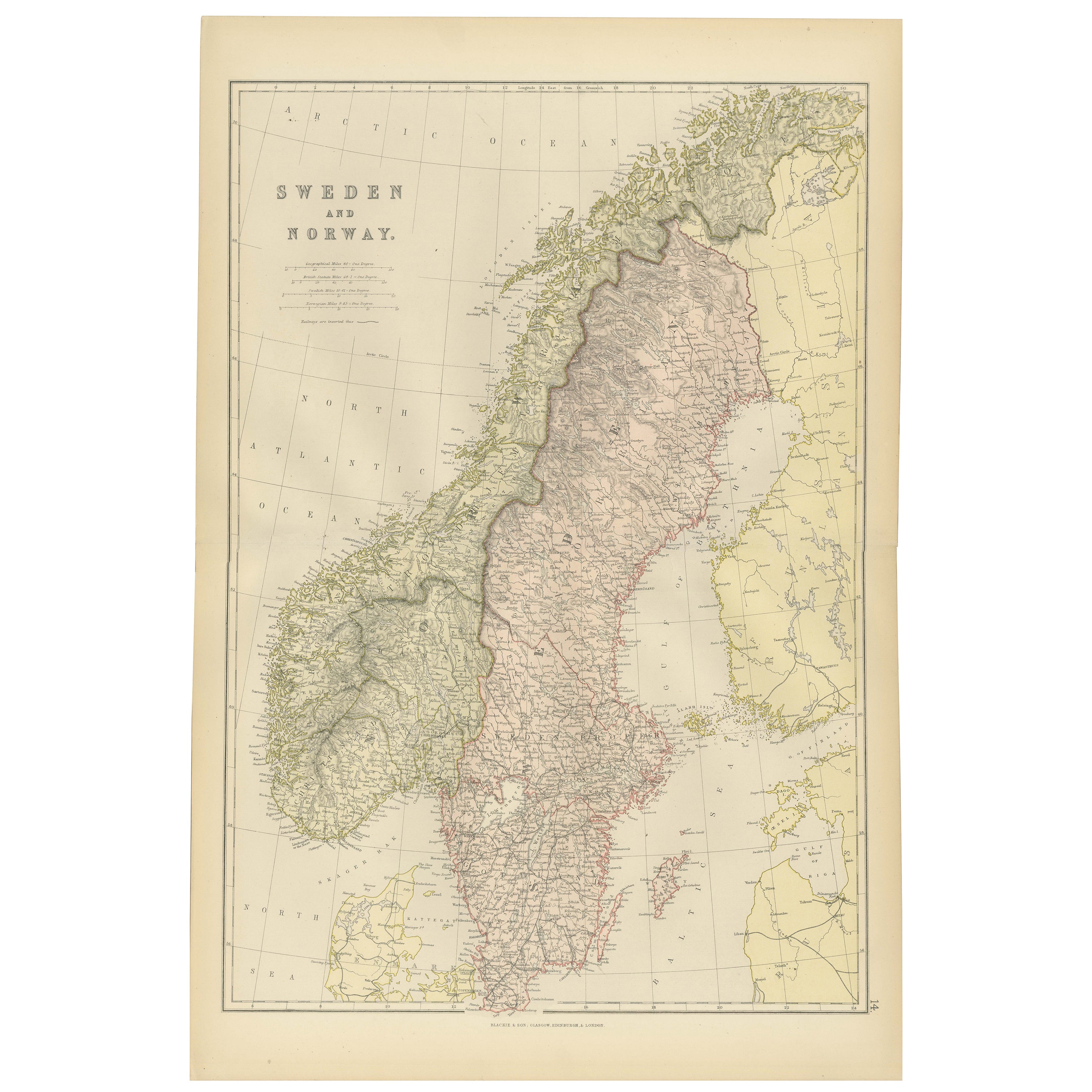
This 1882 map of Sweden and Norway, published by Blackie and Son as part of the 'Comprehensive Atlas and Geography of the World,' provides a detailed depiction of the Scandinavian Pe...
Category
Antique 1880s Maps
Materials
Paper

Antique Map of Sweden and Norway by Petri, c.1873
Located in Langweer, NL
Antique map titled 'Zweden en Noorwegen'. Old map depicting Sweden and Norway. This map originates from 'School-Atlas van alle Deelen der Aarde'. Artists and Engravers: Published by ...
Category
Antique 19th Century Maps
Materials
Paper

$112 Sale Price
20% Off
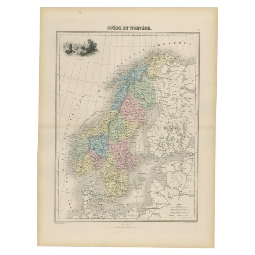
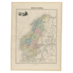
Antique Map of Sweden and Norway by Migeon, 1880
Located in Langweer, NL
Antique map titled 'Suède et Norvége'. Old map of Sweden and Norway. With decorative vignette of Stockholm. This map originates from 'Géographie Universe...
Category
Antique 19th Century Maps
Materials
Paper
$105 Sale Price
20% Off
Antique Map of Sweden and Norway by W. G. Blackie, 1859
Located in Langweer, NL
Antique map titled 'Sweden and Norway'. Original antique map of Sweden and Norway. This map originates from ‘The Imperial Atlas of Modern Geography’. Published by W. G. Blackie, 1859.
Category
Antique Mid-19th Century Maps
Materials
Paper

$239 Sale Price
20% Off
Antique Map of Sweden and Norway by Petri, 1852
Located in Langweer, NL
Antique map titled 'Zweden en Noorwegen'. Map of Sweden and Norway. This map originates from 'School-Atlas van alle deelen der Aarde' by Otto Petri. Artists...
Category
Antique 19th Century Maps
Materials
Paper

$114 Sale Price
20% Off
Antique Map of Scandinavia 1857 – Sweden
Norway in Detail
Located in Langweer, NL
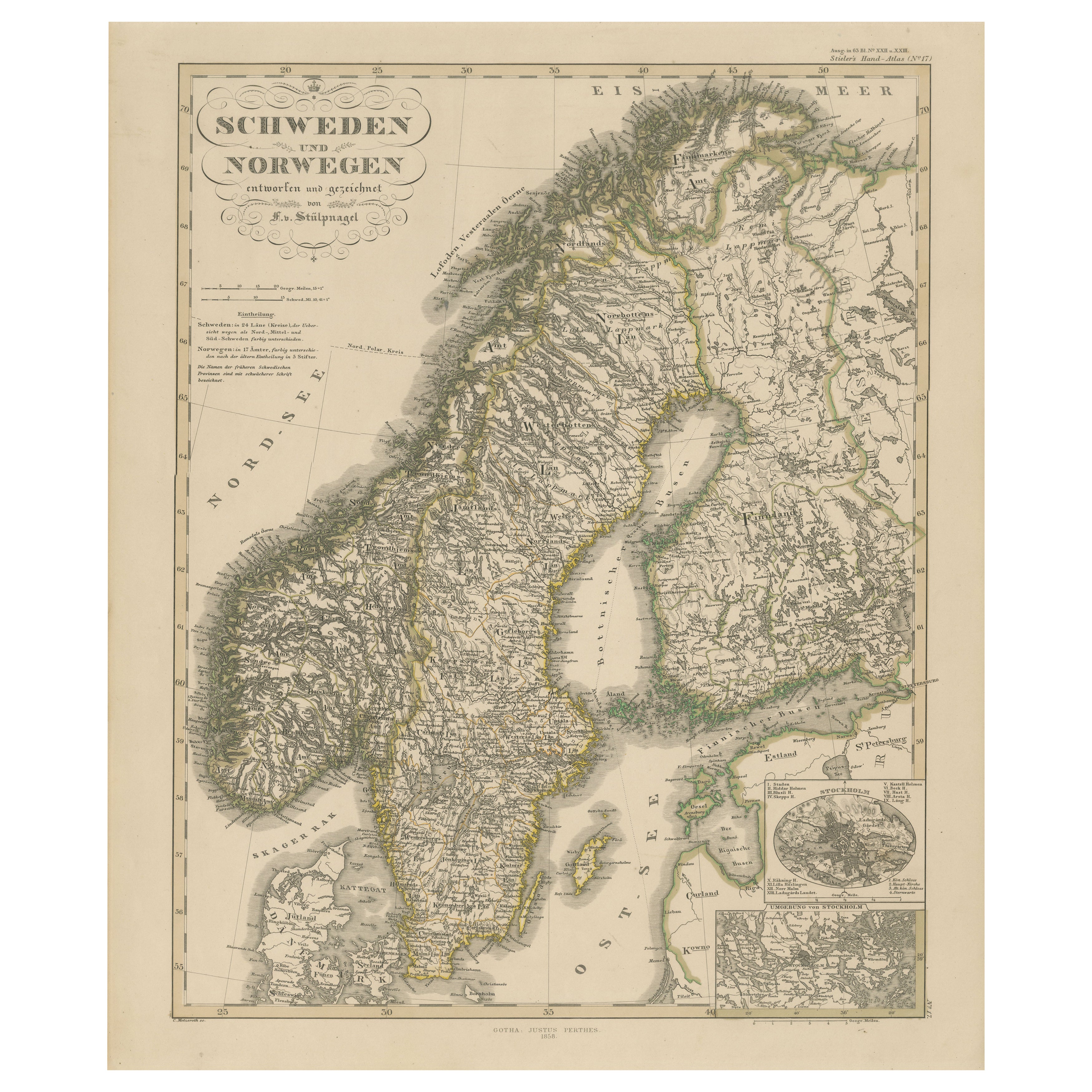
Sweden and Norway Map – Stieler Atlas Engraving, 1858
This fine antique map titled Schweden und Norwegen (Sweden and Norway) was published in 1858 by Justus Perthes of Gotha and dra...
Category
Antique Mid-19th Century German Maps
Materials
Paper
You May Also Like
Original Antique Map of Sweden, Engraved by Barlow, 1806
Located in St Annes, Lancashire
Great map of Sweden
Copper-plate engraving by Barlow
Published by Brightly & Kinnersly, Bungay, Suffolk. 1806
Unframed.
Category
Antique Early 1800s English Maps
Materials
Paper

Large Original Vintage Map of Sweden and Norway circa 1920
Located in St Annes, Lancashire
Great map of Sweden and Norway
Original color. Good condition
Published by Alexander Gross
Unframed.
Category
Vintage 1920s English Victorian Maps
Materials
Paper

Ancient Map of Denmark and Sweden - Original Etching - 19th Century
By Giuseppe Malandrino
Located in Roma, IT
This Map of Denmark and Sweden is an etching realized by an anonymous artist.
The state of preservation of the artwork is good with some small diffused stains.
Sheet dimension: 27x...
Category
Late 19th Century Modern Figurative Prints
Materials
Etching

Denmark. Century Atlas antique vintage map
Located in Melbourne, Victoria
'The Century Atlas. Denmark'
Original antique map, 1903.
Inset maps of 'Faroe Islands', 'Iceland' and 'Copenhagen'.
Central fold as issued. Map name and number printed on the reve...
Category
Early 20th Century Victorian More Prints
Materials
Lithograph

Russia in Europe with Poland and Finland. Century Atlas antique vintage map
Located in Melbourne, Victoria
'The Century Atlas. Russia in Europe with Poland and Finland'
Original antique map, 1903.
Central fold as issued. Map name and number printed on the reverse corners.
Sheet 40cm by ...
Category
Early 20th Century Victorian More Prints
Materials
Lithograph

1849 Map of "Europaische Russland",
Meyer Map of European Russia
, Ric. R017
Located in Norton, MA
1849 Map of
"Europaische Russland"
( Meyer Map of European Russia)
Ric.r017
A lovely map of European Russia dating to 1849 by Joseph Meyer. It covers the European portions of...
Category
Antique 19th Century Unknown Maps
Materials
Paper
