Items Similar to Map of the York to Weft-Chester Road
Want more images or videos?
Request additional images or videos from the seller
1 of 7
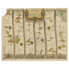
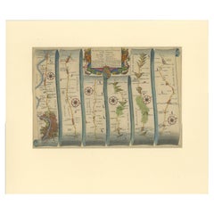
Map of the York to Weft-Chester Road
$328.65
£240
€281.33
CA$452.58
A$492.63
CHF 261.02
MX$5,924.57
NOK 3,318.86
SEK 3,041.37
DKK 2,101.49
About the Item
A road map or strip map by John Ogilby, showing the route from Warrington to Derby, taken from the 1698 edition of Ogilby’s ‘Britannia’ map. Later solid oak frame.
U.K circa 1700.
H 52cm x W 58cm x D 3cm
- Dimensions:Height: 20.48 in (52 cm)Width: 22.84 in (58 cm)Depth: 1.19 in (3 cm)
- Materials and Techniques:
- Period:1700-1709
- Date of Manufacture:1700
- Condition:Wear consistent with age and use. Worn.
- Seller Location:London, GB
- Reference Number:Seller: 9784251stDibs: LU9855246338752
About the Seller
5.0
Vetted Professional Seller
Every seller passes strict standards for authenticity and reliability
Established in 1988
1stDibs seller since 2024
28 sales on 1stDibs
Typical response time: 4 hours
- ShippingRetrieving quote...Shipping from: Sheffield, United Kingdom
- Return Policy
More From This Seller
View AllFabric Covered Picture Frame
Located in London, England
Large oak picture frame covered in original burnt orange velvet and brass studding.
U.K 1900.
H 74cm x W 63cm x D 9cm
Category
Antique Early 1900s British Picture Frames
Materials
Velvet, Oak
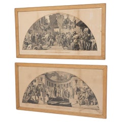
Pair of Prints
Located in London, England
Pair of maple framed prints of young ladies.
Circa 1880.
H 52cm x W 42cm x D 4cm
Category
Antique 19th Century Prints
Materials
Paper
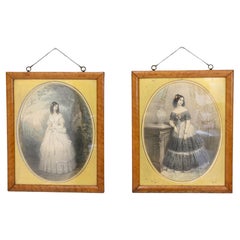
$527 / set
Library Bookcase
Located in London, England
Four door mahogany library bookcase on four drawer base. Circa 1870.
H 262cm x W 261cm x D 48cm
Category
Antique 1870s Bookcases
Materials
Mahogany
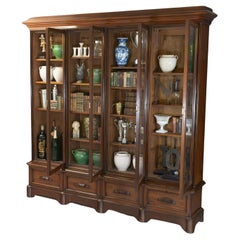
$12,707
Gilded Frame
Located in London, England
Gilded French frame in carved wood. Circa 1930.
H 76cm x W 65cm x D 6cm
Category
Vintage 1930s Picture Frames
Materials
Pine

$576
The Industrial Arts Applied to War and Peace
Located in London, England
Pair of oak framed black and white prints " The Industrial Arts Applied to War and Peace " after Frederic Leighton. Circa 1900
War H 65cm x W 118cm x D 2.5cm - Peace H 65cm x W 122c...
Category
Antique Early 1900s Prints
Materials
Paper
$1,737 / set
Stationery Box
Located in London, England
French leather bound stationery box with decorative gilding. Circa 1950.
H 24cm x W 32.5cm x D 13cm
Category
Vintage 1950s Decorative Boxes
Materials
Leather
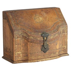
$527
You May Also Like
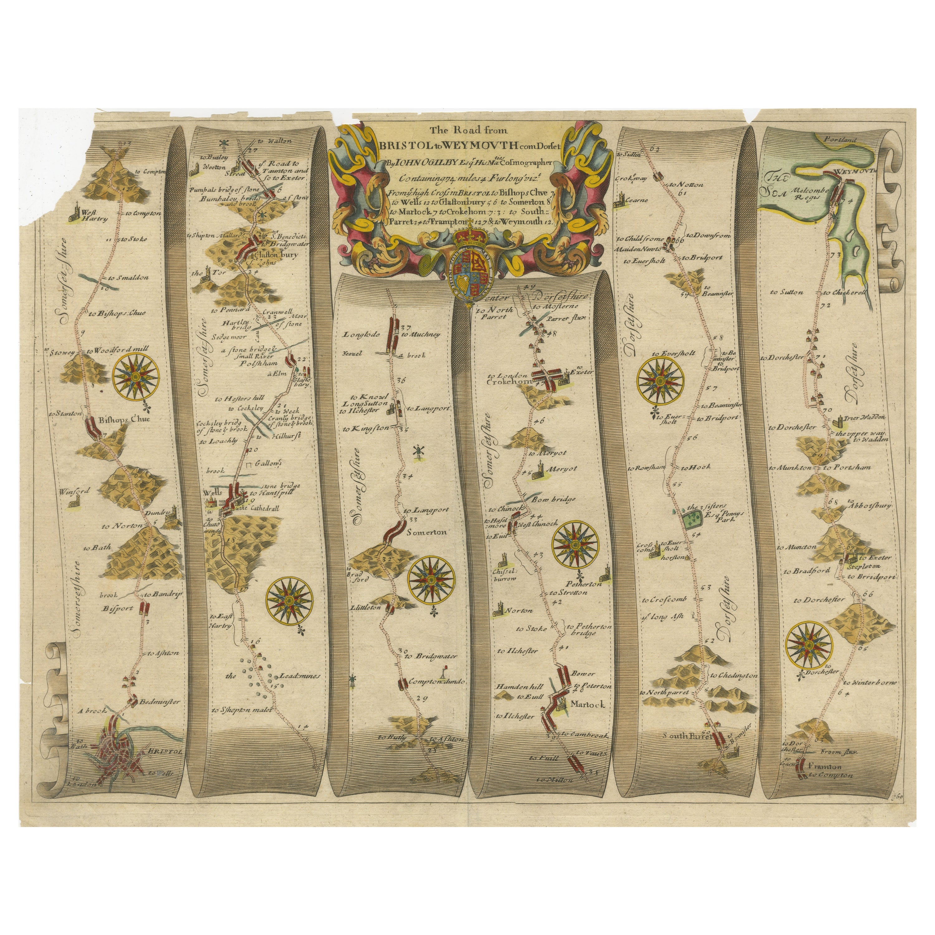
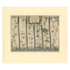
Original Antique Map of the Road from Bristol to Weymouth
Located in Langweer, NL
Antique map titled 'The Road from Bristol to Weymouth (..)'. Original antique map of the road from Bristol to Weymouth. Plate 60 from Ogilby's 'Britannia', the first road atlas of En...
Category
Antique Late 17th Century Maps
Materials
Paper
$209 Sale Price
20% Off
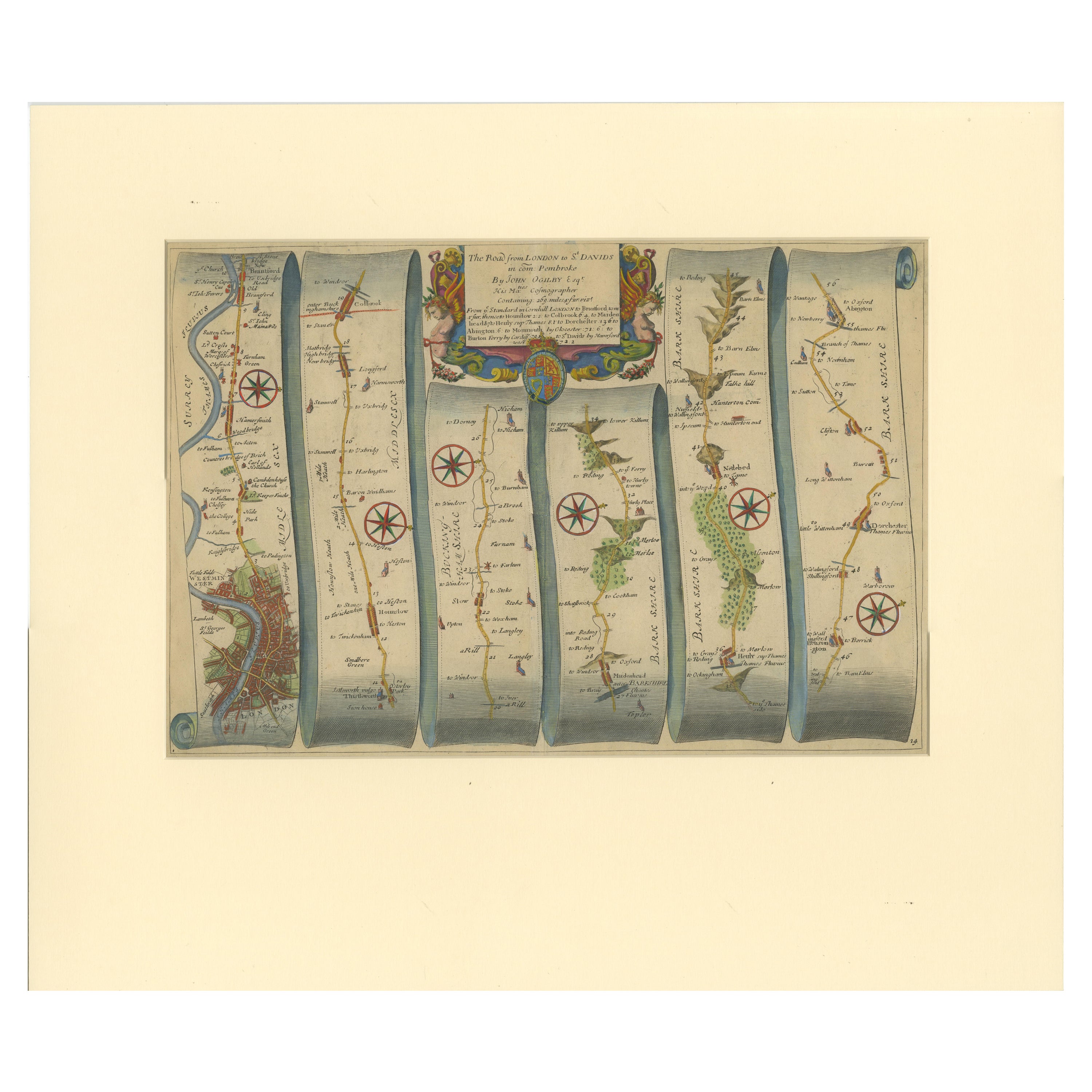
Original Antique Map of the Road from London to Bensington
Located in Langweer, NL
Antique map titled 'The Road from London to St. Davids in com: Pembroke (..)'. A strip map of the road from London to Bensington. The map is ornamented with numerous compass roses, a...
Category
Antique Late 17th Century Maps
Materials
Paper
$514 Sale Price
20% Off
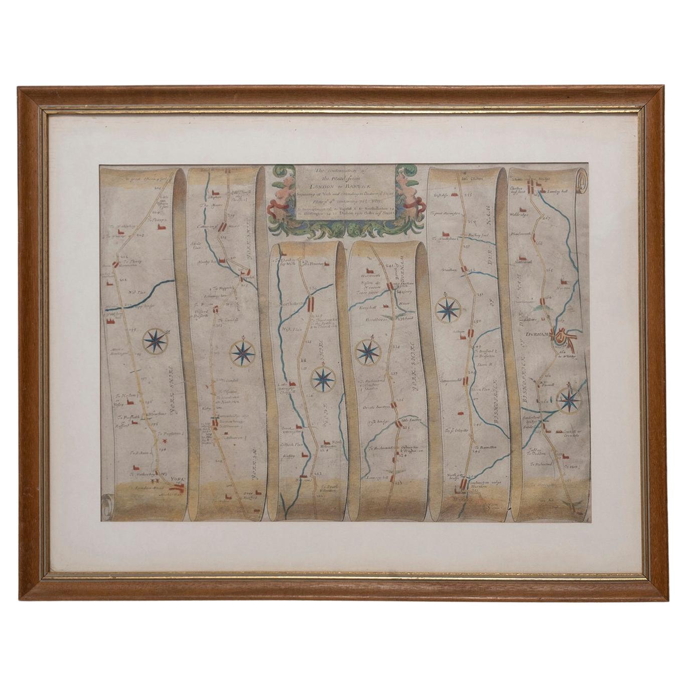
Road Map, John Ogilby, London, Barwick, York, Chester, Darlington, Durham Framed
By John Ogilby
Located in BUNGAY, SUFFOLK
The continuation of the road from London to Barwick beginning at York and extending to Chester in ye Street. Plate ye 4th continuing 76 ½ miles. No 8.
York to Burrowbridge, to Top...
Category
Antique 1670s English Baroque Maps
Materials
Paper

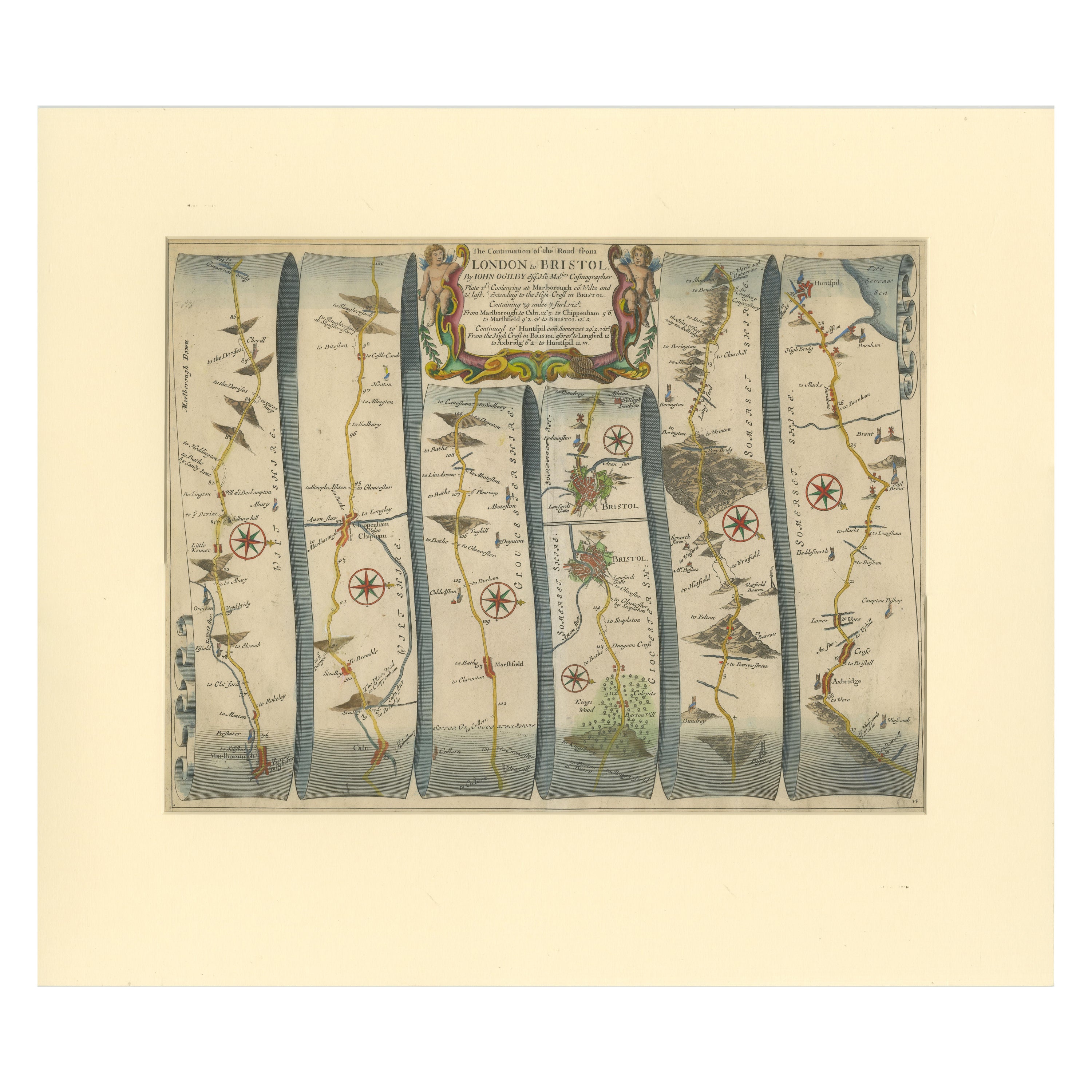
Original Antique Map of the Road from Marlborough to Huntspil
Located in Langweer, NL
Antique map titled 'The Continuation of the Road from London to Bristol (..)'. A strip map of the continuation of the road from London to Bristol, this particular sheet showing the r...
Category
Antique Late 17th Century Maps
Materials
Paper
$514 Sale Price
20% Off
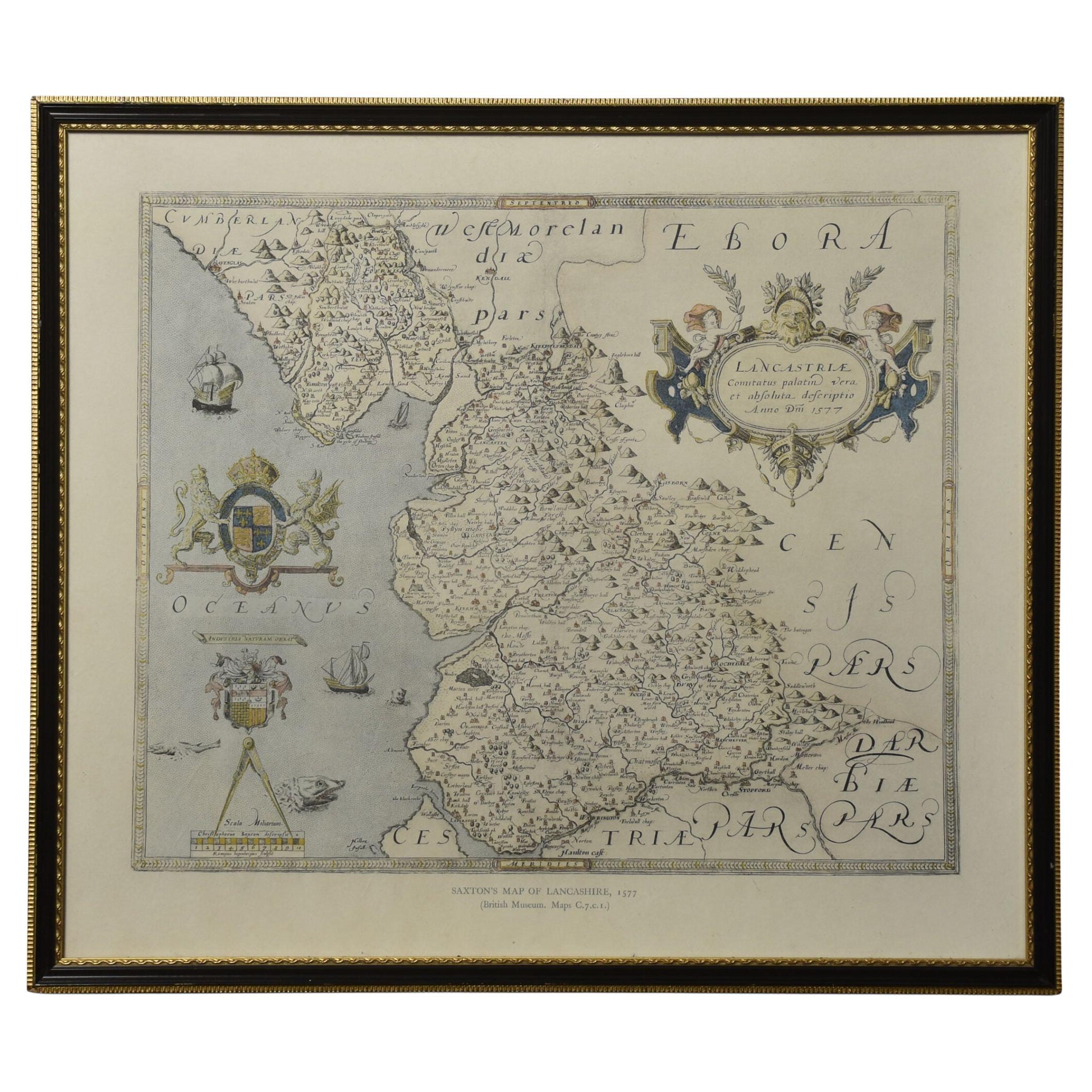
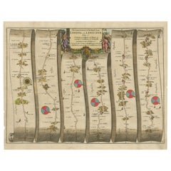
Map of Lancashire
Located in Cheshire, GB
Saxton Map of Lancashire hand coloured. Encased in an ebonised frame.
Dimensions
Height 21 Inches
Width 24 Inches
Depth 1 Inches
Category
Early 20th Century British Maps
Materials
Paper

$761 Sale Price
20% Off
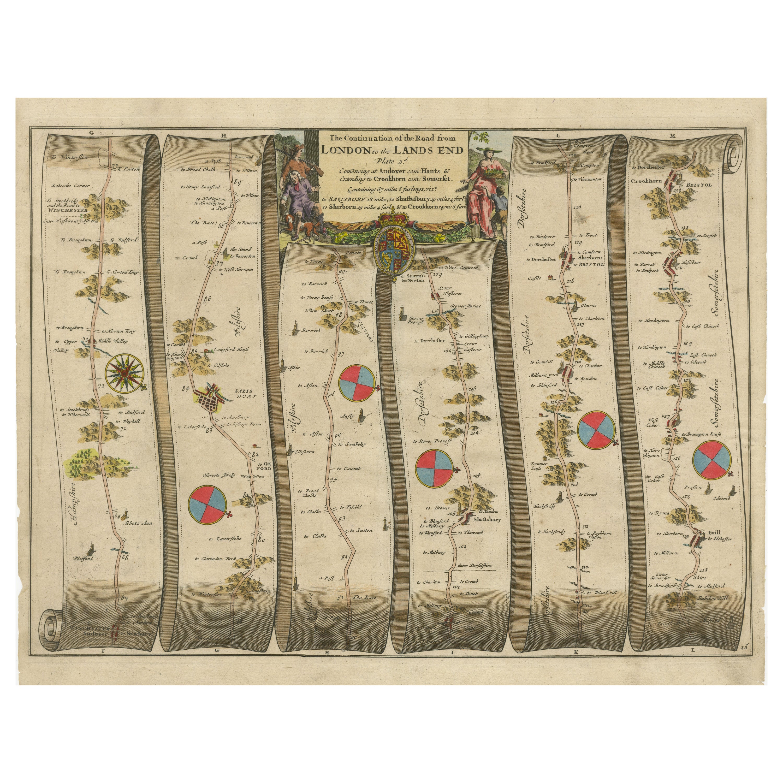
Original Antique Map of the Road from Andover to Crewkerne
Located in Langweer, NL
Antique map titled 'The Continuations of the Road from London to the Lands End'. Original antique map of the road from Andover to Crewkerne. Plate 26 from Ogilby's 'Britannia', the f...
Category
Antique Late 17th Century Maps
Materials
Paper
$734 Sale Price
20% Off