Items Similar to Mediterranean
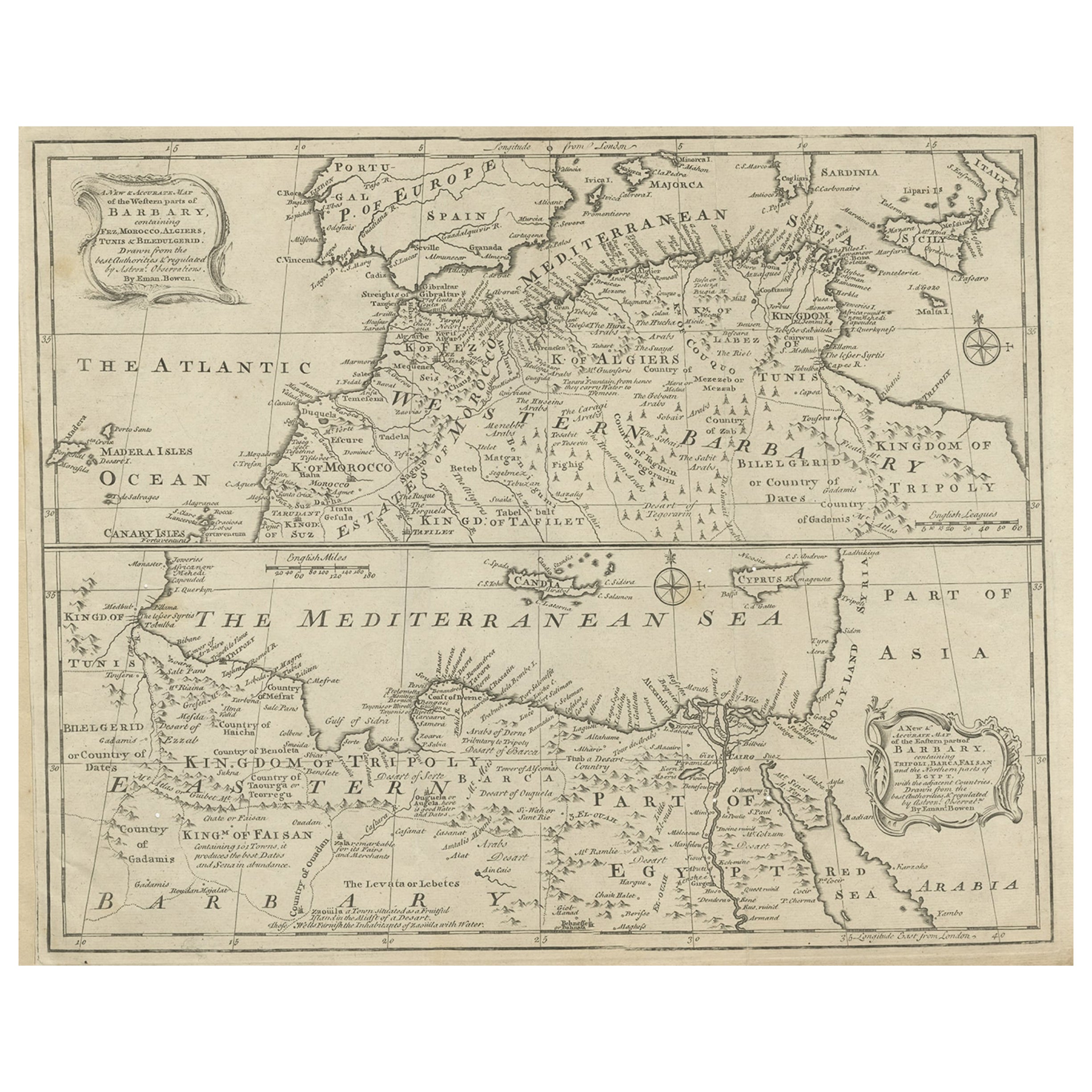
Barbary Coast – Elegant 18th Century Map by Bowen, c.1747

Want more images or videos?
Request additional images or videos from the seller
1 of 10
Mediterranean
Barbary Coast – Elegant 18th Century Map by Bowen, c.1747
$1,051.31
£785.70
€880
CA$1,450.34
A$1,588.57
CHF 836.38
MX$18,959.07
NOK 10,658.95
SEK 9,743.89
DKK 6,707.49
About the Item
Mediterranean
Barbary Coast – Elegant 18th Century Map by Bowen, c.1747
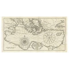
This elegant mid-18th-century engraved map presents the Mediterranean world with a strong focus on the Barbary Coast and North Africa, extending from the Atlantic coast of Morocco across the Mediterranean Sea to Egypt, the Levant, and parts of the Near East. The map encompasses southern Europe, including Spain, Italy, and the islands of the Mediterranean, while highlighting North African regions such as Morocco, Algiers, Tunis, Tripoli, Egypt, and Arabia.
The map was engraved by Emanuel Bowen and published circa 1747, during a period when European interest in the Mediterranean was driven by trade, naval power, diplomacy, and the strategic control of sea routes linking Europe, Africa, and the East. Bowen was one of the most prominent English mapmakers of the 18th century, serving as Royal Geographer to King George II, and his work is valued for its clarity, balance, and decorative refinement.
Coastal outlines, principal cities, kingdoms, and regions are clearly delineated, while inland territories are filled with place names, mountain ranges, and desert annotations that convey both geographic structure and contemporary European perceptions of North Africa and the eastern Mediterranean. The Barbary Coast is prominently labeled, with references to historic kingdoms, trading centers, and ports central to Mediterranean and trans-Saharan commerce. Egypt and the eastern Mediterranean are carefully rendered, including the Nile delta and surrounding regions.
The Mediterranean Sea itself dominates the composition, creating a calm, expansive visual rhythm that gives the map exceptional decorative presence. Decorative cartouches, compass roses, and neatline borders add elegance without overpowering the geography. The engraving style is refined and legible, making the map equally appealing to collectors and interior designers.
This map works beautifully as a statement wall piece, offering a timeless view of the Mediterranean world that complements both classic and contemporary interiors. It also integrates naturally with displays focused on North Africa, the Mediterranean basin, or 18th-century European cartography.
Condition report
Good condition overall. Central vertical fold as issued. Light age toning consistent with period, with a few scattered spots and minor surface marks. Plate mark visible. Margins intact.
Framing tips
A wide off-white or light sand-colored mat enhances the balance of the composition and allows the dense geography to breathe. A medium to dark wood frame or softly ebonized frame gives the piece a refined, hotel-ready appearance suitable for residential or hospitality interiors.
Technique: Copper engraving
Maker: Emanuel Bowen, England, c.1747
- Dimensions:Height: 15.95 in (40.5 cm)Width: 19.89 in (50.5 cm)Depth: 0.01 in (0.2 mm)
- Materials and Techniques:Paper,Engraved
- Place of Origin:
- Period:1740-1749
- Date of Manufacture:circa 1747
- Condition:Good condition overall. Central vertical fold as issued. Light age toning consistent with period, with a few scattered spots and minor surface marks. Plate mark visible. Margins intact.
- Seller Location:Langweer, NL
- Reference Number:Seller: BG-14128-81stDibs: LU3054348017132
About the Seller
5.0
Recognized Seller
These prestigious sellers are industry leaders and represent the highest echelon for item quality and design.
Platinum Seller
Premium sellers with a 4.7+ rating and 24-hour response times
Established in 2009
1stDibs seller since 2017
2,806 sales on 1stDibs
Typical response time: 1 hour
- ShippingRetrieving quote...Shipping from: Langweer, Netherlands
- Return Policy
More From This Seller
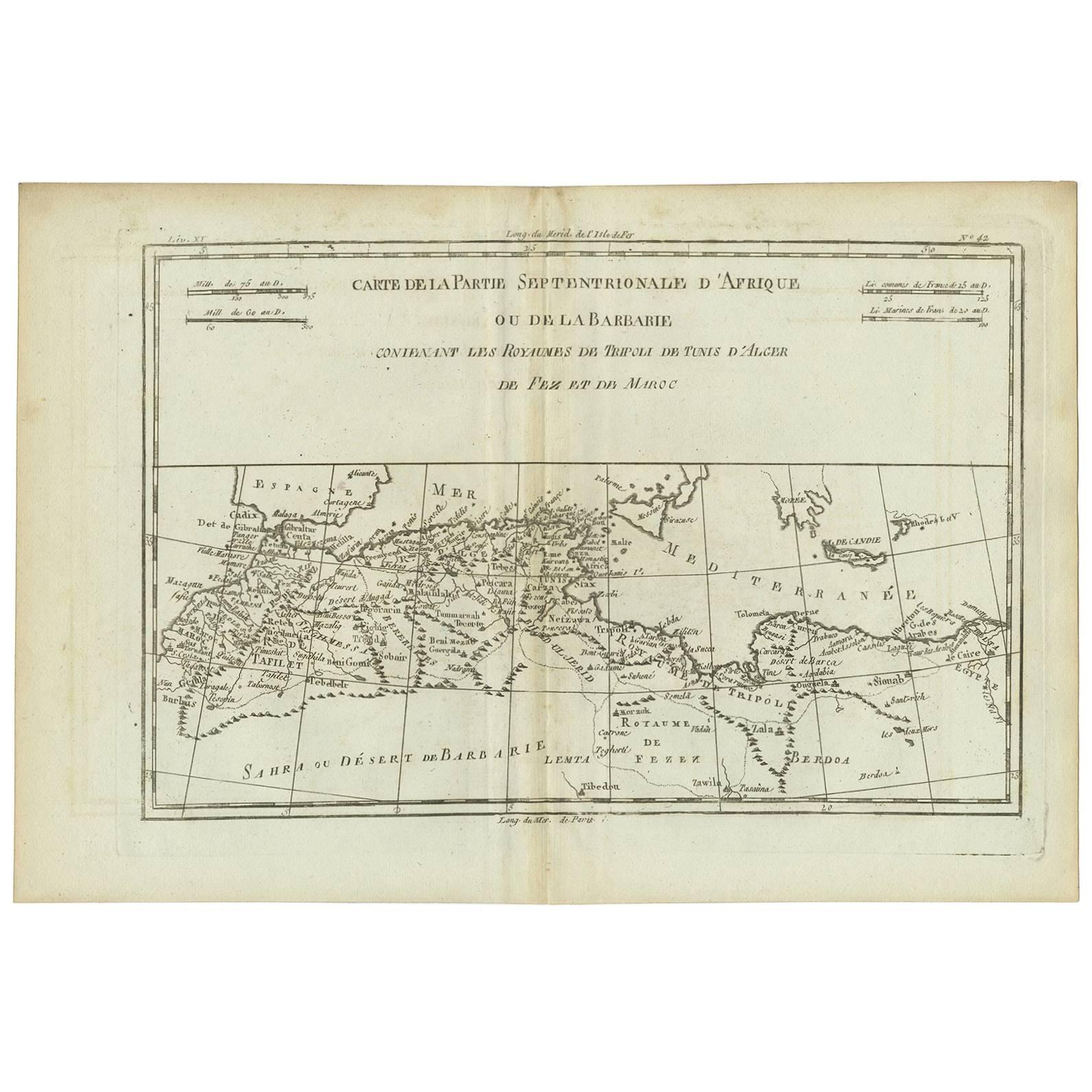
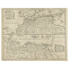
View AllAntique Map of Western and Eastern Barbary in Africa, c.1744
Located in Langweer, NL
Antique map titled 'A New
Accurate Map of the Western Parts of Barbary' and 'A New
Accurate Map of the Eastern Parts of Barbary'. Decorative maps of North Africa and the ...
Category
Antique 18th Century British Maps
Materials
Paper
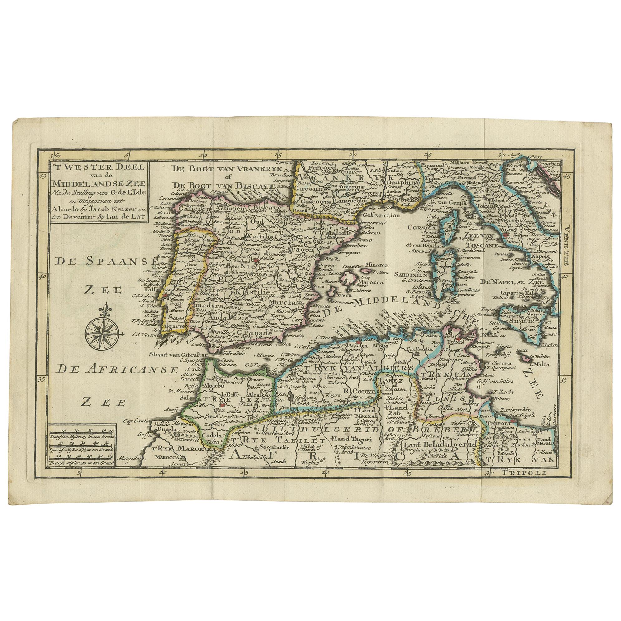
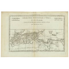
Antique Map of Northern Africa "Barbary Coast" by R. Bonne, circa 1780
Located in Langweer, NL
A fine example of Rigobert Bonne and Guilleme Raynal’s 1780 map of northwestern Africa or the Barbary Coast. Includes the modern day countries of Morocco, Algeria, Tunisia, Libya, and parts of adjacent Spain, Italy and Greece. This map was made in response to European interest in the region due to coastal attacks and incursions by the Barbary Pirates...
Category
Antique Late 18th Century French Maps
Materials
Paper
Antique Map of the Northern Coast of Africa and Southern Europe, circa 1745
By Covens
Mortier
Located in Langweer, NL
Antique map titled 'In Notitiam Ecclesiasticam Africae Tabula Geographica'. Very decorative hand-colored map of the northern coast of Africa, Spain, Italy and the Mediterranean with the islands of Sardinia, Corsica, Majorca, Minorca etc. Sicily features a smoking Mount Aetna. Embellished with three architectural cartouches...
Category
Antique Mid-18th Century Maps
Materials
Paper

$305 Sale Price
67% Off
Antique Map of the Mediterranean Sea and Surroundings by Keizer
de Lat, 1788
Located in Langweer, NL
Antique map titled 't Wester Deel van de Middelandse Zee (..)'. Uncommon original antique map of the Mediterranean Sea and surroundings. This map originates from 'Nieuwe Natuur- Gesc...
Category
Antique Late 18th Century Maps
Materials
Paper

$334 Sale Price
20% Off
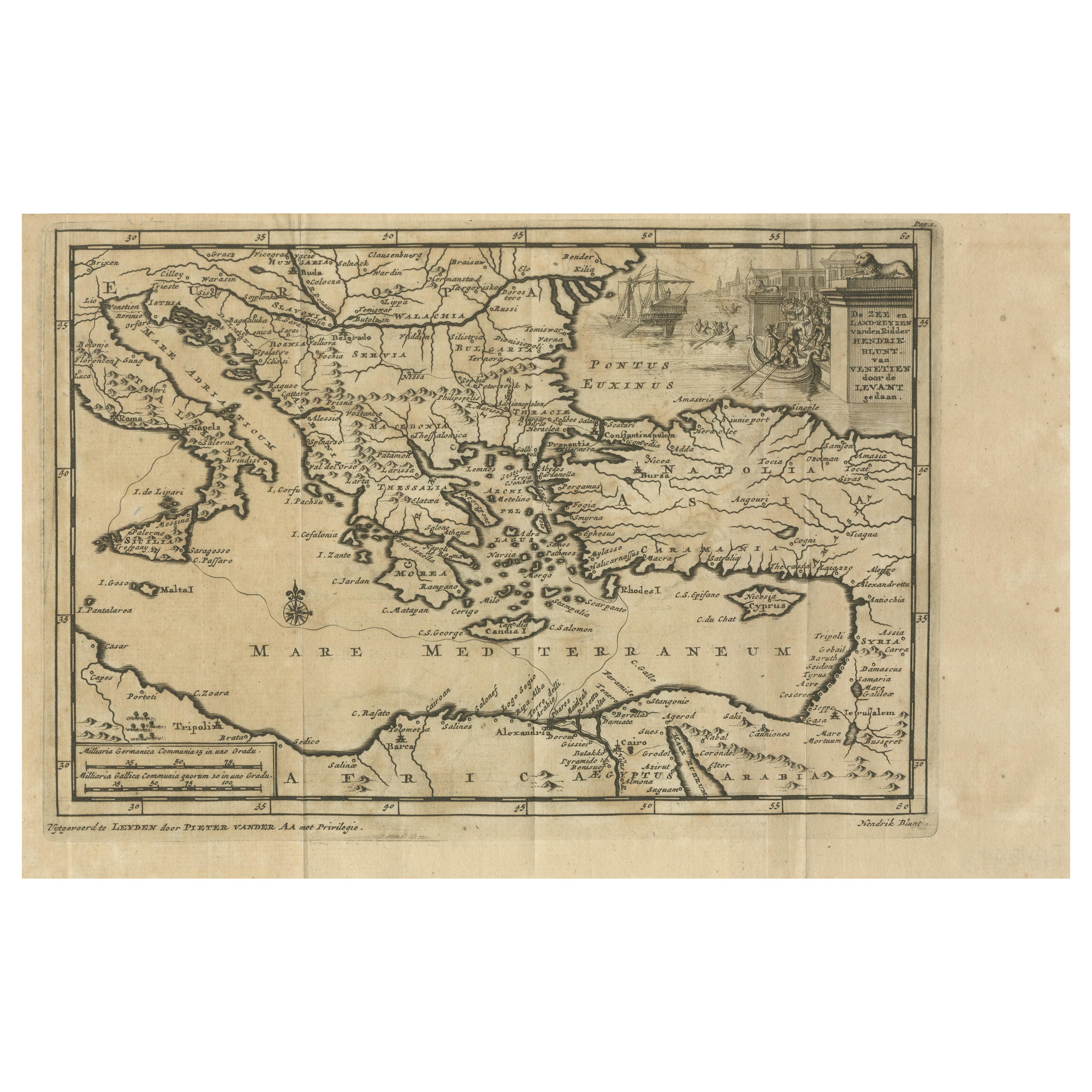
Venetian Trade Routes in the Levant – Antique Map by Pieter van der Aa, ca.1720
Located in Langweer, NL
Venetian Trade Routes in the Levant – Antique Map by Pieter van der Aa, Early 18th Century
This finely engraved map, published by Pieter van der Aa in Leiden, provides a detailed d...
Category
Antique 1720s Maps
Materials
Paper
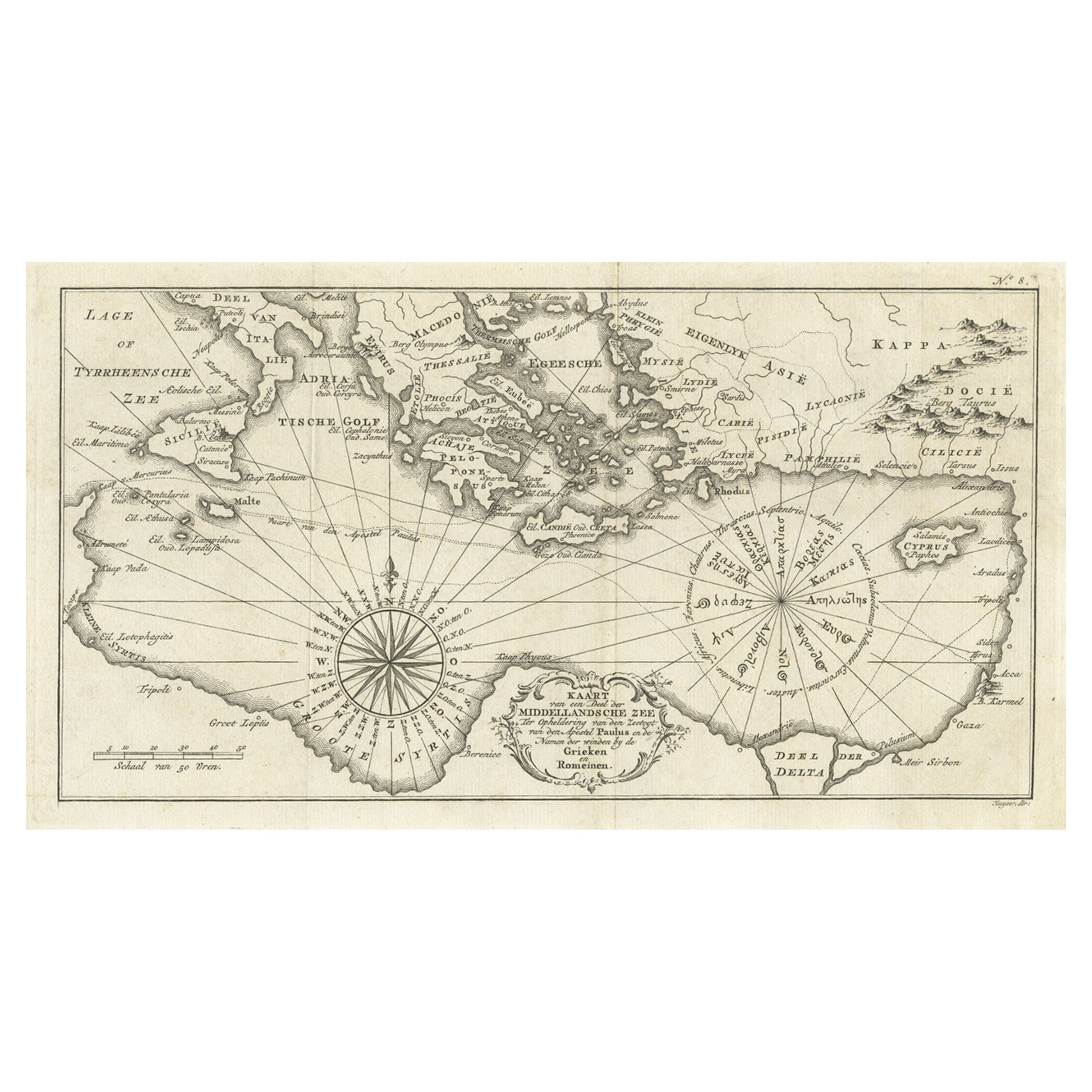
Old Dutch Map of the Region Around the Mediterranean Sea, 1773
Located in Langweer, NL
Antique map titled 'Kaart van een Deel der Middelandsche Zee (..)'.
Old map of the region around the Mediterranean Sea. Originates from the first Dutch editon of an interesting t...
Category
Antique 1770s Maps
Materials
Paper
$344 Sale Price
20% Off
You May Also Like
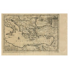
Mediterranean and Adriatic Seas: Original 18th Century Hand-colored Map by Bowen
Located in Alamo, CA
This is an original 18th century hand-colored map entitled "An Accurate Chart of The Mediterranean and Adriatic Sea's; with the Archipelago & Part of the Black Sea. Exhibiting all th...
Category
Mid-18th Century Old Masters Landscape Prints
Materials
Engraving

West Coast of Africa, Guinea
Sierra Leone: An 18th Century Map by Bellin
By Jacques-Nicolas Bellin
Located in Alamo, CA
Jacques Bellin's copper-plate map entitled "Partie de la Coste de Guinee Dupuis la Riviere de Sierra Leona Jusquau Cap das Palmas", depicting the coast of Guinea and Sierra Leone in ...
Category
Antique Mid-18th Century French Maps
Materials
Paper

Africa: A Large 17th Century Hand-Colored Map by Sanson and Jaillot
By Nicolas Sanson
Located in Alamo, CA
This large original hand-colored copperplate engraved map of Africa entitled "L'Afrique divisee suivant l'estendue de ses principales parties ou sont distingues les uns des autres, L...
Category
Antique 1690s French Maps
Materials
Paper

Antique Map - Mare Pacificum - Etching by Johannes Janssonius - 1650s
By Johannes Janssonius
Located in Roma, IT
Mare Pacificum is an antique map realized in 1650 by Johannes Janssonius (1588-1664).
The Map is Hand-colored etching, with coeval watercolorang.
Good conditions with slight foxing...
Category
1650s Modern Figurative Prints
Materials
Etching

Antique Map - Mar Di Athiopia - Etching by Johannes Janssonius - 1650s
By Johannes Janssonius
Located in Roma, IT
Antique Map - Mar Di Athiopia is an antique map realized in 1650 by Johannes Janssonius (1588-1664).
The Map is Hand-colored etching, with coeval watercolorang.
Good conditions wit...
Category
1650s Modern Figurative Prints
Materials
Etching

Map of the East Indies: An Original 18th Century Hand-colored Map by E. Bowen
Located in Alamo, CA
This is an original 18th century hand-colored map entitled "An Accurate Map of the East Indies Exhibiting the Course of the European Trade both on the Continent and Islands" by Emanu...
Category
Mid-18th Century Old Masters Landscape Prints
Materials
Engraving
