Items Similar to Mediterranean, Black Sea
Ottoman Empire Map 1853

Video Loading
Want more images or videos?
Request additional images or videos from the seller
1 of 13
Mediterranean, Black Sea
Ottoman Empire Map 1853
$645.87
£479.60
€540
CA$887.33
A$964.71
CHF 511.49
MX$11,564.41
NOK 6,500.77
SEK 5,955.59
DKK 4,116.53
About the Item
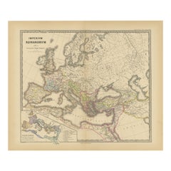
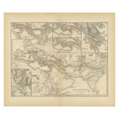
Mediterranean, Black Sea
Ottoman Empire Map 1853
This impressive antique print shows the Mediterranean and Black Sea regions with a focus on the Ottoman Empire, titled “Das Mittelländische und Schwarze Meer nebst Übersicht der Länder des Osmanischen Reichs” meaning “The Mediterranean and Black Sea with an overview of the countries of the Ottoman Empire.” Published in 1853 by Justus Perthes in Gotha as part of Adolf Stieler’s celebrated Hand-Atlas, this map was created under the cartographic supervision of Heinrich Berghaus and engraved by F. v. Stülpnagel.
The map covers Southern Europe, North Africa, and Western Asia, including Italy, Greece, Turkey, Egypt, the Levant, the Arabian Peninsula, and extending east towards Persia. Major cities such as Constantinople (Istanbul), Cairo, Alexandria, Damascus, Baghdad, and Mecca are clearly labelled. It details mountain ranges, river systems, and the territorial divisions within the Ottoman Empire.
Inset maps include:
– Madeira and Canary Islands
– Jerusalem
– Environs of Constantinople
This map is significant as it captures the Ottoman Empire during its final century, illustrating its territorial extent just before the Crimean War (1853–1856) and the subsequent gradual decline of its influence. It is a valuable historical record for understanding 19th-century geopolitics, trade routes, and European colonial interests in the region.
Technique: Copperplate engraving with original hand colouring, used to differentiate political territories and enhance geographical features. German titles and fine annotations are engraved with precision, characteristic of Stieler’s publishing excellence.
Condition summary: Excellent condition with minimal age toning, strong impression, and no tears, repairs, or significant foxing. Colours remain fresh and the paper is firm and stable.
Framing tips: This large Ottoman Empire and Mediterranean map will look distinguished in a dark wood or black frame to emphasise its historical gravitas, paired with a wide ivory or cream mount to balance its composition. UV-protective glass is recommended to preserve the clarity of its engraving and original colours for long-term display.
- Dimensions:Height: 14.77 in (37.5 cm)Width: 17.88 in (45.4 cm)Depth: 0.01 in (0.2 mm)
- Materials and Techniques:Paper,Engraved
- Place of Origin:
- Period:
- Date of Manufacture:1853
- Condition:Condition summary: Excellent condition with minimal age toning, strong impression, and no tears, repairs, or significant foxing. Colours remain fresh and the paper is firm and stable.
- Seller Location:Langweer, NL
- Reference Number:Seller: BG-05552-451stDibs: LU3054345811552
About the Seller
5.0
Recognized Seller
These prestigious sellers are industry leaders and represent the highest echelon for item quality and design.
Platinum Seller
Premium sellers with a 4.7+ rating and 24-hour response times
Established in 2009
1stDibs seller since 2017
2,821 sales on 1stDibs
Typical response time: 1 hour
- ShippingRetrieving quote...Shipping from: Langweer, Netherlands
- Return Policy
More From This Seller
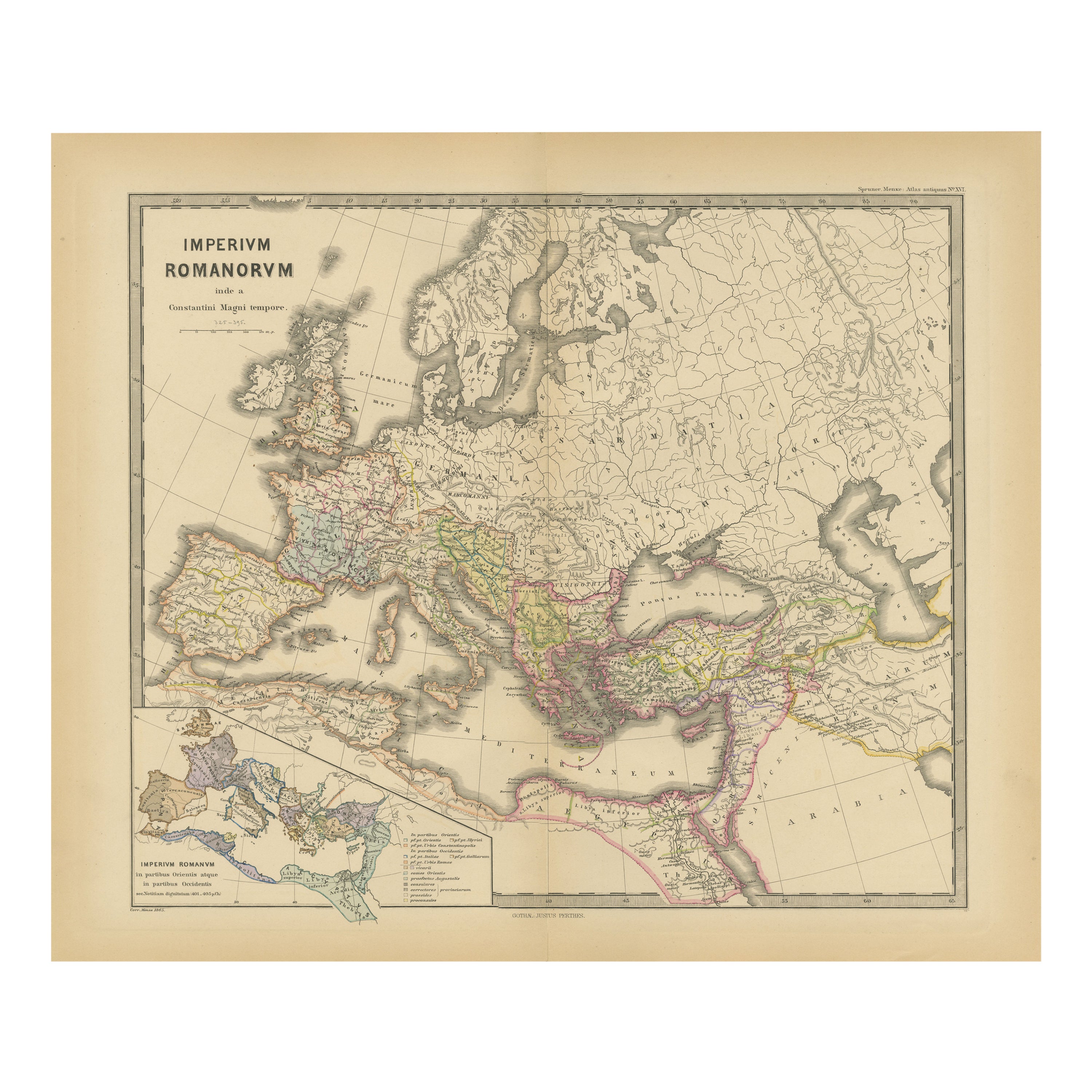
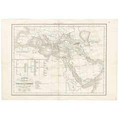
View AllOld Map of Mediterranean Powers: Pompey to Actium (66-31 BC), Published in 1880
Located in Langweer, NL
This is a historical map that depicts the Mediterranean region during a specific timeframe in Roman history, from the return of Pompey the Great after...
Category
Antique 1880s Maps
Materials
Paper
$354 Sale Price
20% Off
Free Shipping
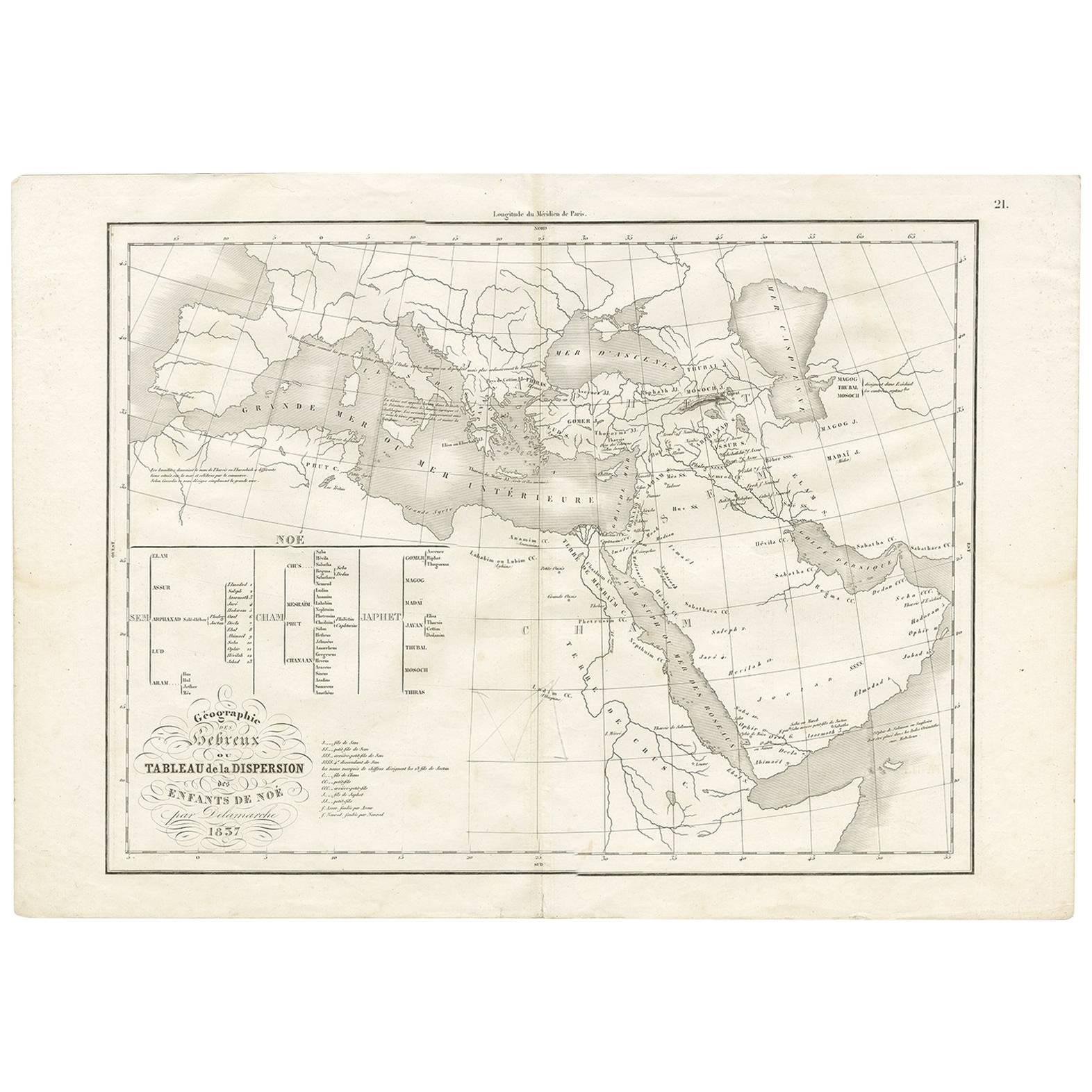
Géographie des Hébreux – Tableau de la Dispersion des Enfants de Noé, 1837
Located in Langweer, NL
Géographie des Hébreux – Tableau de la Dispersion des Enfants de Noé, 1837
This antique map, titled Géographie des Hébreux ou Tableau de la Dispersion des ...
Category
Antique Mid-19th Century French Maps
Materials
Paper
$229 Sale Price
20% Off
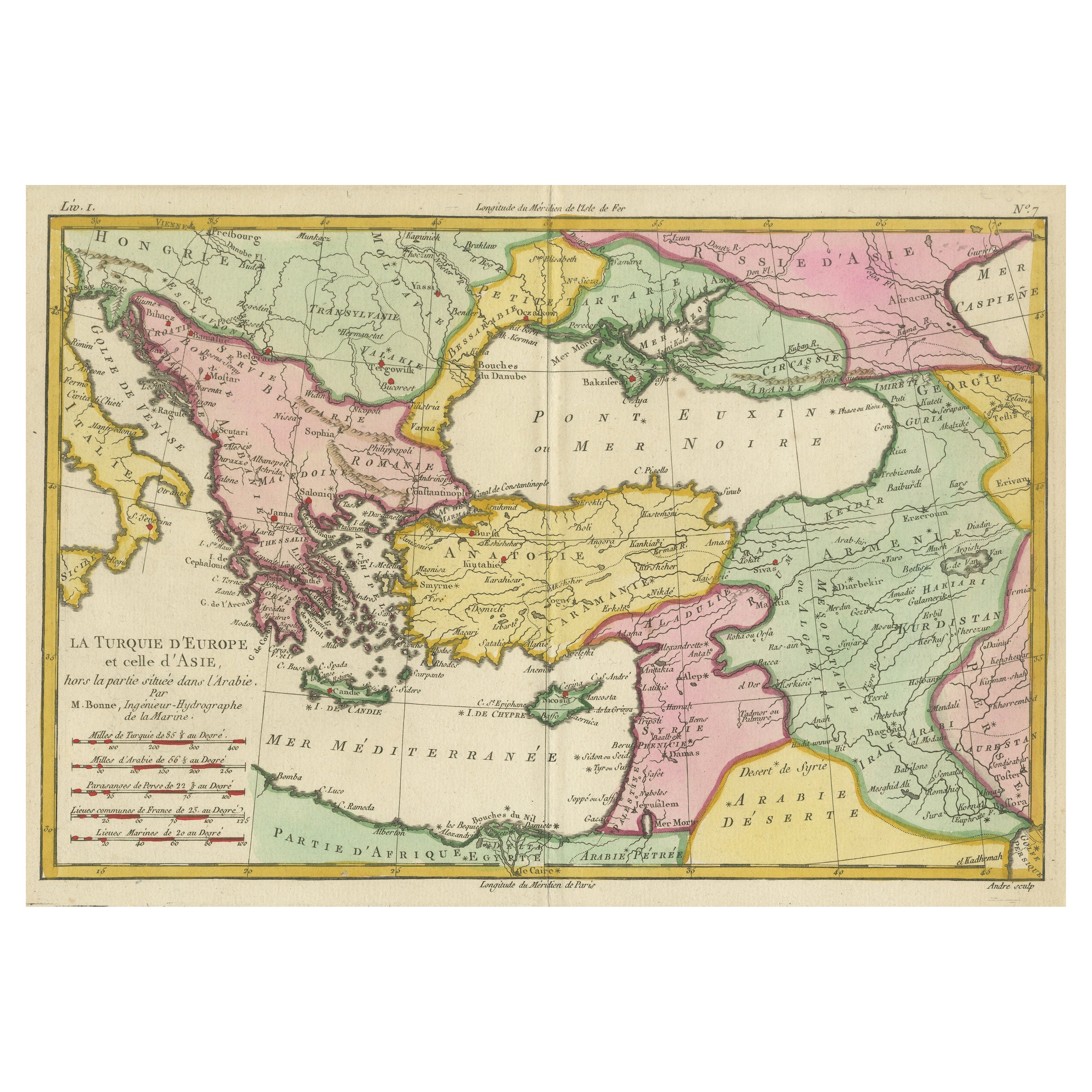
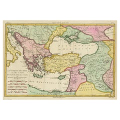
Antique Map of the Eastern Mediterranean and the Balkans
Located in Langweer, NL
Antique map titled 'La Turquie d'Europe et celle d'Asie'. Attractive double page map of the Eastern Mediterranean and the Balkans by R. Bonne. Originates from 'Atlas de Toutes les Pa...
Category
Antique Late 18th Century Maps
Materials
Paper
$516 Sale Price
20% Off
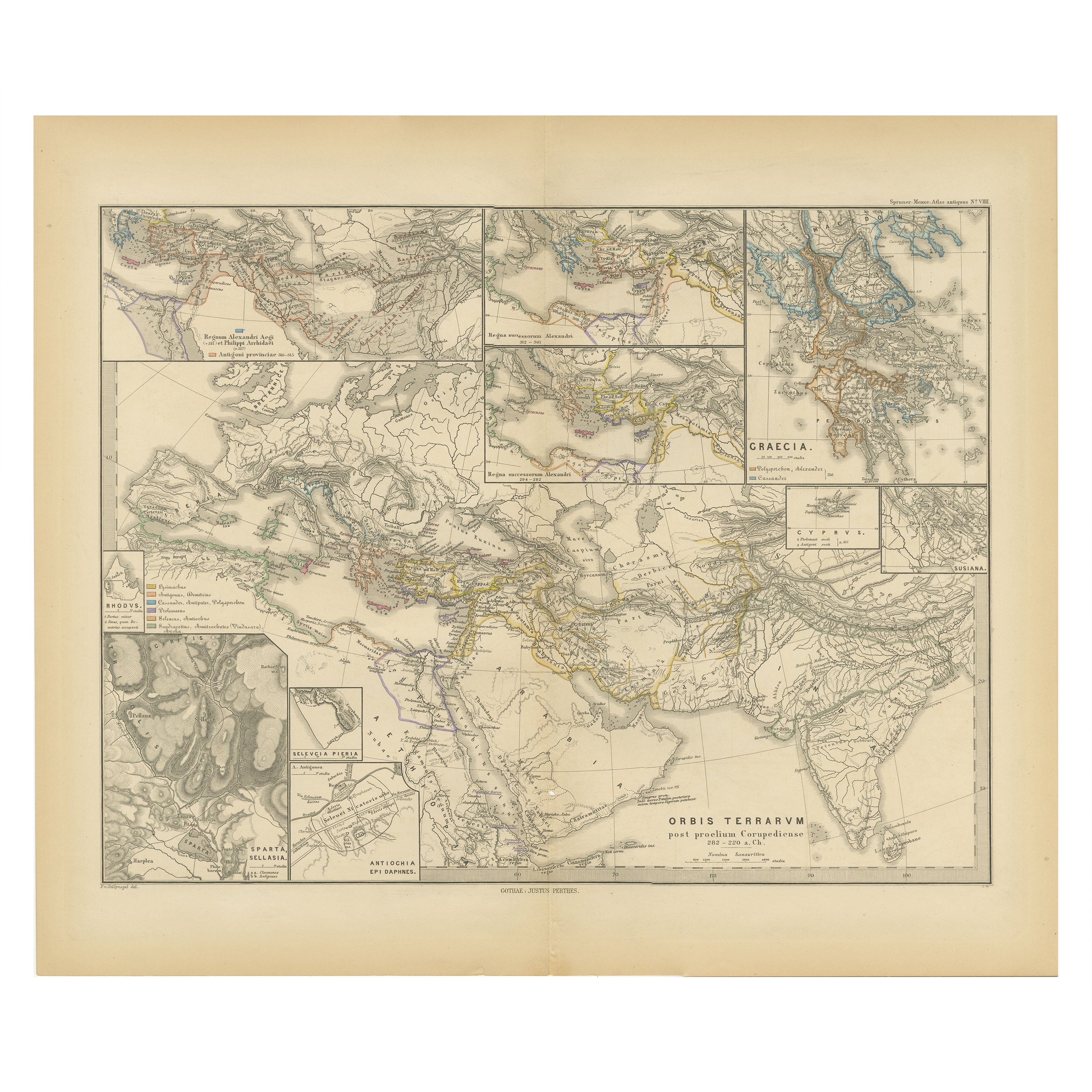
The World After the Battle of Corupedium: Hellenistic Kingdoms Map, 1880
Located in Langweer, NL
The map is titled "ORBIS TERRARUM post proelium Corupedinse," which translates to "The World after the Battle of Corupedium." This battle, which took place in 281 BC in Lydia, was th...
Category
Antique 1880s Maps
Materials
Paper
$354 Sale Price
20% Off
Free Shipping
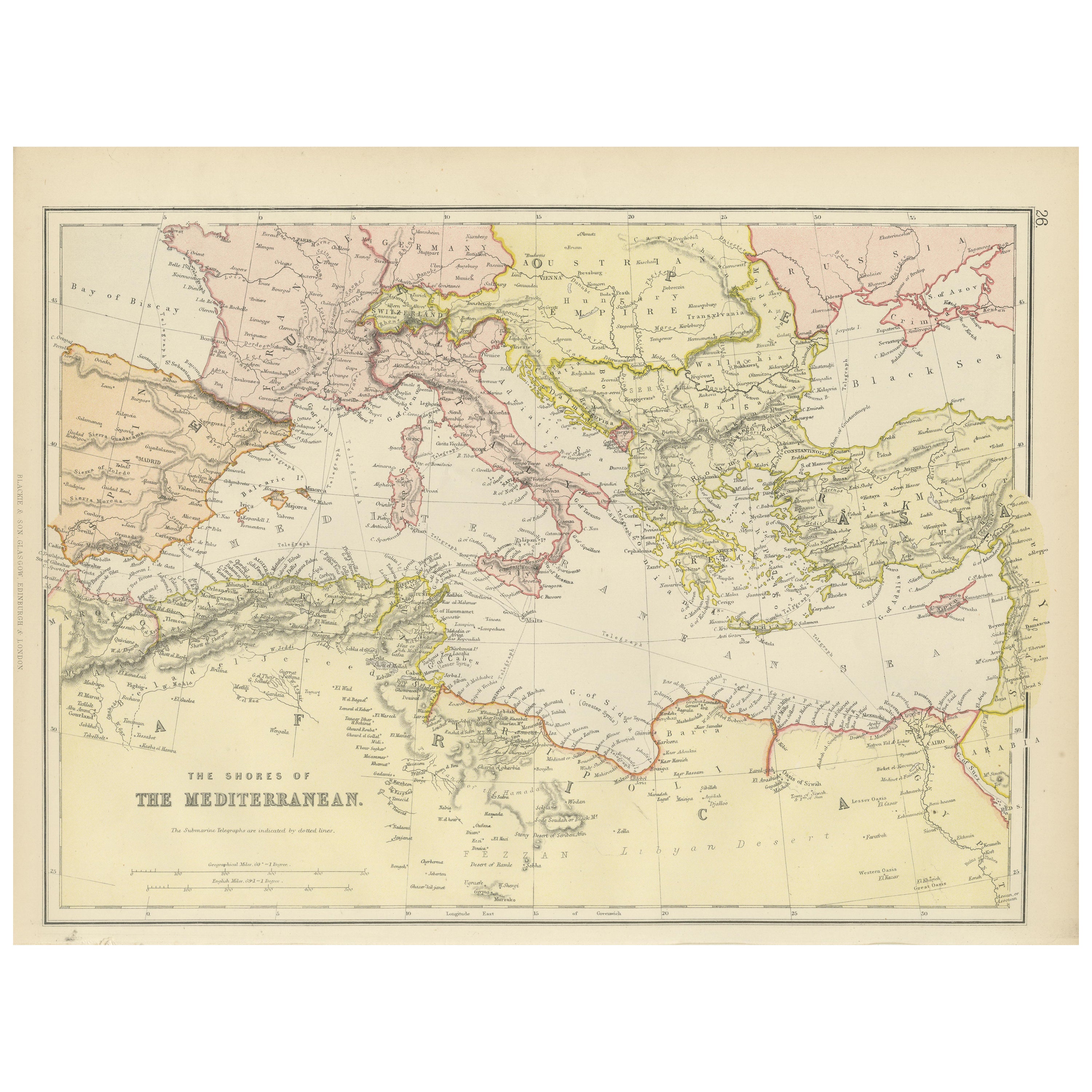
Mediterranean Tapestry: A 19th Century Map of the Mediterranean Shores, 1882
Located in Langweer, NL
This map, titled "The Shores of the Mediterranean," is part of the 1882 atlas by Blackie & Son, and it portrays the coastal regions that surround the Mediterranean Sea. It is a detailed representation of the diverse and historically rich countries that share the Mediterranean coastline, spanning from the Strait of Gibraltar in the west to the Levantine Sea in the east, and from the southern shores of Europe down to the northern coastlines of Africa.
The map is a vivid document of the time, with each country along the Mediterranean basin meticulously outlined. The northern coast includes the southern parts of Europe, featuring Spain...
Category
Antique 1880s Maps
Materials
Paper
$267 Sale Price
20% Off
Antique Map of the Basin of the Mediterranean by Johnston
1909
Located in Langweer, NL
Antique map titled 'Basin of the Mediterranean'. Original antique map of the basin of the Mediterranean. With inset maps of the Strait of Gibraltar, Morocco, Maltese Islands, Valetta...
Category
Early 20th Century American Maps
Materials
Paper
You May Also Like
Original Antique Map of Ancient Greece, Achaia, Corinth, 1786
Located in St Annes, Lancashire
Great map of Ancient Greece. Showing the region of Thessaly, including Mount Olympus
Drawn by J.D. Barbie Du Bocage
Copper plate engraving by P.F Tardieu
Original hand color...
Category
Antique 1780s French Other Maps
Materials
Paper

Large Original Antique Map of The Greek Islands. 1894
Located in St Annes, Lancashire
Superb Antique map of The Greek Islands
Published Edward Stanford, Charing Cross, London 1894
Original colour
Good condition
Unframed.
Free shipping
Category
Antique 1890s English Maps
Materials
Paper

Map of Eastern Roman Empire -Vintage Offset Print - Early 20th Century
Located in Roma, IT
This map of Eastern Roman Empire is a vintage offset print realized in the early 20th Century.
The state of preservation of the artwork is aged with dif...
Category
Early 20th Century Figurative Prints
Materials
Offset

Hand-Colored 18th Century Homann Map of the Black Sea, Turkey and Asia Minor
By Johann Baptist Homann
Located in Alamo, CA
An attractive original early 18th century hand-colored map of the Black Sea and Turkey entitled "Carte de L'Asie Minevre ou de la Natolie et du Pont Evxin Tiree des Voyages et des Ob...
Category
Antique Early 18th Century German Maps
Materials
Paper

$700 Sale Price
20% Off
Map of the Holy Land "Carte de la Syrie et de l
Egypte" by Pierre M. Lapie
By Pierre M. Lapie
Located in Alamo, CA
An early 19th century map of ancient Syria and Egypt entitled "Carte de la Syrie et de l'Egypte anciennes/dressée par M. Lapie, Colonel d'Etat Major, et...
Category
Antique Early 19th Century French Maps
Materials
Paper

$620 Sale Price
20% Off
Large Original Antique Map of Italy. John Dower, 1861
Located in St Annes, Lancashire
Great map of Italy
Lithograph engraving by John Dower
Original colour
Published, 1861
Unframed
Good condition / repair to top right corner seen in last image
Category
Antique 1860s English Victorian Maps
Materials
Paper

More Ways To Browse
Mediterranean Furniture
Mid Century Mediterranean
Large Ottoman Used
German Empire Furniture
Istanbul Antique
Crimean War
Beni Ourain Rugs
Glass Top Wood Base Coffee Tables
T Chair
Pair Of Danish Chairs
Veneer Dining Tables
1970 Italian Armchair
Furniture Uk
House Of Denmark Table And Chairs
Louis Marble Top Side Table
Antique Russian Rugs
Baker Furniture By
For Kids