Items Similar to Mozambique Bay – French Naval Sea Chart by Bellin, c.1765

Want more images or videos?
Request additional images or videos from the seller
1 of 9
Mozambique Bay – French Naval Sea Chart by Bellin, c.1765
$459.95
£343.74
€385
CA$634.52
A$695
CHF 365.92
MX$8,294.60
NOK 4,663.29
SEK 4,262.95
DKK 2,934.53
About the Item
Mozambique Bay – French Naval Sea Chart by Bellin, c.1765
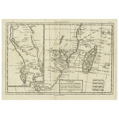
This detailed French sea chart depicts the Bay of Mozambique and the strategically vital island settlement of Mozambique, shown with its fortifications, anchorages, and surrounding islands. The map is titled “Carte de la Baye de Mosambique” and was engraved under the direction of Jacques-Nicolas Bellin, Hydrographer to the French King. It was published in Paris as part of Bellin’s hydrographic work for the Dépôt des cartes et plans de la Marine, circa 1760–1770.
Compiled from multiple manuscript sources, as stated directly in the cartouche (“Dressée sur divers Manuscrits”), the chart reflects the French navy’s effort to refine and correct earlier English and Portuguese mapping of the East African coast. Bellin explicitly notes that this chart differs significantly from English versions previously published, underscoring its role as an authoritative French alternative.
The map focuses on navigational precision. Soundings are carefully plotted throughout the bay, with shoals, reefs, and sandbanks clearly indicated. The fortified island of Mozambique is shown in detail, including the fort, town layout, batteries, and older fortifications. Surrounding islands such as St. George, St. Jacques, and Isle de Luchaque are identified, along with named channels and passes suitable for navigation.
A large compass rose dominates the lower right quadrant, reinforcing the chart’s maritime purpose. Coastal profiles, river mouths, and interior relief are rendered with clarity and restraint, typical of Bellin’s clean and highly legible engraving style. The overall composition balances technical accuracy with visual elegance.
This chart is an important document of 18th-century Indian Ocean navigation and colonial competition. Mozambique was a key hub linking East Africa with Arabia, India, and European trade networks, and Bellin’s charts of the region are increasingly sought after for both their historical relevance and decorative appeal.
Condition report
Good condition overall. Light, even age toning. Minor scattered spots and faint handling marks consistent with period. Plate mark visible. Full margins.
Framing tips
A light warm mat (ivory or pale sand) works well with the soft paper tone and monochrome engraving. A dark wood or black-stained frame enhances the strong graphic contrast of the coastline and compass rose, giving the map a refined, museum-style presentation. Ideal as a stand-alone piece or paired with Indian Ocean island charts.
Technique: Copper engraving
Maker: Jacques-Nicolas Bellin, France, c.1765
- Dimensions:Height: 10.04 in (25.5 cm)Width: 7.45 in (18.9 cm)Depth: 0.01 in (0.2 mm)
- Materials and Techniques:Paper,Engraved
- Place of Origin:
- Period:1760-1769
- Date of Manufacture:circa 1765
- Condition:Good condition overall. Light, even age toning. Minor scattered spots and faint handling marks consistent with period. Plate mark visible. Full margins.
- Seller Location:Langweer, NL
- Reference Number:Seller: BG-14128-21stDibs: LU3054348016572
About the Seller
5.0
Recognized Seller
These prestigious sellers are industry leaders and represent the highest echelon for item quality and design.
Platinum Seller
Premium sellers with a 4.7+ rating and 24-hour response times
Established in 2009
1stDibs seller since 2017
2,806 sales on 1stDibs
Typical response time: 1 hour
- ShippingRetrieving quote...Shipping from: Langweer, Netherlands
- Return Policy
More From This Seller
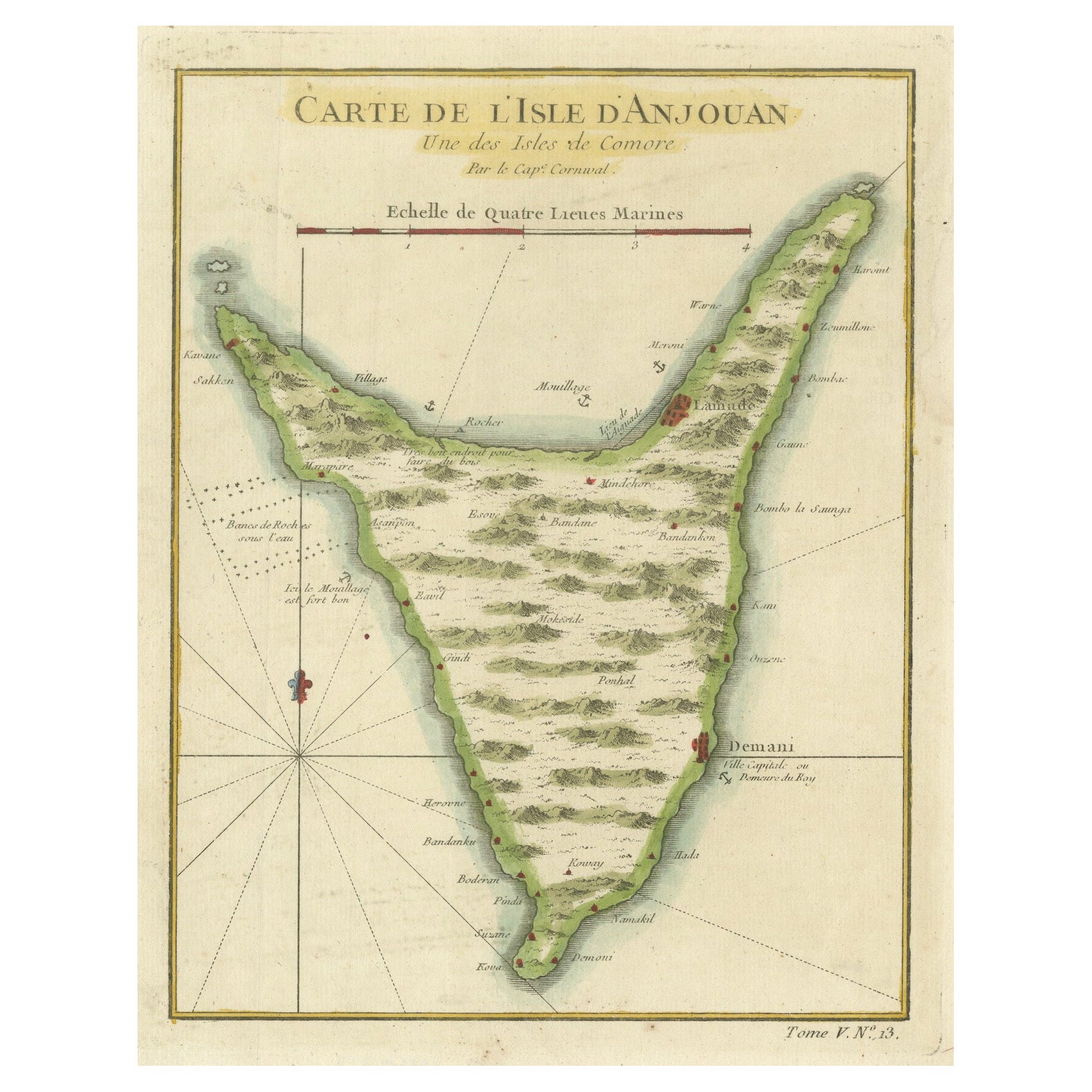
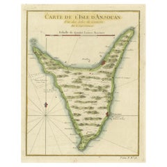
View AllAnjouan Island, Comoros – French Naval Sea Chart by Bellin, c.1765
Located in Langweer, NL
Anjouan Island, Comoros – French Naval Sea Chart by Bellin, c.1765
This finely engraved French sea chart depicts the island of Anjouan (Ndzuwani), one of the Comoros Islands in the ...
Category
Antique 1760s French Maps
Materials
Paper
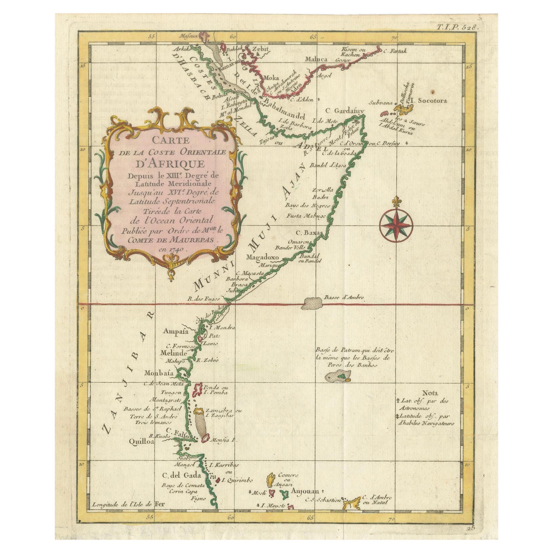
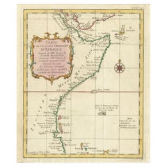
East African Coast – French Map by Bellin, Zanzibar to Arabia, 1740
Located in Langweer, NL
East African Coast – French Map by Bellin, Zanzibar to Arabia, 1740
This important French map depicts the eastern coast of Africa from Mozambique and Zanzibar northward to the Horn ...
Category
Antique 1740s French Maps
Materials
Paper
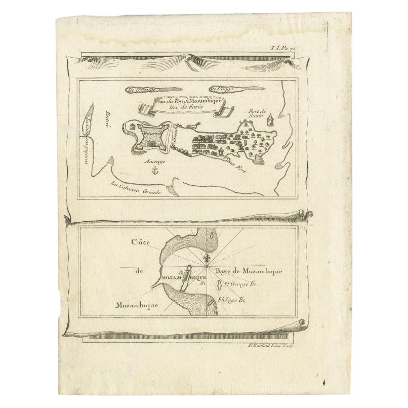
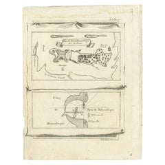
Antique Map of Mozambique Bay and a Map Fort de Mozambique, c.1759
Located in Langweer, NL
Two antique maps on one sheet. The upper antique map is titled 'Plan du Fort de Mozambique tiré de Faria' and depicts the island of Mozambique with its fort, settlement, harbor and i...
Category
Antique 18th Century Maps
Materials
Paper
Martinique Map by Rigobert Bonne – French Antique Map, c.1768
Located in Langweer, NL
Map of Martinique by Rigobert Bonne, circa 1768
This is a detailed antique map of Martinique titled “Isle de la Martinique,” engraved by Rigobert Bonne around 1768 for the Atlas Encyclopédique. Bonne, a renowned French hydrographer and successor to Bellin, is celebrated for his scientifically precise and elegantly engraved maps.
The map shows Martinique with its mountainous interior, rivers, and settlements labelled, including Fort Royal, Fort St. Pierre, Le Marin, and Le Prêcheur. Coastal features, bays, and capes are marked, along with anchorages important for maritime navigation in the 18th century. The depiction includes relief shown pictorially, characteristic of Bonne’s cartographic style, enhancing both geographic understanding and aesthetic appeal.
This copperplate engraving retains original hand colouring outlining the coastlines in delicate blue and brown tones, typical for the period. It served as a key reference for scholars, navigators, and colonial administrators during France’s colonial presence in the Caribbean.
Condition:
Good condition overall. A strong impression with bright, original hand-colour outlines. General age toning, faint offsetting, and a vertical fold as issued in the atlas. Margins ample all around for framing.
Framing suggestions:
This historic Caribbean map...
Category
Antique 1760s French Maps
Materials
Paper

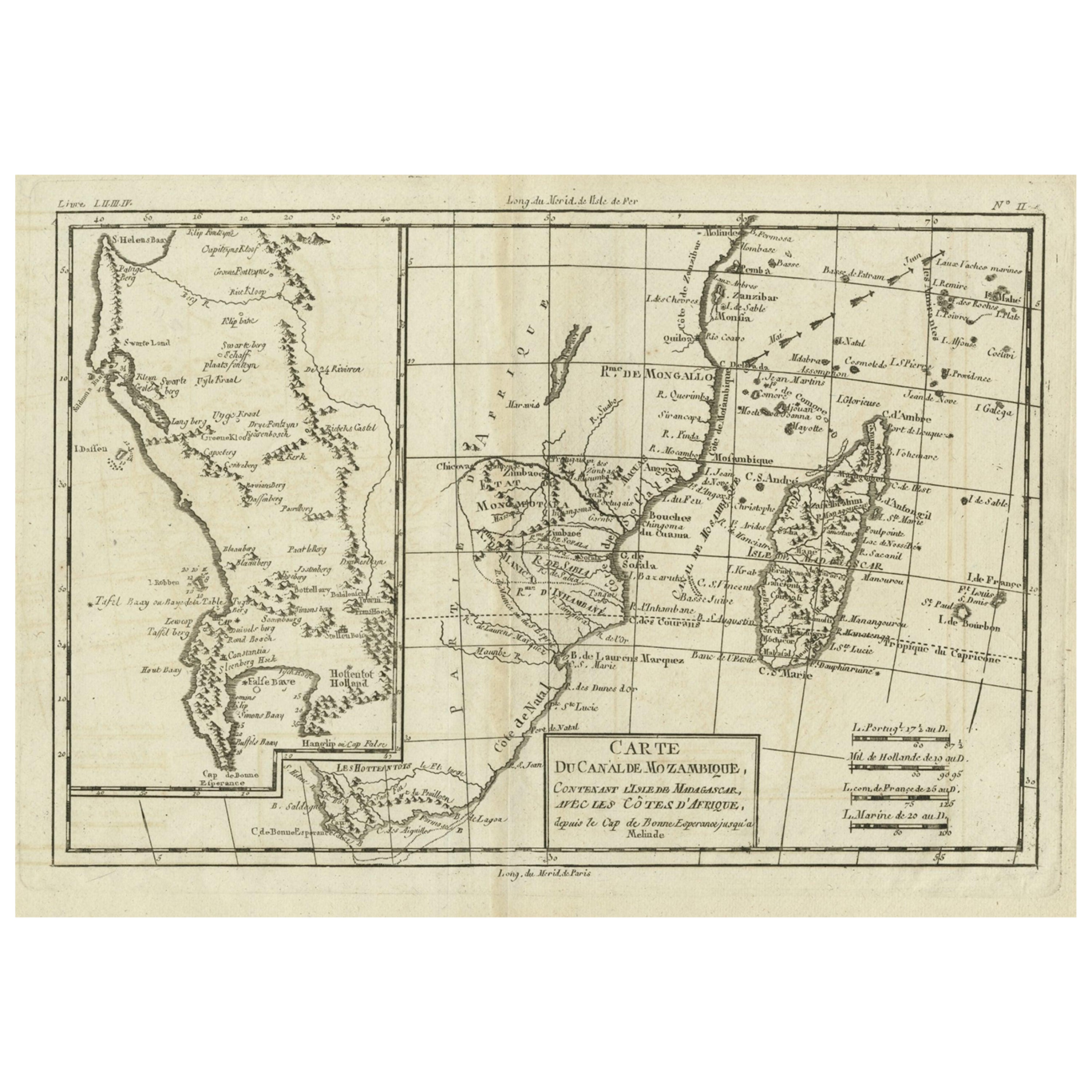
Antique Map of Mozambique Channel with Madagascar and Inset of Cape Region, 1780
Located in Langweer, NL
Antique map titled 'Carte du canal de Mosambique, contenant l'Isle de Madagascar avec les Cotes d'Afrique.' Map of Mozambique Channel, containing the Island of Madagascar with the coasts of Africa from Cape of Good Hope to Melinde. The inset map shows the Cape region in South Africa with False Bay, Robben Island etc. Source unknown, to be determined. Artists and Engravers: Rigobert Bonne (1727-1795 ) was one of the most important cartographers of the late 18th century. In 1773 he succeeded Jacques Bellin as Royal Cartographer to France in the office of the Hydrographer at the Depôt de la Marine. Working in his official capacity Bonne compiled some of the most detailed and accurate maps of the period. Bonne's work represents an important step in the evolution of the cartographic ideology away from the decorative work of the 17th and early 18th century towards a more detail oriented and practical aesthetic. With regard to the rendering of terrain Bonne maps...
Category
Antique 18th Century Maps
Materials
Paper
Map of the Mozambique and Tanzania Coast
Inset Map of Anjouan Island, ca.1700
Located in Langweer, NL
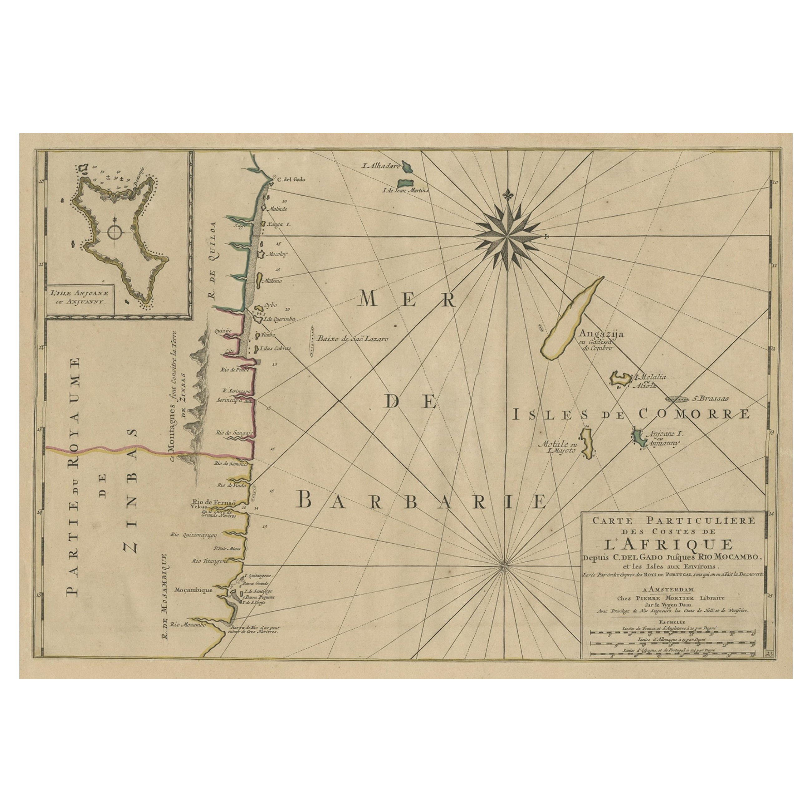
Antique map titled 'Carte particuliere des Costes de l'Afrique'.
Depicts the coasts of Mozambique and Tanzania. With an inset map of Anjouan Island.
Artists and engravers: Pub...
Category
Antique Early 1700s Maps
Materials
Paper
$611 Sale Price
20% Off
You May Also Like
West Coast of Africa; Guinea
Sierra Leone: Bellin 18th Century Map
Located in Alamo, CA
This is a Jacques Bellin copper-plate map entitled "Partie de la Coste de Guinee Dupuis la Riviere de Sierra Leona Jusquau Cap das Palmas", depicting the coast of Guinea and Sierra L...
Category
1740s Old Masters Landscape Prints
Materials
Engraving

West Coast of Africa, Guinea
Sierra Leone: An 18th Century Map by Bellin
By Jacques-Nicolas Bellin
Located in Alamo, CA
Jacques Bellin's copper-plate map entitled "Partie de la Coste de Guinee Dupuis la Riviere de Sierra Leona Jusquau Cap das Palmas", depicting the coast of Guinea and Sierra Leone in ...
Category
Antique Mid-18th Century French Maps
Materials
Paper

Map Of The Island Of Cuba - Guillaume Thomas Raynal (1711-1796)
Located in Porto, PT
This historical map of the Island of Cuba was produced in the late 18th century and is taken from an edition of “Atlas de toutes les parties connues du globe terrestre” by the French...
Category
Antique 18th Century Prints
Materials
Glass, Paper

Antique 1765 Wine Country Folding Map of France, Bordeau etc.
Located in Paonia, CO
Route du Carosse de Bordeaux, part de Paris tous les Mardis a 11 matin. a et pafse 1765 is a comprehensive map with two routes through the wine country of France starting in Paris going south...
Category
1760s Other Art Style Landscape Prints
Materials
Etching

Cadiz Island: A Framed 17th Century Hand-colored Map from Blaeu
s Atlas Major
By Joan (Johannes) Blaeu
Located in Alamo, CA
This is a 17th century hand-colored map entitled "Insula Gaditana Isla de Cadiz" from Johannes (Joan) Blaeu's Atlas Maior, published in Amsterdam in 1662.
The map provides an excellent plan of Cadiz Island on the southwest coast of Spain, with its harbor, fortifications, agricultural fields and several surrounding salt processing areas. Numerous sailing ships of various sizes are included in and around the harbor and bay, including five large sailing ships, as well as twenty-four smaller ships. There is a small compass rose overlying the bay. The bridge to the mainland from the island is shown on the right. There is an extremely ornate and colorful title cartouche in the lower left, with its mythological figures reminiscent of Raphael’s Galatea fresco at the Villa Farnesina in Rome. The vibrant colors are vividly preserved. The master colorist tried to emulate a painting by using various tones to create a three-dimensional effect.
Blaeu's name is present in the plate in the lower right. Blaeu stated in his description of Cadiz: “The main wealth of the islanders consists of salt, which they harvest, and
the tuna fisheries.”
This 17th century hand-colored map is framed in an ornate, partially textured bronze-colored wood frame and glazed with UV protected conservation glass. There is a vertical center fold, as issued. There is a faint crease in the lower right and faint color offset on the left from the right side of the map, resulting from having been in an atlas for hundreds of years. Small foci of paint are present in the upper portion of the left margin and in the left corner margin. The map is otherwise in very good condition.
Due in large part to their powerful trade empire, the Dutch became known for cartography in the seventeenth century. This period is considered the Golden Age of Dutch cartography. Their publishing houses produced the highest quality work in Europe, particularly those maps and charts of foreign lands, and Dutch map-making set the bar for cartographic accuracy and artistry into the early-eighteenth century. Some of the most well-known cartographers worked in Amsterdam during this period. Perhaps the most famous of these was the Blaeu family. Willem Janszoon Blaeu, set up shop in Amsterdam. His son, Johannes (Joan), succeeded him upon his death in 1638, continuing in his father’s position as Hydrographer to the Dutch East India Company and selling maps to the public. The Blaeu map presses, located near Amsterdam’s Dam Square...
Category
Mid-17th Century Old Masters Landscape Prints
Materials
Engraving

Antique Map - Mare Pacificum - Etching by Johannes Janssonius - 1650s
By Johannes Janssonius
Located in Roma, IT
Mare Pacificum is an antique map realized in 1650 by Johannes Janssonius (1588-1664).
The Map is Hand-colored etching, with coeval watercolorang.
Good conditions with slight foxing...
Category
1650s Modern Figurative Prints
Materials
Etching
