Items Similar to Mozambique Channel
Madagascar – Antique African Sea Chart, Bonne c1780
Want more images or videos?
Request additional images or videos from the seller
1 of 10
Mozambique Channel
Madagascar – Antique African Sea Chart, Bonne c1780
$379.70
£283.46
€320
CA$527.52
A$567.42
CHF 303.24
MX$6,688.25
NOK 3,823.21
SEK 3,495.14
DKK 2,438.76
About the Item
Mozambique Channel
Madagascar – Antique African Sea Chart, Bonne c1780
Description:
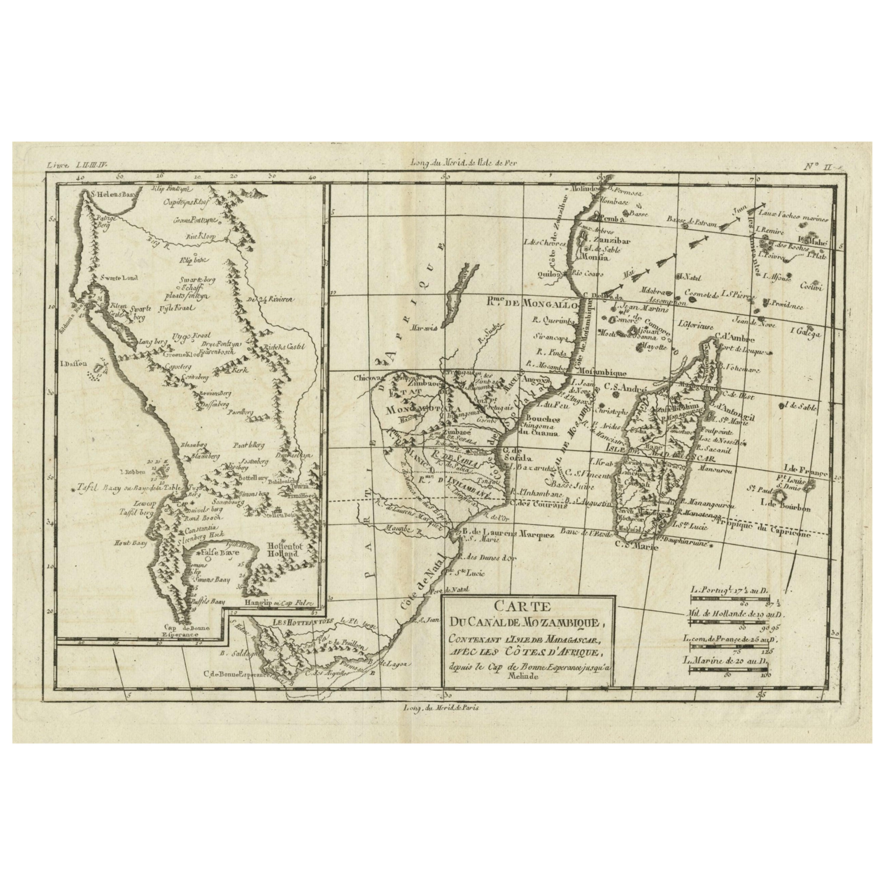
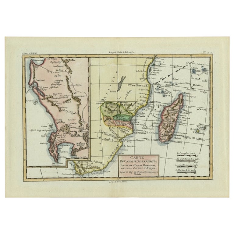
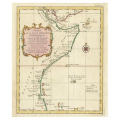
This finely engraved late-18th-century sea chart depicts the Mozambique Channel with Madagascar and the southeastern coast of Africa, extending from the Cape of Good Hope northward toward Melinde. Executed by Rigobert Bonne, hydrographer to the French Navy, the map reflects Enlightenment-era maritime knowledge and European naval interest in East African trade routes. Coastal profiles, soundings, island groups, and prevailing currents are carefully delineated, emphasizing navigation rather than inland detail. Madagascar is shown prominently with early European place names, while the African coast illustrates ports, rivers, and anchorages vital to Indian Ocean commerce. The restrained, elegant engraving and balanced composition make this an excellent example of French nautical cartography from the period, equally suitable for collectors of African maps or refined interior display.
Condition:
Good antique condition. Light age toning, original centerfold as issued, minor surface wear at margins. The map is offered unframed, preserving the sheet in its original, untouched state.
Framing tips:
Pairs well with a dark walnut or ebonized frame and a wide warm-white mat to emphasize the horizontal format.
Keywords:
Mozambique Channel, Madagascar map, East Africa map, Indian Ocean chart, antique sea chart, African coast map, 18th century cartography, French naval map, Rigobert Bonne, maritime engraving
Technique: Copper engraving
Maker: Rigobert Bonne, France, circa 1780
- Dimensions:Height: 10.24 in (26 cm)Width: 16.15 in (41 cm)Depth: 0.01 in (0.2 mm)
- Materials and Techniques:Paper,Engraved
- Place of Origin:
- Period:
- Date of Manufacture:Circa 1780
- Condition:Good antique condition. Light age toning, original centerfold as issued, minor surface wear at margins. The map is offered unframed, preserving the sheet in its original, untouched state.
- Seller Location:Langweer, NL
- Reference Number:Seller: BG-14105-111stDibs: LU3054348264152
About the Seller
5.0
Recognized Seller
These prestigious sellers are industry leaders and represent the highest echelon for item quality and design.
Platinum Seller
Premium sellers with a 4.7+ rating and 24-hour response times
Established in 2009
1stDibs seller since 2017
2,836 sales on 1stDibs
Typical response time: 1 hour
- ShippingRetrieving quote...Shipping from: Langweer, Netherlands
- Return Policy
More From This Seller
View AllAntique Map of Mozambique Channel with Madagascar and Inset of Cape Region, 1780
Located in Langweer, NL
Antique map titled 'Carte du canal de Mosambique, contenant l'Isle de Madagascar avec les Cotes d'Afrique.' Map of Mozambique Channel, containing the Island of Madagascar with the coasts of Africa from Cape of Good Hope to Melinde. The inset map shows the Cape region in South Africa with False Bay, Robben Island etc. Source unknown, to be determined. Artists and Engravers: Rigobert Bonne (1727-1795 ) was one of the most important cartographers of the late 18th century. In 1773 he succeeded Jacques Bellin as Royal Cartographer to France in the office of the Hydrographer at the Depôt de la Marine. Working in his official capacity Bonne compiled some of the most detailed and accurate maps of the period. Bonne's work represents an important step in the evolution of the cartographic ideology away from the decorative work of the 17th and early 18th century towards a more detail oriented and practical aesthetic. With regard to the rendering of terrain Bonne maps...
Category
Antique 18th Century Maps
Materials
Paper
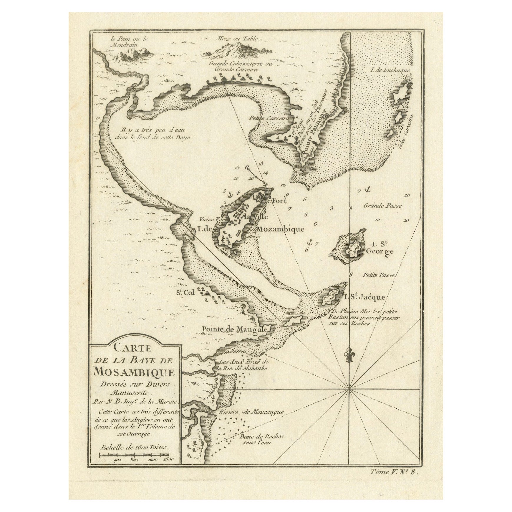
Mozambique Bay – French Naval Sea Chart by Bellin, c.1765
Located in Langweer, NL
Mozambique Bay – French Naval Sea Chart by Bellin, c.1765
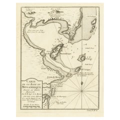
This detailed French sea chart depicts the Bay of Mozambique and the strategically vital island settlement of Mozambique, s...
Category
Antique 1760s French Maps
Materials
Paper
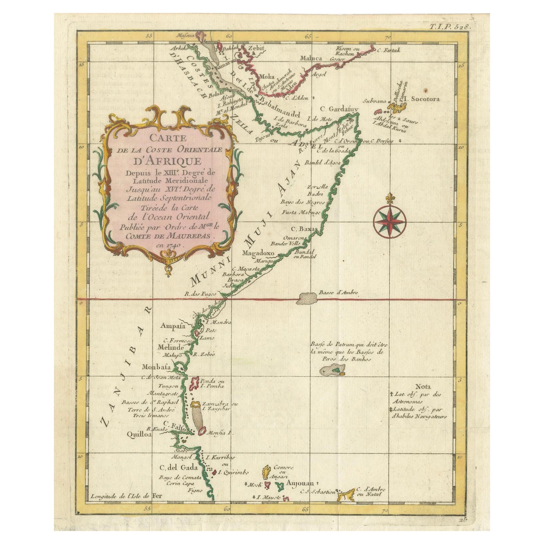
East African Coast – French Map by Bellin, Zanzibar to Arabia, 1740
Located in Langweer, NL
East African Coast – French Map by Bellin, Zanzibar to Arabia, 1740
This important French map depicts the eastern coast of Africa from Mozambique and Zanzibar northward to the Horn ...
Category
Antique 1740s French Maps
Materials
Paper
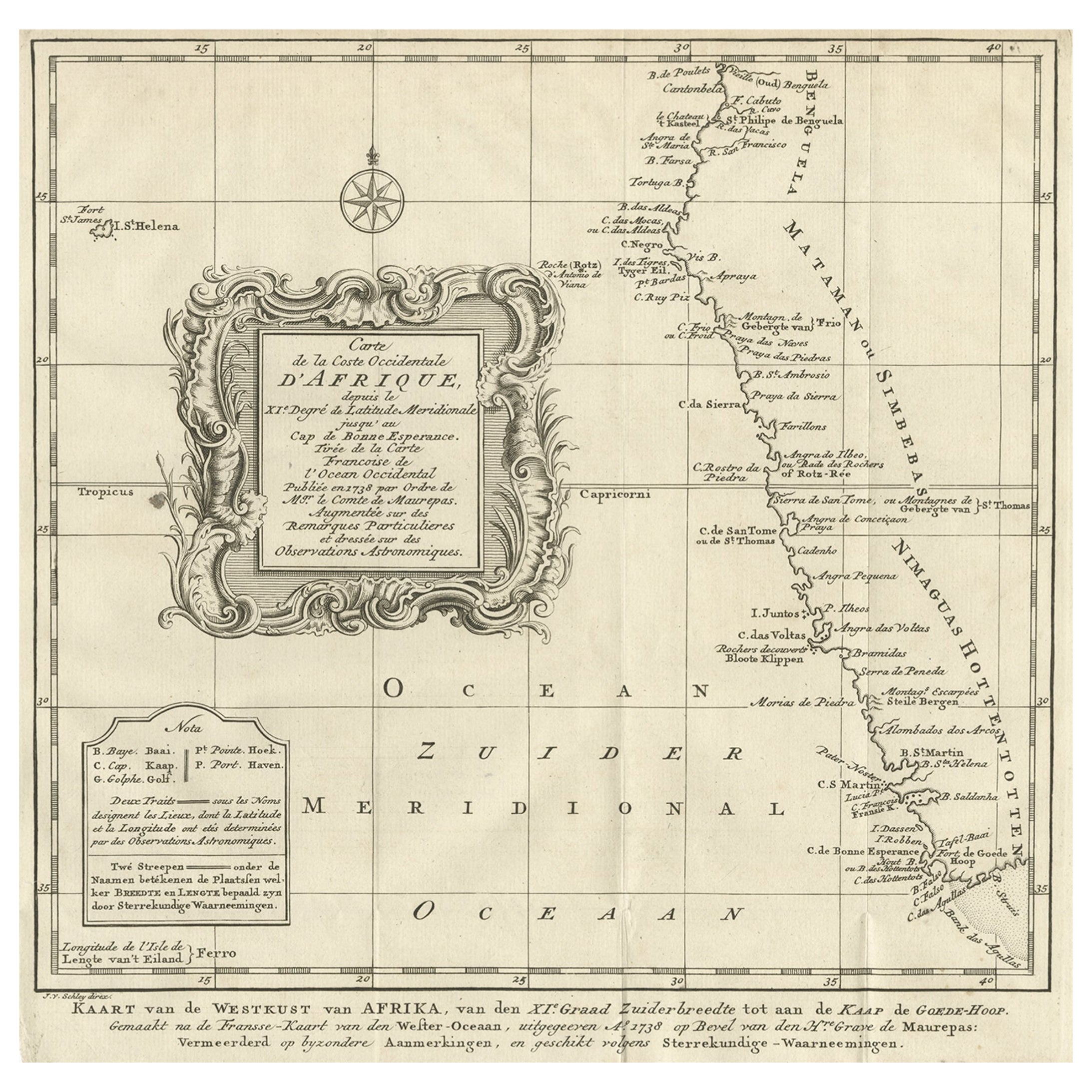
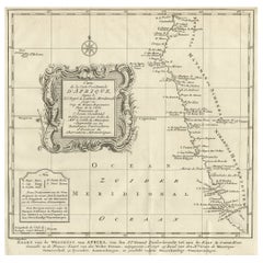
Dutch Antique Map of the West Coast of Africa, to the Cape of Good Hope, 1747
Located in Langweer, NL
Antique map of the Coast of Africa titled 'Kaart van de West Kust van Afrika (..)'.
Map of the west coast of Africa, from 11 degrees south latitude to the Cape of Good Hope. This...
Category
Antique 1740s Maps
Materials
Paper
$370 Sale Price
20% Off
Free Shipping
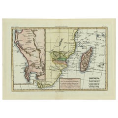
Antique Map of Mozambique and Cape of Good Hope with Kingdom Monomotapa, 1780
Located in Langweer, NL
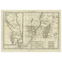
Antique map titled 'Carte Du Canal De Mozambique.' The main map, on the right, covers from the Cape of Good Hope north as far as Zanzibar and modern day Kenya, focusing on the gold r...
Category
Antique 18th Century Maps
Materials
Paper
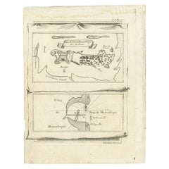
Antique Map of Mozambique Bay and a Map Fort de Mozambique, c.1759
Located in Langweer, NL
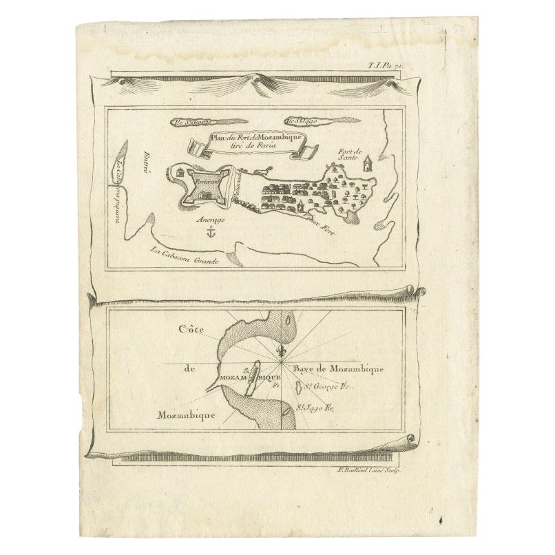
Two antique maps on one sheet. The upper antique map is titled 'Plan du Fort de Mozambique tiré de Faria' and depicts the island of Mozambique with its fort, settlement, harbor and i...
Category
Antique 18th Century Maps
Materials
Paper
You May Also Like
Africa: A Large 17th Century Hand-Colored Map by Sanson and Jaillot
By Nicolas Sanson
Located in Alamo, CA
This large original hand-colored copperplate engraved map of Africa entitled "L'Afrique divisee suivant l'estendue de ses principales parties ou sont distingues les uns des autres, L...
Category
Antique 1690s French Maps
Materials
Paper

Original Antique Map of Africa by Dower, circa 1835
Located in St Annes, Lancashire
Nice map of Africa
Drawn and engraved by J.Dower
Published by Orr & Smith. C.1835
Unframed.
Free shipping
Category
Antique 1830s English Maps
Materials
Paper

West Coast of Africa, Guinea
Sierra Leone: An 18th Century Map by Bellin
By Jacques-Nicolas Bellin
Located in Alamo, CA
Jacques Bellin's copper-plate map entitled "Partie de la Coste de Guinee Dupuis la Riviere de Sierra Leona Jusquau Cap das Palmas", depicting the coast of Guinea and Sierra Leone in ...
Category
Antique Mid-18th Century French Maps
Materials
Paper

Africa: A Large 17th Century Hand-colored Map By Sanson and Jaillot
By Nicholas Sanson d
Abbeville
Located in Alamo, CA
This large original hand-colored copperplate engraved map of Africa entitled "L'Afrique divisee suivant l'estendue de ses principales parties ou sont distingues les uns des autres, L...
Category
1690s Landscape Prints
Materials
Engraving

West Coast of Africa; Guinea
Sierra Leone: Bellin 18th Century Map
Located in Alamo, CA
This is a Jacques Bellin copper-plate map entitled "Partie de la Coste de Guinee Dupuis la Riviere de Sierra Leona Jusquau Cap das Palmas", depicting the coast of Guinea and Sierra L...
Category
1740s Old Masters Landscape Prints
Materials
Engraving

West Africa Entitled "Guinea Propria": An 18th Century Hand Colored Homann Map
By Johann Baptist Homann
Located in Alamo, CA
This is a scarce richly hand colored copper plate engraved map of Africa entitled "Guinea Propria, nec non Nigritiae vel Terrae Nigrorum Maxima Pars" by Johann Baptist Homann (1664-1...
Category
Antique Mid-18th Century German Maps
Materials
Paper
