Items Similar to Napoleonic Wars: Germany Allied Military Campaign Map by Ausfeld, 1814


Want more images or videos?
Request additional images or videos from the seller
1 of 12
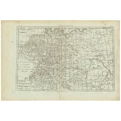
Napoleonic Wars: Germany Allied Military Campaign Map by Ausfeld, 1814
$2,161.61
£1,601
€1,800
CA$2,956.98
A$3,218.10
CHF 1,705.91
MX$38,716.25
NOK 21,636.47
SEK 19,795.85
DKK 13,716.31
About the Item
Title: Napoleonic Wars - Allied Campaign Map Germany 1814 Ausfeld Military
Description:
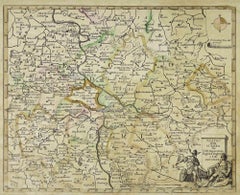
This rare and historically important military map documents the Allied campaigns in central Germany during the final phase of the Napoleonic Wars. Titled “Siegeszeichen der Verbündeten aus den Hauptschlachten”, the map was designed, drawn, and engraved by Carl Ausfeld in Meiningen in 1814, immediately following the collapse of Napoleonic control in German territories. As a contemporary production rather than a later retrospective, it offers a direct visual record of coalition warfare at the decisive moment of European history.
The map focuses on large parts of Prussia, Saxony, Brandenburg, and neighboring regions, clearly identifying key cities such as Berlin, Magdeburg, Leipzig, Dresden, and Frankfurt an der Oder. Rivers, regional boundaries, and an extensive network of roads are carefully engraved, while dense annotations describe troop movements, lines of advance, and strategic concentrations of Allied forces. Radiating routes converge on major battle zones, visually emphasizing the coordinated effort of the coalition armies during the campaigns of 1813–1814.
At the lower center of the sheet is an engraved explanatory text panel outlining the significance of the Allied victories and the cooperation between the participating powers. This element gives the map a commemorative and patriotic character, typical of German military publications issued in the immediate aftermath of Napoleon’s defeat. The overall engraving style is precise and functional, prioritizing clarity and informational depth over ornament, in keeping with early 19th-century German military cartography.
With a large sheet size of approximately 50 x 64 cm, this map has strong visual impact and rewards close study. Such separately issued campaign maps were often folded, consulted, and discarded, making well-preserved examples increasingly scarce today. The combination of a clear Napoleonic date, a fully identified engraver, and a subject tied to major European events makes this an appealing piece for collectors of Napoleonic history, German cartography, and early military mapping, as well as for interior display in a library or study.
Condition report:
Good antique condition. Printed on laid paper. Minor surface dirt and scattered light spotting, mainly in the margins. Margins intact with small edge wear and softening. No major tears or losses. The engraved image and inscriptions remain clear and well-defined. A partially visible cursive name watermark, likely reading “F. Ruhll”, is present and consistent with early 19th-century German papermaker practice. No visible plate mark, consistent with the production method.
Framing tips:
This map frames very well in a classic or scholarly interior. A dark walnut or ebonized wooden frame with a wide off-white or light cream mat complements the warm paper tone and enhances legibility. For a more modern presentation, a thin black frame with museum glass allows the dense cartographic detail to stand out while offering optimal protection.
Technique: Engraving
Maker: B. Carl Ausfeld, Meiningen, 1814
- Dimensions:Height: 25.2 in (64 cm)Width: 19.69 in (50 cm)Depth: 0.01 in (0.2 mm)
- Materials and Techniques:Paper,Engraved
- Place of Origin:
- Period:
- Date of Manufacture:1814
- Condition:Good. Printed on laid paper. Minor surface dirt and scattered light spotting, mainly in the margins. Margins intact with small edge wear and softening. No major tears or losses. The engraved image and inscriptions remain clear and well-defined.
- Seller Location:Langweer, NL
- Reference Number:Seller: BG-14177-61stDibs: LU3054347964952
About the Seller
5.0
Recognized Seller
These prestigious sellers are industry leaders and represent the highest echelon for item quality and design.
Platinum Seller
Premium sellers with a 4.7+ rating and 24-hour response times
Established in 2009
1stDibs seller since 2017
2,816 sales on 1stDibs
Typical response time: 1 hour
- ShippingRetrieving quote...Shipping from: Langweer, Netherlands
- Return Policy
More From This Seller
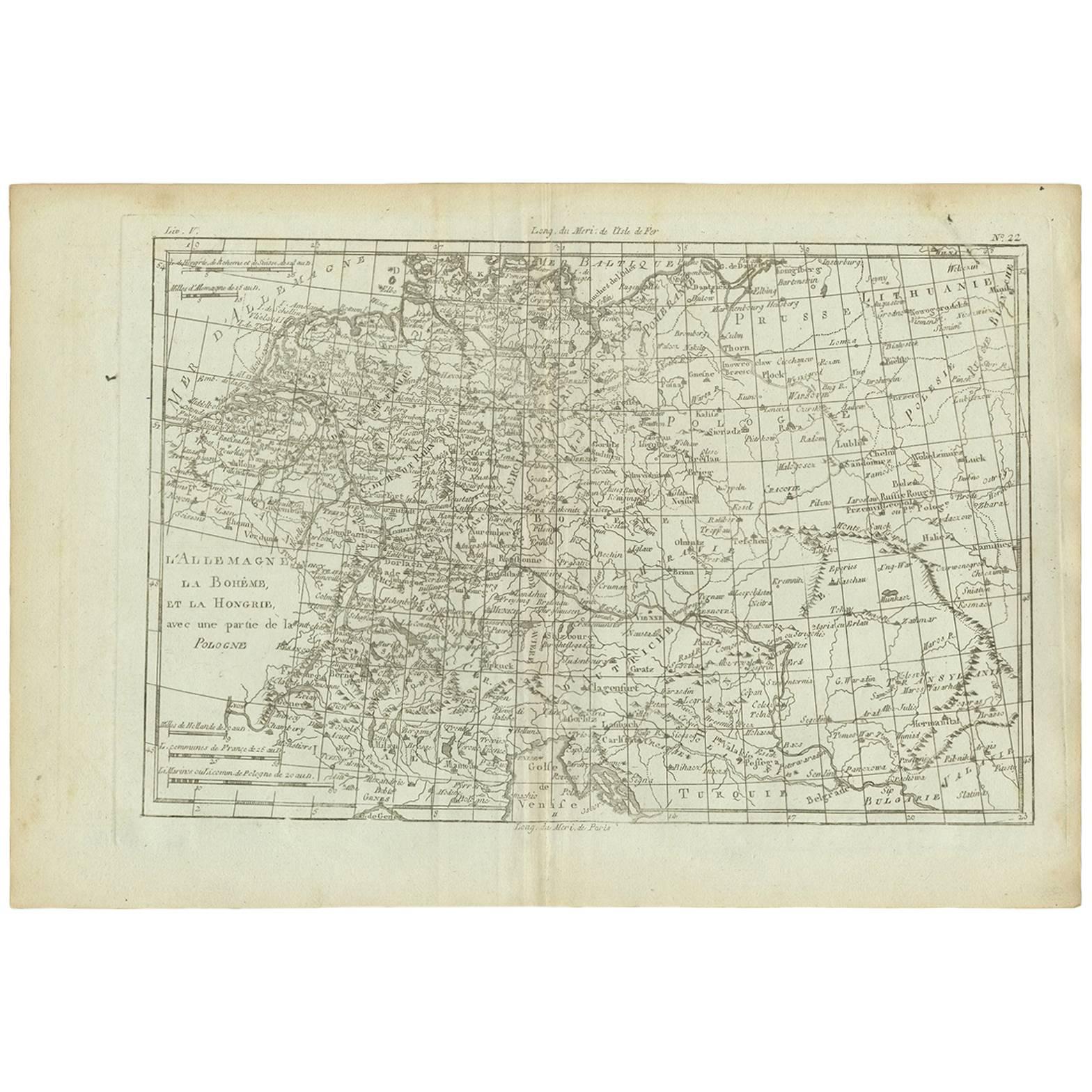
View AllAntique Map of Germany, Bohemia, Hungary and Part of Poland by R. Bonne ‘1780’
Located in Langweer, NL
Antique map titled "L'Allemagne, La Bohême, et la Hongrie avec une partie de la Pologne" by Rigobert Bonne (1729-1795) for "Atlas de toutes les parties connues du globe terrestre" by...
Category
Antique Late 18th Century French Maps
Materials
Paper
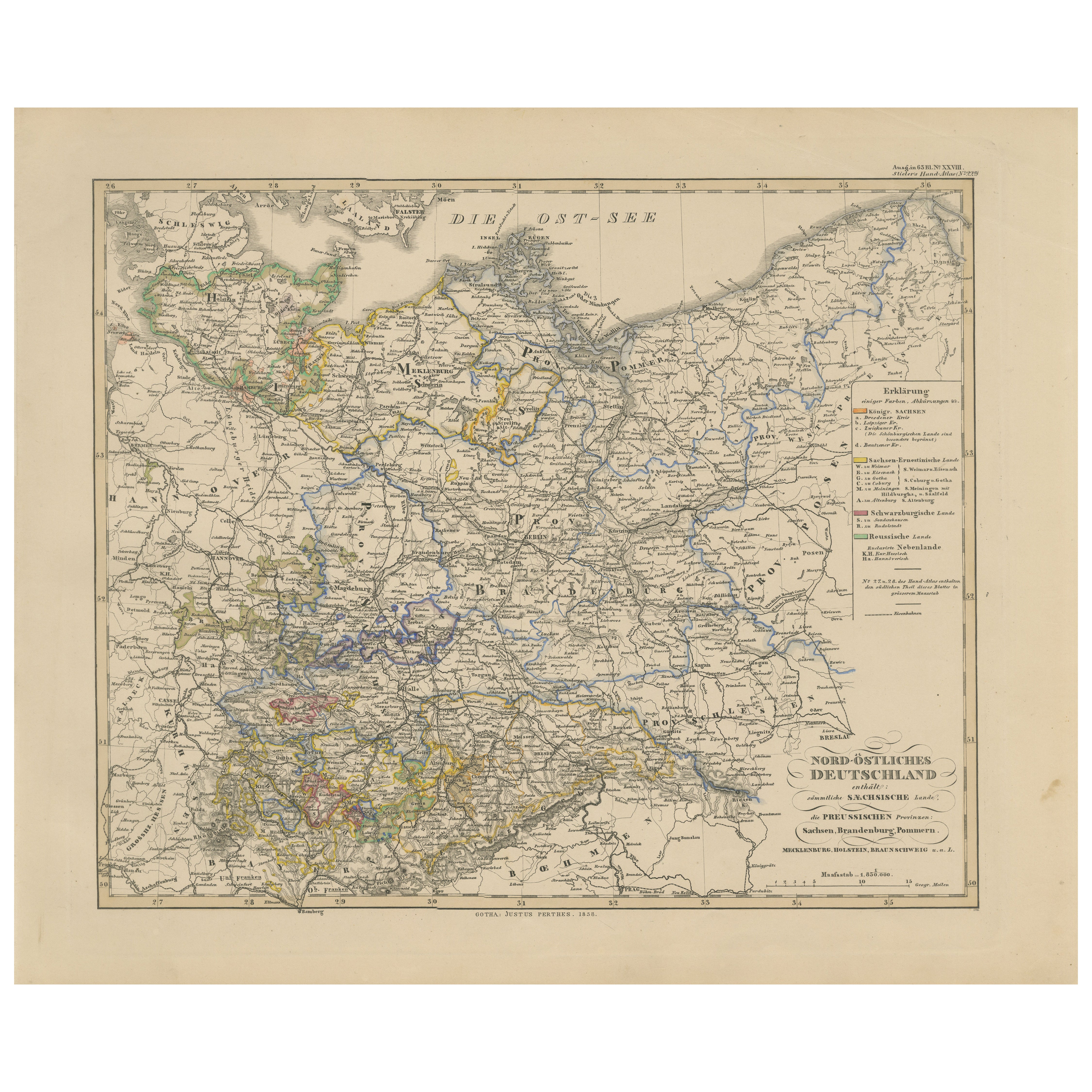
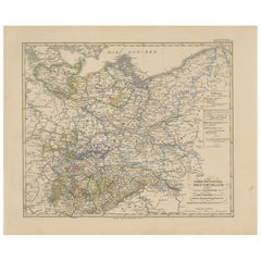
Antique Map of Northeastern Germany – Saxon
Prussian States, 1858
Located in Langweer, NL
Antique Map of Northeastern Germany – Saxon & Prussian States, 1858
Detailed and finely engraved map titled "Nord-Östliches Deutschland enthaltend die Sächsischen Länder und die Pre...
Category
Antique Mid-19th Century German Maps
Materials
Paper
Antique Map of Franconia, a region of Germany,
1811
By John Cary
Located in Langweer, NL
Antique map titled 'A New Map of the Circle of Franconia'. Detailed map of Franconia in Northwestern Germany. Covers from Upper Saxony south to Swabia, west to the Lower Rhine and we...
Category
Antique Early 19th Century Maps
Materials
Paper

Antique 1842 Map of Germany by Pierre M. Lapie, Mid-19th Century
Located in Langweer, NL
Antique map titled 'Carte de la Germanie Ancienne'. Map of Germany. This map originates from 'Atlas universel de géographie ancienne et moderne (..)' by...
Category
Antique Mid-19th Century French Maps
Materials
Paper

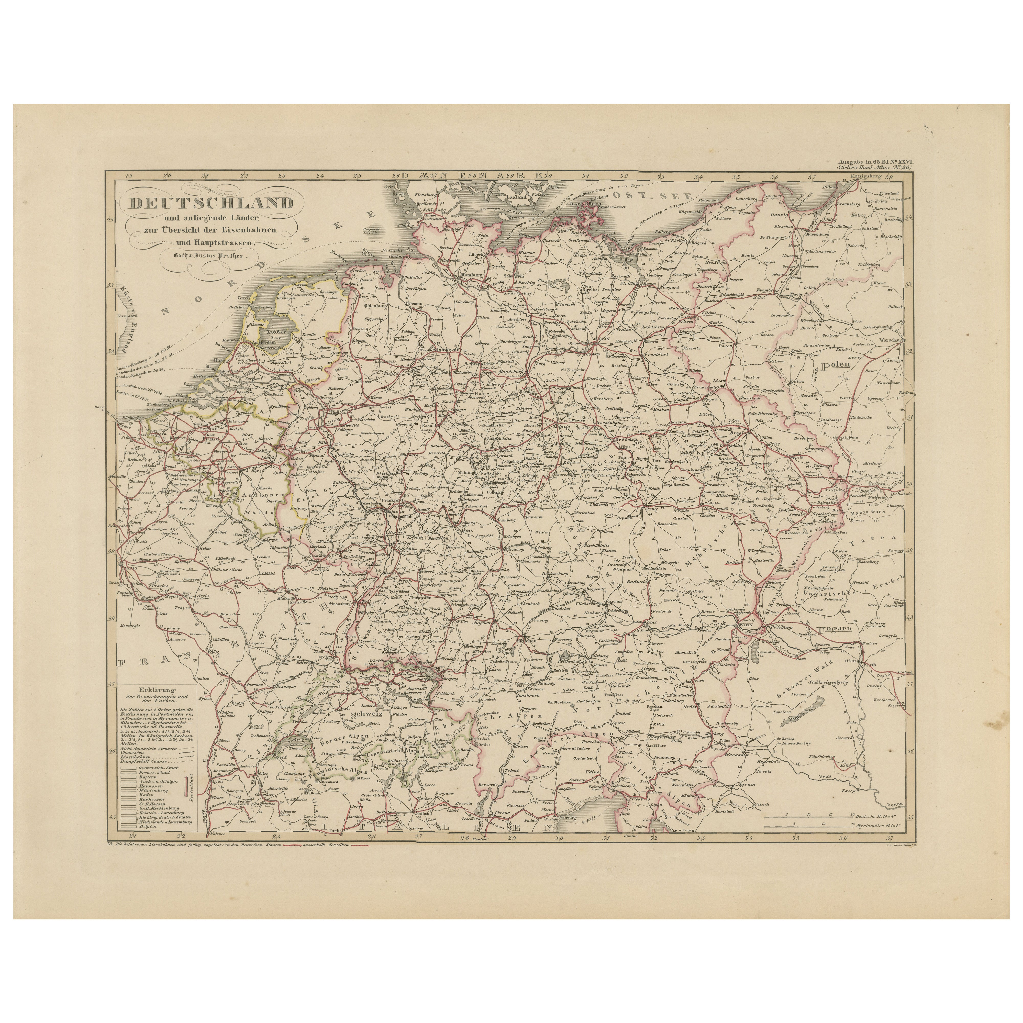
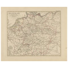
Antique Map of Germany
Railways – Transport Network Overview, 1857
Located in Langweer, NL
Antique Map of Germany & Railways – Transport Network Overview, 1857
Striking 19th-century map titled "Deutschland und angränzende Länder zur Übersicht der Eisenbahnen und Hauptstra...
Category
Antique Mid-19th Century German Maps
Materials
Paper
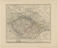
Antique Map of Eastern Germany, Bohemia, Moravia
Silesia – 1858
Located in Langweer, NL
Antique Map of Eastern Germany, Bohemia, Moravia & Silesia – 1858
Detailed 19th-century engraved map titled "Östliches Deutschland mit Böhmen, Mähren und Schlesien" (Eastern German...
Category
Antique Mid-19th Century German Maps
Materials
Paper
You May Also Like
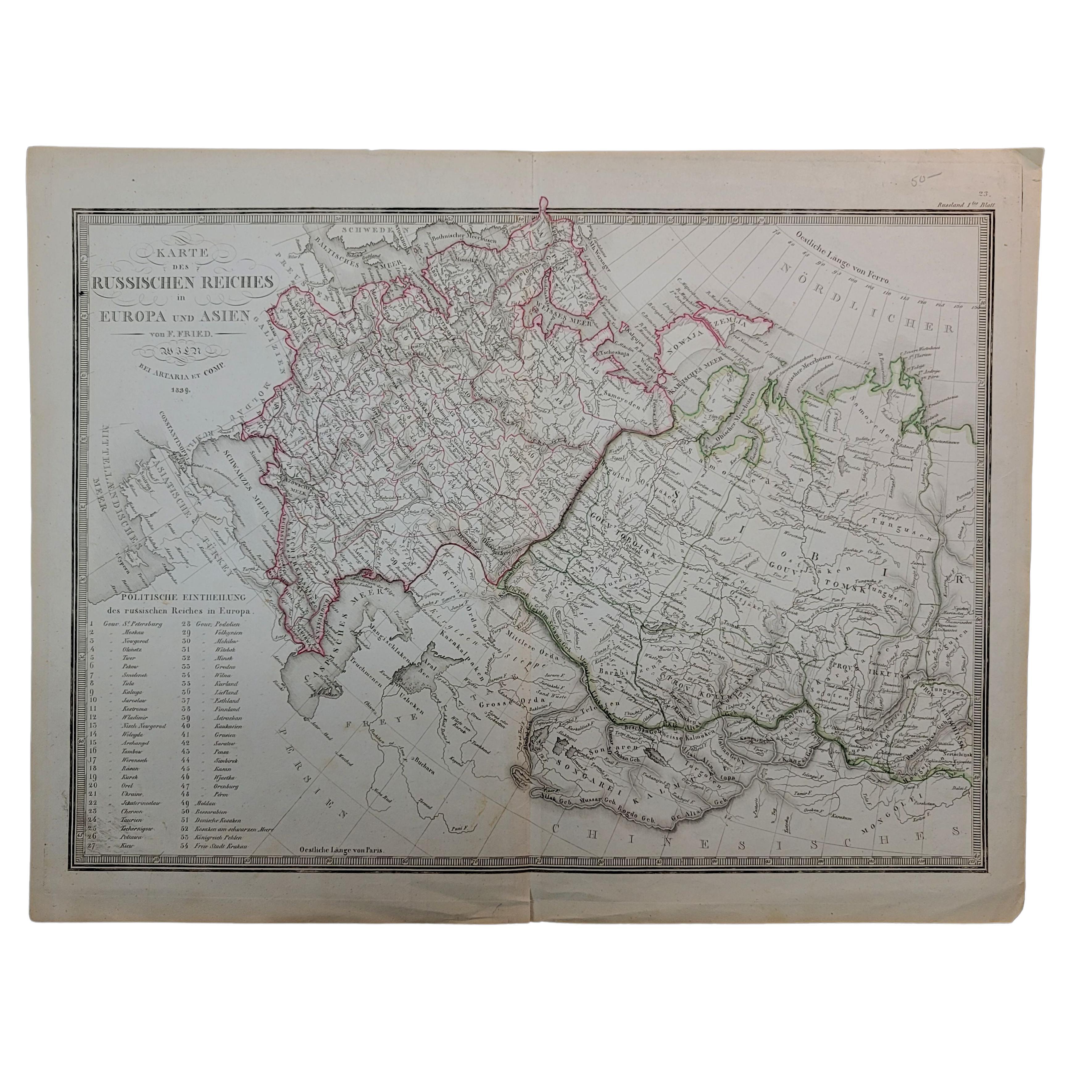
1839 Map of Karte Des "Russischen Reiches in Europa Und Asien" Ric.R0013
Located in Norton, MA
1839 map of Karte Des
"Russischen Reiches in Europa and Asien"
Ric.r013
Map of the European and Asian parts of Russian Empire. Karte der Russischen Reiches in Europa und Asien...
Category
Antique 19th Century Unknown Maps
Materials
Paper

Map of the War between Hungary and Prussia - Etching - 19th Century
Located in Roma, IT
Map of the War between Hungary and Prussia is an etching realized during the 19th century.
Good condition.
Category
Early 19th Century Modern Figurative Prints
Materials
Etching
Map of the War between Hungary and Prussia - Etching - 19th Century
Located in Roma, IT
Map of the War between Hungary and Prussia is an etching realized during the 19th century.
Good condition.
Category
Early 19th Century Modern Figurative Prints
Materials
Etching

German Empire, Southwestern Part. Century Atlas antique vintage map
Located in Melbourne, Victoria
'The Century Atlas. German Empire, Southwestern Part'
Original antique map, 1903.
Central fold as issued. Map name and number printed on the reverse co...
Category
Early 20th Century Victorian More Prints
Materials
Lithograph

Map of Campaign of 1814 - Etching by Pierre François Tardieu - 1837
Located in Roma, IT
Map of Campaign of 1814 is an Etching realized by Pierre François Tardieu in 1837.
Good conditions.
The artwork is realized in a well-balanced composition. the artwork and belongs ...
Category
1830s Modern Figurative Prints
Materials
Lithograph

German Empire, Northern Part. Century Atlas antique vintage map
Located in Melbourne, Victoria
'The Century Atlas. German Empire, Northern Part.'
Original antique map, 1903.
Central fold as issued. Map name and number printed on the reverse corne...
Category
Early 20th Century Victorian More Prints
Materials
Lithograph
