Items Similar to Old 18th Century Composite Map of Key Caribbean Islands with Descriptive Texts


Want more images or videos?
Request additional images or videos from the seller
1 of 8
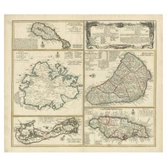
Old 18th Century Composite Map of Key Caribbean Islands with Descriptive Texts
$752.89
$941.1220% Off
£551.77
£689.7120% Off
€624
€78020% Off
CA$1,033.38
CA$1,291.7320% Off
A$1,091.94
A$1,364.9220% Off
CHF 587.25
CHF 734.0620% Off
MX$13,072.54
MX$16,340.6820% Off
NOK 7,357.56
NOK 9,196.9520% Off
SEK 6,738.46
SEK 8,423.0820% Off
DKK 4,753.76
DKK 5,942.2020% Off
About the Item
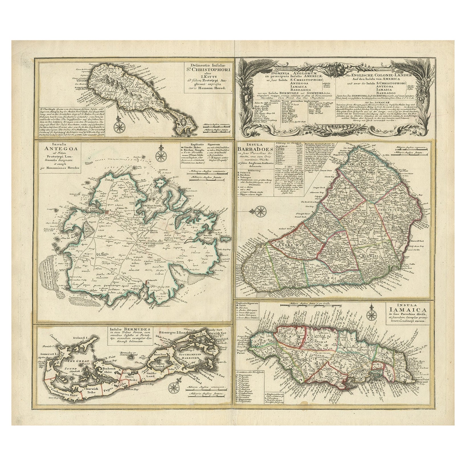
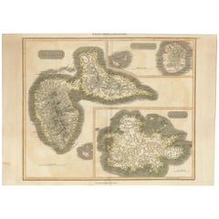
Antique map titled 'Dominia Anglorum in praecipuis Insulis Americae ut sunt Insula S. Christophori, Antegoa, Iamaica, Barbados nec non Insulae Bermudes vel Sommers dictae. Die Englische Colonie-Länder Auf den Insuln von America und zwar die Insuln S. Christophori, Antegoa, Iamaica, Barbados samt den Ins. Bermudes sonst Sommers genannt'.
Beautiful map of the British possessions in the Caribbean. Shows the islands of Saint Christopher or Saint Kitts, Antigua, Bermuda, Barbados, and Jamaica.
This is an elaborate composite map featuring several islands of the Caribbean, each framed within its own colored border and accompanied by descriptive text. The map includes the islands of St. Kitts, Antigua, Barbados, Bermuda, and Jamaica, each meticulously detailed with topographical features, parish borders, and notable settlements.
A prominent feature of this map is the extensive textual descriptions and tables accompanying each island, providing insights into the colonial administration, economic resources, and demographic information of the time. The maps are adorned with ornamental cartouches, which was a common stylistic element of maps from this era, showcasing the artistic flair of the cartographer.
The map is from the 18th century, as you can see by the style of the cartouches and the typography used in the descriptions. The hand coloring on each map is still vibrant, indicating careful preservation. The paper shows signs of age but with all text and cartographic details remaining legible.
Artists and Engravers: Following the long period of Dutch domination, the Homann family became the most important map publishers in Germany in the eighteenth century, the business being founded by J.B. Homann in Nuremberg about the year 1702. Soon after publishing his first atlas in 1707 he became a member of the Berlin academy of Sciences and in 1715 he was appointed Geographer to the Emperor. After the founder's death in 1724, the firm was continued under the direction of his son until 1730 and was then bequeathed to his heirs on the condition that it trades under the name of Homann Heirs. The firm remained in being until the next century and had a wide influence on map publishing in Germany.
- Dimensions:Height: 21.26 in (54 cm)Width: 24.22 in (61.5 cm)Depth: 0 in (0.02 mm)
- Materials and Techniques:
- Period:1740-1749
- Date of Manufacture:circa 1745
- Condition:Condition: Good, two small pieces of tape on the reverse. General age-related toning, a few stains and small tears outside the plate mark or image. Please study image carefully. Vibrant colors.
- Seller Location:Langweer, NL
- Reference Number:Seller: BG-13618-11stDibs: LU3054337731952
About the Seller
5.0
Recognized Seller
These prestigious sellers are industry leaders and represent the highest echelon for item quality and design.
Platinum Seller
Premium sellers with a 4.7+ rating and 24-hour response times
Established in 2009
1stDibs seller since 2017
2,852 sales on 1stDibs
Typical response time: 1 hour
- ShippingRetrieving quote...Shipping from: Langweer, Netherlands
- Return Policy
More From This Seller
View AllOriginal Old Map of St Kitts, Antigua, Bermuda, Barbados, and Jamaica, ca.1745
Located in Langweer, NL
Antique map titled 'Dominia Anglorum in praecipuis Insulis Americae ut sunt Insula S. Christophori, Antegoa, Iamaica, Barbados nec non Insulae Bermudes vel Sommers dictae. Die Englis...
Category
Antique 1740s Maps
Materials
Paper
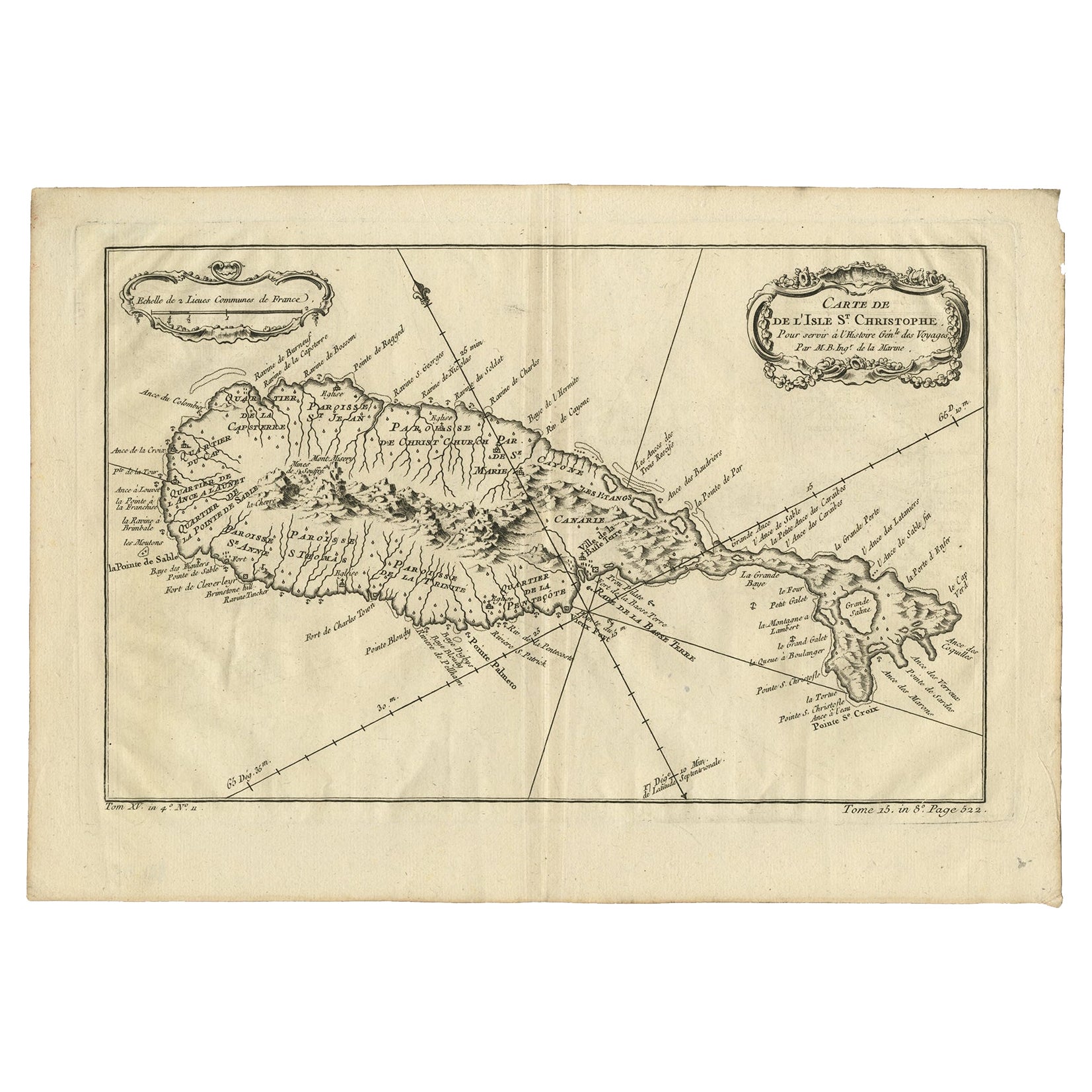
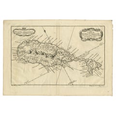
Antique Map of the Caribbean Island of St Kitts, ca.1750
Located in Langweer, NL
Description: Antique map titled 'Carte de l'Isle St. Christophe pour Servir a l'Histoire Genle. des Voyages.'
Detailed map of the Island of St. Kitts, showing the Parishes, towns, ...
Category
Antique 1750s Maps
Materials
Paper
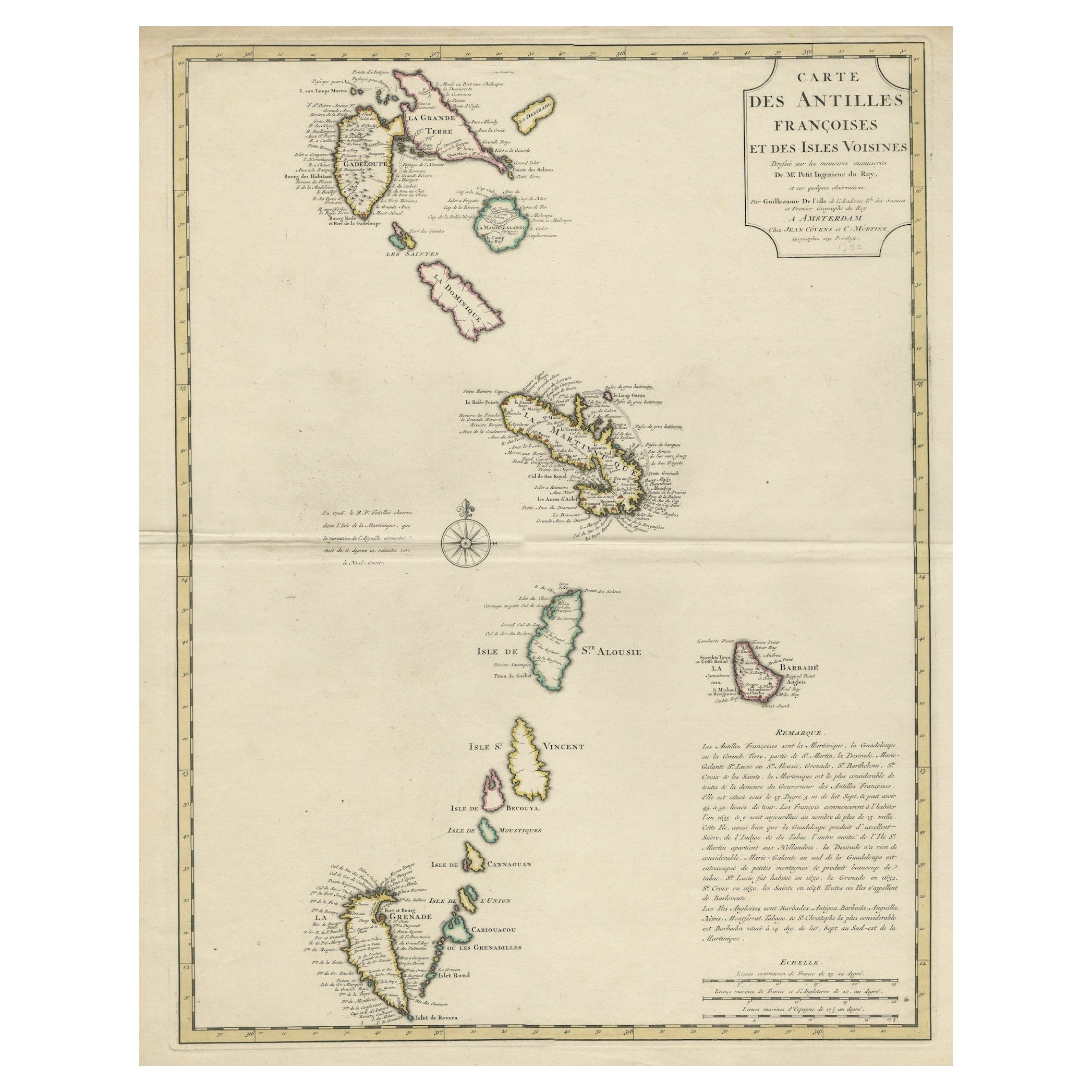
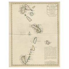
Detailed Antique Map of the Windward Islands in the Caribbean
By Covens
Mortier
Located in Langweer, NL
Antique map titled 'Carte des Antilles Francoises et des Isles Voisines'. Original antique map of the French Antilles, covering an area stretching from Guadeloupe in the north to Gre...
Category
Antique Early 18th Century Maps
Materials
Paper
$907 Sale Price
20% Off
Antique Map of Guadelupe in the Caribbean, 1759
By Jacques-Nicolas Bellin
Located in Langweer, NL
Antique map titled 'Carte De L'Isle De La Guadeloupe'. Detailed map of Guadalupe, Mari-Galante and the Isles de Saintes. Produced by Nichlas Bellin for Prevost d'Exiles influential t...
Category
Antique Mid-18th Century French Maps
Materials
Paper

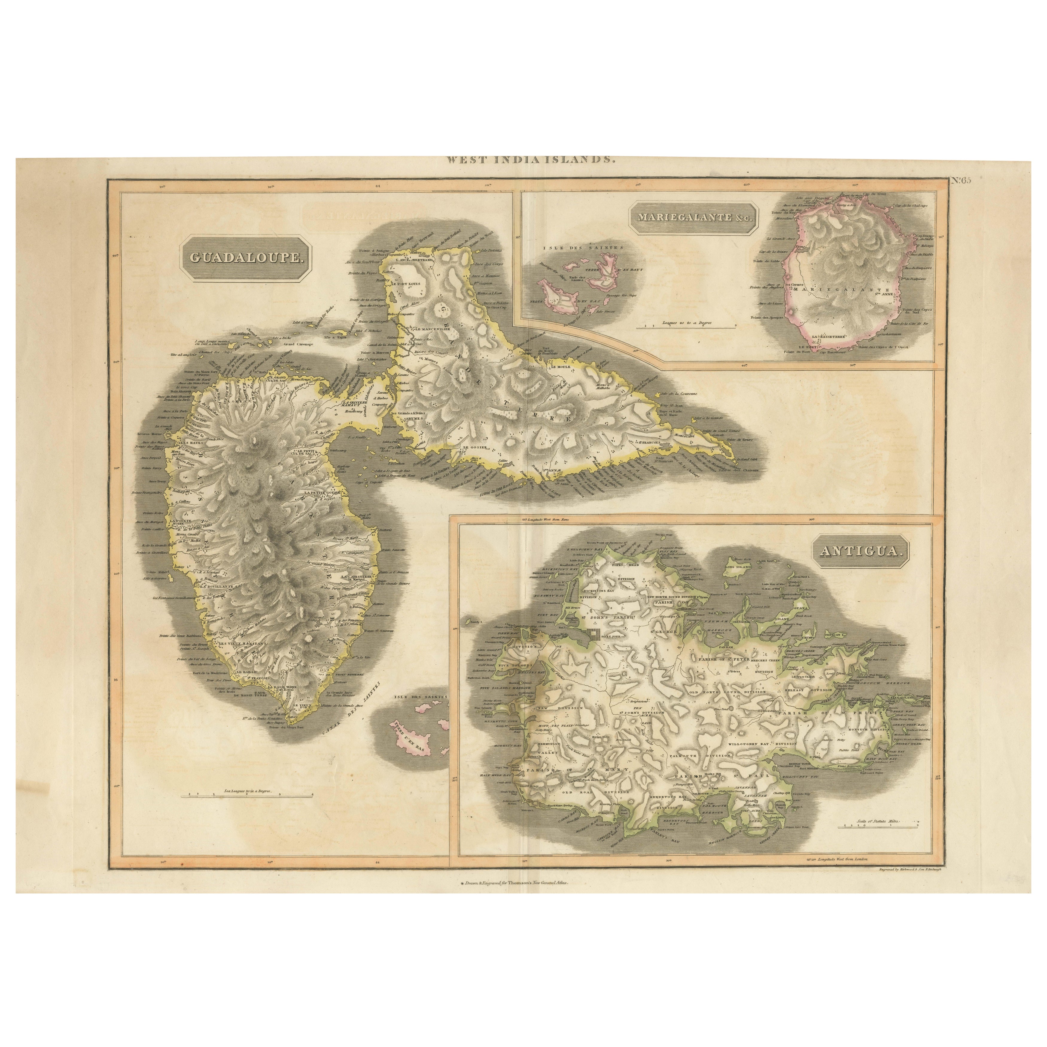
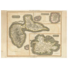
1821 Thomson Map of Guadeloupe, Marie-Galante and Antigua in the West Indies
Located in Langweer, NL
This map, published in 1821 by John Thomson, showcases Guadeloupe, Marie-Galante, and Antigua from the *West India Islands* collection. Part of Thomson's *New General Atlas*, it prov...
Category
Antique 1820s Maps
Materials
Paper
$559 Sale Price
20% Off
Large Antique Map of Guadeloupe and Antigua with Adjacent Isles, 19th Century
Located in Langweer, NL
Title: "Antique Map of Guadeloupe and Antigua with Adjacent Isles, 19th Century"
Source: New General Atlas (circa 1817), published in Edinburgh
Description: This detailed antique m...
Category
Antique Early 19th Century British Maps
Materials
Paper
You May Also Like
St. Christophe
St. Kitts
Island: An 18th Century Hand-colored Map by Bellin
By Jacques-Nicolas Bellin
Located in Alamo, CA
Jacques Bellin's copper-plate map of the Caribbean island of Saint Kitts entitled "Carte De De l'Isle St. Christophe Pour servir á l'Histoire Genle. des V...
Category
Antique Mid-18th Century French Maps
Materials
Paper

West Coast of Africa, Guinea
Sierra Leone: An 18th Century Map by Bellin
By Jacques-Nicolas Bellin
Located in Alamo, CA
Jacques Bellin's copper-plate map entitled "Partie de la Coste de Guinee Dupuis la Riviere de Sierra Leona Jusquau Cap das Palmas", depicting the coast of Guinea and Sierra Leone in ...
Category
Antique Mid-18th Century French Maps
Materials
Paper

Antique Jamaica Map, English, Caribbean, Cartography, Thomas Jefferys, Georgian
Located in Hele, Devon, GB
This is an antique Jamaica map. An English, framed Caribbean island engraving by Thomas Jefferys, dating to the 18th century and later, dated 1794.
Excellent Georgian period cartog...
Category
Antique 1790s British Georgian Maps
Materials
Glass, Paper

Map Of The Island Of Cuba - Guillaume Thomas Raynal (1711-1796)
Located in Porto, PT
This historical map of the Island of Cuba was produced in the late 18th century and is taken from an edition of “Atlas de toutes les parties connues du globe terrestre” by the French...
Category
Antique 18th Century Prints
Materials
Glass, Paper

Captain Cook
s Exploration of Tahiti 18th C. Hand-Colored Map by Bellin
By Jacques-Nicolas Bellin
Located in Alamo, CA
This beautiful 18th century hand-colored copper plate engraved map is entitled "Carte de l'Isle de Taiti, par le Lieutenant J. Cook" was created by Jacques Nicolas Bellin and publish...
Category
Antique Mid-18th Century French Maps
Materials
Paper

Southern Greece: A Large 17th C. Hand-colored Map by Sanson and Jaillot
By Nicolas Sanson
Located in Alamo, CA
This large original hand-colored copperplate engraved map of southern Greece and the Pelopponese Peninsula entitled "La Moree Et Les Isles De Zante, Cefalonie, Ste. Marie, Cerigo & C...
Category
Antique 1690s French Maps
Materials
Paper

More Ways To Browse
Stretcher Tables
M Table
Antique Sultanabad Carpets
China Chair
English Antique Desks
Used Beige Sofa
Antique Plate Germany
Hand Tufted Rugs
Rare China
Side Table Made In Denmark
Thonet Antique
Victorian Hall Tables
Vintage Computer
England Antique Plates
19th Century Round Dining Table
Antique Counters
Antique Thrones
Carved Chinese Tables