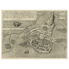
Items Similar to Old Copper Engraving of the Siege of Syracuse, Sicily, Italy, Published, ca.1740

Want more images or videos?
Request additional images or videos from the seller
1 of 5
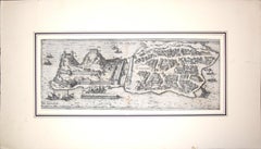
Old Copper Engraving of the Siege of Syracuse, Sicily, Italy, Published, ca.1740
$266.87
$333.5920% Off
£198.27
£247.8320% Off
€224
€28020% Off
CA$370.03
CA$462.5420% Off
A$397.94
A$497.4220% Off
CHF 212.78
CHF 265.9720% Off
MX$4,799
MX$5,998.7520% Off
NOK 2,690.71
NOK 3,363.3920% Off
SEK 2,451.59
SEK 3,064.4820% Off
DKK 1,707.25
DKK 2,134.0720% Off
About the Item
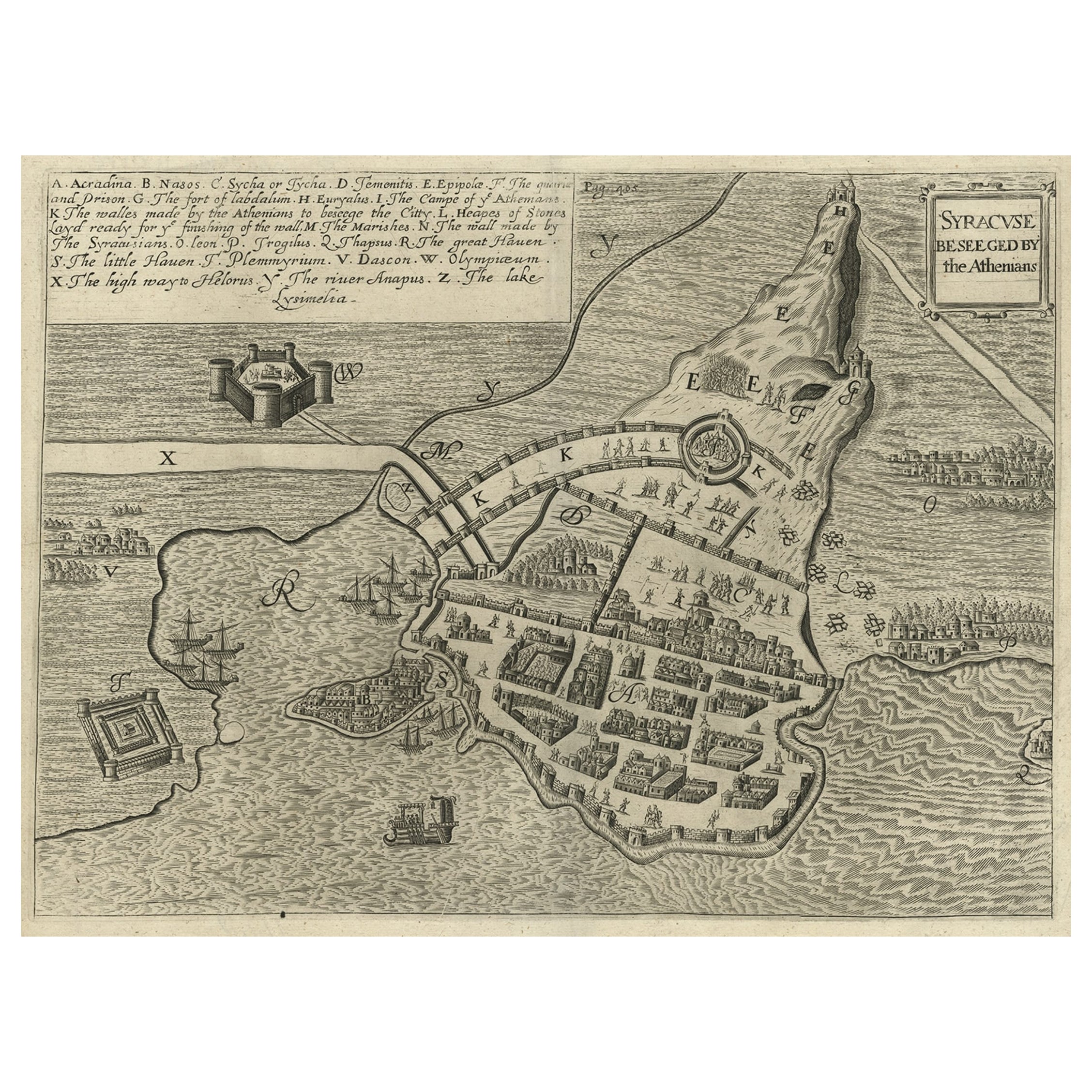
Antique print titled 'Syracuse, Assiégée par les Atheniens'.
Old print of the siege of Syracuse, Sicily, Italy. Source unknown, to be determined.
The siege of Syracuse by the Roman Republic took place in 213–212 BC. The Romans successfully stormed the Hellenistic city of Syracuse after a protracted siege, giving them control of the entire island of Sicily. During the siege, the city was protected by weapons developed by Archimedes. Archimedes, the great inventor and polymath, was slain at the conclusion of the siege by a Roman soldier, in contravention of the Roman proconsul Marcellus' instructions to spare his life.
Artists and Engravers: Anonymous.
- Dimensions:Height: 9.85 in (25 cm)Width: 12.6 in (32 cm)Depth: 0 in (0.02 mm)
- Materials and Techniques:
- Period:1740-1749
- Date of Manufacture:circa 1740
- Condition:Condition: Very good, general age-related toning. Small defect outside image, blank verso. Please study image carefully.
- Seller Location:Langweer, NL
- Reference Number:Seller: BG-12279-6 1stDibs: LU3054327345262
About the Seller
5.0
Recognized Seller
These prestigious sellers are industry leaders and represent the highest echelon for item quality and design.
Platinum Seller
Premium sellers with a 4.7+ rating and 24-hour response times
Established in 2009
1stDibs seller since 2017
2,826 sales on 1stDibs
Typical response time: 1 hour
- ShippingRetrieving quote...Shipping from: Langweer, Netherlands
- Return Policy
More From This Seller
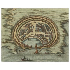
View AllAntique Map of the Siege of Syracuse by the Athenians, 1648 – Thucydides
Located in Langweer, NL
Antique Map of the Siege of Syracuse by the Athenians, 1648 – Thucydides
This finely engraved plan depicts the Siege of Syracuse, one of the most dramatic episodes of the Peloponnes...
Category
Antique Mid-17th Century English Maps
Materials
Paper
$705 Sale Price
20% Off
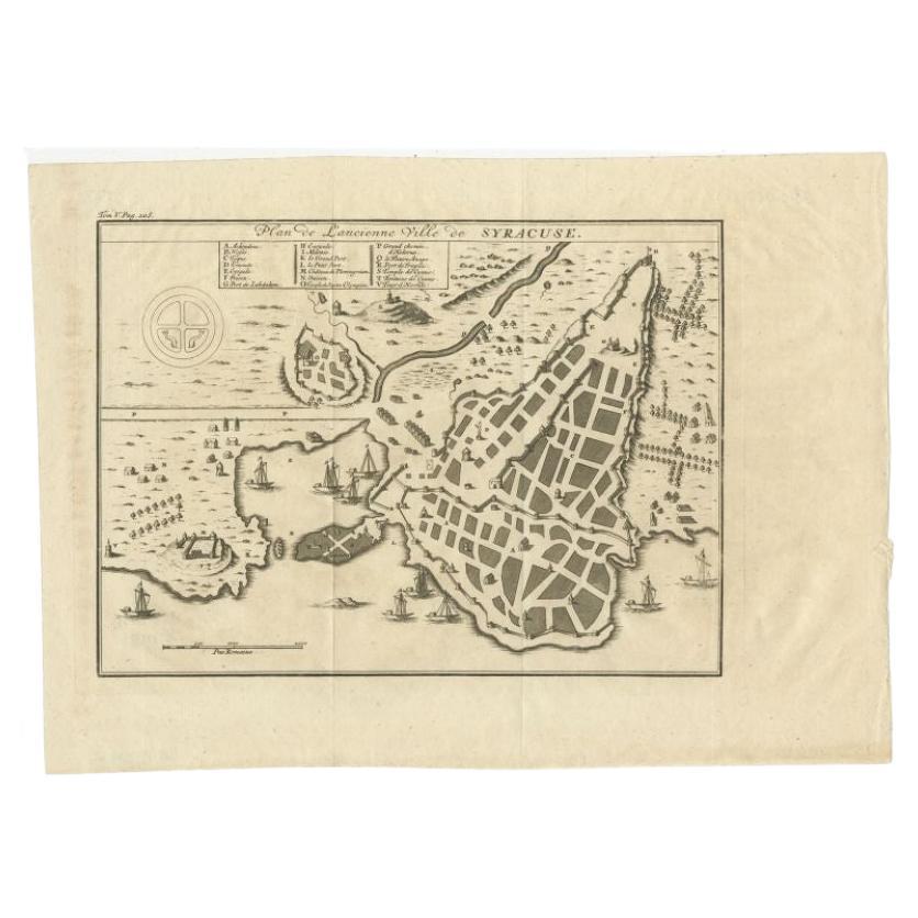
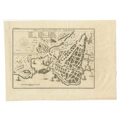
Antique Plan of Ancient Syracuse, cicily, Italy, 1740
Located in Langweer, NL
Antique print titled 'Plan de l'Ancienne Ville de Syracuse'. Plan of ancient Syracuse, Sicily, Italy. Source unknown, to be determined.
Artists and Engravers: Anonymous.
Condit...
Category
Antique 18th Century Maps
Materials
Paper
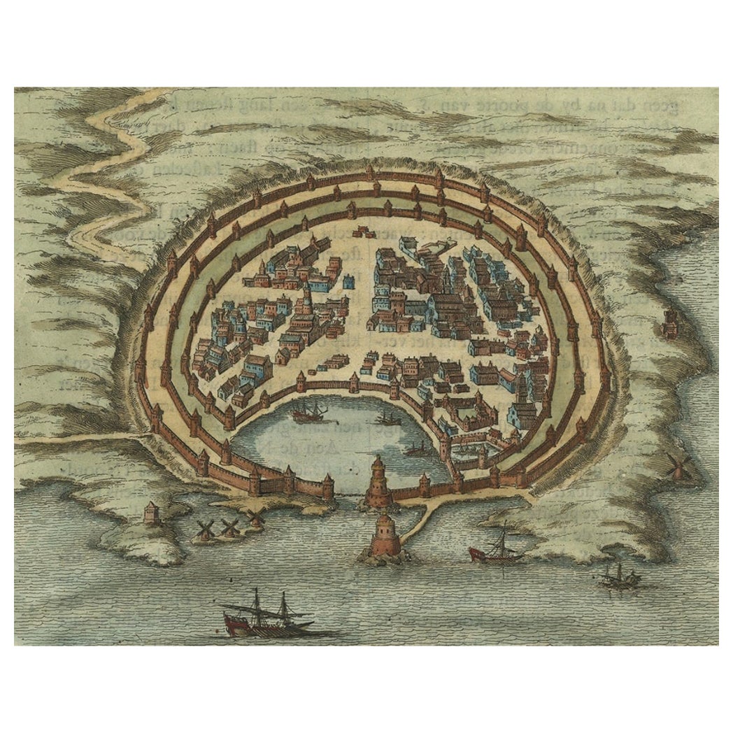
Antique Engraving with a Plan of Rhodes, Greece, 1688
Located in Langweer, NL
Description: Antique map, titled: 'Rhodos.' - Plan of Rhodes, Greece. This map originates from 'Nauwkeurige Beschrijving der eilanden in de in de Archipel der Middellantsche Zee', by...
Category
Antique 1680s Maps
Materials
Paper
$428 Sale Price
20% Off
Spectacular Antique Original Engraving of a Town Plan of Jerusalem, 1708
Located in Langweer, NL
Description: Antique map titled 'Erster Abriss der Stadt Jerusalem wie sie Furnemblich zur Zeit des Hernn Christi beschaffen (..).'
Spectacular town plan...
Category
Antique Early 1700s Maps
Materials
Paper

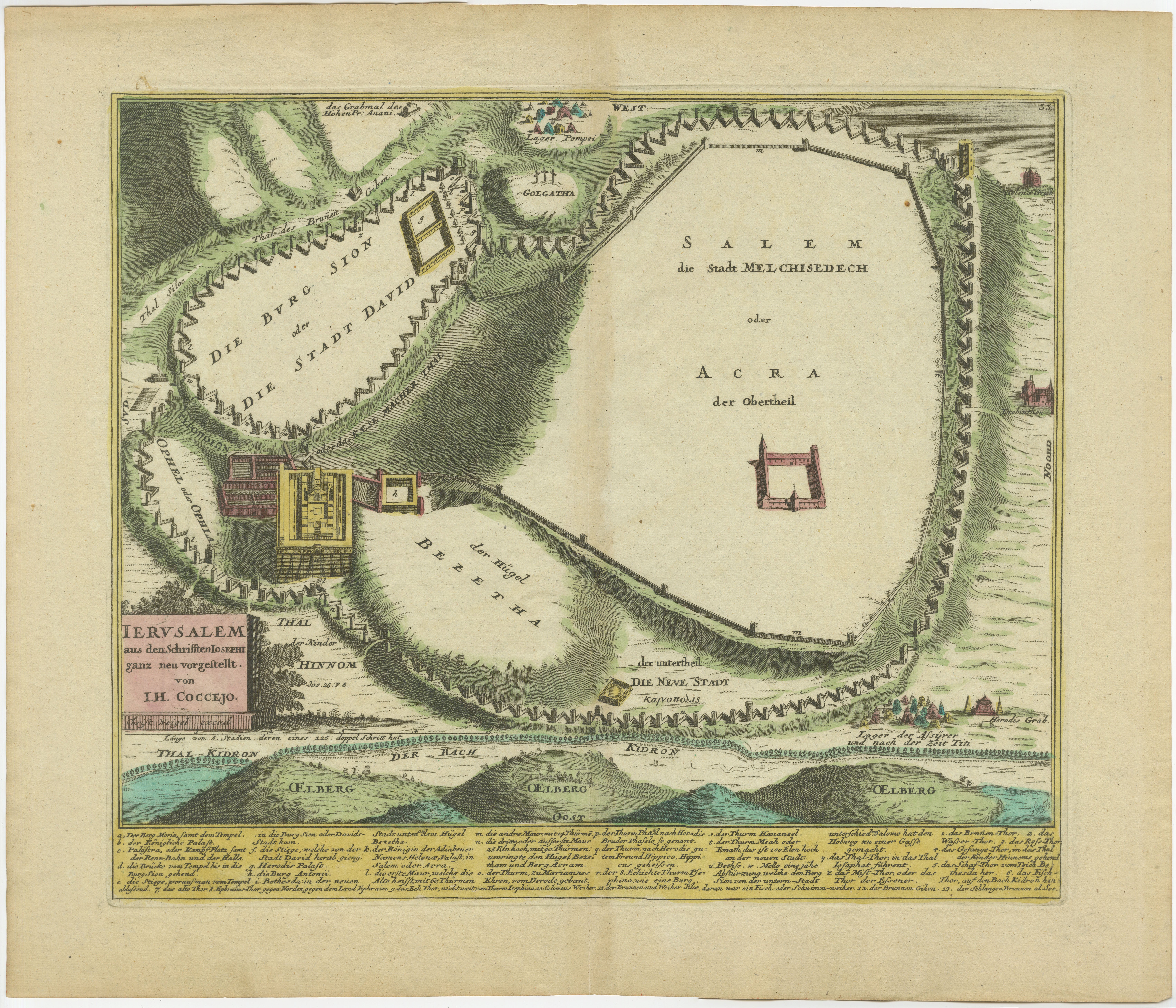
1720 Weigel Engraving of Jerusalem: A Biblical View from Josephus
Perspective
Located in Langweer, NL
1720 Weigel Map of Jerusalem Based on Josephus' Writings
This intricate 1720 bird's-eye view map of ancient Jerusalem by I.H. Coccejo, engraved by Christoph Weigel, offers a fasc...
Category
Antique 1720s Maps
Materials
Paper

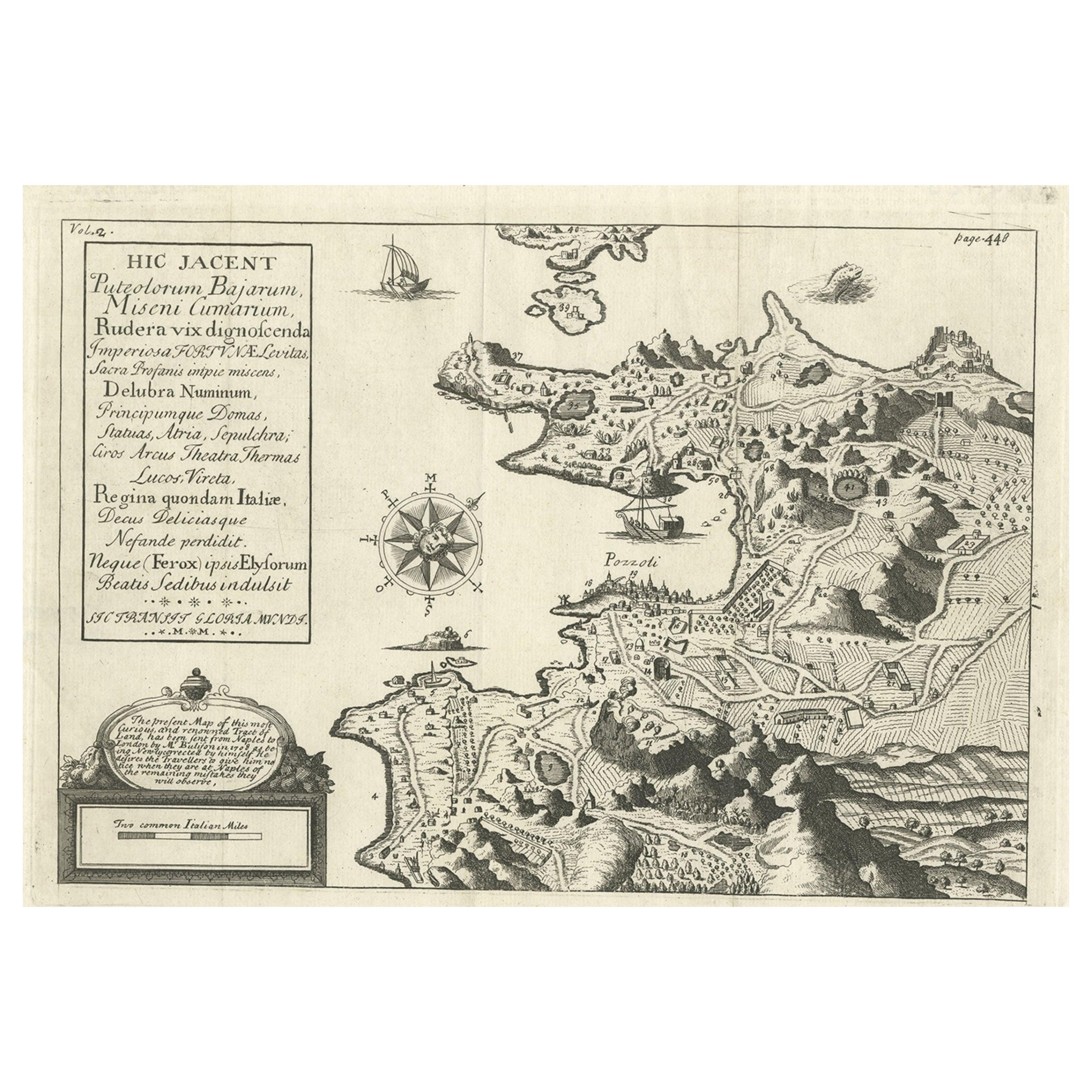
Old Original Map of Pozzuoli Near Naples in the Campania Region, Italy, ca.1740
Located in Langweer, NL
Antique map titled 'Hic Jacent Puteolorum Bajarum (..)'. Old map of the region of Pozzuoli showing the topographic and architectural features of interest. Pozzuoli is a city and comu...
Category
Antique 1740s Maps
Materials
Paper

You May Also Like
18th Century Map Engraving - Plan of the Works of the City of Messina, Sicily
Located in Corsham, GB
A map of Messina, a harbour city in northeast Sicily. Inscribed with the title in plate to the lower edge, 'Plan of the Works of the City of Messina, one of the strongest and most co...
Category
18th Century More Prints
Materials
Engraving

$285 Sale Price
20% Off
Corfu, Big Antique Map from "Civitates Orbis Terrarum" - 1572-1617
By Franz Hogenberg
Located in Roma, IT
Braun G. and Hogenberg F., Corfu, from the collection Civitates Orbis Terrarum, Cologne, T. Graminaeus, 1572-1617. Image dimensions: cm 19 x 48; dimensions: cm 40 x 70.
Very lovely ...
Category
16th Century Landscape Prints
Materials
Etching
17th Century Topographical Map of Cote D
azur, Avignon, Frejus by Iohan Peeters
Located in New York, NY
Fine topographical 17th century map by Iohan Peeters of the towns of Avignon and Frejus in the Cote d'Azur-Provence-Alpes Region of Southeastern France.
Beautifully suited decorativ...
Category
Antique 17th Century Dutch Maps
Materials
Paper

1597 German Map of Alexandria by Georg Braun and Frans Hogenberg
By Georg Braun and Frans Hogenberg
Located in Chapel Hill, NC
1597 Map of Alexandria by Georg Braun and Frans Hogenberg, Germany. From "Civitas Orbis Terrarum", part 2, published in Cologne by Bertram Buchholz. Printed in 2 parts. Title: "Alexa...
Category
Antique 16th Century German Renaissance Maps
Materials
Paper

$480 Sale Price
20% Off
Antique Voc Print Holland Malaysia Old Map Melaka History, 1663
Located in Amsterdam, Noord Holland
From my own collection I offer this impressive Antique print of the city of Malakka
A very interesting piece for collectors . It is an museum piece from the Dutch Institute of Orien...
Category
Antique 17th Century European Paintings
Materials
Paper

$293 Sale Price
20% Off
18th Century French Map and City View of Joppe/Jaffa (Tel Aviv) by Sanson
By Nicholas Sanson d
Abbeville
Located in Alamo, CA
An original antique engraving entitled "Joppe; in ’t Hebreeusch by ouds Japho; hedendaags Japha, of Jaffa; volgens d’aftekening gedaan 1668", by Nicholas Sanson d'Abbeville (1600 - 1667). This is a view of the city of Joppe (in Hebrew Japho), now called Japha or Jaffa, the harbor portion of modern day Tel Aviv, Israel as it appeared in 1668 . It depicts a very busy harbor with numerous boats. A large ship on the left appears to be firing its canons and a small ship on the right appears to be sitting very low in the water, either heavily loaded with cargo or sinking. The town is seen on the far shore with a fortress on a hill across in the background. The map is printed from the original Sanson copperplate and was published in 1709 by his descendants.
The map is presented in an ornate brown wood frame embellished by gold-colored leaves and gold inner trim with a double mat; the outer mat is cream-colored and the inner mat is black. There is a central vertical fold, as issued. There are two small spots in the lower margin and one in the upper margin, as well as two tiny spots adjacent to the central fold. 1717 is written below the date 1668 in the inscription. The map is otherwise in very good condition.
Another map of the "Holy Land" (by Claes Visscher in 1663), with an identical style frame and mat is available. This pair of maps would make a wonderful display grouping. Please see Reference #LU117324709892.
Artist: Nicholas Sanson d'Abbeville (1600 - 1667) and his descendents were important French cartographer's active through the 17th century. Sanson started his career as a historian and initially utilized cartography to illustrate his historical treatises. His maps came to the attention of Cardinal Richelieu and then King Louis XIII of France, who became a supporter and sponsor. He subsequently appointed Sanson 'Geographe Ordinaire du Roi' the official map maker to the king. Sanson not only created maps for the king, but advised him on geographical issues and curated his map collection...
Category
Early 1700s Prints and Multiples
Materials
Engraving

More Ways To Browse
Italian Engraving
Old Copper
Siege Antique
Syracuse Used Furniture
Antique Map Of Thailand
Louisiana Antique Furniture
Map Of Ancient Greece
Map Of Native American Tribes
Old Spice
Romania Map
Used Furniture Nova Scotia
18th Century Scottish Collectibles
Antique Furniture Northumberland
Antique Map Nova Scotia
Antique Map Palestine
California Island Map
Constantinople Map
Croatian Antiques