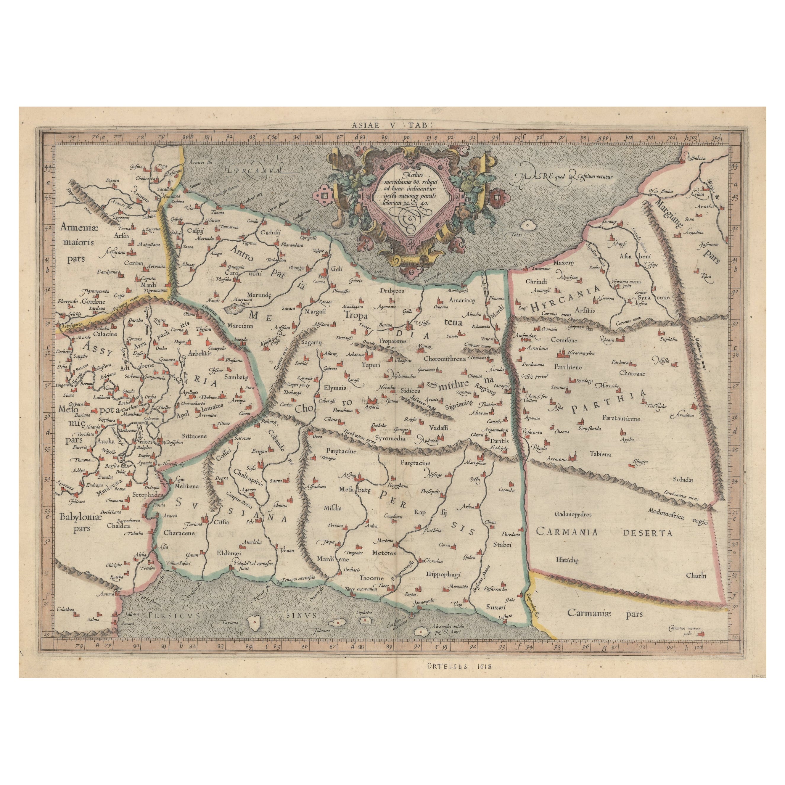
Items Similar to Old Map of Ancient Assyria Divided into Syria, Mesopotamia, Babylonia
Assyria
Want more images or videos?
Request additional images or videos from the seller
1 of 7
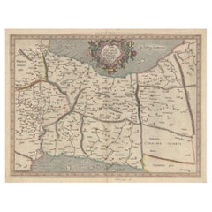
Old Map of Ancient Assyria Divided into Syria, Mesopotamia, Babylonia
Assyria
$735.67
£549.21
€620
CA$1,022.06
A$1,099.37
CHF 587.54
MX$12,958.48
NOK 7,407.46
SEK 6,771.83
DKK 4,725.10
About the Item
This map, "Assyria vetus diuisa in Syriam, Messopotamiam, Babyloniam, et Assyriam", by Pierre Mortier, is a late 17th-century depiction of the historical Middle East.
Title: Ancient Assyria Divided into Syria, Mesopotamia, Babylonia, and Assyria
Cartographer/Publisher: Pierre Mortier (1661–1711)
Publication Details:
- Place: Amsterdam
- Date: Circa 1700
Description: This historical map of the ancient Middle East, created by Pierre Mortier, depicts the region encompassing modern-day Israel, Lebanon, Syria, Jordan, and Iraq. It illustrates the ancient divisions of Assyria, including Syria, Mesopotamia, Babylonia, and Assyria proper.
Notable Features:
- Babylon:
The map prominently locates Babylon near the Euphrates River, highlighting its historical importance.
- Lacus Chaldaicus:
A large lake in southern Iraq, likely representing the Mesopotamian Marshes.
- Ancient Regions:
Includes the historical territories of Phoenicia, Palestine, Syria, Mesopotamia, and Assyria.
- Detailed Topography:
Rivers, cities, and mountain ranges are intricately engraved.
- Cartouche:
The title is displayed in a decorative cartouche in the lower right corner, featuring classical motifs.
This map reflects the geographical understanding of the late 17th century, with a focus on biblical and classical historical geography.
---
Background Information:
Pierre Mortier, a Dutch mapmaker and engraver, was born in Leiden to a family of French refugees. He gained the privilege to publish French maps in the Netherlands in 1690, bringing some of the finest cartographic works to Dutch audiences. Mortier’s maps are known for their artistic detail and precision. His son, Cornelis Mortier, would later partner with Johannes Covens I to establish the renowned Covens
Mortier publishing firm.
This map of Assyria serves as a testament to Mortier’s skill in blending historical cartography with artistic expression, making it both a scholarly and decorative piece.
Condition:
The map is in very good condition for its age, with clear, well-preserved engraving and vibrant hand-coloring. Minimal age-toning and edge wear are present, consistent with 17th-century prints.
---
Keywords:
- Pierre Mortier map
- Ancient Assyria map
- Historical Middle East map
- Babylon map
- Mesopotamia map
- 17th-century cartography
- Phoenicia and Palestine
- Antique map of Syria
- Decorative cartouche
- Biblical geography
- Dimensions:Height: 20.48 in (52 cm)Width: 24.41 in (62 cm)Depth: 0.01 in (0.2 mm)
- Materials and Techniques:Paper,Engraved
- Period:1700-1709
- Date of Manufacture:circa 1700
- Condition:The map is in very good condition for its age, with clear, well-preserved engraving and vibrant hand-coloring. Minimal age-toning and edge wear are present, consistent with 17th-century prints.
- Seller Location:Langweer, NL
- Reference Number:Seller: BG-14043-41stDibs: LU3054343433902
About the Seller
5.0
Recognized Seller
These prestigious sellers are industry leaders and represent the highest echelon for item quality and design.
Platinum Seller
Premium sellers with a 4.7+ rating and 24-hour response times
Established in 2009
1stDibs seller since 2017
2,836 sales on 1stDibs
Typical response time: 1 hour
- ShippingRetrieving quote...Shipping from: Langweer, Netherlands
- Return Policy
More From This Seller
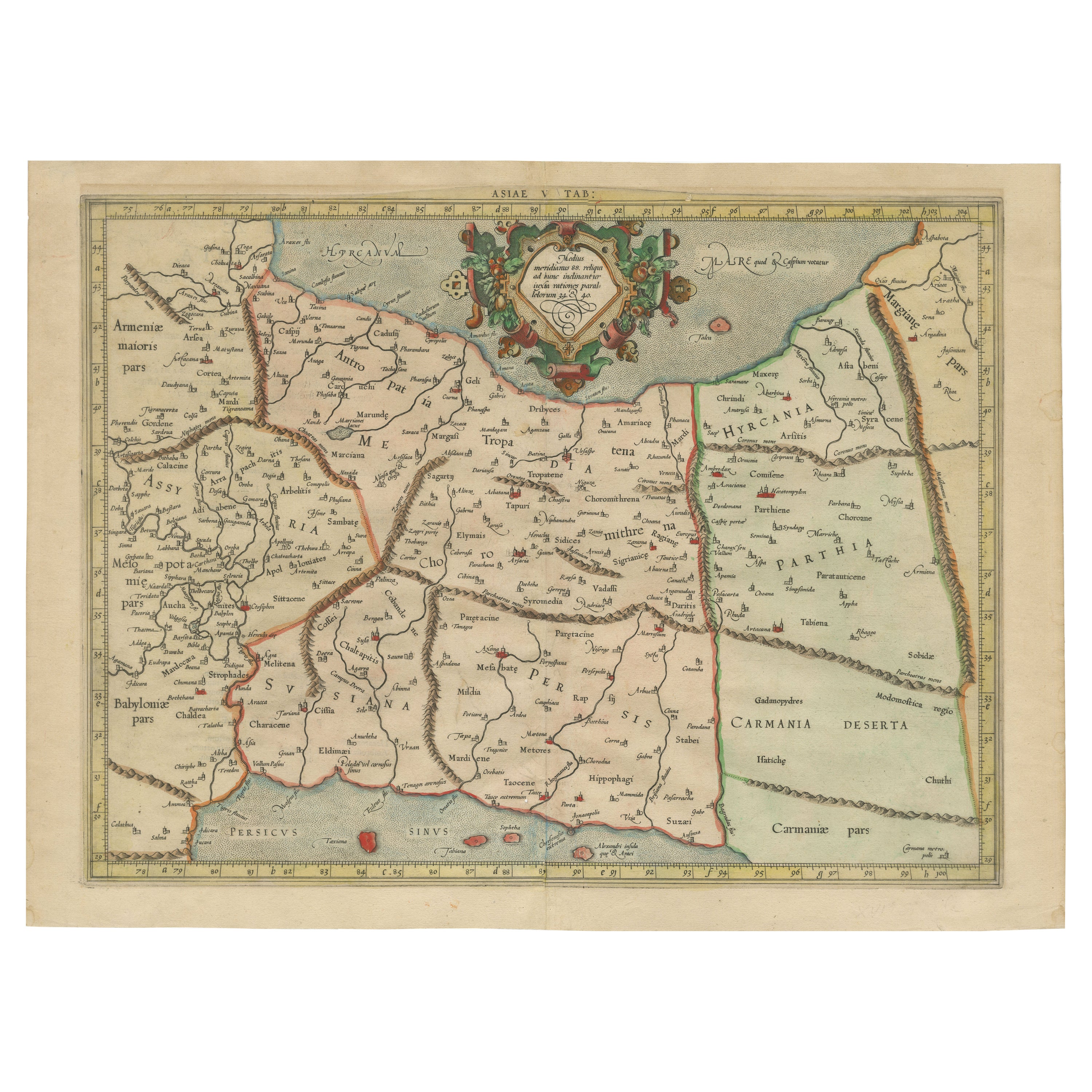
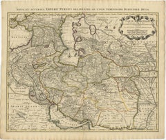
View AllMercator
s Ptolemaic Map of Ancient Assyria, Media, and Persia
Located in Langweer, NL
This map, "Asiae I Tab:", features the region corresponding to modern-day Iran and Iraq, intricately depicted in Gerard Mercator's edition of Claudius Ptolemy's "Tabulae Geographicae...
Category
Antique 16th Century Maps
Materials
Paper
$1,082 Sale Price
20% Off
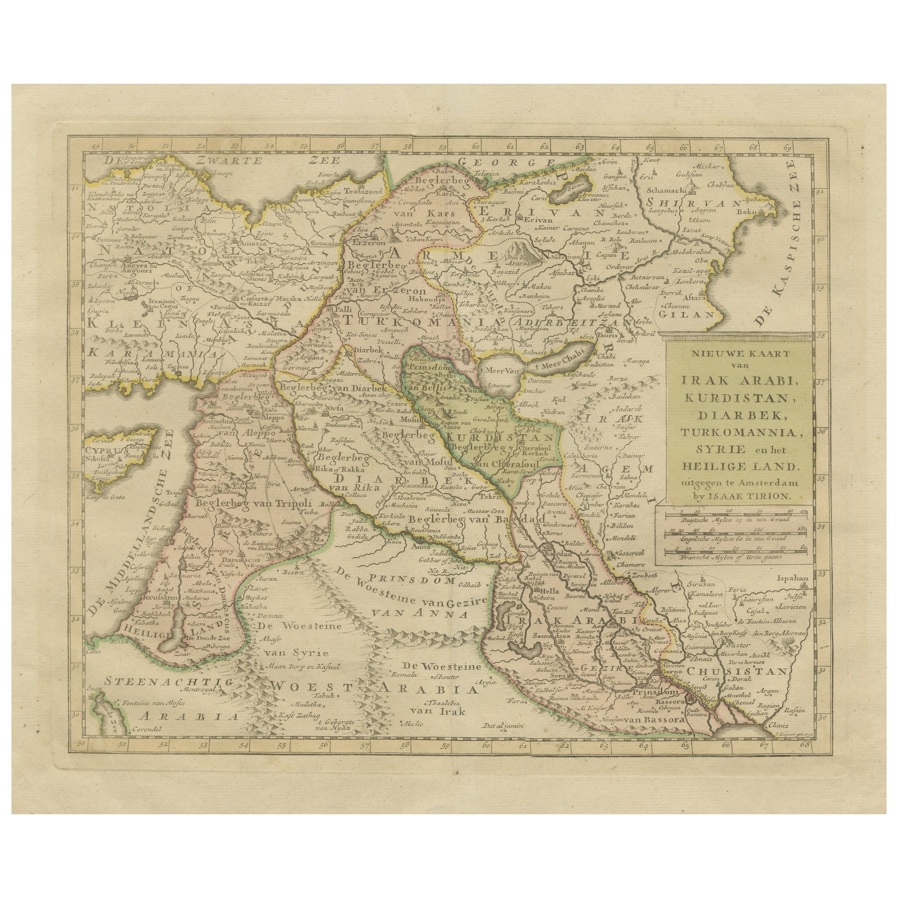
Antique Map of Eastern Turkey, Caucasus, Israel through Iraq and part of Arabia
Located in Langweer, NL
Antique map titled 'Nieuwe Kaart van Irak Arabia, Kurdistan, Diarbek, Turkomannia, Syrie en het Heilige Land'. Beautiful map including eastern Turkey, the Caucasus, Israel through Ir...
Category
Antique Mid-18th Century Maps
Materials
Paper

$436 Sale Price
20% Off
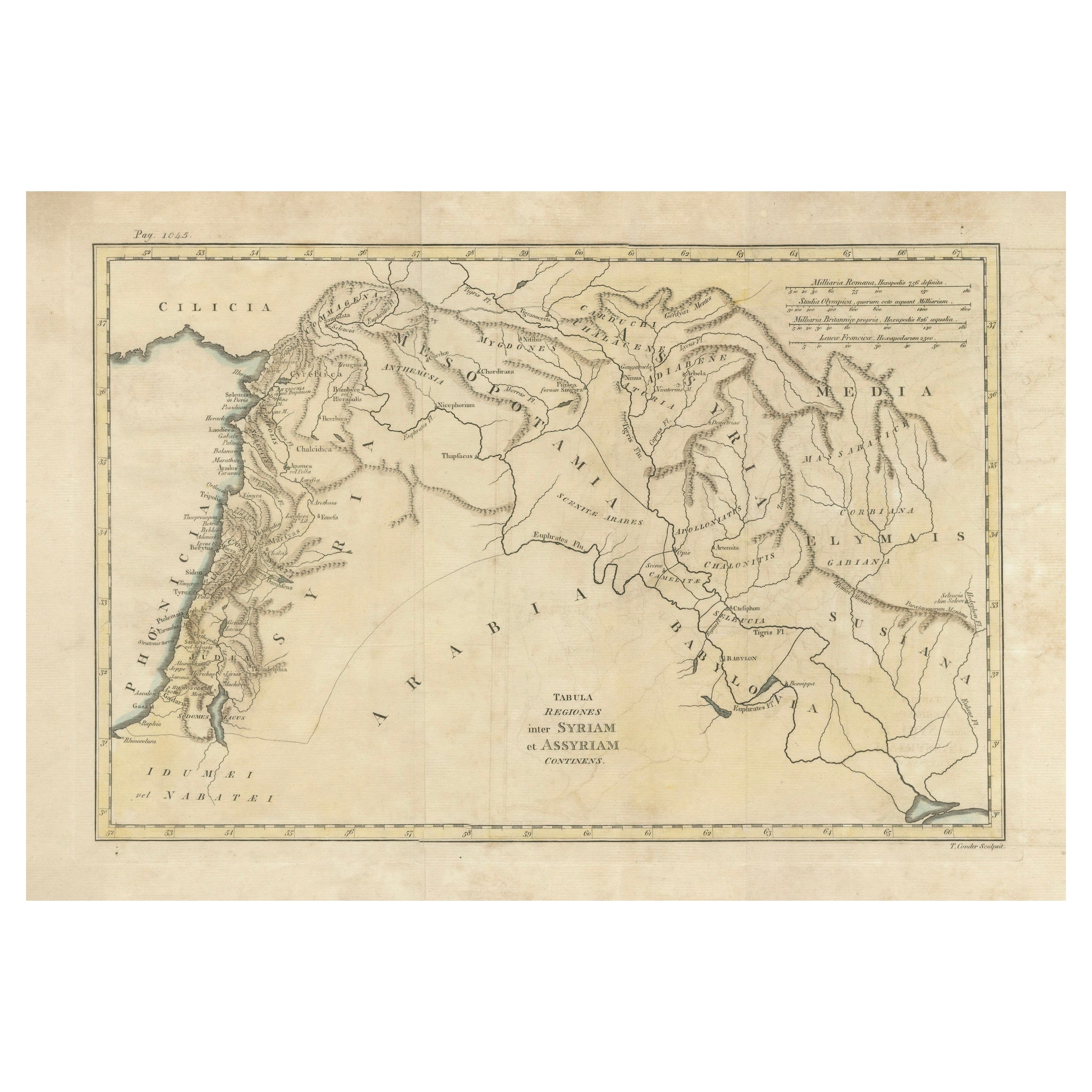
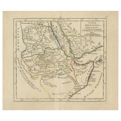
Antique 19th Century Map of Ancient Syria
Assyria - Historical Regions, c.1802
Located in Langweer, NL
19th Century Map of Ancient Syria and Assyria: 'Tabula Regiones inter Syriam et Assyriam continens'"*
This beautifully detailed 18th-century map, titled...
Category
Antique Early 1800s Maps
Materials
Paper
$294 Sale Price
20% Off
Exploring Ancient Persia: Ptolemaic Map of Iran and Iraq by Ptolemy and Mercator
Located in Langweer, NL
Claudius Ptolemy was a mathematician, astronomer and geographer who worked in Alexandria, then a part of the Roman Empire, in the 2nd century AD. One of the most learned and influent...
Category
Antique 1610s Maps
Materials
Paper
$465 Sale Price
20% Off
1742 Antique Map of the Persian Empire with Detailed Borders and Cartouche
Located in Langweer, NL
Title: 1742 Covens & Mortier Map of the Persian Empire by Guillaume De L'Isle
This remarkable 1742 map, "Carte de Perse," was originally designed by Guillaume De L'Isle, a preemin...
Category
Antique 1740s Dutch Maps
Materials
Paper
$1,537 Sale Price
20% Off
Antique Map of Abyssinia, Sudan and the Red Sea, Arabia and Egypt South, 1749
Located in Langweer, NL
Antique map titled 'Nubie, Abissinie et Cote d'Ajan'. Map of Abyssinia, Sudan and the Red Sea by Robert Vaugondy. Covers from Arabia and Egypt south to Mogadishu and includes parts o...
Category
Antique 18th Century Maps
Materials
Paper
You May Also Like
Map of the Holy Land "Carte de la Syrie et de l
Egypte" by Pierre M. Lapie
By Pierre M. Lapie
Located in Alamo, CA
An early 19th century map of ancient Syria and Egypt entitled "Carte de la Syrie et de l'Egypte anciennes/dressée par M. Lapie, Colonel d'Etat Major, et...
Category
Antique Early 19th Century French Maps
Materials
Paper

Persia, Armenia
Adjacent Regions: A 17th Century Hand-colored Map by De Wit
By Frederick de Wit
Located in Alamo, CA
A large 17th century hand colored copperplate engraved map entitled "Novissima nec non Perfectissima Scandinaviae Tabula comprehendens Regnorum Sueciae, Daniae et Norvegiae distincte...
Category
Antique Late 17th Century Dutch Maps
Materials
Paper

Map of the Holy Land "Carte de la Syrie et de l
Egypte" by Pierre Lapie
By Pierre M. Lapie
Located in Alamo, CA
This is an early 19th century map of ancient Syria and Egypt entitled "Carte de la Syrie et de l'Egypte anciennes/dressée par M. Lapie, Colonel d'Etat M...
Category
1830s Landscape Prints
Materials
Engraving

Original Antique Map of Ancient Greece- Boeotia, Thebes, 1787
Located in St Annes, Lancashire
Great map of Ancient Greece. Showing the region of Boeotia, including Thebes
Drawn by J.D. Barbie Du Bocage
Copper plate engraving by P.F T...
Category
Antique 1780s French Other Maps
Materials
Paper

Original Antique Map of Ancient Greece, Achaia, Corinth, 1786
Located in St Annes, Lancashire
Great map of Ancient Greece. Showing the region of Thessaly, including Mount Olympus
Drawn by J.D. Barbie Du Bocage
Copper plate engraving by P.F Tardieu
Original hand color...
Category
Antique 1780s French Other Maps
Materials
Paper

1718 Ides
Witsen Map "Route D
amsterdam a Moscow Et De La Ispahan Et Gamron
Located in Norton, MA
1718 Ides & Witsen map, entitled
"Route D'Amsterdam A Moscow Et De La Ispahan Et Gamron,"
Ric.b005
Subject: Eastern Europe and Central Asia
Period: 1718 (published)
Publicati...
Category
Antique Early 18th Century Dutch Maps
Materials
Paper

More Ways To Browse
Antique Syrian
Palestine Antique
Antique Syrian Furniture
Blue Green Wool And Silk Rug
Brown Sheepskin Chair
Vintage Brass Bar Carts
Antique Botanical Prints
Green Persian Rug
50 X 50 Coffee Table
Milo Baughman 1970
Spanish Baroque Furniture
Stone China
Couch Console
Vintage Burn
Chinese Stone
Sterling Silver Flatware Service For 12
Antique Dining Tables With Leaves
Decorative Wall Panels