Items Similar to Old Map Depicting the Entire Earth
s Surface Divided into Six Parts France 1850
Want more images or videos?
Request additional images or videos from the seller
1 of 17
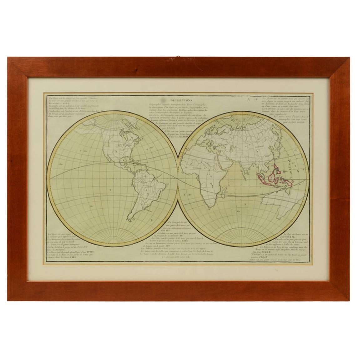
Old Map Depicting the Entire Earth
s Surface Divided into Six Parts France 1850
$1,550.25
£1,147.90
€1,300
CA$2,141.26
A$2,293.29
CHF 1,232.86
MX$27,853.37
NOK 15,577.76
SEK 14,262.60
DKK 9,907.64
About the Item
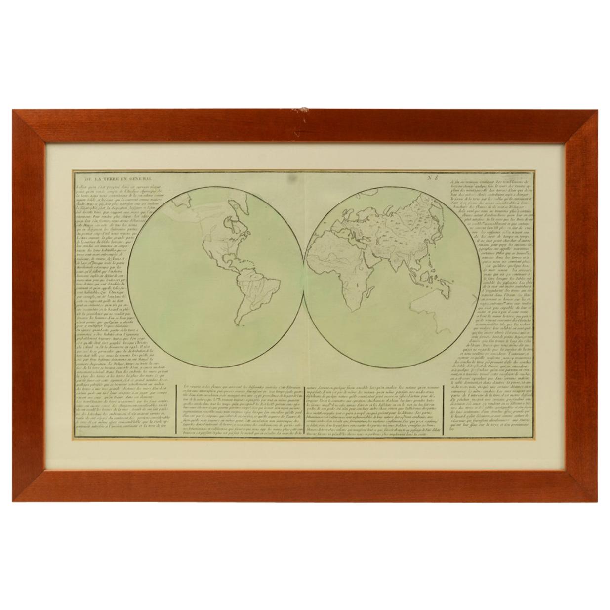
Map depicting the entire earth's surface divided into six parts which depicts the position of peoples on Earth based on the assumption that it is impossible for each people to have the same relationship with Heaven, seasons, and days and hours at the same time of the day. Detailed explanation in French. Printed on paper by engraving on copper plate, coeval coloring. Table n. 6, French manufacture from the mid-19th century, non-contemporary frame made of cherrywood. Size with frame 70.5 x 47 cm - 27.7 x 18.5 inches, thickness of the frame 2 cm - 0.78 inches.
- Dimensions:Height: 18.51 in (47 cm)Width: 27.76 in (70.5 cm)Depth: 0.79 in (2 cm)
- Materials and Techniques:
- Place of Origin:
- Period:
- Date of Manufacture:Mid-19th Century
- Condition:Wear consistent with age and use.
- Seller Location:Milan, IT
- Reference Number:1stDibs: LU1020220894122
About the Seller
5.0
Gold Seller
Premium sellers maintaining a 4.3+ rating and 24-hour response times
Established in 1999
1stDibs seller since 2014
403 sales on 1stDibs
Typical response time: 6 hours
- ShippingRetrieving quote...Shipping from: Milan, Italy
- Return Policy
More From This Seller
View All1850 Old French Map Depicting the Entire Earth
s Surface Divided into Two Parts
Located in Milan, IT
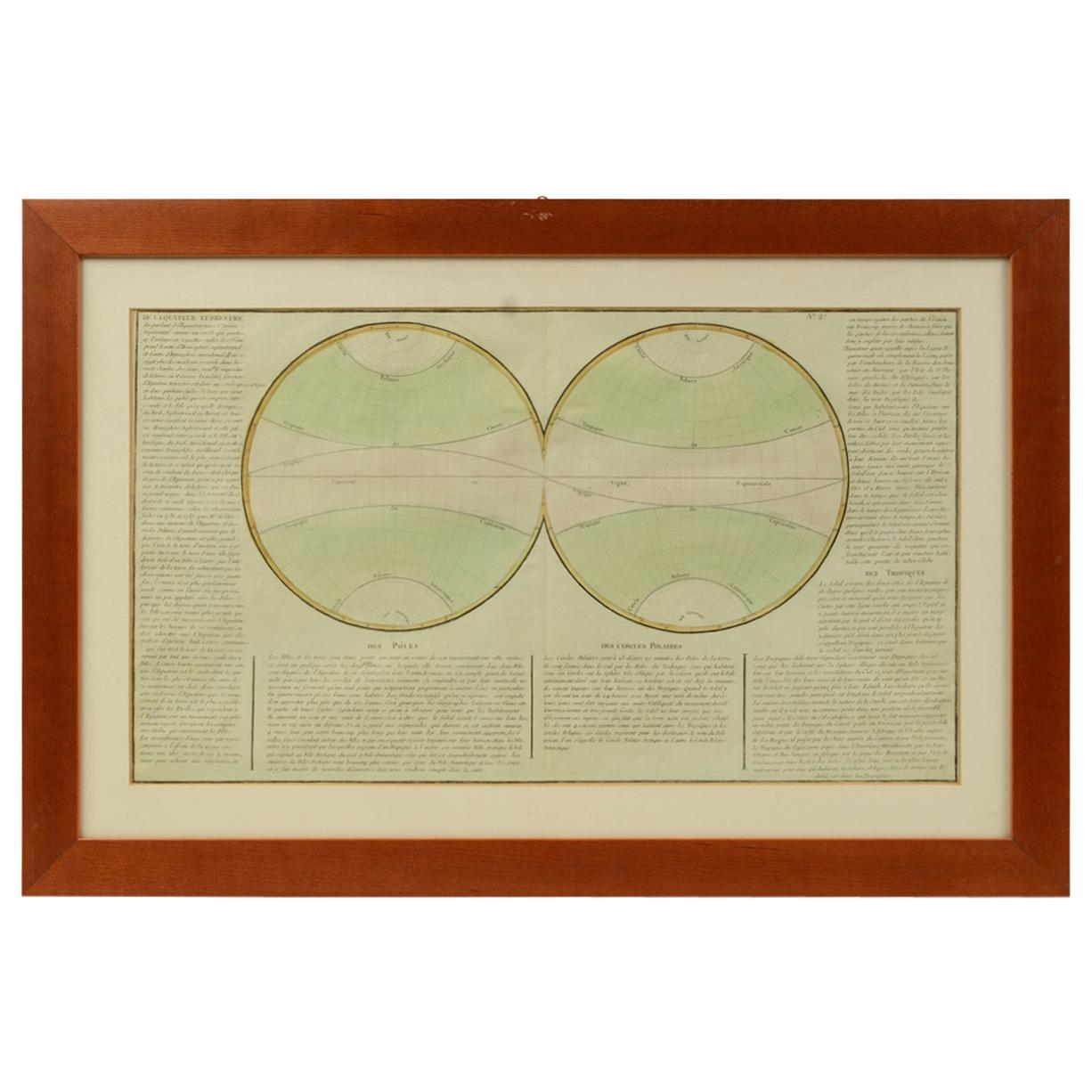
Map depicting the entire earth's surface divided into two parts corresponding to the two hemispheres and showing the Arctic to Antarctic polar circle, the tropics of Cancer and Capri...
Category
Antique Mid-19th Century French Maps
Materials
Glass, Wood, Paper
1850 Old French Map Depicting the Entire Earth
s Surface Divided into Two Parts
Located in Milan, IT
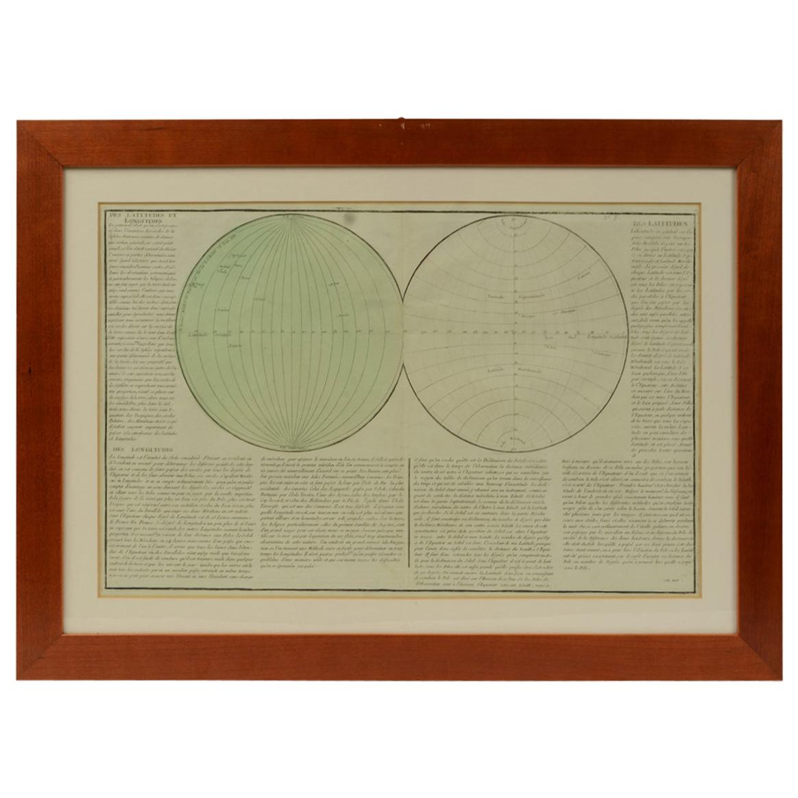
Geographical map depicting the entire earth’s surface divided into two parts that correspond to the two hemispheres or globes, the map deals with the latitudes and longitudes, the me...
Category
Antique Mid-19th Century French Maps
Materials
Glass, Wood, Paper

1850 Old French Map Depicting the Entire Earth
s Surface Divided into Two Parts
Located in Milan, IT
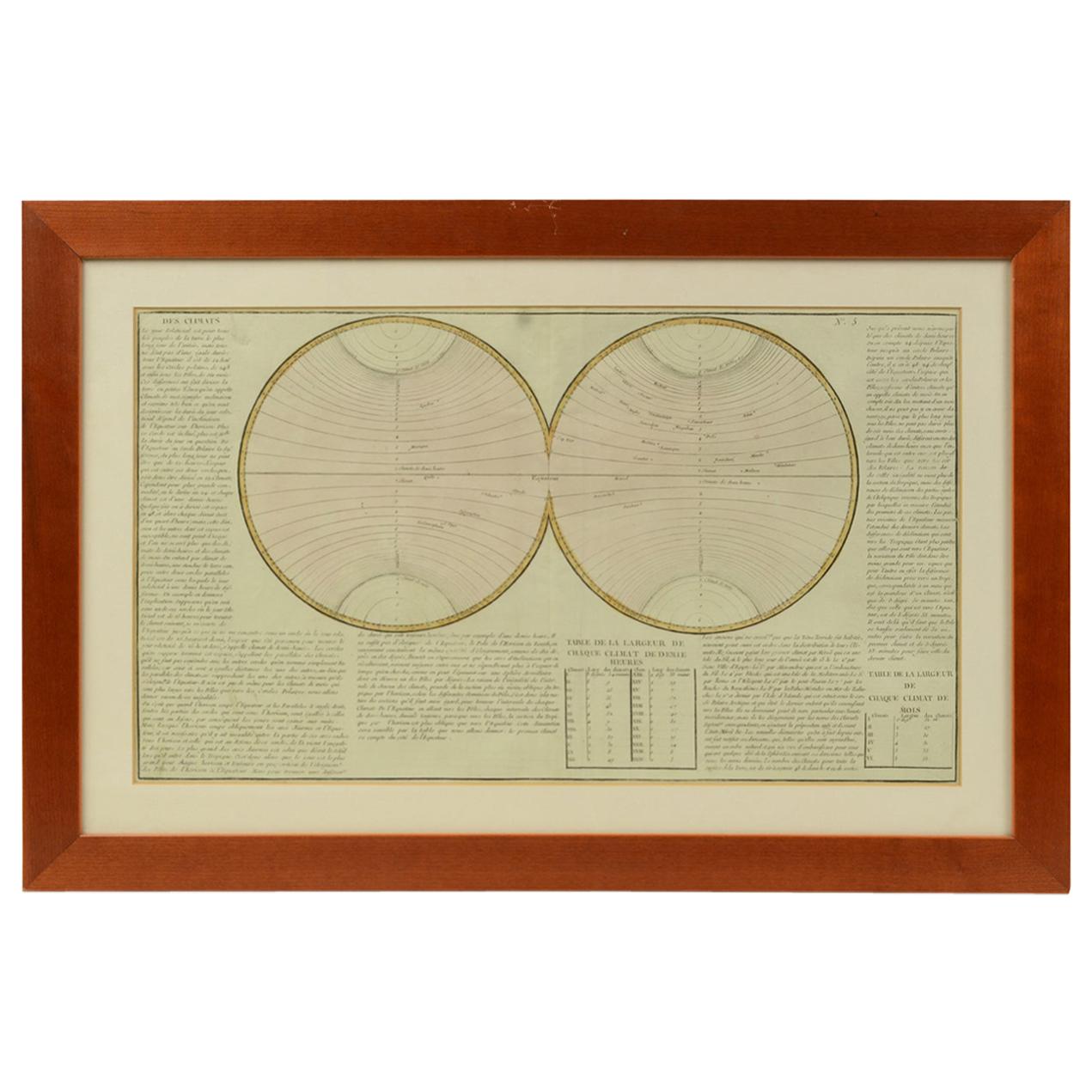
Geographical map depicting the entire earth's surface divided into two parts that correspond to the two hemispheres divided into small climatic zones that depict the climatic trend f...
Category
Antique Mid-19th Century French Scientific Instruments
Materials
Glass, Wood, Paper
1850 Old French Map Depicting the Entire Earth
s Surface Divided into Two Parts
Located in Milan, IT
Geographical map depicting the entire earth's surface divided into two parts that correspond to the two hemispheres or globes, the map deals with the earth in general. Detailed expla...
Category
Antique Mid-19th Century French Maps
Materials
Glass, Wood, Paper

1850 Old French Map Depicting the Entire Earth
s Surface Divided into Two Parts
Located in Milan, IT
Geographical map depicting the entire earth's surface divided into two parts that correspond to the two hemispheres where the emerged lands are depicted which have been classified wi...
Category
Antique Mid-19th Century French Maps
Materials
Glass, Wood, Paper

Carta ad uso del viaggio di Anacarsi il giovine del cartografo D
Anville 1790
Located in Milan, IT
Carta che riproduce la mappa dell’Accademia e i suoi contorni nei pressi di Atene ad uso del viaggio di Anacarsi il giovine, del Signor Barbie di Bocage; la carta, realizzata dal cartografo D'Anville, faceva parte dell'opera: Viaggio del giovane Anacarsi in Grecia di Jean Jacques Barthélemy (1716-1795), rinomato filologo e classicista, pubblicata in lingua italiana...
Category
Antique Late 18th Century Prints
Materials
Paper

You May Also Like
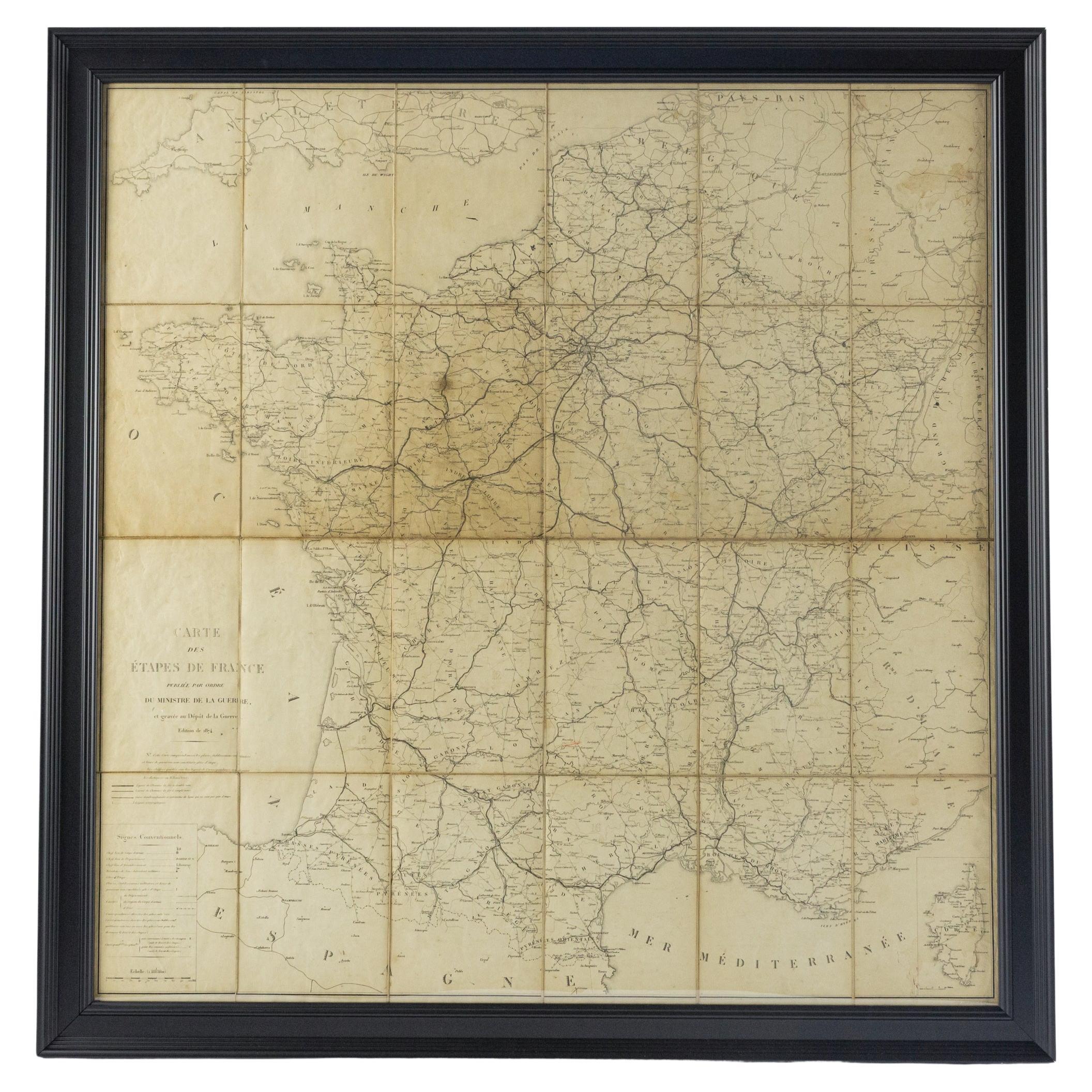
Large 19th Century Map of France
Located in Pease pottage, West Sussex
Large 19th Century Map of France.
Remarkable condition, with a pleasing age worn patina.
Recently framed.
France Circa 1874.
Category
Antique Late 19th Century French Maps
Materials
Linen, Paper

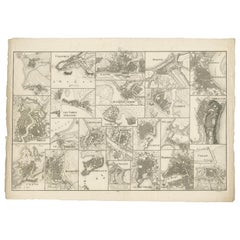
Antique Map of Various Ports in France by Röder
circa 1800
Located in Langweer, NL
Antique print showing various ports in France. Including plans of St. Malo, Granville, Nantes, Dieppe, Bourdeauz, Gibraltar, Lorient, Boulogne sur Mer, Les Sables d'Olonne, Brest, Le Trèport, Antibes, La Ciotat...
Category
Antique Early 19th Century Maps
Materials
Paper
$1,764 Sale Price
20% Off
Original Large Antique Map of Paris, France by John Dower, 1861
Located in St Annes, Lancashire
Fabulous monochrome map of Paris.
Vignettes of St Germain En Laye, Saint Cloud, Versailles and Fontainbleau.
Unframed.
Drawn by J.Dower.
Lithography by Weller. 4 sheets joined to...
Category
Antique 1860s English Victorian Maps
Materials
Paper

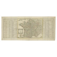
Antique Map of France by Covens
Son, c.1790
Located in Langweer, NL
A detailed description of the 'Carte de France divisée en 83 Departements (..)', an antique map circa 1790, along with information about its publishers, Covens & Mortier:
**Title**:...
Category
Antique 18th Century Maps
Materials
Paper
Plan of Paris, France, by A. Vuillemin, Antique Map, 1845
Located in Colorado Springs, CO
This large and detailed plan of Paris was published by Alexandre Vuillemin in 1845. The map conveys a wonderful amount of information and is decorated throughout with pictorial vigne...
Category
Antique 1840s American Maps
Materials
Paper

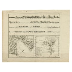
Antique Map of the Strait of Le Maire by Cook, 1803
Located in Langweer, NL
Antique map titled 'Kaart van de Good Success Baai in de Straat van Le Maire (..)'. Antique map of the Strait of Le Maire between Terra Fuego and Staten Island. On top, various coast...
Category
Antique 19th Century Maps
Materials
Paper
$601 Sale Price
20% Off