Items Similar to Old Print of the Spanish Conquest of Cusco or Cuzco, Capital of the Incas, c1750

Want more images or videos?
Request additional images or videos from the seller
1 of 5
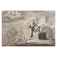
Old Print of the Spanish Conquest of Cusco or Cuzco, Capital of the Incas, c1750
$348.55
£258.18
€290
CA$476.81
A$519.69
CHF 274.76
MX$6,256.13
NOK 3,487.36
SEK 3,197.19
DKK 2,209.64
About the Item
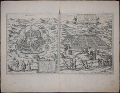
Antique print titled 'Grundriss von Cuzco bey der Eroberung von den Spaniern'.
Old plan of the city of Cusco, Peru, often spelled Cuzco. It shows Cusco during the conquest by the Spaniards. The city was the historic capital of the Inca Empire from the 13th century until the 16th-century Spanish conquest. Source unknown, to be determined.
Artists and Engravers: Anonymous.
Condition: Very good, general age-related toning. Minor wear, blank verso. Please study image carefully.
- Dimensions:Height: 9.65 in (24.5 cm)Width: 7.29 in (18.5 cm)Depth: 0 in (0.02 mm)
- Materials and Techniques:
- Period:1750-1759
- Date of Manufacture:circa 1750
- Condition:
- Seller Location:Langweer, NL
- Reference Number:Seller: BG-101101stDibs: LU3054326675502
About the Seller
5.0
Recognized Seller
These prestigious sellers are industry leaders and represent the highest echelon for item quality and design.
Platinum Seller
Premium sellers with a 4.7+ rating and 24-hour response times
Established in 2009
1stDibs seller since 2017
2,813 sales on 1stDibs
Typical response time: 1 hour
- ShippingRetrieving quote...Shipping from: Langweer, Netherlands
- Return Policy
More From This Seller
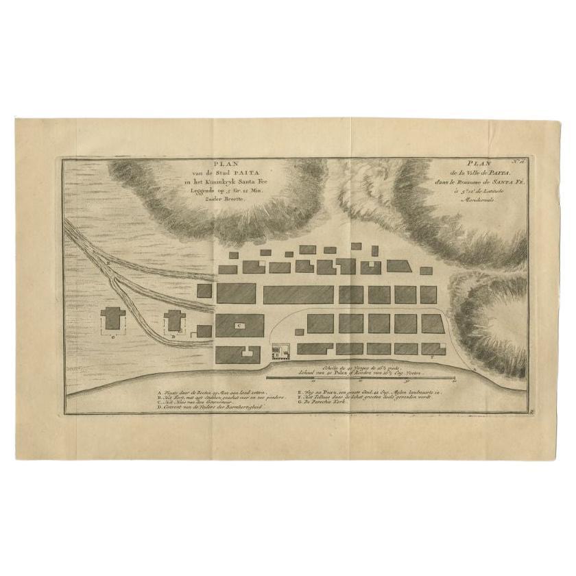
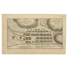
View AllAntique Plan of the City of Paita in Peru, by Anson, 1749
Located in Langweer, NL
Antique map titled 'Plan van de Stad Paita in het Koninkryk Santa Fee (..) - Plan de la Ville de Paita (..)'. Original antique plan of the city of Paita, Peru. This map originates fr...
Category
Antique 18th Century Maps
Materials
Paper
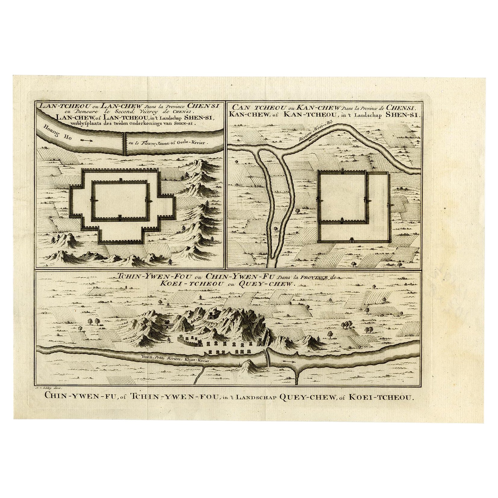
Antique Map of Three Chinese Cities in Chensi and Koei Tcheou, c.1758
Located in Langweer, NL
Antique map titled 'Lan-Tcheou ou Lan-Chew dan la province Chensi; Can Tcheou ou Kan-Chew dan la province de Chensi; Tchin-Ywe-Fou ou Chin-Ywen-Fu dans la province de Koei-Tcheou ou Quey-chew.' Three plans of old Chinese cities...
Category
Antique 18th Century Maps
Materials
Paper

Spectacular Antique Original Engraving of a Town Plan of Jerusalem, 1708
Located in Langweer, NL
Description: Antique map titled 'Erster Abriss der Stadt Jerusalem wie sie Furnemblich zur Zeit des Hernn Christi beschaffen (..).'
Spectacular town plan...
Category
Antique Early 1700s Maps
Materials
Paper

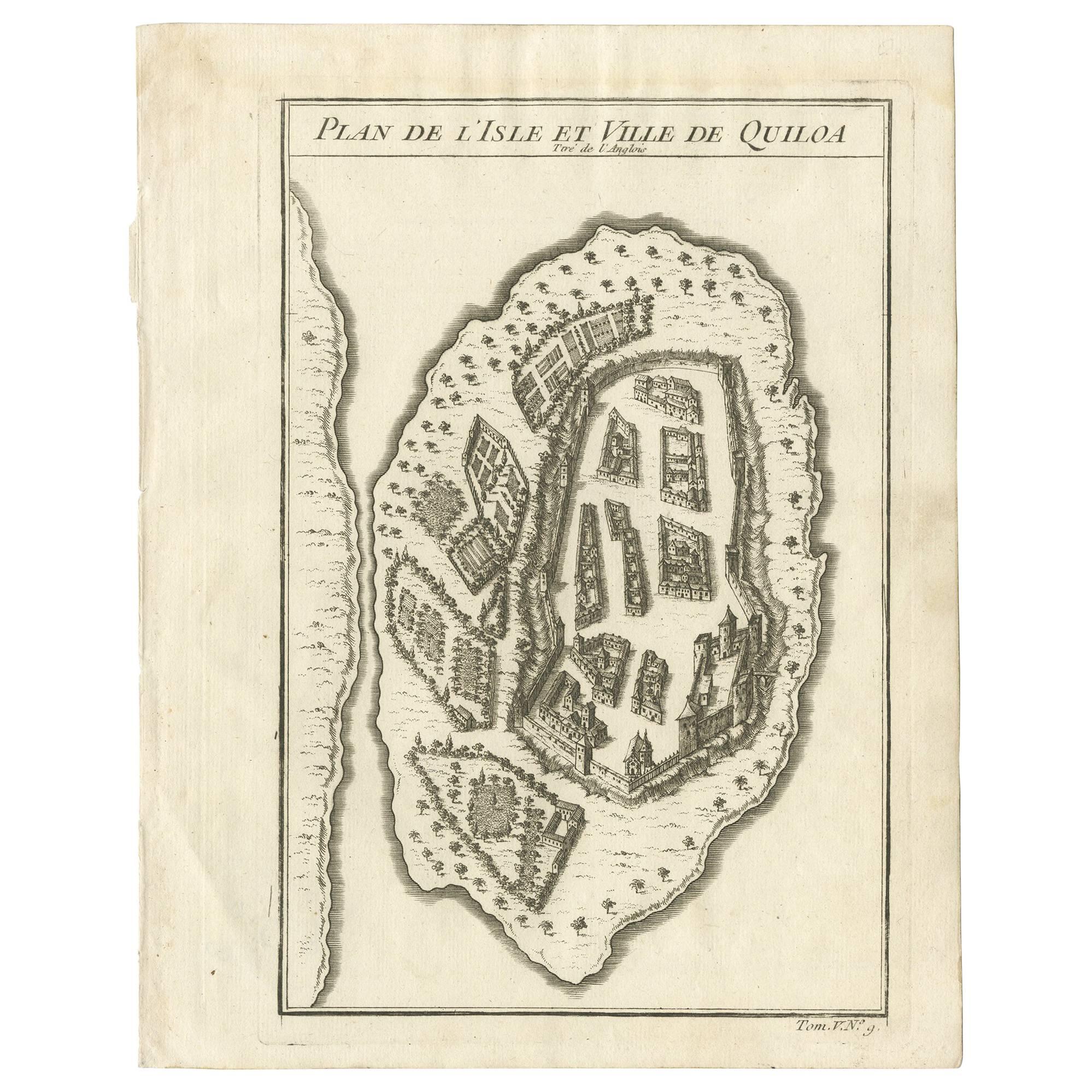
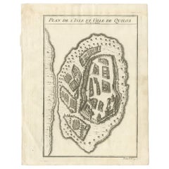
Antique Print of Quiloa
Africa
by J.N. Bellin, circa 1750
Located in Langweer, NL
This bird's-eye view show the East African island of Quiloa, now known as Kilwa Kisiwani in Tanzania. Printed circa 1750, the map shows the fort, settlements, and gardens of the isla...
Category
Antique Mid-18th Century Prints
Materials
Paper
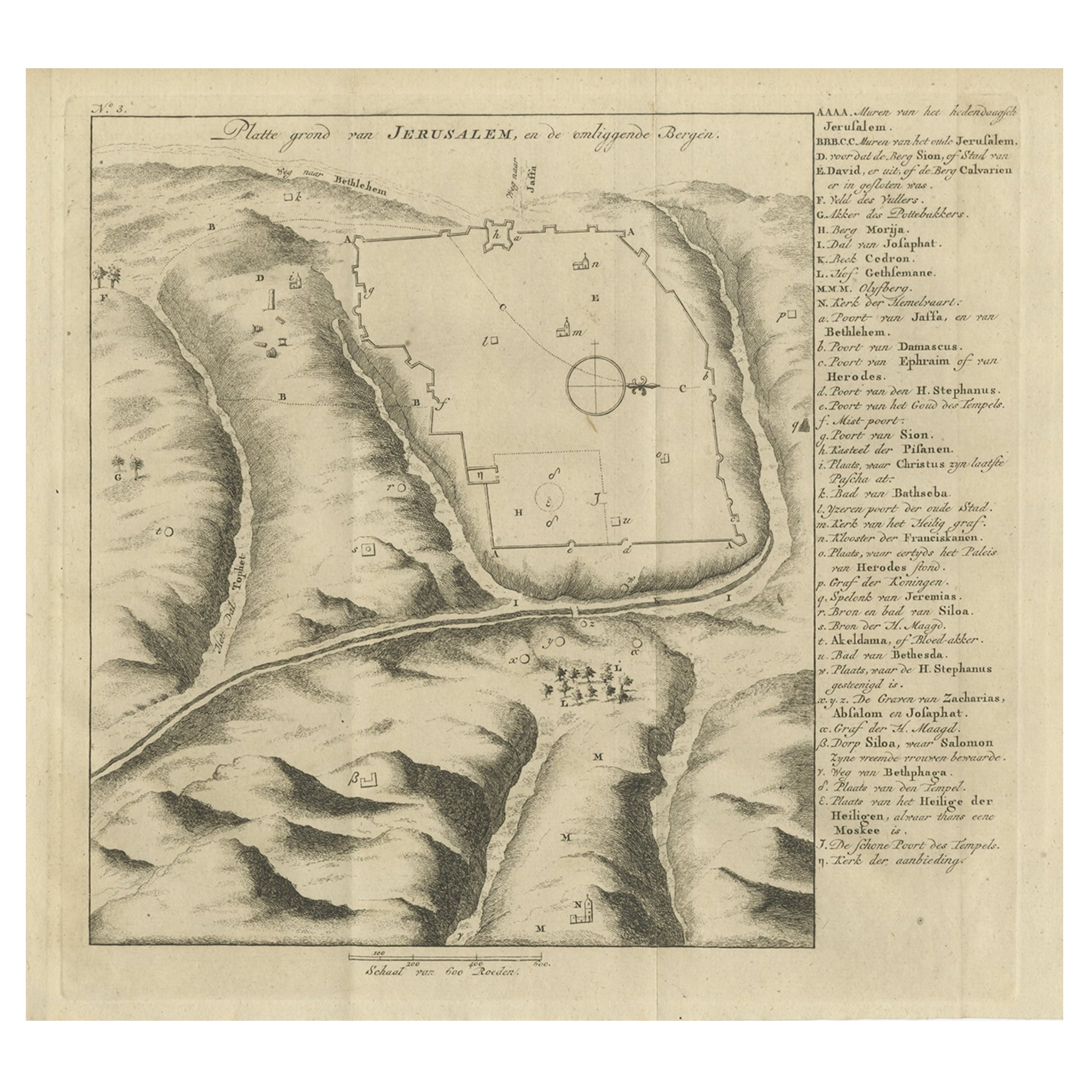
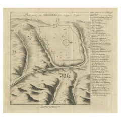
Antique Engraving of a Map or Plan of Jerusalem and Surrounding Mountains, 1773
Located in Langweer, NL
Antique map titled 'Platte grond van Jerusalem, en de omliggende Bergen'. Plan of the city of Jerusalem, with surrounding mountains. Originates from the first Dutch editon of an inte...
Category
Antique 18th Century Maps
Materials
Paper
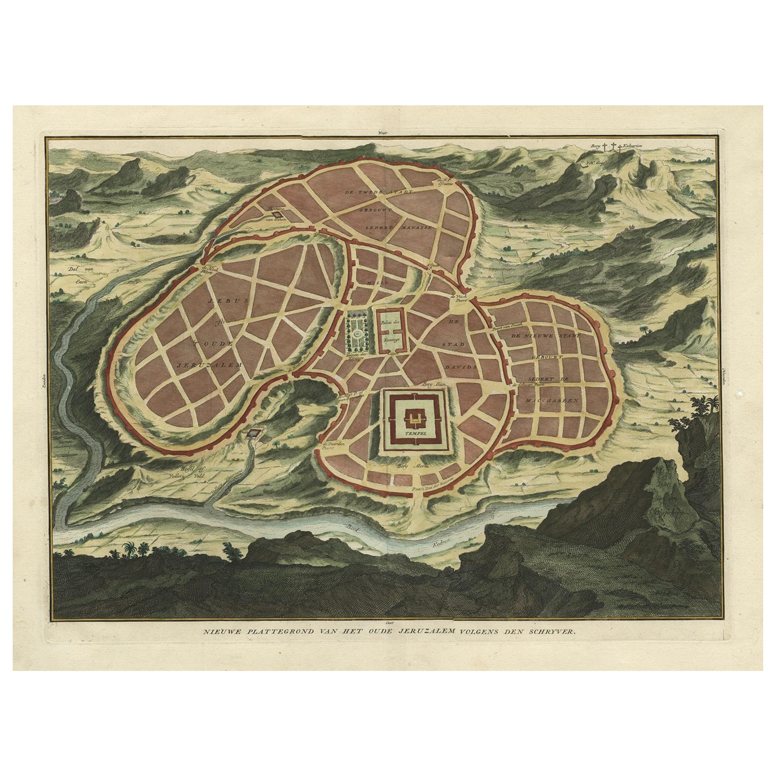
Antique Map of Ancient Jerusalem, depicting The Temple of Solomon, c.1725
Located in Langweer, NL
Antique map titled 'Nieuwe Plattegrond van het Oude Jeruzalem Volgens den Schryver.'
Bird's-eye view of the ancient city of Jerusalem shows its divisions with prominent depictions ...
Category
Antique 18th Century French Maps
Materials
Paper

You May Also Like
Mexico City
Cusco Antique Map, Civitates Orbis Terrarum by Braun
Hogenberg
By Franz Hogenberg
Located in Roma, IT
Etching black and white from Civitates Orbis Terrarum. View of the Old Mexico City, built over the ruins of the Aztec city of Tenochtitlán from 1520, and Cusco, ancient capital of th...
Category
16th Century Landscape Prints
Materials
Etching
17th Century Italian Gravure, Theatrum Statuum Sabaudiae, circa 1682
By Joan (Johannes) Blaeu
Located in Miami, FL
17th century Italian Gravure/Cartography
Le Theatrum statuum Regiae Celsitudinis Sabaudiæ Ducis or at Theatrum Statum Sabaudiæ, is a representative and iconographic representation f...
Category
Antique 17th Century Italian Historical Memorabilia
Materials
Paper
$450 Sale Price
52% Off
Map - Etching by Nicola Fiorillo - 18th Century
Located in Roma, IT
Map from "Antiquities of Herculaneum" is an etching on paper realized by Nicola Fiorillo in the 18th Century.
Signed on the plate.
Good conditions with some folding and foxing.
Th...
Category
18th Century Old Masters Figurative Prints
Materials
Etching
Map of Kalkar - Etching by G. Braun and F. Hogenberg - Late 16th Century
By Franz Hogenberg
Located in Roma, IT
This map of Calcaria is an original etching realized by George Braun and Franz Hogenberg, as part of the famous Series "Civitates Orbis Terrarum" (Atlas of the Cities of the World)....
Category
16th Century Figurative Prints
Materials
Etching
Architectural Roman Map - Etching by Vincenzo Scarpati - 18th Century
Located in Roma, IT
Architectural Roman Map from "Antiquities of Herculaneum" is an etching on paper realized by Vincenzo Scarpati in the 18th Century.
Signed on the plate.
Go...
Category
18th Century Old Masters Figurative Prints
Materials
Etching

Original Antique Print After Jan Luyken, Amsterdam, Genesis XXII. 1724
Located in St Annes, Lancashire
Wonderful copper-plate engraving after Jan Luyken
Published by Marten Schagen, Amsterdam. 1724
Text on verso
The measurement given is the paper size.
Category
Antique 1720s Dutch Renaissance Prints
Materials
Paper
More Ways To Browse
16th Century Spanish
Inca Antique
Antique Maps Of Russian Empire
J C Walker Map
Massachusetts Antiques
Persian Maps
Afghanistan Antique Map
Antique Furniture Delaware
Antique Furniture Wisconsin
Antique Map By Coronelli
Antique Map Iceland
Cyprus Antique Maps
John Speed Maps
M Howard
Used Office Furniture Michigan
Antique Geological Maps
Antique Manitoba
Australian Colonial