Items Similar to Original Antique Map of Africa


Want more images or videos?
Request additional images or videos from the seller
1 of 7
Original Antique Map of Africa
$326.39
$407.9920% Off
£241.87
£302.3420% Off
€272
€34020% Off
CA$446.08
CA$557.6020% Off
A$485.59
A$606.9920% Off
CHF 257.75
CHF 322.1920% Off
MX$5,842.71
MX$7,303.3920% Off
NOK 3,266.07
NOK 4,082.5920% Off
SEK 2,992.64
SEK 3,740.8120% Off
DKK 2,071.91
DKK 2,589.8820% Off
About the Item
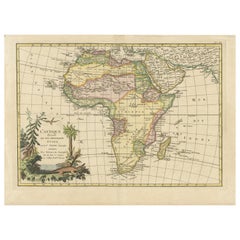
Antique map titled 'Afrika'. Original antique map of Africa, drawn by Van Beusekom. Published by 'Seyffardt's Boekhandel' in Amsterdam, circa 1870.
- Dimensions:Height: 13.39 in (34 cm)Width: 17.09 in (43.4 cm)Depth: 0.02 in (0.5 mm)
- Materials and Techniques:
- Period:
- Date of Manufacture:circa 1870
- Condition:Wear consistent with age and use. General age-related toning. Shows wear and soiling. Overall creasing. Original folding line, blank verso. Please study image carefully.
- Seller Location:Langweer, NL
- Reference Number:Seller: BG-11204-101stDibs: LU3054331109152
About the Seller
5.0
Recognized Seller
These prestigious sellers are industry leaders and represent the highest echelon for item quality and design.
Platinum Seller
Premium sellers with a 4.7+ rating and 24-hour response times
Established in 2009
1stDibs seller since 2017
2,819 sales on 1stDibs
Typical response time: 1 hour
- ShippingRetrieving quote...Shipping from: Langweer, Netherlands
- Return Policy
More From This Seller
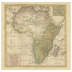
View AllAntique Map of Africa with Mountain Ranges and other details
Located in Langweer, NL
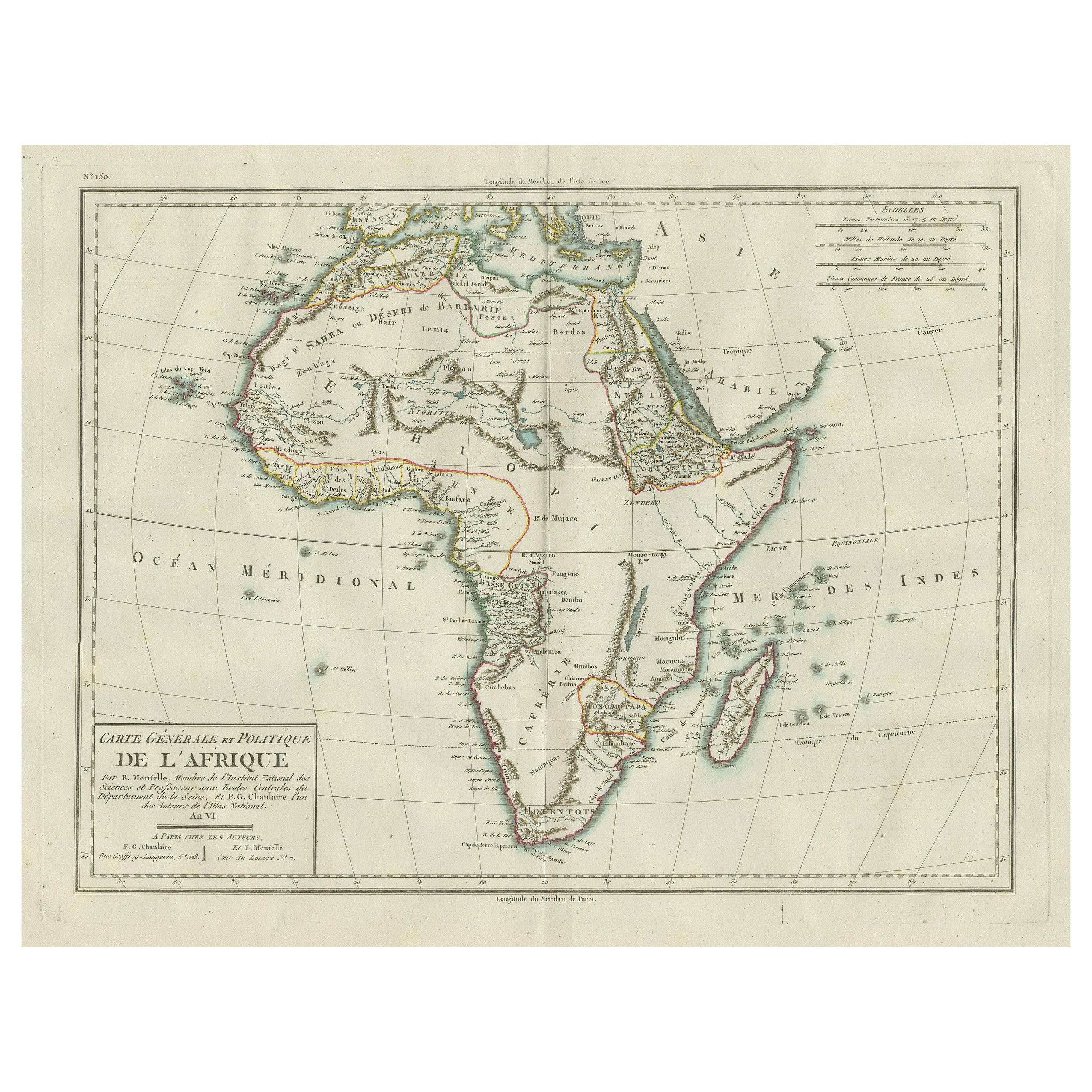
Antique map titled 'Carte générale et Politique de l'Afrique'. Original antique map of Africa. Highlights numerous mountain ranges, lakes and rivers, regions, countries and places. P...
Category
Antique Late 18th Century Maps
Materials
Paper
Original Antique Map of Africa with large decorative cartouche
Located in Langweer, NL
Original antique map titled 'L'Afrique divisée en ses principaux États'. Attractive and precise map of Africa, with large decorative cartouche. Engraved by Janvier. Published by Dela...
Category
Antique Late 18th Century Maps
Materials
Paper
$950 Sale Price
20% Off
Antique Map of Africa with Original Hand Coloring
Located in Langweer, NL
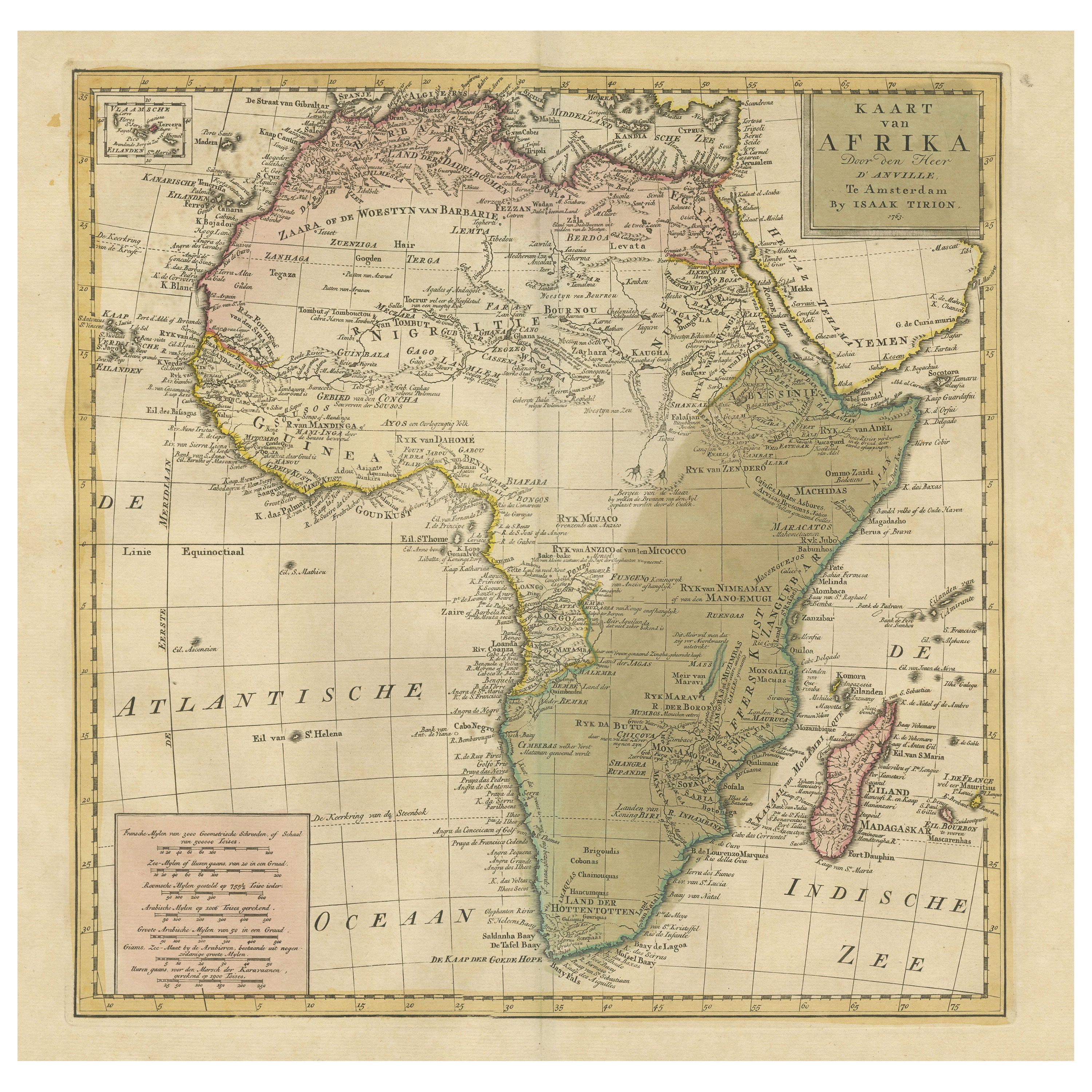
Antique map titled 'Kaart van Afrika door den Heer d'Anville'. Detailed original old map of Africa, with very small inset map titled 'Vlaamsche Eilanden', which shows the Azores. Pub...
Category
Antique Mid-18th Century Maps
Materials
Paper
$748 Sale Price
20% Off
Antique Map of Africa with European Language Borders, 1852
Located in Langweer, NL
Antique map titled 'Afrika'. Map of Africa. This map originates from 'School-Atlas van alle deelen der Aarde' by Otto Petri.
Artists and Engravers: Published by A. Baedeker (Otto...
Category
Antique 19th Century Maps
Materials
Paper

Antique Map of Africa by Bordiga Fratelli
circa 1818
Located in Langweer, NL
Antique map titled 'Carta dell Africa'. Large and quite scarce Italian map of Africa, reflecting the then-current knowledge of the continent's geography, with large areas left comple...
Category
Antique Early 19th Century Maps
Materials
Paper

$1,727 Sale Price
20% Off
Antique Map of Africa by Homann Heirs,
1804
Located in Langweer, NL
Antique map titled 'Charte von Africa'. Large, original antique map of Africa by Franz Ludwig Güssefeld. Published by Homann Heirs, 1804.
Category
Antique Early 19th Century Maps
Materials
Paper

$1,439 Sale Price
20% Off
You May Also Like
Original Antique Map of Africa by Dower, circa 1835
Located in St Annes, Lancashire
Nice map of Africa
Drawn and engraved by J.Dower
Published by Orr & Smith. C.1835
Unframed.
Free shipping
Category
Antique 1830s English Maps
Materials
Paper

"Africa Vetus": a 17th Century Hand-Colored Map by Sanson
By Nicolas Sanson
Located in Alamo, CA
This original hand-colored copperplate engraved map of Africa entitled "Africa Vetus, Nicolai Sanson Christianiss Galliar Regis Geographi" was originally created by Nicholas Sanson d...
Category
Antique Late 17th Century French Maps
Materials
Paper

$1,100 Sale Price
20% Off
Africa: A Large 17th Century Hand-Colored Map by Sanson and Jaillot
By Nicolas Sanson
Located in Alamo, CA
This large original hand-colored copperplate engraved map of Africa entitled "L'Afrique divisee suivant l'estendue de ses principales parties ou sont distingues les uns des autres, L...
Category
Antique 1690s French Maps
Materials
Paper

$1,740 Sale Price
20% Off
Large Original Antique Map of Africa. C.1900
Located in St Annes, Lancashire
Fabulous map of Africa
Original color.
Engraved and printed by the George F. Cram Company, Indianapolis.
Published, C.1900.
Unframed.
Free shipping.
Category
Antique 1890s American Maps
Materials
Paper

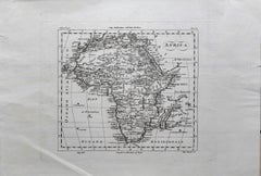
Ancient Map of Africa - Etching - 19th century
Located in Roma, IT
This Map of Africa is an etching realized in the 19th century.
The state of preservation of the artwork is good. At the top of the paper, the inscription “Longitudine del Meridiano ...
Category
19th Century More Prints
Materials
Etching
Map of Africa, archival. Printed in Edinburgh, Scotland, 1916. Free Delivery
Located in Madison, WI
Map of Africa from the geography classroom, 1916 edition. Printed in Edinburgh, Scotland. Mounted on pulldown wooden roller with wall mounting brackets....
Category
Early 20th Century Scottish Edwardian Maps
Materials
Wood, Paper