Items Similar to Original Antique Map of the American State of Oklahoma, 1903
Want more images or videos?
Request additional images or videos from the seller
1 of 5
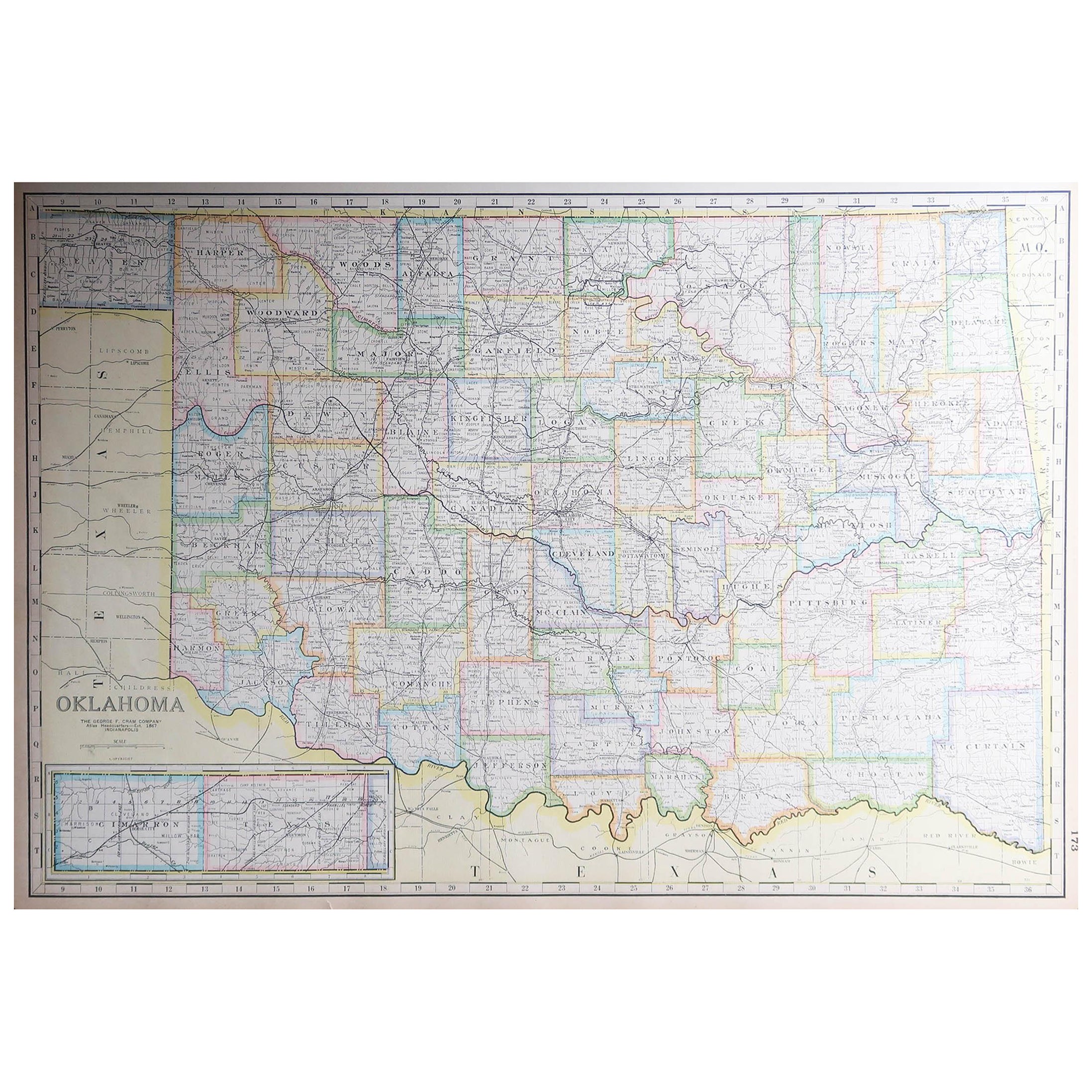
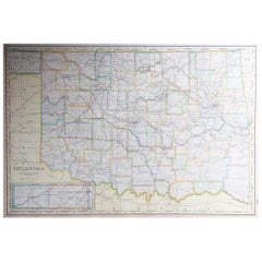
Original Antique Map of the American State of Oklahoma, 1903
$49
£37.31
€42.96
CA$69.44
A$74.69
CHF 39.92
MX$880.38
NOK 503.25
SEK 460.07
DKK 321.02
About the Item
Antique map of Oklahoma
Published By A
C Black. 1903
Original colour
Good condition
Unframed.
Free shipping
- Dimensions:Height: 11.5 in (29.21 cm)Width: 16.25 in (41.28 cm)Depth: 0.07 in (1.78 mm)
- Materials and Techniques:Paper,Other
- Place of Origin:
- Period:1900-1909
- Date of Manufacture:1903
- Condition:Wear consistent with age and use.
- Seller Location:St Annes, GB
- Reference Number:1stDibs: LU1836343728462
About the Seller
4.9
Gold Seller
Premium sellers maintaining a 4.3+ rating and 24-hour response times
1stDibs seller since 2016
3,281 sales on 1stDibs
Typical response time: 1 hour
Associations
International Confederation of Art and Antique Dealers
Associations
- ShippingRetrieving quote...Shipping from: St Annes, United Kingdom
- Return Policy
More From This Seller
View AllLarge Original Antique Map of Oklahoma, USA, circa 1900
Located in St Annes, Lancashire
Fabulous map of Oklahoma
Original color
Engraved and printed by the George F. Cram Company, Indianapolis.
Published, circa 1900
Unframed
Repair to...
Category
Antique 1890s American Maps
Materials
Paper
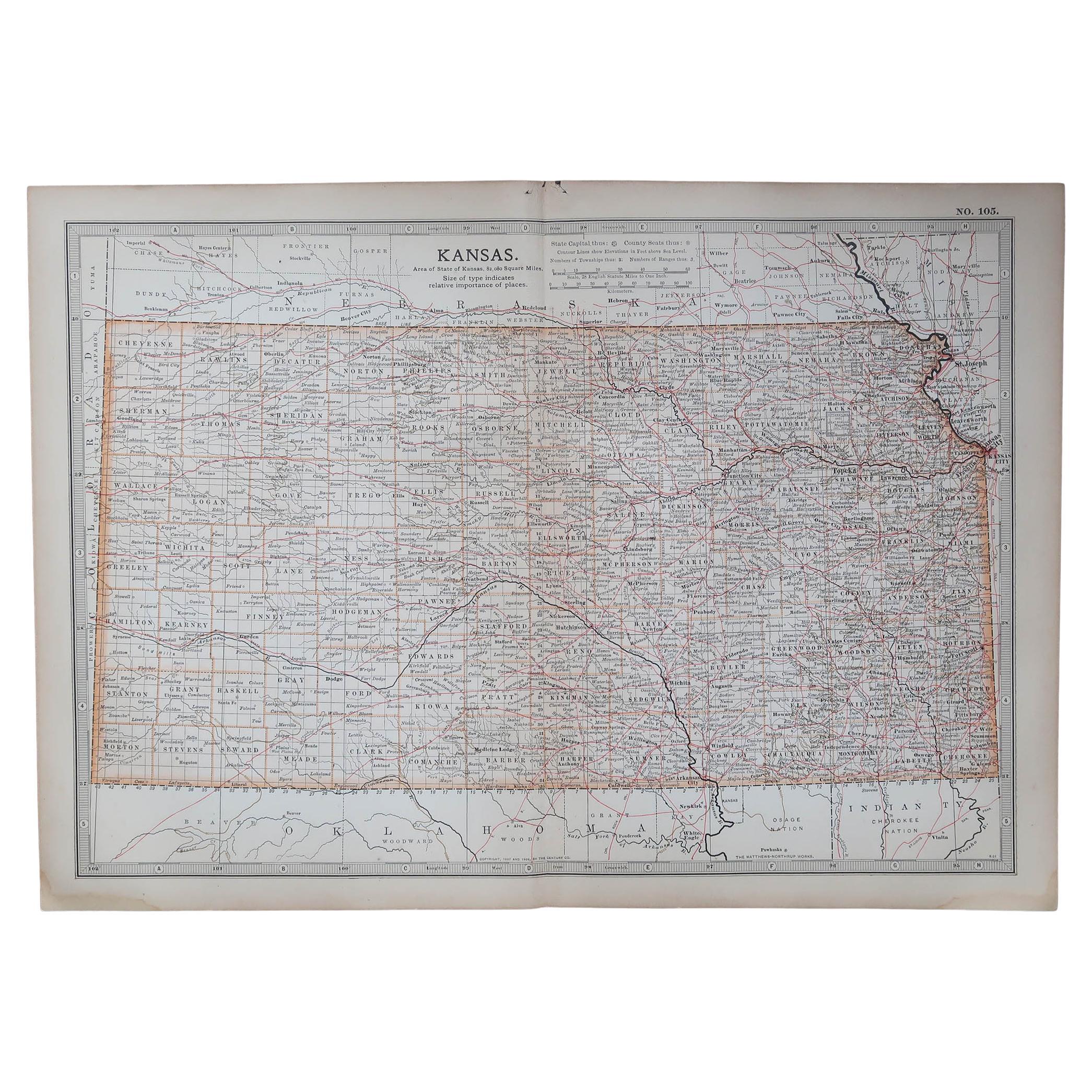
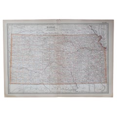
Original Antique Map of the American State of Kansas, 1903
Located in St Annes, Lancashire
Antique map of Kansas
Published By A & C Black. 1903
Original colour
Good condition
Unframed.
Free shipping
Category
Antique Early 1900s English Maps
Materials
Paper
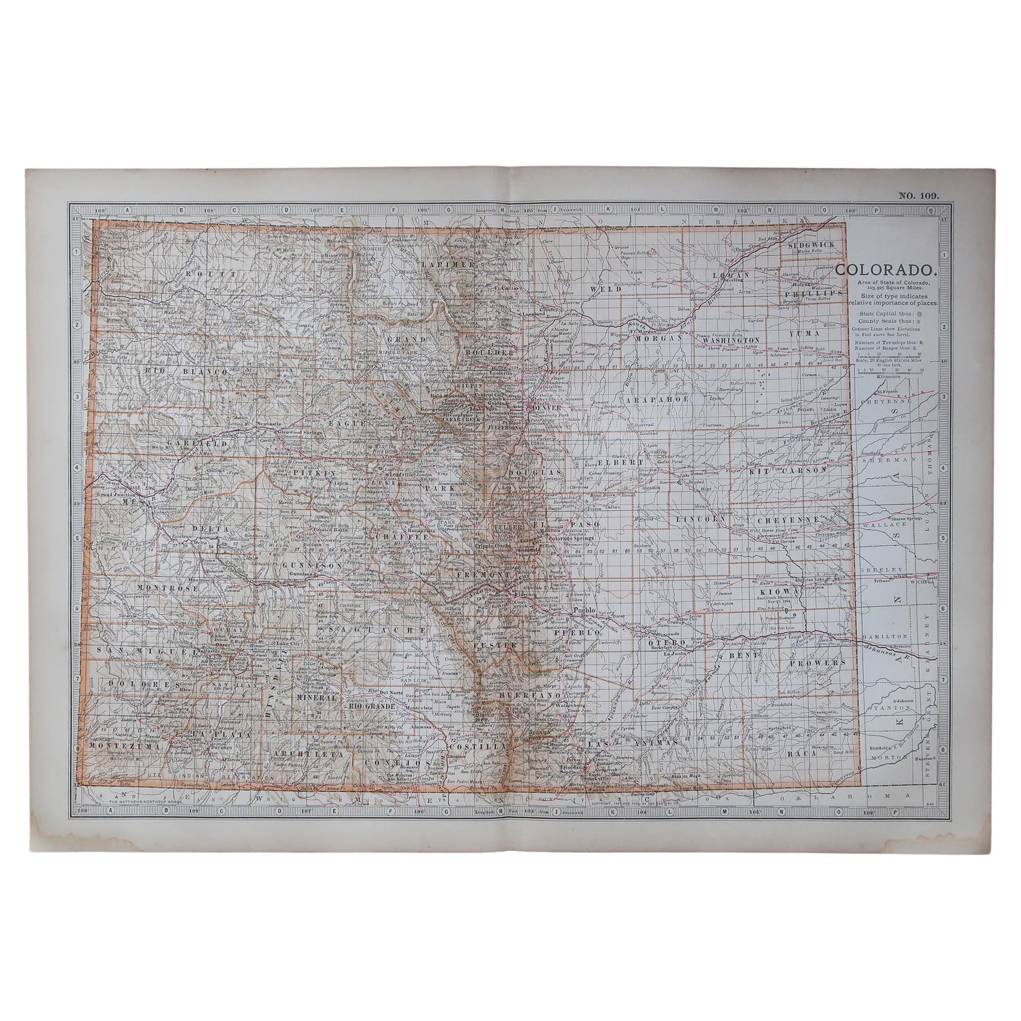
Original Antique Map of the American State of Colorado, 1903
Located in St Annes, Lancashire
Antique map of Colorado
Published By A & C Black. 1903
Original colour
Good condition
Unframed.
Free shipping
Category
Antique Early 1900s English Maps
Materials
Paper

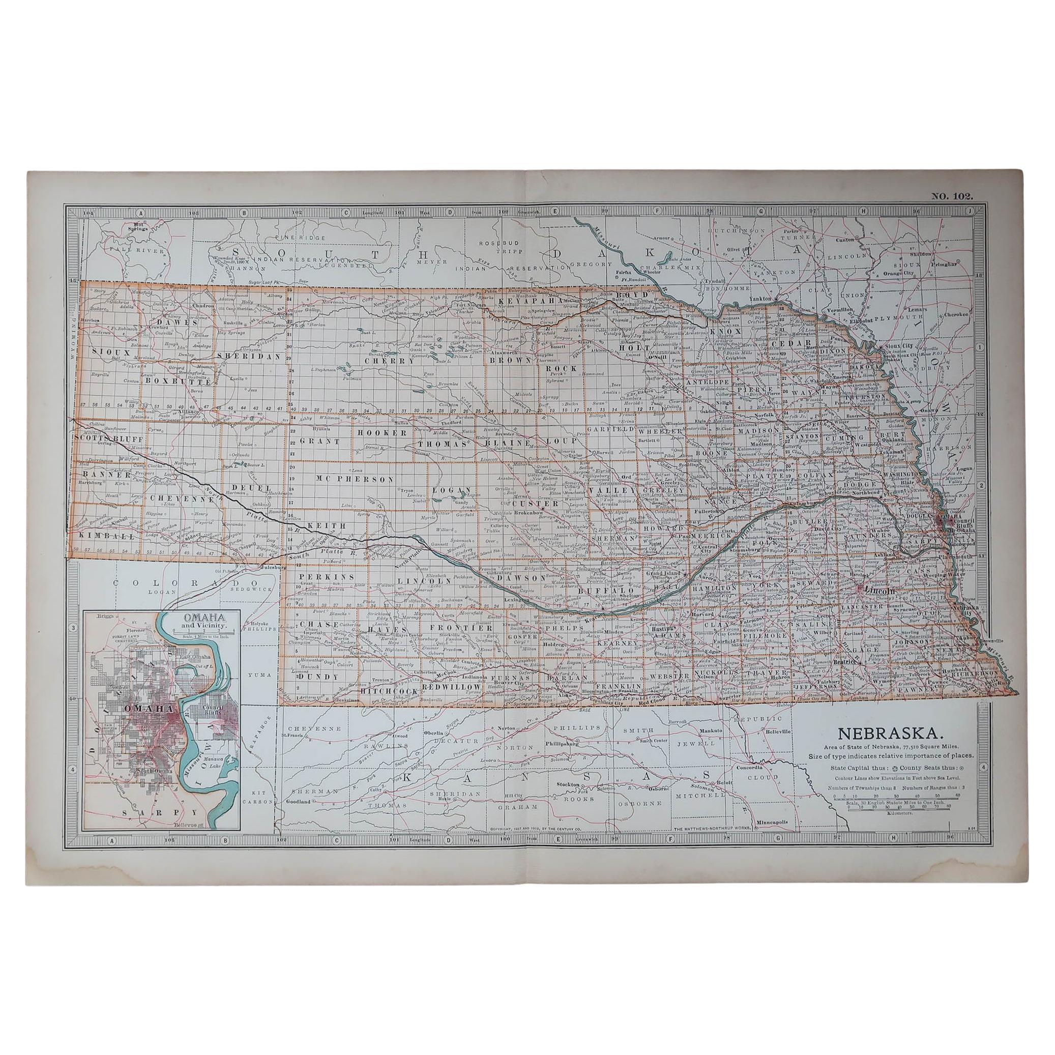
Original Antique Map of the American State of Nebraska, 1903
Located in St Annes, Lancashire
Antique map of Nebraska
Published By A & C Black. 1903
Original colour
Good condition
Unframed.
Free shipping
Category
Antique Early 1900s English Maps
Materials
Paper

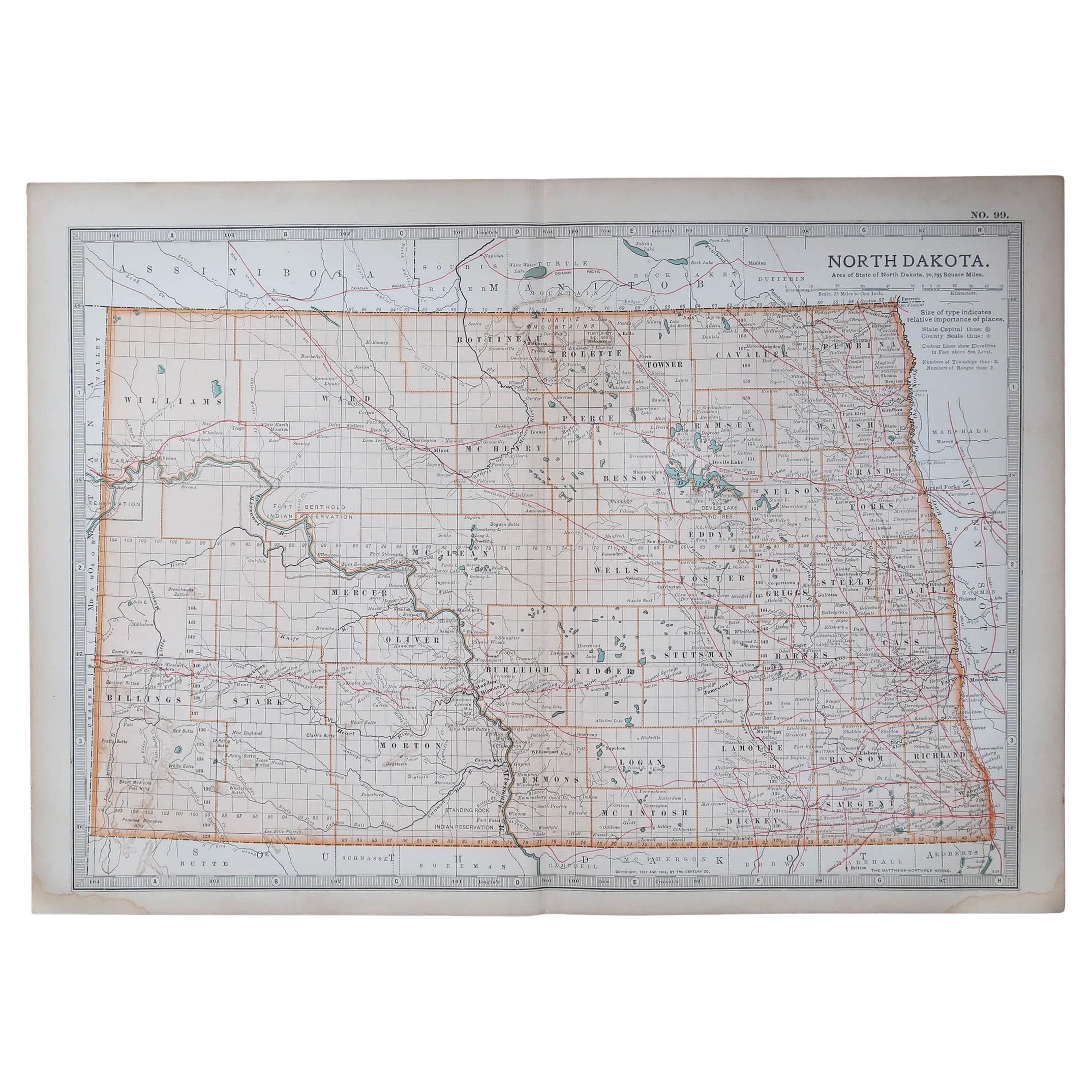
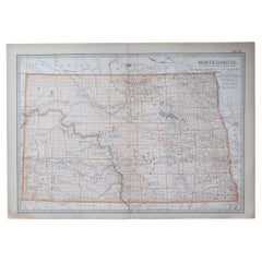
Original Antique Map of the American State of North Dakota, 1903
Located in St Annes, Lancashire
Antique map of North Dakota
Published By A & C Black. 1903
Original colour
Good condition
Unframed.
Free shipping
Category
Antique Early 1900s English Maps
Materials
Paper
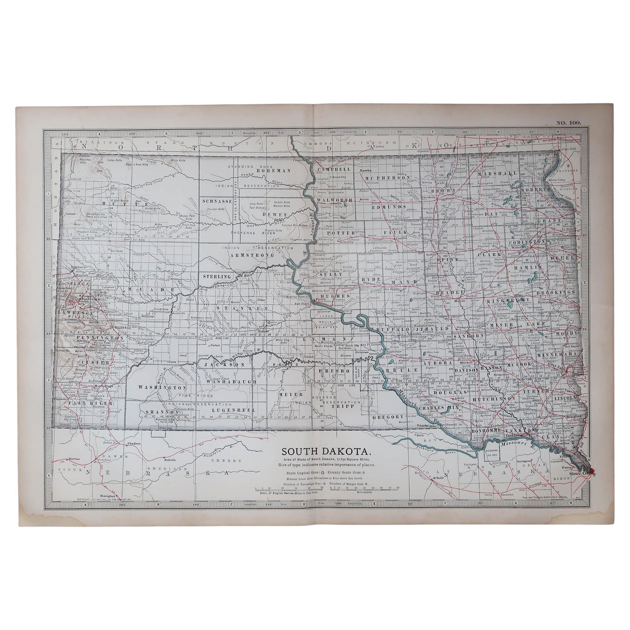
Original Antique Map of the American State of South Dakota, 1903
Located in St Annes, Lancashire
Antique map of South Dakota
Published By A & C Black. 1903
Original colour
Good condition
Unframed.
Free shipping
Category
Antique Early 1900s English Maps
Materials
Paper

You May Also Like
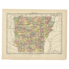
Antique Map of Arkansas from Encyclopaedia Britannica, 1875
Located in Langweer, NL
Antique Map of Arkansas from Encyclopaedia Britannica, 1875
Description:
Original antique map of the U.S. state of Arkansas, published in 1875 for the...
Category
Antique Late 19th Century British Maps
Materials
Paper
Antique Map of the United States
North West
by Johnston,
1909
Located in Langweer, NL
Antique map titled 'United States of North America'. Original antique map of the United States of North America ( North West ). This map originates from the ‘Royal Atlas of Modern Ge...
Category
Early 20th Century Maps
Materials
Paper

$237 Sale Price
20% Off
Antique Map Showing the Locations of Native American Tribes in 1899
Located in Langweer, NL
Antique map titled 'Map showing the Indian Reservations within the Limits of the United States'. Large folding map of the United States showing the Indian Reservations. The present m...
Category
Antique Late 19th Century Maps
Materials
Paper
1890 "Map of Oregon, Kansas, California, and the Territories" by S. A. Mitchell
By Samuel Augustus Mitchell 1
Located in Colorado Springs, CO
Presented is an 1890 map "Map of Oregon, Kansas, California, and the Territories" by S. A. Mitchell Jr. The map was issued in the atlas “Mitchell's New Intermediate Geography” publis...
Category
Antique 1890s American Victorian Maps
Materials
Paper

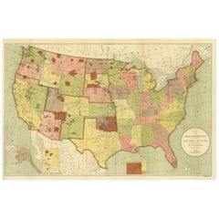
Antique Railroad Map of the United States by Rand, McNally
Co, 1900
Located in Langweer, NL
Antique map titled 'Rand, McNally & Co's New Official Railroad map of the United States with portions of The Dominion of Canada, The Republic of Mexico and the West Indies'. Large railroad map of the United States, sectionalised and laid on linen. Map shows state boundaries for the United States, Mexico, the West Indies, and lower portion of Canada; major cities and towns, military posts, Native American reservations, and railroads; Oklahoma and "Indian Territory." Inset: "Map of Alaska...
Category
20th Century Maps
Materials
Linen, Paper

$2,224 Sale Price
25% Off
Free Shipping
Western Texas Antique Map 1888 – Railroads, Counties
Frontier Towns
Located in Langweer, NL
Western Texas Map 1888 – Rand McNally Antique Lithograph
This antique 1888 map of Western Texas, published by Rand, McNally & Co., depicts the vast frontier counties of the region a...
Category
Antique Late 19th Century American Maps
Materials
Paper
More Ways To Browse
Antique Furniture Oklahoma
Couch Console
Sterling Silver Flatware Service For 12
Antique Dining Tables With Leaves
Decorative Wall Panels
Frank Lloyd Wright For Cassina
Natural Curved
Spanish Wool Rug
Leather Pouf And Ottomans
Low Side Tables
Set Of Four Italian Dining Chairs
Silk Runner Carpet
18th Century Blue And White Porcelain
3x5 Rugs
Italian Lacquer Dining Room Sets
Round Brass Table
Round Table Base
Antique Imari Porcelain