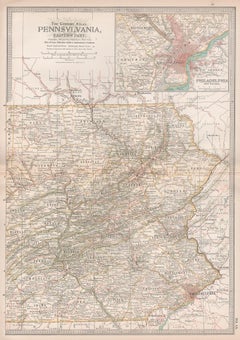
Items Similar to Original Antique Map of the American State of Pennsylvania( Eastern Part ), 1903
Want more images or videos?
Request additional images or videos from the seller
1 of 5
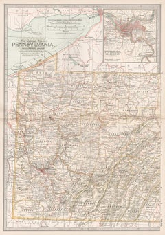
Original Antique Map of the American State of Pennsylvania( Eastern Part ), 1903
$49
£37.33
€42.60
CA$68.86
A$75.04
CHF 39.74
MX$901.33
NOK 503.09
SEK 462.54
DKK 318.19
About the Item
Antique map of Pennsylvania ( Eastern part )
Published By A
C Black. 1903
Original colour
Good condition
Unframed.
Free shipping
- Dimensions:Height: 16.25 in (41.28 cm)Width: 11.5 in (29.21 cm)Depth: 0.07 in (1.78 mm)
- Materials and Techniques:Paper,Other
- Place of Origin:
- Period:1900-1909
- Date of Manufacture:1903
- Condition:Wear consistent with age and use.
- Seller Location:St Annes, GB
- Reference Number:1stDibs: LU1836343724032
About the Seller
4.9
Platinum Seller
Premium sellers with a 4.7+ rating and 24-hour response times
1stDibs seller since 2016
3,245 sales on 1stDibs
Typical response time: 1 hour
Associations
International Confederation of Art and Antique Dealers
Associations
- ShippingRetrieving quote...Shipping from: St Annes, United Kingdom
- Return Policy
More From This Seller
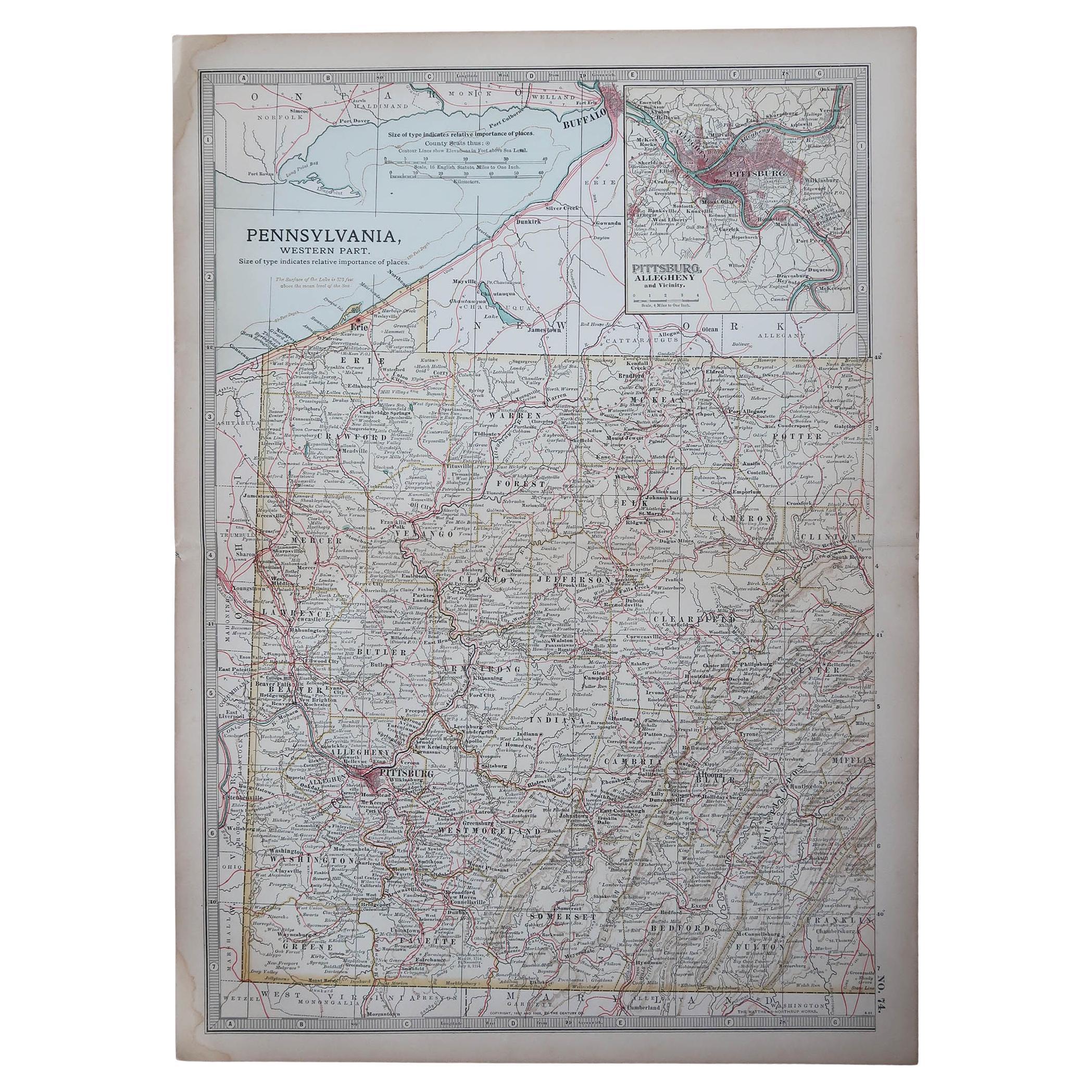
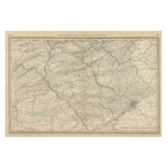
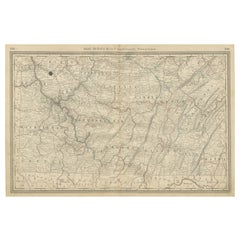
View AllOriginal Antique Map of the American State of Pennsylvania( Western Part ), 1903
Located in St Annes, Lancashire
Antique map of Pennsylvania ( Western part )
Published By A & C Black. 1903
Original colour
Good condition
Unframed.
Free shipping
Category
Antique Early 1900s English Maps
Materials
Paper

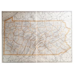
Large Original Antique Map of Pennsylvania, USA, 1894
By Rand McNally
Co.
Located in St Annes, Lancashire
Fabulous map of Pennsylvania
Original color.
By Rand, McNally & Co.
Published, 1894.
Unframed.
Free shipping.
Category
Antique 1890s American Maps
Materials
Paper
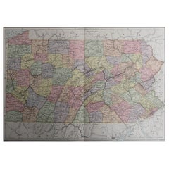
Original Antique Map of the American State of Pennsylvania, 1889
Located in St Annes, Lancashire
Great map of Pennsylvania
Drawn and Engraved by W. & A.K. Johnston
Published By A & C Black, Edinburgh.
Original colour
Unframed.
Repair to a minor tear on bottom edge.
Category
Antique 1880s Scottish Victorian Maps
Materials
Paper
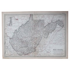
Original Antique Map of the American State of Virginia, 1903
Located in St Annes, Lancashire
Antique map of West Virginia
Published By A & C Black. 1903
Original colour
Good condition
Unframed.
Free shipping
Category
Antique Early 1900s English Maps
Materials
Paper
Original Antique Map of the American State of Ohio ( Southern Part ), 1903
Located in St Annes, Lancashire
Antique map of Ohio ( Southern part )
Published By A & C Black. 1903
Original colour
Good condition
Unframed.
Free shipping
Category
Antique Early 1900s English Maps
Materials
Paper

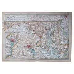
Original Antique Map of the American State of Maryland
Delaware, 1903
Located in St Annes, Lancashire
Antique map of Maryland And Delaware
Published By A & C Black. 1903
Original colour
Good condition
Unframed.
Free shipping
Category
Antique Early 1900s English Maps
Materials
Paper
You May Also Like
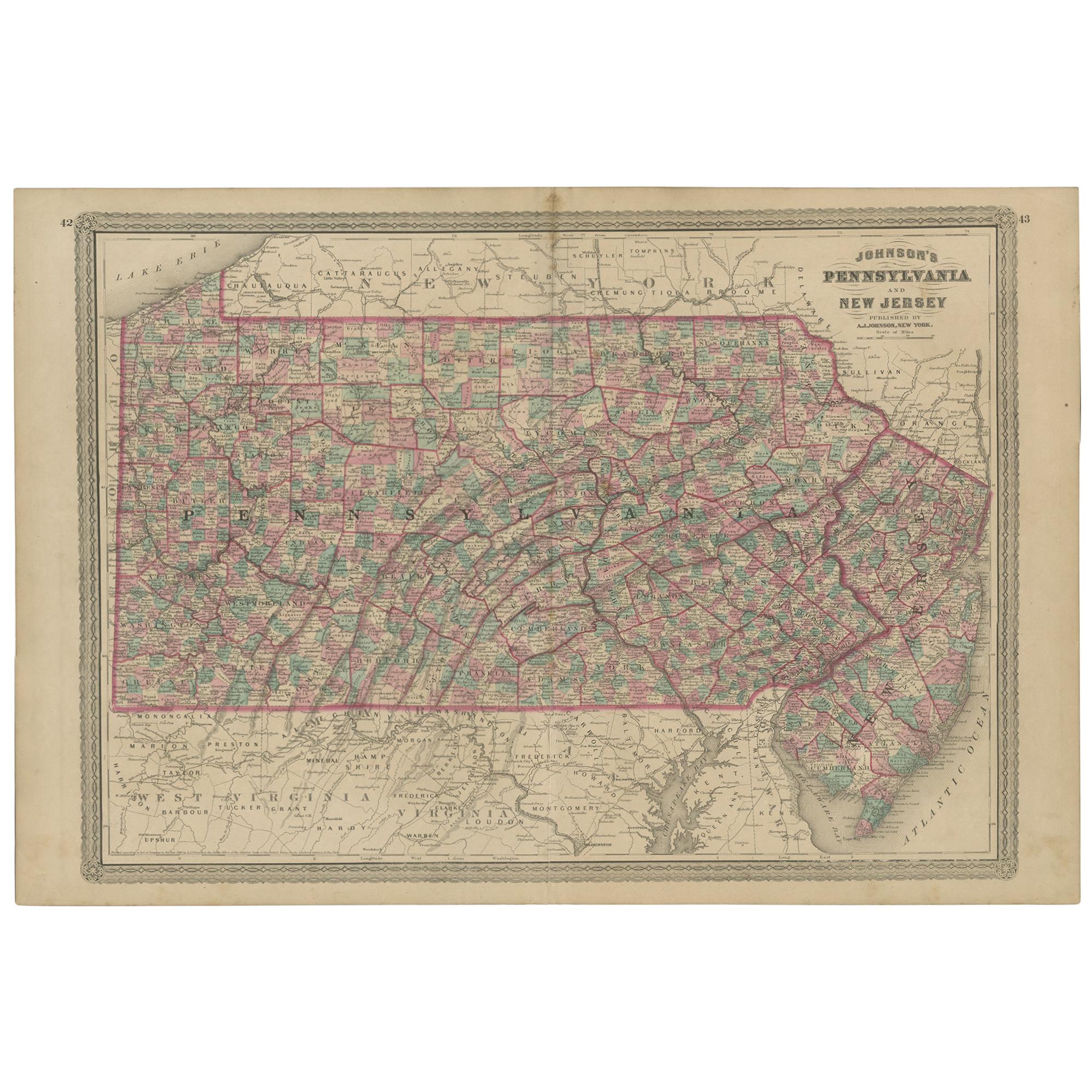
Antique Map of Pennsylvania and New Jersey by Johnson, 1872
Located in Langweer, NL
Antique map titled 'Johnson's Pennsylvania and New Jersey'. Original map showing Pennsylvania and New Jersey. This map originates from 'Johnson's New Illustrated Family Atlas of the ...
Category
Antique Late 19th Century Maps
Materials
Paper

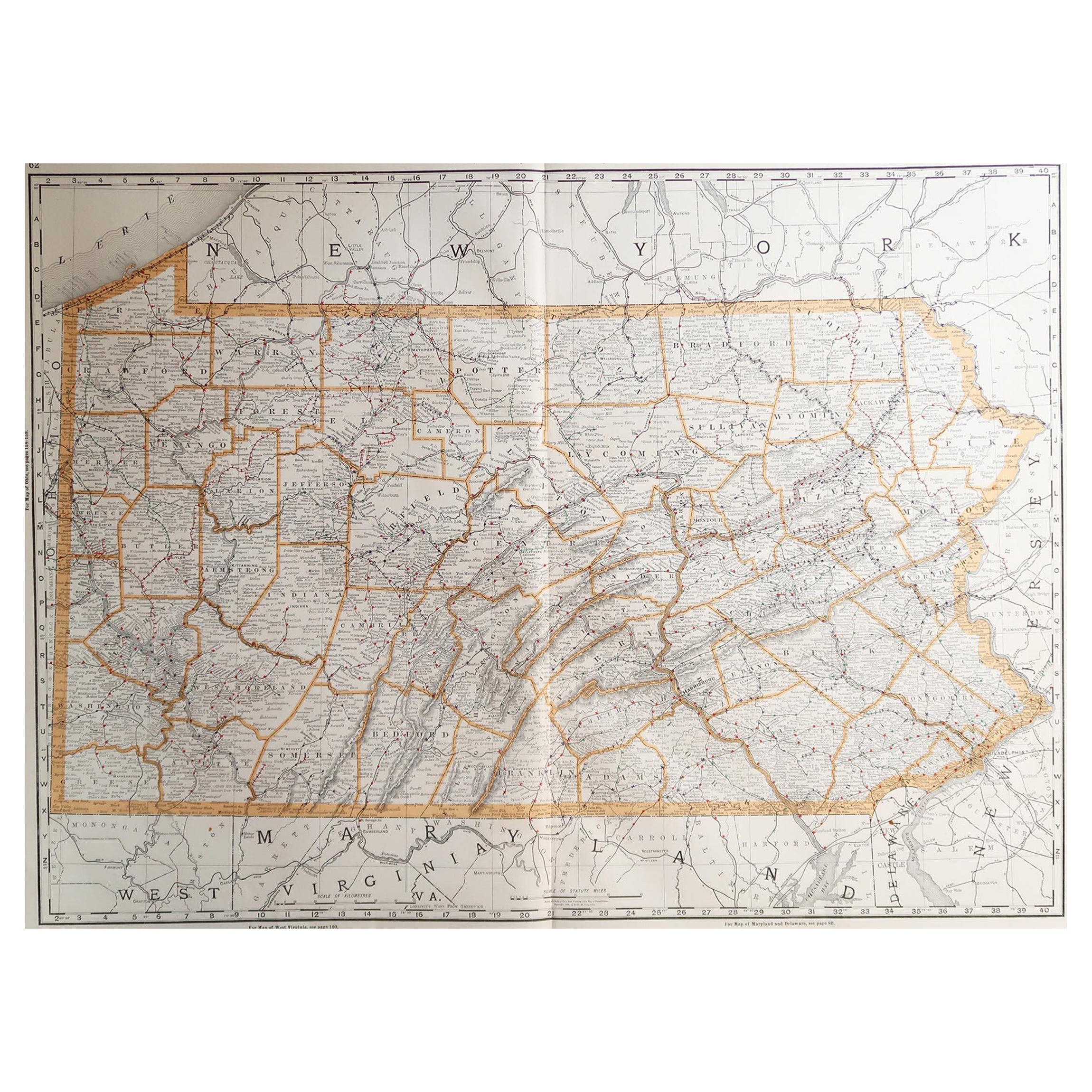
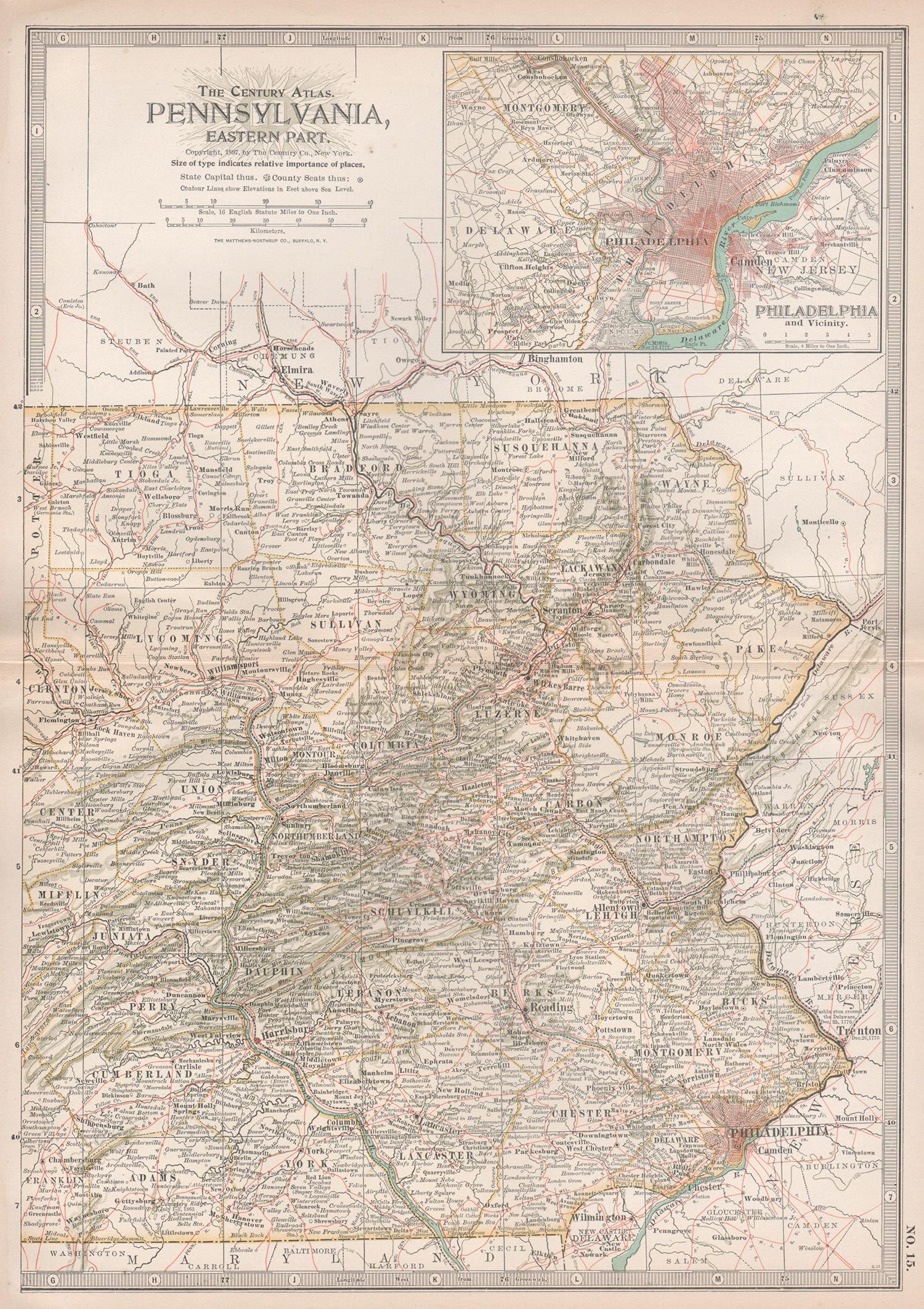
Pennsylvania, Eastern Part. USA. Century Atlas state antique vintage map
Located in Melbourne, Victoria
'The Century Atlas. Pennsylvania, Eastern Part.'
Original antique map, 1903.
Central fold as issued. Map name and number printed on the reverse corners.
Sheet 40cm by 29.5cm.
Category
Early 20th Century Victorian More Prints
Materials
Lithograph
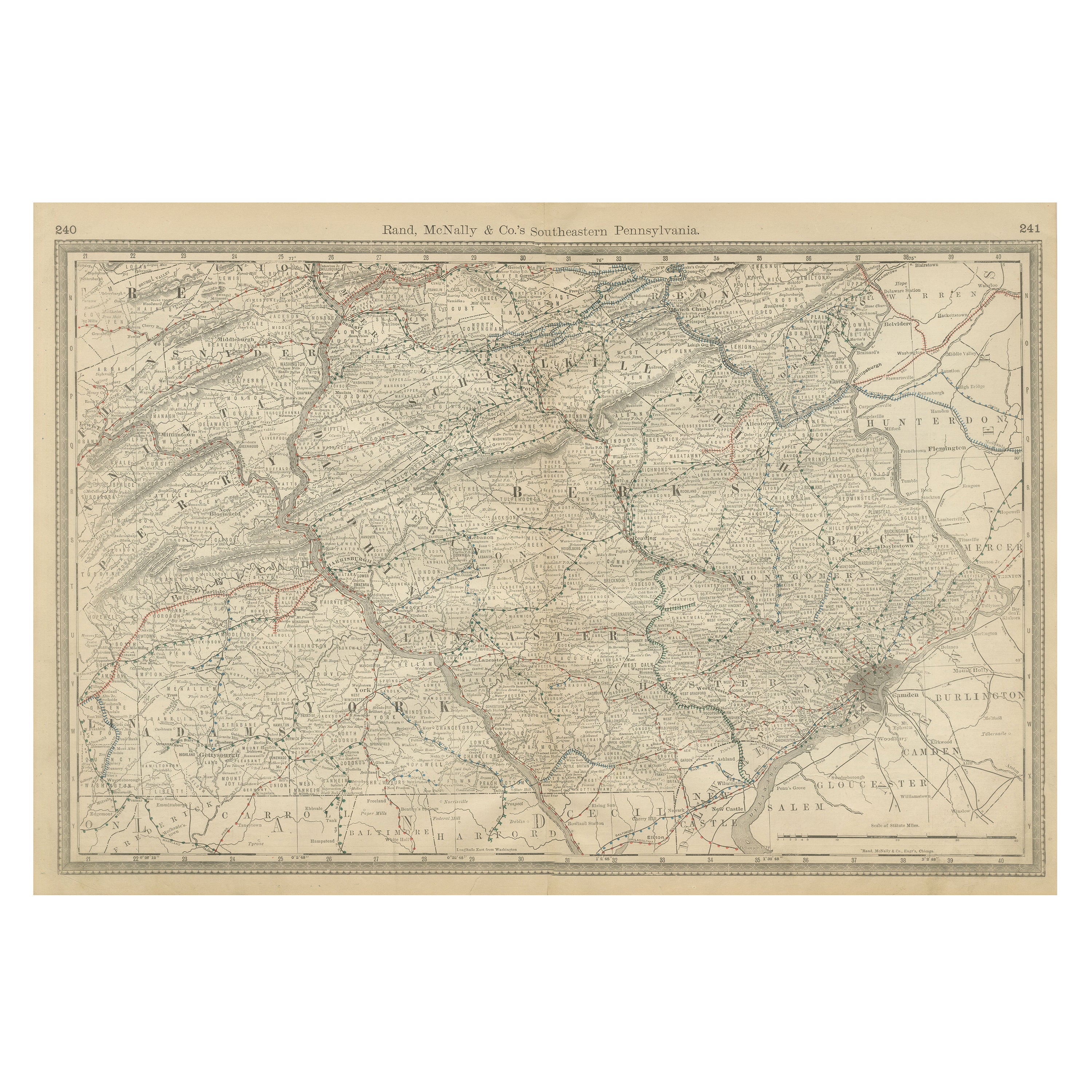
Pennsylvania 1888 Antique Map – The Keystone State, Southeastern Railroads
Located in Langweer, NL
Antique Map of Southeastern Pennsylvania – Rand McNally, circa 1888
This antique map of southeastern Pennsylvania was published by Rand, McNally & Co. around 1888, taken from one of...
Category
Antique Late 19th Century American Maps
Materials
Paper
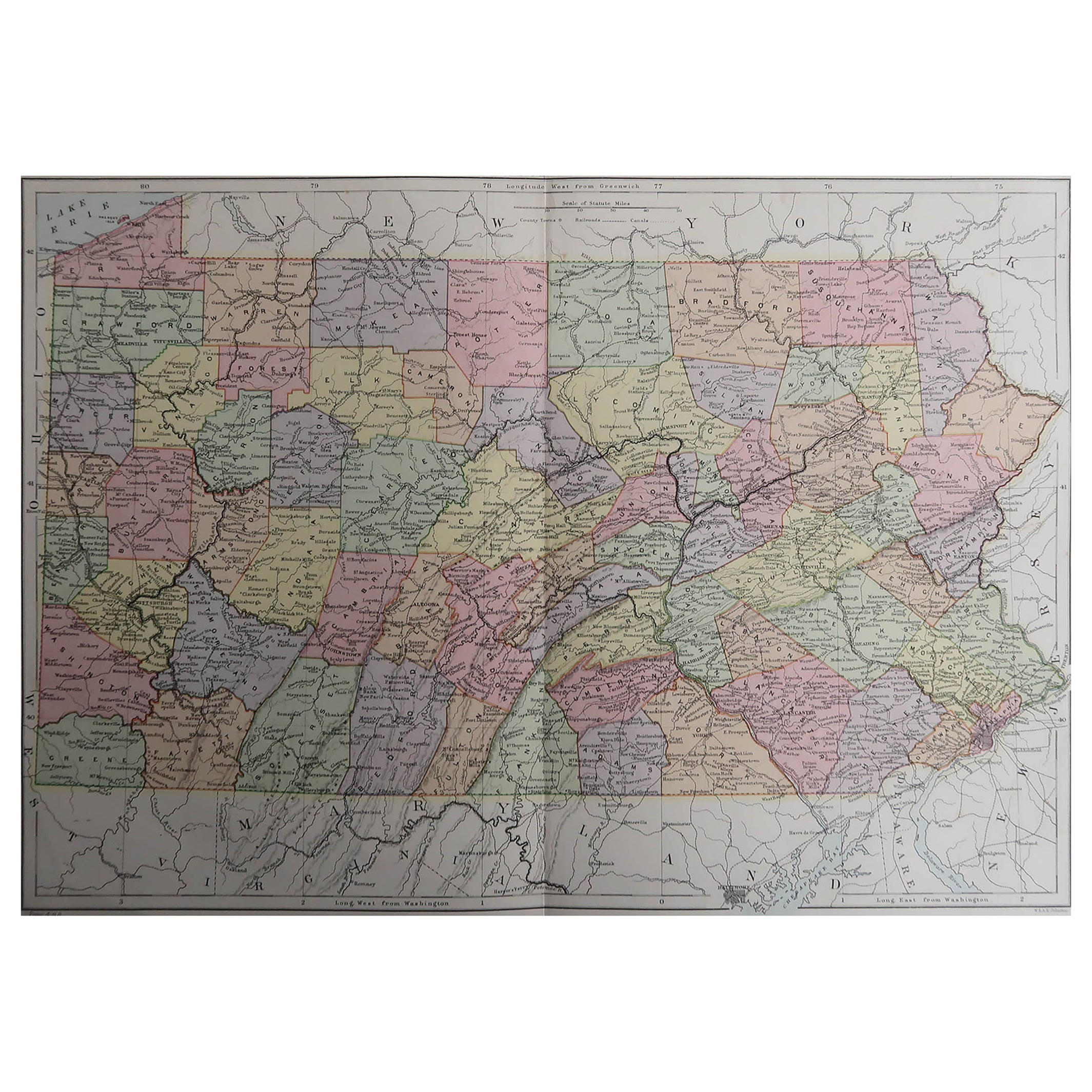
Pennsylvania, Western Part. USA Century Atlas state antique vintage map
Located in Melbourne, Victoria
'The Century Atlas. Pennsylvania, Western Part'
Original antique map, 1903.
Central fold as issued. Map name and number printed on the reverse corners.
Sheet 40cm by 29.5cm.
Category
Early 20th Century Victorian More Prints
Materials
Lithograph
Southwestern Pennsylvania Antique Map c.1888 – Keystone State Counties
Cities
Located in Langweer, NL
Antique Map of Southwestern Pennsylvania – Rand McNally, circa 1888
This antique map of southwestern Pennsylvania was published by Rand, McNally & Co. around 1888. It comes from the...
Category
Antique Late 19th Century American Maps
Materials
Paper
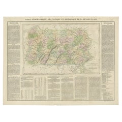
Original Antique Map of Pennsylvania Showing Interesting Statistics Etc, 1825
Located in Langweer, NL
Attractive map of Pennsylvania with bordercoloring of the county and showing the various towns, roads, rivers, bridges, and a host of other details...
Category
Antique 1820s Maps
Materials
Paper
More Ways To Browse
Pennsylvania Antiques
Antique Pennsylvania Furniture
Couch Console
Sterling Silver Flatware Service For 12
Antique Dining Tables With Leaves
Decorative Wall Panels
Frank Lloyd Wright For Cassina
Natural Curved
Spanish Wool Rug
Leather Pouf And Ottomans
Low Side Tables
Set Of Four Italian Dining Chairs
Silk Runner Carpet
18th Century Blue And White Porcelain
3x5 Rugs
Italian Lacquer Dining Room Sets
Round Brass Table
Round Table Base