Items Similar to Original Antique Map of the American State of Texas ( Eastern Part ), 1903
Want more images or videos?
Request additional images or videos from the seller
1 of 5
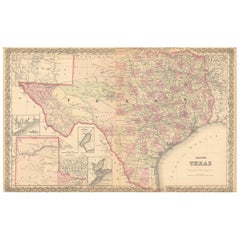
Original Antique Map of the American State of Texas ( Eastern Part ), 1903
$49
£37.11
€42.62
CA$68.67
A$74.69
CHF 39.58
MX$894.90
NOK 503.05
SEK 460.87
DKK 318.55
About the Item
Antique map of Texas ( Eastern part )
Published By A
C Black. 1903
Original colour
Good condition
Unframed.
Free shipping
- Dimensions:Height: 16.25 in (41.28 cm)Width: 11.5 in (29.21 cm)Depth: 0.07 in (1.78 mm)
- Materials and Techniques:Paper,Other
- Place of Origin:
- Period:1900-1909
- Date of Manufacture:1903
- Condition:Wear consistent with age and use.
- Seller Location:St Annes, GB
- Reference Number:1stDibs: LU1836346303522
About the Seller
4.9
Gold Seller
Premium sellers maintaining a 4.3+ rating and 24-hour response times
1stDibs seller since 2016
3,266 sales on 1stDibs
Typical response time: 1 hour
Associations
International Confederation of Art and Antique Dealers
Associations
- ShippingRetrieving quote...Shipping from: St Annes, United Kingdom
- Return Policy
More From This Seller
View AllOriginal Antique Map of the American State of Oklahoma, 1903
Located in St Annes, Lancashire
Antique map of Oklahoma
Published By A & C Black. 1903
Original colour
Good condition
Unframed.
Free shipping
Category
Antique Early 1900s English Maps
Materials
Paper
Original Antique Map of The United States of America by Dower, circa 1835
Located in St Annes, Lancashire
Nice map of the USA
Drawn and engraved by J.Dower
Published by Orr & Smith. C.1835
Unframed.
Free shipping
Category
Antique 1830s English Maps
Materials
Paper

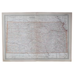
Original Antique Map of the American State of Kansas, 1903
Located in St Annes, Lancashire
Antique map of Kansas
Published By A & C Black. 1903
Original colour
Good condition
Unframed.
Free shipping
Category
Antique Early 1900s English Maps
Materials
Paper
Original Antique Map of the American State of Arizona
New Mexico, 1903
Located in St Annes, Lancashire
Antique map of Arizona and New Mexico
Published By A & C Black. 1903
Original colour
Good condition
Unframed.
Free shipping
Category
Antique Early 1900s English Maps
Materials
Paper

Original Antique Map of the American State of Colorado, 1903
Located in St Annes, Lancashire
Antique map of Colorado
Published By A & C Black. 1903
Original colour
Good condition
Unframed.
Free shipping
Category
Antique Early 1900s English Maps
Materials
Paper

Original Antique Map of the American State of South Carolina, 1903
Located in St Annes, Lancashire
Antique map of South Carolina
Published By A & C Black. 1903
Original colour
Good condition
Unframed.
Free shipping
Category
Antique Early 1900s English Maps
Materials
Paper

You May Also Like
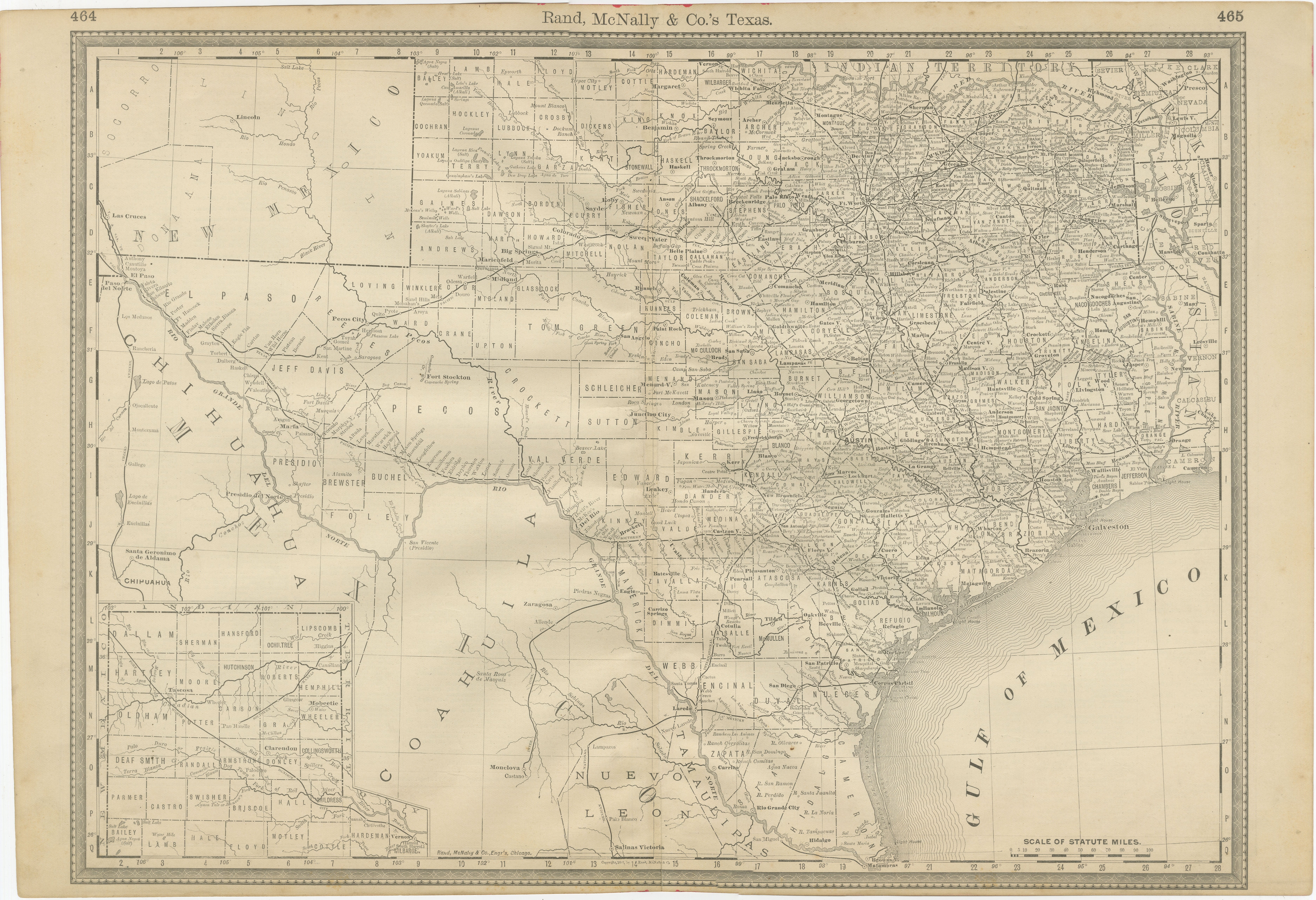
Texas Antique Map 1888 – Railroads, Counties
Frontier Settlements
Located in Langweer, NL
Texas Railroad Map 1888 – Rand McNally Antique Lithograph
This antique 1888 map of Texas, published by Rand, McNally & Co., provides a detailed overview of the state during a critic...
Category
Antique Late 19th Century American Maps
Materials
Paper

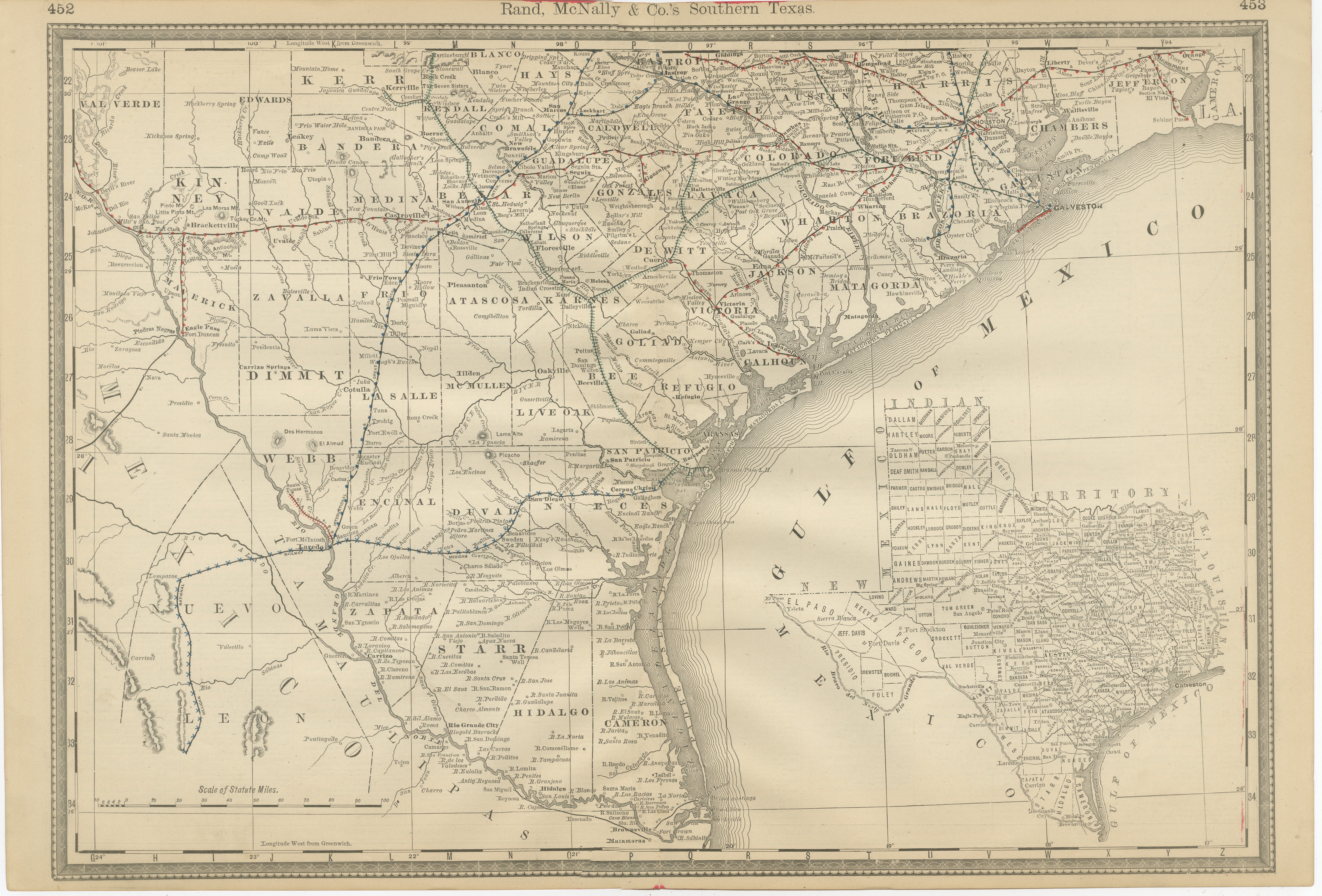
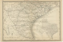
Antique Map 1888 – Southern Texas Railroads, Counties
Settlements
Located in Langweer, NL
Southern Texas Map 1888 – Rand McNally Antique Lithograph
This antique 1888 map of Southern Texas, published by Rand, McNally & Co., depicts the Gulf Coast and borderlands with Mexi...
Category
Antique Late 19th Century American Maps
Materials
Paper
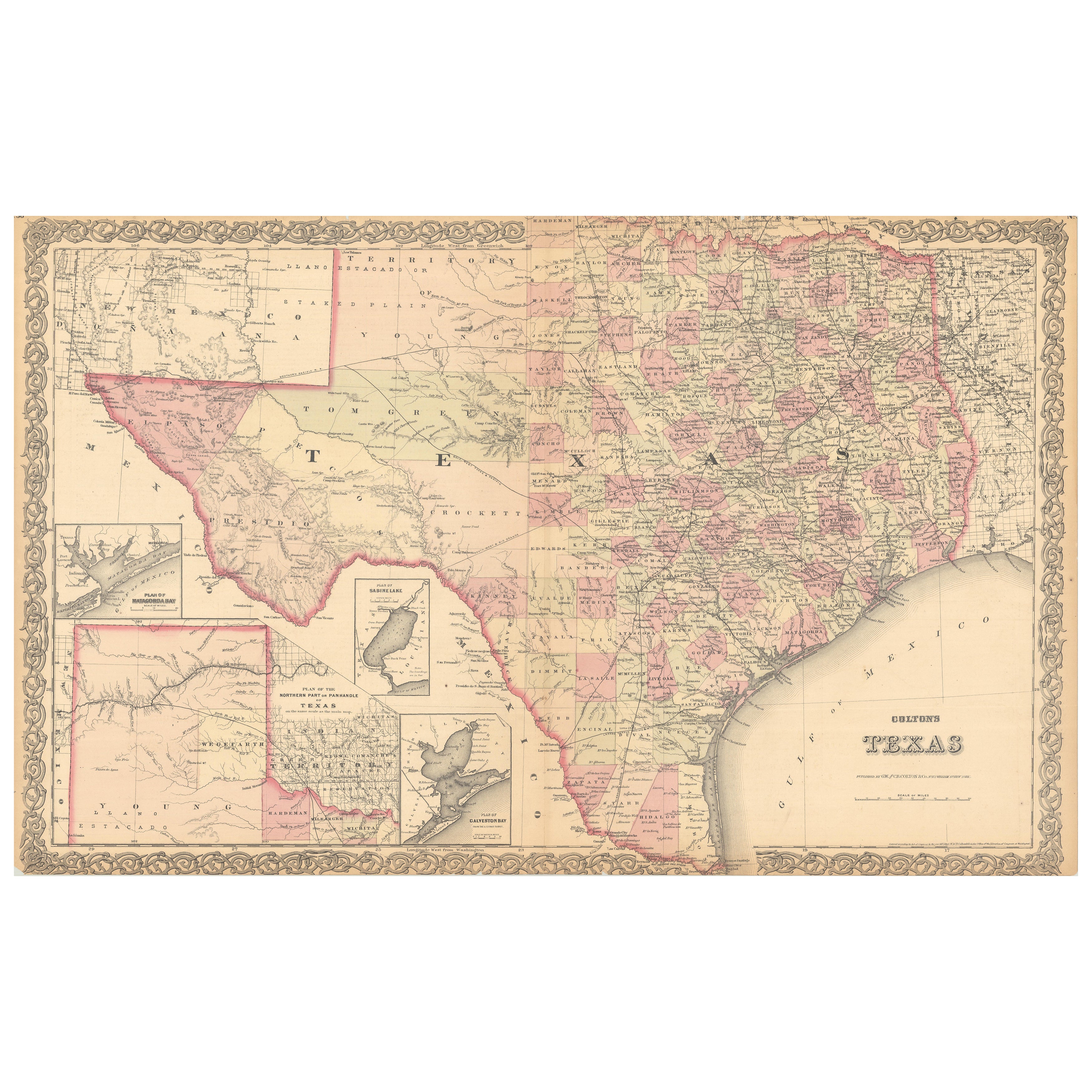
Large Antique Map of Texas with Panhandle
Bay Inset Maps, Colton, 1873
Located in Langweer, NL
Large Antique Map of Texas with Panhandle & Bay Inset Maps, Colton, 1873
This richly detailed and visually striking antique map of Texas was pub...
Category
Antique 1870s Maps
Materials
Paper
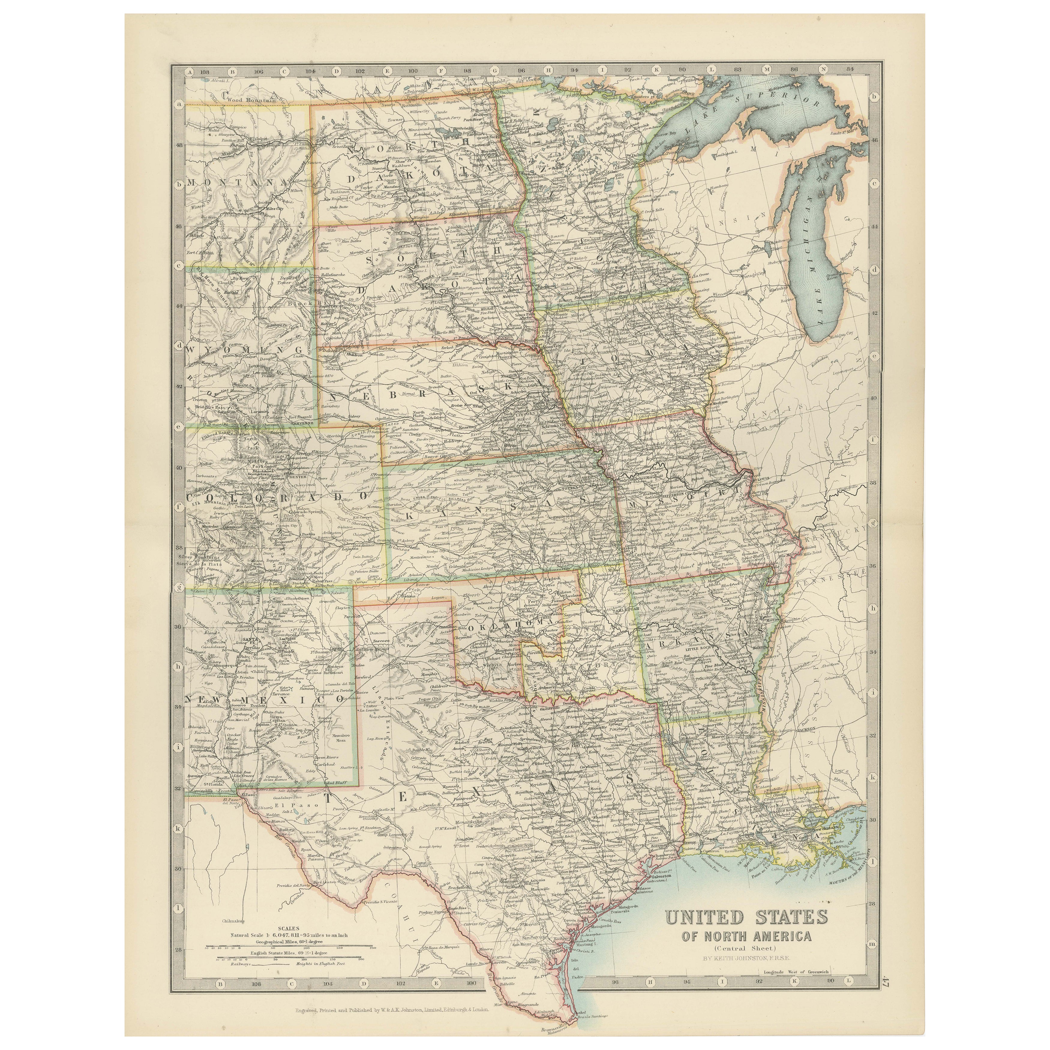
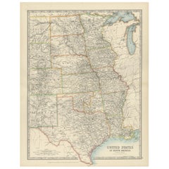
Map of United States Central Sheet 1903 – Railroads, States, and Topography
Located in Langweer, NL
Map of United States Central Sheet 1903 – Railroads, States, and Topography
This is a finely engraved and beautifully colored map titled "United States of North America (Central She...
Category
Early 20th Century English Maps
Materials
Paper
$325 Sale Price
20% Off
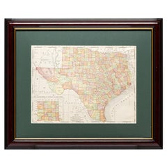
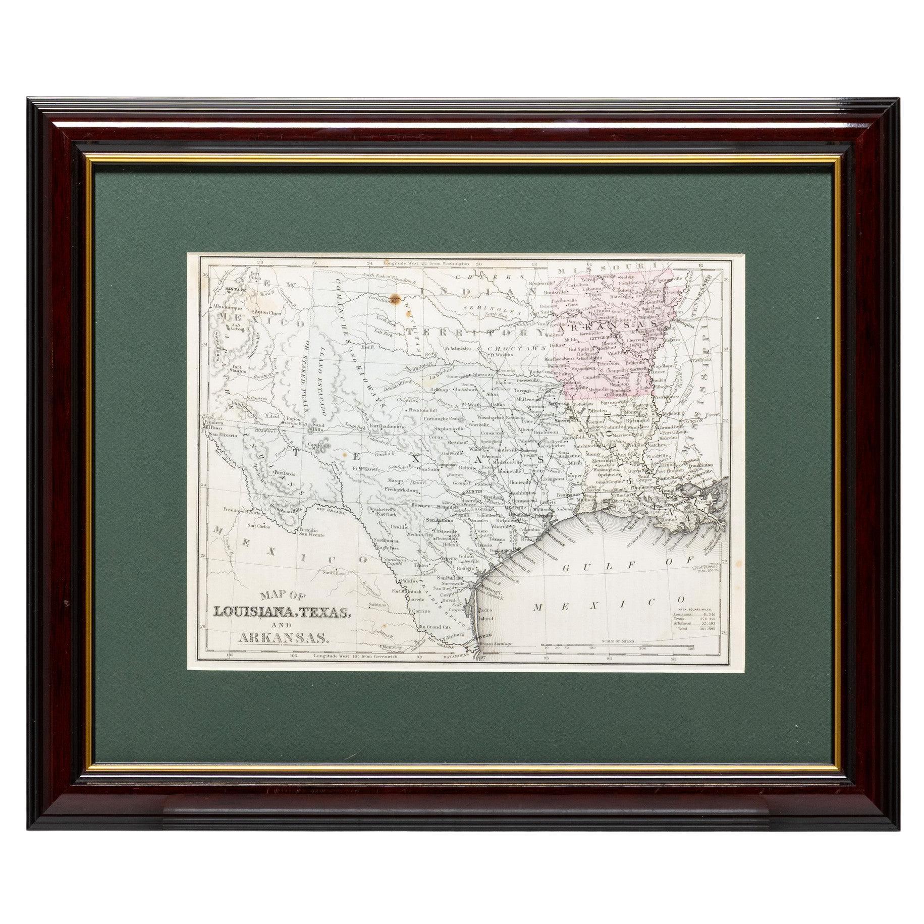
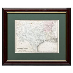
Framed Map of Texas Circa 1880
Located in Coeur d
Alene, ID
Framed circa 1880 map of Texas with Louisiana and Arkansas. Well detailed. Great for display in any home. Encased in cherry and gold frame with dark green mating. Size: 11" x 9", fra...
Category
Antique Late 19th Century American Maps
Materials
Paper
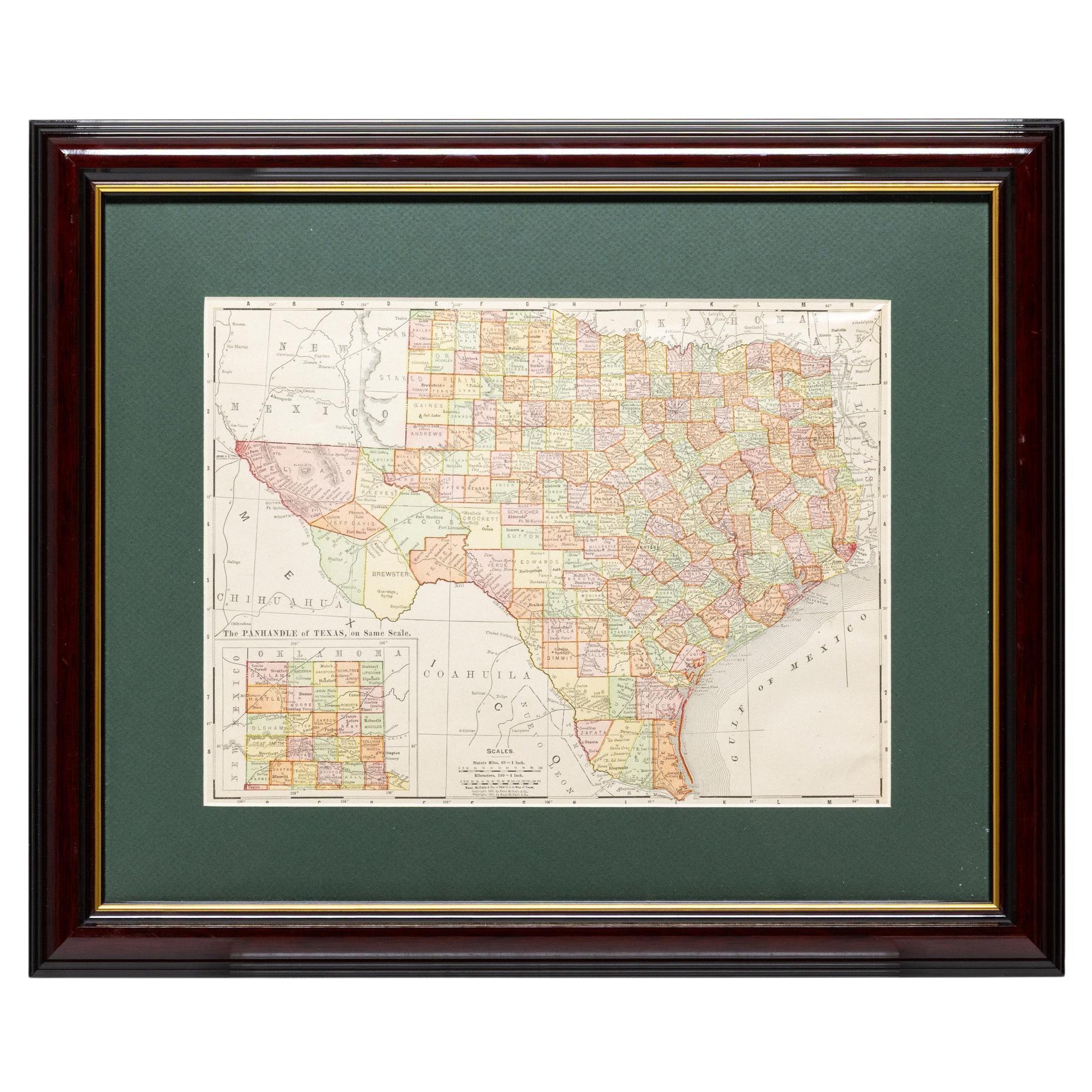
Framed Map of Texas Circa 1908
Located in Coeur d
Alene, ID
Framed circa 1908 map of Texas. Each county separated and colored with panhandle of Texas on same scale in left corner. Well detailed. Would display nicely in any home. Encased in ch...
Category
Early 20th Century American Maps
Materials
Paper