Items Similar to Original Antique Map of The Philippines. C.1900

Want more images or videos?
Request additional images or videos from the seller
1 of 5
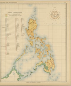
Original Antique Map of The Philippines. C.1900
$75
£56.69
€65.03
CA$104.55
A$113.81
CHF 60.41
MX$1,369.43
NOK 765.51
SEK 701.43
DKK 485.62
About the Item
Fabulous map of The Philippines
Original color.
Engraved and printed by the George F. Cram Company, Indianapolis.
Published, C.1900.
Unframed.
Free shipping.
- Dimensions:Height: 14.5 in (36.83 cm)Width: 11 in (27.94 cm)Depth: 0.07 in (1.78 mm)
- Materials and Techniques:Paper,Other
- Place of Origin:
- Period:
- Date of Manufacture:1900
- Condition:Wear consistent with age and use. ¹.
- Seller Location:St Annes, GB
- Reference Number:1stDibs: LU1836341615692
About the Seller
4.9
Platinum Seller
Premium sellers with a 4.7+ rating and 24-hour response times
1stDibs seller since 2016
3,260 sales on 1stDibs
Typical response time: 1 hour
Associations
International Confederation of Art and Antique Dealers
Associations
- ShippingRetrieving quote...Shipping from: St Annes, United Kingdom
- Return Policy
More From This Seller
View AllOriginal Antique Map of South East Asia by Thomas Clerk, 1817
Located in St Annes, Lancashire
Great map of South East Asia
Copper-plate engraving
Drawn and engraved by Thomas Clerk, Edinburgh.
Published by Mackenzie And Dent, 1817
Unframed.
Category
Antique 1810s English Maps
Materials
Paper

Original Antique Map of US Possessions In The Pacific Ocean, C.1900
Located in St Annes, Lancashire
Fabulous map of US possessions in the Pacific Ocean
Original color.
Engraved and printed by the George F. Cram Company, Indianapolis.
Published, C.1900.
Unframed.
Free shipping.
Category
Antique 1890s American Maps
Materials
Paper

Large Original Vintage Map of British Island Possessions, circa 1920
Located in St Annes, Lancashire
Great map of British Island Possessions
Original color. Good condition
Published by Alexander Gross
Unframed.
Category
Vintage 1920s English Maps
Materials
Paper

Large Original Vintage Map of S.E Asia, with a Vignette of Singapore
Located in St Annes, Lancashire
Great map of South East Asia
Original color. Good condition
Published by Alexander Gross
Unframed.
Category
Vintage 1920s English Maps
Materials
Paper

Large Original Vintage Map of The Pacific Islands Including Hawaii
Located in St Annes, Lancashire
Great map of The Pacific Islands
Unframed
Original color
By John Bartholomew and Co. Edinburgh Geographical Institute
Published, circa 1...
Category
Vintage 1920s British Maps
Materials
Paper

Large Original Antique Map of Asia by Sidney Hall, 1847
Located in St Annes, Lancashire
Great map of Asia
Drawn and engraved by Sidney Hall
Steel engraving
Original colour outline
Published by A & C Black. 1847
Unframed
Free shipping
Category
Antique 1840s Scottish Maps
Materials
Paper

You May Also Like
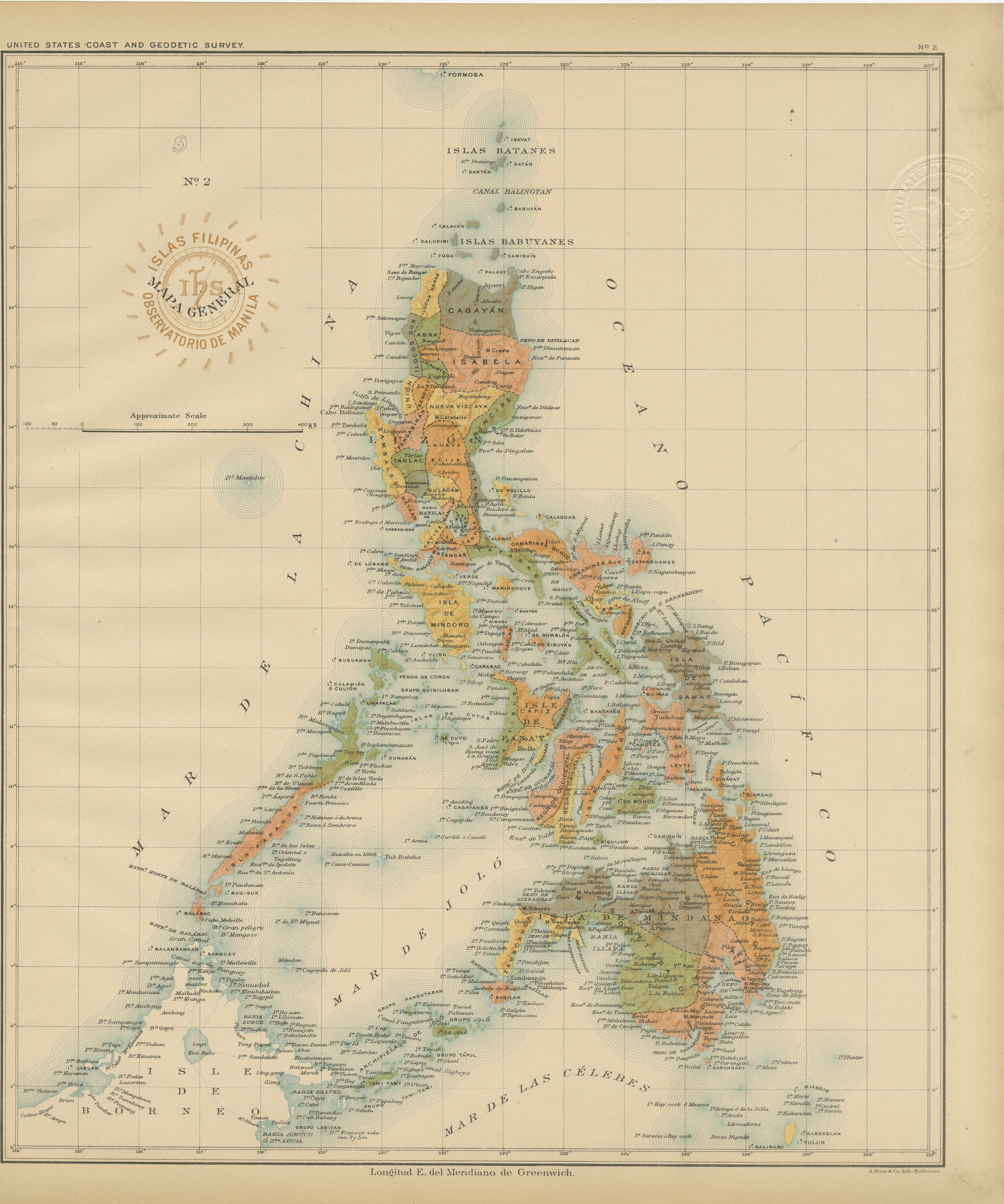
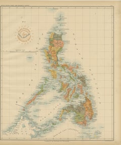
Antique Map of the Philippine Islands – Observatorio de Manila, 1899
Located in Langweer, NL
Antique Map of the Philippine Islands – Observatorio de Manila, 1899
This beautiful chromolithographed map titled “Islas Filipinas” was created in 1899 under the direction of Rev. J...
Category
Antique 1890s Philippine Maps
Materials
Paper
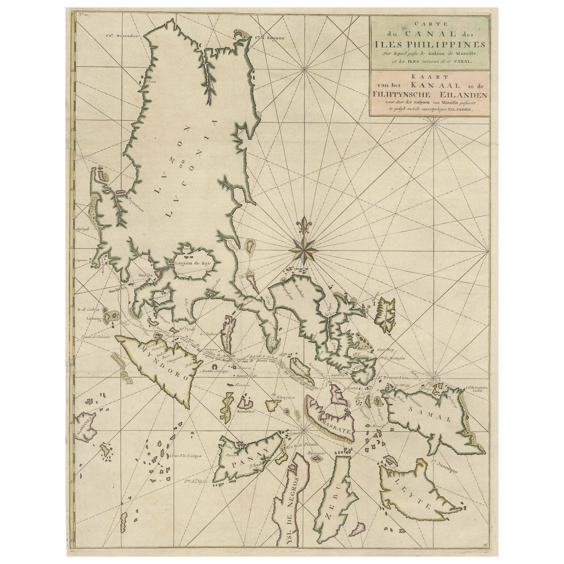
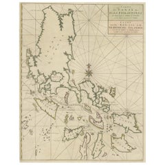
Original Old Map with Many Details Around Manilla in the Philippine Islands
By F. Valentijn
Located in Langweer, NL
Original antique map titled 'Carte du Canal des Iles Philippines (..) - Kaart van het Kanaal in de Filippynsche Eilanden (..)'. Striking and highly detailed chart of the Islands of the Philippines. Shows Islands, bays, reefs, soundings tracks of the Manila Galleon route, etc. Published 1724-1726 by Joannes van Braam...
Category
Antique Early 18th Century Maps
Materials
Paper
$1,055 Sale Price
20% Off
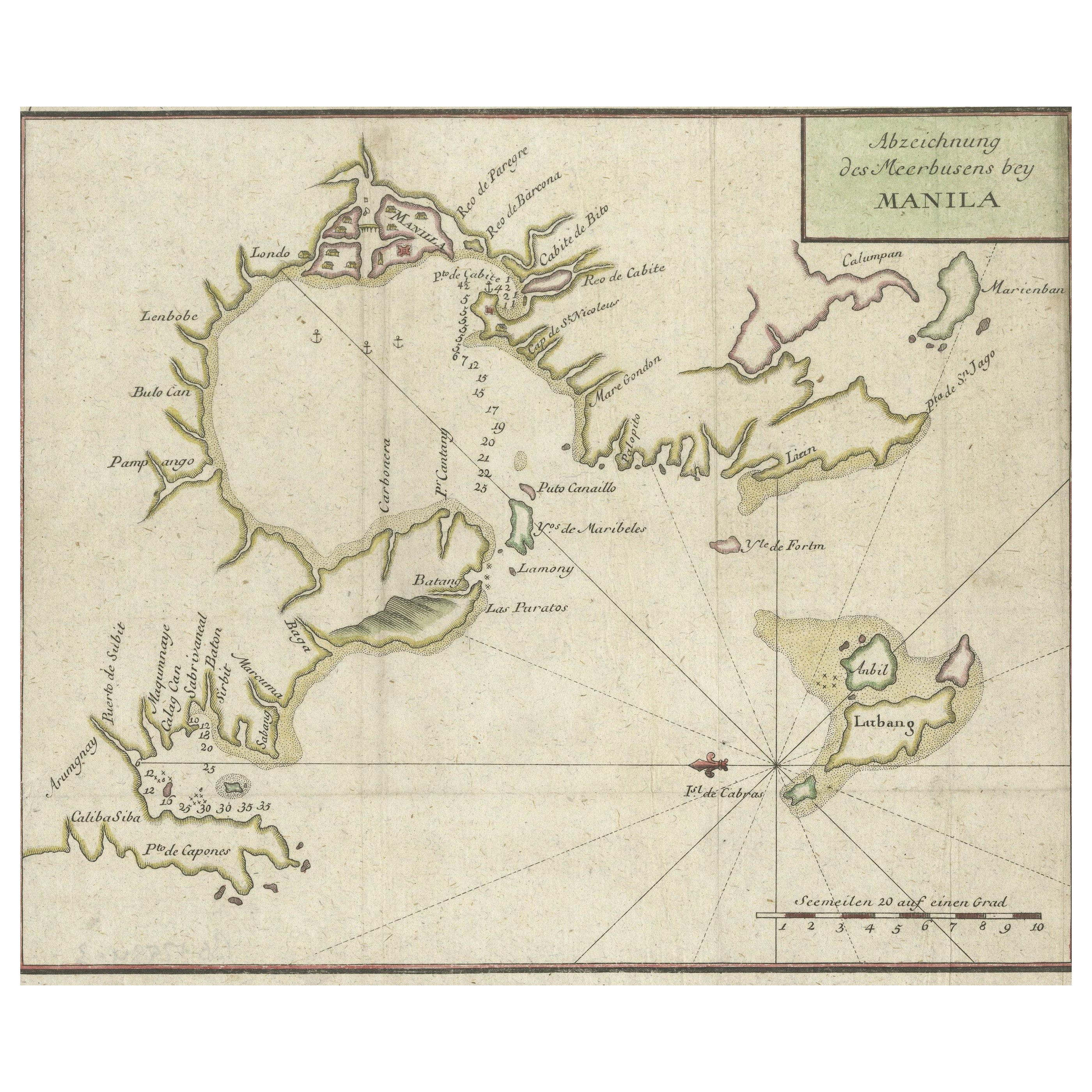
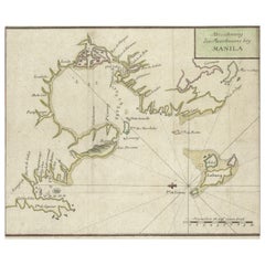
Antique Map of the Bay of Manila, Capital of the Philippines, 1763
Located in Langweer, NL
Antique map titled 'Abzeichnung des Meerbusens bey Manila'. Map of the Bay of Manila, capital of the Philippines. This map originates from a German edition of 'Voyage around the World...
Category
Antique Mid-18th Century British Maps
Materials
Paper
$441 Sale Price
20% Off
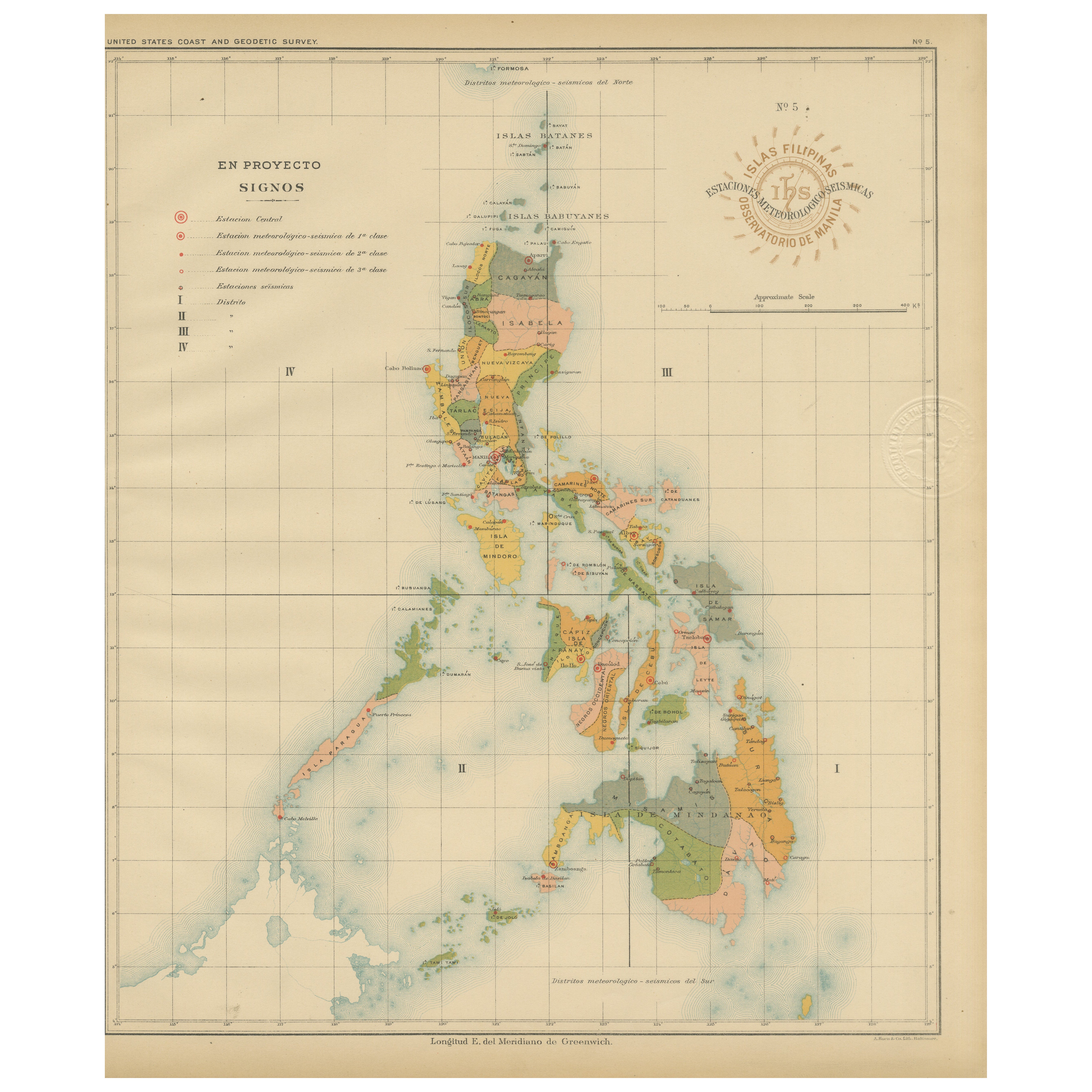
Philippine Meteorological
Seismological Network Map – Manila Observatory, 1899
Located in Langweer, NL
Title: Meteorological and Seismological Stations of the Philippines – Observatorio de Manila, 1899
This rare scientific chromolithograph titled “Islas Filipinas – Estaciones Meteoro...
Category
Antique 1890s Philippine Maps
Materials
Paper

Old Map of the Philippines and Part of Indonesia
Spice Islands
, 1744
Located in Langweer, NL
Antique map titled 'Nieuwe Kaart van de Filippynsche, Ladrones, Moluccos of Specery Eilanden, als mede Celebes etc'.
Old map of the Philippines and part of Indonesia. Originates ...
Category
Antique 1740s Maps
Materials
Paper

$633 Sale Price
20% Off
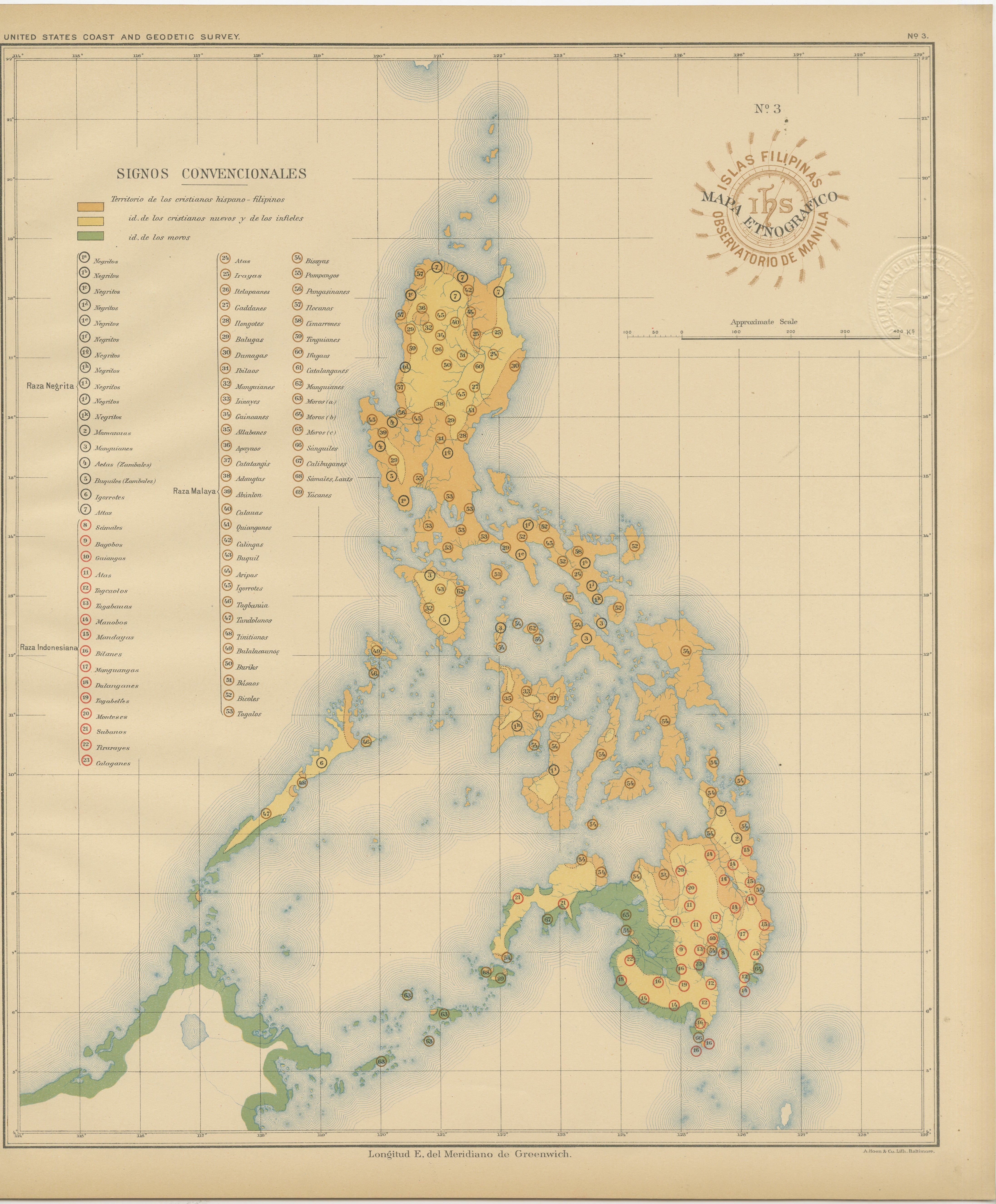
Ethnographic Map of the Philippine Islands – Observatorio de Manila, 1899
Located in Langweer, NL
Ethnographic Map of the Philippine Islands – Observatorio de Manila, 1899
This rare and fascinating chromolithographed map titled “Islas Filipinas – Mapa Etnográfico” was created in...
Category
Antique 1890s Philippine Maps
Materials
Paper
More Ways To Browse
Philippines Antique
18th Century Engravings
Antique Carved Wood Chair
Black Scandinavian Modern Dining Chairs
Dutch Mid Century Modern Table
Gold Modern Coffee Table
Iconic Modern Furniture
Midcentury Modern Gray Glass Vase
Round Glass Coffee Tables
Vintage Cave
18th Century Wood Side Tables
Antique Hand Carved Dining Room Sets
Mid Century Modern Pitcher
Vintage Italian Leather Dining Chair
Vintage Movie Posters
Blue Green Wool And Silk Rug
Brown Sheepskin Chair
Vintage Brass Bar Carts