Items Similar to Original Antique Map of the Road from London to Bensington

Want more images or videos?
Request additional images or videos from the seller
1 of 8
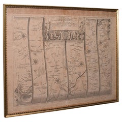
Original Antique Map of the Road from London to Bensington
$514.77
$643.4620% Off
£383.43
£479.2920% Off
€432
€54020% Off
CA$708.88
CA$886.1020% Off
A$771.60
A$964.5020% Off
CHF 408.84
CHF 511.0520% Off
MX$9,279.61
MX$11,599.5120% Off
NOK 5,198.31
NOK 6,497.8920% Off
SEK 4,763.68
SEK 5,954.6020% Off
DKK 3,291.55
DKK 4,114.4420% Off
About the Item
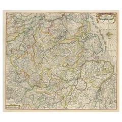
Antique map titled 'The Road from London to St. Davids in com: Pembroke (..)'. A strip map of the road from London to Bensington. The map is ornamented with numerous compass roses, and a decorative title cartouche. Originates from Ogilby's 'Britannia', the first road atlas of England
Wales, first published in 1675.
John Ogilby, born in Edinburgh in 1600, was a man of many parts, his various vocations included dancing instructor, tutor, theatre owner, translator, poet, printer, historian and mapmaker. He did not embark on his last profession until he was over sixty years of age but in the short time before his death in 1675 he achieved lasting fame with his great work on the English roads, 'Britannia', published the year he died. It proved to be a milestone in English cartography, the first real step forward since the publication of Saxton's atlas in 1579.
- Dimensions:Height: 20.08 in (51 cm)Width: 23.23 in (59 cm)Depth: 0.2 in (5 mm)
- Materials and Techniques:
- Period:Late 17th Century
- Date of Manufacture:c.1675
- Condition:Repaired: Original folding line, with repair. General age-related toning. Original folding line, with repair. Few tiny defects on folding line. Passepartout / matting included, however, the map can be easily removed. Minor wear and soiling, blank verso. Please study image carefully.
- Seller Location:Langweer, NL
- Reference Number:Seller: BG-13325-11stDibs: LU3054334059912
About the Seller
5.0
Recognized Seller
These prestigious sellers are industry leaders and represent the highest echelon for item quality and design.
Platinum Seller
Premium sellers with a 4.7+ rating and 24-hour response times
Established in 2009
1stDibs seller since 2017
2,824 sales on 1stDibs
Typical response time: 1 hour
- ShippingRetrieving quote...Shipping from: Langweer, Netherlands
- Return Policy
More From This Seller
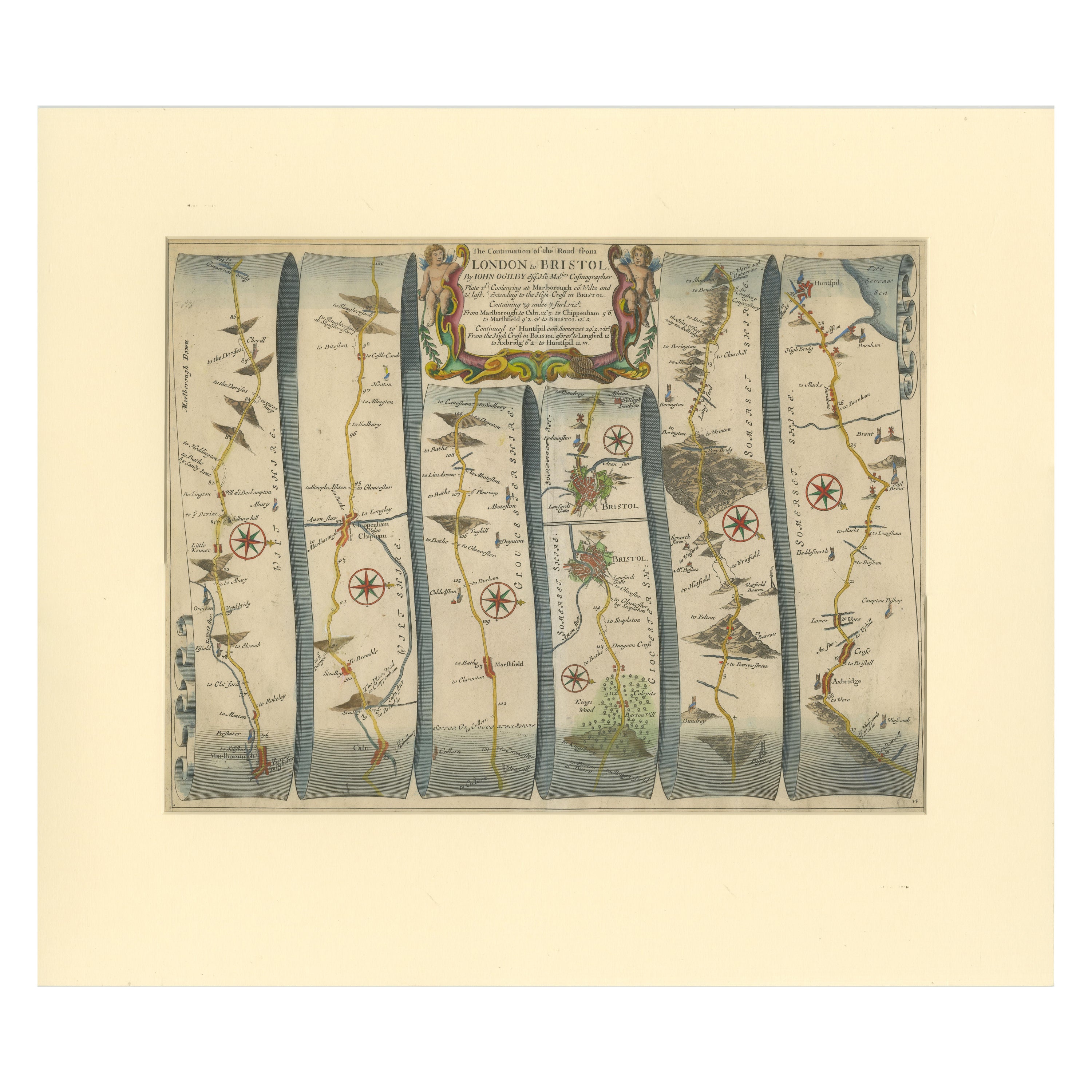
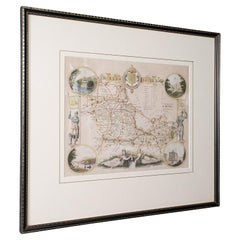
View AllOriginal Antique Map of the Road from Marlborough to Huntspil
Located in Langweer, NL
Antique map titled 'The Continuation of the Road from London to Bristol (..)'. A strip map of the continuation of the road from London to Bristol, this particular sheet showing the r...
Category
Antique Late 17th Century Maps
Materials
Paper
$514 Sale Price
20% Off
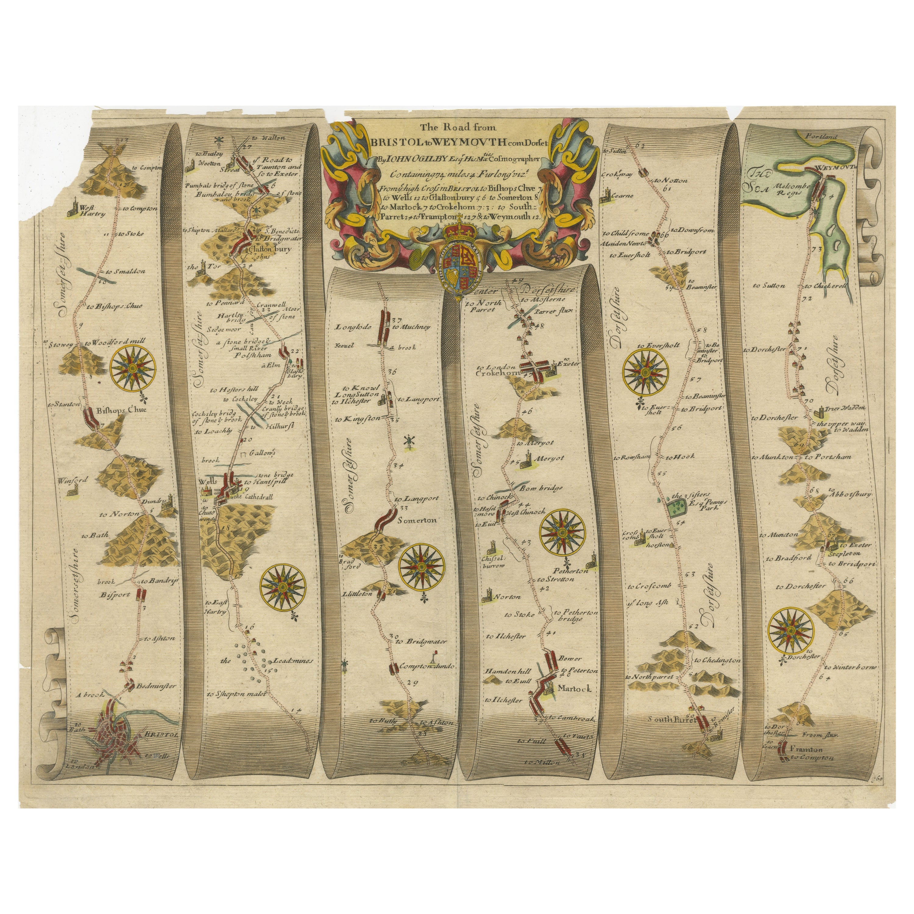
Original Antique Map of the Road from Bristol to Weymouth
Located in Langweer, NL
Antique map titled 'The Road from Bristol to Weymouth (..)'. Original antique map of the road from Bristol to Weymouth. Plate 60 from Ogilby's 'Britannia', the first road atlas of En...
Category
Antique Late 17th Century Maps
Materials
Paper
$209 Sale Price
20% Off
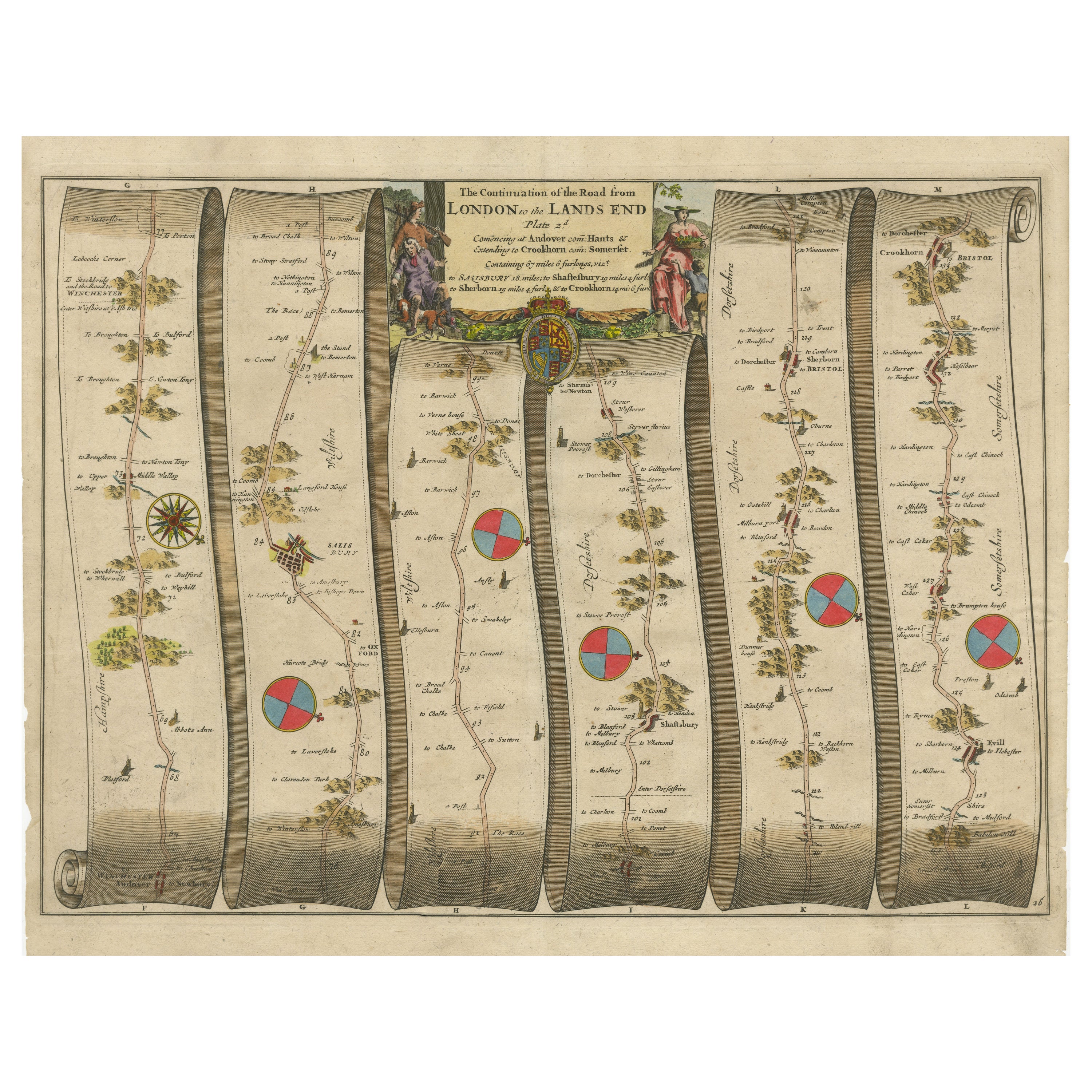
Original Antique Map of the Road from Andover to Crewkerne
Located in Langweer, NL
Antique map titled 'The Continuations of the Road from London to the Lands End'. Original antique map of the road from Andover to Crewkerne. Plate 26 from Ogilby's 'Britannia', the f...
Category
Antique Late 17th Century Maps
Materials
Paper
$734 Sale Price
20% Off
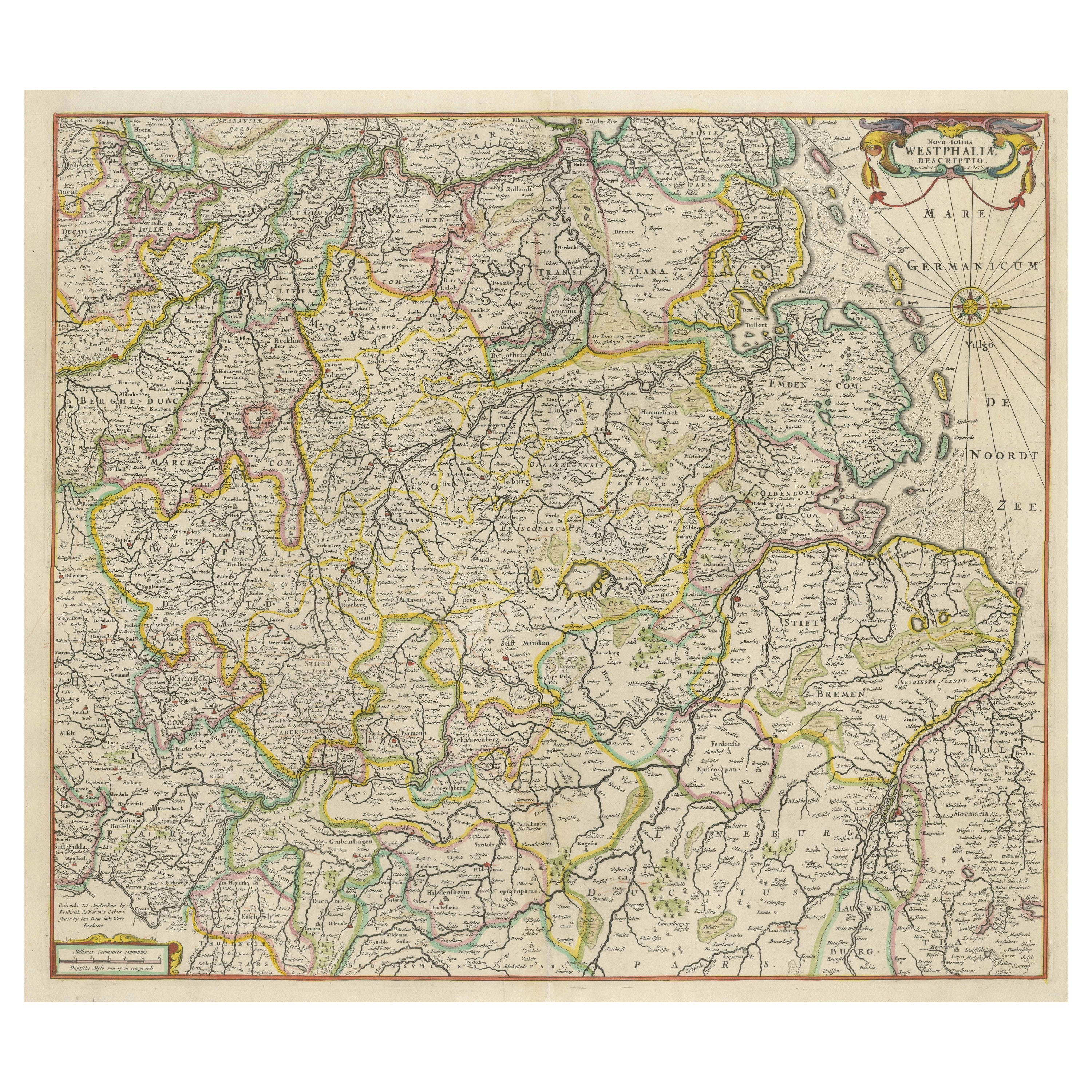
Antique Map of Westphalia, West Orientation
Located in Langweer, NL
Antique map titled 'Nova totius Westphaliae Descriptio'. Detailed map of Westphalia, Northern Germany. Oriented to the west. The area shown extends from Ha...
Category
Antique Late 17th Century Maps
Materials
Paper
$591 Sale Price
20% Off
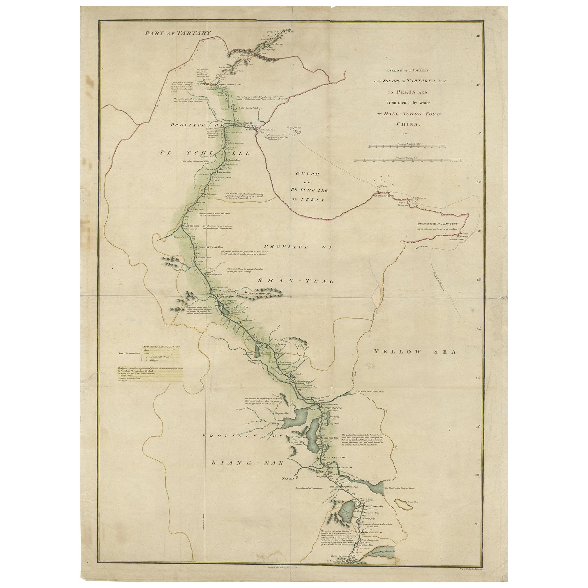
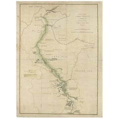
Antique Map of the Journey from Zhe-Hol in Tartary to Beijing and Hang-Tchoo Foo
Located in Langweer, NL
Antique map of China titled 'A Sketch of a Journey from Zhe-Hol in Tartary by land to Pekin and from thence by water to Hang-Tchoo-Foo in China'. Detailed map showing the route taken...
Category
Antique Late 18th Century Maps
Materials
Paper
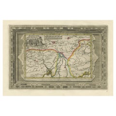
Benedictus Goes’ Route – Antique Map of Tartary to China by Van der Aa, 1714
Located in Langweer, NL
Benedictus Goes’ Route – Antique Map of Tartary to China by Van der Aa, 1714
This fascinating antique map titled De Land-Reyse door Benedictus Goes, van Lahor gedaan, door Tartaryen...
Category
Antique Early 18th Century Dutch Maps
Materials
Paper
$514 Sale Price
20% Off
You May Also Like
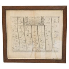
Map of the York to Weft-Chester Road
Located in London, England
A road map or strip map by John Ogilby, showing the route from Warrington to Derby, taken from the 1698 edition of Ogilby’s ‘Britannia’ map. Later solid oak frame.
U.K circa 1700.
H ...
Category
Antique Early 1700s Maps
Materials
Paper
Antique Road Map, Bristol to Weymouth, English, Framed Cartography, Georgian
Located in Hele, Devon, GB
This is an antique coaching road map of Bristol to Weymouth. An English, framed lithograph engraving of regional interest with second map to reverse, dating to the mid 18th century ...
Category
Antique Mid-18th Century British George II Maps
Materials
Glass, Wood, Paper
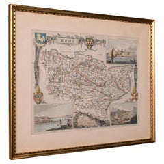
Antique Road Map, London to Hythe, Kent, English, Cartography, John Ogilby, 1675
Located in Hele, Devon, GB
This is an antique Road Map from London to Hythe, Kent. An English, cartographic atlas excerpt by John Ogilby, dating to the late 17th century with later frame, circa 1675
A superb ...
Category
Antique 17th Century British Queen Anne Maps
Materials
Glass, Paper
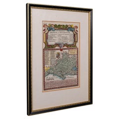
Vintage County Map, Kent, History 19th Century Cartography, After Thomas Moule
Located in Hele, Devon, GB
This is an vintage lithography map of Kent. An English, framed atlas engraving of cartographic interest, with mapping dating to the early 19th century.
Superb reproduction lithograp...
Category
Vintage 1980s British Early Victorian Maps
Materials
Glass, Paper
Antique West Yorkshire Map, English, Framed Lithography, Cartography, Victorian
Located in Hele, Devon, GB
This is an antique lithography map of West Yorkshire. An English, framed atlas engraving of cartographic interest, dating to the mid 19th century and later.
Superb lithography of t...
Category
Antique Mid-19th Century British Victorian Maps
Materials
Paper
1633 Map "La Souverainete De Sedan Et De Raucourt, Et La Prevoste Ric0011
Located in Norton, MA
1653 map entitled
"La Souverainete de Sedan et de Raucourt, et la Prevoste de Doncheri,"
Ric0011
Description:
Lovely map centered on Sedan and Doncheri and the Meuze River fr...
Category
Antique 17th Century Dutch Maps
Materials
Paper

More Ways To Browse
London Antique And Collectable London
Georgetown Map
Hemisphere Antiques
J Matthews
Japanese Kite
Maltese Falcon
Map Tuscany
St Eustatius
Sumba Map
Used Furniture Denver Co
Used Furniture Leominster
Vintage Long Island Map
Vintage World Map Desk
Vintage World Map Mirror
Antique Furniture Toledo Ohio
Antique Maps Washington Dc
Blaeu World Map
Cape Cod Map