Items Similar to Original Antique Map of Sweden, Engraved by Barlow, 1806


Want more images or videos?
Request additional images or videos from the seller
1 of 5
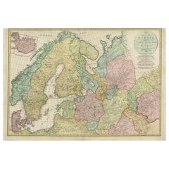
Original Antique Map of Sweden, Engraved by Barlow, 1806
$40
£30.43
€35.07
CA$56.79
A$60.92
CHF 32.68
MX$733.50
NOK 411.94
SEK 375.63
DKK 261.99
About the Item
Great map of Sweden
Copper-plate engraving by Barlow
Published by Brightly
Kinnersly, Bungay, Suffolk. 1806
Unframed.
About the Seller
4.9
Gold Seller
Premium sellers maintaining a 4.3+ rating and 24-hour response times
1stDibs seller since 2016
3,276 sales on 1stDibs
Typical response time: 1 hour
Associations
International Confederation of Art and Antique Dealers
Associations
- ShippingRetrieving quote...Shipping from: St Annes, United Kingdom
- Return Policy
More From This Seller
View AllLarge Original Vintage Map of Sweden and Norway circa 1920
Located in St Annes, Lancashire
Great map of Sweden and Norway
Original color. Good condition
Published by Alexander Gross
Unframed.
Category
Vintage 1920s English Victorian Maps
Materials
Paper

Original Antique Map of Europe, Arrowsmith, 1820
Located in St Annes, Lancashire
Great map of Europe
Drawn under the direction of Arrowsmith.
Copper-plate engraving.
Published by Longman, Hurst, Rees, Orme and Brown, 1820
...
Category
Antique 1820s English Maps
Materials
Paper

Large Original Antique Map of Europe by Sidney Hall, 1847
Located in St Annes, Lancashire
Great map of Europe
Drawn and engraved by Sidney Hall
Steel engraving
Original colour outline
Published by A & C Black. 1847
Unframed
Free shipping.
Category
Antique 1840s Scottish Maps
Materials
Paper

Original Antique Map of South America. C.1780
Located in St Annes, Lancashire
Great map of South America
Copper-plate engraving
Published C.1780
Two small worm holes to left side of map
Unframed.
Category
Antique Early 1800s English Georgian Maps
Materials
Paper

Original Antique Map of The World by Thomas Clerk, 1817
Located in St Annes, Lancashire
Great map of The Eastern and Western Hemispheres
On 2 sheets
Copper-plate engraving
Drawn and engraved by Thomas Clerk, Edinburgh.
Published by Mackenzie And Dent, 1817
...
Category
Antique 1810s English Maps
Materials
Paper

Original Antique Map of The World by Dower, circa 1835
Located in St Annes, Lancashire
Nice map of the World
Drawn and engraved by J.Dower
Published by Orr & Smith. C.1835
Unframed.
Free shipping
Category
Antique 1830s English Maps
Materials
Paper

You May Also Like
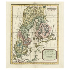
Antique Map of Sweden by Bowen, 1747
Located in Langweer, NL
Antique map titled 'A New & Accurate Map of Sweden'. This map covers Sweden and Finland (shown as part of Sweden) as well as parts of modern day Estonia,...
Category
Antique 18th Century Maps
Materials
Paper

$256 Sale Price
20% Off
Antique Map of Scandinavia by T. Jefferys, circa 1750
Located in Langweer, NL
Antique map titled 'Sweden, Denmark, Norway & Finland'. An original mid-18th century copper engraved antique map of Scandinavia by Thomas Jefferys....
Category
Antique Mid-18th Century Maps
Materials
Paper

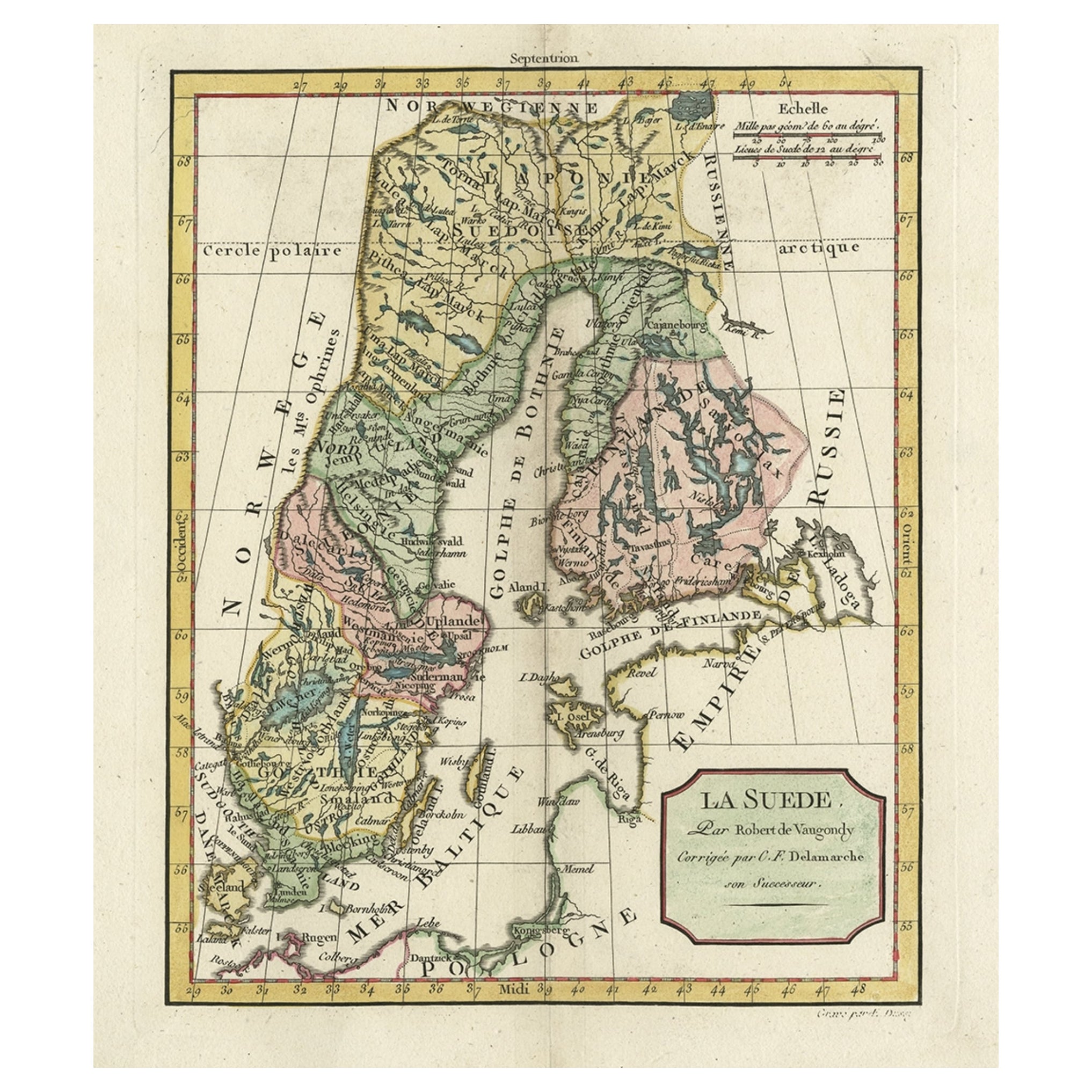
Decorative Antique Map of Sweden and Part of Finland, 1806
Located in Langweer, NL
Antique map titled 'La Suede.'
Decorative map of Sweden and part of Finland by Robert de Vaugondy, revised and published by Delamarche. Source unknown, to be determined.
Artists and Engravers: Made by 'Charles Francois Delamarche' after an anonymous artist. Charles Francois Delamarche (1740-1817) founded the important and prolific Paris based Maison Delamarche map publishing firm in the late 18th century. A lawyer by trade Delamarche entered the map business with the acquisition from Jean-Baptiste Fortin of Robert de Vaugondy's map plates...
Category
Antique Early 1800s French Maps
Materials
Paper
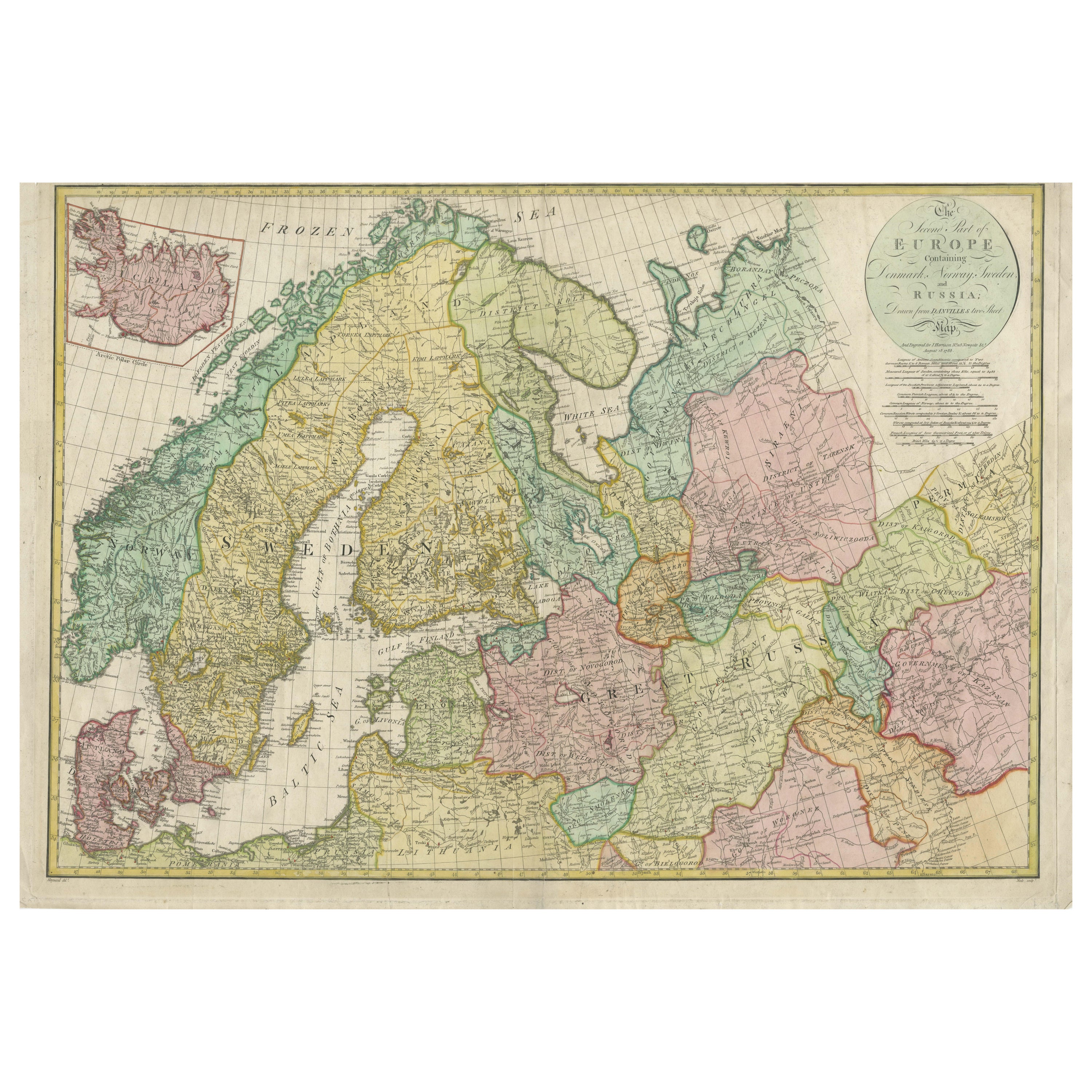
Historical Map of Northern Europe and Russia - Engraved for I. Harrison, 1788
Located in Langweer, NL
Historical Map of Northern Europe and Russia - Engraved for I. Harrison, 1788
This impressive historical map titled A New Map of Europe Containing Denmark, Norway, Sweden and Russ...
Category
Antique 1780s Maps
Materials
Paper
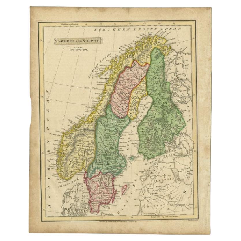
Antique Map of Sweden and Norway by W. G. Blackie, 1859
Located in Langweer, NL
Antique map titled 'Sweden and Norway'. Original antique map of Sweden and Norway. This map originates from ‘The Imperial Atlas of Modern Geography’. Published by W. G. Blackie, 1859.
Category
Antique Mid-19th Century Maps
Materials
Paper

$237 Sale Price
20% Off
Antique Map of Sweden and Norway by Russell, 1814
Located in Langweer, NL
Antique map Scandinavia titled 'Sweden & Norway'. Antique map of Scandinavia with a focus on Sweden and Norway. Artists and Engravers: Engrave...
Category
Antique 19th Century Maps
Materials
Paper

$85 Sale Price
20% Off
More Ways To Browse
Antique Swedish Plates
Antique Swedish Copper
Ancient Bible
Antique Bermuda Furniture
Antique Constellation Map
Antique Map Burgundy
Antique Map Of Hawaii
Antique Maps Of Long Island
Calcutta Map
Gibraltar Antique Map
Guyana Antique Map
Maps Of New Mexico
Saudi Arabia Map
16th Century Scotland
Antique Leather Map
Antique Map Of Argentina
Antique Map Of Colombia
Cornwall Map