Items Similar to Original Antique Map of Tartary
Northern China
Far Eastern Russia
, 1757


Want more images or videos?
Request additional images or videos from the seller
1 of 5
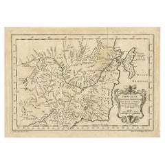
Original Antique Map of Tartary
Northern China
Far Eastern Russia
, 1757
$277.74
$347.1820% Off
£207.71
£259.6320% Off
€232
€29020% Off
CA$382.72
CA$478.4020% Off
A$417.54
A$521.9220% Off
CHF 221.08
CHF 276.3520% Off
MX$5,003.26
MX$6,254.0820% Off
NOK 2,815.61
NOK 3,519.5120% Off
SEK 2,574.66
SEK 3,218.3320% Off
DKK 1,766.96
DKK 2,208.6920% Off
About the Item
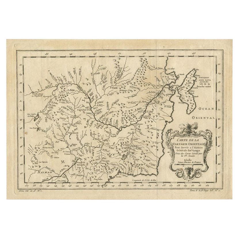
Antique map titled 'Carte de la Tartarie Orientale (..)'.
Original antique map of what is present day northern China and far eastern Russia. Centered on the Amur River, it shows what is a good bit of Manchuria and the Russia province of Khabarovsk. Shows the major hydrography as well as general terrain and what few towns and cities exist in the area. Just offshore is the Russian island of Sakhalin, though very primitively depicted. This map originates from 'Histoire générale des Voyages' by A. Prévost.
Artists and Engravers: Jacques-Nicolas Bellin (1703 - 1772) was one of the most important cartographers of the 18th century. With a career spanning some 50 years, Bellin is best understood as geographe de cabinet and transitional mapmaker spanning the gap between 18th and early 19th century cartographic styles. His long career as Hydrographer and Ingénieur Hydrographe at the French Dépôt des cartes et plans de la Marine resulted in hundreds of high quality nautical charts of practically everywhere in the world. A true child of the Enlightenment Era, Bellin's work focuses on function and accuracy tending in the process to be less decorative than the earlier 17th and 18th century cartographic work. Unlike many of his contemporaries, Bellin was always careful to cite his references and his scholarly corpus consists of over 1400 articles on geography prepared for Diderot's Encyclopedie. Bellin, despite his extraordinary success, may not have enjoyed his work, which is described as "long, unpleasant, and hard." In addition to numerous maps and charts published during his lifetime, many of Bellin's maps were updated (or not) and published posthumously. He was succeeded as Ingénieur Hydrographe by his student, also a prolific and influential cartographer, Rigobert Bonne.
- Dimensions:Height: 9.61 in (24.4 cm)Width: 13.47 in (34.2 cm)Depth: 0 in (0.02 mm)
- Materials and Techniques:
- Period:1750-1759
- Date of Manufacture:1757
- Condition:Wear consistent with age and use. Condition: Good, minor foxing. Original plate mark visible. Please study scan carefully.
- Seller Location:Langweer, NL
- Reference Number:Seller: BL-00017 1stDibs: LU3054327236472
About the Seller
5.0
Recognized Seller
These prestigious sellers are industry leaders and represent the highest echelon for item quality and design.
Platinum Seller
Premium sellers with a 4.7+ rating and 24-hour response times
Established in 2009
1stDibs seller since 2017
2,792 sales on 1stDibs
Typical response time: <1 hour
- ShippingRetrieving quote...Shipping from: Langweer, Netherlands
- Return Policy
More From This Seller
View AllAntique Map of Northern China and Eastern Russia by Bellin, 1757
Located in Langweer, NL
Antique map titled 'Carte de la Tartarie Orientale (..)'. Original antique map of what is present day northern China and far eastern Russia. Centered on...
Category
Antique 18th Century Maps
Materials
Paper
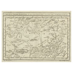
Antique Map of Northern China and Far Eastern Russia Around the Amur River, 1754
Located in Langweer, NL
Antique map titled 'Carte De La Tartarie Orientale (..)'. A map for this far eastern portion of what is present day northern China and far eastern Russia...
Category
Antique 1750s Maps
Materials
Paper

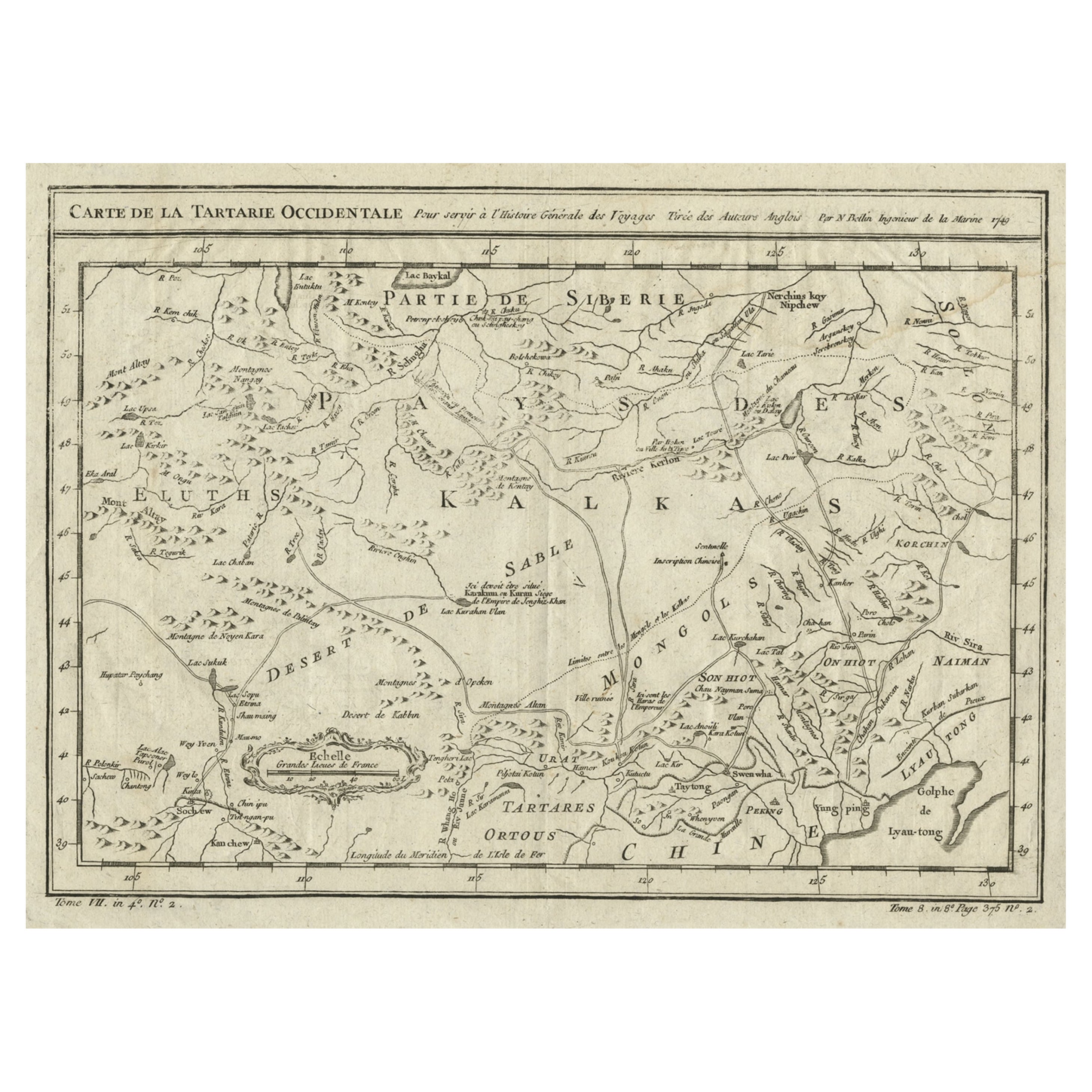
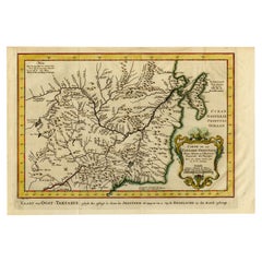
Antique Map of Manchuria and the Northeast Portion of Tartary
Located in Langweer, NL
Antique map titled 'Carte de la Tartarie Orientale (..)'. Detailed map of Manchuria and the Northeast portion of Tartary, including Sagallan Anga Hata--Isle de la Bouche...
Category
Antique Mid-18th Century Maps
Materials
Paper

$277 Sale Price
20% Off
Interesting Antique Map of Tartary and Northeast Asia, 1749
Located in Langweer, NL
Condition: Good, given age. Original folds, as issued. Some small water stains above image and top-right. Please study scan carefully.
Category
Antique 1740s Maps
Materials
Paper
$277 Sale Price
20% Off
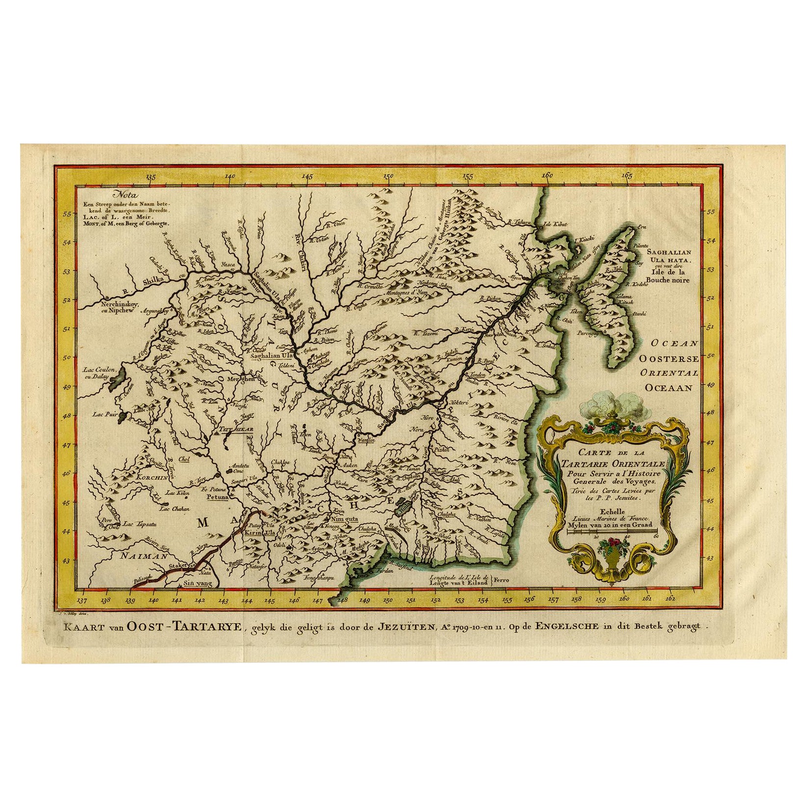
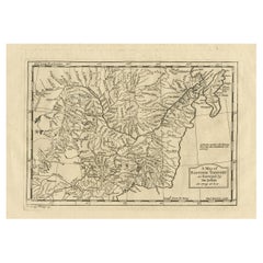
Antique Map of Eastern Tartary, now the Primorsky Krai Area, Russia, 1758
By Jakob van der Schley
Located in Langweer, NL
Antique map titled 'Carte de la Tartarie orientale.' A map of Eastern Tartary. East Tartary is an old names for the Manchu-inhabited territory extending from the River Amur to Sakhal...
Category
Antique 18th Century Maps
Materials
Paper
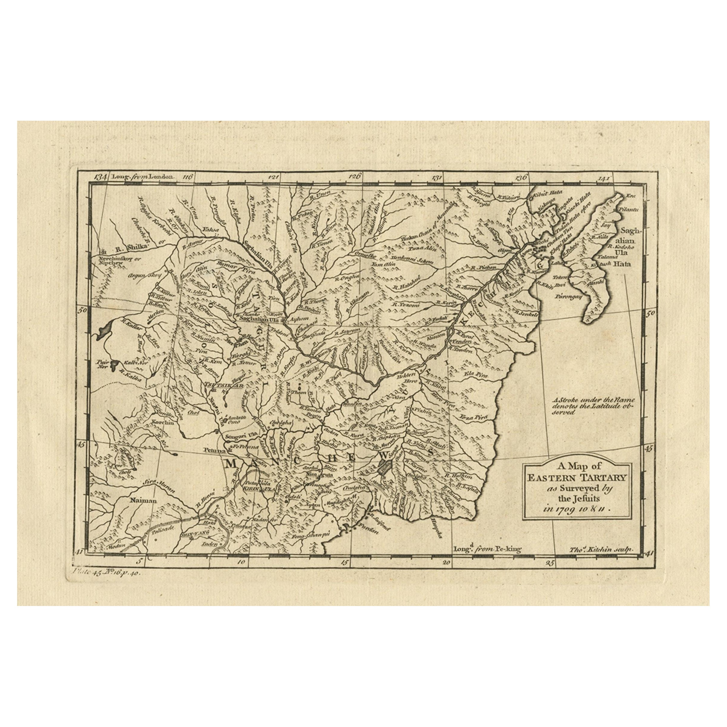
Antique Map of Eastern Tartary as Surveyed by the Jesuits, 1746
By Thomas Kitchin
Located in Langweer, NL
Antique map titled 'A Map of Eastern Tartary as Surveyed by the Jesuits in 1709, 10 & 11'. The map covers much of the course of the Amur River or Heilong Jiang, the world's tenth lon...
Category
Antique 18th Century Maps
Materials
Paper
You May Also Like
Antique French Map of Asia Including China Indoneseia India, 1783
Located in Amsterdam, Noord Holland
Very nice map of Asia. 1783 Dedie au Roy.
Additional information:
Country of Manufacturing: Europe
Period: 18th century Qing (1661 - 1912)
Condition: Overall Condition B (Good Used)...
Category
Antique 18th Century European Maps
Materials
Paper

$486 Sale Price
40% Off
1627 Hendrik Hondius Map Entitled "Vltoniae Orientalis Pars, " Ric.a009
Located in Norton, MA
1627 Hendrik Hondius map entitled
"Vltoniae orientalis pars,"
Ric.a009
Title:
Vltoniae orientalis : pars
Title (alt.) :
Ultoniae orientalis pars
Creator:
Mercator, Gerh...
Category
Antique 17th Century Dutch Maps
Materials
Paper

Super Rare Antique French Map of Chine and the Chinese Empire, 1780
Located in Amsterdam, Noord Holland
Super Rare Antique French Map of Chine and the Chinese Empire, 1780
Very nice map of Asia. 1780 Made by Bonne.
Additional information:
Type: Map
...
Category
Antique 18th Century European Maps
Materials
Paper

$438 Sale Price
49% Off
1714 Henri Chatelain "Nouvelle Carte Des Etatas Du Grand.Duc De Mos Moscovie Eur
Located in Norton, MA
A 1714 Henri Chatelain map, entitled
"Nouvelle Carte Des Etatas Du Grand Duc De Moscovie En Europe,"
Ricb001
Henri Abraham Chatelain (1684-1743) was a Huguenot pastor of Parisi...
Category
Antique Early 18th Century Dutch Maps
Materials
Paper

Original Antique Map of China, Arrowsmith, 1820
Located in St Annes, Lancashire
Great map of China
Drawn under the direction of Arrowsmith
Copper-plate engraving
Published by Longman, Hurst, Rees, Orme and Brown, 1820
Unfr...
Category
Antique 1820s English Maps
Materials
Paper

Antique 1803 Italian Map of Asia Including China Indoneseia India
Located in Amsterdam, Noord Holland
Antique 1803 Italian Map of Asia Including China Indoneseia India
Very nice map of Asia. 1803.
Additional information:
Type: Map
Country of Manufacturing: Europe
Period: 19th centu...
Category
Antique 19th Century European Maps
Materials
Paper

$438 Sale Price
39% Off
More Ways To Browse
Dutch Bible
New Jersey 19th Century
Thailand Map
Antique Coal Mining
Antique Dutch Bible
Antique Louisiana Map
Antique Maps Of Sicily
Iran Map
Map Of Great Britain
Sardinia Map
Antique Map Of Thailand
Antique Wooden Roller
Croatia Map
Kentucky Antique Furniture
Louisiana Antique Furniture
Map Of Ancient Greece
Map Of Native American Tribes
Old Spice