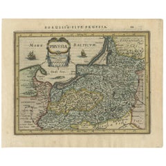
Items Similar to Original Decorative Antique Map of Prussia, 1628

Want more images or videos?
Request additional images or videos from the seller
1 of 5
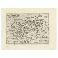
Original Decorative Antique Map of Prussia, 1628
On Hold
$528.39
$660.4920% Off
On Hold
£391.36
£489.1920% Off
On Hold
€440
€55020% Off
On Hold
CA$722.82
CA$903.5220% Off
On Hold
A$786.65
A$983.3120% Off
On Hold
CHF 417
CHF 521.2520% Off
On Hold
MX$9,463.97
MX$11,829.9720% Off
On Hold
NOK 5,288.91
NOK 6,611.1420% Off
On Hold
SEK 4,838.99
SEK 6,048.7320% Off
On Hold
DKK 3,352.88
DKK 4,191.0920% Off
About the Item
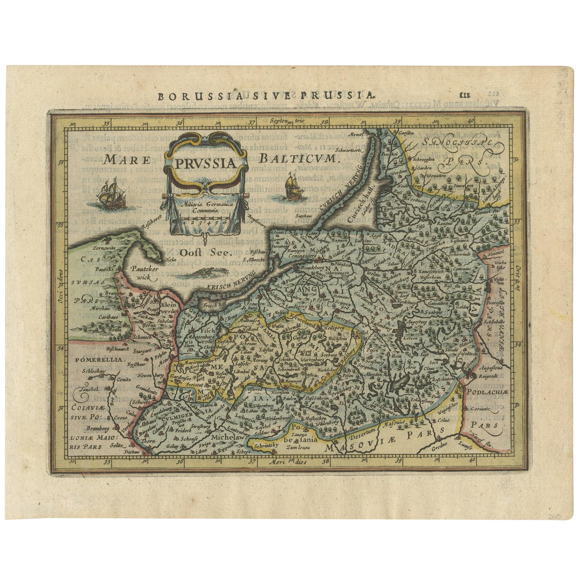
Antique map titled 'Prussia'. Original antique map of Prussia, a historically prominent German state that originated in 1525 with a duchy centered on the region of Prussia on the southeast coast of the Baltic Sea. This map originates from 'Atlas Minor Gerardi Mercatoris' published by J. Janssonius, 1628.
Artists and Engravers: Gerardus Mercator was a 16th-century geographer, cosmographer and cartographer from the County of Flanders. He is most renowned for creating the 1569 world map based on a new projection which represented sailing courses of constant bearing (rhumb lines) as straight lines—an innovation that is still employed in nautical ch
- Dimensions:Height: 7.09 in (18 cm)Width: 9.45 in (24 cm)Depth: 0 in (0.02 mm)
- Materials and Techniques:
- Period:1620-1629
- Date of Manufacture:1628
- Condition:Wear consistent with age and use. Condition: Good, general age-related toning. Minor wear, small hole outside image and top right corner missing. Latin text on verso, please study image carefully.
- Seller Location:Langweer, NL
- Reference Number:Seller: BG-12835-2 1stDibs: LU3054327151692
About the Seller
5.0
Recognized Seller
These prestigious sellers are industry leaders and represent the highest echelon for item quality and design.
Platinum Seller
Premium sellers with a 4.7+ rating and 24-hour response times
Established in 2009
1stDibs seller since 2017
2,816 sales on 1stDibs
Typical response time: 1 hour
- ShippingRetrieving quote...Shipping from: Langweer, Netherlands
- Return Policy
More From This Seller
View AllAntique Map of Prussia by Janssonius, 1628
Located in Langweer, NL
Antique map titled 'Prussia'. Original antique map of Prussia, a historically prominent German state that originated in 1525 with a duchy centered on th...
Category
Antique Mid-17th Century Dutch Maps
Materials
Paper
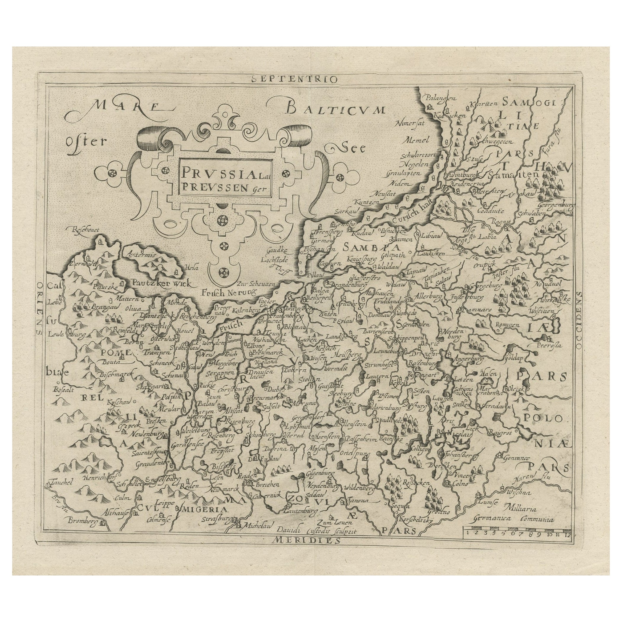
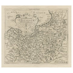
Original Antique Map of Prussia, ca.1630
Located in Langweer, NL
Antique map titled 'Prussia - Preussen'. Original map of Prussia, a historically prominent German state that originated in 1525 with a duchy centered on...
Category
Antique 1630s Maps
Materials
Paper
$653 Sale Price
20% Off
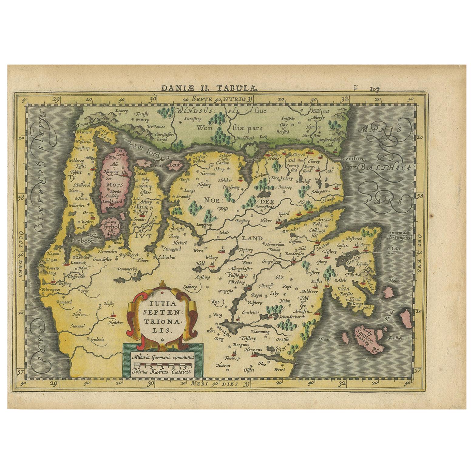
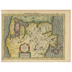
Antique Copper Engraved Map of Northern Jutland by P. Kaerius, 1628
Located in Langweer, NL
Antique map titled 'Iutia Septentrionalis'. Copper engraved map of Northern Jutland (Denmark) by P. Kaerius. This map originates from 'Atlas Minor (..)' by G. Mercator.
Category
Antique Mid-17th Century Dutch Maps
Materials
Paper
Antique Map of Prussia by Blaeu, circa 1635
By Willem Blaeu
Located in Langweer, NL
Antique map titled 'Prussiae Nova Tabula'. Rare early edition of Blaeu's map of Prussia, embellished with a gorgeous large format cartouche, compass ros...
Category
Antique Mid-17th Century Maps
Materials
Paper

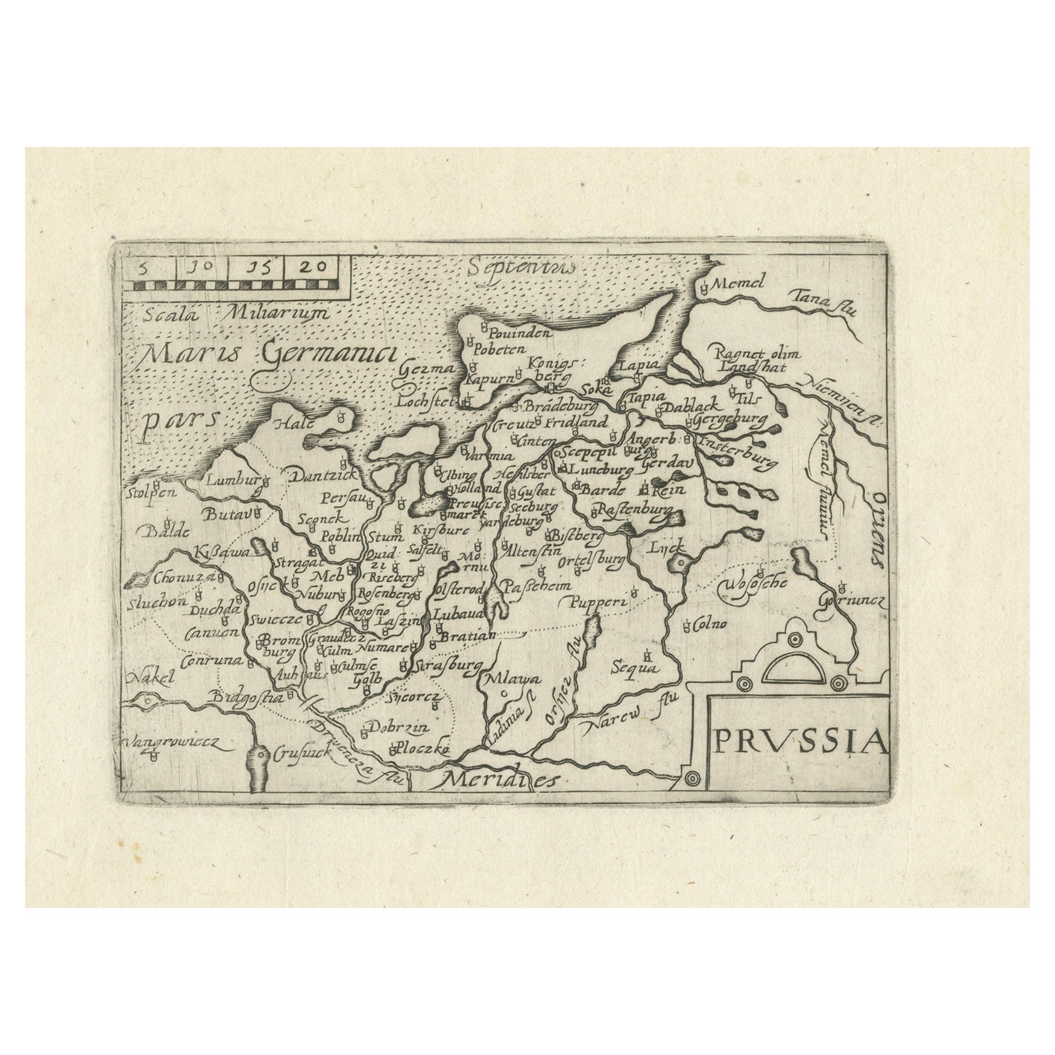
Extremele Rare, Original Miniature Map of Prussia, ca.1640
Located in Langweer, NL
Antique map titled 'Prussia'. Extremele rare, original miniature map of Prussia, a historically prominent German state that originated in 1525 with a du...
Category
Antique 1640s European Maps
Materials
Paper
$845 Sale Price
20% Off
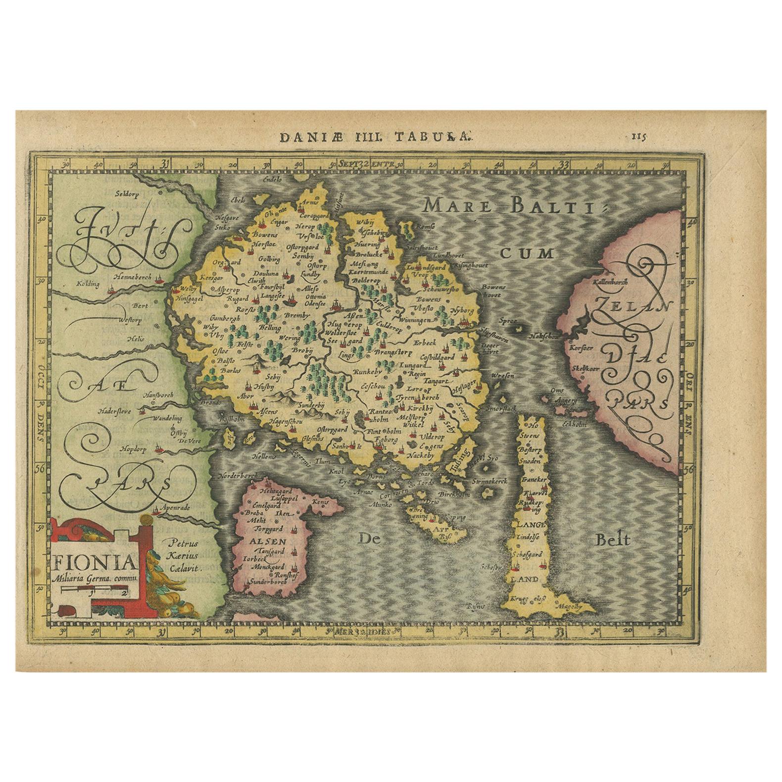
Antique Map of the Island of Funen by Kaerius, 1628
Located in Langweer, NL
Antique map titled 'Fionia'. Copper engraved map of the Island of Funen (Denmark) by P. Kaerius. Funen is Denmark's second largest island, between the Jutland peninsula, and the capi...
Category
Antique Mid-17th Century Maps
Materials
Paper

You May Also Like
Original Antique Map of Europe, Arrowsmith, 1820
Located in St Annes, Lancashire
Great map of Europe
Drawn under the direction of Arrowsmith.
Copper-plate engraving.
Published by Longman, Hurst, Rees, Orme and Brown, 1820
...
Category
Antique 1820s English Maps
Materials
Paper

Original Antique Map of Hungary, Arrowsmith, 1820
Located in St Annes, Lancashire
Great map of Hungary
Drawn under the direction of Arrowsmith.
Copper-plate engraving.
Published by Longman, Hurst, Rees, Orme and Brown, 1820
Unframed.
Category
Antique 1820s English Maps
Materials
Paper

Original Antique Map of Ireland- Kerry. C.1840
Located in St Annes, Lancashire
Great map of Kerry
Steel engraving
Drawn under the direction of A.Adlard
Published by How and Parsons, C.1840
Unframed.
Category
Antique 1840s English Maps
Materials
Paper

Original Antique Map of China, Arrowsmith, 1820
Located in St Annes, Lancashire
Great map of China
Drawn under the direction of Arrowsmith
Copper-plate engraving
Published by Longman, Hurst, Rees, Orme and Brown, 1820
Unfr...
Category
Antique 1820s English Maps
Materials
Paper

Original Antique Map of South America. C.1780
Located in St Annes, Lancashire
Great map of South America
Copper-plate engraving
Published C.1780
Two small worm holes to left side of map
Unframed.
Category
Antique Early 1800s English Georgian Maps
Materials
Paper

Original Antique Map of South Africa, Arrowsmith, 1820
Located in St Annes, Lancashire
Great map of South Africa.
Drawn under the direction of Arrowsmith.
Copper-plate engraving.
Published by Longman, Hurst, Rees, Orme and Br...
Category
Antique 1820s English Maps
Materials
Paper

More Ways To Browse
Taiwan Map
Antique Chicago Maps
Dutch Bible
New Jersey 19th Century
Thailand Map
Antique Coal Mining
Antique Dutch Bible
Antique Louisiana Map
Antique Maps Of Sicily
Iran Map
Map Of Great Britain
Sardinia Map
Antique Map Of Thailand
Antique Wooden Roller
Croatia Map
Kentucky Antique Furniture
Louisiana Antique Furniture
Map Of Ancient Greece