Items Similar to Palestine
Holy Land Map with Jerusalem Insets – Nieuwe Hand-Atlas, 1876

Want more images or videos?
Request additional images or videos from the seller
1 of 12
Palestine
Holy Land Map with Jerusalem Insets – Nieuwe Hand-Atlas, 1876
$491.98
£364.59
€410
CA$672.40
A$731.96
CHF 388.52
MX$8,807.03
NOK 4,923.12
SEK 4,510.97
DKK 3,123.09
About the Item
Palestine
Holy Land Map with Jerusalem Insets – Nieuwe Hand-Atlas, 1876
This detailed 19th-century map titled “Palestina” offers a comprehensive cartographic portrait of the Holy Land as it was understood in scholarly and biblical geography during the late 1800s. Published in 1876 in the *Nieuwe Hand-Atlas der Aarde in haren Tegenwoordigen Toestand* by M. Frijlink, revised by A. van Otterloo, and printed by D. Noothoven van Goor in Leiden, the map combines historical, biblical, and topographical information with meticulous Dutch engraving.
The main map extends from Lebanon in the north to the Sinai Peninsula in the south, and from the Mediterranean coast across the Jordan Valley into the mountainous regions of Judea, Samaria, Galilee, and Transjordan. Cities and towns of both historical and biblical significance—Jerusalem, Bethlehem, Nazareth, Jericho, Hebron, Safed, Tiberias, Jaffa, Gaza, Tyre, Sidon, and Beersheba—are clearly labeled. Rivers, mountains, deserts, caravan routes, and administrative divisions are finely engraved, giving the entire region exceptional clarity.
What makes this map particularly rich are its numerous inset maps:
• **Jerusalem and surroundings** — A close view of the city’s topography and ancient sites.
• **Present-day Jerusalem** — Showing city walls, religious landmarks, and 19th-century expansions.
• **Route of the Israelites from Egypt** — A historical-biblical route depiction extending across the Sinai.
• **Holy Land in biblical times** — A broader contextual map covering the Eastern Mediterranean.
• **Sinai and the Red Sea** — Depicting the presumed areas of the Exodus.
• **Wider Middle East** — Highlighting trade routes, ancient kingdoms, and scriptural geography.
The combination of biblical references with modern 19th-century geography reflects how cartographers of the era sought to unify contemporary scholarship with religious tradition. This plate is therefore equally appealing to collectors of historical cartography, Judaica, Christian history, and Eastern Mediterranean studies.
Engraved with precision and softened by hand-colored boundary lines, the map has a balanced and elegant composition that exemplifies Dutch atlas production during the period.
Condition Report: Good condition for age. Light toning and small foxing around the margins. Original center fold as issued. Clean impression with well-preserved engraving detail. No tears, repairs, or losses.
Framing Tips: A soft ivory mat enhances the fine linework, while a walnut, dark oak, or understated black frame gives the map a refined presence. Because of the multiple inset maps, a slightly wider mat margin creates visual balance. Beautiful for libraries, study rooms, or interiors focused on biblical history or Middle Eastern cartography.
Keywords: Palestine, Holy Land, Israel, Judea, Samaria, Galilee, Jerusalem, Bethlehem, Nazareth, Hebron, Jericho, Jaffa, Gaza, Beersheba, Dead Sea, Sea of Galilee, Jordan River, Lebanon, Phoenicia, Tyre, Sidon, Carmel, Haifa, Mount Sinai, Sinai Peninsula, Egypt, Red Sea, Damascus, Petra, Edom, Moab, Ammon, Philistia, Canaan, Biblical geography, Exodus route, Ottoman Palestine, 19th century Holy Land map, 1876 Palestina map, Nieuwe Hand-Atlas.
- Dimensions:Height: 17.33 in (44 cm)Width: 21.66 in (55 cm)Depth: 0.01 in (0.2 mm)
- Materials and Techniques:
- Place of Origin:
- Period:
- Date of Manufacture:1876
- Condition:Condition Report: Good condition for age. Light toning and small foxing around the margins. Original center fold as issued. Clean impression with well-preserved engraving detail. No tears, repairs, or losses.
- Seller Location:Langweer, NL
- Reference Number:Seller: BG-12788-221stDibs: LU3054347559712
About the Seller
5.0
Recognized Seller
These prestigious sellers are industry leaders and represent the highest echelon for item quality and design.
Platinum Seller
Premium sellers with a 4.7+ rating and 24-hour response times
Established in 2009
1stDibs seller since 2017
2,819 sales on 1stDibs
Typical response time: 1 hour
- ShippingRetrieving quote...Shipping from: Langweer, Netherlands
- Return Policy
More From This Seller
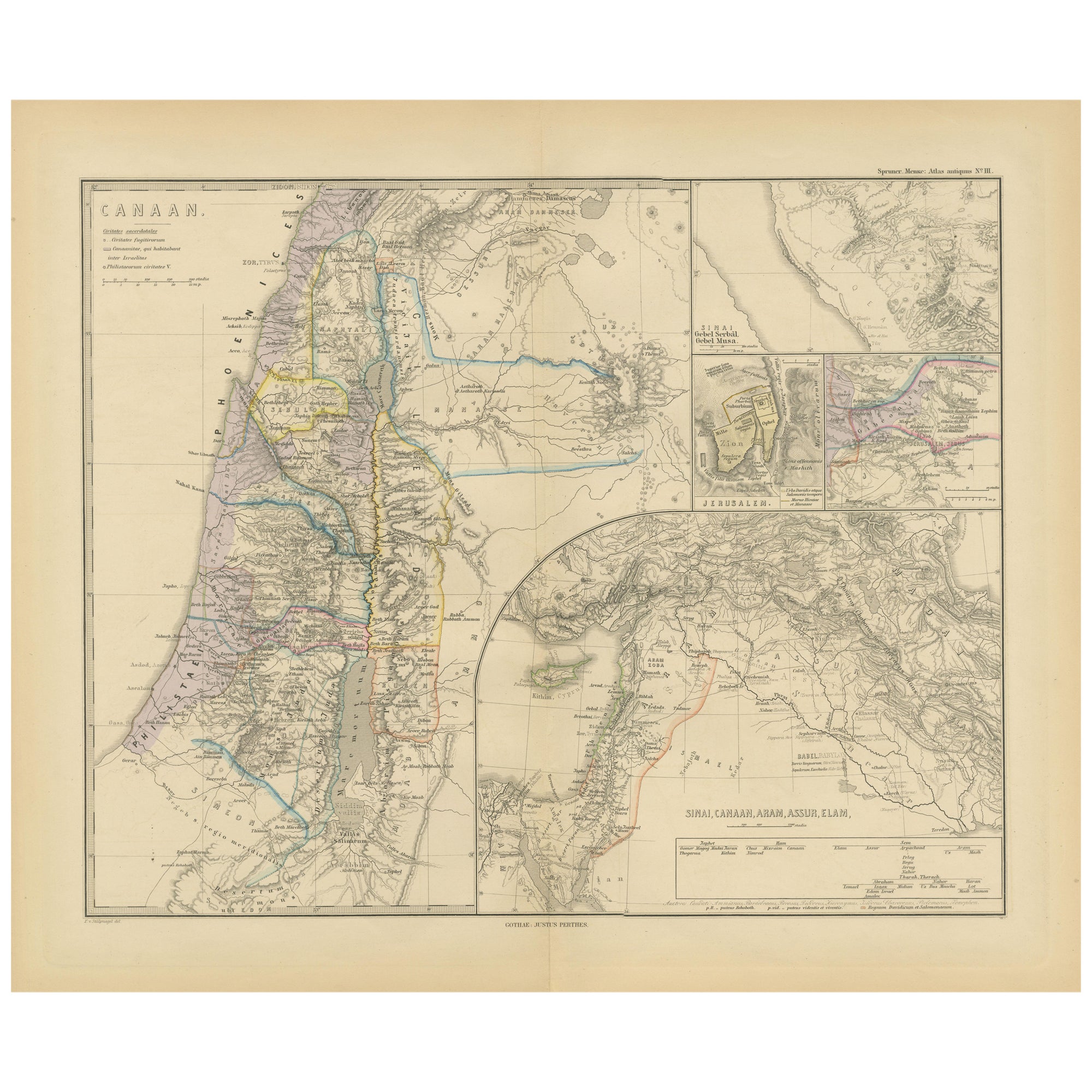
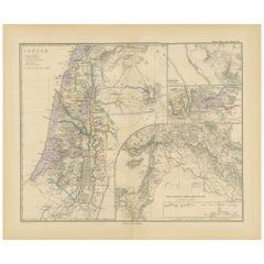
View AllHistorical Map of Canaan with Insets of Jerusalem and Surrounding Regions, 1880
Located in Langweer, NL
The map titled "CANAAN" depicts the historical region known as Canaan, located in the Levant, which corresponds to modern-day Israel, Palestinian territories, Lebanon, and parts of S...
Category
Antique 1880s Maps
Materials
Paper
$355 Sale Price
20% Off
Free Shipping
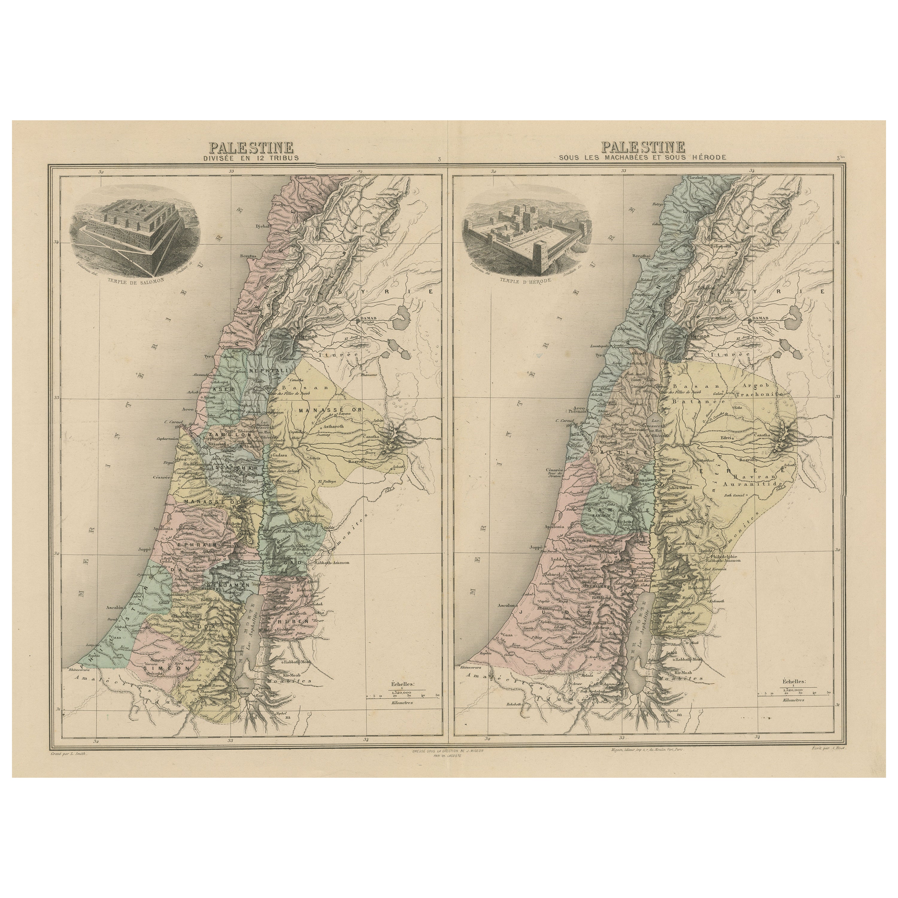
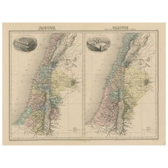
Palestine: Tribes
Maccabees – Antique Map by Migeon, Paris, 1892
Located in Langweer, NL
Palestine Divided into Tribes & Under the Maccabees – Antique Map by Migeon, 1892
This detailed antique map features two historical views of the Holy Land side by side: Palestine di...
Category
Antique Late 19th Century Maps
Materials
Paper
$326 Sale Price
20% Off
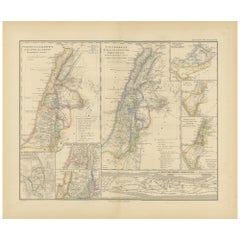
Antique Map of Egypt and Palestina by H. Kiepert, circa 1870
By Heinrich Kiepert
Located in Langweer, NL
Antique map titled 'Aegyptus, Phoenice et Palestina'. With inset maps of Tyrus, Alexandria and Hierosolyma. This map originates from 'Atlas Antiquus. Zwölf Karten zur Alten Geschicht...
Category
Antique Late 19th Century German Maps
Materials
Paper

$153 Sale Price
20% Off
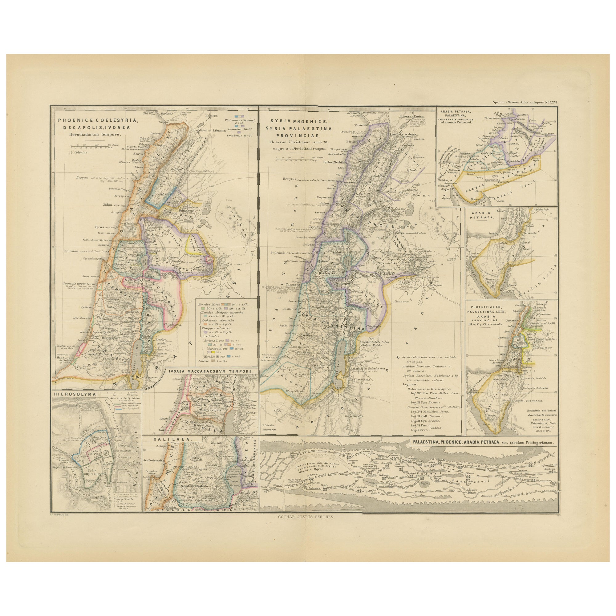
Levant in Antiquity: Lands of Phoenicia, Judea, and Neighboring Kingdoms, 1880
Located in Langweer, NL
The map is titled "PHOENICE, COELESYRIA, IDUMAEA, JUDAEA MACCABAEORUM TEMPORE," which translates to "Phoenicia, Coele-Syria, Idumea, Judea at the Time of the Maccabees."
This origi...
Category
Antique 1880s Maps
Materials
Paper
$355 Sale Price
20% Off
Free Shipping
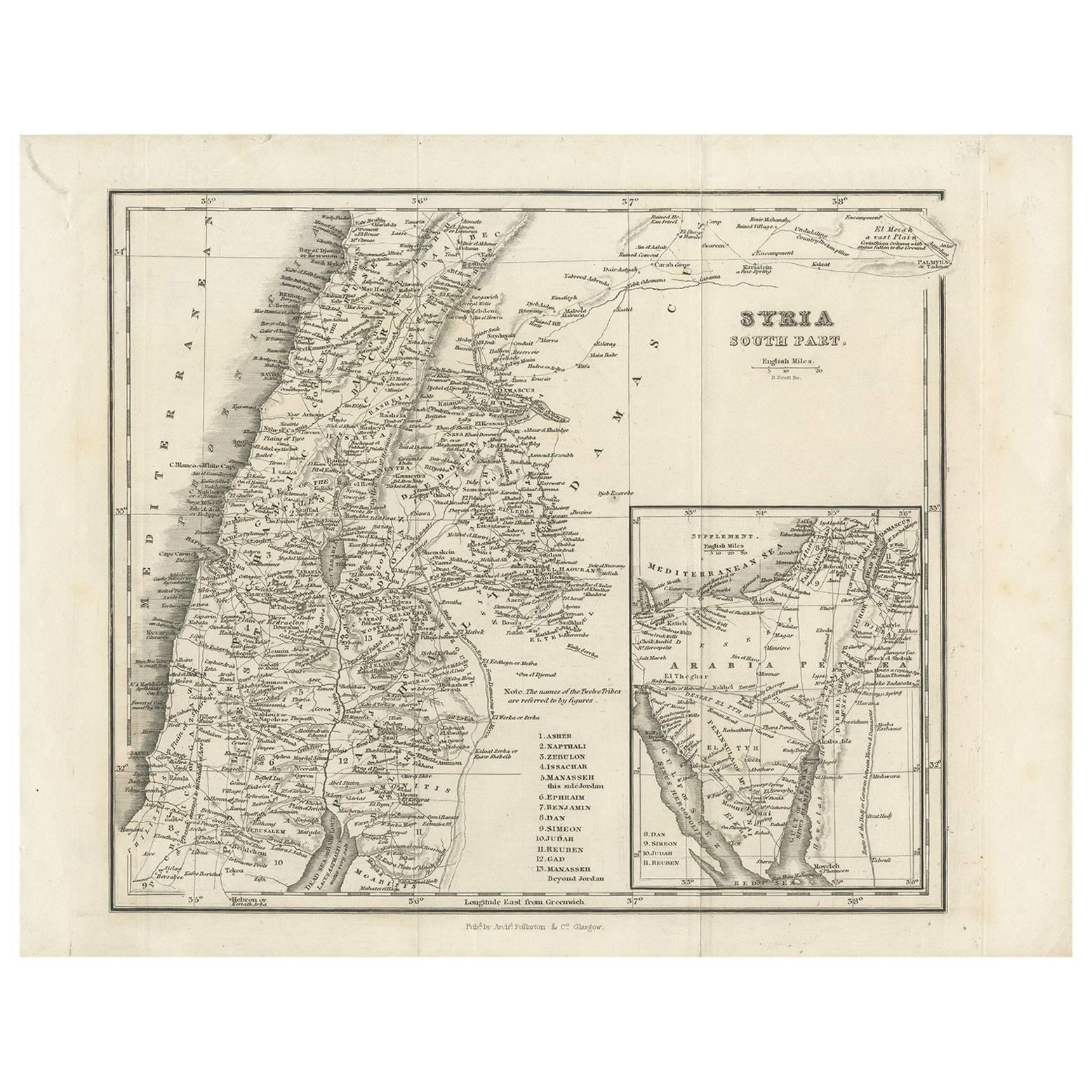
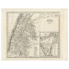
Antique Map of Southern Syria by Fullarton
Co, circa 1860
Located in Langweer, NL
Antique map titled 'Syria south part'. Published by Fullarton & Co, Glasgow, circa 1860.
- Title: Syria South Part
- Publisher: Fullarton & Co, Glasgow
- Date of Publication: Circa ...
Category
Antique Mid-19th Century English Maps
Materials
Paper
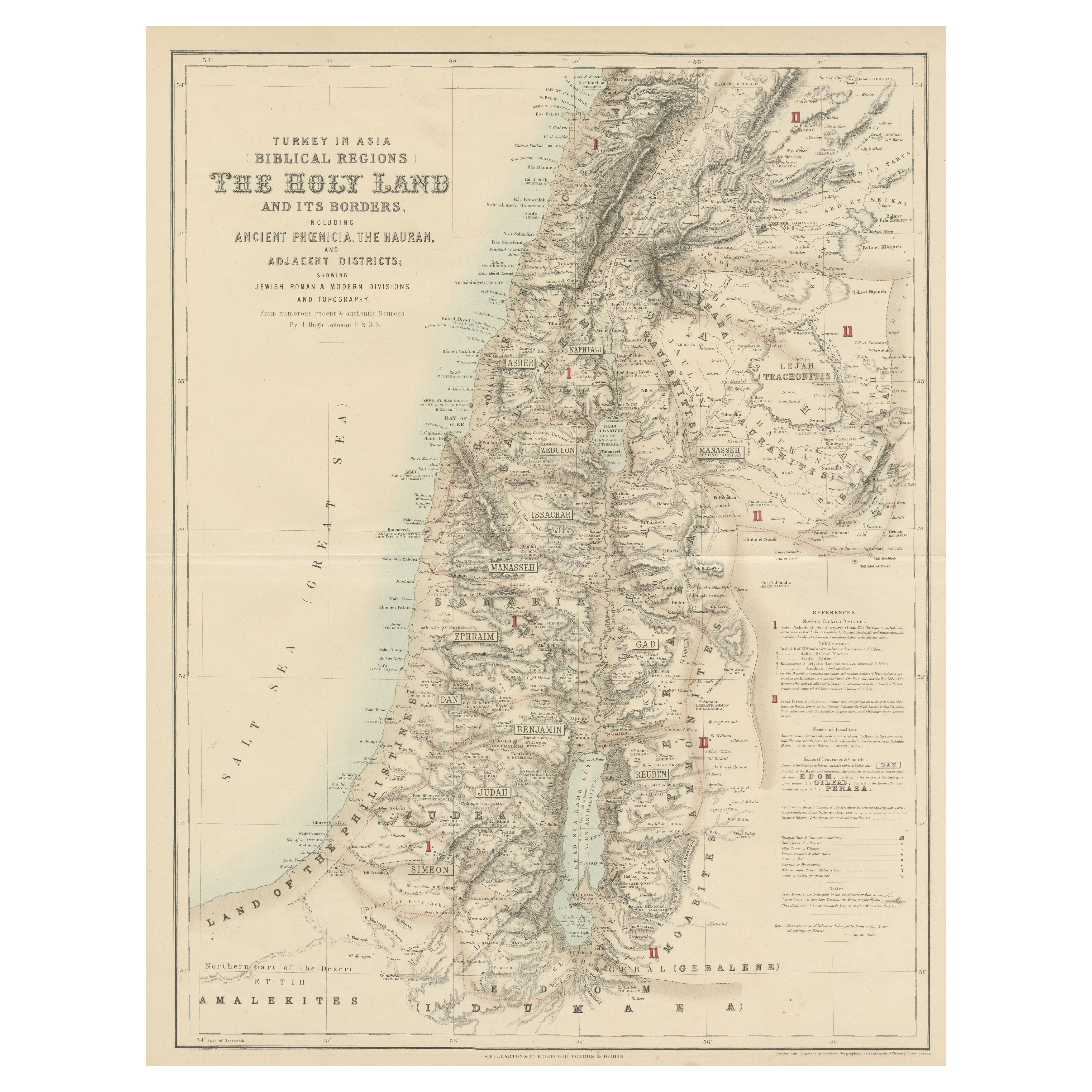
Turkey in Asia: Biblical Regions and the Holy Land from The Royal Atlas (1856)
Located in Langweer, NL
This antique map titled "Turkey in Asia (Biblical Regions) The Holy Land and its Borders" comes from "The Royal Illustrated Atlas", which was published in 1856 by A. Fullarton & Co. ...
Category
Antique Mid-19th Century Maps
Materials
Paper
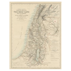
$633 Sale Price
20% Off
You May Also Like
Large Original Vintage Map of Israel, circa 1920
Located in St Annes, Lancashire
Great map of Israel
Original color.
Good condition
Published by Alexander Gross
Unframed.
Category
Vintage 1920s English Edwardian Maps
Materials
Paper

Map of the Holy Land "Carte de la Syrie et de l
Egypte" by Pierre M. Lapie
By Pierre M. Lapie
Located in Alamo, CA
An early 19th century map of ancient Syria and Egypt entitled "Carte de la Syrie et de l'Egypte anciennes/dressée par M. Lapie, Colonel d'Etat Major, et...
Category
Antique Early 19th Century French Maps
Materials
Paper

$620 Sale Price
20% Off
Map of the Holy Land "Carte de la Syrie et de l
Egypte" by Pierre Lapie
By Pierre M. Lapie
Located in Alamo, CA
This is an early 19th century map of ancient Syria and Egypt entitled "Carte de la Syrie et de l'Egypte anciennes/dressée par M. Lapie, Colonel d'Etat M...
Category
1830s Landscape Prints
Materials
Engraving

Africa. North-West Part. Century Atlas antique vintage map
Located in Melbourne, Victoria
'The Century Atlas. Africa. Southern Part'
Original antique map, 1903.
Central fold as issued. Map name and number printed on the reverse corners.
Sheet 40cm by 29.5cm.
Category
Early 20th Century Victorian More Prints
Materials
Lithograph

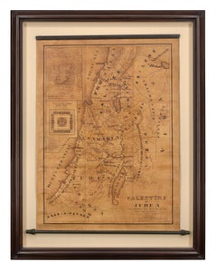
Map of Palestine or Judea, Illustrating the History of the New Testament
By Rev. Nathan B. Rogers
Located in New York, NY
Pen and ink on paper, laid down on canvas, mounted to wooden scroll bars
Signed and dated lower right: “Drawn by N. B. Rogers August. 1843”
Inscribed with an ownership inscription on the verso: Rev. E. D. Daniels, Palmer, Mass.
Provenance:
Rev. Eugene Davidson Daniels, Palmer, Massachusetts, 1871
This extraordinary manuscript map is a rare survivor of the devotional and educational culture of New England in the first half of the nineteenth century. Although at first glance resembling a large-scale engraving or printed publication, this precisely rendered wall map was entirely drawn by hand, the product of meticulous research by a minister working in isolation in rural Maine. The map shows New Testament era cities, towns, tribal areas, and political borders as well as physical features such as rivers, lakes, mountains, and hills (indicated by half-tone cross-hatching). On to this geographically accurate rendering of the Holy Land, Rogers has located and inscribed significant locales mentioned in the Gospels and has annotated these places with relevant citations from the Bible. He further records these by plotting the travels of Jesus on what resemble a series of trails across the Holy Land. Each is distinguished by a different pattern of dots and dashes – correlated to an explanatory table at the lower right. From this we know that these lines document the “Flight into Egypt and return,” “Travels of Christ from Nazareth to Jerusalem and return,” “Travels from the commencement of his Ministry to the first Passover,” “Travels from the first and the second Passover,” “Travels from Jerusalem to Galilee after the 2nd Passover,” and “Travels from the third Passover to the Crucifixion.”
An inset map of “Jerusalem...
Category
19th Century More Art
Materials
Canvas, Paper, Ink, Pen
Circa 1825 original engraving of the map of Syria by Giraldon Bovinet
Located in PARIS, FR
The circa 1825 original engraving of "Syrie" by Giraldon Bovinet, based on the work of L. Vivien, is a historically significant map that reflects early 19th-century cartographic tech...
Category
1820s Prints and Multiples
Materials
Paper, Engraving
