Items Similar to Physical
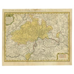
Political Map of Switzerland: Late 18th Century - Mentelle Atlas


Want more images or videos?
Request additional images or videos from the seller
1 of 8
Physical
Political Map of Switzerland: Late 18th Century - Mentelle Atlas
$503.19
$628.9920% Off
£375.35
£469.1920% Off
€424
€53020% Off
CA$700.37
CA$875.4620% Off
A$751.37
A$939.2220% Off
CHF 403.02
CHF 503.7820% Off
MX$9,046.43
MX$11,308.0420% Off
NOK 5,080.55
NOK 6,350.6920% Off
SEK 4,632.76
SEK 5,790.9520% Off
DKK 3,231.20
DKK 4,03920% Off
About the Item
Antique Map with Title: 'Carte Physique et Politique de la Suisse'
**Publication Details:**
- **Atlas Title:** Nouvel Atlas Universel de Géographie Ancienne et Moderne
- **Purpose:** For the Nouvelle Edition de la Géographie de Guthrie
- **Mapmakers:** E. Mentelle, with contributions from various geographical works
- **Publisher:** Chez Hyacinthe Langlois, Libraire, quai des Augustins, n° 45
- **Year:** An VI - 1797 (French Revolutionary Calendar)
**Geographical Scope:**
This antique map illustrates the physical and political landscape of Switzerland, capturing its various regions, cantons, and neighboring areas.
**Map Features:**
- **Regions Displayed:** Entire territory of Switzerland, including all its cantons.
- **Notable Regions and Territories:** Detailed depictions of Swiss cantons such as Zurich, Bern, Lucerne, and Geneva, as well as neighboring regions of France and Italy.
- **Seas and Bodies of Water:** Lake Geneva, Lake Constance, and various rivers within Switzerland.
- **Topographical Details:** Includes mountain ranges, rivers, and other significant geographical features as understood in the late 18th century.
- **Cartographic Style:** Detailed engraving with hand-colored boundaries, emphasizing both historical accuracy and artistic presentation.
**Purpose and Use:**
This map serves as a detailed visual representation of the geographical and political landscape of Switzerland, reflecting the geographical understanding and cartographic style of the late 18th century. It is part of a larger atlas that includes 60 maps, providing a comprehensive view of both ancient and modern geography as known in 1797.
### Condition Report
The map is in good condition with minor age-related wear. Hand-colored boundaries are well-preserved, enhancing the clarity of regions and features. Slight fold lines and edge wear are visible, with some age spots.
### Coloring
The hand-colored boundaries on the map highlight regions and territories, adding clarity and visual appeal, typical of late 18th-century cartographic practices.
- Dimensions:Height: 16.23 in (41.2 cm)Width: 22.25 in (56.5 cm)Depth: 0.01 in (0.2 mm)
- Materials and Techniques:Paper,Engraved
- Period:
- Date of Manufacture:1797
- Condition:The map is in good condition with minor age-related wear. Hand-colored boundaries are well-preserved, enhancing the clarity of regions and features. Slight fold lines and edge wear are visible, with some age spots.
- Seller Location:Langweer, NL
- Reference Number:Seller: BG-13769-161stDibs: LU3054340561872
About the Seller
5.0
Recognized Seller
These prestigious sellers are industry leaders and represent the highest echelon for item quality and design.
Platinum Seller
Premium sellers with a 4.7+ rating and 24-hour response times
Established in 2009
1stDibs seller since 2017
2,830 sales on 1stDibs
Typical response time: 1 hour
- ShippingRetrieving quote...Shipping from: Langweer, Netherlands
- Return Policy
More From This Seller
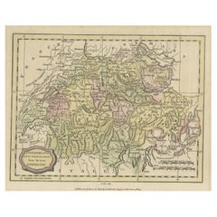
View AllAntique Map of Switzerland by Keizer
de Lat, 1788
Located in Langweer, NL
Antique map titled 'La Suisse (..)'. Uncommon original antique map of Switzerland. This map originates from 'Nieuwe Natuur- Geschied- en Handelkundige Zak- en Reisatlas' by Gerrit Br...
Category
Antique Late 18th Century Maps
Materials
Paper

$332 Sale Price
20% Off
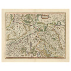
Map of Northwestern Switzerland (Basel and Zurich Region) by Willem
Jan Blaeu
Located in Langweer, NL
Map of Northwestern Switzerland by Willem & Jan Blaeu (Circa 1650)
This is a detailed map of Northwestern Switzerland, specifically depicting the region between Basel and Zurich, cr...
Category
Antique 1650s Maps
Materials
Paper
$901 Sale Price
30% Off
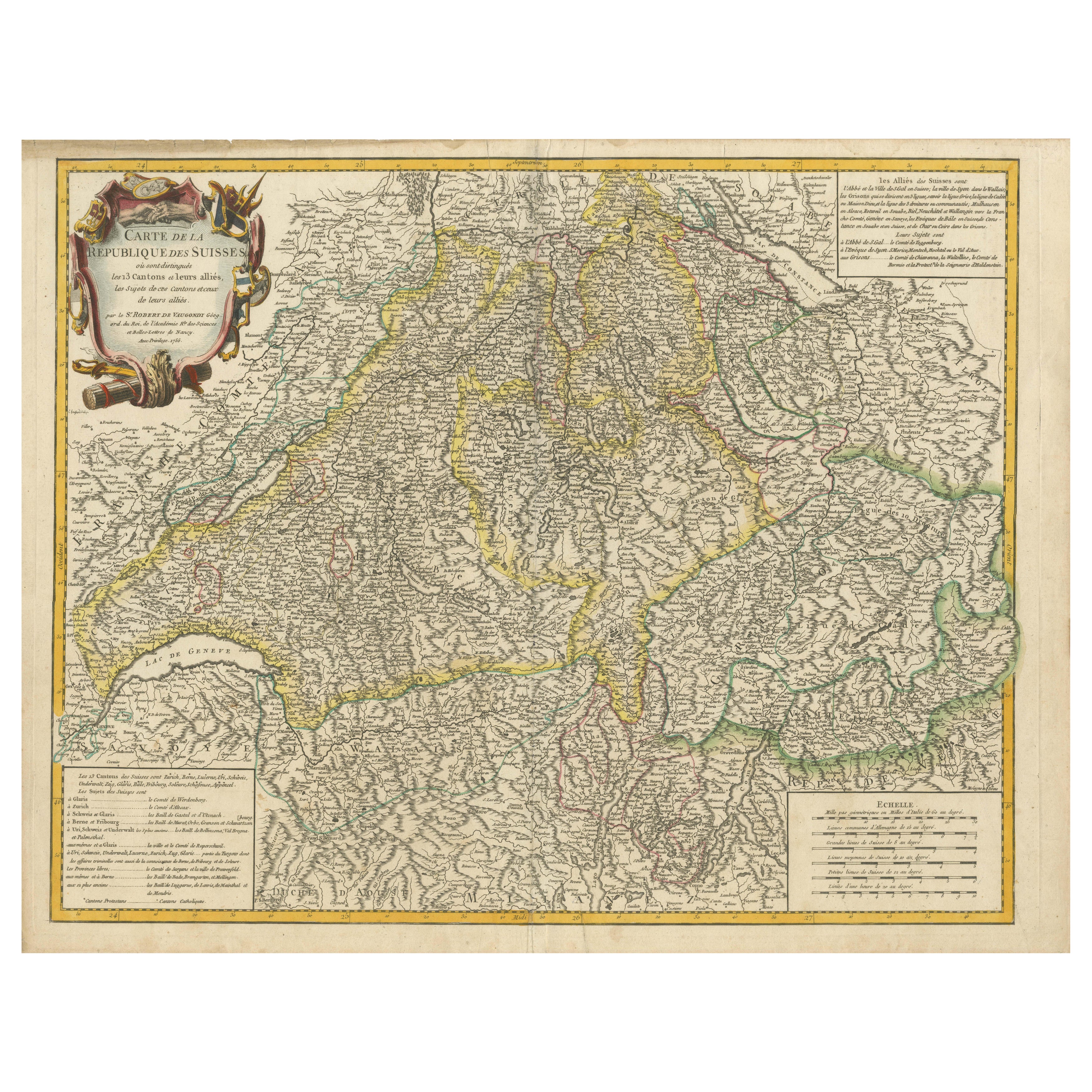
18th-Century Map of the Swiss Confederation by Robert de Vaugondy
Located in Langweer, NL
Title: 18th-Century Map of the Swiss Confederation by Robert de Vaugondy
Description: This detailed 18th-century map by Gilles Robert de Vaugondy presents the Swiss Confederation,...
Category
Antique 1750s Maps
Materials
Paper
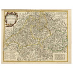
Antique Map of Switzerland by J.B. Homann, 1751
By Johann Baptist Homann
Located in Langweer, NL
Decorative example of Homann's map of Switzerland, with decorative cartouche and the coat of arms of each of the 13 Cantons.
Category
Antique Mid-18th Century Maps
Materials
Paper

Antique Map of Switzerland by Homann, 1753
Located in Langweer, NL
Antique map Switzerland titled 'Territorium Reipublicae liberae Helveticae Scaphusiensis (..)'. Regional map of Switzerland. Artists and Engrav...
Category
Antique 18th Century Maps
Materials
Paper
$282 Sale Price
20% Off
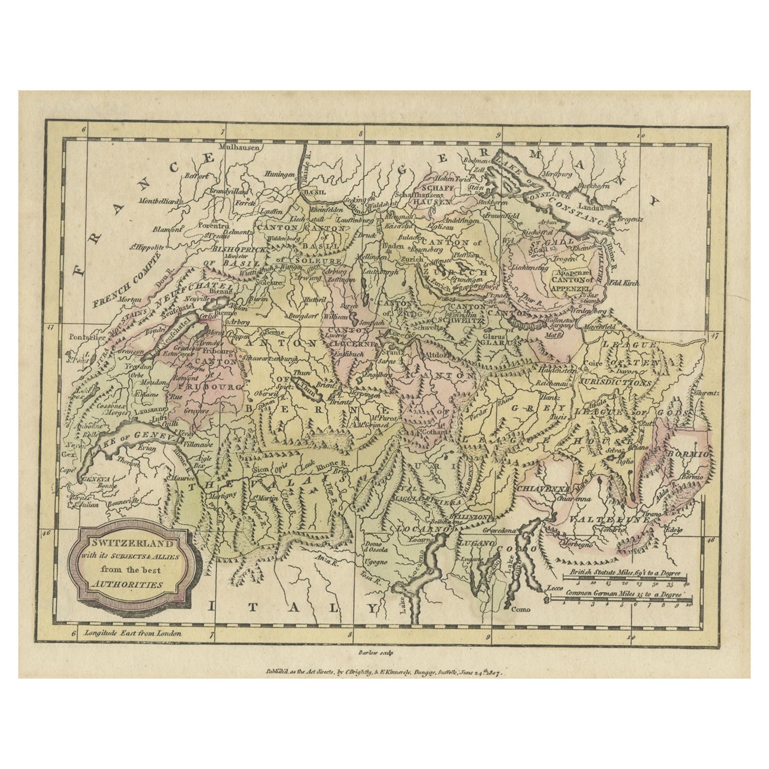
Small Original Antique Map of Switzerland and Surroundings, 1807
Located in Langweer, NL
Antique map titled 'Switzerland with its subjects & allies from the best authorities'.
Small map of Switzerland and surroundings. Originates from 'A general view of the world' by...
Category
Antique Early 1800s Maps
Materials
Paper
$123 Sale Price
20% Off
You May Also Like
Map of Switzerland - Etching - 19th Century
Located in Roma, IT
This map of Netherlands is an etching realized in 19th century.
The state of preservation of the artwork is excellent. The signature "F.B." is engraved on the lower right. At the to...
Category
19th Century Figurative Prints
Materials
Etching

1839 Map of Karte Des "Russischen Reiches in Europa Und Asien" Ric.R0013
Located in Norton, MA
1839 map of Karte Des
"Russischen Reiches in Europa and Asien"
Ric.r013
Map of the European and Asian parts of Russian Empire. Karte der Russischen Reiches in Europa und Asien...
Category
Antique 19th Century Unknown Maps
Materials
Paper

1752 Vaugoundy Map of Flanders : Belgium, France, and the Netherlands, Ric.a002
Located in Norton, MA
Large Vaugoundy Map of Flanders:
Belgium, France, and the Netherlands
Colored -1752
Ric.a002
Description: This is a 1752 Didier Robert de Vaugondy map of Flanders. The map de...
Category
Antique 17th Century Unknown Maps
Materials
Paper

Hand Colored 18th Century Homann Map of Austria Including Vienna and the Danube
By Johann Baptist Homann
Located in Alamo, CA
"Archiducatus Austriae inferioris" is a hand colored map of Austria created by Johann Baptist Homann (1663-1724) and published in Nuremberg, Germany in 1728 shortly after his death. ...
Category
Antique Early 18th Century German Maps
Materials
Paper

Large Original Vintage Map of Switzerland, circa 1920
Located in St Annes, Lancashire
Great map of Switzerland
Original color.
Good condition
Published by Alexander Gross
Unframed.
Category
Vintage 1920s English Maps
Materials
Paper
1771 Bonne Map of Poitou, Touraine and Anjou, France, Ric.a015
Located in Norton, MA
1771 Bonne Map of Poitou,
Touraine and Anjou, France
Ric.a015
1771 Bonne map of Potiou, Touraine and Anjou entitled "Carte des Gouvernements D'Anjou et du Saumurois, de la Touraine, du Poitou,du Pays d'aunis, Saintonge?Angoumois,"
Carte des gouvernements d'Anjou et du Saumurois, de la Touraine, du Poitou, du Pays d'Aunis, Saintonge-Angoumois. Projettee et assujettie au ciel par M. Bonne, Hyd. du Roi. A Paris, Chez Lattre, rue St. Jacques a la Ville de Bord(ea)ux. Avec priv. du Roi. 1771. Arrivet inv. & sculp., Atlas moderne ou collection de cartes sur toutes...
Category
Antique 17th Century Unknown Maps
Materials
Paper

More Ways To Browse
1960s Glass Top Coffee Table
Black Glass Coffee Tables
Mid Century Wrought Iron Chairs
Earth Toned Rug
Black Marble Table Vintage
Goblets
Mid Century Modern Yellow Chair
Paulin Pierre
Used Pianos Pianos
18th Century Engravings
Antique Carved Wood Chair
Black Scandinavian Modern Dining Chairs
Dutch Mid Century Modern Table
Gold Modern Coffee Table
Iconic Modern Furniture
Japanese Metal
Midcentury Modern Gray Glass Vase
Round Glass Coffee Tables