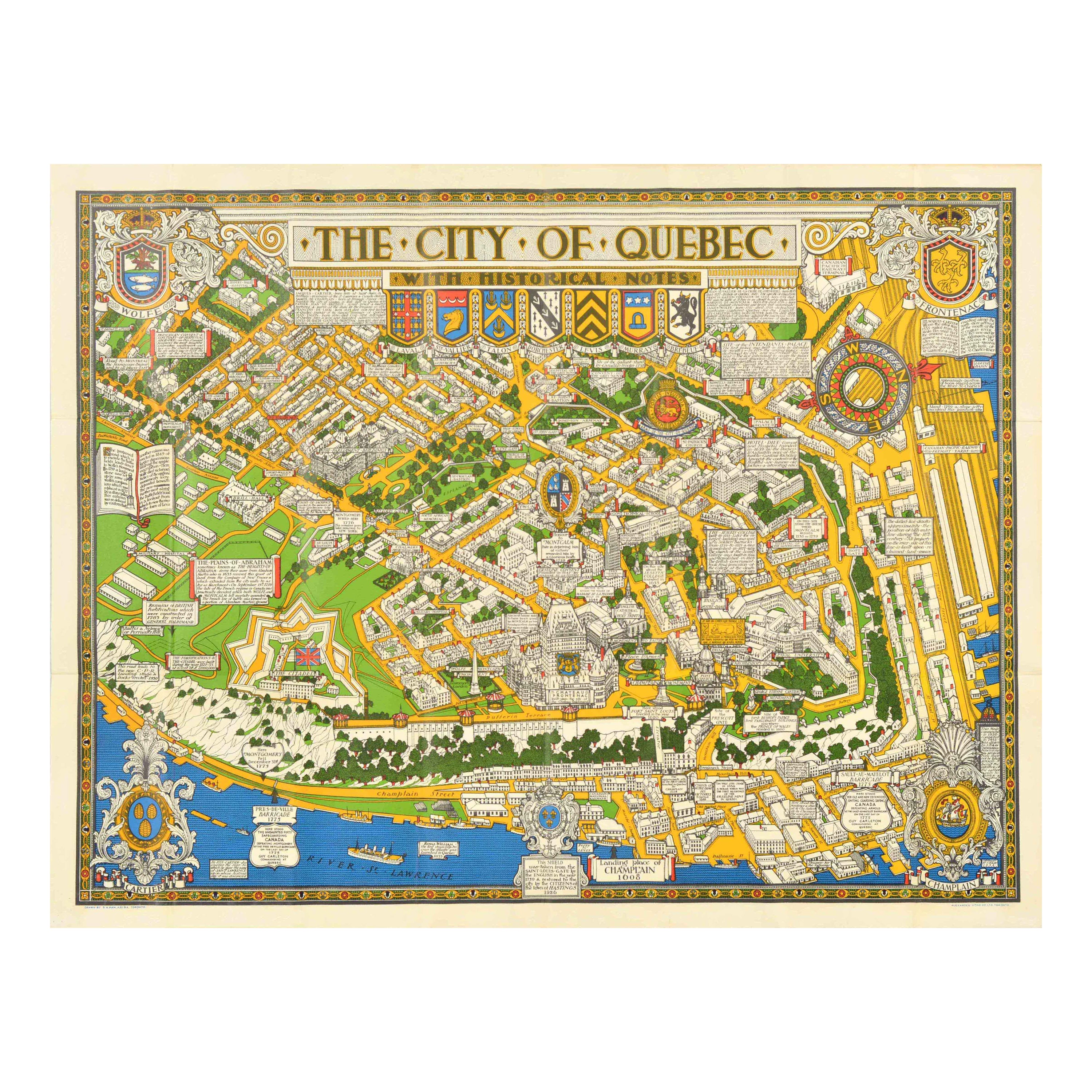
Items Similar to Quebec City Pictorial Map, The City of Quebec with Historical Notes, 1932

Want more images or videos?
Request additional images or videos from the seller
1 of 9
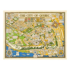
Quebec City Pictorial Map, The City of Quebec with Historical Notes, 1932
$812.79
£606.79
€685
CA$1,129.21
A$1,214.63
CHF 649.13
MX$14,317.03
NOK 8,184.05
SEK 7,481.78
DKK 5,220.47
About the Item
Antique Florida Highway Map – Conners Highway, Lake Okeechobee Roads, ca.1924
This striking pictorial map of Quebec City was created in 1932 by Samuel Herbert Maw and reflects the popular interwar tradition of decorative, information-rich city maps inspired by the work of MacDonald Gill. The composition is densely packed with streets, buildings, parks, fortifications, and landmarks, interwoven with historical notes that guide the viewer through the city’s past in a lively and engaging manner.
The map presents Quebec City in a deliberately playful and non-literal manner, as explicitly stated by the artist in a printed note at the lower right: the map was begun in 1926 and completed in 1932, and its dimensions and proportions are “not to be taken seriously,” the intention being to amuse as well as instruct. North is oriented to the right, indicated by a large and boldly designed compass rose. Throughout the sheet, architectural landmarks, civic buildings, and historic sites are carefully labeled, creating a richly layered visual narrative rather than a strictly cartographic document.
Decorative heraldic elements enhance the design, with the crests of Wolfe, Frontenac, Champlain, and Cartier incorporated into the corners of the map. The River St. Lawrence forms a strong visual anchor along the lower edge, while the fortified upper town and surrounding districts are rendered in a charming, almost storybook style. The overall effect is both educational and decorative, making the map as suitable for display as for close reading.
Samuel Herbert Maw was an English-born artist who produced several notable pictorial maps during his time in Canada, and this work stands among his most accomplished and visually engaging productions. This example is accompanied by the original publisher’s envelope, with the title and artist printed on the front, adding to its desirability and completeness.
Condition: A crisp, colorful example, originally issued folded, with only very light wear along the fold lines. The original envelope shows short edge tears and minor soiling, consistent with age and handling.
- Dimensions:Height: 25.12 in (63.8 cm)Width: 33.39 in (84.8 cm)Depth: 0.01 in (0.2 mm)
- Materials and Techniques:
- Place of Origin:Canada
- Period:
- Date of Manufacture:1932
- Condition:A crisp, colorful example, originally issued folded, with only very light wear along the fold lines. The original envelope shows short edge tears and minor soiling, consistent with age and handling.
- Seller Location:Langweer, NL
- Reference Number:Seller: BG-141931stDibs: LU3054348251692
About the Seller
5.0
Recognized Seller
These prestigious sellers are industry leaders and represent the highest echelon for item quality and design.
Platinum Seller
Premium sellers with a 4.7+ rating and 24-hour response times
Established in 2009
1stDibs seller since 2017
2,836 sales on 1stDibs
Typical response time: 1 hour
- ShippingRetrieving quote...Shipping from: Langweer, Netherlands
- Return Policy
More From This Seller
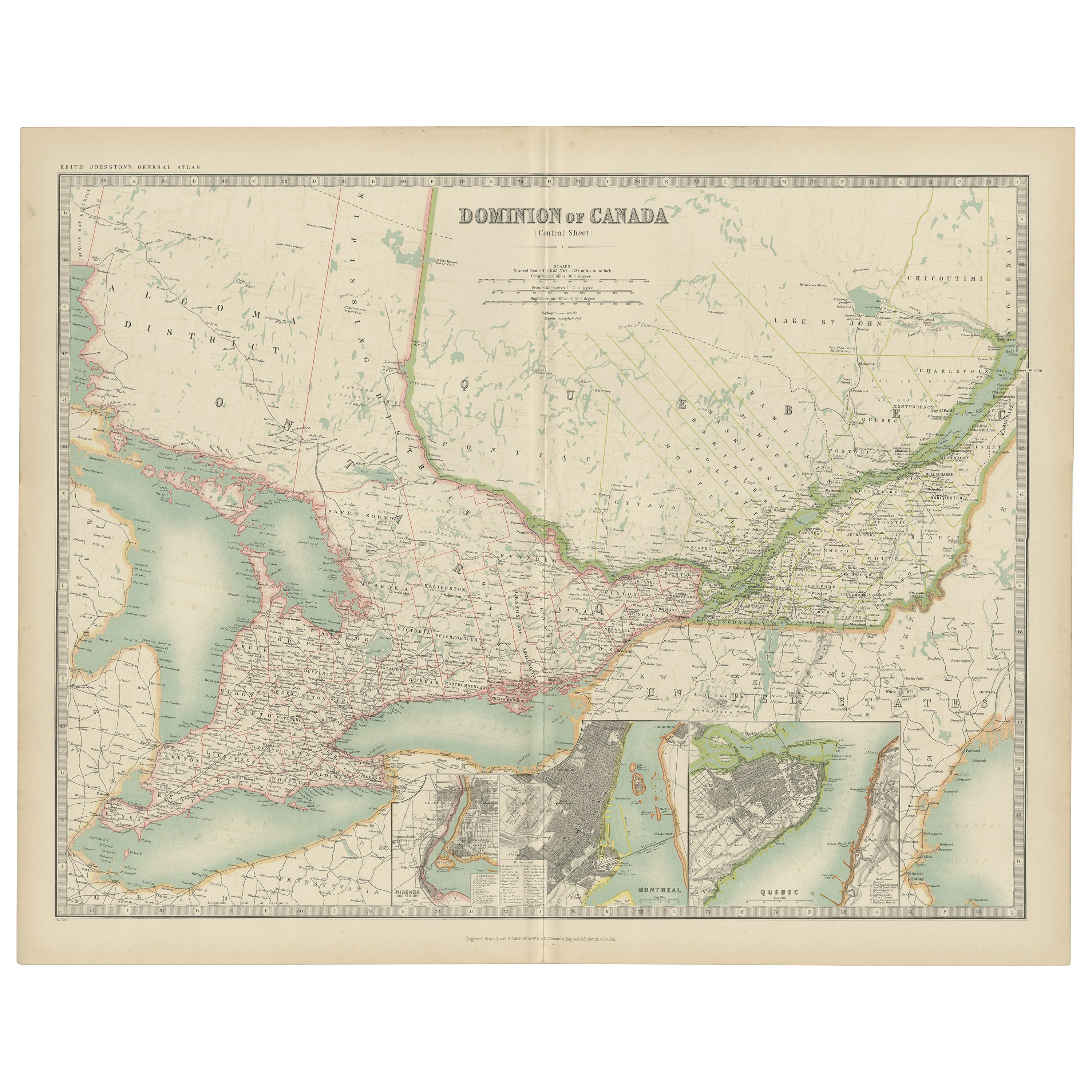
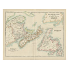
View AllAntique Map of Canada by Johnston
1909
Located in Langweer, NL
Antique map titled 'Dominion of Canada'. Original antique map of Canada. With inset maps of Niagara, Montreal, Quebec. This map originates from t...
Category
Early 20th Century Maps
Materials
Paper
$237 Sale Price
20% Off
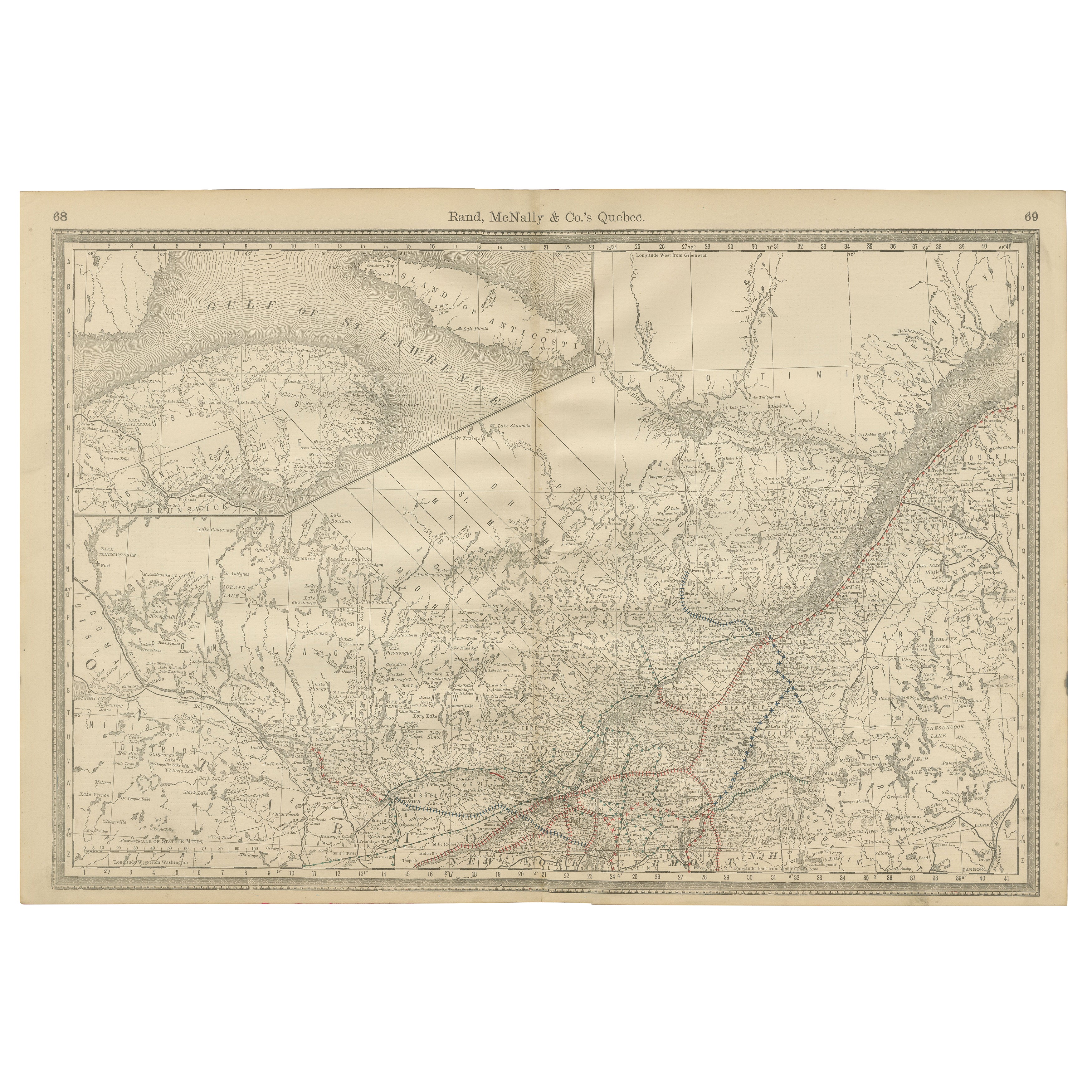
Quebec Antique Railroad Map c.1888 – La Belle Province, Cities
Towns
Located in Langweer, NL
Antique Map of Quebec, Canada – Rand McNally, circa 1888
This antique map of Quebec was published by Rand, McNally & Co. around 1888. Drawn from their late 19th-century atlas series...
Category
Antique Late 19th Century American Maps
Materials
Paper
Antique Map of Canada by Johnston
1909
Located in Langweer, NL
Antique map titled 'Dominion of Canada'. Original antique map of Canada. With inset map of Newfoundland. This map originates from the ‘Royal Atla...
Category
Early 20th Century Maps
Materials
Paper
$237 Sale Price
20% Off
Antique Map of France by Johnston (1909)
Located in Langweer, NL
Antique map titled 'France'. Original antique map of France. With inset maps of France in provinces, part of the Riviera and Corsica. This map or...
Category
Early 20th Century Maps
Materials
Paper

$237 Sale Price
20% Off
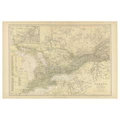
Antique Map of Canada, The Province of Ontario and Part of Quebec, 1882
Located in Langweer, NL
This is a historical map from the 1882 Blackie Atlas, this time detailing "The Province of Ontario, and Part of Quebec" in Canada. The map presents a detailed illustration of Ontario...
Category
Antique 1880s Maps
Materials
Paper
$237 Sale Price
20% Off
Free Shipping
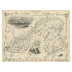
Antique Map of East Canada
Quebec and New Brunswick
by Tallis
c.1850
Located in Langweer, NL
Antique map titled 'East Canada, and New Brunswick'. Decorative regional map of East Canada or what is now Quebec and New Brunswick. With decorative vign...
Category
Antique Mid-19th Century Maps
Materials
Paper
You May Also Like
Original Vintage Travel Poster Quebec Map With Historical Notes Canada Pictorial
Located in London, GB
Original vintage travel map poster for The City of Quebec with historical notes drawn by S.H. Maw Toronto (Samuel Herbert Maw; 1881-1952) featuring ...
Category
Vintage 1930s Canadian Posters
Materials
Paper
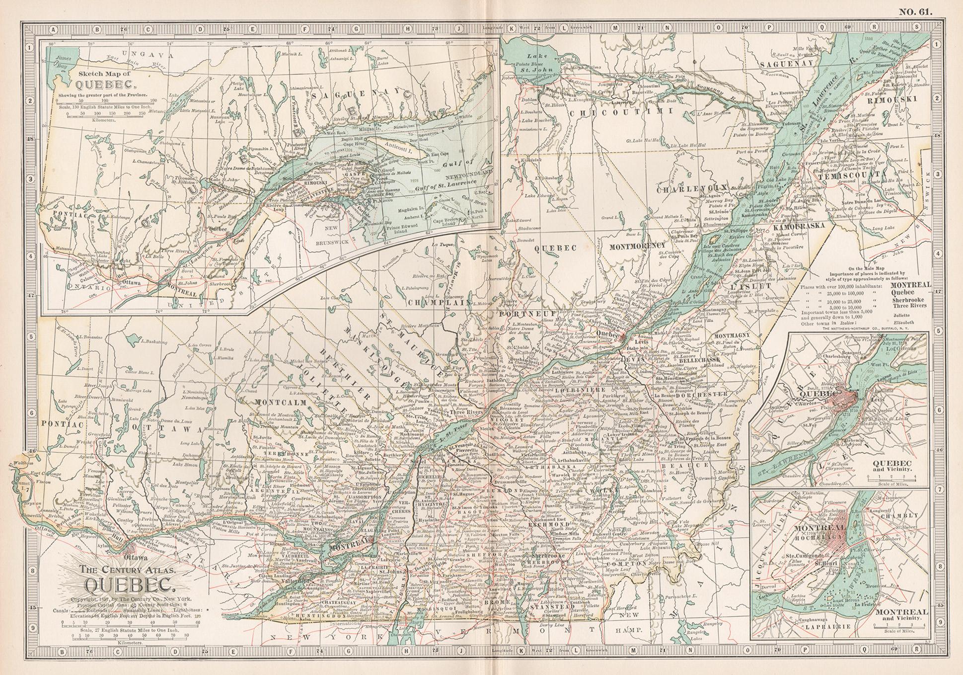
Quebec. Canada. Century Atlas antique vintage map
Located in Melbourne, Victoria
'The Century Atlas. Quebec'
Original antique map, 1903.
Inset maps 'Sketch Map of Quebec', Quebec and Vicinity; and 'Montreal and Vicinity'.
Central fo...
Category
Early 20th Century Victorian More Prints
Materials
Lithograph

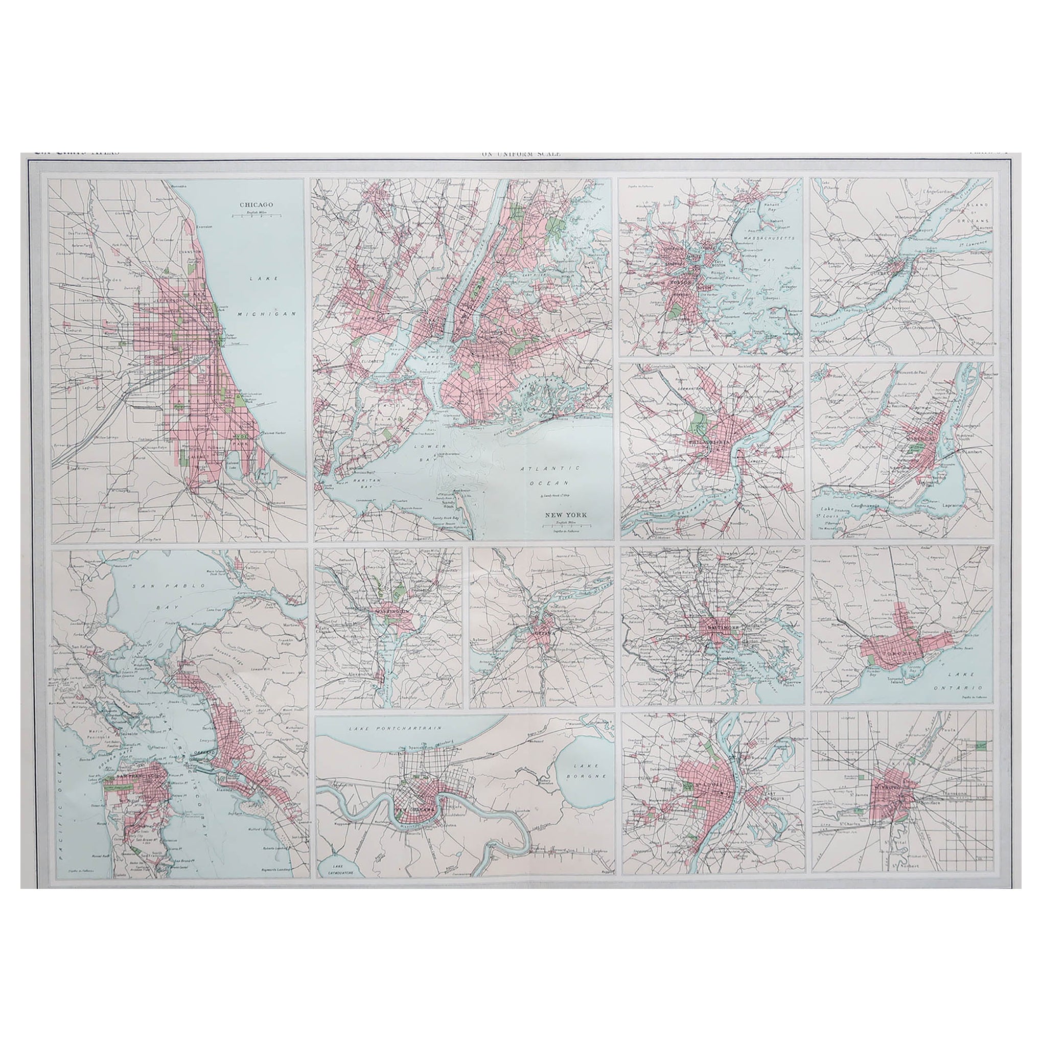
Antique Map of American Cities, Vignette of New York City, circa 1920
Located in St Annes, Lancashire
Great maps of American Cities
Unframed
Original color
By John Bartholomew and Co. Edinburgh Geographical Institute
Published, circa 1920
Category
Vintage 1920s British Maps
Materials
Paper

Large Original Antique City Plan of Montreal, Canada, circa 1900
By Rand McNally
Co.
Located in St Annes, Lancashire
Fabulous colorful map of Montreal
Original color
By Rand, McNally & Co.
Published, circa 1900
Unframed
Minor edge tears
Free shipping.
Category
Antique Early 1900s American Maps
Materials
Paper

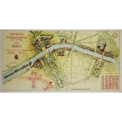
1937 original poster illustrated map of the Exposition Internationale
Located in PARIS, FR
This 1937 original poster presents a detailed illustrated map of the Exposition Internationale des Arts et Techniques dans la Vie Moderne, held in Paris. The International Exposition...
Category
1930s Prints and Multiples
Materials
Paper, Lithograph, Linen
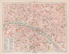
Paris, France. Antique Map City Plan Chromolithograph, circa 1895
Located in Melbourne, Victoria
'Paris'
Colour lithograph. 1895.
250mm by 305mm (sheet).
Late 19th century German lithograph plan of Paris, France.
Central vertical fold. Printed street index on the reverse o...
Category
Late 19th Century Victorian More Prints
Materials
Lithograph