Items Similar to Rare 1690 Map of England by Nicolaes Visscher II – Heptarchy Depicted
Want more images or videos?
Request additional images or videos from the seller
1 of 12
Rare 1690 Map of England by Nicolaes Visscher II – Heptarchy Depicted
$1,613.72
$2,017.1520% Off
£1,204.72
£1,505.9020% Off
€1,360
€1,70020% Off
CA$2,241.94
CA$2,802.4320% Off
A$2,411.53
A$3,014.4120% Off
CHF 1,288.79
CHF 1,610.9920% Off
MX$28,425.05
MX$35,531.3120% Off
NOK 16,248.63
NOK 20,310.7920% Off
SEK 14,854.33
SEK 18,567.9220% Off
DKK 10,364.73
DKK 12,955.9120% Off
About the Item
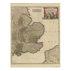
Map of England 1690 by Nicolaes Visscher II – Heptarchy and Counties Shown
Antique 1690 map of England by Nicolaes Visscher II, showing the Anglo-Saxon Heptarchy and detailed county divisions. Rare 17th-century original.
This richly detailed and allegorically embellished map of England, published by Nicolaes Visscher II around 1690, is titled *Angliae Regnum tam in Septem Antiqua Anglo-Saxonum Regna quam in Omnes Hodiernas Regiones Accuratissime Distinctum*. It represents a fascinating blend of historical and contemporary geography, illustrating both the seven early Anglo-Saxon kingdoms—East Anglia, Mercia, Northumbria, Kent, Essex, Sussex, and Wessex—and the administrative counties of the late 17th century.
The map was produced during a period of close political and cultural ties between the Netherlands and England, shortly after the Glorious Revolution of 1688–1689, when the Dutch stadtholder William of Orange became King William III of England. The Dutch publisher Visscher created this map as a tribute to the new monarch, celebrating the harmony between the two nations.
Decorative elements enrich the work significantly. In the upper right corner, an elaborate title cartouche features allegorical figures, including Saint Cecilia with her lyre, surrounded by muses. Below this sits the royal coat of arms and a dedication to William III. At the bottom, another striking vignette depicts a ceremonial or royal gathering. Two putti at the left hold the royal arms aloft, and in the upper left, distance scales and a key are included.
The cartography is densely packed with towns and post roads, offering a snapshot of 17th-century England’s landscape and infrastructure. The cartouche is signed by draftsman Philip Tideman and engraver Gilliam van der Gouwen, two notable artists of the period.
This map is a rare and valuable artifact from the late 17th century, not only for its geographic accuracy and detail but also for its political symbolism and artistic flair.
Condition summary:
Very good condition with original hand coloring with gold highlighted. Strong impression, full margins, except the right margin, and only light age toning. A large and richly detailed and decorative map celebrating Anglo-Dutch relations.
Framing tip:
Frame in dark wood or gold with a light cream or parchment-toned mat. Use UV-protective glass to preserve the vivid colors and delicate linework. A perfect centerpiece for a study, office, or history-themed interior.
- Dimensions:Height: 25.56 in (64.9 cm)Width: 20.48 in (52 cm)Depth: 0.01 in (0.2 mm)
- Materials and Techniques:Paper,Engraved
- Place of Origin:
- Period:Late 17th Century
- Date of Manufacture:1690
- Condition:Very good condition with original hand coloring with gold highlighted. Strong impression, full margins, except the right margin, and only light age toning. A large and richly detailed and decorative map celebrating Anglo-Dutch relations.
- Seller Location:Langweer, NL
- Reference Number:Seller: BG-14091-11stDibs: LU3054345468012
About the Seller
5.0
Recognized Seller
These prestigious sellers are industry leaders and represent the highest echelon for item quality and design.
Platinum Seller
Premium sellers with a 4.7+ rating and 24-hour response times
Established in 2009
1stDibs seller since 2017
2,836 sales on 1stDibs
Typical response time: 1 hour
- ShippingRetrieving quote...Shipping from: Langweer, Netherlands
- Return Policy
More From This Seller
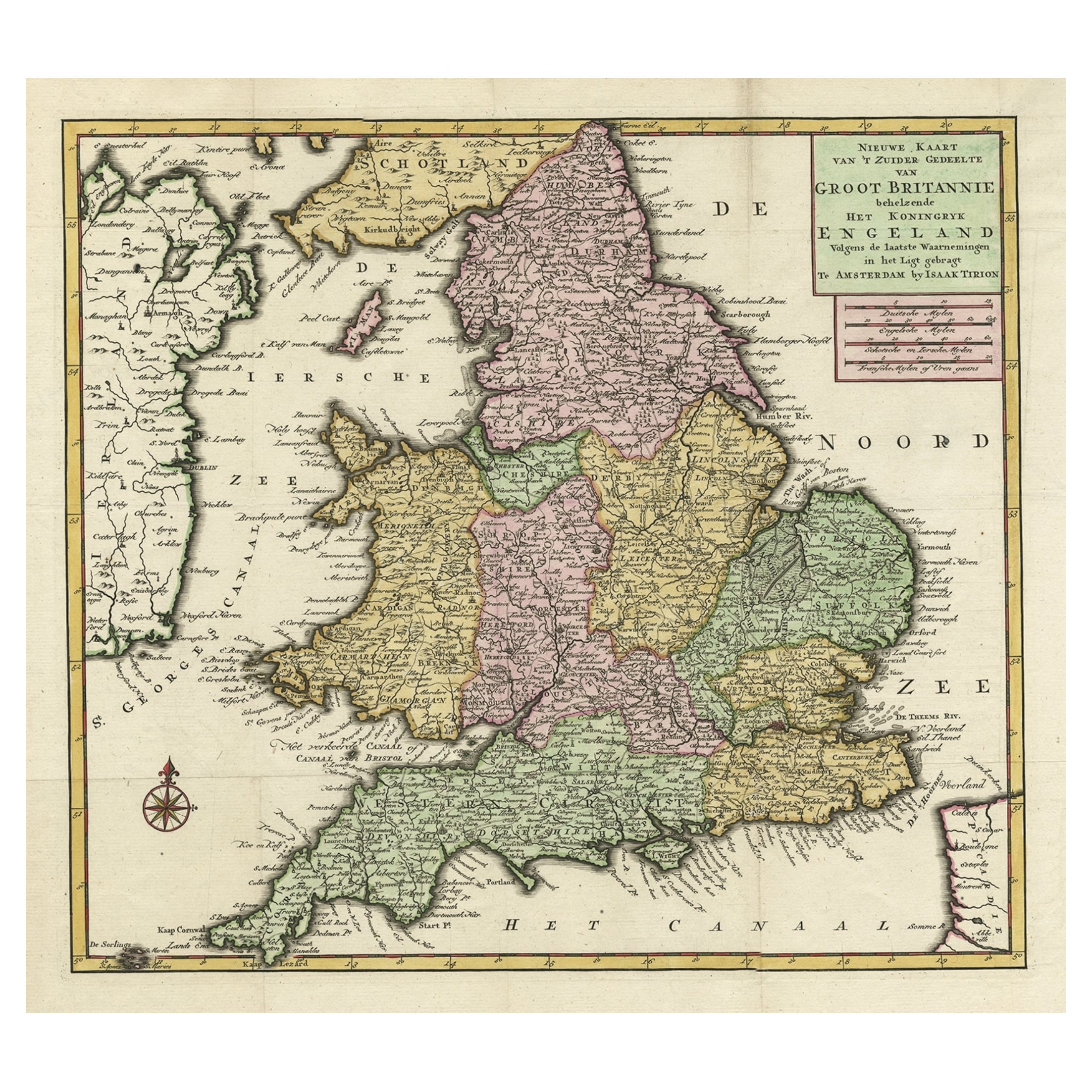
View AllAntique Map of the South Part of Great Britain by Tirion, c.1750
By Isaak Tirion
Located in Langweer, NL
Antique map titled 'Nieuwe Kaart van 'T Zuider Gedeelte van Groot Britannie behelzende Het Koningryk Engeland (..).'
Attractive map showing the south part of Great Britain; the K...
Category
Antique 18th Century Maps
Materials
Paper
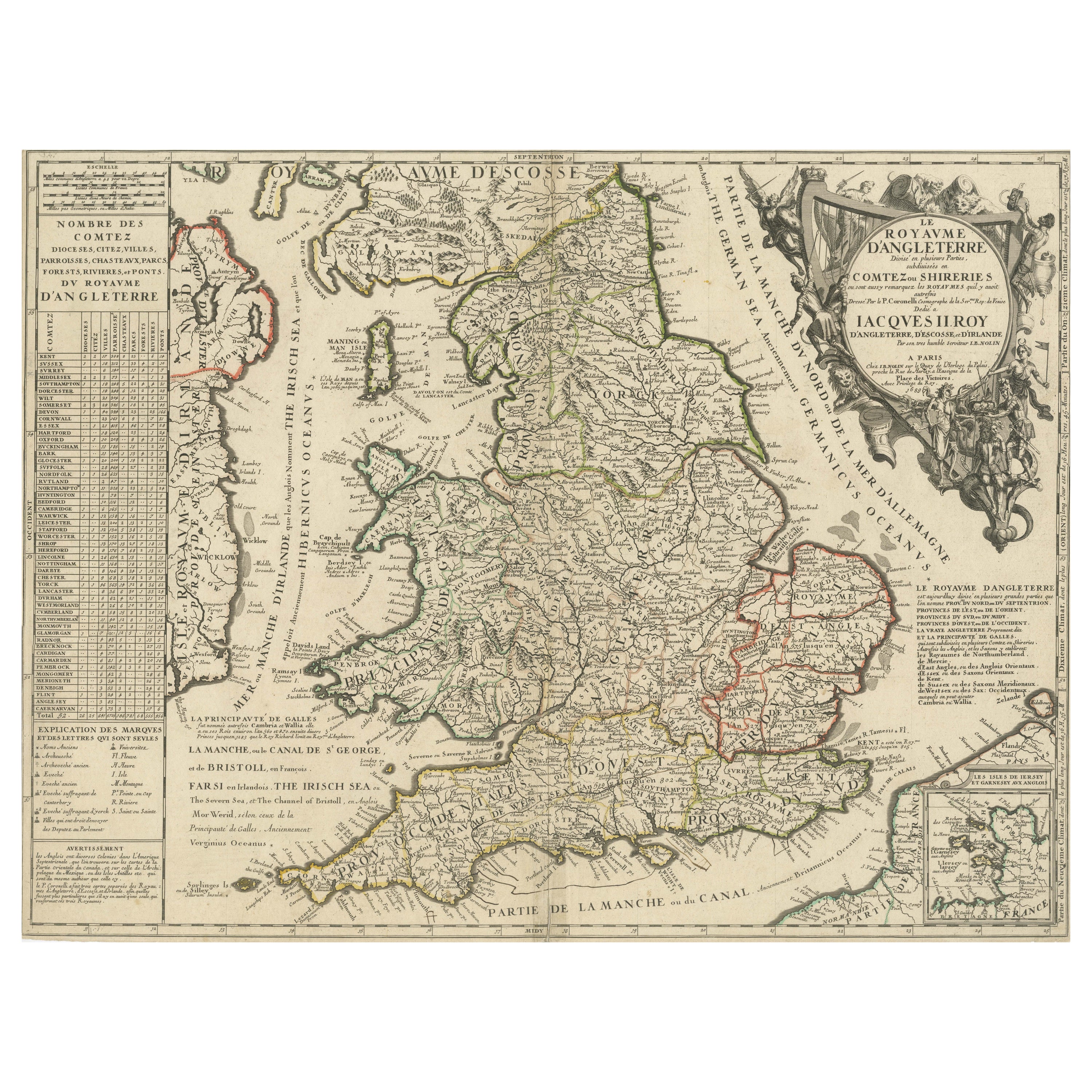
Original Antique Map of England and Wales with Large Cartouche
Located in Langweer, NL
Antique map titled 'Le Royaume d'Angleterre divisé en plusieurs Parties (..)'. Large and rare map of England and Wales by J.B. Nolin after Coronelli. With decorative cartouche, table...
Category
Antique Late 17th Century Maps
Materials
Paper

$417 Sale Price
20% Off
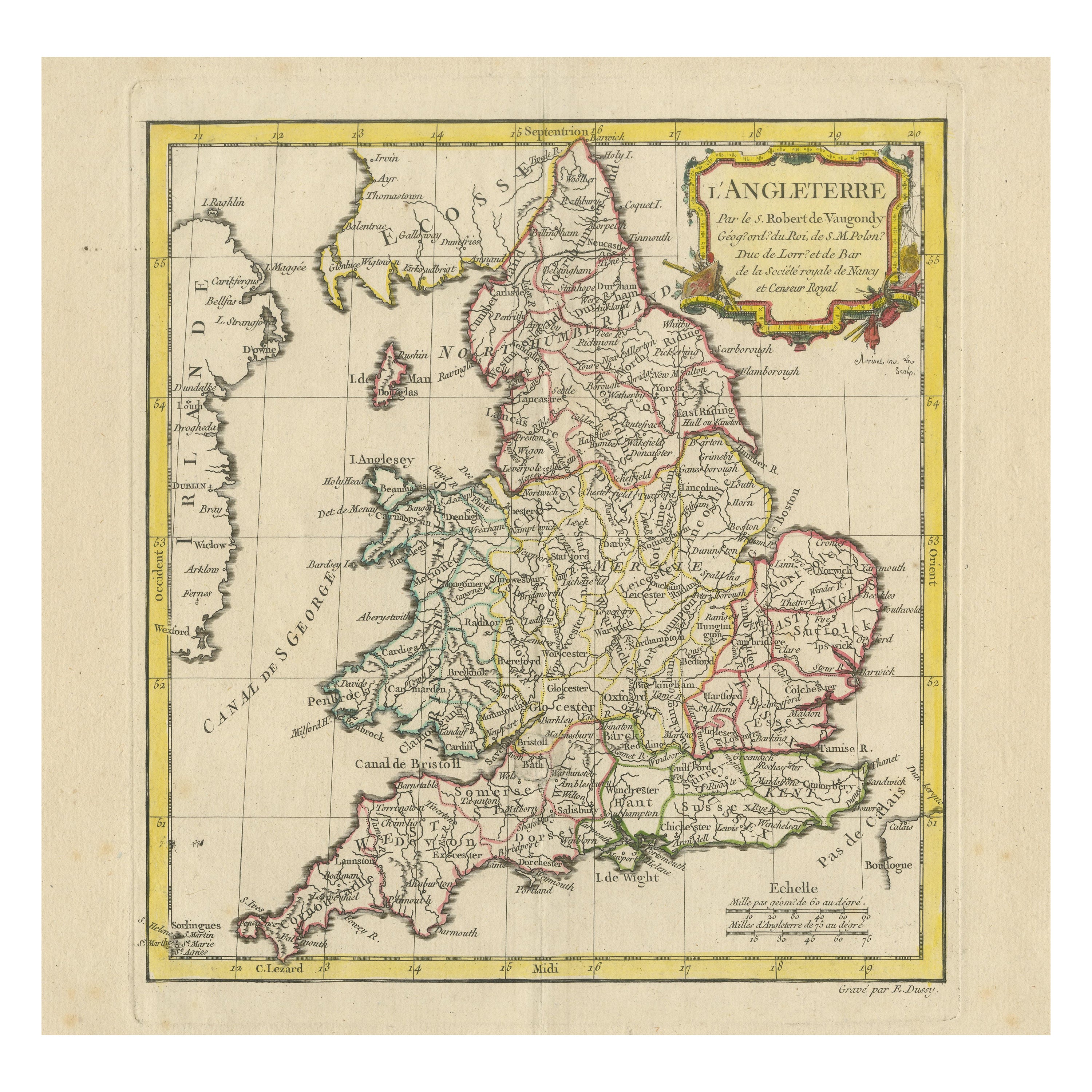
Original Antique Map of England with Decorative Cartouche
Located in Langweer, NL
Antique map titled 'l'Angleterre (..)'. Original antique map of England, with beautiful hand coloring and decorative cartouche. This map originates from 'Nouvel Atlas Portatif destin...
Category
Antique Late 18th Century Maps
Materials
Paper
$275 Sale Price
20% Off
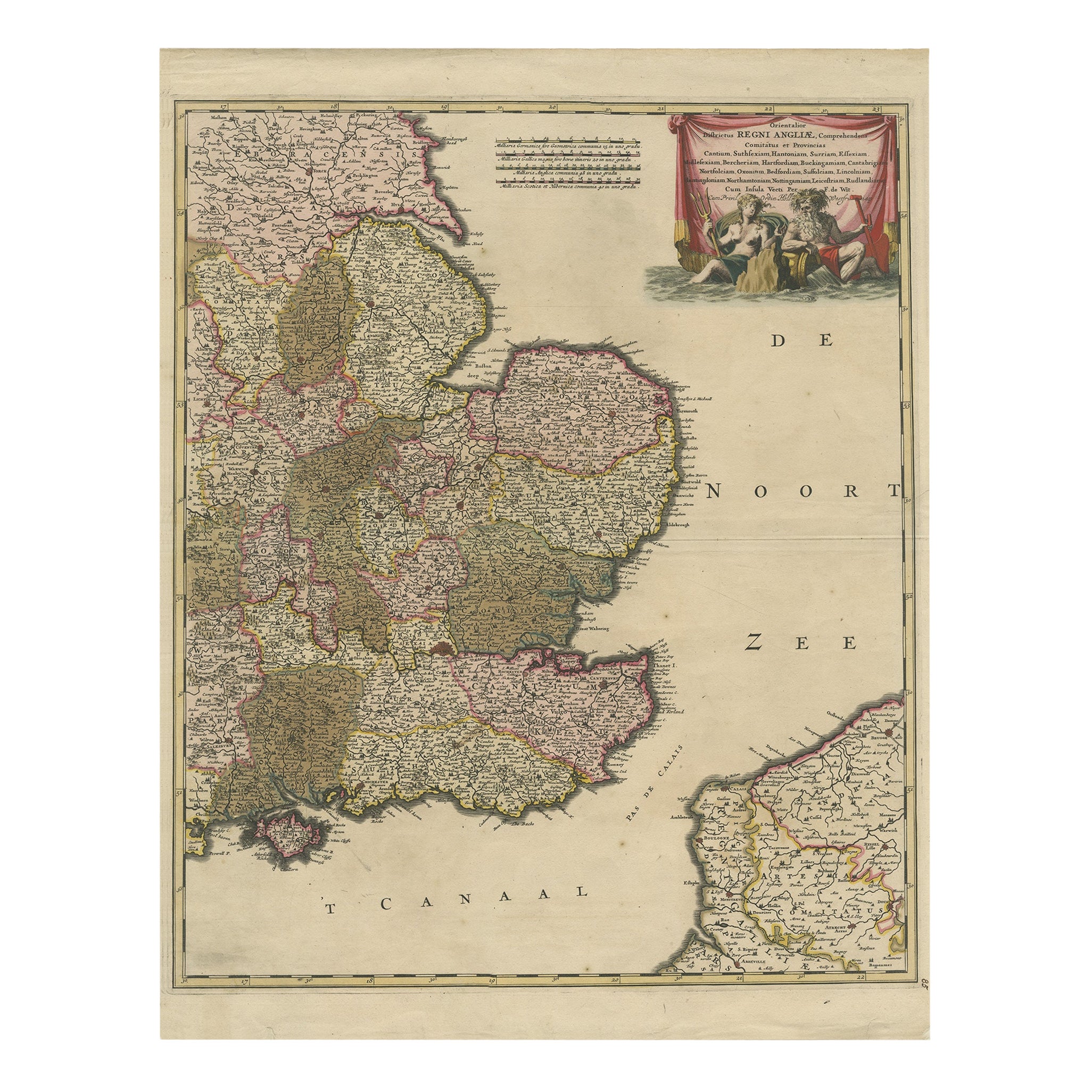
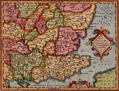
Detailed Antique Map of Southeast England, incl Warwickshire and Hampshire, 1690
Located in Langweer, NL
Antique map titled 'Orientalior districtus Regni Angliae (..)'.
Detailed map of southeast England encompassing the country from Lincolnshire and the Wash south and including Warw...
Category
Antique 1690s Maps
Materials
Paper
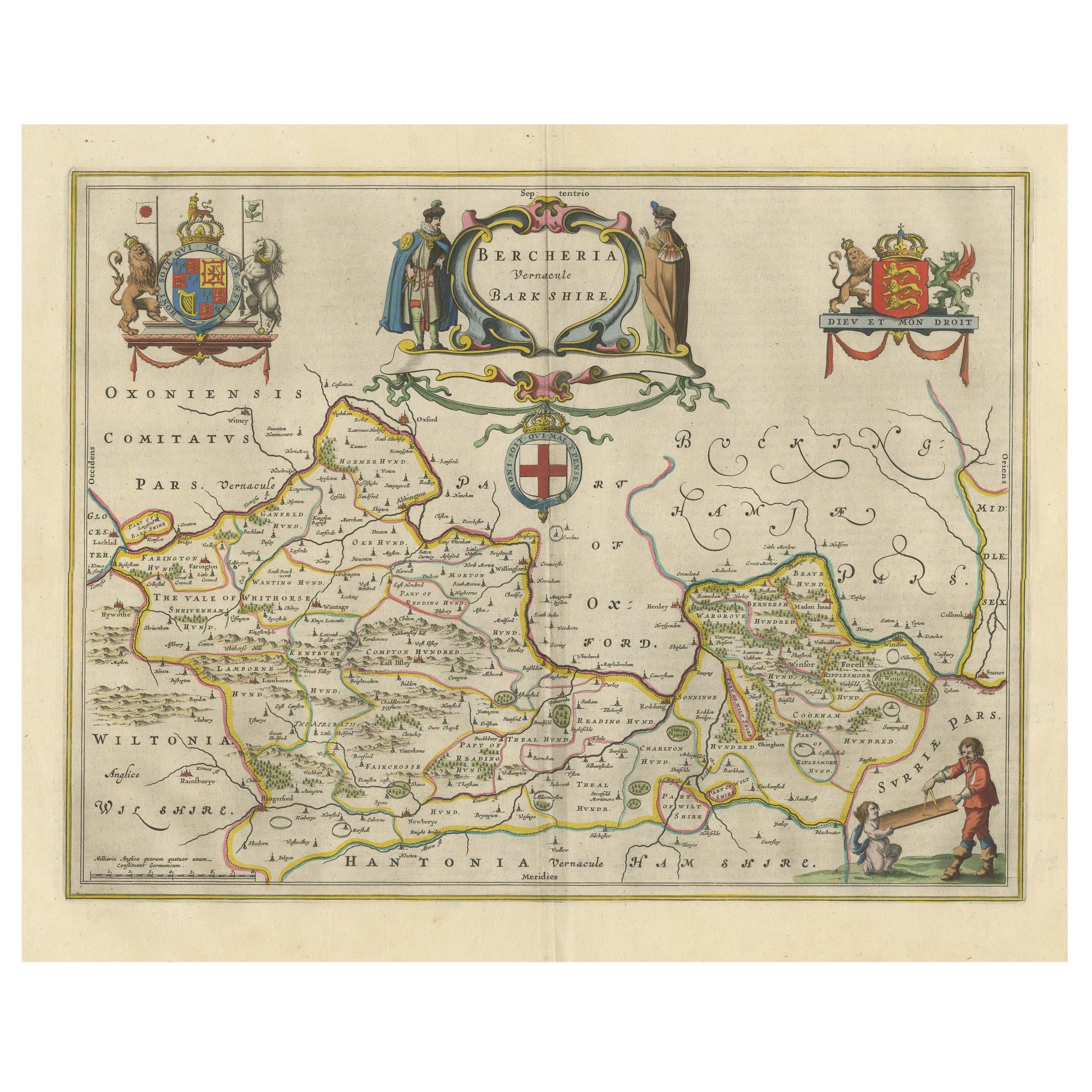
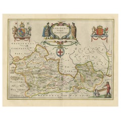
Antique Map of Berkshire, South East England
By Joan (Johannes) Blaeu
Located in Langweer, NL
Antique map titled 'Bercheria vernacule Barkshire'. Original old map of Berkshire, a historic county in South East England. Published circa 1665 by J. Blaeu. Willem Jansz. Blaeu and ...
Category
Antique Mid-17th Century Maps
Materials
Paper
$1,139 Sale Price
20% Off
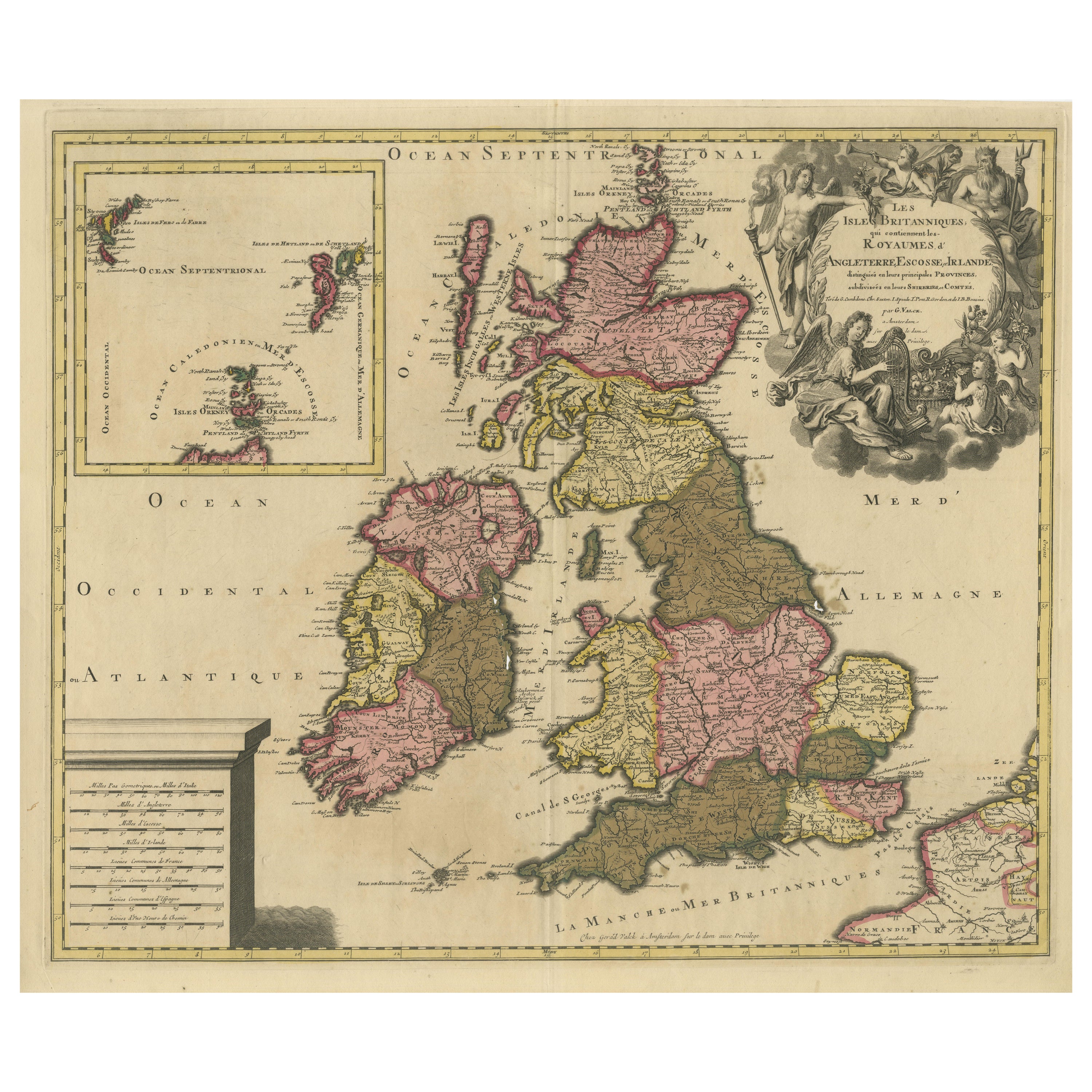
Rare Hand-colored Map of the British Isles by Gerard Valk, Published circa 1700
Located in Langweer, NL
Map of the British Isles by Gerard Valk circa 1700 – Hand-Colored Engraving
This elegant copperplate engraving titled *Les Isles Britanniques, qui contiennent les Royaumes d'Anglete...
Category
Antique Early 1700s Dutch Maps
Materials
Paper

You May Also Like
17th Century Hand-Colored Map of Southeastern England by Mercator and Hondius
By Gerard Mercator
Located in Alamo, CA
A 17th century copperplate hand-colored map entitled "The Sixt Table of England" by Gerard Mercator and Jodocus Hondius, published in Amsterdam in 1635 in 'Cosmographicall Descriptio...
Category
Antique Mid-17th Century Dutch Maps
Materials
Paper

Great Britain, N. France: A Large 17th C. Hand-colored Map by Sanson and Jaillot
By Nicholas Sanson d
Abbeville
Located in Alamo, CA
This large hand-colored 17th century copperplate engraved map entitled "Le Royaume D Angleterre, distingué en ses Provinces. Par le Sr. Sanson. Geographe du Roy. Presenté A Monseigne...
Category
1690s Landscape Prints
Materials
Engraving

England and the British Isles: A Large 17th Century Hand-colored Map by de Wit
By Frederick de Wit
Located in Alamo, CA
This is a large hand-colored 17th century map of England and the British Isles by Frederick de Wit entitled "Accuratissima Angliæ Regni et Walliæ Principatus", published in Amsterdam in 1680. It is a highly detailed map of England, Scotland, the Scottish Isles...
Category
Late 17th Century Other Art Style Landscape Prints
Materials
Engraving

Large 17th Century Hand Colored Map of England and the British Isles by de Wit
By Frederick de Wit
Located in Alamo, CA
A large hand colored 17th century map of England and the British Isles by Frederick de Wit entitled "Accuratissima Angliæ Regni et Walliæ Principatus", published in Amsterdam in 1680. It is a highly detailed map of England, Scotland, the Scottish Isles...
Category
Antique Late 17th Century Dutch Maps
Materials
Paper

Southeastern England: A 17th Century Hand-Colored Map by Mercator and Hondius
By Gerard Mercator
Located in Alamo, CA
A 17th century copperplate hand-colored map entitled "The Sixt Table of England" by Gerard Mercator and Jodocus Hondius, published in Amsterdam in 1635 in 'Cosmographicall Descriptio...
Category
1630s Landscape Prints
Materials
Engraving
18th Century Emanuel Bowen Map of County of York, c.1740
By Emanuel Bowen
Located in Royal Tunbridge Wells, Kent
Antique 18th century British rare and original Emanuel Bowen (1694-1767) map of the County of York divided into its Ridings and subdivided into wapontakes, mounted in solid wood fram...
Category
Antique Early 18th Century British Maps
Materials
Paper

More Ways To Browse
Rare Artifact
17th Century Dutch Wood Frames
William Holland
William Of Orange
Anglo Dutch
Ceremonial Vignette
Antique Victorian Dining Tables
Italian Plastic Chairs
Black Crystal Glasses
French Mid Century Modern Rug
China Silk Rug
Chrome Glass Coffee Tables
Antique Italian Chairs
Antique Walnut Bar
Beni Ourain Rugs
French Iron And Glass Table
Glass Top Wood Base Coffee Tables
T Chair