Items Similar to Rare 1791 von Reilly Map of Franeker and Harlingen, Friesland, Netherlands


Video Loading
Want more images or videos?
Request additional images or videos from the seller
1 of 11
Rare 1791 von Reilly Map of Franeker and Harlingen, Friesland, Netherlands
$466.73
£349.40
€390
CA$642.51
A$702.39
CHF 371.59
MX$8,405.20
NOK 4,728.01
SEK 4,328.01
DKK 2,971.32
About the Item
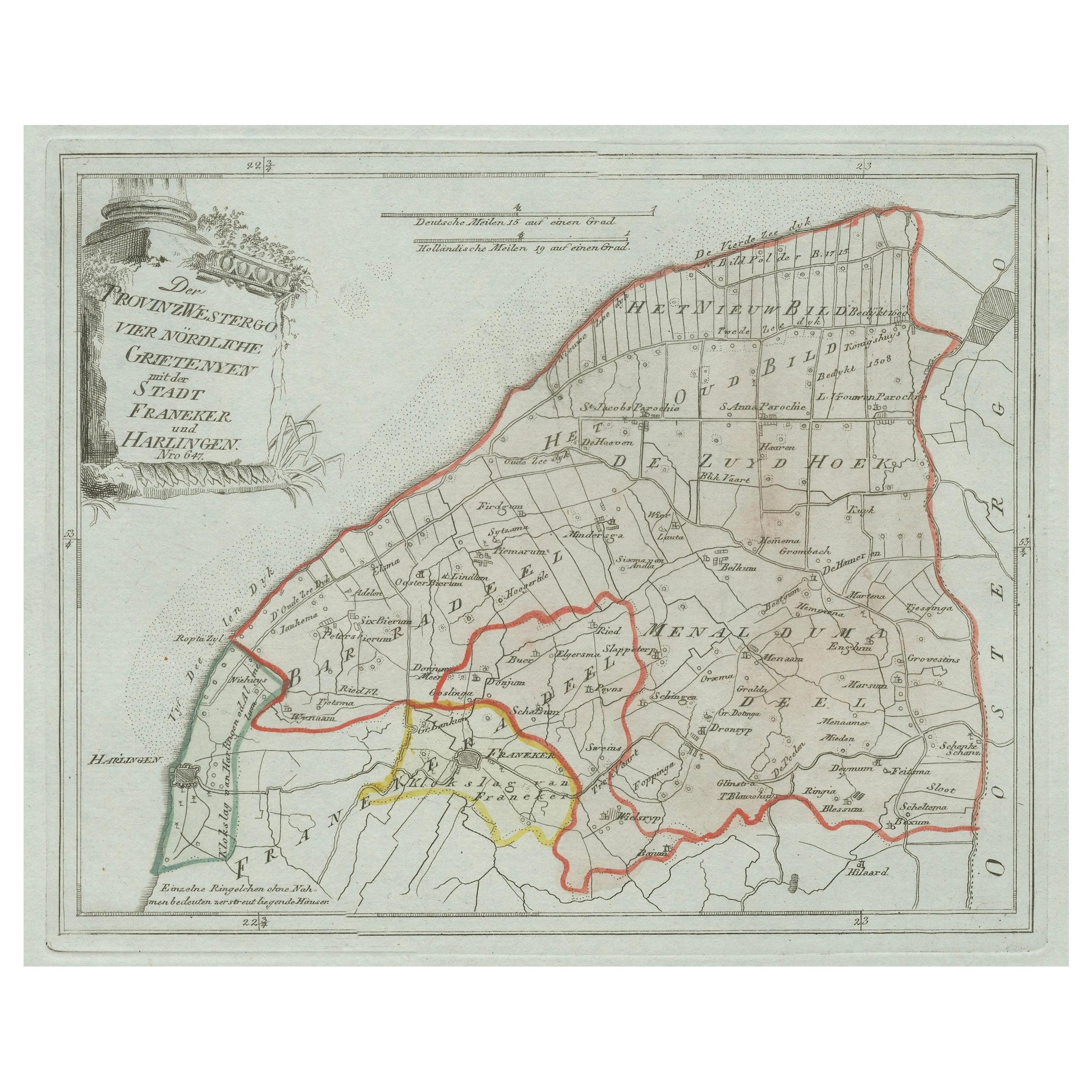
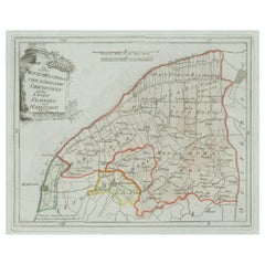
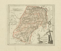
Antique Map of Franeker and Harlingen by von Reilly, 1791
Fine original map titled Der Provinz Westergo vier nördliche Grietenyen mit der Stadt Franeker und Harlingen, published in Vienna in 1791. This decorative map presents the northern part of the Westergo region in Friesland, the Netherlands, focusing on the important towns of Franeker and Harlingen. The map is outlined in contemporary hand color, marking boundaries between grietenijen (rural districts), waterways, and settlements.
The map originates from Franz Joseph Johann von Reilly’s ambitious atlas project *Schauplatz der fünf Theile der Welt* (“Showplace of the Five Parts of the World”), one of the first comprehensive atlases produced in Austria at the end of the 18th century. Von Reilly (1766–1820) was a Viennese publisher and dealer of maps and prints, best remembered for his atlases and geographical works. The engraving was executed by Ignaz Alberti (also Albrecht, 1760–1794), a skilled Austrian engraver and publisher active in Vienna, whose fine linework and cartographic clarity are evident in this plate.
The map is decorated with an elegant title cartouche at upper left, framed by classical motifs and foliage. It provides a historical snapshot of Friesland in the late 18th century, when Franeker was still home to one of Europe’s oldest universities (established in 1585, closed in 1811) and Harlingen flourished as a harbor city with trade routes across the North Sea.
An attractive piece for collectors of Dutch provincial maps and Austrian cartography, this map combines both historical and decorative interest.
Condition report: Good condition with general age-related toning. Original contemporary hand coloring, margins well preserved. Blank verso. Please study the images carefully for a full impression of condition.
Framing tips: A classic gilt or dark wood frame paired with a cream or light ivory mat will emphasize the hand coloring and cartouche detail. For a more dramatic presentation, a double mat with a subtle green or ochre inner line can echo the palette of the map.
Technique: Engraving with original hand color
Maker: Franz Joseph Johann von Reilly, engraved by Ignaz Alberti, Vienna, 1791
- Dimensions:Height: 11.42 in (29 cm)Width: 15.56 in (39.5 cm)Depth: 0.01 in (0.2 mm)
- Materials and Techniques:Paper,Engraved
- Place of Origin:
- Period:
- Date of Manufacture:1791
- Condition:Condition report: Good to excellent condition almost no general age-related toning. Original contemporary hand coloring, margins well preserved. Blank verso.
- Seller Location:Langweer, NL
- Reference Number:Seller: PCT-10491stDibs: LU3054327873292
About the Seller
5.0
Recognized Seller
These prestigious sellers are industry leaders and represent the highest echelon for item quality and design.
Platinum Seller
Premium sellers with a 4.7+ rating and 24-hour response times
Established in 2009
1stDibs seller since 2017
2,793 sales on 1stDibs
Typical response time: <1 hour
- ShippingRetrieving quote...Shipping from: Langweer, Netherlands
- Return Policy
More From This Seller
View AllAntique Map of Franeker and Harlingen, Friesland by von Reilly, 1791
Located in Langweer, NL
Antique Map of Franeker and Harlingen, Friesland by von Reilly, 1791
Original engraved map titled Der Provinz Westergo vier nördliche Grietenyen mit der Stadt Franeker und Harlingen...
Category
Antique 18th Century Austrian Maps
Materials
Paper
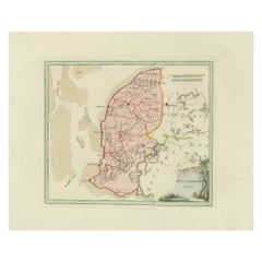
Antique Map of Friesland by Von Reilly, 1791
Located in Langweer, NL
Antique map titled 'Friesland'. Map of the province of Friesland, the Netherlands. This map orginates from 'Schauplatz der fünf Theile der Welt'. Artists and Engravers: Franz Joseph ...
Category
Antique 18th Century Austrian Maps
Materials
Paper

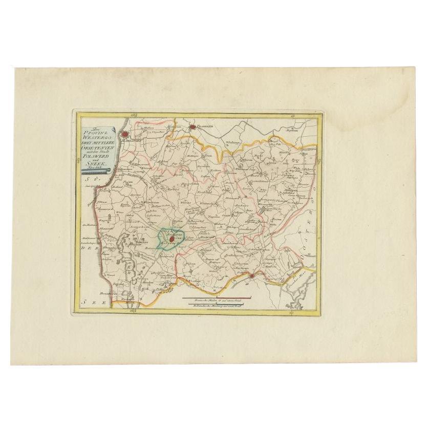
Bolsward
Sneek, Westergo (Friesland) – von Reilly antique map, 1791
Located in Langweer, NL
Title: Bolsward & Sneek, Westergo (Friesland) – von Reilly antique map, 1791
Description:
Crisp late-18th-century map of the Westergo region in Friesland focusing on the “drey mittl...
Category
Antique 18th Century Austrian Maps
Materials
Paper
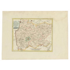
Antique Map of Southern Westergo, Friesland by von Reilly, 1791
Located in Langweer, NL
Antique Map of Southern Westergo, Friesland by von Reilly, 1791
Original engraved map titled Westergoo Norde, published in Vienna in 1791. This sheet depicts the southern and coasta...
Category
Antique 18th Century Austrian Maps
Materials
Paper
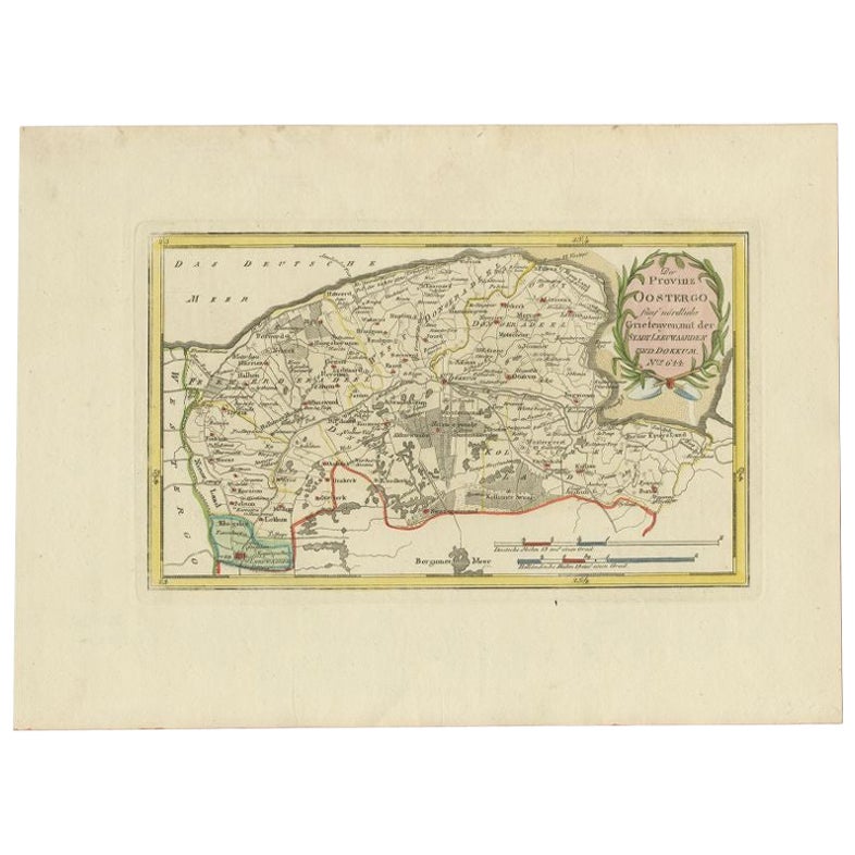
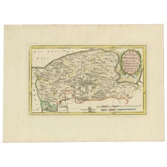
Antique Map of the Region of Leeuwarden and Dokkum in The Netherlands, 1791
Located in Langweer, NL
Antique map titled 'Der Provinz Oostergo fünf nördliche Grietenyen mit der Stadt Leeuwaarden und Dokkum'. Map of the region of Leeuwarden and Dokkum, Friesland, the Netherlands. This...
Category
Antique 18th Century Maps
Materials
Paper
$150 Sale Price
20% Off
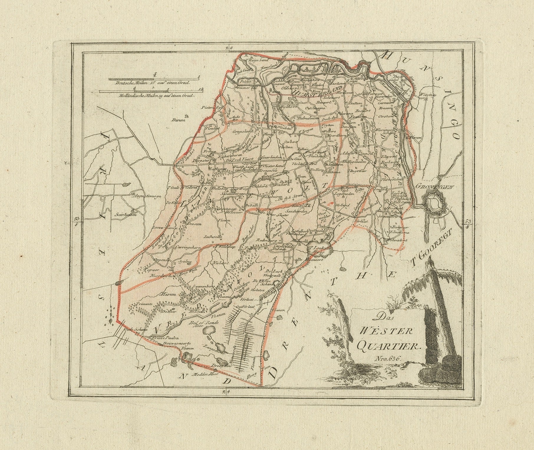
Antique map Westerkwartier Groningen by von Reilly, Vienna, 1791
Located in Langweer, NL
Title: Antique map Westerkwartier Groningen by von Reilly, Vienna, 1791
Engraved map with original hand color of the Westerkwartier (western quarter) of the province of Groningen, N...
Category
Antique 18th Century Austrian Maps
Materials
Paper
You May Also Like
1752 Vaugoundy Map of Flanders : Belgium, France, and the Netherlands, Ric.a002
Located in Norton, MA
Large Vaugoundy Map of Flanders:
Belgium, France, and the Netherlands
Colored -1752
Ric.a002
Description: This is a 1752 Didier Robert de Vaugondy map of Flanders. The map de...
Category
Antique 17th Century Unknown Maps
Materials
Paper

1771 Bonne Map of Poitou, Touraine and Anjou, France, Ric.a015
Located in Norton, MA
1771 Bonne Map of Poitou,
Touraine and Anjou, France
Ric.a015
1771 Bonne map of Potiou, Touraine and Anjou entitled "Carte des Gouvernements D'Anjou et du Saumurois, de la Touraine, du Poitou,du Pays d'aunis, Saintonge?Angoumois,"
Carte des gouvernements d'Anjou et du Saumurois, de la Touraine, du Poitou, du Pays d'Aunis, Saintonge-Angoumois. Projettee et assujettie au ciel par M. Bonne, Hyd. du Roi. A Paris, Chez Lattre, rue St. Jacques a la Ville de Bord(ea)ux. Avec priv. du Roi. 1771. Arrivet inv. & sculp., Atlas moderne ou collection de cartes sur toutes...
Category
Antique 17th Century Unknown Maps
Materials
Paper

1839 Map of Karte Des "Russischen Reiches in Europa Und Asien" Ric.R0013
Located in Norton, MA
1839 map of Karte Des
"Russischen Reiches in Europa and Asien"
Ric.r013
Map of the European and Asian parts of Russian Empire. Karte der Russischen Reiches in Europa und Asien...
Category
Antique 19th Century Unknown Maps
Materials
Paper

1635 Willem Blaeu Map of Northern France"Comitatvs Bellovacvm" Ric.a08
Located in Norton, MA
1635 Willem Blaeu map of northern France, entitled.
"Comitatvs Bellovacvm Vernacule Beavvais,"
Colored
Ric.a008
“COMITATVS BELLOVACVM…” Amsterdam: W...
Category
Antique 17th Century Unknown Maps
Materials
Paper

1643 Willem&Joan Blaeu Map NW Flanders "Flandriae Teutonicae Pars Prientalior
Located in Norton, MA
1643 Willem and Joan Blaeu map of northwest Flanders, entitled
"Flandriae Teutonicae Pars Prientalior,"
Ric0012
" Authentic" - Map of the northwest Fl...
Category
Antique 17th Century Dutch Maps
Materials
Paper

Map of Germany - Original Etching - 1820
Located in Roma, IT
Map of Germany is an Original Etching realized by an unknown artist of 19th century in 1820.
Very good condition on two sheets of white paper joined at...
Category
1820s Modern Figurative Prints
Materials
Etching

More Ways To Browse
Franz Joseph
Johann Baptist Homann On Sale
Magellan Map
Map Of Puerto Rico
Map Ukraine
Papua New Guinea Antique Map
Serbia Antique Map
Stanford Antique Furniture
Tipu Sultan
Used Office Furniture Cornwall
Vintage Wooden Roller
Albania Antique Map
Ancient Bible
Antique Bermuda Furniture
Antique Constellation Map
Antique Map Burgundy
Antique Map Of Hawaii
Antique Maps Of Long Island