Items Similar to Rare 1791 von Reilly Map of Friesland Province, Netherlands, 18th Century


Video Loading
Want more images or videos?
Request additional images or videos from the seller
1 of 12
Rare 1791 von Reilly Map of Friesland Province, Netherlands, 18th Century
$408.31
£302.41
€340
CA$558.54
A$607.86
CHF 322.23
MX$7,313.07
NOK 4,086.89
SEK 3,739.22
DKK 2,590.86
About the Item
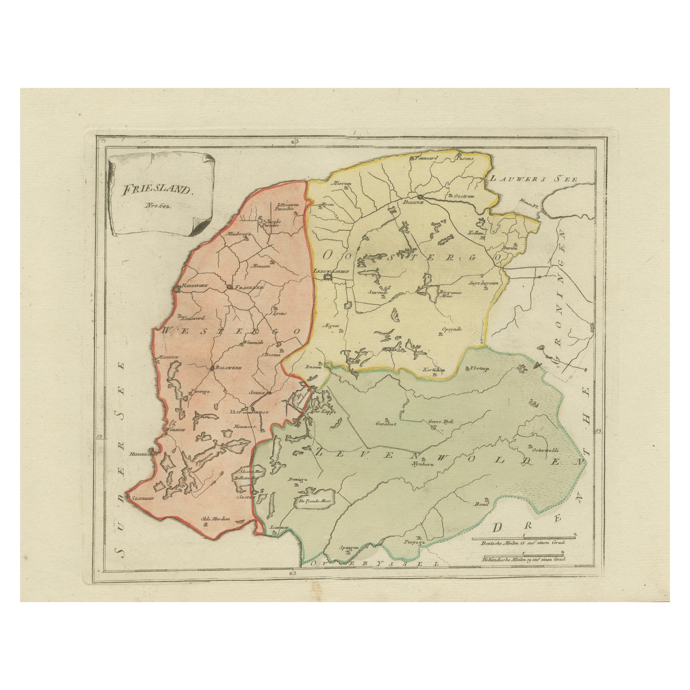
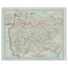
Antique General Map of Friesland by von Reilly, 1791
Original engraved map titled *Friesland*, published in Vienna in 1791. This is the general overview map of the province of Friesland from Franz Joseph Johann von Reilly’s *Schauplatz der fünf Theile der Welt* (“Showplace of the Five Parts of the World”). The sheet covers the entire province, from the Zuiderzee (now IJsselmeer) and the Frisian lakes in the south to the Lauwerszee in the north, with its borders marked against Groningen, Drenthe, and Overijssel.
Towns and villages are clearly marked, along with rivers, waterways, and lakes that characterize Friesland’s historic landscape. Districts are outlined in original hand color, with Oostergo and Westergo shown distinctly, making the map not only a useful geographical record but also a decorative representation of the province.
Franz Joseph Johann von Reilly (1766–1820) was a Viennese art dealer, publisher, and cartographer whose *Schauplatz der fünf Theile der Welt* was the first Austrian world atlas project. His work combined cartographic precision with aesthetic appeal, making his maps highly collectible today. The engraving was executed by Ignaz Alberti (1760–1794), a noted Austrian engraver and publisher, who brought clarity and elegance to the series.
This general map is especially significant when paired with the detailed district maps of Friesland, as it provides the full provincial context. Collectors value these maps for their rarity, their historical perspective on Friesland’s geography, and their fine Austrian engraving style.
Condition report: Very good condition with light general toning. Minor age marks in margins, well outside the image area. Original hand coloring preserved. Blank verso.
Framing tips: A dark wooden or black frame paired with an ivory or cream mat will bring out the engraved detail. For a cohesive set, framing this map together with the detailed district sheets can create an impressive provincial series.
Technique: Engraving with original hand color
Maker: Franz Joseph Johann von Reilly, engraved by Ignaz Alberti, Vienna, 1791
- Dimensions:Height: 12.88 in (32.7 cm)Width: 19.97 in (50.7 cm)Depth: 0.01 in (0.2 mm)
- Materials and Techniques:Paper,Engraved
- Place of Origin:
- Period:
- Date of Manufacture:1791
- Condition:Condition report: Very good condition with light general toning. Minor age marks in margins, well outside the image area. Original hand coloring preserved. Blank verso.
- Seller Location:Langweer, NL
- Reference Number:Seller: BG-13229-11stDibs: LU3054346650082
About the Seller
5.0
Recognized Seller
These prestigious sellers are industry leaders and represent the highest echelon for item quality and design.
Platinum Seller
Premium sellers with a 4.7+ rating and 24-hour response times
Established in 2009
1stDibs seller since 2017
2,816 sales on 1stDibs
Typical response time: 1 hour
- ShippingRetrieving quote...Shipping from: Langweer, Netherlands
- Return Policy
More From This Seller
View AllAntique General Map of Friesland – Dutch Provincial Map by von Reilly, 1791
Located in Langweer, NL
Antique General Map of Friesland by von Reilly, 1791
Original engraved map titled Friesland No. 640, published in Vienna in 1791. This sheet is the general overview of the province ...
Category
Antique 18th Century Austrian Maps
Materials
Paper
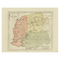
Antique Map of Friesland by Von Reilly, 1791
Located in Langweer, NL
Antique map titled 'Friesland'. Map of the province of Friesland, the Netherlands. This map orginates from 'Schauplatz der fünf Theile der Welt'. Artists and Engravers: Franz Joseph ...
Category
Antique 18th Century Austrian Maps
Materials
Paper

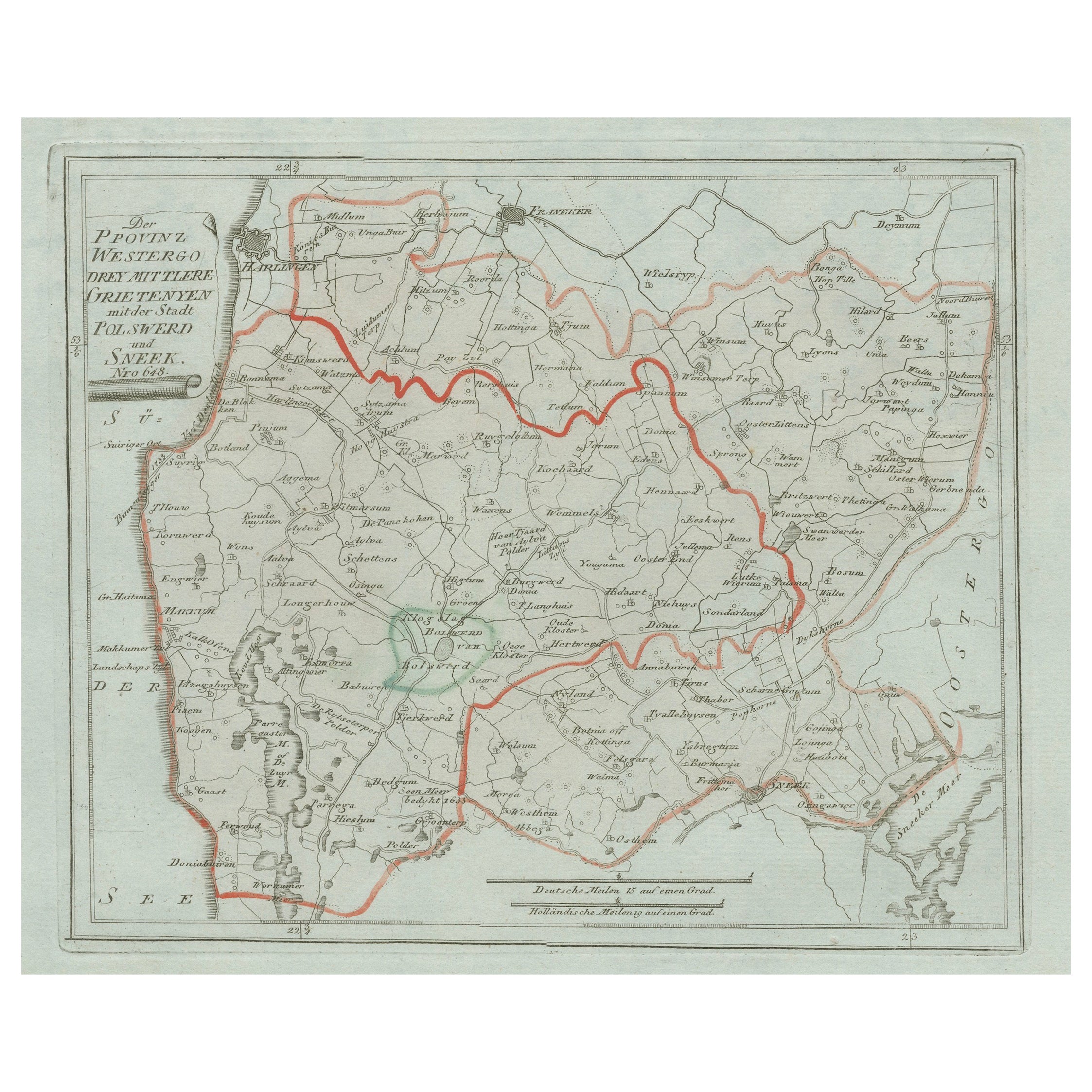
Antique Map of Sneek and Surroundings, Friesland by von Reilly, 1791
Located in Langweer, NL
Antique Map of Sneek and Surroundings, Friesland by von Reilly, 1791
Original 18th-century engraved map titled Der Provinz Westergo drey mittlere Grietenyen, mit der Stadt Bolsward ...
Category
Antique Late 18th Century Austrian Maps
Materials
Paper
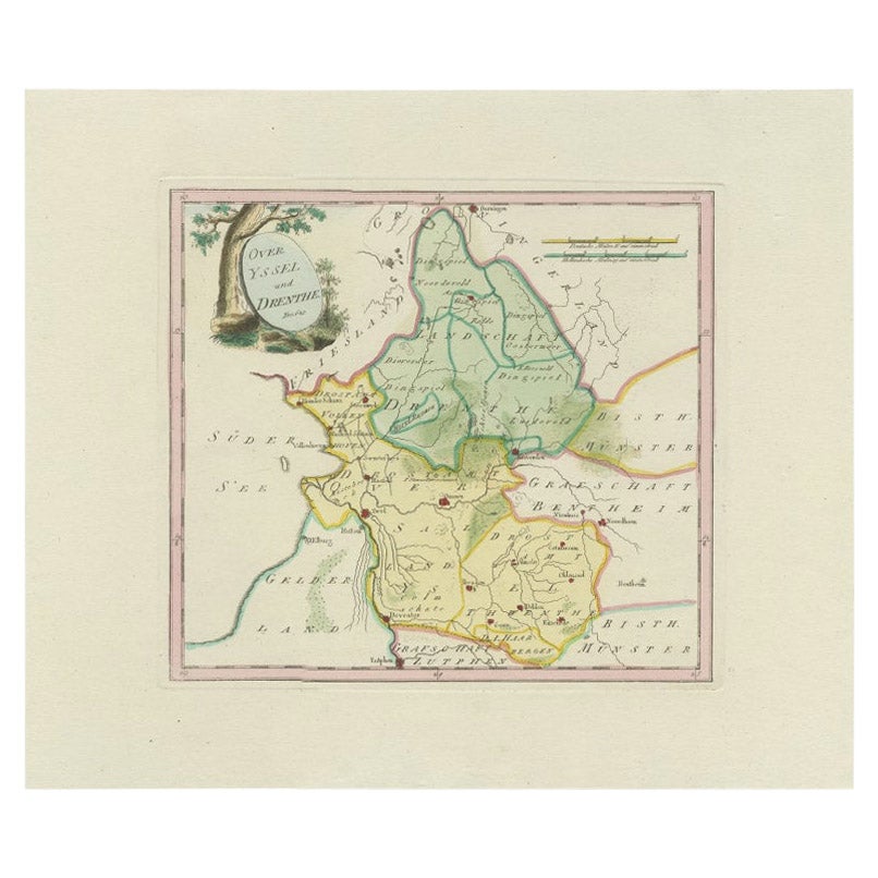
Antique Map of Overijssel and Drenthe by Von Reilly, c.1795
Located in Langweer, NL
Antique map titled 'Overyssel und Drenthe'. Decorative map of Overijssel and Drenthe, The Netherlands. This map originates from 'Schauplatz Der Funf Theile der Welt' (Wien: Reilly, 1...
Category
Antique 18th Century Maps
Materials
Paper
$148 Sale Price
20% Off
Antique Map of Southern Westergo, Friesland by von Reilly, 1791
Located in Langweer, NL
Antique Map of Southern Westergo, Friesland by von Reilly, 1791
Original engraved map titled Westergoo Norde, published in Vienna in 1791. This sheet depicts the southern and coasta...
Category
Antique 18th Century Austrian Maps
Materials
Paper
Zevenwolden, Friesland – von Reilly antique map, 1791
Located in Langweer, NL
Title: Zevenwolden, Friesland – von Reilly antique map, 1791
Fine late-18th-century engraved map of the region of Zevenwolden in Friesland, the Netherlands. Published in 1791 for Fr...
Category
Antique 18th Century Austrian Maps
Materials
Paper
You May Also Like
1752 Vaugoundy Map of Flanders : Belgium, France, and the Netherlands, Ric.a002
Located in Norton, MA
Large Vaugoundy Map of Flanders:
Belgium, France, and the Netherlands
Colored -1752
Ric.a002
Description: This is a 1752 Didier Robert de Vaugondy map of Flanders. The map de...
Category
Antique 17th Century Unknown Maps
Materials
Paper

1657 Janssonius Map of Vermandois and Cappelle, Ric. A-004
Located in Norton, MA
1657 Janssonius map of
Vermandois and Cappelle
Ric.a004
Description: Antique map of France titled 'Descriptio Veromanduorum - Gouvernement de la Cappelle'. Two detailed maps o...
Category
Antique 17th Century Unknown Maps
Materials
Paper

1635 Willem Blaeu Map of Northern France"Comitatvs Bellovacvm" Ric.a08
Located in Norton, MA
1635 Willem Blaeu map of northern France, entitled.
"Comitatvs Bellovacvm Vernacule Beavvais,"
Colored
Ric.a008
“COMITATVS BELLOVACVM…” Amsterdam: W...
Category
Antique 17th Century Unknown Maps
Materials
Paper

1643 Willem&Joan Blaeu Map NW Flanders "Flandriae Teutonicae Pars Prientalior
Located in Norton, MA
1643 Willem and Joan Blaeu map of northwest Flanders, entitled
"Flandriae Teutonicae Pars Prientalior,"
Ric0012
" Authentic" - Map of the northwest Fl...
Category
Antique 17th Century Dutch Maps
Materials
Paper

1839 Map of Karte Des "Russischen Reiches in Europa Und Asien" Ric.R0013
Located in Norton, MA
1839 map of Karte Des
"Russischen Reiches in Europa and Asien"
Ric.r013
Map of the European and Asian parts of Russian Empire. Karte der Russischen Reiches in Europa und Asien...
Category
Antique 19th Century Unknown Maps
Materials
Paper

1790 Thomas Stackhouse Map, Entitled "Russia in Europe, " , Ric.a004
Located in Norton, MA
1790 Thomas Stackhouse map, entitled
"Russia in Europe"
Ric.a004
Stackhouse, Thomas
Russia in Europe [map]
London: T. Stackhouse, 1783. Map. Matted hand-colored copper engraving. Image size: 14.5 x 15.25 inches. Mat size: 22.75 x 23.75 inches. A beautiful example of this map of Eastern Europe...
Category
Antique 17th Century Unknown Maps
Materials
Paper
