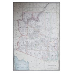
Items Similar to Rare 1888 Map of Arizona – Railroads, Mines
Early Frontier Settlements

Want more images or videos?
Request additional images or videos from the seller
1 of 10
Rare 1888 Map of Arizona – Railroads, Mines
Early Frontier Settlements
$569.55
£424.74
€480
CA$792.79
A$850.84
CHF 456.08
MX$10,239.46
NOK 5,750.54
SEK 5,243.69
DKK 3,657.31
About the Item
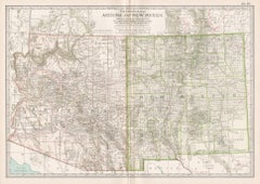
Antique Map of Arizona – Railroads, Mining Districts
Settlements, 1888
This antique engraved map presents the Territory of Arizona as it appeared in 1888, a period when the region was still a rugged frontier but rapidly developing under the influence of railroads, mining, and westward migration. Published by Rand, McNally
Co. in Chicago, the map was included in their Improved Indexed Business Atlas and Shippers Guide, which provided businessmen, shippers, and travelers with accurate geographic and commercial information.
The map depicts Arizona in extraordinary detail. Railroad lines, shown in red and blue, crisscross the territory, including the Southern Pacific Railroad traversing the southern section from Yuma through Tucson and onward toward New Mexico, and the Atlantic
Pacific line running through northern Arizona via Flagstaff and Winslow. These railroads were lifelines for settlers and industries, connecting mining towns, ranches, and military posts to markets across the United States.
Counties such as Yavapai, Pima, Cochise, Maricopa, and Mohave are clearly marked, each showing a network of settlements, stage roads, rivers, and topographic features. The map highlights significant mining districts and camps, which were central to Arizona’s economic development during the late 19th century. Locations such as Prescott, Tucson, Phoenix, Tombstone, and Nogales are all labeled, alongside smaller frontier communities that often grew around mining operations or railroad depots. Natural features including the Mogollon Range, the Colorado River, and the arid Sonoran Desert are also depicted, reflecting the varied and challenging geography of the territory.
The map’s historical significance lies in its timing: Arizona was still a U.S. territory in 1888, not achieving statehood until 1912. This cartographic record captures the region during its formative years, when conflicts between settlers, Native American tribes, and military outposts shaped its social and political development. It also illustrates the importance of railroads in transforming Arizona from a remote frontier into an integrated part of the nation’s economy.
Printed using engraving techniques on sturdy paper, this map reflects Rand McNally’s reputation for precision and clarity in late 19th-century atlas production.
Condition summary: Good condition overall. Light toning consistent with age, faint foxing in some margins, and original fold lines as issued. Paper remains strong with no significant tears or repairs. Clear plate impression throughout.
Framing tips: This map’s historic charm is best complemented by a frame in walnut or dark oak, enhancing its antique character. A soft cream or parchment-colored mount will highlight the fine engraved detail. For a more modern presentation, a simple black frame with a wide ivory mat will make the railroad lines and territorial features stand out vividly.
Technique: Engraving
Maker: Rand, McNally
Co., Chicago, 1888
- Dimensions:Height: 20.67 in (52.5 cm)Width: 14.18 in (36 cm)Depth: 0.01 in (0.2 mm)
- Materials and Techniques:Paper,Engraved
- Place of Origin:
- Period:
- Date of Manufacture:1888
- Condition:Condition summary: Good condition overall. Light toning consistent with age, faint foxing in some margins, and original fold lines as issued. Paper remains strong with no significant tears or repairs. Clear plate impression throughout.
- Seller Location:Langweer, NL
- Reference Number:Seller: BG-12794-631stDibs: LU3054346342222
About the Seller
5.0
Recognized Seller
These prestigious sellers are industry leaders and represent the highest echelon for item quality and design.
Platinum Seller
Premium sellers with a 4.7+ rating and 24-hour response times
Established in 2009
1stDibs seller since 2017
2,830 sales on 1stDibs
Typical response time: 1 hour
- ShippingRetrieving quote...Shipping from: Langweer, Netherlands
- Return Policy
More From This Seller
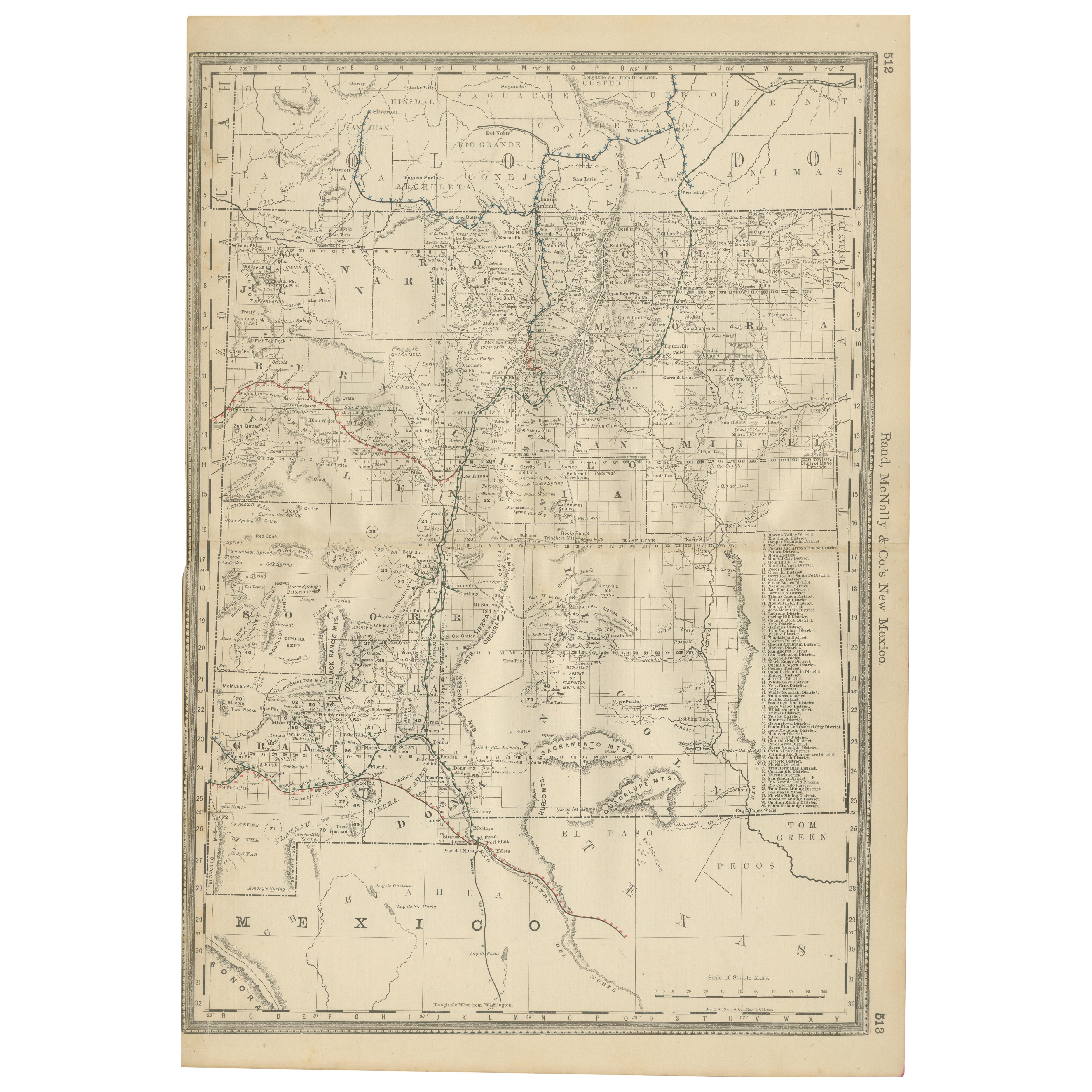
View All1888 New Mexico Map – Railroads, Counties
The Land of Enchantment
Located in Langweer, NL
Antique Map of New Mexico – Railroads, Counties & Frontier Settlements, 1888
This antique engraved map depicts the Territory of New Mexico in 1888, engraved and published by Rand, M...
Category
Antique Late 19th Century American Maps
Materials
Paper

1888 Idaho Map – The Gem State’s Railroads, Mining Camps
Counties
Located in Langweer, NL
Antique Map of Idaho – Railroads, Mining Camps & Counties, 1888
This antique engraved map depicts the Territory of Idaho in 1888, engraved and published by Rand, McNally & Co. in Ch...
Category
Antique Late 19th Century American Maps
Materials
Paper
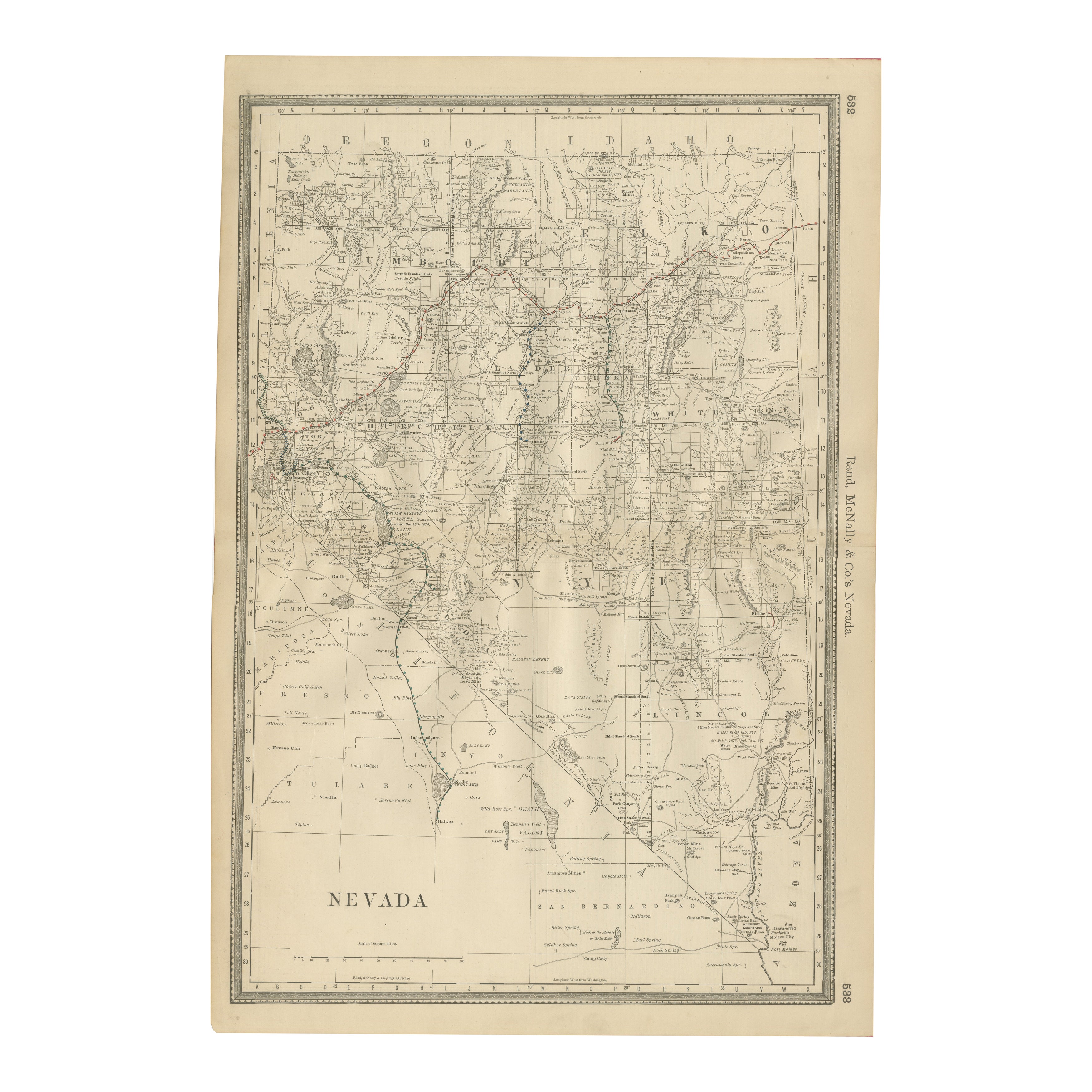
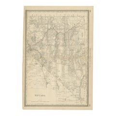
Antique Map of Nevada – Railroads, Mining Camps
Counties, 1888
Located in Langweer, NL
Antique Map of Nevada – Railroads, Mining Camps & Counties, 1888
This antique engraved map depicts the state of Nevada in 1888, engraved and published by Rand, McNally & Co. in Chic...
Category
Antique Late 19th Century American Maps
Materials
Paper
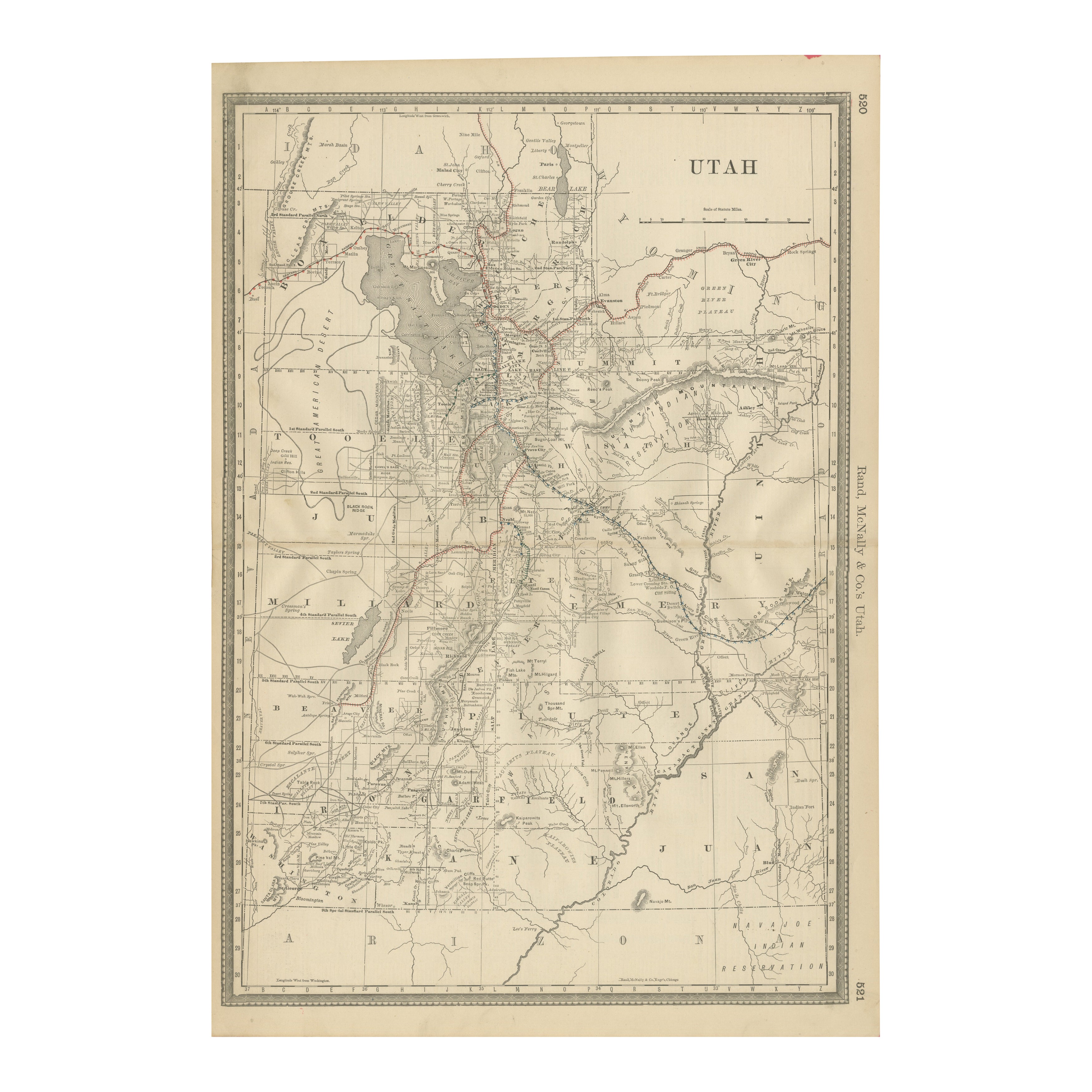
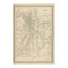
Rare 1888 Utah Map – The Beehive State’s Railroads, Counties
Great Salt Lake
Located in Langweer, NL
Antique Map of Utah – Railroads, Counties & Great Salt Lake, 1888
This antique engraved map presents the Territory of Utah in 1888, published by Rand, McNally & Co. in Chicago for t...
Category
Antique Late 19th Century American Maps
Materials
Paper
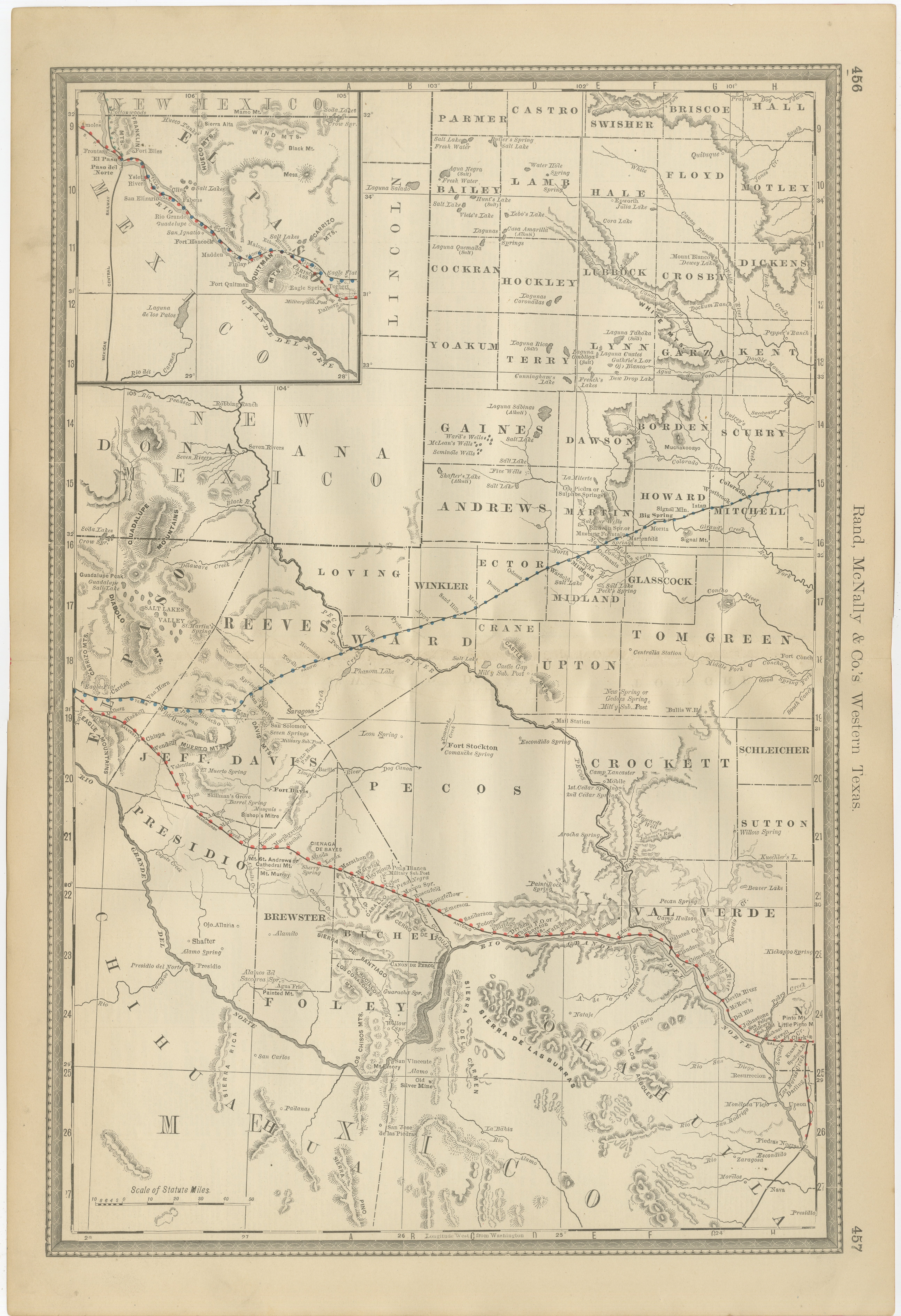
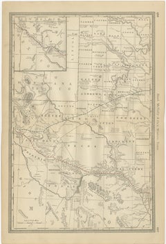
Western Texas Antique Map 1888 – Railroads, Counties
Frontier Towns
Located in Langweer, NL
Western Texas Map 1888 – Rand McNally Antique Lithograph
This antique 1888 map of Western Texas, published by Rand, McNally & Co., depicts the vast frontier counties of the region a...
Category
Antique Late 19th Century American Maps
Materials
Paper
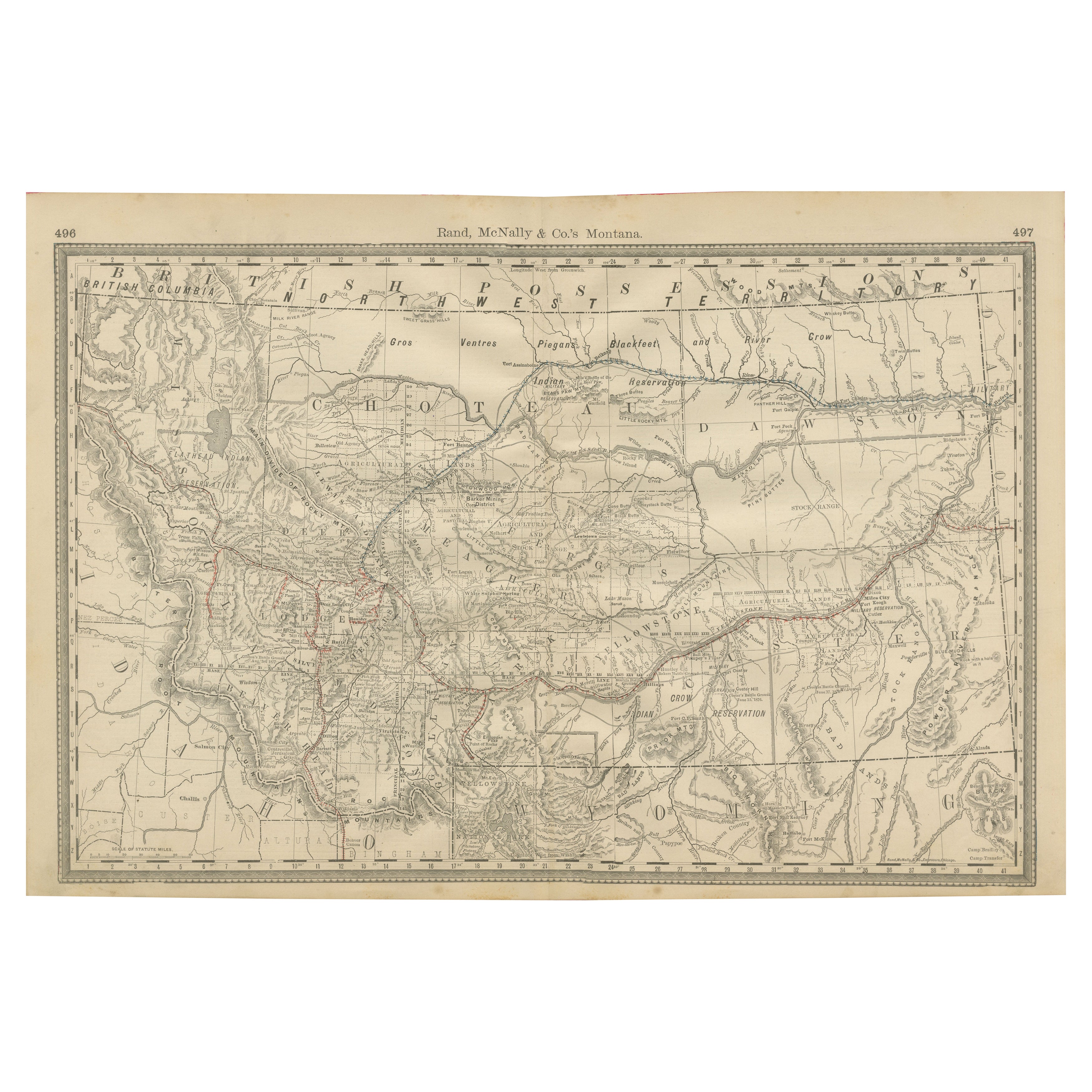
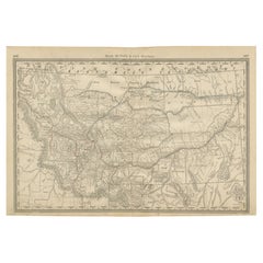
Old Map of Montana – Railroads, Indian Reservations
Frontier Settlements 1888
Located in Langweer, NL
Antique Map of Montana – Railroads, Indian Reservations & Frontier Settlements, 1888
This antique engraved map depicts the Territory of Montana in 1888, engraved and published by Ra...
Category
Antique Late 19th Century American Maps
Materials
Paper
You May Also Like
Large Original Antique Map of Arizona, Usa, C.1900
Located in St Annes, Lancashire
Fabulous map of Arizona
Original color.
Engraved and printed by the George F. Cram Company, Indianapolis.
Published, C.1900.
Unframed.
Free shipping.
Category
Antique 1890s American Maps
Materials
Paper
Original Antique Map of the American State of Arizona
New Mexico, 1903
Located in St Annes, Lancashire
Antique map of Arizona and New Mexico
Published By A & C Black. 1903
Original colour
Good condition
Unframed.
Free shipping
Category
Antique Early 1900s English Maps
Materials
Paper

Original Antique Map of the American State of Colorado, 1903
Located in St Annes, Lancashire
Antique map of Colorado
Published By A & C Black. 1903
Original colour
Good condition
Unframed.
Free shipping
Category
Antique Early 1900s English Maps
Materials
Paper

Arizona and New Mexico. USA. Century Atlas state antique vintage map
Located in Melbourne, Victoria
'The Century Atlas. Arizona and New Mexico.'
Original antique map, 1903.
Central fold as issued. Map name and number printed on the reverse corners.
Sheet 29.5cm by 40cm.
Category
Early 20th Century Victorian More Prints
Materials
Lithograph
Large Original Antique Map of Utah, USA, 1894
By Rand McNally
Co.
Located in St Annes, Lancashire
Fabulous map of Utah
Original color
By Rand, McNally & Co.
Published, 1894
Unframed
Free shipping.
Category
Antique 1890s American Maps
Materials
Paper

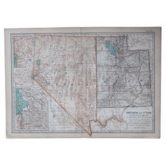
Original Antique Map of the American State of Nevada
Utah, 1903
Located in St Annes, Lancashire
Antique map of Nevada and Utah
Published By A & C Black. 1903
Original colour
Good condition
Unframed.
Free shipping
Category
Antique Early 1900s English Maps
Materials
Paper