Items Similar to Rare 18th C. Newport Map

Want more images or videos?
Request additional images or videos from the seller
1 of 6
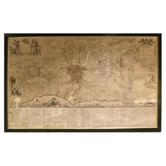
Rare 18th C. Newport Map
$19,500per item
£14,859.36per item
€17,136.95per item
CA$27,695.83per item
A$29,757.63per item
CHF 15,964.91per item
MX$350,579.15per item
Quantity
About the Item
Rare 18th C, Map titled "A plan of the town of Newport in the province of Rhode Island". Earliest printed plan of Newport, published for the use of the British just prior to their occupation in 1776. Issued in the Atlantic Neptune, an atlas of North American waters published by J.F.W. Des Barres 1776.
Great condition, professionally mounted and framed. Measures 29-1/2" by 21" sight, 37" by 27-3/4" framed.
- Dimensions:Height: 37 in (93.98 cm)Width: 27.5 in (69.85 cm)Depth: 2 in (5.08 cm)
- Materials and Techniques:
- Place of Origin:
- Period:1770-1779
- Date of Manufacture:1776
- Condition:Minor fading.
- Seller Location:Sandwich, MA
- Reference Number:Seller: PMABFNP1stDibs: LU10061242485162
About the Seller
5.0
Vetted Professional Seller
Every seller passes strict standards for authenticity and reliability
Established in 1962
1stDibs seller since 2024
Typical response time: Several days
- ShippingRetrieving quote...Shipping from: Sandwich, MA
- Return Policy
More From This Seller
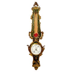
View AllAntique French Ormolu Barometer
Located in Sandwich, MA
Wonderful antique French mercury barometer. Louis XVI ormolu style with elaborate cast bronze leaves and polychrome paint. Features a large squirrel tail thermometer and decorative s...
Category
Antique Late 19th Century French Louis XVI Scientific Instruments
Materials
Bronze
Nantucket Autumn Painting by Andrew Shunney
By Andrew Shunney
Located in Sandwich, MA
Vintage painting "Nantucket Autumn" by Andrew Shunney (American: 1916 - 1978), circa 1960s. Acrylic on canvas modern minimalist Nantucket autumnal landscape with marsh, creek and cot...
Category
Mid-20th Century Paintings
Materials
Acrylic

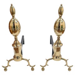
Pair of Antique John Bailey Federal Brass Andirons
Located in Sandwich, MA
Antique pair of brass Federal style double lemon top andirons by John Bailey of New York City circa 1800. Cast iron dogs. Great condition. Measures 23-1/2" high by 11-3/4" wide by 21...
Category
Antique Early 1800s American Andirons
Materials
Brass
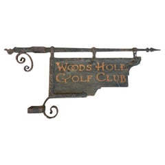
Woods Hole Golf Club Antique Sign from Cape Cod
Located in Sandwich, MA
Antique sign from the Woods Hole Golf Club in Falmouth, MA circa 1900. Includes original wrought iron bracket meant for mounting on a square post. Great original surface. Also reads ...
Category
Antique 1890s American Signs
Materials
Wrought Iron
Antique Charles Ray Nantucket Lightship Basket
Located in Sandwich, MA
Antique Nantucket Lightship Basket, attributed to Charles Ray (1798-1884) circa 1870. Swing handled small open round cane woven basket with...
Category
Antique Late 19th Century American Decorative Baskets
Materials
Cane, Rattan, Wood

Nantucket Doorway Painting by Volney Allan Richardson
Located in Sandwich, MA
Oil on canvas painting titled "Nantucket Doorway" by Volney Allan Richardson (American, 1880-1955). Signed lower right corner, wonderful origin...
Category
Early 20th Century Paintings
Materials
Paint

You May Also Like
Antique Map of New Ireland, 1774
Located in Langweer, NL
Antique print titled 'Neu Irrland (..)'. Antique map of New Ireland with 7 coastal profiles, Papua New Guinea. Originates from 'Geschichte der See-Reisen u...
Category
Antique 18th Century German Maps
Materials
Paper

$275 Sale Price
20% Off
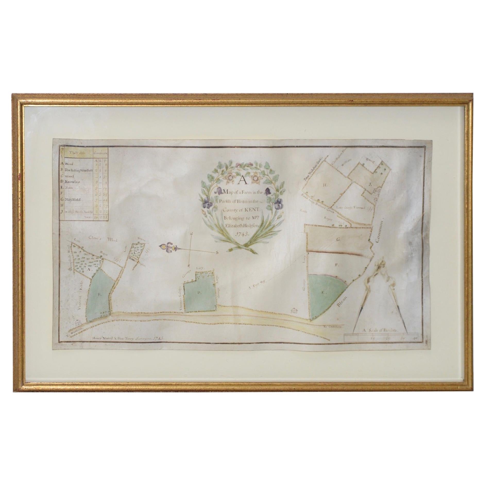
Mid-18th Century Hand Drawn English Farm Map on Vellum, circa 1740s
Located in San Francisco, CA
Mid-18th century hand drawn English farm map on Vellum circa 1740s
Henry Maxted & Isaac Terry, Surveyors.
A Map of a Farm in the Parish of Blean in the County of KENT: Belonging to Mrs Elizabeth Hodgson circa 1743.
A beautiful hand drawn map...
Category
Antique Mid-18th Century English Maps
Materials
Lambskin

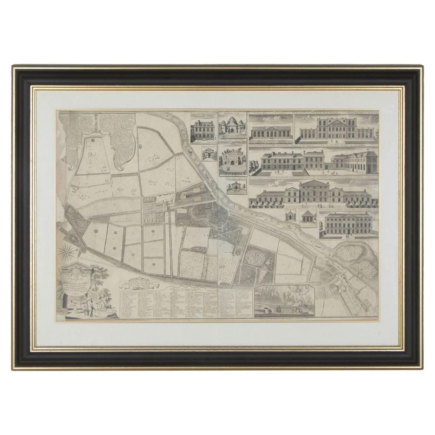
1748 Map of Richmond Upon Thames by John Roque
Located in Gloucestershire, GB
A 1748 map of Richmond-Upon-Thames by famed surveyor and cartographer, John Roque. Placed in a simple black and gilt frame. The map is in fair condition but there are small sections ...
Category
Antique Mid-18th Century English Maps
Materials
Wood, Paper

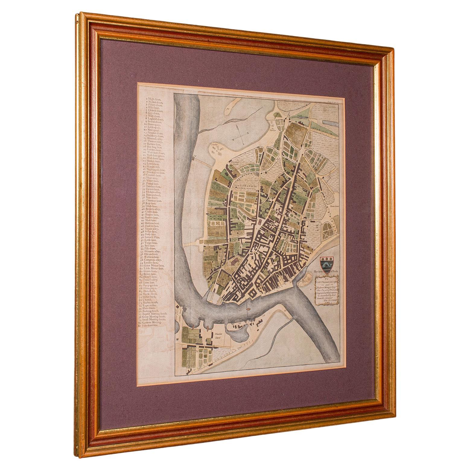
Antique Town Plan Map, Poole, English, Framed Cartography, Georgian, Circa 1780
Located in Hele, Devon, GB
This is an antique town plan map of Poole in Dorset. An English, framed atlas engraving, dating to the 18th century and later.
Fascinating cartography with annotated streets and pl...
Category
Antique Late 18th Century British George III Maps
Materials
Glass, Wood, Paper

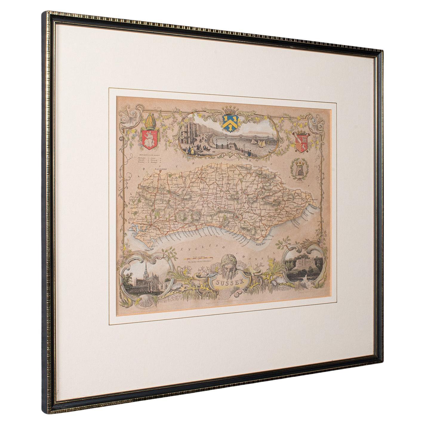
Antique County Map, Sussex, English, Framed Lithography, Cartography, Victorian
Located in Hele, Devon, GB
This is an antique lithography map of Sussex. An English, framed atlas engraving of cartographic interest, dating to the mid 19th century and later.
Superb lithography of Sussex an...
Category
Antique Mid-19th Century British Victorian Maps
Materials
Paper

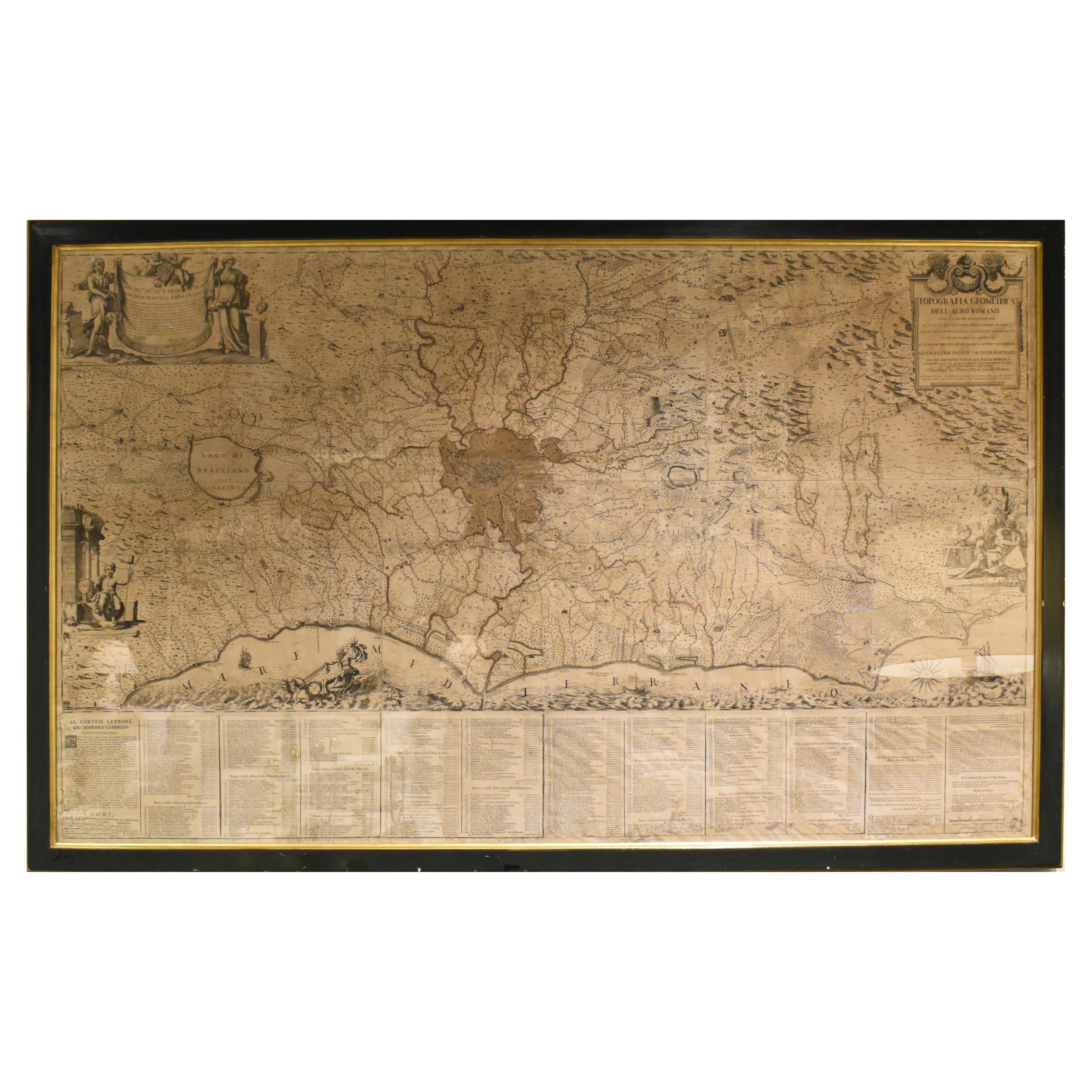
18th Century Map of Rome
Surrounding Vicinity
Located in New Orleans, LA
Intriguing framed map of Rome and the surrounding vicinity featuring detailed cartography, ornamental illustrations, and text index at the bottom. A great, historical conversation pi...
Category
Antique 18th Century Italian Antiquities
Materials
Paper
More Ways To Browse
Newport Furniture
18th Century Wood Side Tables
Antique Hand Carved Dining Room Sets
Mid Century Modern Pitcher
Vintage Italian Leather Dining Chair
Vintage Movie Posters
Blue Green Wool And Silk Rug
Brown Sheepskin Chair
Vintage Brass Bar Carts
Antique Botanical Prints
Green Persian Rug
17th Century Blue And White
50 X 50 Coffee Table
Antique Wood Panel Painted
Milo Baughman 1970
Spanish Baroque Furniture
Stone China
Couch Console