Items Similar to Rare Antique Hand-Colored Map of Eastern Friesland by von Reilly, 1791


Video Loading
Want more images or videos?
Request additional images or videos from the seller
1 of 11
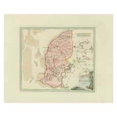
Rare Antique Hand-Colored Map of Eastern Friesland by von Reilly, 1791
$527.05
£394.11
€440
CA$726.14
A$791.96
CHF 419.53
MX$9,494.46
NOK 5,342.90
SEK 4,885.68
DKK 3,352.98
About the Item
Antique Map of Eastern Friesland by von Reilly, 1791
Original engraved map titled Der Provinz Vriesenland vier östliche Grietenyen, published in Vienna in 1791. This detailed sheet depicts the eastern districts (grietenijen) of Friesland, bordering the provinces of Drenthe and Overijssel. The map is finely engraved, with boundaries highlighted in original hand color and the mapped area filled with a light green wash.
This map was published in Franz Joseph Johann von Reilly’s ambitious atlas *Schauplatz der fünf Theile der Welt* (“Showplace of the Five Parts of the World”), one of the most significant Austrian cartographic projects of the late 18th century. Von Reilly (1766–1820), a Viennese publisher and dealer in prints, sought to compile an atlas that combined accuracy with decorative appeal. The engraving work was carried out by Ignaz Alberti (1760–1794), whose crisp linework and clarity gave von Reilly’s maps their distinctive quality.
The map provides a historical record of the eastern Frisian landscape at the close of the 18th century. Numerous towns and villages are shown, along with waterways, dikes, and fields, offering a snapshot of the agricultural and administrative divisions of the time. The title cartouche, placed at upper right, is framed by foliage in the neoclassical style typical of von Reilly’s atlas.
This is a highly collectible piece for those interested in Friesland, Dutch provincial cartography, or Austrian mapmaking. Its combination of geographical precision and decorative character ensures it remains both historically significant and visually appealing.
Condition report: Good condition overall with light age toning. Some minor water staining visible in the right margin, outside the printed area. Original hand coloring preserved. Blank verso.
Framing tips: A dark wooden or ebonized frame with a cream mount will highlight the engraved detail and hand coloring. A double mat with a fine green inner line can be added to echo the map’s wash and enhance its visual depth.
Technique: Engraving with original hand color
Maker: Franz Joseph Johann von Reilly, engraved by Ignaz Alberti, Vienna, 1791
- Dimensions:Height: 13 in (33 cm)Width: 20.48 in (52 cm)Depth: 0.01 in (0.2 mm)
- Materials and Techniques:Paper,Engraved
- Place of Origin:
- Period:
- Date of Manufacture:1791
- Condition:Condition report: Good condition with general age-related toning. A small water stain is visible along the right margin, far outside the engraved area. Original hand coloring intact. Blank verso.
- Seller Location:Langweer, NL
- Reference Number:Seller: BG-13229-211stDibs: LU3054346650012
About the Seller
5.0
Recognized Seller
These prestigious sellers are industry leaders and represent the highest echelon for item quality and design.
Platinum Seller
Premium sellers with a 4.7+ rating and 24-hour response times
Established in 2009
1stDibs seller since 2017
2,791 sales on 1stDibs
Typical response time: <1 hour
- ShippingRetrieving quote...Shipping from: Langweer, Netherlands
- Return Policy
More From This Seller
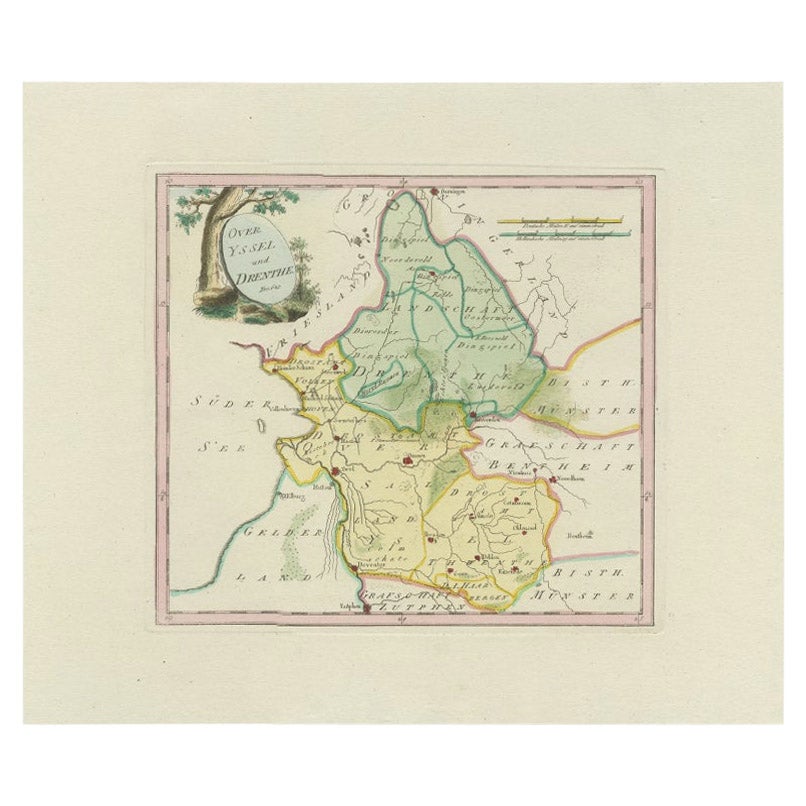
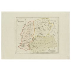
View AllAntique Map of Overijssel and Drenthe by Von Reilly, c.1795
Located in Langweer, NL
Antique map titled 'Overyssel und Drenthe'. Decorative map of Overijssel and Drenthe, The Netherlands. This map originates from 'Schauplatz Der Funf Theile der Welt' (Wien: Reilly, 1...
Category
Antique 18th Century Maps
Materials
Paper
$148 Sale Price
20% Off
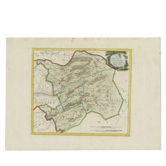
Antique Map of Southern Westergo, Friesland by von Reilly, 1791
Located in Langweer, NL
Antique Map of Southern Westergo, Friesland by von Reilly, 1791
Original engraved map titled Westergoo Norde, published in Vienna in 1791. This sheet depicts the southern and coasta...
Category
Antique 18th Century Austrian Maps
Materials
Paper
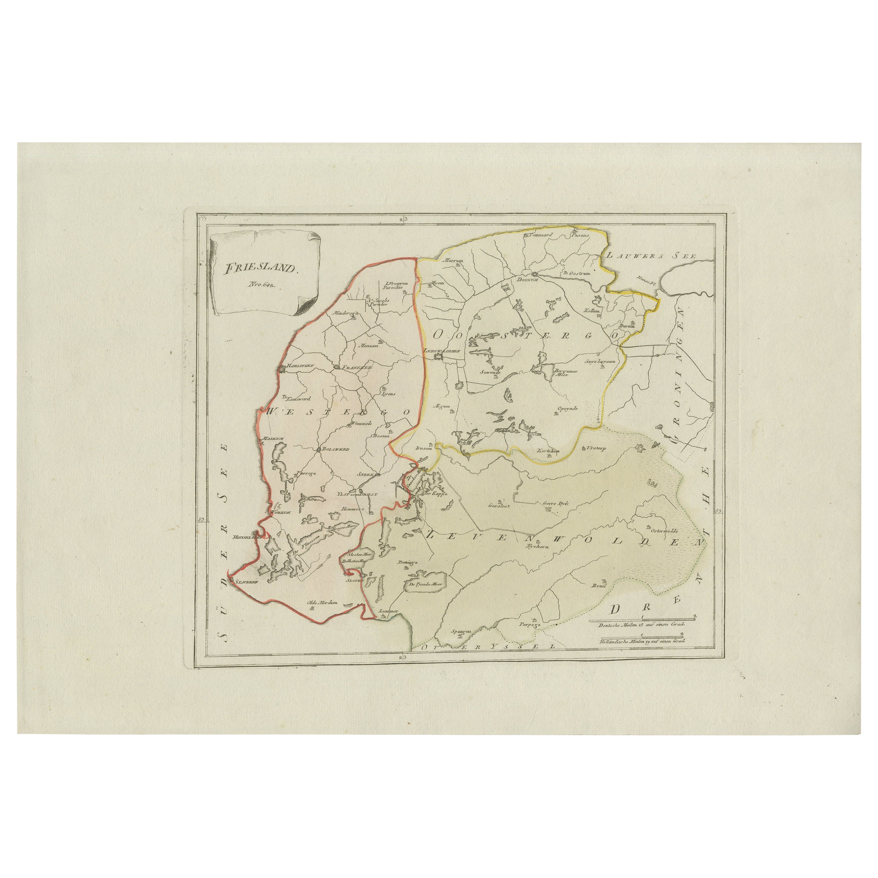
Antique Map of Friesland by Von Reilly, 1791
Located in Langweer, NL
Antique map titled 'Friesland'. Map of the province of Friesland, the Netherlands. This map orginates from 'Schauplatz der fünf Theile der Welt'. Artists and Engravers: Franz Joseph ...
Category
Antique 18th Century Austrian Maps
Materials
Paper

Rare 1791 von Reilly Map of Friesland Province, Netherlands, 18th Century
Located in Langweer, NL
Antique General Map of Friesland by von Reilly, 1791
Original engraved map titled *Friesland*, published in Vienna in 1791. This is the general overview map of the province of Fries...
Category
Antique Late 18th Century Austrian Maps
Materials
Paper
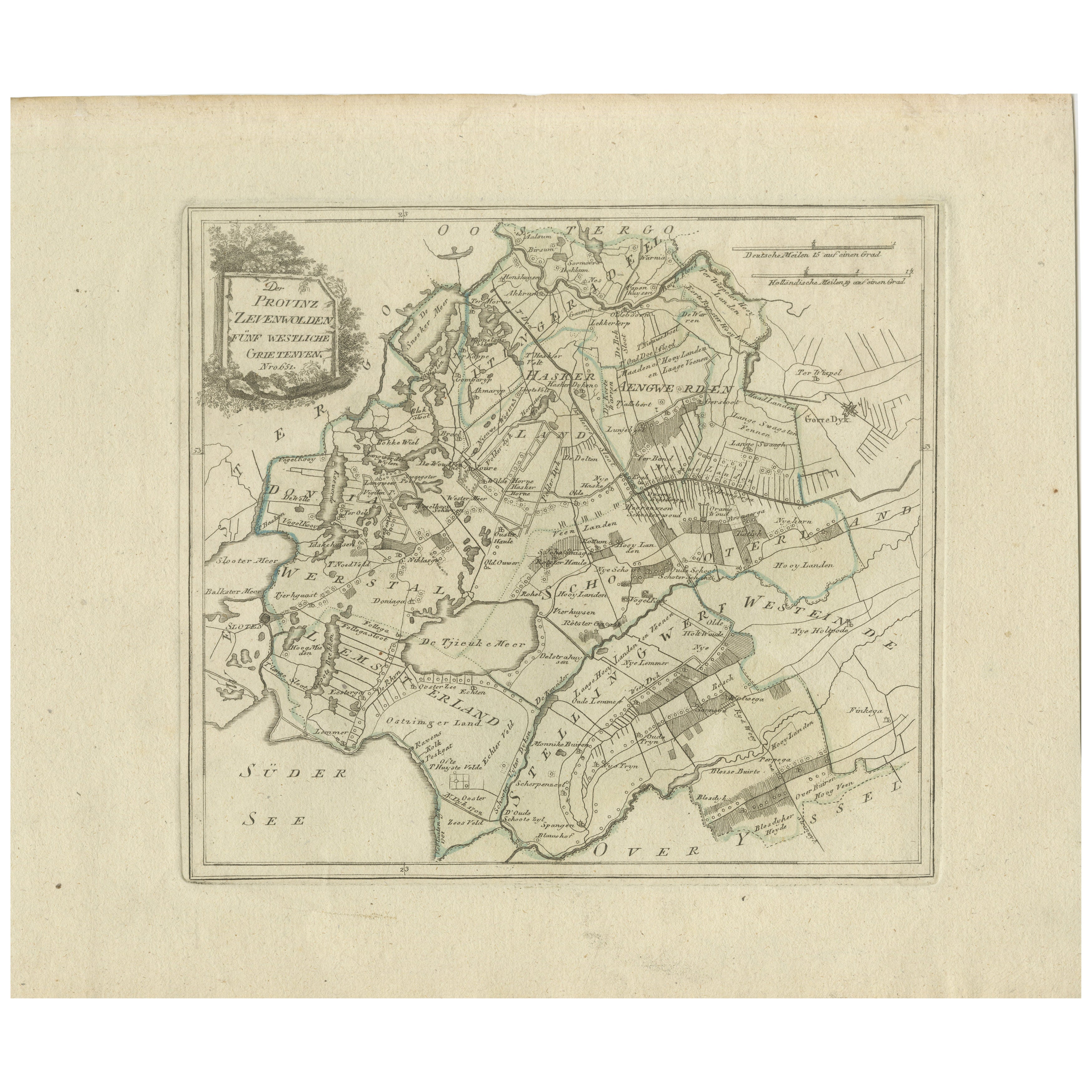
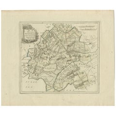
Antique Map of Zevenwolden by Von Reilly, 1791
Located in Langweer, NL
Friesland Zevenwouden eastern districts map, Reilly, Vienna, c.1791–95
Description:
Engraved map with original hand color of the Zevenwouden (Seven Forests) region in Friesland, Net...
Category
Antique 18th Century Austrian Maps
Materials
Paper
Antique Map of Zevenwolden, Friesland by von Reilly, 1791
Located in Langweer, NL
Antique Map of Zevenwolden, Friesland by von Reilly, 1791
Original engraved map titled Der Provinz Zevenwolden fünf westliche Grietenyen No. 644, published in Vienna in 1791. This s...
Category
Antique 18th Century Austrian Maps
Materials
Paper
You May Also Like
1752 Vaugoundy Map of Flanders : Belgium, France, and the Netherlands, Ric.a002
Located in Norton, MA
Large Vaugoundy Map of Flanders:
Belgium, France, and the Netherlands
Colored -1752
Ric.a002
Description: This is a 1752 Didier Robert de Vaugondy map of Flanders. The map de...
Category
Antique 17th Century Unknown Maps
Materials
Paper

Southern Holland: An Original 17th C. Hand-colored Visscher Map "Hollandiae"
By Nicolaus Visscher
Located in Alamo, CA
This a beautiful framed hand colored 17th century map of the southern portions of Holland by Nicolaus (Nicolas) Visscher II entitled "Hollandiae pars Meridionalis, vulgo Zuyd-Holland", published in Amsterdam in 1678. The map shows the region between Breda, Heusden, Gornichem, Gouda, Dordrecht, and Willemstad. It includes a decorative cartouche in the lower left corner.
The map is presented in an attractive maple colored wood frame with gold trim and a fabric mat. There is a central vertical fold, as issued. There are small areas of discoloration consistent with age. The map is otherwise in very good condition.
The Visscher family were one of the great cartographic families of the 17th century. Begun by Claes Jansz Visscher...
Category
Late 17th Century Other Art Style Landscape Prints
Materials
Engraving

1839 Map of Karte Des "Russischen Reiches in Europa Und Asien" Ric.R0013
Located in Norton, MA
1839 map of Karte Des
"Russischen Reiches in Europa and Asien"
Ric.r013
Map of the European and Asian parts of Russian Empire. Karte der Russischen Reiches in Europa und Asien...
Category
Antique 19th Century Unknown Maps
Materials
Paper

English Engraved Hand Colored Map of the North Eastern United States, circa 1817
Located in Charleston, SC
English copper engraved hand colored map of the North Eastern United States matted under glass in a gilt frame, Early 19th Century. Drawn and Engraved for Thomson's New General Atlas...
Category
Antique 1810s English George III Maps
Materials
Glass, Giltwood, Paint, Paper

Original Antique Map of Ancient Greece- Boeotia, Thebes, 1787
Located in St Annes, Lancashire
Great map of Ancient Greece. Showing the region of Boeotia, including Thebes
Drawn by J.D. Barbie Du Bocage
Copper plate engraving by P.F T...
Category
Antique 1780s French Other Maps
Materials
Paper

1771 Bonne Map of Poitou, Touraine and Anjou, France, Ric.a015
Located in Norton, MA
1771 Bonne Map of Poitou,
Touraine and Anjou, France
Ric.a015
1771 Bonne map of Potiou, Touraine and Anjou entitled "Carte des Gouvernements D'Anjou et du Saumurois, de la Touraine, du Poitou,du Pays d'aunis, Saintonge?Angoumois,"
Carte des gouvernements d'Anjou et du Saumurois, de la Touraine, du Poitou, du Pays d'Aunis, Saintonge-Angoumois. Projettee et assujettie au ciel par M. Bonne, Hyd. du Roi. A Paris, Chez Lattre, rue St. Jacques a la Ville de Bord(ea)ux. Avec priv. du Roi. 1771. Arrivet inv. & sculp., Atlas moderne ou collection de cartes sur toutes...
Category
Antique 17th Century Unknown Maps
Materials
Paper
