Items Similar to Rare Detailed Antique Map of Prague and Its North West Environs, ca.1760


Want more images or videos?
Request additional images or videos from the seller
1 of 6
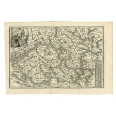
Rare Detailed Antique Map of Prague and Its North West Environs, ca.1760
$533.96
£398.19
€450
CA$743.24
A$797.66
CHF 427.58
MX$9,599.50
NOK 5,391.13
SEK 4,915.96
DKK 3,428.73
About the Item
Description: original antique map of the environs of North West Prague. This map originates from the 'Gentlemans Magazine'. Published circa 1760.
Artists and Engravers: Engraved by Gibson.
Condition: Fair/good, age-related toning. Original folding lines, some wear. Small repair, blank verso. Please study image carefully.
About the Seller
5.0
Recognized Seller
These prestigious sellers are industry leaders and represent the highest echelon for item quality and design.
Platinum Seller
Premium sellers with a 4.7+ rating and 24-hour response times
Established in 2009
1stDibs seller since 2017
2,830 sales on 1stDibs
Typical response time: 1 hour
- ShippingRetrieving quote...Shipping from: Langweer, Netherlands
- Return Policy
More From This Seller
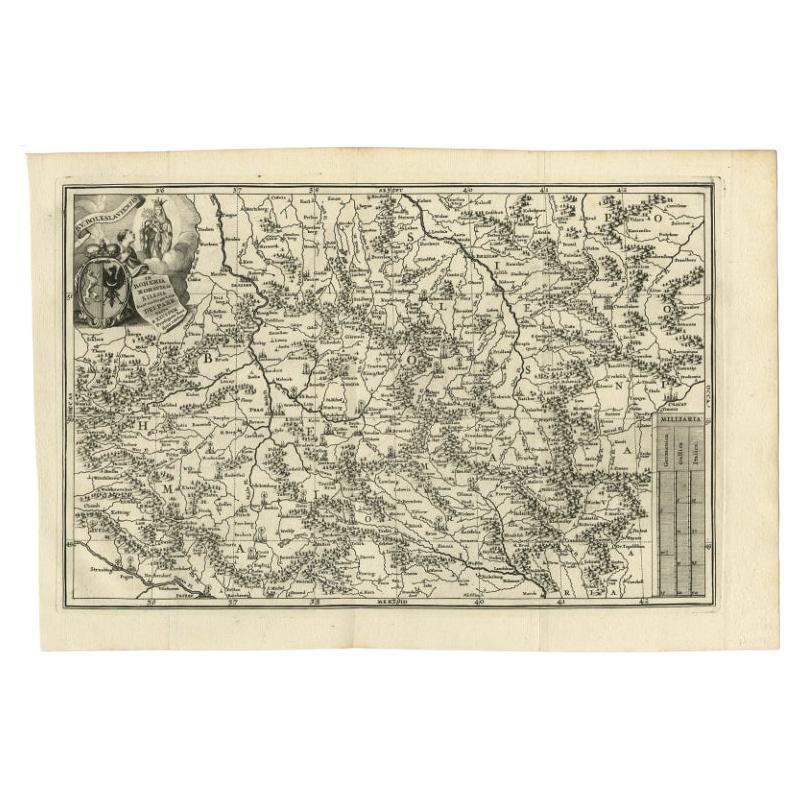
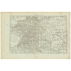
View AllAntique Uncommon Map of Bohemia, Moravia and Silesia, 1699
Located in Langweer, NL
Antique map titled 'B. V. Boleslaviensis in Bohemia, Moravia et Silesia (..).' Detailed uncommon map of the Bohemia, Moravia and Silesia. Source unknown, to be determined.
Artists...
Category
Antique 17th Century Maps
Materials
Paper
Antique Map of Austria by N. Visscher, circa 1690
Located in Langweer, NL
Antique map titled 'Austriae Archiducatus pars superior in omnes ejusdem'. Spectacular large map of Upper and Lower Austria between Passau and Wien with figurative cartouche and armo...
Category
Antique Late 17th Century Maps
Materials
Paper

$882 Sale Price
20% Off
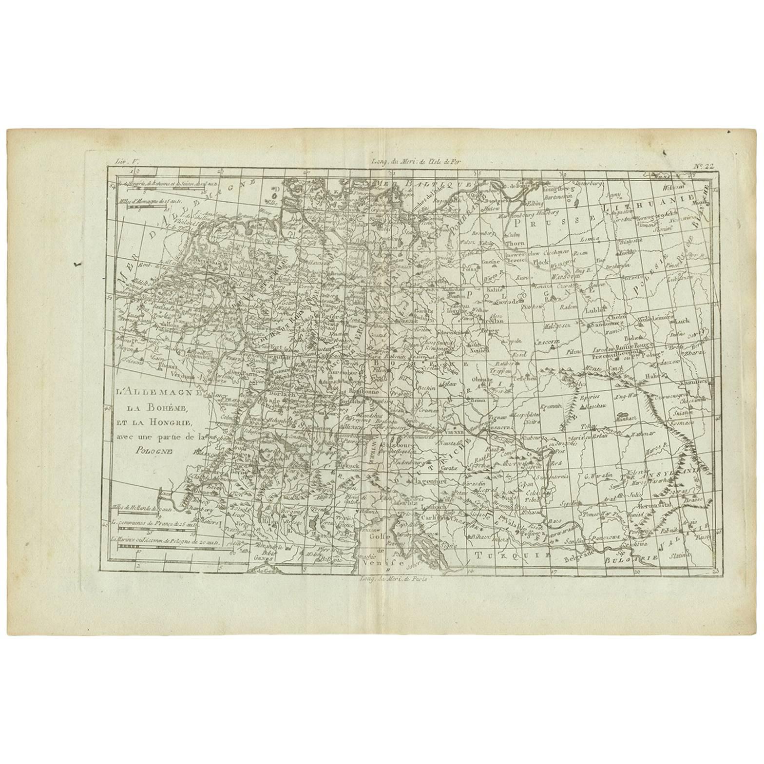
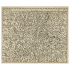
Antique Map of Germany, Bohemia, Hungary and Part of Poland by R. Bonne ‘1780’
Located in Langweer, NL
Antique map titled "L'Allemagne, La Bohême, et la Hongrie avec une partie de la Pologne" by Rigobert Bonne (1729-1795) for "Atlas de toutes les parties connues du globe terrestre" by...
Category
Antique Late 18th Century French Maps
Materials
Paper
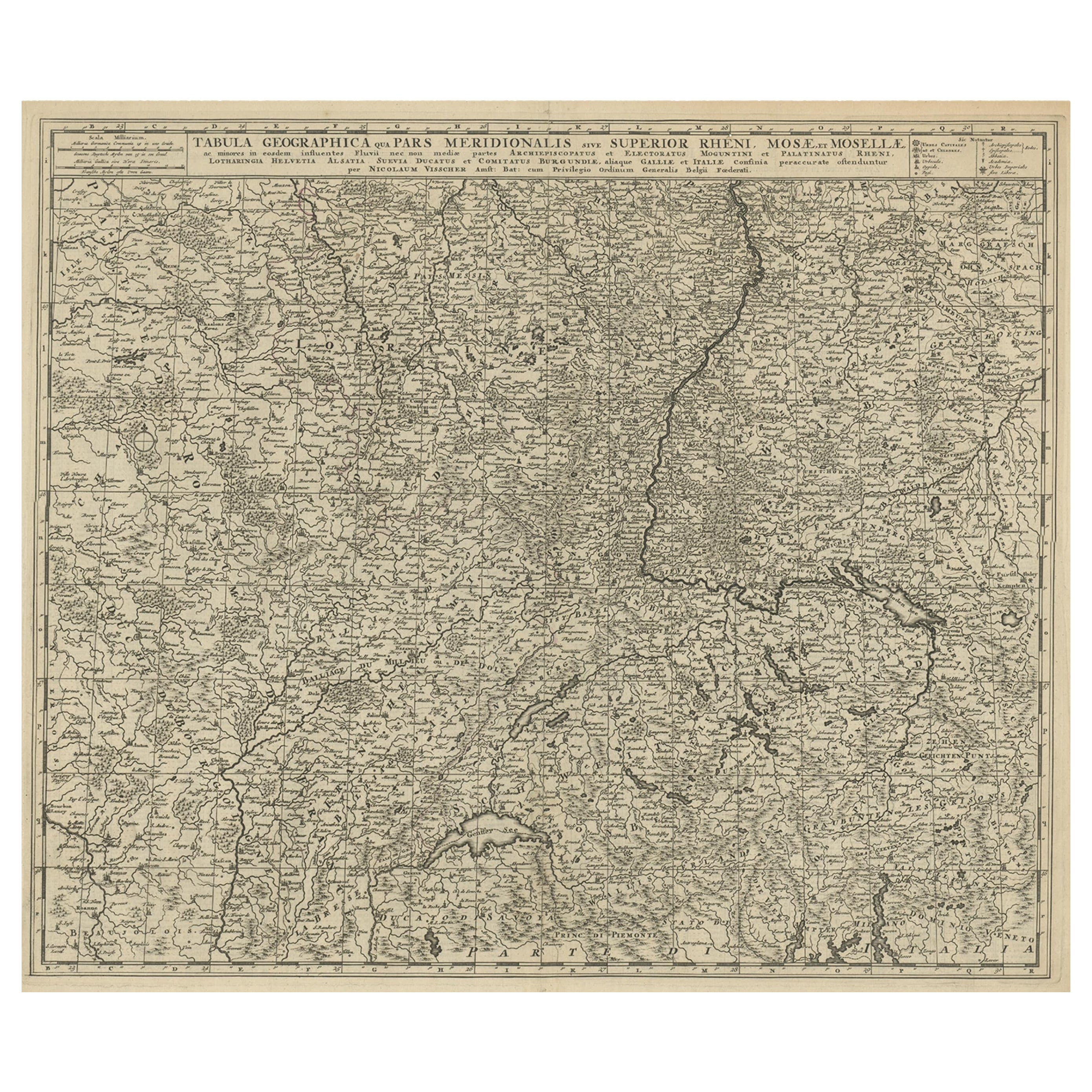
Original Antique Detailed Map of the Rhine and Moselle River Regions, ca.1680
Located in Langweer, NL
Antique map titled 'Tabula Geographica qui Pars Meridionalis sive Superior Rheni, Mosae et Mosellae (..).'
Detailed map of the Rhine and Moselle River regions and contigous parts...
Category
Antique 1680s Maps
Materials
Paper
$522 Sale Price
20% Off
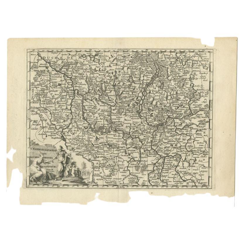
Antique Map of the Brandenburg Region by Sanson, c.1705
Located in Langweer, NL
Antique map Germany titled 't Markgraafschap en Keurvorstendom van Brandenburg'. Antique map of the Brandenburg region in Germany. Includes the cit...
Category
Antique 18th Century Maps
Materials
Paper

Antique Map of the Lorraine Region, c.1760
Located in Langweer, NL
Untitled antique map of the Lorraine region, France. A cultural and historical region in north-eastern France, now located in the administrative region of Grand Est. Lorraine's name ...
Category
Antique 18th Century Maps
Materials
Paper

You May Also Like
Original Antique Map of Hungary, Arrowsmith, 1820
Located in St Annes, Lancashire
Great map of Hungary
Drawn under the direction of Arrowsmith.
Copper-plate engraving.
Published by Longman, Hurst, Rees, Orme and Brown, 1820
Unframed.
Category
Antique 1820s English Maps
Materials
Paper

1752 Vaugoundy Map of Flanders : Belgium, France, and the Netherlands, Ric.a002
Located in Norton, MA
Large Vaugoundy Map of Flanders:
Belgium, France, and the Netherlands
Colored -1752
Ric.a002
Description: This is a 1752 Didier Robert de Vaugondy map of Flanders. The map de...
Category
Antique 17th Century Unknown Maps
Materials
Paper

1657 Janssonius Map of Vermandois and Cappelle, Ric. A-004
Located in Norton, MA
1657 Janssonius map of
Vermandois and Cappelle
Ric.a004
Description: Antique map of France titled 'Descriptio Veromanduorum - Gouvernement de la Cappelle'. Two detailed maps o...
Category
Antique 17th Century Unknown Maps
Materials
Paper

18th Century Emanuel Bowen Map of County of York, c.1740
By Emanuel Bowen
Located in Royal Tunbridge Wells, Kent
Antique 18th century British rare and original Emanuel Bowen (1694-1767) map of the County of York divided into its Ridings and subdivided into wapontakes, mounted in solid wood fram...
Category
Antique Early 18th Century British Maps
Materials
Paper

Original Large Antique Map of Paris, France by John Dower, 1861
Located in St Annes, Lancashire
Fabulous monochrome map of Paris.
Vignettes of St Germain En Laye, Saint Cloud, Versailles and Fontainbleau.
Unframed.
Drawn by J.Dower.
Lithography by Weller. 4 sheets joined to...
Category
Antique 1860s English Victorian Maps
Materials
Paper

1839 Map of Karte Des "Russischen Reiches in Europa Und Asien" Ric.R0013
Located in Norton, MA
1839 map of Karte Des
"Russischen Reiches in Europa and Asien"
Ric.r013
Map of the European and Asian parts of Russian Empire. Karte der Russischen Reiches in Europa und Asien...
Category
Antique 19th Century Unknown Maps
Materials
Paper

More Ways To Browse
Antique Maps Of Russian Empire
J C Walker Map
Massachusetts Antiques
Persian Maps
Afghanistan Antique Map
Antique Furniture Delaware
Antique Furniture Wisconsin
Antique Map By Coronelli
Antique Map Iceland
Cyprus Antique Maps
John Speed Maps
M Howard
Used Office Furniture Michigan
Antique Geological Maps
Antique Manitoba
Australian Colonial
Bengal Map
Stanford Furniture