Items Similar to Relief Atlas Map of Africa by Hachette – Antique c.1883 French Map


Video Loading
Want more images or videos?
Request additional images or videos from the seller
1 of 11
Relief Atlas Map of Africa by Hachette – Antique c.1883 French Map
$466.52
£346.42
€390
CA$640.97
A$697.13
CHF 369.45
MX$8,353.05
NOK 4,695.55
SEK 4,301.76
DKK 2,973.40
About the Item
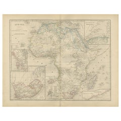
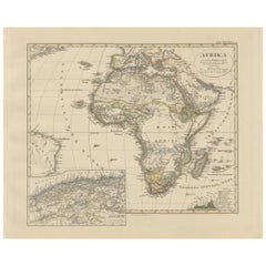
Antique Map of Africa – Relief Atlas Map by Hachette, circa 1880
Description:
This is an attractive antique map titled “Afrique,” published by Hachette in Paris around 1880. The map originates from a French educational “Atlas en relief” and illustrates the continent of Africa with elevation shown in shaded relief, giving a vivid sense of the topography and physical geography of the region.
The map depicts political boundaries, major cities, rivers, and mountain ranges of Africa as known in the late 19th century, during the period of colonial expansion often referred to as the “Scramble for Africa.” Colonial possessions are distinguished using coloured borders and shading according to European powers: France (Fr), Portugal (Pt), England (A), and Spain (E). The map also includes islands such as Madagascar, Seychelles, Cape Verde, Canary Islands, and islands in the Indian and Atlantic Oceans.
This relief atlas edition is printed with delicate colouring and fine engraved details, designed for educational use in French schools to teach students the physical and geopolitical features of the African continent. The bottom left legend explains the hypsometric colouring used to indicate elevation from lowlands to high mountains. The publication line reads: “E. Hachette, Editeur, 79, Rue Serpente, à Paris.”
Condition:
Good condition for age. Clean impression with only minor age toning in the margins. Original foldlines flattened. The printed area is bright and retains original colour shading. Very slight edge wear on the sheet, not affecting the image.
Framing tip:
This antique African map would look elegant float-mounted within a black or dark wood frame to contrast with its light earth-tone palette. It suits both vintage map collections and modern interiors with travel or colonial exploration themes.
- Dimensions:Height: 10.12 in (25.7 cm)Width: 12.84 in (32.6 cm)Depth: 0.01 in (0.2 mm)
- Materials and Techniques:
- Period:
- Date of Manufacture:circa 1883
- Condition:Good condition for age. Clean impression with only minor age toning in the margins. Original foldlines flattened. The printed area is bright and retains original colour shading. Very slight edge wear on the sheet, not affecting the image.
- Seller Location:Langweer, NL
- Reference Number:Seller: BG-13384-361stDibs: LU3054345657862
About the Seller
5.0
Recognized Seller
These prestigious sellers are industry leaders and represent the highest echelon for item quality and design.
Platinum Seller
Premium sellers with a 4.7+ rating and 24-hour response times
Established in 2009
1stDibs seller since 2017
2,823 sales on 1stDibs
Typical response time: 1 hour
- ShippingRetrieving quote...Shipping from: Langweer, Netherlands
- Return Policy
More From This Seller
View AllAntique Map of Africa, Highlighting Colonial Divisions, Geographic Features 1903
Located in Langweer, NL
Title: Antique Map of Africa, 1903, Highlighting Colonial Divisions and Geographic Features
Description: This antique map, titled "Africa," was engraved and published in 1903 by W. ...
Category
Early 20th Century Maps
Materials
Paper

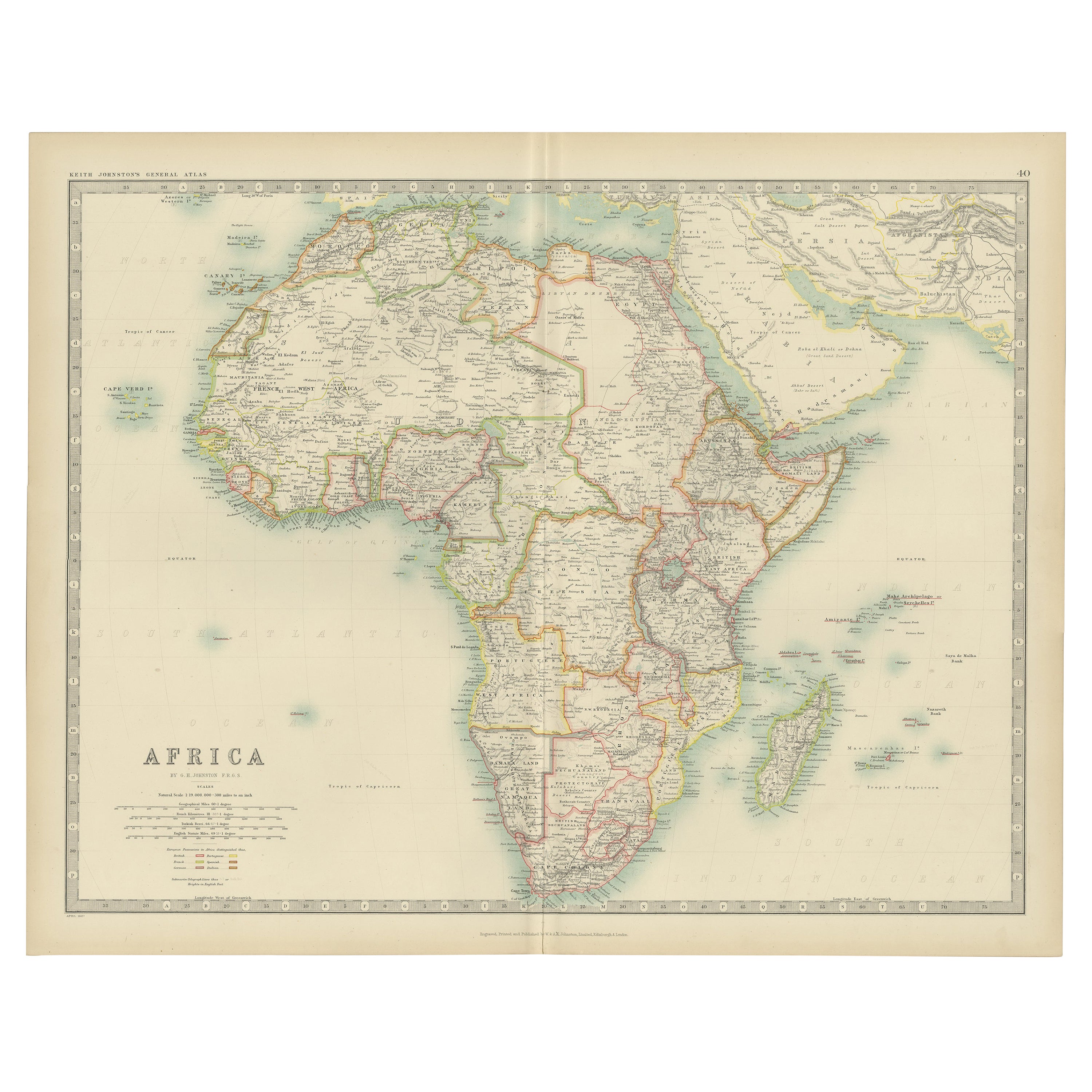
Antique Map of Africa by Johnston (1909)
Located in Langweer, NL
Antique map titled 'Africa'. Original antique map of Africa. This map originates from the ‘Royal Atlas of Modern Geography’. Published by W. & A....
Category
Early 20th Century Maps
Materials
Paper

$239 Sale Price
20% Off
Africa Map with Egypt
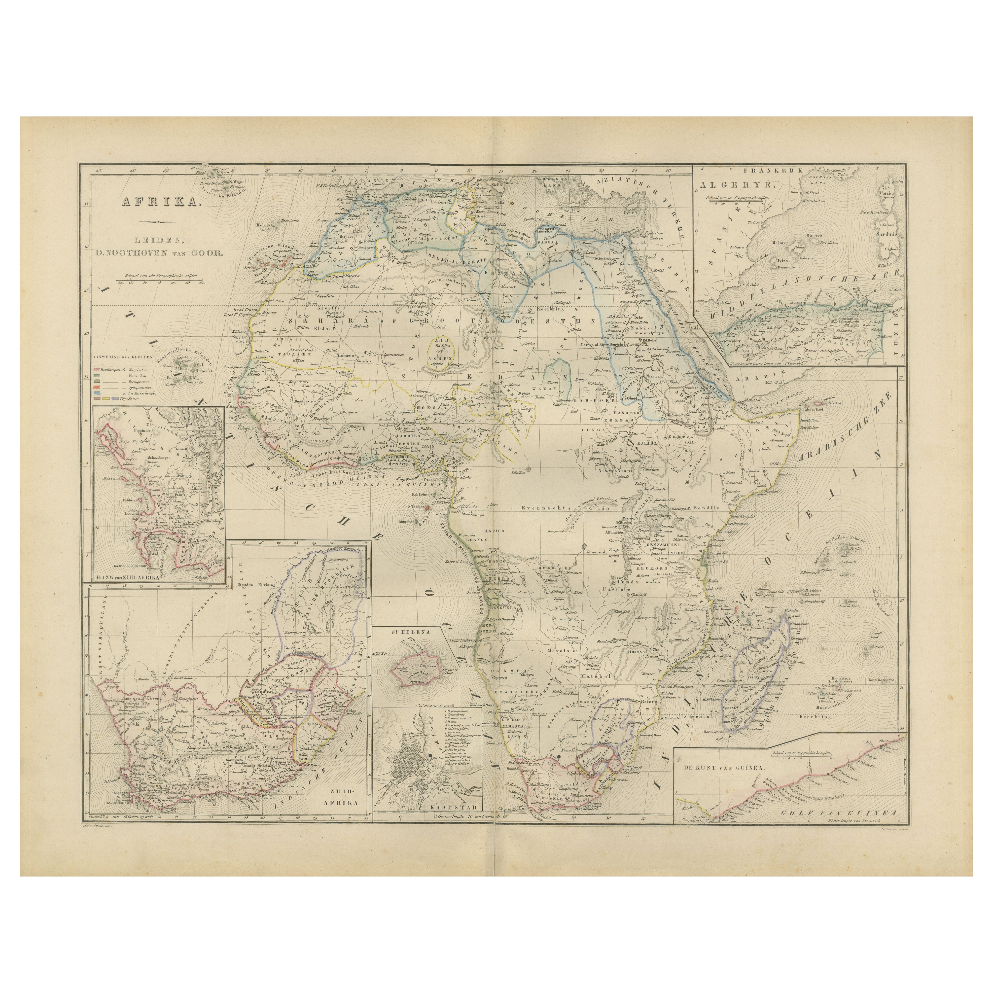
South Africa Insets – Nieuwe Hand-Atlas, 1876
Located in Langweer, NL
Africa Map with Egypt & South Africa Insets – Nieuwe Hand-Atlas, 1876
This 19th-century map titled “Afrika,” published in 1876 in the Nieuwe Hand-Atlas der Aarde in haren Tegenwoord...
Category
Antique 1870s Dutch Maps
Materials
Paper
Antique Map of Africa by A
C, Black, 1870
Located in Langweer, NL
Antique map titled 'Africa'. Original antique map of Africa. This map originates from ‘Black's General Atlas of The World’. Published by A & C. Black, 1870.
Category
Antique Late 19th Century Maps
Materials
Paper

$263 Sale Price
20% Off
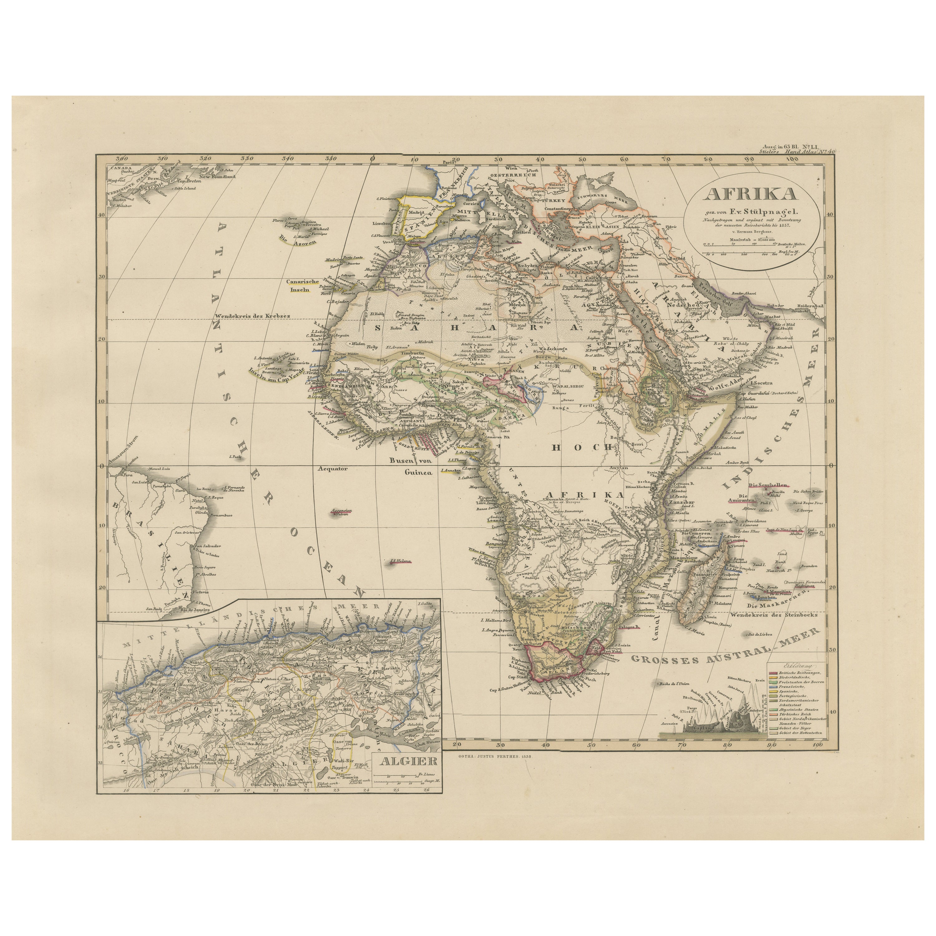
Colorfull Antique Map of Africa with Algeria Inset – Stieler Atlas 1858
Located in Langweer, NL
Antique Map of Africa with Algeria Inset – Stieler Atlas 1858
This antique map of Africa, engraved by F. von Stülpnagel and published by Justus Perthes in 1858, is a finely detailed...
Category
Antique Mid-19th Century German Maps
Materials
Paper
Antique Map of Africa with European Language Borders, 1852
Located in Langweer, NL
Antique map titled 'Afrika'. Map of Africa. This map originates from 'School-Atlas van alle deelen der Aarde' by Otto Petri.
Artists and Engravers: Published by A. Baedeker (Otto...
Category
Antique 19th Century Maps
Materials
Paper

You May Also Like
Original Antique Map of Africa by Dower, circa 1835
Located in St Annes, Lancashire
Nice map of Africa
Drawn and engraved by J.Dower
Published by Orr & Smith. C.1835
Unframed.
Free shipping
Category
Antique 1830s English Maps
Materials
Paper

Large Original Antique Map of Africa. C.1900
Located in St Annes, Lancashire
Fabulous map of Africa
Original color.
Engraved and printed by the George F. Cram Company, Indianapolis.
Published, C.1900.
Unframed.
Free shipping.
Category
Antique 1890s American Maps
Materials
Paper

Africa. Central. Century Atlas antique vintage map
Located in Melbourne, Victoria
'The Century Atlas. Africa. Central'
Inset map of 'Madagascar'.
Original antique map, 1903.
Central fold as issued. Map name and number printed on the reverse corners.
Sheet 29.5cm...
Category
Early 20th Century Victorian More Prints
Materials
Lithograph

Africa. North-East Part. Century Atlas antique vintage map
Located in Melbourne, Victoria
'The Century Atlas. Africa. North-East Part'
Original antique map, 1903.
Inset map of 'Nile Delta and Suez Canal'.
Central fold as issued. Map name and nu...
Category
Early 20th Century Victorian More Prints
Materials
Lithograph

Africa. Southern Part. Century Atlas antique vintage map
Located in Melbourne, Victoria
'The Century Atlas. Africa. Southern Part'
Original antique map, 1903.
Inset maps of 'Cape Town', 'Johannesburg' and 'Ladysmith'.
Central fold as issued. Map name and number printe...
Category
Early 20th Century Victorian More Prints
Materials
Lithograph

Map of Africa, archival. Printed in Edinburgh, Scotland, 1916. Free Delivery
Located in Madison, WI
Map of Africa from the geography classroom, 1916 edition. Printed in Edinburgh, Scotland. Mounted on pulldown wooden roller with wall mounting brackets....
Category
Early 20th Century Scottish Edwardian Maps
Materials
Wood, Paper
More Ways To Browse
French Relief
Africa Colonial
African Relief
Antique Victorian Dining Tables
Italian Plastic Chairs
Black Crystal Glasses
French Mid Century Modern Rug
China Silk Rug
Chrome Glass Coffee Tables
Antique Italian Chairs
Antique Walnut Bar
Beni Ourain Rugs
French Iron And Glass Table
Glass Top Wood Base Coffee Tables
T Chair
Antique Silver Basket
Antique Walkers
Ebony Wood Furniture