Items Similar to Roman Gaul
Northern Italy – Antique Map of La Gaule by Andriveau-Goujon, 1861


Want more images or videos?
Request additional images or videos from the seller
1 of 10
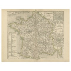
Roman Gaul
Northern Italy – Antique Map of La Gaule by Andriveau-Goujon, 1861
$466.24
£347.97
€390
CA$643.15
A$703.49
CHF 370.41
MX$8,399.01
NOK 4,720.92
SEK 4,318.51
DKK 2,971.16
About the Item
Roman Gaul
Northern Italy – Antique Map of La Gaule by Andriveau-Goujon, 1861
This antique map titled "Carte Comparée de La Gaule" was published in Paris in 1861 by J. Andriveau-Goujon and offers a richly detailed historical representation of ancient Gaul, the Roman provinces of Northern Italy, and part of Germania. Issued as plate 10 in the Atlas Universel, the map provides a comparative cartographic view of Roman territorial divisions overlaid on modern geography, ideal for historians, collectors, and classical scholars.
The map spans a wide swathe of Western Europe, centering on modern-day France but extending into Belgium, Switzerland, Germany, and Northern Italy. Using distinct pastel colors, the map delineates Roman provinces such as Aquitania, Gallia Lugdunensis, Gallia Narbonensis, Belgica, and parts of Germania Superior and Raetia. Many Roman cities are identified with their Latin names — including Lutetia (Paris), Lugdunum (Lyon), Arelate (Arles), Burdigala (Bordeaux), Massilia (Marseille), and Augusta Treverorum (Trier).
The cartouche in the upper right reads:
"Carte Comparée de La Gaule divisée en 17 provinces Romaines, de l’Italie Septentrionale, et d’une partie de la Grande Germanie, publiée par J. Andriveau-Goujon, Rue du Bac No. 4, Paris, 1849", with the date 1861 below, indicating a reissue or updated edition.
The map is surrounded by a bold decorative border and includes longitudinal measurements referenced to Paris. Fine engraving and color printing techniques were used to achieve clear geographic readability, combined with subtle aesthetic appeal.
This map is an exceptional resource for visualizing the Roman Empire’s provincial structure superimposed on the modern layout of Europe. It would be an excellent addition to any collection focused on classical antiquity, Roman cartography, or French historical geography.
Condition: Very good condition. Clean sheet with original hand coloring. Slight toning to edges and minor foxing in blank margins. Centerfold as issued; no tears or repairs. Plate mark visible.
Framing tips: Frame in a dark walnut or black frame with a light cream or off-white mat to enhance the classical appearance. A gold-trimmed inner mat can add a refined historical feel suitable for libraries or academic settings.
Technique: Engraving with original hand coloring
Maker: J. Andriveau-Goujon, Paris, 1861
- Dimensions:Height: 20.91 in (53.1 cm)Width: 27.64 in (70.2 cm)Depth: 0.01 in (0.2 mm)
- Materials and Techniques:Paper,Engraved
- Place of Origin:
- Period:
- Date of Manufacture:1860
- Condition:Condition: Very good condition. Clean sheet with original hand coloring. Slight toning to edges and minor foxing in blank margins. Centerfold as issued; no tears or repairs. Plate mark visible.
- Seller Location:Langweer, NL
- Reference Number:Seller: BG-14099-21stDibs: LU3054346184972
About the Seller
5.0
Recognized Seller
These prestigious sellers are industry leaders and represent the highest echelon for item quality and design.
Platinum Seller
Premium sellers with a 4.7+ rating and 24-hour response times
Established in 2009
1stDibs seller since 2017
2,810 sales on 1stDibs
Typical response time: <1 hour
- ShippingRetrieving quote...Shipping from: Langweer, Netherlands
- Return Policy
More From This Seller
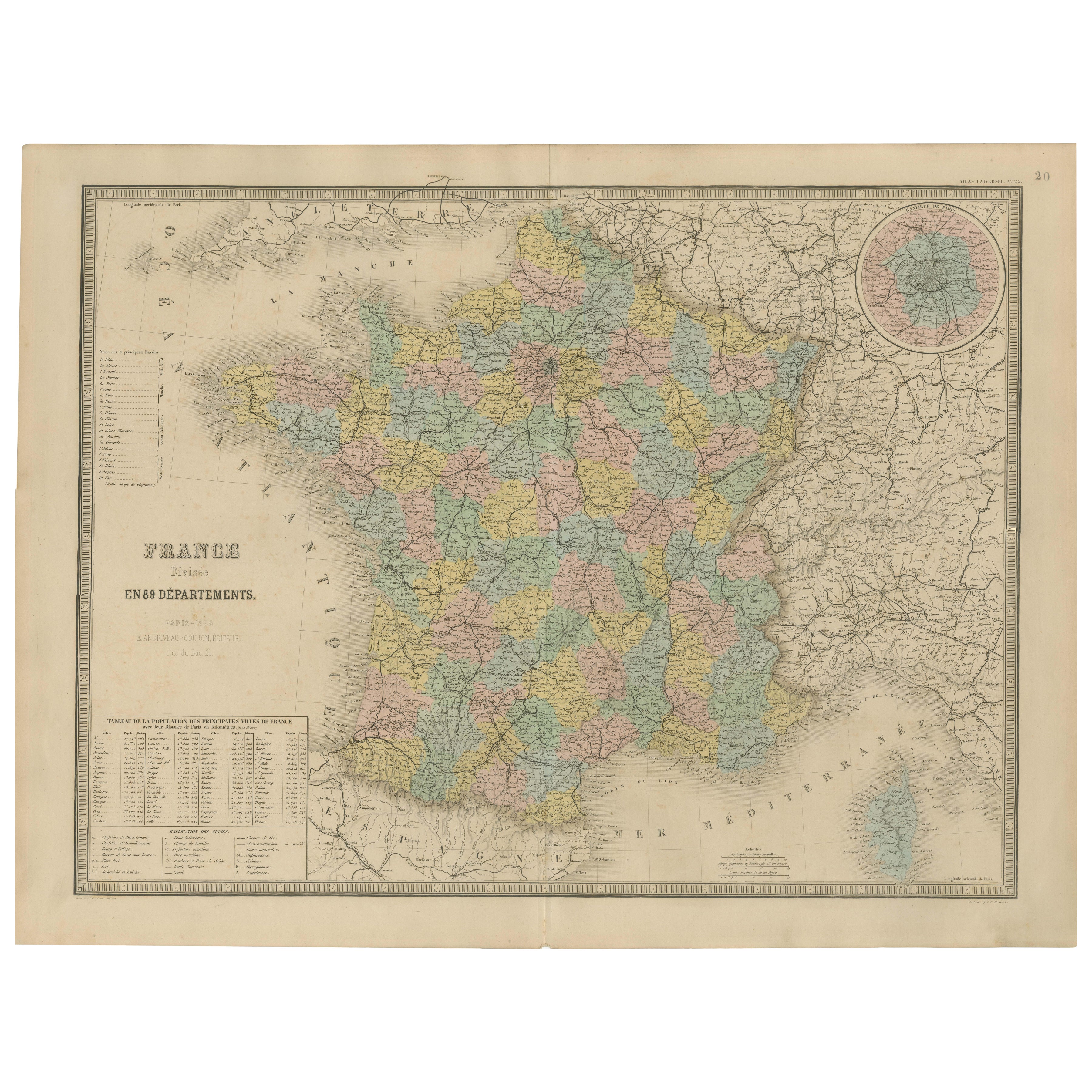
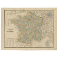
View AllAntique Map of France – Divided into 89 Departments by Andriveau-Goujon, 1861
Located in Langweer, NL
Antique Map of France – Divided into 89 Departments by Andriveau-Goujon, 1861
This finely engraved and beautifully hand-colored map titled “France divisée en 89 Départements” was pu...
Category
Antique Mid-19th Century French Maps
Materials
Paper
Antique Map of France, 1903, with Inset of Paris and Corsica
Located in Langweer, NL
Title: Antique Map of France, 1903, with Inset of Paris and Corsica
Description:
This antique map, titled "France," was engraved and published in 1903 by the renowned W. & A.K. John...
Category
Early 20th Century Maps
Materials
Paper

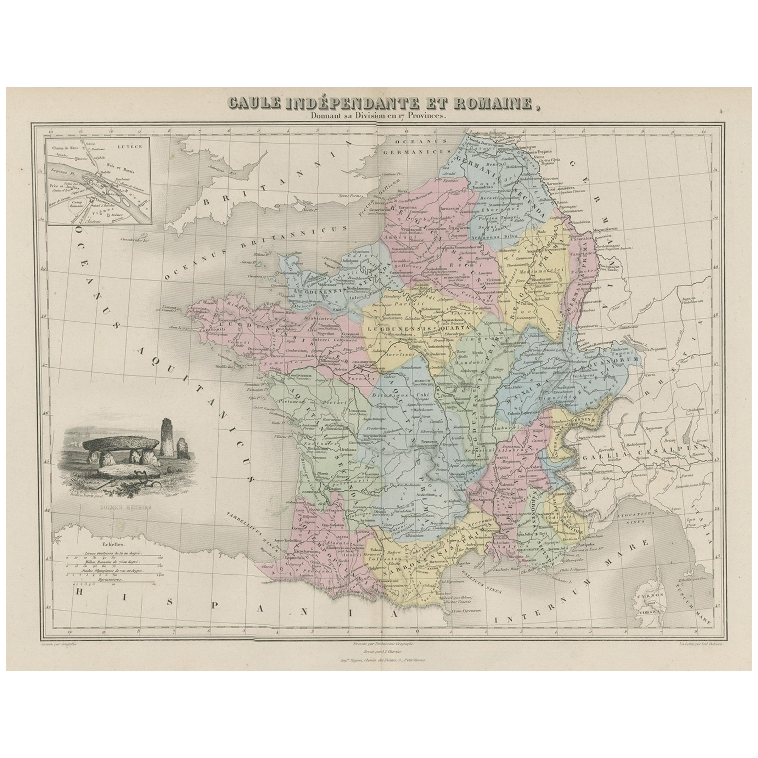
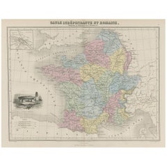
Antique Map of France in Ancient Roman Times, 1880
Located in Langweer, NL
Antique map titled 'Gaule indépendante et Romaine'.
Old map of Gaul or France in ancient Roman times. The map covers from the southern part of England (Britannia) to the north of S...
Category
Antique 19th Century Maps
Materials
Paper
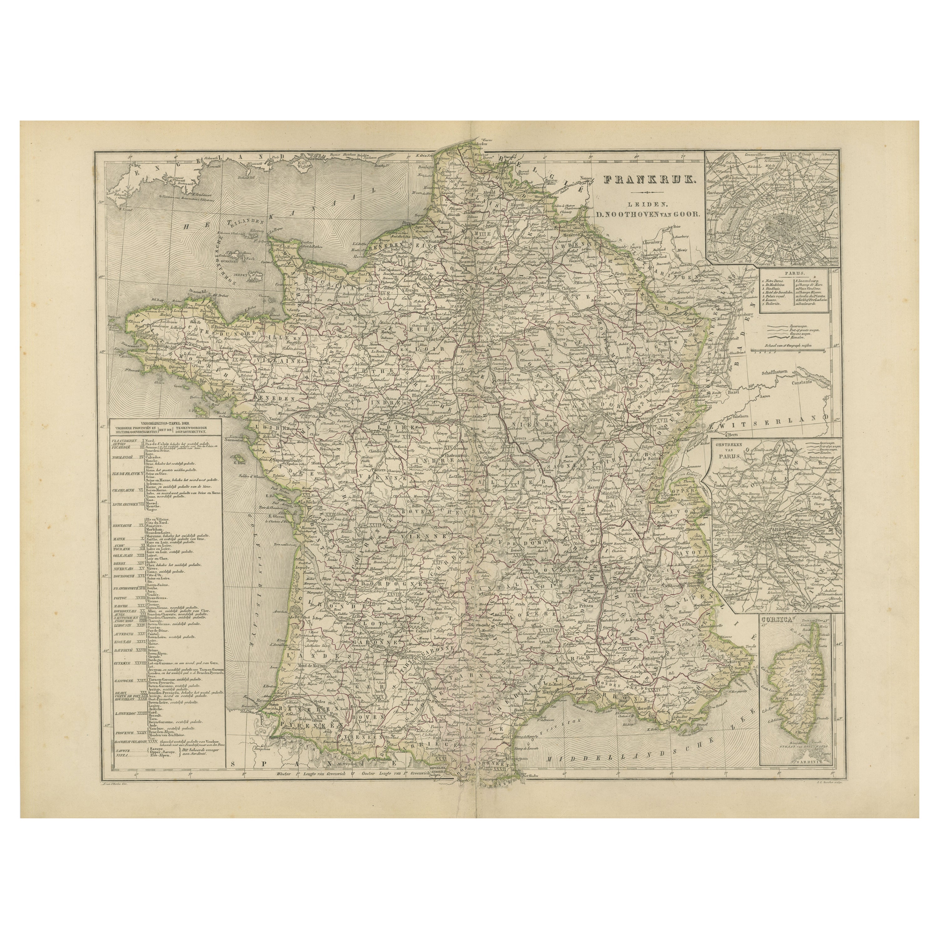
Map of France with Corsica and Paris Inset – Nieuwe Hand-Atlas, 1876
Located in Langweer, NL
Title: Map of France with Corsica and Paris Inset – Nieuwe Hand-Atlas, 1876
Description:
This detailed 19th-century map, titled “Frankrijk,” was published in 1876 in the *Nieuwe Han...
Category
Antique 1870s Dutch Maps
Materials
Paper
Antique Map of France by Lapie, 1842
Located in Langweer, NL
Antique map titled 'Carte des Gaules'. Map of France. This map originates from 'Atlas universel de géographie ancienne et moderne (..)' by Pierre M. Lapie and Alexandre E. Lapie. Pie...
Category
Antique Mid-19th Century Maps
Materials
Paper

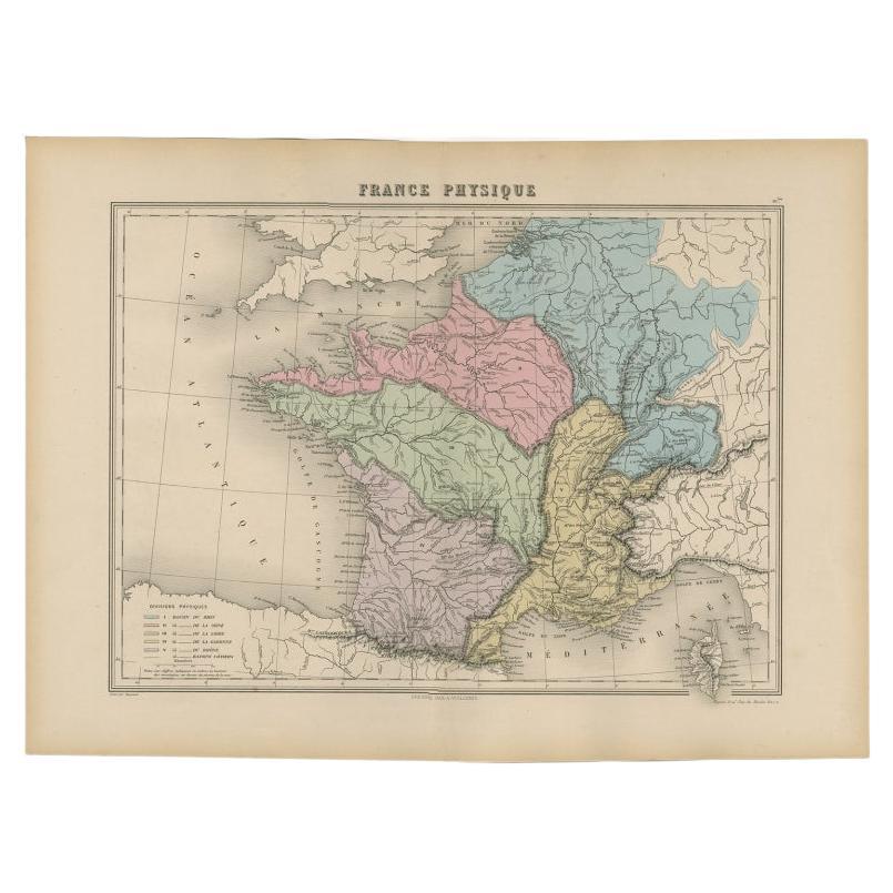
Antique Map of France by Migeon, 1880
Located in Langweer, NL
Antique map titled 'France Physique'. Old map of France. This map originates from 'Géographie Universelle Atlas-Migeon' by J. Migeon.
Artists and Engravers: Published by J. Migeon...
Category
Antique 19th Century Maps
Materials
Paper

You May Also Like
France, Northern Part. Century Atlas antique map
Located in Melbourne, Victoria
'The Century Atlas. France, Northern Part.'
Original antique map, 1903.
Inset maps of 'France in Provinces' and 'Paris and Vicinity'.
Central fold as issued. Map name and number pr...
Category
Early 20th Century Victorian More Prints
Materials
Lithograph

Italy, Northern Part. Century Atlas antique vintage map
Located in Melbourne, Victoria
'The Century Atlas. Italy, Northern Part.'
Original antique map, 1903.
Central fold as issued. Map name and number printed on the reverse corners.
Sheet 29.5cm by 40cm.
Category
Early 20th Century Victorian More Prints
Materials
Lithograph

1849 Map of "Europaische Russland",
Meyer Map of European Russia
, Ric. R017
Located in Norton, MA
1849 Map of
"Europaische Russland"
( Meyer Map of European Russia)
Ric.r017
A lovely map of European Russia dating to 1849 by Joseph Meyer. It covers the European portions of...
Category
Antique 19th Century Unknown Maps
Materials
Paper

Large Original Antique Map of Italy. John Dower, 1861
Located in St Annes, Lancashire
Great map of Italy
Lithograph engraving by John Dower
Original colour
Published, 1861
Unframed
Good condition / repair to top right corner seen in last image
Category
Antique 1860s English Victorian Maps
Materials
Paper

Italy, Central and Southern Part. Century Atlas antique map
Located in Melbourne, Victoria
'The Century Atlas. Italy, Central and Southern Part.'
Original antique map, 1903.
Inset maps of Sicily and Naples.
Central fold as issued. Map name an...
Category
Early 20th Century Victorian More Prints
Materials
Lithograph

L
Isere, France. Antique map of French department, 1856
By Victor Levasseur
Located in Melbourne, Victoria
'Dept. de L'Isere', Steel engraving with original outline hand-colouring., 1856, from Levasseur's 'Atlas National Illustre'.
This area is known for its production of Bleu du Vercor...
Category
19th Century Naturalistic Landscape Prints
Materials
Engraving

More Ways To Browse
Mid Century Italian Provincial Furniture
Antique Gallia
Pair Of Danish Chairs
Veneer Dining Tables
1970 Italian Armchair
Furniture Uk
House Of Denmark Table And Chairs
Louis Marble Top Side Table
Antique Russian Rugs
Baker Furniture By
For Kids
Sterling Silver Flatware Set Service For 12
Tufted Bar
Pair Of French Antique Armchairs
1970s Brass Glass Coffee Table
Antique Column Base
Charles Rennie Mackintosh For Cassina
Glass Salt