Items Similar to Scotland Map – Highlands, Islands, and Northern England 1858

Video Loading
Want more images or videos?
Request additional images or videos from the seller
1 of 11
Scotland Map – Highlands, Islands, and Northern England 1858
$407.99
£302.34
€340
CA$557.60
A$606.99
CHF 322.19
MX$7,303.39
NOK 4,082.59
SEK 3,740.81
DKK 2,589.88
About the Item
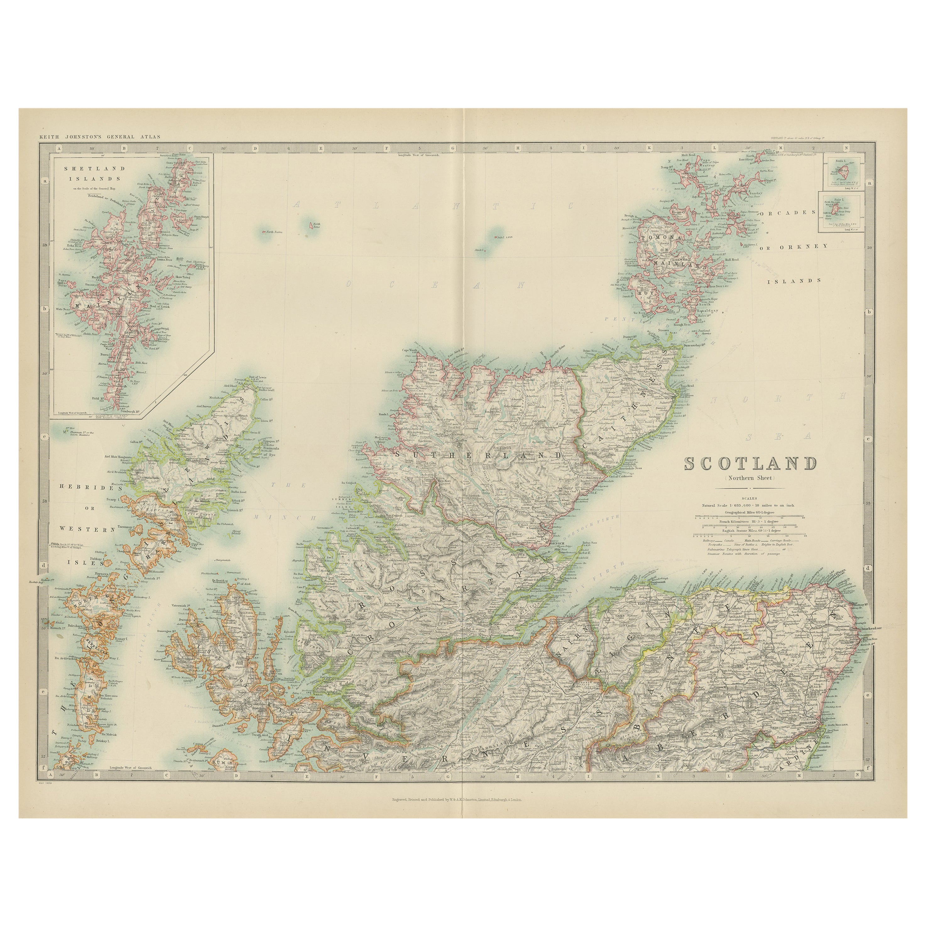
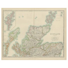
Scotland Map – Highlands, Islands, and Northern England 1858
This attractive antique print shows Scotland and its surroundings titled “Schotland mit der nördlichen Spitze von England” meaning “Scotland with the northern tip of England.” Published in 1858 by Justus Perthes in Gotha as part of Adolf Stieler’s renowned Hand-Atlas, the map was created by cartographer F. v. Stülpnagel. It provides detailed topographical and political information, including major towns, roads, rivers, and mountain ranges.
The map covers the entire country from the Borders through the Central Lowlands up to the Highlands, including the Hebrides (Western Isles) and Orkney Islands. It also extends into northern England, showing Northumberland, Durham, and Cumberland. Important towns such as Edinburgh, Glasgow, Aberdeen, Inverness, and Dundee are labelled clearly, as are significant geographical features like Loch Ness, Ben Nevis, and the Grampian Mountains.
This map is significant as it reflects mid-19th-century Scotland just before the major industrial expansions of the later Victorian period, capturing historical county boundaries, transportation routes, and settlements as they existed in 1858. It is of interest to collectors for its fine engraving and to historians for its depiction of Scotland during an era of social and economic transformation.
Technique: Copperplate engraving with original hand colouring used to outline counties and territories in subtle yet clear hues. German titles and detailed annotations are engraved with precision.
Condition summary: Excellent condition with minimal toning, no tears, repairs, or significant foxing. Colours remain vivid and paper is strong and stable.
Framing tips: This detailed map of Scotland will look distinguished in a dark wood or black frame to highlight its fine cartographic detail. Pair with a wide ivory or cream mount to balance its historical and decorative presentation. UV-protective glass is recommended to preserve the clarity of the engraving and original colouring for long-term display.
- Dimensions:Height: 14.77 in (37.5 cm)Width: 17.88 in (45.4 cm)Depth: 0.01 in (0.2 mm)
- Materials and Techniques:Paper,Engraved
- Place of Origin:
- Period:
- Date of Manufacture:1857
- Condition:Condition summary: Excellent condition with minimal toning, no tears, repairs, or significant foxing. Colours remain vivid and paper is strong and stable.
- Seller Location:Langweer, NL
- Reference Number:Seller: BG-05552-211stDibs: LU3054345811372
About the Seller
5.0
Recognized Seller
These prestigious sellers are industry leaders and represent the highest echelon for item quality and design.
Platinum Seller
Premium sellers with a 4.7+ rating and 24-hour response times
Established in 2009
1stDibs seller since 2017
2,816 sales on 1stDibs
Typical response time: 1 hour
- ShippingRetrieving quote...Shipping from: Langweer, Netherlands
- Return Policy
More From This Seller
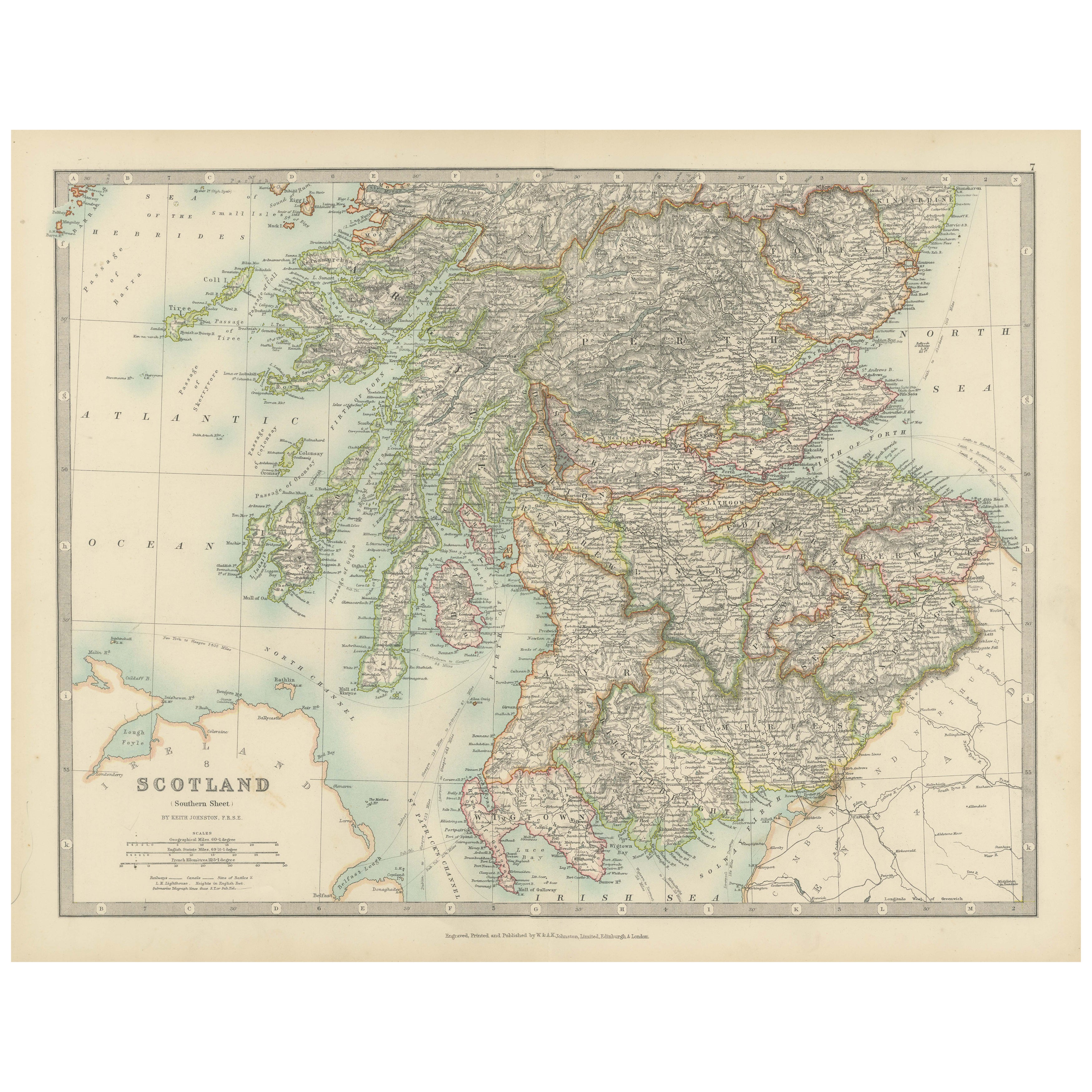
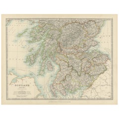
View AllAntique Map of Southern Scotland, 1903, with Coastal and Inland Details
Located in Langweer, NL
Title: Antique Map of Southern Scotland, 1903, with Coastal and Inland Details
Description:
This exquisite antique map, titled "Scotland (Southern Sheet I)," was engraved and publis...
Category
Early 20th Century Maps
Materials
Paper
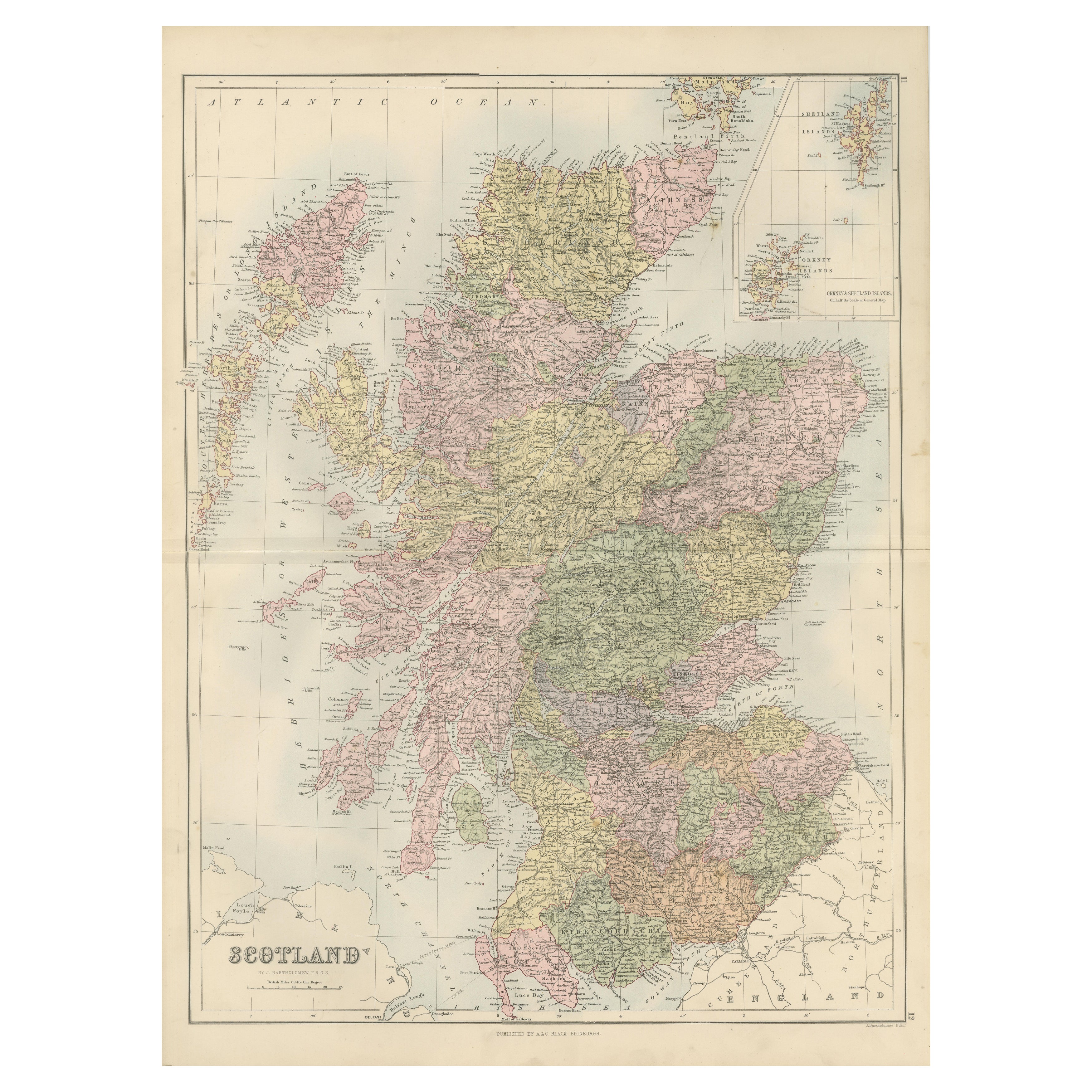
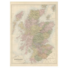
Antique Map of Scotland with Counties and Islands – Black’s Atlas, 1884
Located in Langweer, NL
Here is a catalogue entry in your preferred format for the Scotland map you uploaded:
---
Title: Antique Map of Scotland with Counties and Islands – Bla...
Category
Antique 1880s Scottish Maps
Materials
Paper
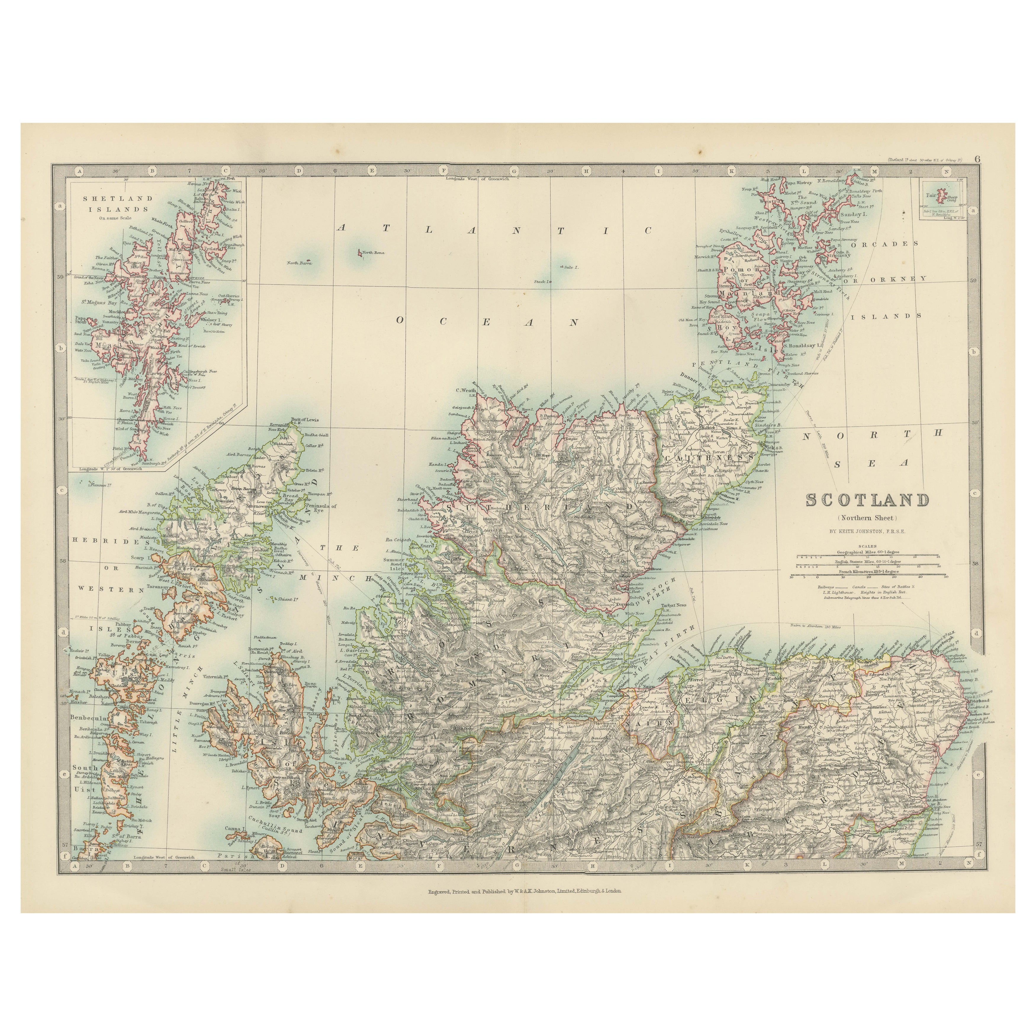
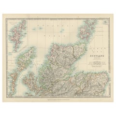
Antique Map of Northern Scotland, 1903, with Intricate Coastal Features
Located in Langweer, NL
Title: Antique Map of Northern Scotland and Islands, 1903, with Intricate Coastal Features
Description:
This striking antique map, titled "Scotland (Northern Sheet I)," was engraved...
Category
Early 20th Century Maps
Materials
Paper
Antique Map of the Northern Part of Scotland by Black
1854
Located in Langweer, NL
Antique map titled 'Scotland'. Original map of the northern part of Scotland. With an inset map of the Orkney Isles. This map originates from 'General Atlas Of The World: Containing ...
Category
Antique Mid-19th Century Maps
Materials
Paper

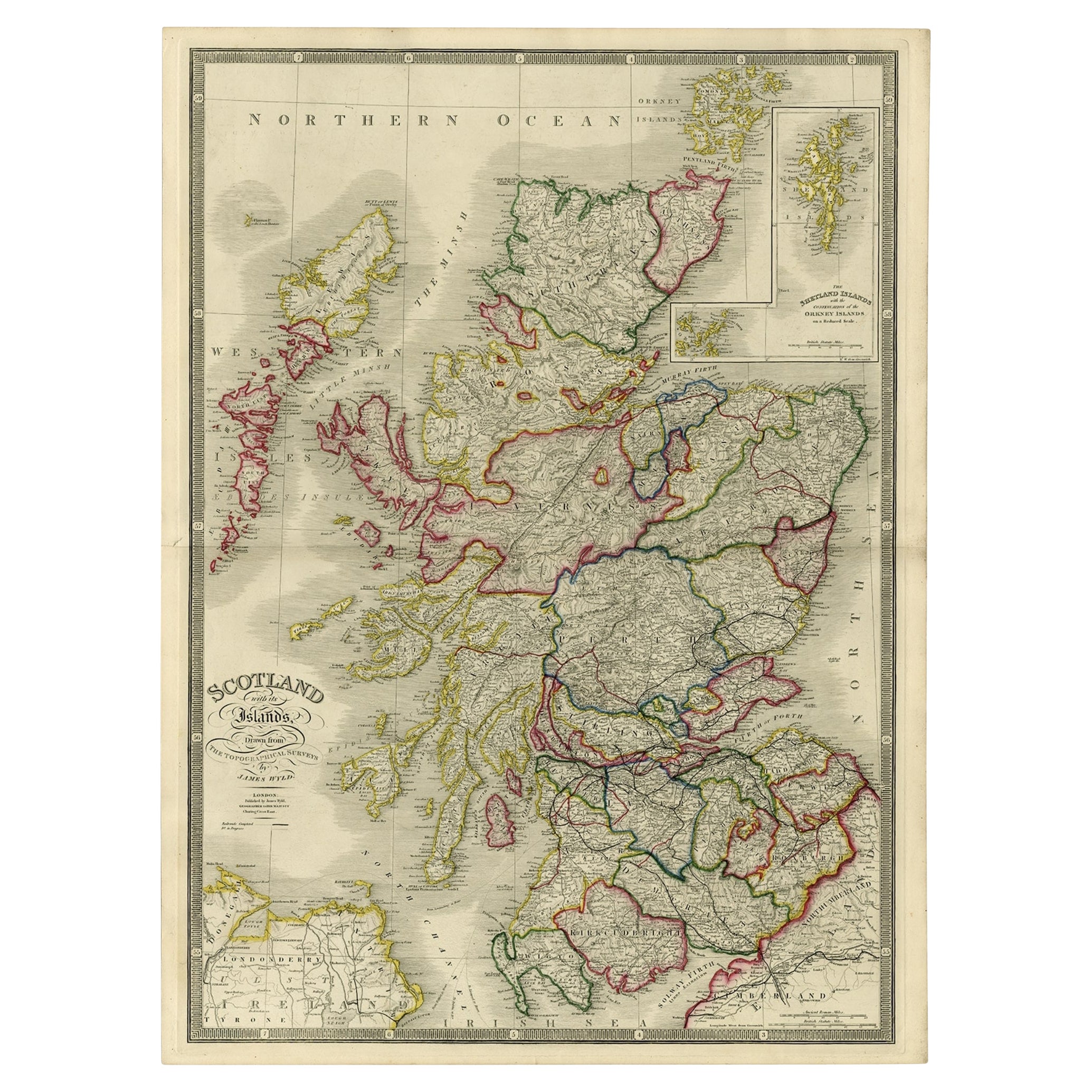
Antique Map of Scotland With an Inset Map of the Shetland Islands, 1854
Located in Langweer, NL
Stunning Map of Scotland that will look beautiful in any setting framed on the wall.
Description: Large Antique map titled 'Scotland with its Islands, drawn from the Topographical surveys...
Category
Antique 1850s Maps
Materials
Paper

Antique Map of Scotland
Northern
by Johnston,
1909
Located in Langweer, NL
Antique map titled 'Scotland'. Original antique map of Scotland. With inset map of the Shetland Islands. This map originates from the ‘Royal Atlas of M...
Category
Early 20th Century Maps
Materials
Paper
$239 Sale Price
20% Off
You May Also Like
Original Antique Map of Scotland by Dower, circa 1835
Located in St Annes, Lancashire
Nice map of Scotland
Drawn and engraved by J.Dower
Published by Orr & Smith. C.1835
Unframed.
Free shipping
Category
Antique 1830s English Maps
Materials
Paper

England, Scotland
Ireland: A Hand Colored Map of Great Britain by Tirion
By Isaak Tirion
Located in Alamo, CA
This is a hand-colored double page copperplate map of Great Britain entitled "Nieuwe Kaart van de Eilanden van Groot Brittannien Behelzende de Kon...
Category
Antique Mid-18th Century Dutch Maps
Materials
Paper

$700 Sale Price
20% Off
England and Wales, Northern Part. Century Atlas antique vintage map
Located in Melbourne, Victoria
'The Century Atlas. England and Wales, Northern Part'
Original antique map, 1903.
Central fold as issued. Map name and number printed on the reverse corners.
Sheet 29.5cm by 40cm.
Category
Early 20th Century Victorian More Prints
Materials
Lithograph

Large Original Vintage Map of the United Kingdom, circa 1920
Located in St Annes, Lancashire
Great map of The United Kingdom
Unframed
Original color
By John Bartholomew and Co. Edinburgh Geographical Institute
Published, circa 1920
Free shipping.
Category
Vintage 1920s British Maps
Materials
Paper

Map Huntingdonshire R Scott Archibald Fullarton
Co Glasgow
Located in BUNGAY, SUFFOLK
Folding Map of Huntingdonshire by R Scott with distances from London and reference to the hundreds.
Published by Archibald Fullarton & Co Glasgow. Measure: 40...
Category
Antique 19th Century English Victorian Maps
Materials
Paper

Original Antique English County Map, Nottinghamshire, J
C Walker, 1851
Located in St Annes, Lancashire
Great map of Nottinghamshire
Original colour
By J & C Walker
Published by Longman, Rees, Orme, Brown & Co. 1851
Unframed.
Category
Antique 1850s English Other Maps
Materials
Paper

More Ways To Browse
Antique Scottish Prints
Dundee Antique
China Silk Rug
Chrome Glass Coffee Tables
Antique Italian Chairs
Beni Ourain Rugs
French Iron And Glass Table
Glass Top Wood Base Coffee Tables
T Chair
Antique Silver Basket
Antique Walkers
Ebony Wood Furniture
Opalescent Glass
Pair Of Danish Chairs
Veneer Dining Tables
1970 Italian Armchair
Furniture Uk
House Of Denmark Table And Chairs