Items Similar to Set of two Antique Maps of Oregon, Idaho, Wyoming, Nebraska
Iowa, ca.1879

Want more images or videos?
Request additional images or videos from the seller
1 of 11
Set of two Antique Maps of Oregon, Idaho, Wyoming, Nebraska
Iowa, ca.1879
$459.51per set
$574.39per set20% Off
£343.21per set
£429.01per set20% Off
€384per set
€480per set20% Off
CA$633.06per set
CA$791.33per set20% Off
A$689.92per set
A$862.41per set20% Off
CHF 365.34per set
CHF 456.68per set20% Off
MX$8,286.71per set
MX$10,358.39per set20% Off
NOK 4,625.34per set
NOK 5,781.68per set20% Off
SEK 4,252.55per set
SEK 5,315.68per set20% Off
DKK 2,925.42per set
DKK 3,656.77per set20% Off
About the Item
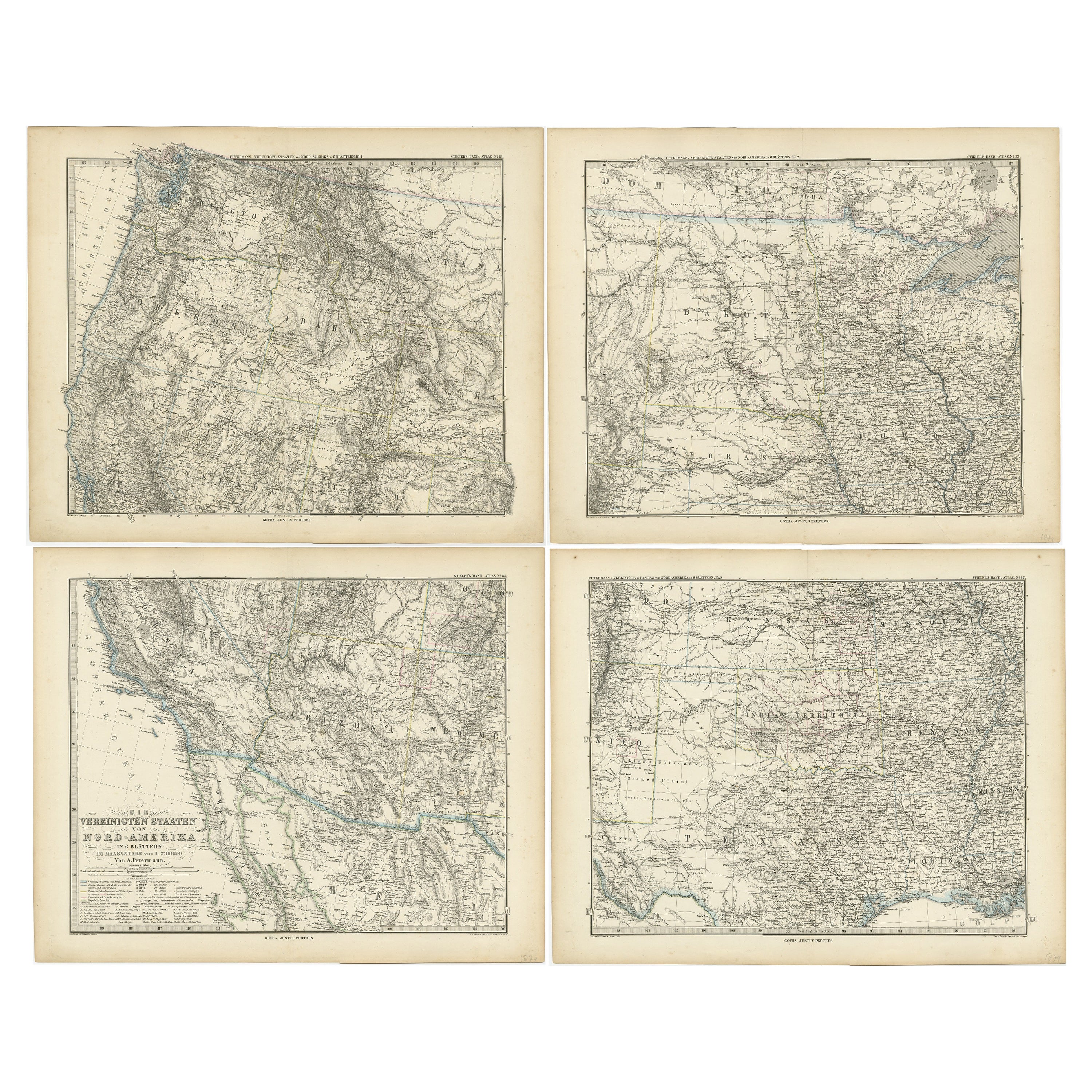
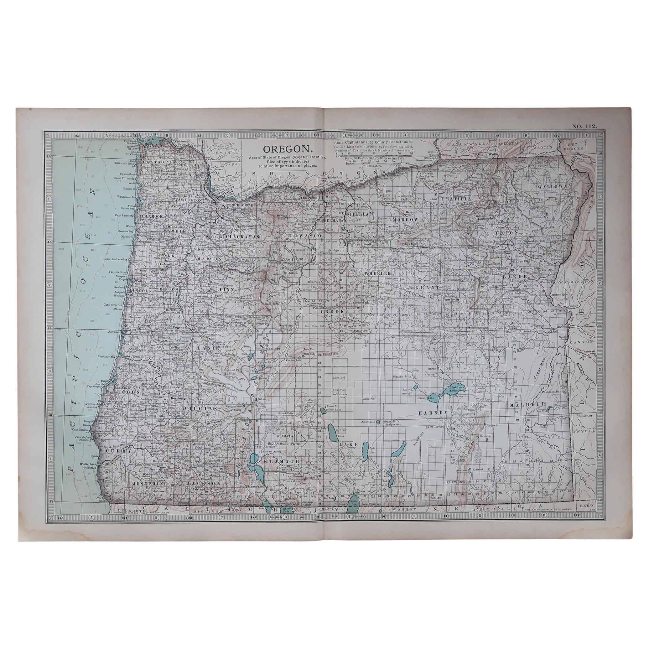
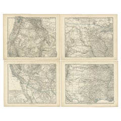
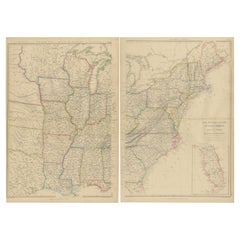
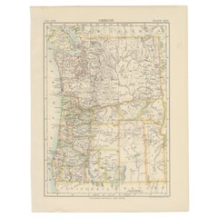
Set of two individual antique maps of part of the United States. It shows the region and surroundings of Oregon, Idaho, Wyoming, Nebraska, Iowa, Dakota and Wisconsin. Published as part of a set of six individual maps.
These maps originate from Stielers Handatlas, published circa 1879. Stielers Handatlas (after Adolf Stieler, 1775–1836), formally titled Hand-Atlas über alle Theile der Erde und über das Weltgebäude (Handy atlas of all parts of the world and of the universe), was the leading German world atlas of the last three decades of the 19th and the first half of the 20th century. Published by Justus Perthes of Gotha (established 1785 and still existing there) it went through ten editions from 1816 to 1945. As with many 19th century publications, an edition was issued in parts; for example, the eighth edition was issued in 32 monthly parts.
- Dimensions:Height: 15.12 in (38.4 cm)Width: 18.82 in (47.8 cm)Depth: 0.02 in (0.5 mm)
- Sold As:Set of 2
- Materials and Techniques:
- Place of Origin:
- Period:
- Date of Manufacture:c.1879
- Condition:Wear consistent with age and use. General age-related toning. Original folding lines. Shows some wear and soiling. Few small defects in margins. Blank verso. Please study images carefully.
- Seller Location:Langweer, NL
- Reference Number:Seller: BG-13190-11 BG-13192-71stDibs: LU3054331373632
About the Seller
5.0
Recognized Seller
These prestigious sellers are industry leaders and represent the highest echelon for item quality and design.
Platinum Seller
Premium sellers with a 4.7+ rating and 24-hour response times
Established in 2009
1stDibs seller since 2017
2,788 sales on 1stDibs
Typical response time: <1 hour
- ShippingRetrieving quote...Shipping from: Langweer, Netherlands
- Return Policy
More From This Seller
View AllSet of 4 Antique Maps of part of the United States of America, c.1874
Located in Langweer, NL
Set of four individual antique maps of part of the United States. Published as part of a set of six individual maps.
These maps originate from Stielers Handatlas, published circa 1...
Category
Antique Mid-19th Century German Maps
Materials
Paper
$715 Sale Price / set
35% Off
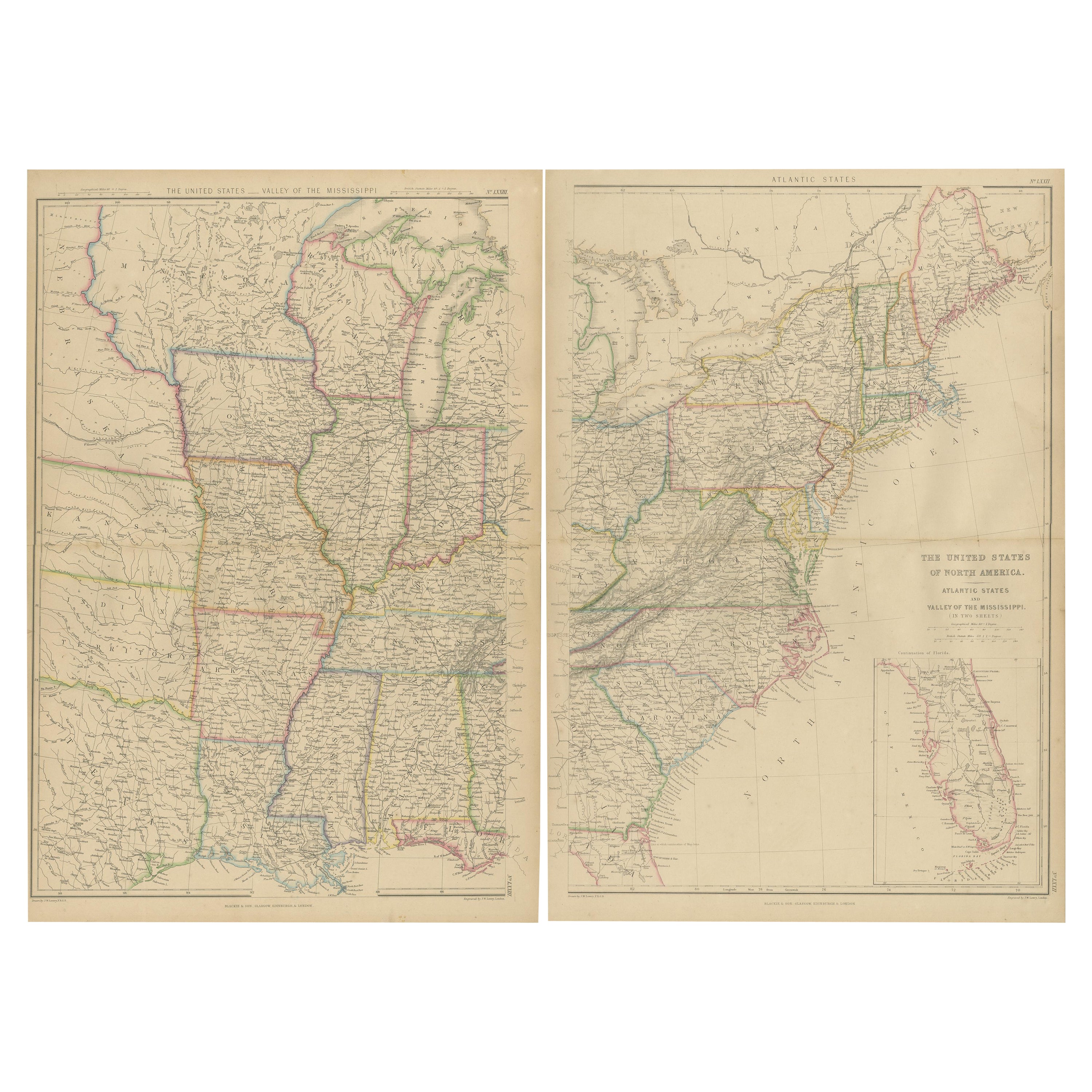
Set of 2 Antique Maps of the United States by W. G. Blackie, 1859
Located in Langweer, NL
Antique map titled 'The United States of North America, Atlantic States and Valley of the Mississippi'. Original antique map of the United States of North America, Atlantic States an...
Category
Antique Mid-19th Century Maps
Materials
Paper
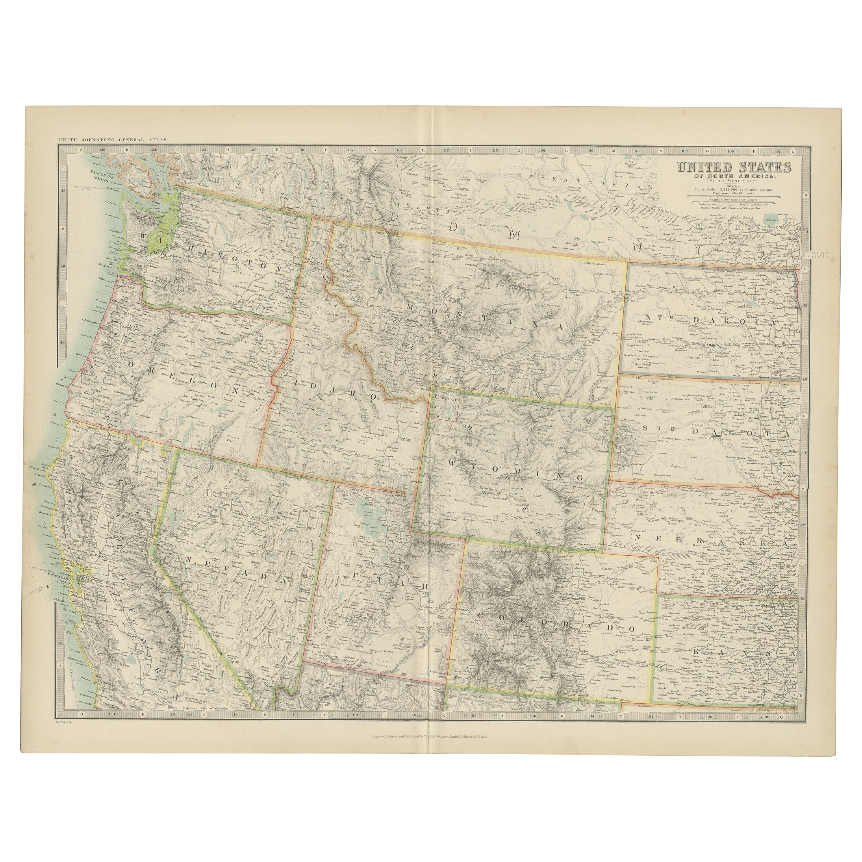
Antique Map of the United States
North West
by Johnston,
1909
Located in Langweer, NL
Antique map titled 'United States of North America'. Original antique map of the United States of North America ( North West ). This map originates from the ‘Royal Atlas of Modern Ge...
Category
Early 20th Century Maps
Materials
Paper

$239 Sale Price
20% Off
Antique Map of Oregon
Located in Langweer, NL
Antique map titled 'Oregon'. Original antique map of Oregon, United States. This print originates from 'Encyclopaedia Britannica', Ninth Edition. Publish...
Category
Antique Late 19th Century Maps
Materials
Paper
$277 Sale Price
20% Off
Antique Map of Part of the United States Including Lower California
Arizona
Located in Langweer, NL
Antique map of part of the United States of America including Lower California, Arizona and part of Mexico. This map was part of a set of six individual sheets with maps of the Unite...
Category
Antique Late 19th Century Maps
Materials
Paper

$421 Sale Price
20% Off
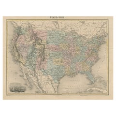
Antique Map of the United States with Vignette of Washington
Located in Langweer, NL
Antique map titled 'États-Unis'. A very attractive and detailed late 19th century map of the United States, with a fine decorative vignette of Washington. The extensive railway netwo...
Category
Antique Late 19th Century Maps
Materials
Paper
$459 Sale Price
20% Off
You May Also Like
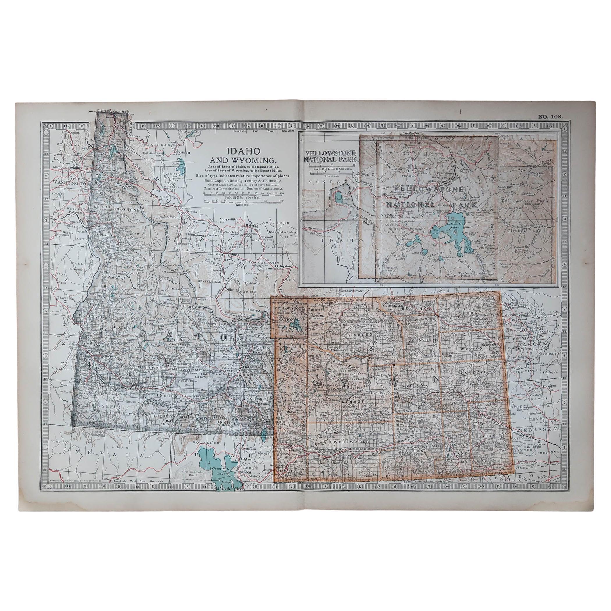
Original Antique Map of the American State of Idaho
Wyoming, 1903
Located in St Annes, Lancashire
Antique map of Idaho and Wyoming
Published By A & C Black. 1903
Original colour
Good condition
Unframed.
Free shipping
Category
Antique Early 1900s English Maps
Materials
Paper

Original Antique Map of the American State of Oregon, 1903
Located in St Annes, Lancashire
Antique map of Oregon
Published By A & C Black. 1903
Original colour
Good condition
Unframed.
Free shipping
Category
Antique Early 1900s English Maps
Materials
Paper

Original Antique Map of the American State of Colorado, 1903
Located in St Annes, Lancashire
Antique map of Colorado
Published By A & C Black. 1903
Original colour
Good condition
Unframed.
Free shipping
Category
Antique Early 1900s English Maps
Materials
Paper

Original Antique Map of the American State of Washington, 1903
Located in St Annes, Lancashire
Antique map of Washington
Published By A & C Black. 1903
Original colour
Good condition
Unframed.
Free shipping
Category
Antique Early 1900s English Maps
Materials
Paper

Pair Antique Italian Maps of the North American Eastern Seaboard
Located in New York, NY
Pair antique Italian maps of the North American Eastern Seaboard. Late 18th early 19th century original Italian documentation of the East Coast of the United States from Passamaquadd...
Category
Antique Late 18th Century Italian Maps
Materials
Wood, Paper

Original Antique Map of the American State of Washington, 1889
Located in St Annes, Lancashire
Great map of Washington
Drawn and Engraved by W. & A.K. Johnston
Published By A & C Black, Edinburgh.
Original colour
Unframed.
Category
Antique 1880s Scottish Victorian Maps
Materials
Paper
