Items Similar to Southwestern U.S. Immigration Map for Texas, Arkansas, and Louisiana, 1881
Want more images or videos?
Request additional images or videos from the seller
1 of 10
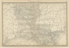
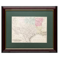
Southwestern U.S. Immigration Map for Texas, Arkansas, and Louisiana, 1881
$989.97
$1,319.9525% Off
£733.63
£978.1725% Off
€825
€1,10025% Off
CA$1,352.99
CA$1,803.9925% Off
A$1,472.84
A$1,963.7925% Off
CHF 781.79
CHF 1,042.3825% Off
MX$17,721.46
MX$23,628.6225% Off
NOK 9,906.28
NOK 13,208.3825% Off
SEK 9,076.95
SEK 12,102.6125% Off
DKK 6,284.27
DKK 8,379.0325% Off
About the Item
Southwestern U.S. Immigration Map - Published by The Southwestern Immigration Company, Austin, Texas. Detailed Railroad Routes and Regional Statistics for Texas, Arkansas, and Louisiana. Historical Document Promoting Settlement and Economic Growth in the Southwest.
This patina rich map is titled "Map of the South West," published by The Southwestern Immigration Company with a central office in Austin, Texas. The map is dated 1881.
Description:
- The map encompasses parts of Texas, New Mexico, Arkansas, and Louisiana and prominently features railroad lines, depicted in black, crisscrossing the region. This suggests a focus on transportation routes, which were crucial for immigration and commerce during this period.
Contains detailed statistics on crops, education, school and charity endowments, and public lands for sale in Texas at the time.
It also provides information on crops and education in Arkansas and for Louisiana it lists various statistics, including population figures, crop production, and educational statistics.
The map was published by The Southwestern Immigration Company, with the central office located in Austin, Texas. The map is from the year 1881.
Interesting Aspects:
This map provides a snapshot of the Southwestern United States during a time of significant growth and development, highlighting the importance of railroads in expanding access to new areas. The map served as a tool to encourage immigration and settlement in the region, using the detailed statistics to showcase the potential for agriculture and education.
The inclusion of detailed statistics on crops, education, and land sales provides valuable insights into the economic and social conditions of the time.
The cartography style and the inclusion of promotional text reflect the period's design aesthetics and marketing strategies.
This map is a fascinating historical document that offers a glimpse into the efforts to promote and develop the Southwestern United States in the late 19th century.
- Dimensions:Height: 26.97 in (68.5 cm)Width: 25.2 in (64 cm)Depth: 0.01 in (0.2 mm)
- Materials and Techniques:
- Period:
- Date of Manufacture:1881
- Condition:Map is in fair to good condition. It shows signs of aging with yellowing, minor tears, frayed edges, fold lines and larger holes in the paper. Stains and discoloration are present, but text and details remain legible. Linnen backing for support.
- Seller Location:Langweer, NL
- Reference Number:Seller: BG-13757-11stDibs: LU3054340307172
About the Seller
5.0
Recognized Seller
These prestigious sellers are industry leaders and represent the highest echelon for item quality and design.
Platinum Seller
Premium sellers with a 4.7+ rating and 24-hour response times
Established in 2009
1stDibs seller since 2017
2,819 sales on 1stDibs
Typical response time: 1 hour
- ShippingRetrieving quote...Shipping from: Langweer, Netherlands
- Return Policy
More From This Seller
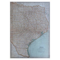
View AllAntique Map 1888 – Southern Texas Railroads, Counties
Settlements
Located in Langweer, NL
Southern Texas Map 1888 – Rand McNally Antique Lithograph
This antique 1888 map of Southern Texas, published by Rand, McNally & Co., depicts the Gulf Coast and borderlands with Mexi...
Category
Antique Late 19th Century American Maps
Materials
Paper
Texas Antique Map 1888 – Railroads, Counties
Frontier Settlements
Located in Langweer, NL
Texas Railroad Map 1888 – Rand McNally Antique Lithograph
This antique 1888 map of Texas, published by Rand, McNally & Co., provides a detailed overview of the state during a critic...
Category
Antique Late 19th Century American Maps
Materials
Paper

Large Antique Map of Texas with Panhandle
Bay Inset Maps, Colton, 1873
Located in Langweer, NL
Large Antique Map of Texas with Panhandle & Bay Inset Maps, Colton, 1873
This richly detailed and visually striking antique map of Texas was pub...
Category
Antique 1870s Maps
Materials
Paper
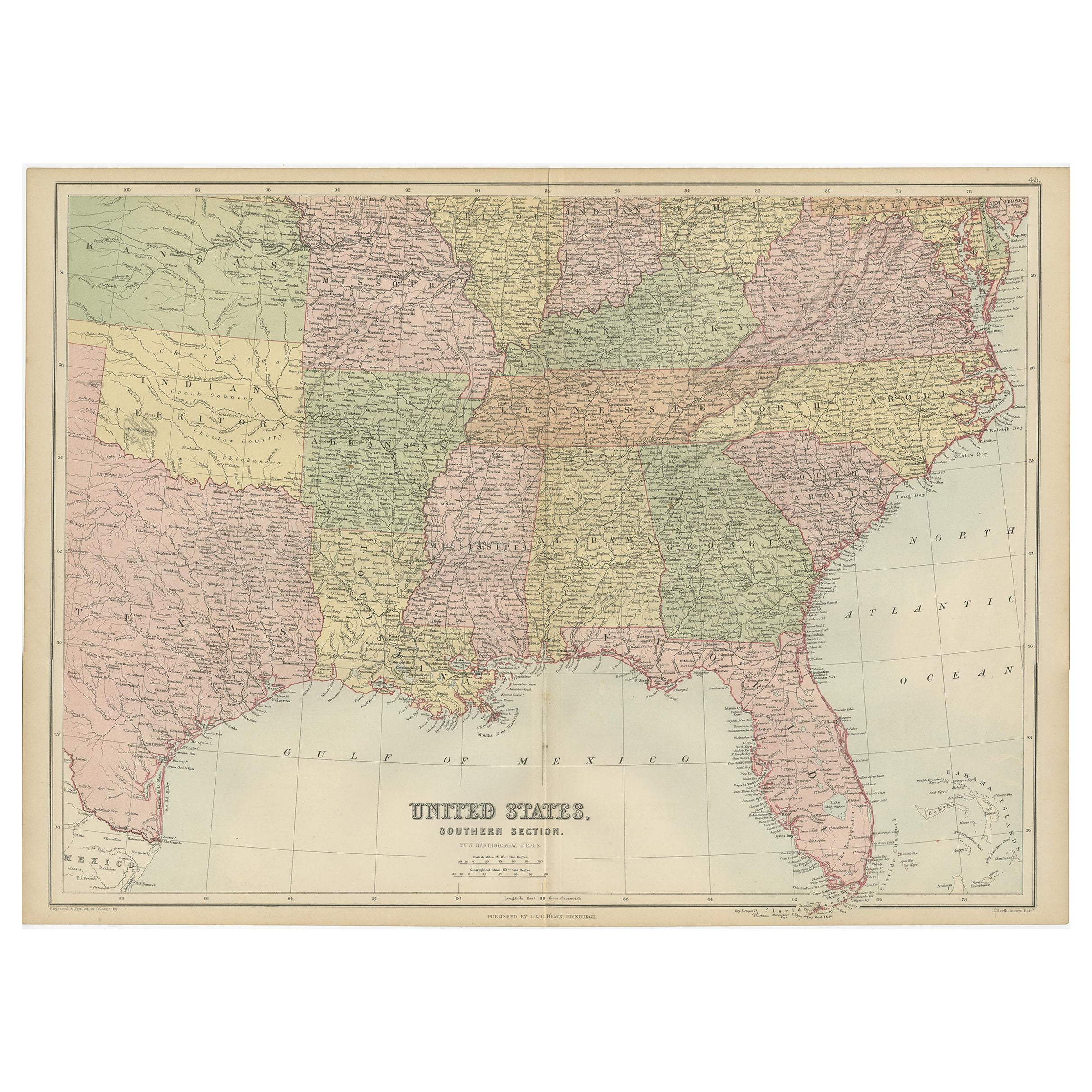
Antique Map of The United States Southern Section by A
C. Black, 1870
Located in Langweer, NL
Antique map titled 'United States Southern Section'. Original antique map of Map of The United States Southern Section. This map originates from ‘Black's General Atlas of The World’....
Category
Antique Late 19th Century Maps
Materials
Paper

$239 Sale Price
20% Off
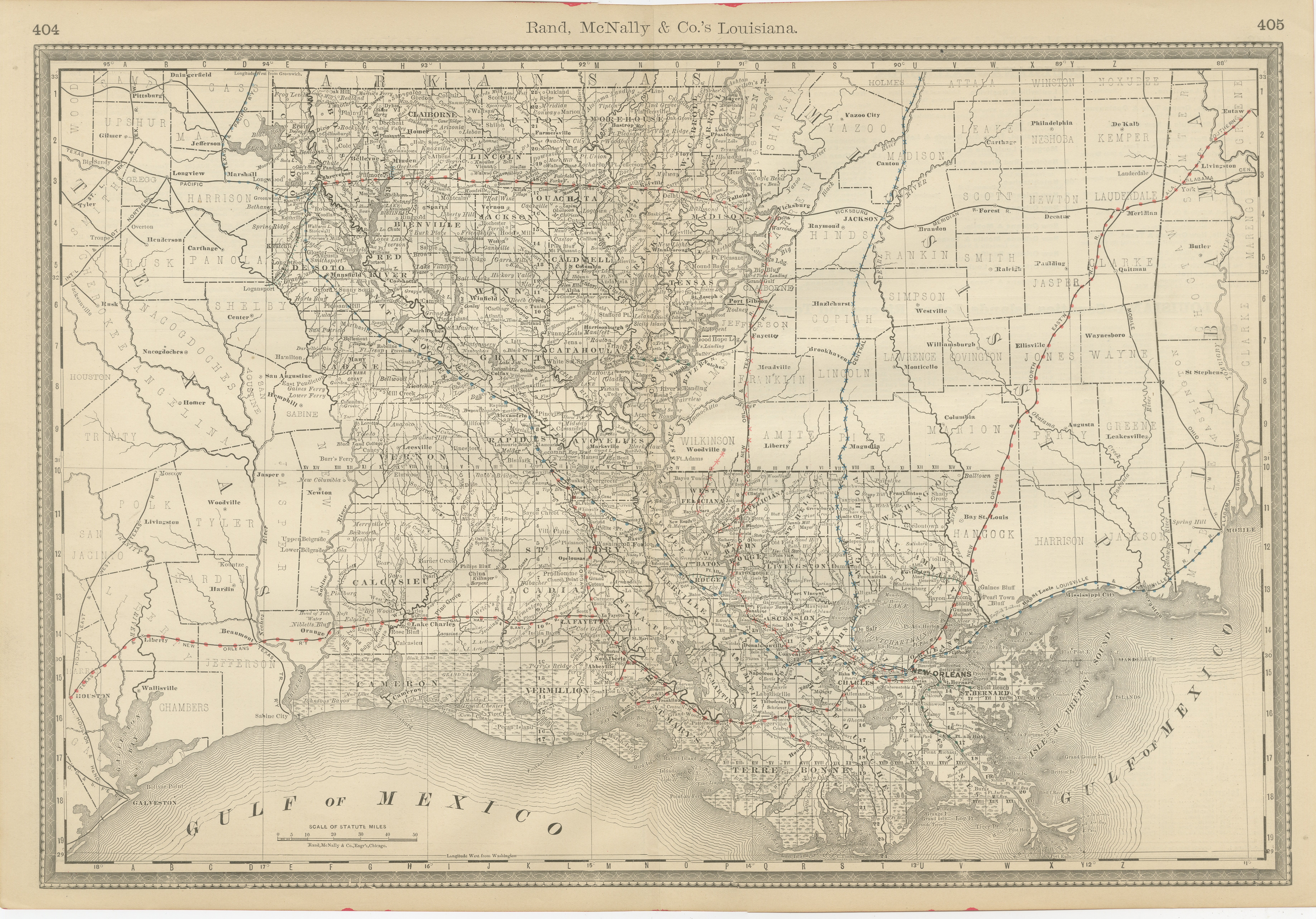
Louisiana Antique Map 1888 – The Pelican State, Railroads
Counties
Located in Langweer, NL
Louisiana Map 1888 – Rand McNally Antique Lithograph
This antique 1888 map of Louisiana, published by Rand, McNally & Co., provides a richly detailed picture of the state in the lat...
Category
Antique Late 19th Century American Maps
Materials
Paper
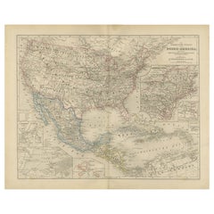
United States, Mexico
West Indies Map – Nieuwe Hand-Atlas, 1876
Located in Langweer, NL
United States, Mexico & West Indies Map – Nieuwe Hand-Atlas, 1876
This richly detailed 1876 map, titled “De Vereenigde Staten van Noord-Amerika, Mexico, West-Indië en de Vereenigde ...
Category
Antique 1870s Dutch Maps
Materials
Paper
You May Also Like
Original Antique Map of the American State of Texas ( Eastern Part ), 1903
Located in St Annes, Lancashire
Antique map of Texas ( Eastern part )
Published By A & C Black. 1903
Original colour
Good condition
Unframed.
Free shipping
Category
Antique Early 1900s English Maps
Materials
Paper
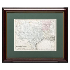
Framed Map of Texas Circa 1880
Located in Coeur d
Alene, ID
Framed circa 1880 map of Texas with Louisiana and Arkansas. Well detailed. Great for display in any home. Encased in cherry and gold frame with dark green mating. Size: 11" x 9", fra...
Category
Antique Late 19th Century American Maps
Materials
Paper
Framed Map of Texas Circa 1886
Located in Coeur d
Alene, ID
Framed circa 1886 map of Texas including Louisiana, Texas and Arkansas, with Indian territory. Well detailed. Great for display in any home. Encased in cherry and gold frame with dar...
Category
Antique Late 19th Century American Maps
Materials
Paper
Original Antique Map of the American State of Louisiana, 1903
Located in St Annes, Lancashire
Antique map of Louisiana
Published By A & C Black. 1903
Original colour
Good condition
Unframed.
Free shipping
Category
Antique Early 1900s English Maps
Materials
Paper

Framed Map of Texas Circa 1908
Located in Coeur d
Alene, ID
Framed circa 1908 map of Texas. Each county separated and colored with panhandle of Texas on same scale in left corner. Well detailed. Would display nicely in any home. Encased in ch...
Category
Early 20th Century American Maps
Materials
Paper
1847 Antique Map of Mexico, Texas and California by Samuel Augustus Mitchell
By Samuel Augustus Mitchell 1
Located in Colorado Springs, CO
Presented is the second edition of Samuel Augustus Mitchell's Map of Mexico, Including Yucatan & Upper California, an important map showing the progress of the Mexican-American War. ...
Category
Antique 1840s American Maps
Materials
Paper

More Ways To Browse
Historical Documents
Time And Style
Used Southwestern Furniture
Louisiana Furniture
Arkansas Furniture
Pair Arm Chairs
Sterling Silver Dinner Sets
United Chair Company
Italian Beech Chairs
Shirvan Rugs
Vintage Danish Tables And Chairs
1960s Glass Top Coffee Table
Black Glass Coffee Tables
Burnt Wood
Mid Century Wrought Iron Chairs
Earth Toned Rug
Black Marble Table Vintage
Goblets