Items Similar to Spain
Portugal Map – Iberian Peninsula by Bonne c.1780


Want more images or videos?
Request additional images or videos from the seller
1 of 9
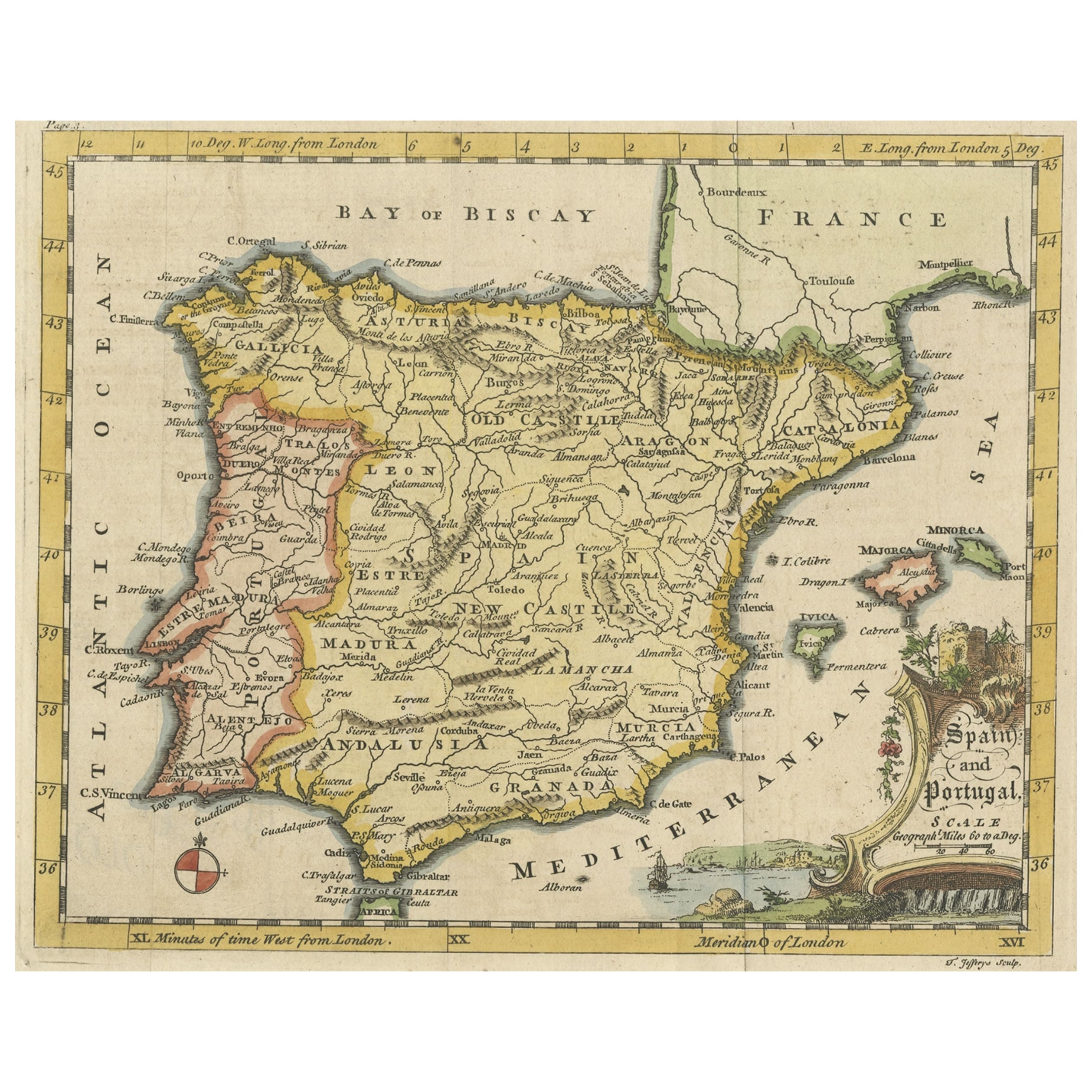
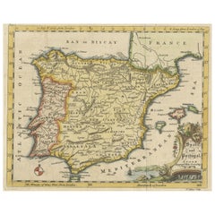
Spain
Portugal Map – Iberian Peninsula by Bonne c.1780
$372.59
£275.99
€310
CA$509.69
A$555.53
CHF 293.71
MX$6,687.59
NOK 3,727.87
SEK 3,417.69
DKK 2,362.03
About the Item
Spain
Portugal Map – Iberian Peninsula by Bonne c.1780
DESCRIPTION
This engraved map of Spain and Portugal presents the Iberian Peninsula with clear political and geographic organization. Produced by Rigobert Bonne, it shows cities, river systems, mountain ranges, and coastlines central to Atlantic exploration and colonial administration. The map reflects Iberia’s continued strategic importance in global trade. Its sober style and balanced layout make it well suited for both historical study and interior display.
KEYWORDS
Spain Portugal map, Iberian Peninsula, Lisbon Madrid Seville, Atlantic exploration routes, colonial trade hubs
CONDITION REPORT
Even toning. Central fold. Light edge wear and small spots.
FRAMING TIPS
Warm mat with simple gilt or walnut frame complements the elongated peninsula.
Technique: Engraving
Maker: Rigobert Bonne, France, circa 1780
- Dimensions:Height: 10.24 in (26 cm)Width: 16.15 in (41 cm)Depth: 0.01 in (0.2 mm)
- Materials and Techniques:Paper,Engraved
- Place of Origin:
- Period:
- Date of Manufacture:Circa 1780
- Condition:Even toning. Central fold as issued. Light edge wear and small spots.
- Seller Location:Langweer, NL
- Reference Number:Seller: BG-14105-81stDibs: LU3054348107892
About the Seller
5.0
Recognized Seller
These prestigious sellers are industry leaders and represent the highest echelon for item quality and design.
Platinum Seller
Premium sellers with a 4.7+ rating and 24-hour response times
Established in 2009
1stDibs seller since 2017
2,813 sales on 1stDibs
Typical response time: 1 hour
- ShippingRetrieving quote...Shipping from: Langweer, Netherlands
- Return Policy
More From This Seller
View AllAntique Map of the Arabian Peninsula by Bonne
c.1780
Located in Langweer, NL
Antique map titled 'Carte de l'Arabie, du Golfe Persique, et de la Mer Rouge (..)'. Original antique map of the Arabian Peninsula, including the horn...
Category
Antique Late 18th Century Maps
Materials
Paper

$528 Sale Price
20% Off
Antique Map of Spain
Portugal
Iberian Peninsula
, Decorative Cartouche, c1755
Located in Langweer, NL
Antique map titled 'Spain and Portugal'.
Small, detailed antique map of Spain and Portugal (Iberian Peninsula). Decorative title cartouche.
Artists and Engravers: Thomas Jeff...
Category
Antique 1750s Maps
Materials
Paper
$230 Sale Price
20% Off
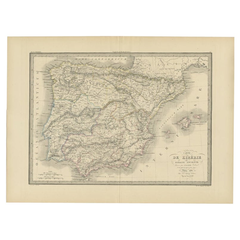
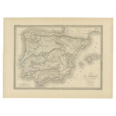
Antique Map of Iberia or the Iberian Peninsula with Portugal and Spain, 1842
Located in Langweer, NL
Antique map titled 'Carte de l'Ibérie ou Espagne Ancienne'. Map of Iberia, or the Iberian Peninsula. This map originates from 'Atlas universel de géographie ancienne et moderne (..)'...
Category
Antique 19th Century Maps
Materials
Paper
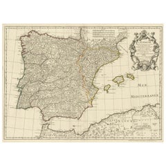
Large Decorative Map of the Iberian Peninsula
Located in Langweer, NL
Antique map titled 'L'Espagne (..)'. Large map of the Iberian Peninsula, including the Balearic Islands and part of the north coast of Africa. The map is based on the cartography of ...
Category
Antique Mid-18th Century Maps
Materials
Paper
Antique Map of Europe by R. Bonne, 1780
Located in Langweer, NL
A fine example of Rigobert Bonne and Guilleme Raynal’s 1780 map of Europe. Drawn by R. Bonne for G. Raynal’s Atlas de Toutes les Parties Connues du Globe Terrestre, Dressé pour l'His...
Category
Antique Late 18th Century French Maps
Materials
Paper

$151 Sale Price
30% Off
Iberian Peninsula
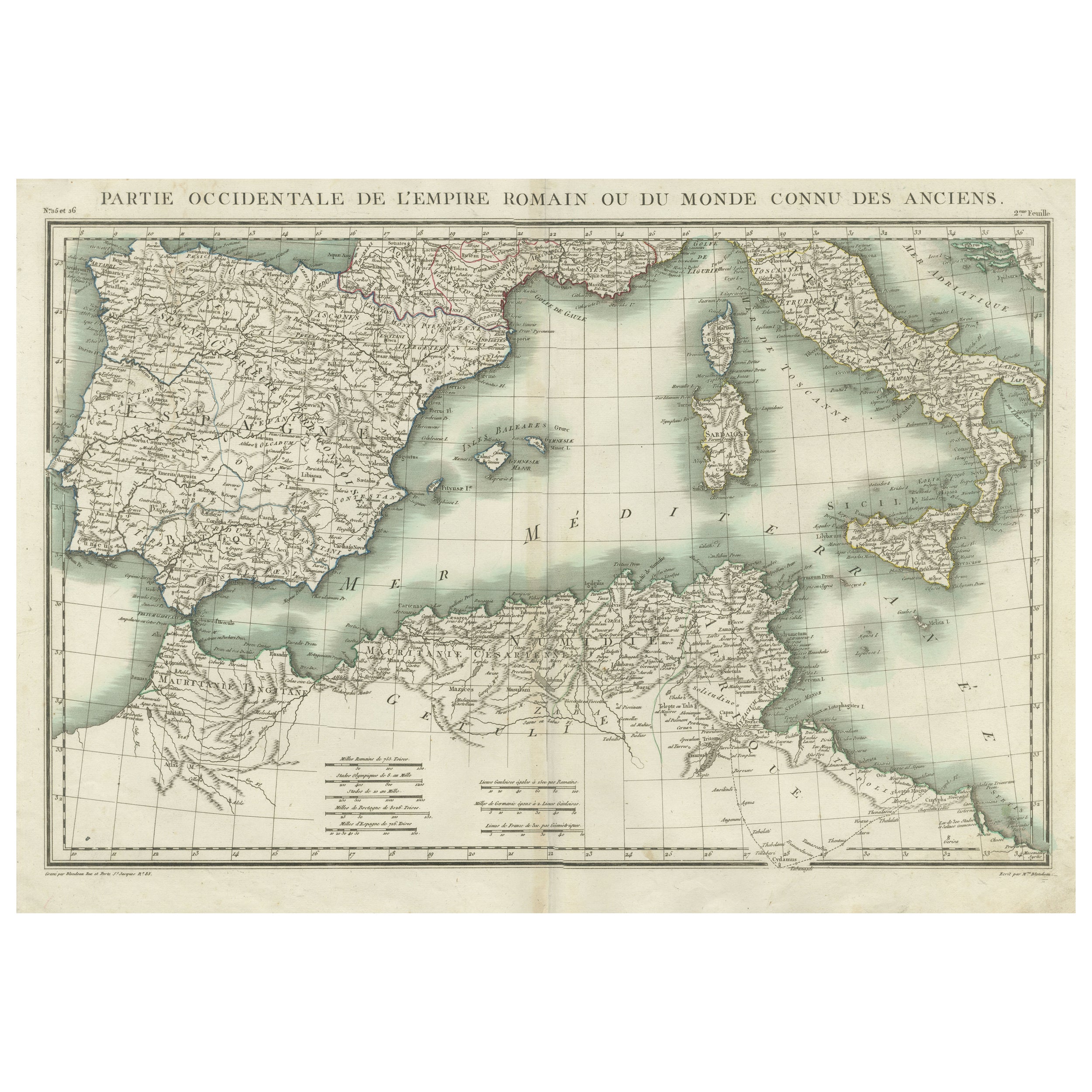
Mediterranean Map: Western Roman Empire, by Tardieu, 1802
Located in Langweer, NL
Antique Map with Title: "Partie Occidentale de l'Empire Romain ou du Monde connu des Anciens"
Publication Details:
- Atlas Title: Nouvel Atlas Universel de Géographie Ancienne et M...
Category
Antique Early 1800s Maps
Materials
Paper
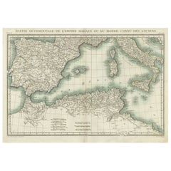
$519 Sale Price
20% Off
You May Also Like
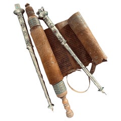
Antique Judaica Torah Esther Scroll Pre-Expulsion Iberian Peninsula Spain 1470
Located in Doha, QA
This is an absolutely incredible rare and truly unique pre-expulsion Iberian Peninsula handwritten Esther Scroll, inked onto animal leather parchment (15th century, -laboratory teste...
Category
Antique 15th Century and Earlier Spanish Renaissance Religious Items
Materials
Silver, Bronze
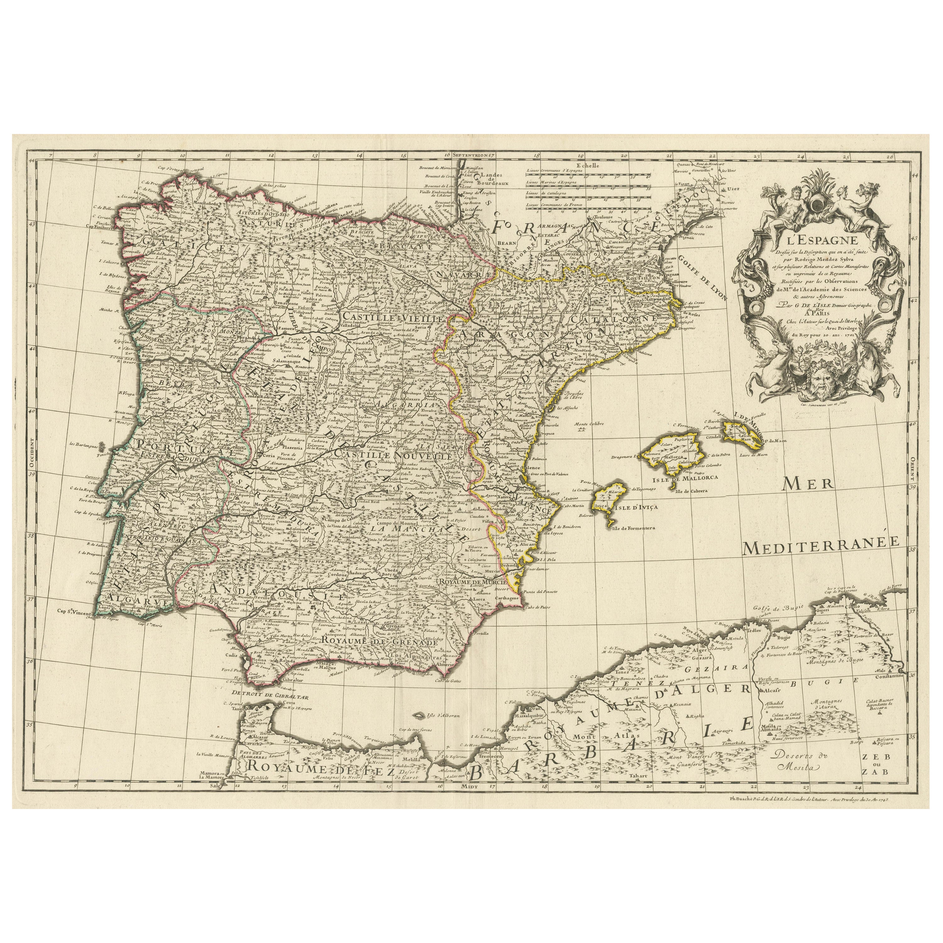
18th Century Hand Colored Map of Spain and Portugal by Visscher
By Nicolaes Visscher II
Located in Alamo, CA
This is an early 18th century map of Spain and Portugal, with attractive original hand-coloring, entitled "Hispaniae et Portugalliae Regna per Nicolaum Visscher cum Privilegio Ordinu...
Category
Antique Early 18th Century Dutch Maps
Materials
Paper

$1,020 Sale Price
20% Off
1771 Bonne Map of Poitou, Touraine and Anjou, France, Ric.a015
Located in Norton, MA
1771 Bonne Map of Poitou,
Touraine and Anjou, France
Ric.a015
1771 Bonne map of Potiou, Touraine and Anjou entitled "Carte des Gouvernements D'Anjou et du Saumurois, de la Touraine, du Poitou,du Pays d'aunis, Saintonge?Angoumois,"
Carte des gouvernements d'Anjou et du Saumurois, de la Touraine, du Poitou, du Pays d'Aunis, Saintonge-Angoumois. Projettee et assujettie au ciel par M. Bonne, Hyd. du Roi. A Paris, Chez Lattre, rue St. Jacques a la Ville de Bord(ea)ux. Avec priv. du Roi. 1771. Arrivet inv. & sculp., Atlas moderne ou collection de cartes sur toutes...
Category
Antique 17th Century Unknown Maps
Materials
Paper

Original Antique Map of South America. C.1780
Located in St Annes, Lancashire
Great map of South America
Copper-plate engraving
Published C.1780
Two small worm holes to left side of map
Unframed.
Category
Antique Early 1800s English Georgian Maps
Materials
Paper

Portugal: A Large 17th Century Hand-colored Map by Sanson and Jaillot
By Nicolas Sanson
Located in Alamo, CA
This large hand-colored map entitled "Le Royaume de Portugal et des Algarves Divisee en see Archeveches, Eveches et Territoires Par le Sr Sanson" was originally created by Nicholas S...
Category
Antique 1690s French Maps
Materials
Paper

$1,740 Sale Price
20% Off
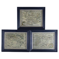
Rare Set of 3 Map Samplers by A Charles. Italy, Spain
France
Located in Chelmsford, Essex
Set of 3 Map Samplers by A Charles. All depict countries, cities, seas and landmarks of the respective countries. The first entitled, 'SPAIN and PORTUGAL'. The second, 'MAP OF FRANCE...
Category
Antique Early 19th Century English Tapestries
Materials
Linen