Items Similar to Super Rare Antique French Map of Chine and the Chinese Empire, 1780


Want more images or videos?
Request additional images or videos from the seller
1 of 8
Super Rare Antique French Map of Chine and the Chinese Empire, 1780
$438.40
$866.1949% Off
£333.83
£646.6549% Off
€384.40
€73049% Off
CA$621.25
CA$1,203.3949% Off
A$668.24
A$1,294.4249% Off
CHF 357.13
CHF 691.7849% Off
MX$7,876.70
MX$15,257.5649% Off
NOK 4,502.56
NOK 8,721.6949% Off
SEK 4,116.20
SEK 7,973.2849% Off
DKK 2,872.11
DKK 5,563.4249% Off
About the Item
Super Rare Antique French Map of Chine and the Chinese Empire, 1780
Very nice map of Asia. 1780 Made by Bonne.
Additional information:
Type: Map
Country of Manufacturing: Europe
Period: 18th century Qing (1661 - 1912)
Condition: Overall Condition A (Good): Some trace of use.
Dimension: 25.5 W x 35 H cm
- Dimensions:Height: 13.78 in (35 cm)Width: 10.04 in (25.5 cm)Depth: 0.04 in (1 mm)
- Materials and Techniques:
- Place of Origin:
- Period:
- Date of Manufacture:1780
- Condition:Overall Condition A (Good ): Some trace of use.
- Seller Location:Amsterdam, NL
- Reference Number:Seller: 1450423957251stDibs: LU4863235958282
About the Seller
5.0
Gold Seller
Premium sellers maintaining a 4.3+ rating and 24-hour response times
Established in 2015
1stDibs seller since 2019
297 sales on 1stDibs
Typical response time: 7 hours
- ShippingRetrieving quote...Shipping from: Amsterdam, Netherlands
- Return Policy
More From This Seller
View AllAntique French Map of Asia Including China Indoneseia India, 1783
Located in Amsterdam, Noord Holland
Very nice map of Asia. 1783 Dedie au Roy.
Additional information:
Country of Manufacturing: Europe
Period: 18th century Qing (1661 - 1912)
Condition: Overall Condition B (Good Used)...
Category
Antique 18th Century European Maps
Materials
Paper

$486 Sale Price
40% Off
Antique 1803 Italian Map of Asia Including China Indoneseia India
Located in Amsterdam, Noord Holland
Antique 1803 Italian Map of Asia Including China Indoneseia India
Very nice map of Asia. 1803.
Additional information:
Type: Map
Country of Manufacturing: Europe
Period: 19th centu...
Category
Antique 19th Century European Maps
Materials
Paper

$438 Sale Price
39% Off
Antique Voc Print Holland Malaysia Old Map Melaka History, 1663
Located in Amsterdam, Noord Holland
From my own collection I offer this impressive Antique print of the city of Malakka
A very interesting piece for collectors . It is an museum piece from the Dutch Institute of Orien...
Category
Antique 17th Century European Paintings
Materials
Paper

$293 Sale Price
20% Off
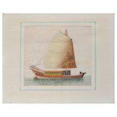
Antique Chinese Rice Pit painting of a Boat Top Quality Canton, 19th Century
Located in Amsterdam, Noord Holland
Antique Chinese Rice Pit painting of a Boat Top Quality Canton, 19th Century.
Fabulous painting.
Additional information:
Material: Porcelain & Pottery
Type:...
Category
Antique 19th Century Chinese Paintings
Materials
Porcelain
$662 Sale Price
20% Off
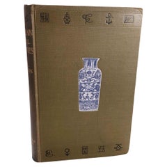
Reference Book Chinese
Japanese Porcelain of All Countries - Hobson, R.L.
Located in Amsterdam, Noord Holland
Porcelain__Oriental Continental and British (Porcelain of All Countries)
Hobson, R.L.
Title: Porcelain__Oriental Continental and British …
Publisher: Archibald Constable & Co. Ltd,...
Category
20th Century Books
Materials
Paper
Antique 19/20th c Chinese Water Color painting Classic Literati Qing Dynasty
Located in Amsterdam, Noord Holland
Country of origin: Japan
Age: Qing China or Japan Meiji Period 19th century
Size: 74.5 x 54.5cm
Condition
Period
19th century PRoC (1949 - now)
Category
Antique 19th Century Chinese Planters, Cachepots and Jardinières
Materials
Porcelain
$615 Sale Price
86% Off
You May Also Like
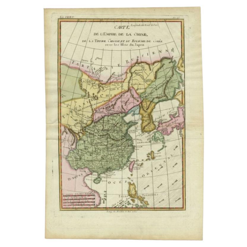
Antique Map of the Empire of China by Bonne, c.1780
By Rigobert Bonne
Located in Langweer, NL
Antique map titled 'Carte de L'Empire de la Chine.' Decorative map of the Empire of China, depicting China, Corea ( Korea ), Japan, Tonquin and the Philippine island Lucon. Source un...
Category
Antique 18th Century Maps
Materials
Paper

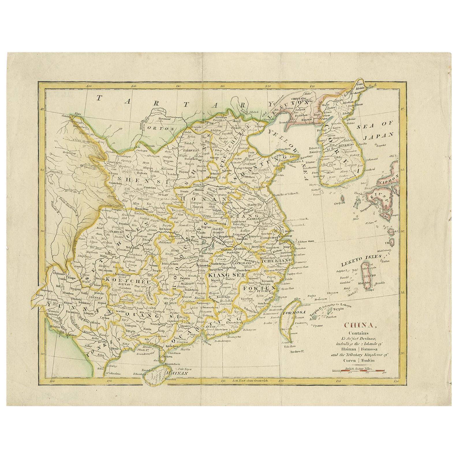
Antique Map of China by Artist Wilkinson, Engraved Paper, 1803
Located in Langweer, NL
Antique map titled 'China, Contains 15 Subject Provinces Including the 2 Islands of Hainan, Formosa and the Tributary Kingdoms of Korea, Tonkin'. Old map depicting China, extending f...
Category
Antique Early 19th Century British Maps
Materials
Paper

Antique Map of China, Also Depicting Formosa
Taiwan
and Part of Korea, c.1840
Located in Langweer, NL
Antique map titled 'China'. Old map of China, also depicting Formosa (Taiwan) and part of Korea. Source unknown, to be determined.
Artists and Engravers: Anonymous.
Condition: ...
Category
Antique 19th Century Maps
Materials
Paper

Antique Map of China, Korea, Japan and the Northern Philippines, circa 1780
Located in Langweer, NL
Antique map titled 'Carte de l'Empire de la Chine de la Tartarie Chinoise, et du Royaume de Corée'. Interesting and detailed map of China, Korea, Japan and the Northern Philippines. ...
Category
Antique Late 18th Century European Maps
Materials
Paper

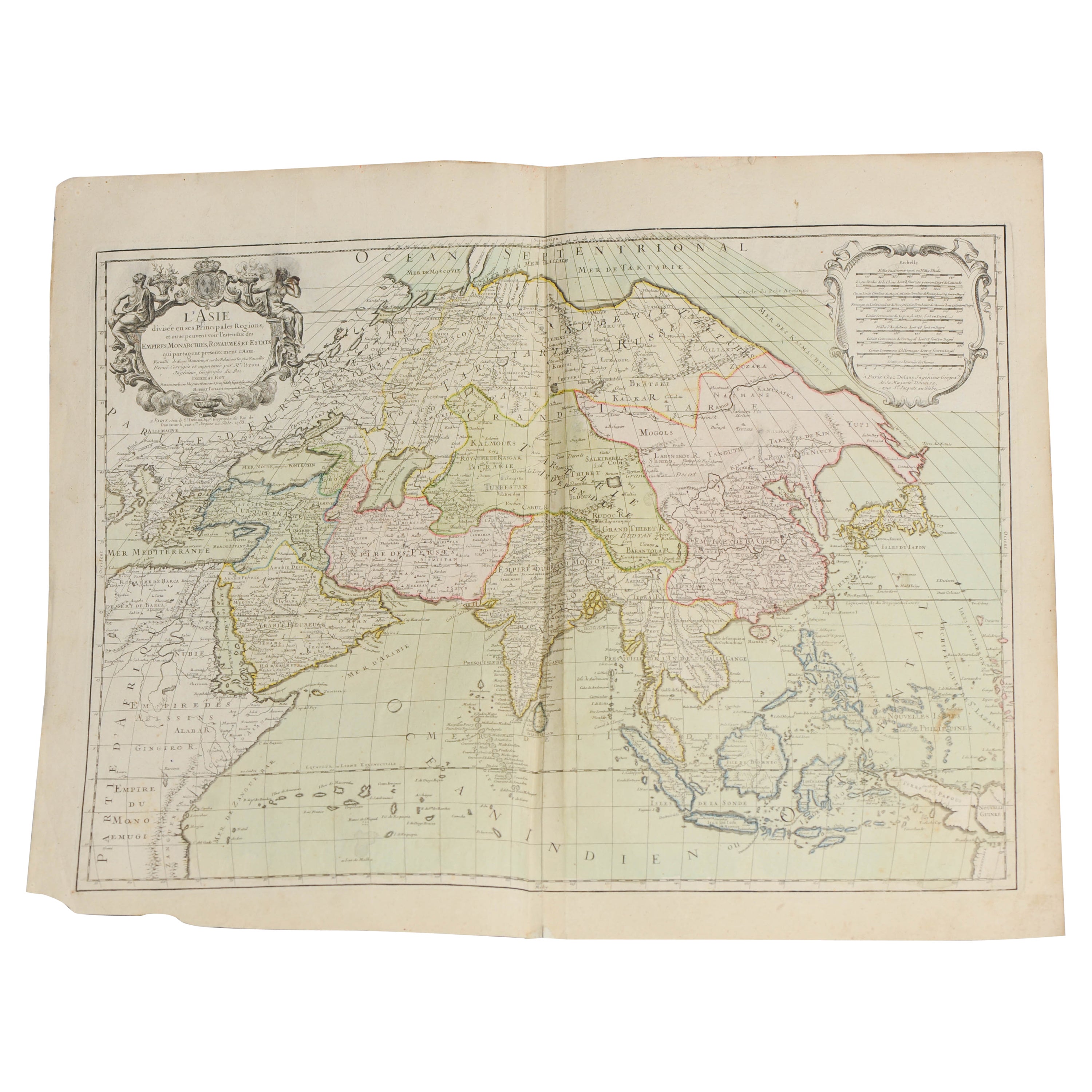
Antique Map of Asia by Alexandre Blondeau, Paper Print, Circa 1800
Located in Langweer, NL
Asia Map, from Mediterranean to Japan – Antique Map by Alexandre Blondeau, c. 1800
This fine circa 1800 map of Asia presents the entire continent in a single, coherent composition, ...
Category
Antique Early 19th Century Maps
Materials
Paper

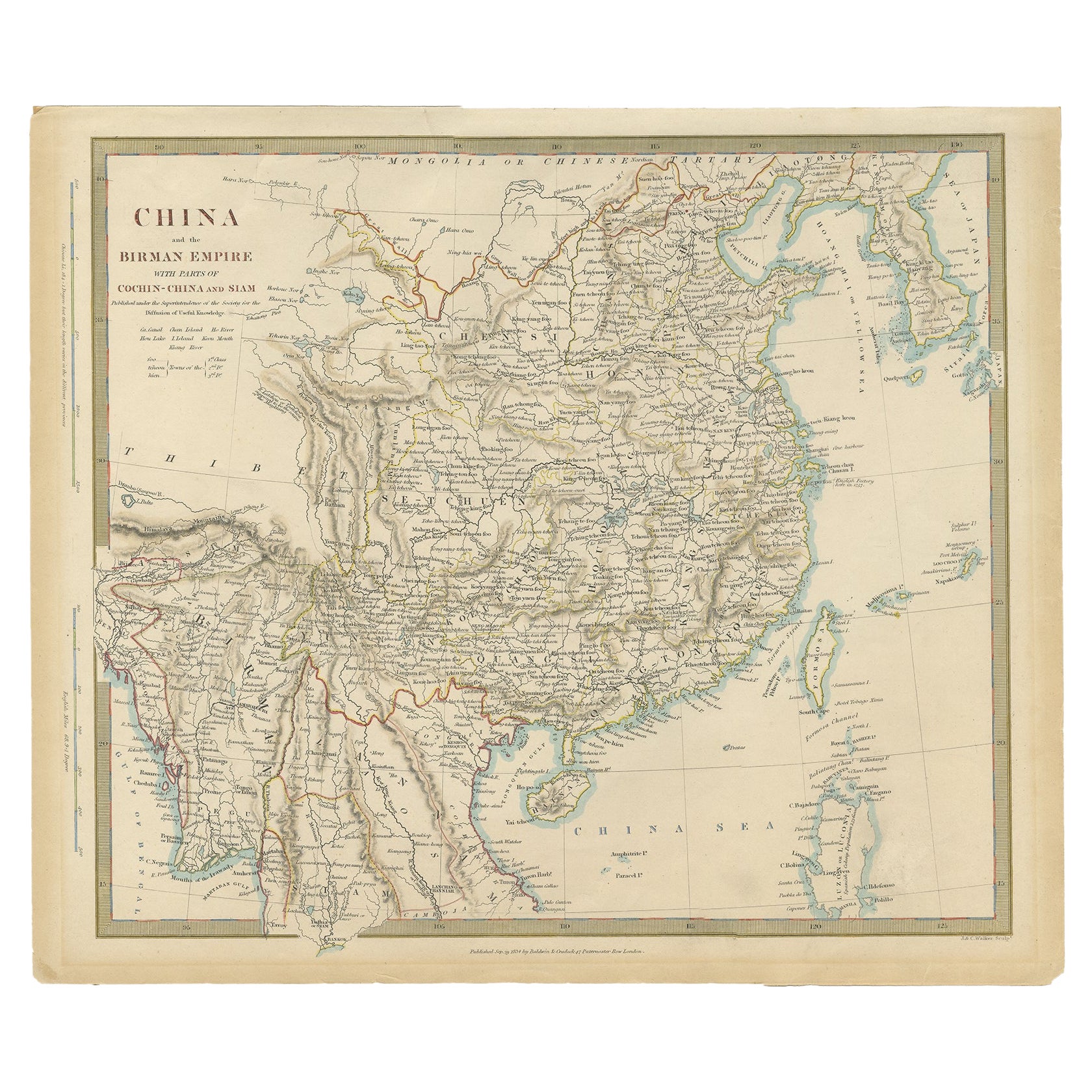
Antique Map of the Chinese Empire and Japan by Lapie, 1842
Located in Langweer, NL
Antique map titled 'Carte de L'Empire Chinois et du Japon'. Map of the Chinese Empire (China) and Japan. This map originates from 'Atlas universel de géographie ancienne et moderne (...
Category
Antique Mid-19th Century Maps
Materials
Paper

More Ways To Browse
Irish Antiques 16th Century
Ithaca Antique Map
Leonard Jones
Russia Globe
Salt Lake City Used Furniture
World Map Copper
Green French Glass
Mid Century Modern Wicker Chair
Mid-Century Modern Wicker Chairs
Curved Back Mid Century Dining Chairs
Glass Stopper
Stretcher Tables
Antique French Lithographs
M Table
Antique Sultanabad Carpets
China Chair
English Antique Desks
Used Beige Sofa