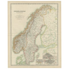
Items Similar to Sweden
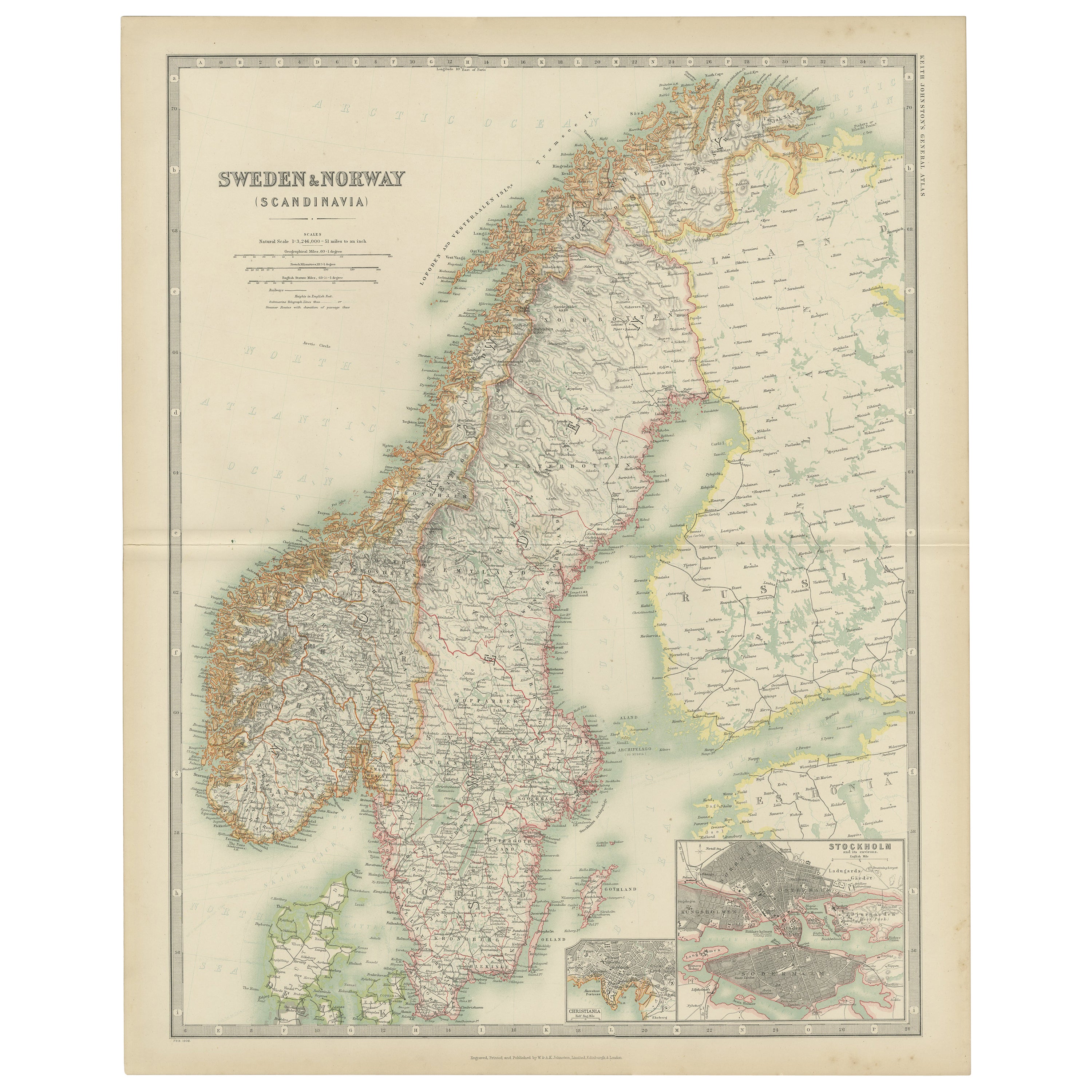
Norway – Antique Map of Scandinavia with Stockholm Inset, 1865


Video Loading
Want more images or videos?
Request additional images or videos from the seller
1 of 12
Sweden
Norway – Antique Map of Scandinavia with Stockholm Inset, 1865
$329.99
£244.54
€275
CA$451
A$490.95
CHF 260.60
MX$5,907.15
NOK 3,302.09
SEK 3,025.65
DKK 2,094.76
About the Item
Sweden
Norway – Antique Map of Scandinavia with Stockholm Inset, 1865
This finely detailed antique map titled Sweden
Norway (Scandinavia) offers a comprehensive 19th-century view of the Nordic Peninsula, featuring the nations of Sweden and Norway in their full geographical extent. Published in 1865 as part of the esteemed Royal Atlas of Modern Geography by Alexander Keith Johnston, the map reflects the advanced cartographic knowledge and printing techniques of the Victorian era.
The map is notable for its clarity and precision, showing mountain ranges, rivers, cities, railway lines, and administrative divisions across the Scandinavian landscape. An inset map of Stockholm and its surroundings adds valuable geographic and historical context, highlighting the capital region of Sweden in more granular detail.
Johnston, a respected Scottish geographer and cartographer, created the Royal Atlas to serve as a scientific and educational reference for both scholars and laypeople. His maps were recognized for their accuracy and elegance and were used by universities and institutions across the British Empire. The publication by William Blackwood and Sons of Edinburgh and London ensured wide distribution and high production quality.
This map stands out for its delicate coloration, precise typography, and beautifully engraved topographical features, typical of Johnston’s work. It offers not only historical insights into Scandinavian boundaries and infrastructure but also a visual representation of the growing importance of geography in Victorian education and statecraft.
Condition report: Excellent condition. Lightly age-toned paper with original hand-color outlining. Central fold as issued and some foxing on the right side in the margin. A few faint creases and minor edge wear, but no tears or repairs. Strong impression with fine detail.
Framing tips: A large, neutral-toned mount and slim black or dark wood frame will bring out the map’s pale blue and red details. A double mat with an inner grey or steel-blue accent could echo the icy Scandinavian landscape.
- Dimensions:Height: 24.41 in (62 cm)Width: 19.1 in (48.5 cm)Depth: 0.02 in (0.5 mm)
- Materials and Techniques:Paper,Engraved
- Place of Origin:
- Period:
- Date of Manufacture:1865
- Condition:Excellent condition. Lightly age-toned paper with original hand-color outlining. Central fold as issued and some foxing on the right side of the paper. A few faint creases and minor edge wear, but no tears or repairs. Strong impression with details.
- Seller Location:Langweer, NL
- Reference Number:Seller: BG-05553/241stDibs: LU3054310726643
About the Seller
5.0
Recognized Seller
These prestigious sellers are industry leaders and represent the highest echelon for item quality and design.
Platinum Seller
Premium sellers with a 4.7+ rating and 24-hour response times
Established in 2009
1stDibs seller since 2017
2,819 sales on 1stDibs
Typical response time: 1 hour
- ShippingRetrieving quote...Shipping from: Langweer, Netherlands
- Return Policy
More From This Seller
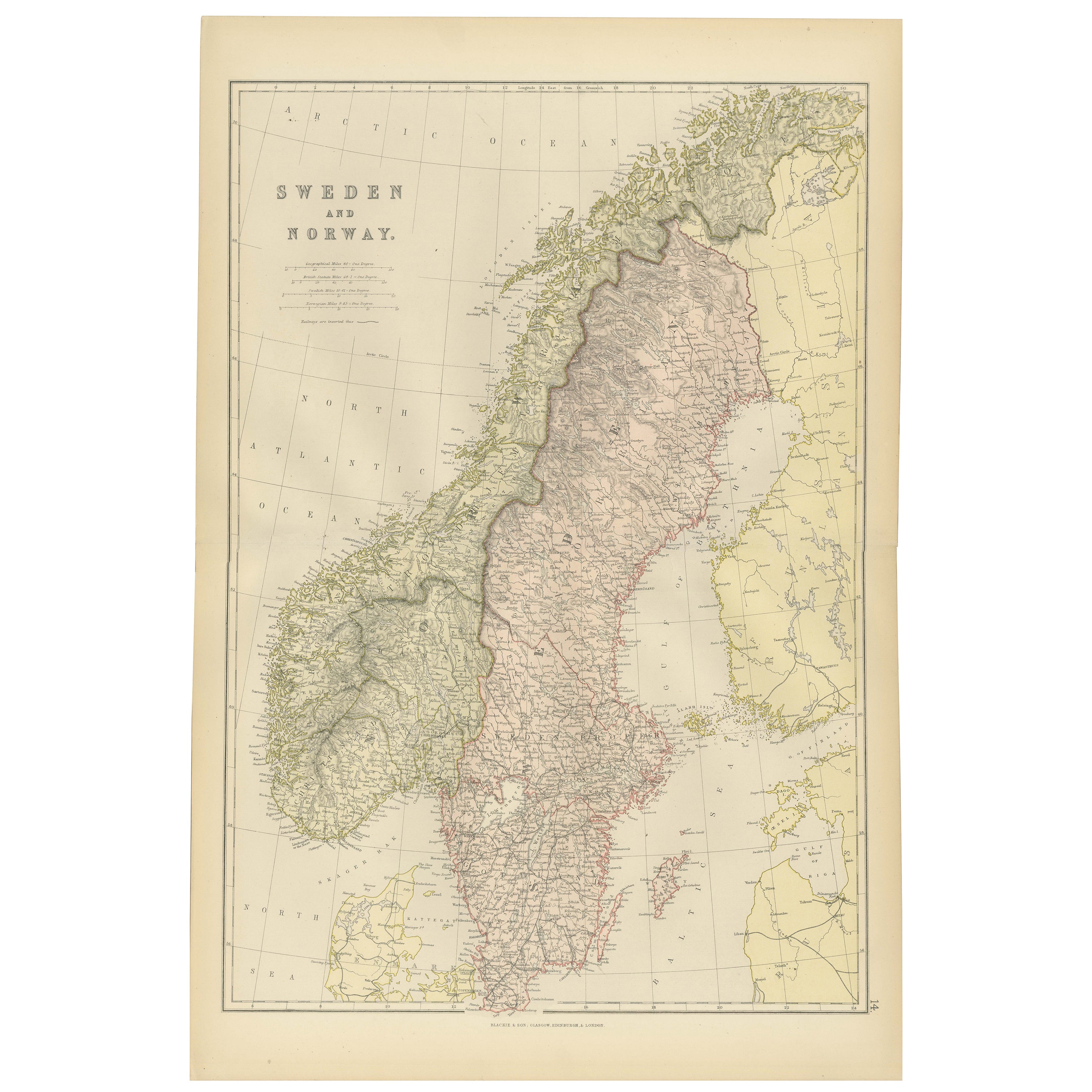
View AllAntique Map of Sweden and Norway by W. G. Blackie, 1859
Located in Langweer, NL
Antique map titled 'Sweden and Norway'. Original antique map of Sweden and Norway. This map originates from ‘The Imperial Atlas of Modern Geography’. Published by W. G. Blackie, 1859.
Category
Antique Mid-19th Century Maps
Materials
Paper

$239 Sale Price
20% Off
Antique Map of Sweden and Norway by Johnston (1909)
Located in Langweer, NL
Antique map titled 'Sweden and Norway'. Original antique map of Sweden and Norway. With inset maps of Christiania and Stockholm. This map originates from...
Category
Early 20th Century Maps
Materials
Paper
$239 Sale Price
20% Off
1882 Map of Sweden and Norway Highlighting Geographical and Political Features
Located in Langweer, NL
This 1882 map of Sweden and Norway, published by Blackie and Son as part of the 'Comprehensive Atlas and Geography of the World,' provides a detailed depiction of the Scandinavian Pe...
Category
Antique 1880s Maps
Materials
Paper

Antique Map of Sweden
Norway, 1903, with Intricate Topographical Detail
Located in Langweer, NL
Title: Antique Map of Sweden & Norway, 1903, with Intricate Topographical Detail
Description:
This antique map, titled "Sweden & Norway (Scandinavia)," was engraved and published in...
Category
Early 20th Century Maps
Materials
Paper

Antique Map of Sweden and Norway by Petri, c.1873
Located in Langweer, NL
Antique map titled 'Zweden en Noorwegen'. Old map depicting Sweden and Norway. This map originates from 'School-Atlas van alle Deelen der Aarde'. Artists and Engravers: Published by ...
Category
Antique 19th Century Maps
Materials
Paper

$112 Sale Price
20% Off
Antique Map of Sweden and Norway by Petri, 1852
Located in Langweer, NL
Antique map titled 'Zweden en Noorwegen'. Map of Sweden and Norway. This map originates from 'School-Atlas van alle deelen der Aarde' by Otto Petri. Artists...
Category
Antique 19th Century Maps
Materials
Paper

$115 Sale Price
20% Off
You May Also Like
Large Original Vintage Map of Sweden and Norway circa 1920
Located in St Annes, Lancashire
Great map of Sweden and Norway
Original color. Good condition
Published by Alexander Gross
Unframed.
Category
Vintage 1920s English Victorian Maps
Materials
Paper

Original Antique Map of Sweden, Engraved by Barlow, 1806
Located in St Annes, Lancashire
Great map of Sweden
Copper-plate engraving by Barlow
Published by Brightly & Kinnersly, Bungay, Suffolk. 1806
Unframed.
Category
Antique Early 1800s English Maps
Materials
Paper

Ancient Map of Denmark and Sweden - Original Etching - 19th Century
By Giuseppe Malandrino
Located in Roma, IT
This Map of Denmark and Sweden is an etching realized by an anonymous artist.
The state of preservation of the artwork is good with some small diffused stains.
Sheet dimension: 27x...
Category
Late 19th Century Modern Figurative Prints
Materials
Etching

Denmark. Century Atlas antique vintage map
Located in Melbourne, Victoria
'The Century Atlas. Denmark'
Original antique map, 1903.
Inset maps of 'Faroe Islands', 'Iceland' and 'Copenhagen'.
Central fold as issued. Map name and number printed on the reve...
Category
Early 20th Century Victorian More Prints
Materials
Lithograph

Sweden
Adjacent Portions of Scandinavia: A Hand-Colored 18th C. Map by Homann
By Johann Baptist Homann
Located in Alamo, CA
This hand-colored map of Sweden and adjacent portions of Scandinavia entitled "Regni Sueciae in Omnes suas Subjacentes Provincias accurate divisi Tabula Generalis" was created by Joh...
Category
Antique 1720s German Maps
Materials
Paper

$780 Sale Price
20% Off
Scandinavia
Portions of Eastern Europe: 18th Century Hand-Colored Homann Map
By Johann Baptist Homann
Located in Alamo, CA
An early 18th century hand-colored copper-plate map entitled "Regni Sueciae in omnes suas Subjacentes Provincias accurate divisi Tabula Generalis" by Johann Baptist Homann (1663-1724...
Category
Antique Early 18th Century German Maps
Materials
Paper

$780 Sale Price
20% Off
More Ways To Browse
Map Stand
Antique World Maps
Map Of Europe
Antique Maps Of Holland
Compass Rose Antique
Antique Furniture Portugal
Antique Maps Of Europe
Mexican Antiques
Map Of Africa
Mississippi Antique
Antique Furniture Plans
Ancient Collectibles
Antique Wood Coat Of Arms
Antique Quadrant
Antique Maps Of Africa
Antique Map India
Antique Map Of The South Of France
Antique English Maps